Terra-i, An eye on Habitat Change
•Transferir como PPTX, PDF•
0 gostou•489 visualizações

Terra-i is a system that uses neural networks and MODIS data to monitor habitat change in near real-time. It maps habitat loss every 16 days at 250m resolution. Its goals are to monitor natural habitat conversion, have continental coverage, support government decision making, and quantify habitat change rates. Terra-i predicts vegetation greenness using past NDVI and precipitation data, compares this to MODIS measurements to detect anomalies, and calibrates results with Landsat images. Comparisons show it correlates well with other systems like PRODES. Terra-i is a tool for rapid habitat monitoring at continental to regional scales to inform conservation policy.

Recomendados
Recomendados
Mais conteúdo relacionado
Mais procurados
Mais procurados (10)
Destaque
Destaque (7)
Semelhante a Terra-i, An eye on Habitat Change
Semelhante a Terra-i, An eye on Habitat Change (20)
Mais de Decision and Policy Analysis Program
Mais de Decision and Policy Analysis Program (20)
Terra-i, An eye on Habitat Change
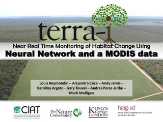
- 1. Near Real Time Monitoring of Habitat Change Using Neural Network and a MODIS data Louis Reymondin – Alejandro Coca – Andy Jarvis – Karolina Argote - Jerry Touval – Andres Perez-Uribe – Mark Mulligan
- 2. What is Terra- Terra-i is a system of habitat changes monitoring that uses different mathematical models that combine vegetation data (MODIS NDVI) and precipitation data (TRMM) to detect deviations from the natural cycle of the vegetation over time and thus antrophogenic impacts on natural ecosystems. It has maps of habitat loss every 16 days at the continental level with 250 meters of spatial resolution.
- 3. Terra- goals To use high-frequency imaging and moderate spatial resolution for ... Monitoring the conversion of natural habitats in near real time. (Results 2 months after the date of capture) Have a continental coverage of all types of habitat. Be a support for government agencies in making decisions. Quantifying habitat conversion rates and make analysis of trends from 2004 to date. Monitor the impact on protected areas in Latin America.
- 4. Terra- approach The intensity of vegetation greenness is a natural cycle that depends on climatic factors (precipitation, temperature), site variables (type of vegetation, soil characteristics) and disturbances (natural or anthropogenic). Terra-i is a model to predict the evolution of vegetation greenness intensity, based on measures of vegetation behavior in time and current weather measurements to detect significant habitat changes. .
- 5. Inputs data 1. Vegetation Index (MOD13Q1 MODIS Product , 16 days, 250m) Normalized difference vegetation index (NDVI) represents the amount and vigor of vegetation. In each area the values are closely related to vegetation type and climatic conditions as well as the predominant land use pattern.
- 6. Tiles MODIS level analysis Processed Terra-i data Incoming Test Tiles / Terra-i This gives us greater automation of the process, synchronizing the stages download, pre-processing of MODIS data, Terra-i processing load and soon final results in the map server and FTP.
- 7. Input data 2. Precipitation Data of the Tropical Rainfall Measuring Mission(3hours, 28km) TRMM is led by NASA and the Japan Aerospace Exploration Agency (JAXA). It monitors and studies tropical and subtropical rainfall, between 35 º N and 35 º S. It was released on November 27th, 1997 from Japan.
- 8. Research methodology overview The methodology can be split into two main steps: The training step (using data from 2000 to 2004) • Models are trained in order to find the relationship 1. between recent precipitation and the changes in the color of the vegetation (for different vegetation types) The detection step (using data from 2004 to present) • The trained models output are compared with the 2. satellite measurements in order to detect anomalies in the vegetation state.
- 9. Model training NDVI and QA MODIS data MOD13Q1, Precipitation (TRMM 3b42) (2000-2004) To reduce the noise present Time series gap-filling and in the data smoothing To reduce processing (clouds, atmospheric duration, the NDVI time series Clustering variations, shadows…) K-Means with the same trends during the years are grouped together Random pixels sampling for each cluster Neural network training Original NDVI data Cleaned NDVI data
- 10. Anomaly detection NDVI and QA MODIS data MOD13Q1, Precipitation (TRMM) (2004-2011) Time series gap-filling and smoothing NDVI Prediction from 2004 to 2011 Calibration using habitat Difference between the NDVI sensor changes maps generated with maps measurement and the NDVI predicted Landsat satellite images (30m) of change by the neural network probabilities NDVI increase Rules NDVI decrease Vegetation changes Clasification of (anthropogenic) maps change Results Floods Drought
- 11. Methodology – Change detection The goal of the model is to predict what is the NDVI value at the date t taking as input the NDVI values at t-1, t-2 … t-n and the previous rainfall. INPUTS: Past NDVI (MODIS 13Q1) Previous rainfall (TRMM 3b42) OUTPUT: 16 day predicted NDVI Prediction Multilayer perceptron Bayesian Neural Network (BNN) Model trainning and noise approximation change Scaled Conjugate Gradient (SCG) Gaussian noise Input automatic selection Automatic relevance determination (ARD)
- 12. Calibration with Landsat Images 2004 2009 As Terra-i generates maps of conversion probabilities, we use Landsat images in order to calibrate the results and select the most appropriate probability threshold for each cluster to generate binary changed/unchanged maps.
- 13. Terra-i results comparation with local models Terra-i results were compared with deforestation data produced by the National Institute for Space Research Instituto Nacional de Pesquisas Espaciais (INPE) from 2004 to 2009 through monitoring systems as PRODES and DETER. PRODES The Project of estimation of deforestation in the Brazilian Amazon (PRODES) generated estimations from 2003 using a digital classification system with Landsat images (30m). DETER DETER is a near real time deforestation detection system. It publishes fortnightly deforestation alerts for the Brazilian Amazon using MODIS images (500m). The comparison shows a high correlation between Terra-i and PRODES systems.
- 14. Comparison with PRODES Comparison with PRODES % of matching detections % of PRODES detection within a MODIS pixels
- 15. The Software
- 16. Results
- 17. 2004 – 2012
- 18. Habitat Loss in Colombia 2004-2011 Annual Rate : 118,026 Ha/year Total Loss: 944,206 Ha *
- 19. Habitat Loss in The Biological corridor in Meta
- 20. Habitat Loss in Brasil 2004-June 2011 Annual Rate: 1,789,138 Ha/year Total Loss: 13,418,538 Ha *
- 21. Road impact assessment The Trans-Chaco Highway (2002-2006), Paraguay
- 22. Road impact assessment The Trans-Chaco Highway, Paraguay Conclusions • Very high levels of deforestation pre- and post- road construction • But > 300% increase in deforestation rates since road finished, with a footprint that likely goes beyond 50km buffer Road: Trans-Chaco Highway Project period: 2002-2006 Average pre-road deforestation rate: 23,000 Average post-road deforestation rate: 97,000 (+319%) Year of peak deforestation: 2010 Footprint (modal deforestation distance): 30-40km
- 23. Improve more and more our system by developing methodologies for analyzing the information generated.
- 25. Future Deforestation Scenarios BR-364 Road, Brasil PROOF OF CONCEPT Base map Potential deforestation at T=0 Potential deforestation at T=150 Predicted deforestation Actual deforestation (Terra-i)
- 26. Integration Terra-i with others Policy Support Systems • Terra-i can also be used within the WaterWorld and Co$ting Nature Policy Support Systems to understand the impact of recent land cover change on hydrology and the production and delivery of ecosystem services. • Data: http://geodata.policysupport.org/ Water flows Erosion
- 27. www.terra-i.org
- 28. & “The best way improve a system is to get people to use it” Dr. Mulligan (Kings College of London)
- 29. Conclusions Terra-i is: A mapping and monitoring system for rapid assessment of land cover conversion at a medium scale (250m). A tool for monitoring conversion of habitat at continental, national and regional level in close to real time. A tool for understanding the effectiveness of protected areas and other conservation measures in stabilizing or reducing land cover conversion. A spatial support system for decision making in public policy and private development initiatives. Through its linkage with WaterWorld and Co$ting Nature, a system for understanding the likely impacts of near real-time land cover change on a wide range of ecosystem services. Terra-i isn’t: X Detailed monitoring tool in local level. For this it requires second-level monitoring (with high resolution images) and third level (field data). X A system to monitor degradation.
Notas do Editor
- La implementación del sistema para el conjunto de datos de América Latina es un gran reto desde la perspectiva informática, trabajar con datos de 250 metros de resolución significa que el grid analizado representa más de mil millones de valores individuales para cada periodo de tiempo (cada 16 días). Esto implica que más de 26 mil millones de valores deben ser procesados por año. Es por esto que se utilizan tecnologías de tipo data mining y programación distribuida, que permiten analizar una gran cantidad de datos en un menor tiempo. Terra-I se corre en super computadoras, dotadas con 8 procesadores.
- En Colombia las causas de pérdida de hábitat varían en cada región. En la región Andina la pérdida de bosques se asocia principalmente a la expansión de la frontera agrícola, el desarrollo de nueva infraestructura e incendios forestales. Mientras que en la Amazonia y el Pacífico la principal causa es la explotación maderera.
- En Colombia las causas de pérdida de hábitat varían en cada región. En la región Andina la pérdida de bosques se asocia principalmente a la expansión de la frontera agrícola, el desarrollo de nueva infraestructura e incendios forestales. Mientras que en la Amazonia y el Pacífico la principal causa es la explotación maderera.
- WaterWorld was used to calculate the hydrological baseline and terra-i chosen as the deforestation scenario to run the alternative. The images show the change in flows (left) and sediment from the baseline to the alternative. Flows increased below of reduced evapo-transpiration. Erosion increased in the deforested areas and sedimentation increased in the river draining these areas.