Regional context of Raipur, Chhattisgarh.
•
6 gostaram•2,216 visualizações

Regional context study for Raipur, studying the climate, location attributes, geological attributes, hydro-geological attributes etc for formation of housing strategies and options.

Recomendados
Recomendados
Mais conteúdo relacionado
Mais procurados
Mais procurados (20)
Destaque
Destaque (20)
Semelhante a Regional context of Raipur, Chhattisgarh.
Semelhante a Regional context of Raipur, Chhattisgarh. (20)
Último
Último (20)
Regional context of Raipur, Chhattisgarh.
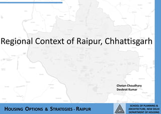
- 1. Regional Context of Raipur, Chhattisgarh HOUSING OPTIONS & STRATEGIES - RAIPUR Chetan Choudhary Deobrat Kumar SCHOOL OF PLANNING & ARCHITECTURE, NEW DELHI DEPARTMENT OF HOUSING
- 2. HOUSING OPTIONS & STRATEGIES - RAIPUR REGIONAL SETTING SCHOOL OF PLANNING & ARCHITECTURE, NEW DELHI DEPARTMENT OF HOUSING LOCATION OF CHHATTISGARH • Chhattisgarh is a state in Central India. • The geographical location of Chhattisgarh is • ··17 degree 46 min north to 24 degree 5 min north latitude • ··80 degree 15 min east to 84 degree 20 min east longitude. ··Madhya Pradesh borders Chhattisgarh in the north western part. Maharashtra borders Chhattisgarh on the west and ··Andhra Pradesh lies in its south. ··Orissa is located in the eastern side. ··Jharkhand borders Chhattisgarh in the north eastern part. Location of Raipur : lies between lat 19’57 to 21’53 north, and longitude 81’25 to 83’38 east District bounded by: north – bilaspur district south – koraput district of Orissa east – kalahandi of Orissa north east – sarangarh tehsil of Raigarh district south east – kurud district The state was formed on November 1, 2000 by partitioning 16 Chhattisgarhi-speaking southeastern districts of Pradesh. It is the 10th largest state in India, with an area of 135,190 km2 (52,200 sq mi). By population, it ranks as the 16th most-populated state of the nation. The population density of the state per square km is 108. It is an important electricity and steel-producing state of India. Chhattisgarh accounts for 15% of the total steel producer of the country. Raipur district covers an area 41775.45Sqkm which is 30% of Chhattisgarh state. The Raupur tehsil covers an area of 9,374.85 Sqkm Which is 22.44% of Raipur district. Planning area of the city is 188Sqkm and Municipal area 143 Sqkm At the time of the 2011 census, the population of the Municipal Corporation area was 10.1 lakh. REGIONAL SETTING
- 3. HOUSING OPTIONS & STRATEGIES - RAIPUR REGIONAL SETTING SCHOOL OF PLANNING & ARCHITECTURE, NEW DELHI DEPARTMENT OF HOUSING TOWARDS MUMBAI TOWARDS KOLKATA TOWARDS VISHAKHAPATNAM TOWARDS BILASPUR NH 6 MAJOR URBAN AREAS Raipur Urban Agglomeration Durg - Bhilai Urban Agglomeration. Rajnandgaon ROAD WAYS The region is well connected by 3 national highways and 3 state highways connection the region with major cities NH 6- connection Raipur to Mumbai and Kolkata NH 43- connection Raipur to Vishakhapatnam NH 200- connection Raipur to Bilaspur The three state highways in the region area SH 2, SH 7 and SH 9 connecting Raipur with other parts of the state RAILWAYS The main Mumbai –Howrah railway line passes through the region. The other railway lines are from Raipur to Bilaspur and Raipur to Visakhapatnam. AIRWAYS Three airports in the region are: Swami Vikekanand Ariport which is around 13 km from the city of Raipur in the South East. The two other small airports near Tilda and Jamul are private. RAIPUR, MAJOR LINKAGES IN REGIONAL CONTEXT
- 4. RAIPUR CITY AND ITS SURROUNDING HOUSING OPTIONS & STRATEGIES - RAIPUR REGIONAL SETTING SCHOOL OF PLANNING & ARCHITECTURE, NEW DELHI DEPARTMENT OF HOUSING NATIONAL LEVEL PERSPECTIVE ·Naya Raipur falls within the East – west urban corridor . ·In the east-west corridor connecting Mumbai to Kolkata, Nagpur and Nasik have developed as metropolitan region, but a gap has been formed between Nasik to Kolkata. ·In central India, no metropolitan cities have emerged to cater the service population. In the absence of Metropolitan region in Central India, the prospect of Raipur–Naya Raipur City to develop as a major metropolitan region is very high. STATE LEVEL PERSPECTIVE At State level the maximum concentration of urban settlement is along NH-6, which links Raipur and its surrounding region with Eastern India to Western India. The corridor has been the major transportation route for raw materials from the State of Bihar, Orissa and Chhattisgarh, which is further transported to industrially developed area in the western India. The major agglomerations in this corridor are: ·· Raipur Urban Agglomeration and Durg - Bhilai Urban Agglomeration. The strong linkages can be seen in this corridor where more than 40 percent of Chhattisgarh urban population resides. The development along the section of NH-6 towards Raipur, and Mahasamand is also formed. NH6 connects the state with Kolkata and Visakhapatnam via Bheemunipatnam. Most of the urban settlements have come up due to easy connection with Kolkata and Vishakhapatnam. ·Arang is also developing as major urban node in the corridor. ·Based on locally available resources, such as minerals, forests, and agriculture, industrial growth has taken place in the corridor with the establishment of cement, iron, aluminum industry and production of energy. ·More than 600 large & Small-scale industries have been established. ·Industrial estates at Urla, Siltara and Borai are located in and around Raipur and Bhilai town.
- 5. IMPORTANT CITIES IN THE REGION AND FUNCTIONS HOUSING OPTIONS & STRATEGIES - RAIPUR REGIONAL SETTING Jamul Kumhari Raipur Raipur Durg Arang SCHOOL OF PLANNING & ARCHITECTURE, NEW DELHI DEPARTMENT OF HOUSING Raipur acts as a multifunctional city. Within the state contiguous urban regions are emerging cantered around Raipur City, Durg-Bhilai and all other emerging or existing centres in the region are linked to Mumbai and Kolkata with increasing fast rail and road transport. Raipur and Durg have service and trade and commerce as the dominant activity. Bhilai is still functioning as industrial town, where more than 40% of workforce is engaged in industrial activity. Trade and Commerce have also gained momentum. Jamul, Chaoni are purely industrial town where about 70% of the total workforce is engaged in the industrial activity. Kumhari has also shown its orientation towards industrial economic base. Main functions of town Name of town Services, trade and commerce Raipur, Durg and Tilda Industry Bhilai, Jamul, Chaoni Agro based Arang, Patan Naya Raipur Bhilai
- 6. HOUSING OPTIONS & STRATEGIES - RAIPUR REGIONAL SETTING SCHOOL OF PLANNING & ARCHITECTURE, NEW DELHI DEPARTMENT OF HOUSING PHYSIOGRAPHY Relief and Topography In general, the surrounding Region has a gentle topography with slopes ranging between 0% to 5%. The maximum elevation in the Region occurs close to Abhanpur in the south (327m) whereas the lowest areas in the Region are along the Kharun and Mahanadi rivers (257m). Geography Raipur is located near the centre of a large plain, sometimes referred as the "rice bowl of India", where hundreds of varieties of rice are grown. The Mahanadi River flows to the east of the city of Raipur, and the southern side has dense forests. The Maikal Hills rise on the north-west of Raipur; on the north, the land rises and merges with the Chota Nagpur Plateau, which extends north-east across Jharkhand state. On the south of Raipur lies the Deccan Plateau. Raipur is situated on Proterozoic chandi formation of Raipur group comprising of limestone, shale and sand stone. Rock formation of chandi formation is exposed horizontally bedded with thick beds of lime stone. Soil The zone comprises of alluvial soil in the Indogangetic plane and some portions contain lateritic soils and also hilly portion. The alluvial soil is very good for production of clay bricks while in other parts laterite blocks are used. In the hilly region, stone walling is made. The area is rich in minerals.
- 7. Drainage Pattern There are three main rivers flowing towards north and north-east within the region. These are Sheonath on the west of Durg, Kharun on the west of Raipur and Mahanadi at the extreme east of the region. Besides these, Kulhan nala drains the area on south-east of Raipur and joins Kharun river. HOUSING OPTIONS & STRATEGIES - RAIPUR REGIONAL SETTING SCHOOL OF PLANNING & ARCHITECTURE, NEW DELHI DEPARTMENT OF HOUSING PHYSIOGRAPHY Forest and Vegetation The region has three reserved forests namely Bilari, Bilari Ghugat and Khaudabari, but these forests are now degraded. There are some protected forests in the region. A few patches of dense forest are also observed close to Tilda. Further, social forestry plantations are present throughout the Region wherein Eucalyptus and other local species like Neem, Mahua and Sisham are observed. Other tree species found in the Region consist of Peepal, Banyan and Mango trees, particularly along tank bunds. Acacia species are seen principally in the agricultural fields and in the upland stretches. Hydrogeology The rock formation comprising the lime stone, sand stone and shale form the main repository of ground water in the area. Depth of dug wells in the area varies from 7 to 21m, with diameter ranging from 2 to 6m. Depth of bore wells in the area varies from 30 to 120m, with diameter from 0.10 to 0.15 MAHANADI RIVER SHEONATH RIVER KHARUN RIVER KHARUN RIVER
- 8. HOUSING OPTIONS & STRATEGIES - RAIPUR REGIONAL SETTING SCHOOL OF PLANNING & ARCHITECTURE, NEW DELHI DEPARTMENT OF HOUSING CLIMATOLOGY The climate of the state is mainly dry and hot. In the summer months, the temperature is very high and the state is frequented by dust storms. In the months of winter, very cold wind blows over the state. Chhattisgarh receives a good amount of rainfall of 133mm as mean. The state receives rainfall mainly from the South West monsoon winds. The temperature varies between 30 and 47 °C (86 and 117 °F) in summer and between 5 and 25 °C (41 and 77 °F) during winter. However, extremes in temperature can be observed with scales falling to less than 0°C to 49°C. The region has seen the highest temp increase in past 100 years, of around 1 °C. The predominant wind flow is from the southwest direction, except during the post monsoon and winter months, when it comes mostly from the northeast. The wind speed in general ranges between 2.9 km. per hr. to 8.69 km. per hr. considering that the mining and industrial areas are mostly located to the north and west.
- 9. HOUSING OPTIONS & STRATEGIES - RAIPUR REGIONAL SETTING SCHOOL OF PLANNING & ARCHITECTURE, NEW DELHI DEPARTMENT OF HOUSING PHYSIOGRAPHY