"3D Printing - 3D Mapping". Lecture at Aristotelian University of Thessaloniki/School of Surveyors-ERDAS 2011 World Tour
•Transferir como PPT, PDF•
1 gostou•1,058 visualizações


Recomendados
Recomendados
Mais conteúdo relacionado
Destaque
Destaque (19)
Semelhante a "3D Printing - 3D Mapping". Lecture at Aristotelian University of Thessaloniki/School of Surveyors-ERDAS 2011 World Tour
Semelhante a "3D Printing - 3D Mapping". Lecture at Aristotelian University of Thessaloniki/School of Surveyors-ERDAS 2011 World Tour (20)
Último
Último (20)
"3D Printing - 3D Mapping". Lecture at Aristotelian University of Thessaloniki/School of Surveyors-ERDAS 2011 World Tour
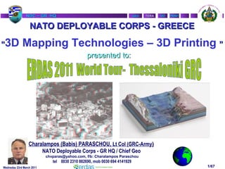
- 1. NATO UNCLASSIFIED VIZVIZ PRINTPRINTTERATERANDC – GR HQNDC – GR HQ GEOGEO Wednsday 23rd March 2011 1/67 Charalampos (Babis) PARASCHOU, Lt Col (GRC-Army) NATO Deployable Corps - GR HQ / Chief Geo chvparas@yahoo.com, f/b: Charalampos Paraschou tel 0030 2310 882690, mob 0030 694 4141929 NATO DEPLOYABLE CORPS - GREECENATO DEPLOYABLE CORPS - GREECE ““3D Mapping Technologies – 3D Printing ”” presented to:presented to:
- 2. NATO UNCLASSIFIED VIZVIZ PRINTPRINTTERATERANDC – GR HQNDC – GR HQ GEOGEO Wednsday 23rd March 2011 2/67 AGENDAAGENDA 1)1) NDC-GR HQNDC-GR HQ 2)2) USING ERDAS SOFTWARE for Creating 3D ANAGLYPHUSING ERDAS SOFTWARE for Creating 3D ANAGLYPH MAPS (Red-Blue glasses)MAPS (Red-Blue glasses) 3)3) USING ERDAS SOFTWARE for Creating Stereo ModelUSING ERDAS SOFTWARE for Creating Stereo Model from Oblique AirPhotosfrom Oblique AirPhotos 4)4) 3D Map Printers3D Map Printers 5)5) Proposal for new toolsProposal for new tools 6)6) Q&AQ&A So, only 48 slides, but many of them are photosSo, only 48 slides, but many of them are photos
- 3. NATO UNCLASSIFIED VIZVIZ PRINTPRINTTERATERANDC – GR HQNDC – GR HQ GEOGEO Wednsday 23rd March 2011 3/67 AGENDAAGENDA 1)1) NDC-GR HQNDC-GR HQ 2)2) USING ERDAS SOFTWARE for Creating 3D ANAGLYPHUSING ERDAS SOFTWARE for Creating 3D ANAGLYPH MAPS (Red-Blue glasses)MAPS (Red-Blue glasses) 3)3) USING ERDAS SOFTWARE for Creating Stereo ModelUSING ERDAS SOFTWARE for Creating Stereo Model from Oblique AirPhotosfrom Oblique AirPhotos 4) 3D Map Printers3D Map Printers 5) Proposal for new toolsProposal for new tools 6)6) Q&AQ&A So, only 48 slides, but many of them are photosSo, only 48 slides, but many of them are photos
- 4. NATO UNCLASSIFIED VIZVIZ PRINTPRINTTERATERANDC – GR HQNDC – GR HQ GEOGEO Wednsday 23rd March 2011 4/67 ARRC EUROCORPS GE/NL CORPS NRDC-IT NRDC-SP NRDC-TU MILAN VALENCIA ISTANBUL STRASBOURG MUNSTER REIHDAHLEN LILLE NRDC-FR MNC-NE NDC-GR THESSALONIKI SZCZECIN KRAKOW II (POL) CII (POL) C NATO Land HQ LaydownNATO Land HQ Laydown
- 5. NATO UNCLASSIFIED VIZVIZ PRINTPRINTTERATERANDC – GR HQNDC – GR HQ GEOGEO Wednsday 23rd March 2011 5/67 NDC-GR HQ PEACETIME LOCATION <1/2>
- 6. NATO UNCLASSIFIED VIZVIZ PRINTPRINTTERATERANDC – GR HQNDC – GR HQ GEOGEO Wednsday 23rd March 2011 6/67 We are here NDC-GR NDC-GR PEACETIME LOCATION<2/2>
- 7. NATO UNCLASSIFIED VIZVIZ PRINTPRINTTERATERANDC – GR HQNDC – GR HQ GEOGEO Wednsday 23rd March 2011 7/67 EMBLEM To cut the Gordian knot -To cut the Gordian knot - ΤΩ ΞΙΦΕΙ ΤΟΝ ΔΕΣΜΟΝ ΛΕΛΥΣΘΑΙΤΩ ΞΙΦΕΙ ΤΟΝ ΔΕΣΜΟΝ ΛΕΛΥΣΘΑΙ TUR ESP ROU ITA DEU FRA BGR GRC
- 8. NATO UNCLASSIFIED VIZVIZ PRINTPRINTTERATERANDC – GR HQNDC – GR HQ GEOGEO Wednsday 23rd March 2011 8/67 GIS workstations 60” Scanner 42” Color Plotter 60” Color Plotter A3 Color Laser Jet Printer Geo Server HARDWARE Erdas Imagine 10 MapInfo 8.5 ArcGIS 9.2 ArcGIS Server Photoshop CS4 CorelDraw10 COMMERCIAL SOFTWARE EQUIPMENT of GEO SECTION SPECIAL EQUIPMENT Mobile Printery: XEIKON 4000
- 9. NATO UNCLASSIFIED VIZVIZ PRINTPRINTTERATERANDC – GR HQNDC – GR HQ GEOGEO Wednsday 23rd March 2011 9/67 GEOSPATIAL SUPPORT - ROUTINE Display of geospatial information and other associated datasets Analysis & Interpretation Visualization Staff Planning
- 10. NATO UNCLASSIFIED VIZVIZ PRINTPRINTTERATERANDC – GR HQNDC – GR HQ GEOGEO Wednsday 23rd March 2011 10/67 Vector DataVector Data Raster DataRaster Data Digital Terrain Elevation DataDigital Terrain Elevation Data Aerial PhotographsAerial Photographs Satellite ImagerySatellite Imagery Open sources (books, internet,…)Open sources (books, internet,…) Cartograpic Workshop - GIS Data Base
- 11. NATO UNCLASSIFIED VIZVIZ PRINTPRINTTERATERANDC – GR HQNDC – GR HQ GEOGEO 11/67 WARNING
- 12. NATO UNCLASSIFIED VIZVIZ PRINTPRINTTERATERANDC – GR HQNDC – GR HQ GEOGEO Wednsday 23rd March 2011 12/67 GEOSPATIAL INFORMATIONGEOSPATIAL INFORMATION Geospatial Information is facts about the Earth referenced by geographic position and arranged in a coherent structure. This includes topographic, aeronautical, hydrographic, geo-referenced imagery, planimetric, relief, thematic, geodetic, geophysical products, data, information, publications and materials. (From MC 296/1). Available in both paper and digital formats.
- 13. NATO UNCLASSIFIED VIZVIZ PRINTPRINTTERATERANDC – GR HQNDC – GR HQ GEOGEO Wednsday 23rd March 2011 13/67 FUTURE MISSIONS 2001 2002 IOC 2004 FOC 2006 2007 2008 2012 F O C NEW TARGETS C A P A B I L I T I E S FUTURE MISSIONS CREVALCREVAL F O CF O C WAY AHEAD
- 14. NATO UNCLASSIFIED VIZVIZ PRINTPRINTTERATERANDC – GR HQNDC – GR HQ GEOGEO Wednsday 23rd March 2011 14/67 AGENDAAGENDA 1)1) NDC-GR HQNDC-GR HQ 2)2) USING ERDAS SOFTWARE for Creating 3D ANAGLYPHUSING ERDAS SOFTWARE for Creating 3D ANAGLYPH MAPS (Red-Blue glasses)MAPS (Red-Blue glasses) 3)3) USING ERDAS SOFTWARE for Creating Stereo ModelUSING ERDAS SOFTWARE for Creating Stereo Model from Oblique AirPhotosfrom Oblique AirPhotos 4) 3D Map Printers3D Map Printers 5) Proposal for new toolsProposal for new tools 6)6) Q&AQ&A So, only 48 slides, but many of them are photosSo, only 48 slides, but many of them are photos
- 15. NATO UNCLASSIFIED VIZVIZ PRINTPRINTTERATERANDC – GR HQNDC – GR HQ GEOGEO Wednsday 23rd March 2011 15/67 © ERDAS, Inc. A Hexagon Company. All Rights Reserved What is Stereo Viewing? <1/3>What is Stereo Viewing? <1/3> • Imagine a “Real World” scene...Imagine a “Real World” scene...
- 16. NATO UNCLASSIFIED VIZVIZ PRINTPRINTTERATERANDC – GR HQNDC – GR HQ GEOGEO Wednsday 23rd March 2011 16/67 © ERDAS, Inc. A Hexagon Company. All Rights Reserved What is Stereo Viewing?What is Stereo Viewing? <2/3><2/3> How would a camera “see” thisHow would a camera “see” this scene?scene? 1 perspective center1 perspective center No depth perceptionNo depth perception 2D image2D image
- 17. NATO UNCLASSIFIED VIZVIZ PRINTPRINTTERATERANDC – GR HQNDC – GR HQ GEOGEO Wednsday 23rd March 2011 17/67 © ERDAS, Inc. A Hexagon Company. All Rights Reserved What is Stereo Viewing? <3/3>What is Stereo Viewing? <3/3> How would a human “see” thisHow would a human “see” this scene?scene? 2 perspective centers2 perspective centers Human brain resolves two imagesHuman brain resolves two images into a 3D imageinto a 3D image Depth perceptionDepth perception Left Eye Right Eye
- 18. NATO UNCLASSIFIED VIZVIZ PRINTPRINTTERATERANDC – GR HQNDC – GR HQ GEOGEO Wednsday 23rd March 2011 26/67 Summary of 3D viewing:Summary of 3D viewing: Producing a 3D anaglyph map (red- blue glasses): Software (Erdas Imagine in our case) Using a DEM which accuracy is direct related with the map scale Computes the parallax for every map pixel Creates a new digital map file where the red-blue layers moved from pix to pix according to the parallax Final step: Producing all the above files in GeoPDF;
- 19. NATO UNCLASSIFIED VIZVIZ PRINTPRINTTERATERANDC – GR HQNDC – GR HQ GEOGEO Wednsday 23rd March 2011 27/67 AGENDAAGENDA 1)1) NDC-GR HQNDC-GR HQ 2)2) USING ERDAS SOFTWARE for Creating 3D ANAGLYPHUSING ERDAS SOFTWARE for Creating 3D ANAGLYPH MAPS (Red-Blue glasses)MAPS (Red-Blue glasses) 3)3) USING ERDAS SOFTWARE for Creating Stereo ModelUSING ERDAS SOFTWARE for Creating Stereo Model from Oblique AirPhotosfrom Oblique AirPhotos 4) 3D Map Printers3D Map Printers 5) Proposal for new toolsProposal for new tools 6)6) Q&AQ&A So, only 48 slides, but many of them are photosSo, only 48 slides, but many of them are photos
- 20. NATO UNCLASSIFIED VIZVIZ PRINTPRINTTERATERANDC – GR HQNDC – GR HQ GEOGEO Wednsday 23rd March 2011 28/67 USING ERDAS COMMERCIAL SOFTWARE forUSING ERDAS COMMERCIAL SOFTWARE for Creating Stereo Model from Oblique AirPhotosCreating Stereo Model from Oblique AirPhotos Using oblique stereo-pair air photos to create 2 different images at different times using ERDAS LPS ver. 10.1 software solution. First period simultaneous acquisition of 6 oblique airphotos / 3 strips processed with bundle adjustment. The method is not oriented to the type of camera, so it can be generalized for any type of camera..
- 21. NATO UNCLASSIFIED VIZVIZ PRINTPRINTTERATERANDC – GR HQNDC – GR HQ GEOGEO Wednsday 23rd March 2011 29/67 Step by step the work with ERDAS <1/17>
- 22. NATO UNCLASSIFIED VIZVIZ PRINTPRINTTERATERANDC – GR HQNDC – GR HQ GEOGEO Wednsday 23rd March 2011 30/67 Step by step the work with ERDAS <2/17>
- 23. NATO UNCLASSIFIED VIZVIZ PRINTPRINTTERATERANDC – GR HQNDC – GR HQ GEOGEO Wednsday 23rd March 2011 31/67 Step by step the work with ERDAS <3/17>
- 24. NATO UNCLASSIFIED VIZVIZ PRINTPRINTTERATERANDC – GR HQNDC – GR HQ GEOGEO Wednsday 23rd March 2011 32/67 Step by step the work with ERDAS <4/17>
- 25. NATO UNCLASSIFIED VIZVIZ PRINTPRINTTERATERANDC – GR HQNDC – GR HQ GEOGEO Wednsday 23rd March 2011 33/67 Step by step the work with ERDAS <5/17>
- 26. NATO UNCLASSIFIED VIZVIZ PRINTPRINTTERATERANDC – GR HQNDC – GR HQ GEOGEO Wednsday 23rd March 2011 34/67 Step by step the work with ERDAS <6/17>
- 27. NATO UNCLASSIFIED VIZVIZ PRINTPRINTTERATERANDC – GR HQNDC – GR HQ GEOGEO Wednsday 23rd March 2011 35/67 Step by step the work with ERDAS <7/17>
- 28. NATO UNCLASSIFIED VIZVIZ PRINTPRINTTERATERANDC – GR HQNDC – GR HQ GEOGEO Wednsday 23rd March 2011 38/67 Step by step the work with ERDAS <10/17>
- 29. NATO UNCLASSIFIED VIZVIZ PRINTPRINTTERATERANDC – GR HQNDC – GR HQ GEOGEO Wednsday 23rd March 2011 39/67 Step by step the work with ERDAS <11/17>
- 30. NATO UNCLASSIFIED VIZVIZ PRINTPRINTTERATERANDC – GR HQNDC – GR HQ GEOGEO Wednsday 23rd March 2011 40/67 Step by step the work with ERDAS <12/17>
- 31. NATO UNCLASSIFIED VIZVIZ PRINTPRINTTERATERANDC – GR HQNDC – GR HQ GEOGEO Wednsday 23rd March 2011 41/67 Step by step the work with ERDAS <13/17>
- 32. NATO UNCLASSIFIED VIZVIZ PRINTPRINTTERATERANDC – GR HQNDC – GR HQ GEOGEO Wednsday 23rd March 2011 42/67 Step by step the work with ERDAS <14/17>
- 33. NATO UNCLASSIFIED VIZVIZ PRINTPRINTTERATERANDC – GR HQNDC – GR HQ GEOGEO Wednsday 23rd March 2011 43/67 Step by step the work with ERDAS <15/17>
- 34. NATO UNCLASSIFIED VIZVIZ PRINTPRINTTERATERANDC – GR HQNDC – GR HQ GEOGEO Wednsday 23rd March 2011 44/67 Step by step the work with ERDAS <16/17>
- 35. NATO UNCLASSIFIED VIZVIZ PRINTPRINTTERATERANDC – GR HQNDC – GR HQ GEOGEO Wednsday 23rd March 2011 45/67 Step by step the work with ERDAS <17/17>
- 36. NATO UNCLASSIFIED VIZVIZ PRINTPRINTTERATERANDC – GR HQNDC – GR HQ GEOGEO Wednsday 23rd March 2011 46/67 AGENDAAGENDA 1)1) NDC-GR HQNDC-GR HQ 2)2) USING ERDAS SOFTWARE for Creating 3D ANAGLYPHUSING ERDAS SOFTWARE for Creating 3D ANAGLYPH MAPS (Red-Blue glasses)MAPS (Red-Blue glasses) 3)3) USING ERDAS SOFTWARE for Creating Stereo ModelUSING ERDAS SOFTWARE for Creating Stereo Model from Oblique AirPhotosfrom Oblique AirPhotos 4)4) 3D Map Printers3D Map Printers 5) Proposal for new toolsProposal for new tools 6)6) Q&AQ&A So, only 48 slides, but many of them are photosSo, only 48 slides, but many of them are photos
- 37. NATO UNCLASSIFIED VIZVIZ PRINTPRINTTERATERANDC – GR HQNDC – GR HQ GEOGEO Wednsday 23rd March 2011 47/67 Output Device for 3D SoftwareOutput Device for 3D Software
- 38. NATO UNCLASSIFIED VIZVIZ PRINTPRINTTERATERANDC – GR HQNDC – GR HQ GEOGEO Wednsday 23rd March 2011 48/67 Three-Dimensional Printing technology (3DP) originally developedThree-Dimensional Printing technology (3DP) originally developed at the Massachusetts Institute of Technology (MIT) in 1993.at the Massachusetts Institute of Technology (MIT) in 1993. 3DP technology creates 3D physical prototypes by solidifying layers3DP technology creates 3D physical prototypes by solidifying layers of deposited powder using a liquid binder.of deposited powder using a liquid binder. By definition 3DP is an extremely versatile and rapid processBy definition 3DP is an extremely versatile and rapid process accommodating geometry of varying complexity in hundreds ofaccommodating geometry of varying complexity in hundreds of different applications, and supporting many types of materials.different applications, and supporting many types of materials. 3D Printing for GIS3D Printing for GIS
- 39. NATO UNCLASSIFIED VIZVIZ PRINTPRINTTERATERANDC – GR HQNDC – GR HQ GEOGEO Wednsday 23rd March 2011 49/67 Our choice - Z Corporation (PV Engineering)Our choice - Z Corporation (PV Engineering) AdvantagesAdvantages Probably the World’s Fastest 3D PrinterProbably the World’s Fastest 3D Printer Unrivaled speed delivers parts in hours versus daysUnrivaled speed delivers parts in hours versus days Only reasonable option for large GIS modelsOnly reasonable option for large GIS models Best Value in ClassBest Value in Class Most inexpensive partsMost inexpensive parts Most affordable systemMost affordable system Great PartsGreat Parts High definition parts for great detail and accuracyHigh definition parts for great detail and accuracy ColorColor Only technology that prints in full colorOnly technology that prints in full color Essential for printing realistic GIS modelsEssential for printing realistic GIS models Sample CustomersSample Customers US Army - US Army Corp of Engineers - University of Michigan etcUS Army - US Army Corp of Engineers - University of Michigan etc
- 40. NATO UNCLASSIFIED VIZVIZ PRINTPRINTTERATERANDC – GR HQNDC – GR HQ GEOGEO Wednsday 23rd March 2011 50/67 3D Printing-How it Works <1/4>3D Printing-How it Works <1/4> Spread a layer of powder Print a slice of the part Spread another layer of powder Parts are printed with no supports to remove
- 41. NATO UNCLASSIFIED VIZVIZ PRINTPRINTTERATERANDC – GR HQNDC – GR HQ GEOGEO Wednsday 23rd March 2011 51/67 3D Printing-How it Works <2/4>3D Printing-How it Works <2/4> Z Corp. 3D printers use standard inkjet printing technology to createZ Corp. 3D printers use standard inkjet printing technology to create parts layer-by-layer by depositing a liquid binder onto thin layers ofparts layer-by-layer by depositing a liquid binder onto thin layers of powder.powder. Instead of feeding paper under the print heads like a 2D printer, a 3DInstead of feeding paper under the print heads like a 2D printer, a 3D printer moves the print heads over a bed of powder upon which itprinter moves the print heads over a bed of powder upon which it prints the cross-sectional data sent from the software.prints the cross-sectional data sent from the software. The Z Corp. system requires powder to be distributed accurately andThe Z Corp. system requires powder to be distributed accurately and evenly across the build platform.evenly across the build platform. 3D Printers accomplish this task by using a feed piston and platform,3D Printers accomplish this task by using a feed piston and platform, which rises incrementally for each layer.which rises incrementally for each layer. A roller mechanism spreads powder fed from the feed piston ontoA roller mechanism spreads powder fed from the feed piston onto the build platform.the build platform. The excess powder falls down an overflow chute, into a container forThe excess powder falls down an overflow chute, into a container for reuse in the next build.reuse in the next build. Spread a layer of powder
- 42. NATO UNCLASSIFIED VIZVIZ PRINTPRINTTERATERANDC – GR HQNDC – GR HQ GEOGEO Wednsday 23rd March 2011 52/67 3D Printing-How it Works <3/4>3D Printing-How it Works <3/4> Once the layer of powder is spread, the inkjet print heads print theOnce the layer of powder is spread, the inkjet print heads print the cross-sectional area for the first, or bottom slice of the part onto thecross-sectional area for the first, or bottom slice of the part onto the smooth layer of powder, binding the powder together.smooth layer of powder, binding the powder together. A piston then lowers the build platform 0.1016mm (0.004”), and aA piston then lowers the build platform 0.1016mm (0.004”), and a new layer of powder is spread on top.new layer of powder is spread on top. The print heads apply the data for the next cross section onto theThe print heads apply the data for the next cross section onto the new layer, which binds itself to the previous layer.new layer, which binds itself to the previous layer. ZPrint repeats this process for all of the layers of the part.ZPrint repeats this process for all of the layers of the part. The 3D printing process creates an exact physical model of theThe 3D printing process creates an exact physical model of the geometry represented by 3D data.geometry represented by 3D data. Process time depends on the height of the part or parts being built.Process time depends on the height of the part or parts being built. Typically, these 3D printers build at a vertical rate of 25mm – 50mmTypically, these 3D printers build at a vertical rate of 25mm – 50mm (1” – 2”) per hour.(1” – 2”) per hour. Print cross sectionPrint cross section
- 43. NATO UNCLASSIFIED VIZVIZ PRINTPRINTTERATERANDC – GR HQNDC – GR HQ GEOGEO Wednsday 23rd March 2011 53/67 3D Printing-How it Works <4/4>3D Printing-How it Works <4/4> When the 3D printing process completes, loose powder surroundsWhen the 3D printing process completes, loose powder surrounds and supports the part in the build chamber.and supports the part in the build chamber. Users can remove the part from the build chamber after theUsers can remove the part from the build chamber after the materials have had time to set, and return unprinted, loose powdermaterials have had time to set, and return unprinted, loose powder back to the feed platform for reuse.back to the feed platform for reuse. Users then use forced air to blow the excess powder off the printedUsers then use forced air to blow the excess powder off the printed part, a short process which takes less than 10 minutes.part, a short process which takes less than 10 minutes. Z Corp. technology does not require the use of solid or attachedZ Corp. technology does not require the use of solid or attached supports during the printing process, and all unused material issupports during the printing process, and all unused material is reusable.reusable. Print a layer of powderPrint a layer of powder
- 44. NATO UNCLASSIFIED VIZVIZ PRINTPRINTTERATERANDC – GR HQNDC – GR HQ GEOGEO Wednsday 23rd March 2011 54/67 Our choice - Spectrum Z™510Our choice - Spectrum Z™510 High Definition High Fidelity Full Color Large Build Volume
- 45. NATO UNCLASSIFIED VIZVIZ PRINTPRINTTERATERANDC – GR HQNDC – GR HQ GEOGEO Wednsday 23rd March 2011 55/67 High DefinitionHigh Definition High resolution 600 X 540 DPI printing Great detail and accuracy 4 pt font! High Color FidelityHigh Color Fidelity Full 24-bit color Large Build EnvelopeLarge Build Envelope 10”x 14”x 8” (250 x 350 x 200 mm)10”x 14”x 8” (250 x 350 x 200 mm)
- 46. NATO UNCLASSIFIED VIZVIZ PRINTPRINTTERATERANDC – GR HQNDC – GR HQ GEOGEO Wednsday 23rd March 2011 56/67 Sample Applications (1/5)Sample Applications (1/5) Operations/Response Planning Communication and Review Cartographic Displays Advanced 3D Visualization
- 47. NATO UNCLASSIFIED VIZVIZ PRINTPRINTTERATERANDC – GR HQNDC – GR HQ GEOGEO Wednsday 23rd March 2011 57/67 Operations/Response Planning (2/5)Operations/Response Planning (2/5) Deploy 3D Terrain and Urban models to field units andDeploy 3D Terrain and Urban models to field units and operation centersoperation centers Replace the ‘Sand Table’ with models printed withthe ‘Sand Table’ with models printed with real-time geospatial intelligencereal-time geospatial intelligence Line of sightLine of sight Plume analysisPlume analysis Least cost pathLeast cost path
- 48. NATO UNCLASSIFIED VIZVIZ PRINTPRINTTERATERANDC – GR HQNDC – GR HQ GEOGEO Wednsday 23rd March 2011 58/67 Communication and Review (3/5)Communication and Review (3/5) Communication models for client/public review process Full color models add communication power and customer impact Easy to understand complex information
- 49. NATO UNCLASSIFIED VIZVIZ PRINTPRINTTERATERANDC – GR HQNDC – GR HQ GEOGEO Wednsday 23rd March 2011 59/67 Cartographic Display (4/5)Cartographic Display (4/5) Topography and terrain from GIS data Hydrography City Models Cartographer/Analyst map production Educational/Museum Displays
- 50. NATO UNCLASSIFIED VIZVIZ PRINTPRINTTERATERANDC – GR HQNDC – GR HQ GEOGEO Wednsday 23rd March 2011 60/67 Advanced 3D Visualization (5/5)Advanced 3D Visualization (5/5) Full Color 3D output enables:Full Color 3D output enables: Geologic researchGeologic research Site study and evaluationSite study and evaluation Subsurface visualizationSubsurface visualization Watershed AnalysisWatershed Analysis Viewshed determinationsViewshed determinations
- 51. NATO UNCLASSIFIED VIZVIZ PRINTPRINTTERATERANDC – GR HQNDC – GR HQ GEOGEO Wednsday 23rd March 2011 61/67 Preparing the GeoData for 3D printingPreparing the GeoData for 3D printing 1. Chose the level of detail and area you want to model 2. Determine the size and scale of the model 3. How will the model be displayed? 4. Export a VRML file for 3D printing from ERDAS Virtual GIS software DEM (digital elevation model) Color Image Orthorectified, registered to the DEM. Satellite, Aerial, Annotation, Chloropleth 5. Print 3D model of VRML file on 3D Printer using simple Z Corp software
- 52. NATO UNCLASSIFIED VIZVIZ PRINTPRINTTERATERANDC – GR HQNDC – GR HQ GEOGEO Wednsday 23rd March 2011 62/67 Summary of AdvantagesSummary of Advantages Rapidly produce sophisticated cartography at very low cost Hours instead of days/weeks Tens or hundreds of dollars instead of thousands Full-color models Fundamentally change the way you use GIS data to communicate Raise exposure & visibility of GEO data Communicate clearly with clients, co-workers or public Perform analysis on critical elements with quick, inexpensive, easily reproducible models
- 53. NATO UNCLASSIFIED VIZVIZ PRINTPRINTTERATERANDC – GR HQNDC – GR HQ GEOGEO Wednsday 23rd March 2011 63/67 AGENDAAGENDA 1)1) NDC-GR HQNDC-GR HQ 2)2) USING ERDAS SOFTWARE for Creating 3D ANAGLYPHUSING ERDAS SOFTWARE for Creating 3D ANAGLYPH MAPS (Red-Blue glasses)MAPS (Red-Blue glasses) 3)3) USING ERDAS SOFTWARE for Creating Stereo ModelUSING ERDAS SOFTWARE for Creating Stereo Model from Oblique AirPhotosfrom Oblique AirPhotos 4) 3D Map Printers3D Map Printers 5)5) Proposal for new toolsProposal for new tools 6)6) Q&AQ&A So, only 48 slides, but many of them are photosSo, only 48 slides, but many of them are photos
- 54. NATO UNCLASSIFIED VIZVIZ PRINTPRINTTERATERANDC – GR HQNDC – GR HQ GEOGEO Wednsday 23rd March 2011 64/67 Proposal for new toolsProposal for new tools 1.1. VRML free viewer for use and dissemination with VRML files which haveVRML free viewer for use and dissemination with VRML files which have been created by ERDAS Virtual GISbeen created by ERDAS Virtual GIS (also it will be fruitful for the preparation of(also it will be fruitful for the preparation of 3D-printed3D-printed maps &maps & holographicholographic maps)maps) 2.2. Creating a 3D photo using non metric (amateur) cameraCreating a 3D photo using non metric (amateur) camera
- 55. NATO UNCLASSIFIED VIZVIZ PRINTPRINTTERATERANDC – GR HQNDC – GR HQ GEOGEO Wednsday 23rd March 2011 65/67 AGENDAAGENDA 1)1) NDC-GR HQNDC-GR HQ 2)2) USING ERDAS SOFTWARE for Creating 3D ANAGLYPHUSING ERDAS SOFTWARE for Creating 3D ANAGLYPH MAPS (Red-Blue glasses)MAPS (Red-Blue glasses) 3)3) USING ERDAS SOFTWARE for Creating Stereo ModelUSING ERDAS SOFTWARE for Creating Stereo Model from Oblique AirPhotosfrom Oblique AirPhotos 4) 3D Map Printers3D Map Printers 5) Proposal for new toolsProposal for new tools 6)6) Q & AQ & A (maybe)(maybe) So, only 48 slides, but many of them are photosSo, only 48 slides, but many of them are photos
- 56. NATO UNCLASSIFIED VIZVIZ PRINTPRINTTERATERANDC – GR HQNDC – GR HQ GEOGEO Wednsday 23rd March 2011 66/67 Thank you for your attention,Thank you for your attention, I am pending your questions..??I am pending your questions..??
- 57. NATO UNCLASSIFIED VIZVIZ PRINTPRINTTERATERANDC – GR HQNDC – GR HQ GEOGEO Wednsday 23rd March 2011 67/67 Hellenic (Greek) Military Geographic Service MottoHellenic (Greek) Military Geographic Service Motto ‘‘Αεί, οΑεί, ο ΘεόςΘεός οο μέγας γεωμετρείμέγας γεωμετρεί’’ 3, 1 4 1 5 9 . . . =3, 1 4 1 5 9 . . . = ππ (Always, God is the big geometrist)(Always, God is the big geometrist)
Notas do Editor
- ERDAS 2011 World Tour - Thessaloniki Wednsaday 23rd March 2011, 15:15 LtC Charalampos (Babis) PARASCHOU Ladies and gentlemen, I’m Lieutenant Colonel of the Greek Army, PARASHOU is my surname, Haralampos is my name and it means “hara” plus “lampos” in greek: you are shining from joy ness. My family and friends call me Babis and I think it is easier for you also. I serve in NATO Deployable Corps in Greece and you can see on the screen my contact details via e-mail, facebook, office phone or cell phone. Next slide pls
- ERDAS 2011 World Tour - Thessaloniki Wednsaday 23rd March 2011, 15:15 LtC Charalampos (Babis) PARASCHOU This is the agenda of my presentation. First, a small introduction about NDC-GR HQ; After a description of the method which is used for creating Stereo Model from Oblique airphotos. Then I will present you the need for printing maps into the field that traditional offset printing technique is not adequate. In the end a few words about our next planned step – printing 3D maps into the field. PS: hide slides there iot describe in full detail some complicated methods and of course to give a reason to buy the cd with presentation Next slide pls
- ERDAS 2011 World Tour - Thessaloniki Wednsaday 23rd March 2011, 15:15 LtC Charalampos (Babis) PARASCHOU This is the agenda of my presentation. First, a small introduction about NDC-GR HQ; After a description of the method which is used for creating Stereo Model from Oblique airphotos. Then I will present you the need for printing maps into the field that traditional offset printing technique is not adequate. In the end a few words about our next planned step – printing 3D maps into the field. PS: hide slides there iot describe in full detail some complicated methods and of course to give a reason to buy the cd with presentation Next slide pls
- ERDAS 2011 World Tour - Thessaloniki Wednsaday 23rd March 2011, 15:15 LtC Charalampos (Babis) PARASCHOU NDC-GR Headquarters is one of the three Lower Readiness Headquarters , which, along with the seven High Readiness ones, constitute the Graduated Forces Headquarters. Next slide pls
- ERDAS 2011 World Tour - Thessaloniki Wednsaday 23rd March 2011, 15:15 LtC Charalampos (Babis) PARASCHOU The peacetime Headquarters is sited in the city of Thessaloniki ,… Next slide pls
- ERDAS 2011 World Tour - Thessaloniki Wednsaday 23rd March 2011, 15:15 LtC Charalampos (Babis) PARASCHOU in “Pedion Areos’’ Camp, downtown Thessaloniki. The Headquarters were activated on the solid basis of the Hellenic third Army Corps, one of the older formations of the contemporary Hellenic Army which was established in nineteen thirteen (1913). On the screen, left down, is the main building of the traditional Headquarters . Next slide pls
- ERDAS 2011 World Tour - Thessaloniki Wednsaday 23rd March 2011, 15:15 LtC Charalampos (Babis) PARASCHOU NDC-GR emblem; Allow me as a Greek to say a few words about history: The HQ ’s emblem comprises of both National and NATO symbols. CLICK Our motto is “ T O CUT THE GORDIAN KNOT ”, in Greek ( Τω ξίφει τον δεσμόν λελύσθαι), Alexander’s response to the challenge of unbinding the famous knot . It took place in the ancient city of Gordium, in nowadays Turkey, upon the outbreak of his expedition against the Persian Empire , in three hundred thirty four (334) BC. The emblem includes: -The motto to declare the strong will of this HQ to overcome the difficulties by all available means . -A part of the Greek flag. CLICK -A miniature of the parent HQs emblem. CLICK -The NATO symbo. CLICK - T he spear, the well known Macedonian SARISSA and the shield illustrating the location of the Permanent HQ. Next slide pls
- ERDAS 2011 World Tour - Thessaloniki Wednsaday 23rd March 2011, 15:15 LtC Charalampos (Babis) PARASCHOU Our equipment, typical hardware and software for a geo section.
- ERDAS 2011 World Tour - Thessaloniki Wednsaday 23rd March 2011, 15:15 LtC Charalampos (Babis) PARASCHOU Here you see what we see as our day to day business, in geo section. Also, two examples of this work: the rock drill map (eight by nine meters) and a flood prediction map Next pls
- ERDAS 2011 World Tour - Thessaloniki Wednsaday 23rd March 2011, 15:15 LtC Charalampos (Babis) PARASCHOU Based on the NATO standardized Geographic Information which is primarily provided by the Geographic services of our Member nations and /or the NATO and to complete the Standard information, by open source material and mission oriented evaluation of this information.
- ERDAS 2011 World Tour - Thessaloniki Wednsaday 23rd March 2011, 15:15 LtC Charalampos (Babis) PARASCHOU
- ERDAS 2011 World Tour - Thessaloniki Wednsaday 23rd March 2011, 15:15 LtC Charalampos (Babis) PARASCHOU On the screen you see what Geospatial Information is, focus in “paper”, also focus that we in NATO Geo make no distinction between the geographic and hydrographic disciplines and we need to be able to handle and exploit land/air maps and sea charts ..this is not so in my nation, Greece and probably in some others... Next slide pls
- ERDAS 2011 World Tour - Thessaloniki Wednsaday 23rd March 2011, 15:15 LtC Charalampos (Babis) PARASCHOU Here you see a trace of history of our HQ We started thinking about it in 2001 We started manning it in 2002 (I joined it, that year) We passed IOC in 2003, and FOC in 2005; because in 2004 was Athens Olympic Games. In 2008 we passed successfully the Combat Readiness Evaluation deployed from Thessaloniki to Kriti island, a distance of 600 km. Our next target is NRF two thousands twelve (2012). NRF 2012 is a challenge for geo section because we have to establish a Geo Support Company. At this point I would like to add, that some allied officers in NDC-GR said: “NATO defined Greek HQ as NRF in 2012 to be sure about the end of the world”. I hope this is not true, but if it is, we can do it. Next pls
- ERDAS 2011 World Tour - Thessaloniki Wednsaday 23rd March 2011, 15:15 LtC Charalampos (Babis) PARASCHOU This is the agenda of my presentation. First, a small introduction about NDC-GR HQ; After a description of the method which is used for creating Stereo Model from Oblique airphotos. Then I will present you the need for printing maps into the field that traditional offset printing technique is not adequate. In the end a few words about our next planned step – printing 3D maps into the field. PS: hide slides there iot describe in full detail some complicated methods and of course to give a reason to buy the cd with presentation Next slide pls
- ERDAS 2011 World Tour - Thessaloniki Wednsaday 23rd March 2011, 15:15 LtC Charalampos (Babis) PARASCHOU
- ERDAS 2011 World Tour - Thessaloniki Wednsaday 23rd March 2011, 15:15 LtC Charalampos (Babis) PARASCHOU
- ERDAS 2011 World Tour - Thessaloniki Wednsaday 23rd March 2011, 15:15 LtC Charalampos (Babis) PARASCHOU
- ERDAS 2011 World Tour - Thessaloniki Wednsaday 23rd March 2011, 15:15 LtC Charalampos (Babis) PARASCHOU
- ERDAS 2011 World Tour - Thessaloniki Wednsaday 23rd March 2011, 15:15 LtC Charalampos (Babis) PARASCHOU
- ERDAS 2011 World Tour - Thessaloniki Wednsaday 23rd March 2011, 15:15 LtC Charalampos (Babis) PARASCHOU
- ERDAS 2011 World Tour - Thessaloniki Wednsaday 23rd March 2011, 15:15 LtC Charalampos (Babis) PARASCHOU
- ERDAS 2011 World Tour - Thessaloniki Wednsaday 23rd March 2011, 15:15 LtC Charalampos (Babis) PARASCHOU
- ERDAS 2011 World Tour - Thessaloniki Wednsaday 23rd March 2011, 15:15 LtC Charalampos (Babis) PARASCHOU
- ERDAS 2011 World Tour - Thessaloniki Wednsaday 23rd March 2011, 15:15 LtC Charalampos (Babis) PARASCHOU
- ERDAS 2011 World Tour - Thessaloniki Wednsaday 23rd March 2011, 15:15 LtC Charalampos (Babis) PARASCHOU
- ERDAS 2011 World Tour - Thessaloniki Wednsaday 23rd March 2011, 15:15 LtC Charalampos (Babis) PARASCHOU This is the agenda of my presentation. First, a small introduction about NDC-GR HQ; After a description of the method which is used for creating Stereo Model from Oblique airphotos. Then I will present you the need for printing maps into the field that traditional offset printing technique is not adequate. In the end a few words about our next planned step – printing 3D maps into the field. PS: hide slides there iot describe in full detail some complicated methods and of course to give a reason to buy the cd with presentation Next slide pls
- ERDAS 2011 World Tour - Thessaloniki Wednsaday 23rd March 2011, 15:15 LtC Charalampos (Babis) PARASCHOU The window that you see is the friendly graphical Project Manager for ERDAS LPS. The chosen camera solution is Digital and the SW provides it in the list.
- ERDAS 2011 World Tour - Thessaloniki Wednsaday 23rd March 2011, 15:15 LtC Charalampos (Babis) PARASCHOU After the selection the desired projection we add the images in the project process by making pyramids on line.
- ERDAS 2011 World Tour - Thessaloniki Wednsaday 23rd March 2011, 15:15 LtC Charalampos (Babis) PARASCHOU By knowing the camera’s parameters we can edit the focal length.
- ERDAS 2011 World Tour - Thessaloniki Wednsaday 23rd March 2011, 15:15 LtC Charalampos (Babis) PARASCHOU Edit the pixel size of the images.
- ERDAS 2011 World Tour - Thessaloniki Wednsaday 23rd March 2011, 15:15 LtC Charalampos (Babis) PARASCHOU We start point measurement of GCP’s and tie points.
- ERDAS 2011 World Tour - Thessaloniki Wednsaday 23rd March 2011, 15:15 LtC Charalampos (Babis) PARASCHOU And of course we run automatic tie point measurement.
- ERDAS 2011 World Tour - Thessaloniki Wednsaday 23rd March 2011, 15:15 LtC Charalampos (Babis) PARASCHOU By forming the deviation needed and editing all parameters that photogrametrically can give us the best results for the block adjustment we go to the “solve” and triangulation summary with the expected results.
- ERDAS 2011 World Tour - Thessaloniki Wednsaday 23rd March 2011, 15:15 LtC Charalampos (Babis) PARASCHOU Control, tie, check points in the block.
- ERDAS 2011 World Tour - Thessaloniki Wednsaday 23rd March 2011, 15:15 LtC Charalampos (Babis) PARASCHOU Only control.
- ERDAS 2011 World Tour - Thessaloniki Wednsaday 23rd March 2011, 15:15 LtC Charalampos (Babis) PARASCHOU Points between the strips that are equal in each strip.
- ERDAS 2011 World Tour - Thessaloniki Wednsaday 23rd March 2011, 15:15 LtC Charalampos (Babis) PARASCHOU 3D viewing 2x.
- ERDAS 2011 World Tour - Thessaloniki Wednsaday 23rd March 2011, 15:15 LtC Charalampos (Babis) PARASCHOU 3D viewing 1x.
- ERDAS 2011 World Tour - Thessaloniki Wednsaday 23rd March 2011, 15:15 LtC Charalampos (Babis) PARASCHOU 3D viewing x2.
- ERDAS 2011 World Tour - Thessaloniki Wednsaday 23rd March 2011, 15:15 LtC Charalampos (Babis) PARASCHOU 3D viewing x4.
- ERDAS 2011 World Tour - Thessaloniki Wednsaday 23rd March 2011, 15:15 LtC Charalampos (Babis) PARASCHOU This is the agenda of my presentation. First, a small introduction about NDC-GR HQ; After a description of the method which is used for creating Stereo Model from Oblique airphotos. Then I will present you the need for printing maps into the field that traditional offset printing technique is not adequate. In the end a few words about our next planned step – printing 3D maps into the field. PS: hide slides there iot describe in full detail some complicated methods and of course to give a reason to buy the cd with presentation Next slide pls
- ERDAS 2011 World Tour - Thessaloniki Wednsaday 23rd March 2011, 15:15 LtC Charalampos (Babis) PARASCHOU Here we can see the output device, the printer and the final result.
- ERDAS 2011 World Tour - Thessaloniki Wednsaday 23rd March 2011, 15:15 LtC Charalampos (Babis) PARASCHOU Also, after a market research a greek company PV Engineers.. After a market research in Greece, the Company PV.. fullfilled the criteria we put and the Z™ -series p rinters is, in our opinion, the most appropriate machine…
- ERDAS 2011 World Tour - Thessaloniki Wednsaday 23rd March 2011, 15:15 LtC Charalampos (Babis) PARASCHOU For the reasons that I am showing you in the next slide we chose this printer
- ERDAS 2011 World Tour - Thessaloniki Wednsaday 23rd March 2011, 15:15 LtC Charalampos (Babis) PARASCHOU An example of
- ERDAS 2011 World Tour - Thessaloniki Wednsaday 23rd March 2011, 15:15 LtC Charalampos (Babis) PARASCHOU The principal uses for 3D printed architecture models are design study, customer communication and creation of elements for presentation models. Pictured here is a model of a large sports stadium bowl developed by a leading architecture firm in the US Next pls
- ERDAS 2011 World Tour - Thessaloniki Wednsaday 23rd March 2011, 15:15 LtC Charalampos (Babis) PARASCHOU In early design exploration, many architects will use the printer to study a particular design element, rather than the complete finished design. In this case, the bowl of the stadium and the points of entry to the stadium are critical design elements. Next pls
- ERDAS 2011 World Tour - Thessaloniki Wednsaday 23rd March 2011, 15:15 LtC Charalampos (Babis) PARASCHOU The parts have impact with customers. Often these parts are used to get customer buy-in on key design elements. Full color parts also add an extra dimension in communication, and can be integrated with other elements to make a presentation model. The model pictured below is a proposed concept for an apartment group in Italy. Next pls
- ERDAS 2011 World Tour - Thessaloniki Wednsaday 23rd March 2011, 15:15 LtC Charalampos (Babis) PARASCHOU These models can be used with the traditional model making process to add value, including: Accurate terrain maps to form the base of a model Realistic secondary buildings in a cityscape. [Today the secondary buildings are often represented in simple block form only.] Any element that can be produced quickly and then finished by the model maker to the desired level. This allows the model maker to focus on higher value added tasks. Next pls
- ERDAS 2011 World Tour - Thessaloniki Wednsaday 23rd March 2011, 15:15 LtC Charalampos (Babis) PARASCHOU Z Corporation has pioneered the use of full color printing for GIS [Geographic Information Systems] data. These accurate, repeatable 3D terrain models can be used for a variety of research and planning functions. Next pls
- ERDAS 2011 World Tour - Thessaloniki Wednsaday 23rd March 2011, 15:15 LtC Charalampos (Babis) PARASCHOU We chose the level of detail and area we want to model, then we determine the size and scale of the model But how will the model be displayed? First exporting a VRML/PLY file for 3D printing from GIS software which includes: DEM (digital elevation model) Color Image Orthorectified, registered to the DEM. Satellite, Aerial, Annotation, Chloropleth We print 3D model of VRML file on 3D Printer using simple Z Corp software
- ERDAS 2011 World Tour - Thessaloniki Wednsaday 23rd March 2011, 15:15 LtC Charalampos (Babis) PARASCHOU Using quick, inexpensive models makes it possible to use 3D models frequently in customer communication and get better feedback These models can quickly create base geometry that can be further enhanced by a skilled model maker and used as a final presentation model The models are true to the digital data and reproducible. If a series of iterations are considered, each iteration is correct and not subject to differences in model making technique. Next pls
- ERDAS 2011 World Tour - Thessaloniki Wednsaday 23rd March 2011, 15:15 LtC Charalampos (Babis) PARASCHOU This is the agenda of my presentation. First, a small introduction about NDC-GR HQ; After a description of the method which is used for creating Stereo Model from Oblique airphotos. Then I will present you the need for printing maps into the field that traditional offset printing technique is not adequate. In the end a few words about our next planned step – printing 3D maps into the field. PS: hide slides there iot describe in full detail some complicated methods and of course to give a reason to buy the cd with presentation Next slide pls
- ERDAS 2011 World Tour - Thessaloniki Wednsaday 23rd March 2011, 15:15 LtC Charalampos (Babis) PARASCHOU This is the agenda of my presentation. First, a small introduction about NDC-GR HQ; After a description of the method which is used for creating Stereo Model from Oblique airphotos. Then I will present you the need for printing maps into the field that traditional offset printing technique is not adequate. In the end a few words about our next planned step – printing 3D maps into the field. PS: hide slides there iot describe in full detail some complicated methods and of course to give a reason to buy the cd with presentation Next slide pls
- ERDAS 2011 World Tour - Thessaloniki Wednsaday 23rd March 2011, 15:15 LtC Charalampos (Babis) PARASCHOU Thank you, indeed. If you have any questions..
- ERDAS 2011 World Tour - Thessaloniki Wednsaday 23rd March 2011, 15:15 LtC Charalampos (Babis) PARASCHOU If you have no more questions allow me to close my presentation, remind that I am Greek with the emblem of Greek Army Geographic Service