SlideShare uma empresa Scribd logo
1 de 18
Baixar para ler offline
Status of Worldmap, 2016
GeoNode Summit 2016, Rome, Italy - 11/29/2016
Benjamin Lewis, Paolo Corti
Harvard Center for Geographic Analysis
A brief history
● WorldMap was developed by Harvard CGA as a branch of GeoNode 1.2 and
released in July 2011 as a public space for scholars and the public to upload and
share spatial data
● Before WorldMap CGA developed several platforms with similar aims: AfricaMap
(launched in 2007), Boston Research Map (sociology), VermontMap (geology),
ParisMap (history) and ChinaMap
● Within a year WorldMap had about 12k datasets and 8k users
● Right now, after 5 years, there are about 20k users, 23k datasets and 7k maps.
There are about 1,300 visitors per day and every month more than 400 new
datasets are uploaded to the system
● It is such a popular platform that we have to deal with SEO spam!!!
● It was just deployed in production Hypermap Registry, that will let the users to
search and load in their maps a plethora of remote services
Large range of data categories
Place Locations (4769) Boundaries (3543) Society & Demographics
(2708) Structures (1572) Transportation (1072) Environmental
Resources, Conservation (1049) Imagery & Base Maps (993) Earth
Sciences (844) Planning & Cadastral Data (798) Health & Human
Ecology (643) Economic Activities & Employment (640) Utilities &
Infrastructure (636) Rivers, Streams, Lakes (510) Farming &
Agriculture (416) Ecology & Biota (291) Elevation (234) Climate &
Weather (159) Military Bases & Activities (151) Oceans (133)
Some interesting map applications created on WorldMap
Open Source Stack
● GeoNode (Django)
● PostgreSQL/PostGIS
● GeoServer
● GeoNetwork
● GeoExt
● Solr/Lucene
● Nginx, uwsgi, Tomcat
● RabbitMQ/Celery
External Applications interacting with WorldMap
● Harvard Dataverse: open source
web application to share,
preserve, cite, explore and
analyze research data
● MapWarper: a tool for digitally
aligning (geo-rectifying)
scanned historical maps
● HHypermap: a platform to
manage and search thousands of
remote map services
● GeoTweet Archive: a database
with millions of geotweets
harvested daily since 2012
What is new? HHypermap
● A new powerful search
interface has been developed
● The user interface is based on
Harvard Hypermap, a system
for building and maintaining
a comprehensive registry of
map services and that enables
powerful search for data by
time and space as well as by
keyword
What is next? WorldMap 2.6
● Migrate the platform to GeoNode 2.6 (including GeoServer to
latest version and pycsw to replace GeoNetwork)
● Migrate custom applications (Create Layers, Gazetteer…) to
GeoNode 2.6 contrib applications
● Use docker for deployment workflows
● Enhance the test suite
Applications that we will port from WorldMap to
GeoNode
● Create Layers
● Gazetteer
● Map Notes
● Table Joins
● CSV import
● GeoServer PostGIS store sharding
● Map snapshots and revisions
● Hypermap Registry
● Feature Level Search (work in progress)
Create Layers
Gazetteer
Map Notes
Table Joins and CSV import
GeoServer PostGIS data store sharding
From a large GeoServer PostGIS data store we had to move to an horizontal
partitioning architecture, with a shard data store for every month
WM Data
2016
Feb
2016
May
2016
Jan
2016
Mar
2016
Apr
2016
Jun
2016
Aug
2016
Nov
2016
Jul
2016
Sep
2016
Oct
2016
Dic
2016
2015
2015 2015 2014
2015
Map Snapshot and Revisions
Hypermap Registry
Deployed on Amazon AWS
● Scalable servers, right now:
○ Django EC2 m3.large
○ Postgres EC2 r3.xlarge
○ GeoServer EC2 m3.xlarge
○ HHypermap EC2 t2.medium
○ Solr EC2 r3.large
● Moving deployment workflows to Docker
References
● Harvard University CGA: http://gis.harvard.edu/
● WorldMap: http://worldmap.harvard.edu/
● Harvard Hypermap public registry: http://hh.worldmap.harvard.edu/
● HHypermap code repository: https://github.com/cga-harvard/HHypermap

Mais conteúdo relacionado

Mais procurados

An introduction to OpenStreetMap (HUMBUG)
An introduction to OpenStreetMap (HUMBUG)An introduction to OpenStreetMap (HUMBUG)
An introduction to OpenStreetMap (HUMBUG)dbdean
 
GeOng presentation about OpenStreetMap
GeOng presentation about OpenStreetMapGeOng presentation about OpenStreetMap
GeOng presentation about OpenStreetMapchippy
 
GeoNode intro and demo
GeoNode intro and demoGeoNode intro and demo
GeoNode intro and demoPaolo Corti
 
Introduction to OpenStreetMap
Introduction to OpenStreetMapIntroduction to OpenStreetMap
Introduction to OpenStreetMapdbdean
 
An Introduction to OpenStreetMap (UQ GIS Students)
An Introduction to OpenStreetMap (UQ GIS Students)An Introduction to OpenStreetMap (UQ GIS Students)
An Introduction to OpenStreetMap (UQ GIS Students)dbdean
 
ABCD-GIS_Seto_harvardCGA
ABCD-GIS_Seto_harvardCGAABCD-GIS_Seto_harvardCGA
ABCD-GIS_Seto_harvardCGAToshikazu Seto
 
Utilization of OpenAerialMap for Mapping in OSM
Utilization of OpenAerialMap for Mapping in OSM Utilization of OpenAerialMap for Mapping in OSM
Utilization of OpenAerialMap for Mapping in OSM Ervin Malicdem
 
Introduction to OpenStreetMap
Introduction to OpenStreetMapIntroduction to OpenStreetMap
Introduction to OpenStreetMapJeff Haack
 
shift2010 - 17apr2010 - OpenStreetMap: a free map for our world
shift2010 - 17apr2010 - OpenStreetMap: a free map for our worldshift2010 - 17apr2010 - OpenStreetMap: a free map for our world
shift2010 - 17apr2010 - OpenStreetMap: a free map for our worldSimone Cortesi
 
Earth Science Needs and Opportunities to Define the EOSC Service Roadmap
Earth Science Needs and Opportunities to Define the EOSC Service RoadmapEarth Science Needs and Opportunities to Define the EOSC Service Roadmap
Earth Science Needs and Opportunities to Define the EOSC Service RoadmapEOSCpilot .eu
 
EOSCpilot - 2nd stakeholders meeting - Eearth Sciences - Terradue
EOSCpilot - 2nd stakeholders meeting - Eearth Sciences - TerradueEOSCpilot - 2nd stakeholders meeting - Eearth Sciences - Terradue
EOSCpilot - 2nd stakeholders meeting - Eearth Sciences - Terradueterradue
 
The State of Big Data for Geo - ESRI Big Data Meetup
The State of Big Data for Geo - ESRI Big Data MeetupThe State of Big Data for Geo - ESRI Big Data Meetup
The State of Big Data for Geo - ESRI Big Data Meetupseagor
 
Introduction of open source gis
Introduction of open source gisIntroduction of open source gis
Introduction of open source gisHiroaki Sengoku
 
The Bronze Age of OpenStreetMap - Ilya zverik - State of the Map 2013
The Bronze Age of OpenStreetMap - Ilya zverik - State of the Map 2013The Bronze Age of OpenStreetMap - Ilya zverik - State of the Map 2013
The Bronze Age of OpenStreetMap - Ilya zverik - State of the Map 2013OSMFstateofthemap
 
Presenting OpenStreetMap in Ghana during Project Flood Risk Accra Workshop
Presenting OpenStreetMap in Ghana during Project Flood Risk Accra WorkshopPresenting OpenStreetMap in Ghana during Project Flood Risk Accra Workshop
Presenting OpenStreetMap in Ghana during Project Flood Risk Accra WorkshopEnock Seth Nyamador
 
HOT OSM Community mapping in Lower Shire, Malawi
HOT OSM Community mapping in Lower Shire, MalawiHOT OSM Community mapping in Lower Shire, Malawi
HOT OSM Community mapping in Lower Shire, MalawiSeverin Menard
 

Mais procurados (20)

An introduction to OpenStreetMap (HUMBUG)
An introduction to OpenStreetMap (HUMBUG)An introduction to OpenStreetMap (HUMBUG)
An introduction to OpenStreetMap (HUMBUG)
 
Introduction to GIS
Introduction to GISIntroduction to GIS
Introduction to GIS
 
GeOng presentation about OpenStreetMap
GeOng presentation about OpenStreetMapGeOng presentation about OpenStreetMap
GeOng presentation about OpenStreetMap
 
GeoNode intro and demo
GeoNode intro and demoGeoNode intro and demo
GeoNode intro and demo
 
Introduction to OpenStreetMap
Introduction to OpenStreetMapIntroduction to OpenStreetMap
Introduction to OpenStreetMap
 
An Introduction to OpenStreetMap (UQ GIS Students)
An Introduction to OpenStreetMap (UQ GIS Students)An Introduction to OpenStreetMap (UQ GIS Students)
An Introduction to OpenStreetMap (UQ GIS Students)
 
ABCD-GIS_Seto_harvardCGA
ABCD-GIS_Seto_harvardCGAABCD-GIS_Seto_harvardCGA
ABCD-GIS_Seto_harvardCGA
 
Diaz Collect Earth remote sensing activity data Nov 10 2014
Diaz Collect Earth remote sensing activity data Nov 10 2014Diaz Collect Earth remote sensing activity data Nov 10 2014
Diaz Collect Earth remote sensing activity data Nov 10 2014
 
Utilization of OpenAerialMap for Mapping in OSM
Utilization of OpenAerialMap for Mapping in OSM Utilization of OpenAerialMap for Mapping in OSM
Utilization of OpenAerialMap for Mapping in OSM
 
Introduction to OpenStreetMap
Introduction to OpenStreetMapIntroduction to OpenStreetMap
Introduction to OpenStreetMap
 
Os Percy
Os PercyOs Percy
Os Percy
 
shift2010 - 17apr2010 - OpenStreetMap: a free map for our world
shift2010 - 17apr2010 - OpenStreetMap: a free map for our worldshift2010 - 17apr2010 - OpenStreetMap: a free map for our world
shift2010 - 17apr2010 - OpenStreetMap: a free map for our world
 
Earth Science Needs and Opportunities to Define the EOSC Service Roadmap
Earth Science Needs and Opportunities to Define the EOSC Service RoadmapEarth Science Needs and Opportunities to Define the EOSC Service Roadmap
Earth Science Needs and Opportunities to Define the EOSC Service Roadmap
 
EOSCpilot - 2nd stakeholders meeting - Eearth Sciences - Terradue
EOSCpilot - 2nd stakeholders meeting - Eearth Sciences - TerradueEOSCpilot - 2nd stakeholders meeting - Eearth Sciences - Terradue
EOSCpilot - 2nd stakeholders meeting - Eearth Sciences - Terradue
 
The State of Big Data for Geo - ESRI Big Data Meetup
The State of Big Data for Geo - ESRI Big Data MeetupThe State of Big Data for Geo - ESRI Big Data Meetup
The State of Big Data for Geo - ESRI Big Data Meetup
 
Introduction of open source gis
Introduction of open source gisIntroduction of open source gis
Introduction of open source gis
 
The Bronze Age of OpenStreetMap - Ilya zverik - State of the Map 2013
The Bronze Age of OpenStreetMap - Ilya zverik - State of the Map 2013The Bronze Age of OpenStreetMap - Ilya zverik - State of the Map 2013
The Bronze Age of OpenStreetMap - Ilya zverik - State of the Map 2013
 
Presenting OpenStreetMap in Ghana during Project Flood Risk Accra Workshop
Presenting OpenStreetMap in Ghana during Project Flood Risk Accra WorkshopPresenting OpenStreetMap in Ghana during Project Flood Risk Accra Workshop
Presenting OpenStreetMap in Ghana during Project Flood Risk Accra Workshop
 
Os Racicot
Os RacicotOs Racicot
Os Racicot
 
HOT OSM Community mapping in Lower Shire, Malawi
HOT OSM Community mapping in Lower Shire, MalawiHOT OSM Community mapping in Lower Shire, Malawi
HOT OSM Community mapping in Lower Shire, Malawi
 

Destaque

Optimaal inzetten van touchtables in ruimtelijke planvorming, Geodan
Optimaal inzetten van touchtables in ruimtelijke planvorming, GeodanOptimaal inzetten van touchtables in ruimtelijke planvorming, Geodan
Optimaal inzetten van touchtables in ruimtelijke planvorming, GeodanEsriGISConferentie
 
Dublin Core Wereldwijd; Interoperabiliteit als een visie
Dublin Core Wereldwijd; Interoperabiliteit als een visieDublin Core Wereldwijd; Interoperabiliteit als een visie
Dublin Core Wereldwijd; Interoperabiliteit als een visieplatform meta-informatie
 
Metadata gebruiken, wat komt er bij kijken
Metadata gebruiken, wat komt er bij kijkenMetadata gebruiken, wat komt er bij kijken
Metadata gebruiken, wat komt er bij kijkenovonder
 
SEO bij Marketingfacts - 16 september 2014 Marketingfacts Updates
SEO bij Marketingfacts - 16 september 2014 Marketingfacts UpdatesSEO bij Marketingfacts - 16 september 2014 Marketingfacts Updates
SEO bij Marketingfacts - 16 september 2014 Marketingfacts UpdatesDanny Oosterveer
 
Het gemak van een Geoportaal, Esri Nederland
Het gemak van een Geoportaal, Esri NederlandHet gemak van een Geoportaal, Esri Nederland
Het gemak van een Geoportaal, Esri NederlandEsriGISConferentie
 
Spatial Data Infrastructure Best Practices with GeoNode
Spatial Data Infrastructure Best Practices with GeoNodeSpatial Data Infrastructure Best Practices with GeoNode
Spatial Data Infrastructure Best Practices with GeoNodeSebastian Benthall
 
metadata & open source #osgeonl dag 2012
metadata & open source #osgeonl dag 2012 metadata & open source #osgeonl dag 2012
metadata & open source #osgeonl dag 2012 pvangenuchten
 
Introduction to Metadata
Introduction to MetadataIntroduction to Metadata
Introduction to MetadataEUDAT
 
Geonode Presentation (ppt)
Geonode Presentation (ppt)Geonode Presentation (ppt)
Geonode Presentation (ppt)Iwl Pcu
 
Metadata & Google: a love story
Metadata & Google: a love storyMetadata & Google: a love story
Metadata & Google: a love storyArne van Elk
 
Micro services and Containers
Micro services and ContainersMicro services and Containers
Micro services and ContainersRichard Harvey
 
Metadata an overview
Metadata an overviewMetadata an overview
Metadata an overviewrobin fay
 

Destaque (15)

Optimaal inzetten van touchtables in ruimtelijke planvorming, Geodan
Optimaal inzetten van touchtables in ruimtelijke planvorming, GeodanOptimaal inzetten van touchtables in ruimtelijke planvorming, Geodan
Optimaal inzetten van touchtables in ruimtelijke planvorming, Geodan
 
Dublin Core Wereldwijd; Interoperabiliteit als een visie
Dublin Core Wereldwijd; Interoperabiliteit als een visieDublin Core Wereldwijd; Interoperabiliteit als een visie
Dublin Core Wereldwijd; Interoperabiliteit als een visie
 
Metadata gebruiken, wat komt er bij kijken
Metadata gebruiken, wat komt er bij kijkenMetadata gebruiken, wat komt er bij kijken
Metadata gebruiken, wat komt er bij kijken
 
SEO bij Marketingfacts - 16 september 2014 Marketingfacts Updates
SEO bij Marketingfacts - 16 september 2014 Marketingfacts UpdatesSEO bij Marketingfacts - 16 september 2014 Marketingfacts Updates
SEO bij Marketingfacts - 16 september 2014 Marketingfacts Updates
 
Het gemak van een Geoportaal, Esri Nederland
Het gemak van een Geoportaal, Esri NederlandHet gemak van een Geoportaal, Esri Nederland
Het gemak van een Geoportaal, Esri Nederland
 
Spatial Data Infrastructure Best Practices with GeoNode
Spatial Data Infrastructure Best Practices with GeoNodeSpatial Data Infrastructure Best Practices with GeoNode
Spatial Data Infrastructure Best Practices with GeoNode
 
metadata & open source #osgeonl dag 2012
metadata & open source #osgeonl dag 2012 metadata & open source #osgeonl dag 2012
metadata & open source #osgeonl dag 2012
 
Geonode 2.0
Geonode 2.0Geonode 2.0
Geonode 2.0
 
Meta made in Gelderland
Meta made in GelderlandMeta made in Gelderland
Meta made in Gelderland
 
Introduction to Metadata
Introduction to MetadataIntroduction to Metadata
Introduction to Metadata
 
2 Ine De Visser Geonovum
2 Ine De Visser Geonovum2 Ine De Visser Geonovum
2 Ine De Visser Geonovum
 
Geonode Presentation (ppt)
Geonode Presentation (ppt)Geonode Presentation (ppt)
Geonode Presentation (ppt)
 
Metadata & Google: a love story
Metadata & Google: a love storyMetadata & Google: a love story
Metadata & Google: a love story
 
Micro services and Containers
Micro services and ContainersMicro services and Containers
Micro services and Containers
 
Metadata an overview
Metadata an overviewMetadata an overview
Metadata an overview
 

Semelhante a Status of WorldMap, 2016

State of GeoNode 2019
State of GeoNode 2019State of GeoNode 2019
State of GeoNode 2019Paolo Corti
 
Application packaging and systematic processing in earth observation exploita...
Application packaging and systematic processing in earth observation exploita...Application packaging and systematic processing in earth observation exploita...
Application packaging and systematic processing in earth observation exploita...terradue
 
Humanitarian OpenStreetMap Team [H.O.T.] Training for SBTF
Humanitarian OpenStreetMap Team [H.O.T.] Training for SBTFHumanitarian OpenStreetMap Team [H.O.T.] Training for SBTF
Humanitarian OpenStreetMap Team [H.O.T.] Training for SBTFStandby Task Force
 
WORLDMAP: A SPATIAL INFRASTRUCTURE TO SUPPORT TEACHING AND RESEARCH (BROWN BA...
WORLDMAP: A SPATIAL INFRASTRUCTURE TO SUPPORT TEACHING AND RESEARCH (BROWN BA...WORLDMAP: A SPATIAL INFRASTRUCTURE TO SUPPORT TEACHING AND RESEARCH (BROWN BA...
WORLDMAP: A SPATIAL INFRASTRUCTURE TO SUPPORT TEACHING AND RESEARCH (BROWN BA...Micah Altman
 
OER World Map Project
OER World Map Project OER World Map Project
OER World Map Project Robert Farrow
 
Implementing an Open Source Spatiotemporal Search Platform for Spatial Data I...
Implementing an Open Source Spatiotemporal Search Platform for Spatial Data I...Implementing an Open Source Spatiotemporal Search Platform for Spatial Data I...
Implementing an Open Source Spatiotemporal Search Platform for Spatial Data I...Paolo Corti
 
One GeoNode, many GeoNodes
One GeoNode, many GeoNodesOne GeoNode, many GeoNodes
One GeoNode, many GeoNodesGeoSolutions
 
Open Source GIS Stack: Data hub for flexibility, performance and effectiveness
Open Source GIS Stack: Data hub for flexibility, performance and effectivenessOpen Source GIS Stack: Data hub for flexibility, performance and effectiveness
Open Source GIS Stack: Data hub for flexibility, performance and effectivenesseHealth Africa
 
Introduction to OpenStreetMap and Humanitarian OSM Team for Plan Internationa...
Introduction to OpenStreetMap and Humanitarian OSM Team for Plan Internationa...Introduction to OpenStreetMap and Humanitarian OSM Team for Plan Internationa...
Introduction to OpenStreetMap and Humanitarian OSM Team for Plan Internationa...chippy
 
BigDataEurope 1st SC5 Workshop, Project Teleios & LEO, by M. Koubarakis, Univ...
BigDataEurope 1st SC5 Workshop, Project Teleios & LEO, by M. Koubarakis, Univ...BigDataEurope 1st SC5 Workshop, Project Teleios & LEO, by M. Koubarakis, Univ...
BigDataEurope 1st SC5 Workshop, Project Teleios & LEO, by M. Koubarakis, Univ...BigData_Europe
 
Activities Of The Foss4 G20080122
Activities Of The Foss4 G20080122Activities Of The Foss4 G20080122
Activities Of The Foss4 G20080122Toru Mori
 
GeoNetwork workshop introduction mapwindow conference 2012 Velp
GeoNetwork workshop introduction mapwindow conference 2012 VelpGeoNetwork workshop introduction mapwindow conference 2012 Velp
GeoNetwork workshop introduction mapwindow conference 2012 Velppvangenuchten
 
Foss4G2013 Mappy-ing Open Source
Foss4G2013 Mappy-ing Open SourceFoss4G2013 Mappy-ing Open Source
Foss4G2013 Mappy-ing Open SourceAudrey Malherbe
 
Building an Open Source, Real-Time, Billion Object Spatio-Temporal Search Pla...
Building an Open Source, Real-Time, Billion Object Spatio-Temporal Search Pla...Building an Open Source, Real-Time, Billion Object Spatio-Temporal Search Pla...
Building an Open Source, Real-Time, Billion Object Spatio-Temporal Search Pla...Paolo Corti
 
Geohistory-Géohistoire Canada: Developing a partnership for historical GIS an...
Geohistory-Géohistoire Canada: Developing a partnership for historical GIS an...Geohistory-Géohistoire Canada: Developing a partnership for historical GIS an...
Geohistory-Géohistoire Canada: Developing a partnership for historical GIS an...nacis_slides
 
ISRSE37 Terradue Cloud Platform & ellip
ISRSE37 Terradue Cloud Platform & ellipISRSE37 Terradue Cloud Platform & ellip
ISRSE37 Terradue Cloud Platform & ellipterradue
 
Free remote sensing and GIS data
Free remote sensing and GIS dataFree remote sensing and GIS data
Free remote sensing and GIS dataNopphawanTamkuan
 
Open Source based GIS devlopment cases by Gaia3D_20150417
Open Source based GIS devlopment cases by Gaia3D_20150417Open Source based GIS devlopment cases by Gaia3D_20150417
Open Source based GIS devlopment cases by Gaia3D_20150417BJ Jang
 

Semelhante a Status of WorldMap, 2016 (20)

State of GeoNode 2019
State of GeoNode 2019State of GeoNode 2019
State of GeoNode 2019
 
Application packaging and systematic processing in earth observation exploita...
Application packaging and systematic processing in earth observation exploita...Application packaging and systematic processing in earth observation exploita...
Application packaging and systematic processing in earth observation exploita...
 
OSM HOT SBTF 2013_03_16
OSM HOT SBTF 2013_03_16OSM HOT SBTF 2013_03_16
OSM HOT SBTF 2013_03_16
 
Humanitarian OpenStreetMap Team [H.O.T.] Training for SBTF
Humanitarian OpenStreetMap Team [H.O.T.] Training for SBTFHumanitarian OpenStreetMap Team [H.O.T.] Training for SBTF
Humanitarian OpenStreetMap Team [H.O.T.] Training for SBTF
 
WORLDMAP: A SPATIAL INFRASTRUCTURE TO SUPPORT TEACHING AND RESEARCH (BROWN BA...
WORLDMAP: A SPATIAL INFRASTRUCTURE TO SUPPORT TEACHING AND RESEARCH (BROWN BA...WORLDMAP: A SPATIAL INFRASTRUCTURE TO SUPPORT TEACHING AND RESEARCH (BROWN BA...
WORLDMAP: A SPATIAL INFRASTRUCTURE TO SUPPORT TEACHING AND RESEARCH (BROWN BA...
 
OER World Map Project
OER World Map Project OER World Map Project
OER World Map Project
 
Implementing an Open Source Spatiotemporal Search Platform for Spatial Data I...
Implementing an Open Source Spatiotemporal Search Platform for Spatial Data I...Implementing an Open Source Spatiotemporal Search Platform for Spatial Data I...
Implementing an Open Source Spatiotemporal Search Platform for Spatial Data I...
 
One GeoNode, many GeoNodes
One GeoNode, many GeoNodesOne GeoNode, many GeoNodes
One GeoNode, many GeoNodes
 
Open Source GIS Stack: Data hub for flexibility, performance and effectiveness
Open Source GIS Stack: Data hub for flexibility, performance and effectivenessOpen Source GIS Stack: Data hub for flexibility, performance and effectiveness
Open Source GIS Stack: Data hub for flexibility, performance and effectiveness
 
Introduction to OpenStreetMap and Humanitarian OSM Team for Plan Internationa...
Introduction to OpenStreetMap and Humanitarian OSM Team for Plan Internationa...Introduction to OpenStreetMap and Humanitarian OSM Team for Plan Internationa...
Introduction to OpenStreetMap and Humanitarian OSM Team for Plan Internationa...
 
BigDataEurope 1st SC5 Workshop, Project Teleios & LEO, by M. Koubarakis, Univ...
BigDataEurope 1st SC5 Workshop, Project Teleios & LEO, by M. Koubarakis, Univ...BigDataEurope 1st SC5 Workshop, Project Teleios & LEO, by M. Koubarakis, Univ...
BigDataEurope 1st SC5 Workshop, Project Teleios & LEO, by M. Koubarakis, Univ...
 
Activities Of The Foss4 G20080122
Activities Of The Foss4 G20080122Activities Of The Foss4 G20080122
Activities Of The Foss4 G20080122
 
GeoNetwork workshop introduction mapwindow conference 2012 Velp
GeoNetwork workshop introduction mapwindow conference 2012 VelpGeoNetwork workshop introduction mapwindow conference 2012 Velp
GeoNetwork workshop introduction mapwindow conference 2012 Velp
 
Foss4G2013 Mappy-ing Open Source
Foss4G2013 Mappy-ing Open SourceFoss4G2013 Mappy-ing Open Source
Foss4G2013 Mappy-ing Open Source
 
Building an Open Source, Real-Time, Billion Object Spatio-Temporal Search Pla...
Building an Open Source, Real-Time, Billion Object Spatio-Temporal Search Pla...Building an Open Source, Real-Time, Billion Object Spatio-Temporal Search Pla...
Building an Open Source, Real-Time, Billion Object Spatio-Temporal Search Pla...
 
Lesson1 esa summer_school_brovelli
Lesson1 esa summer_school_brovelliLesson1 esa summer_school_brovelli
Lesson1 esa summer_school_brovelli
 
Geohistory-Géohistoire Canada: Developing a partnership for historical GIS an...
Geohistory-Géohistoire Canada: Developing a partnership for historical GIS an...Geohistory-Géohistoire Canada: Developing a partnership for historical GIS an...
Geohistory-Géohistoire Canada: Developing a partnership for historical GIS an...
 
ISRSE37 Terradue Cloud Platform & ellip
ISRSE37 Terradue Cloud Platform & ellipISRSE37 Terradue Cloud Platform & ellip
ISRSE37 Terradue Cloud Platform & ellip
 
Free remote sensing and GIS data
Free remote sensing and GIS dataFree remote sensing and GIS data
Free remote sensing and GIS data
 
Open Source based GIS devlopment cases by Gaia3D_20150417
Open Source based GIS devlopment cases by Gaia3D_20150417Open Source based GIS devlopment cases by Gaia3D_20150417
Open Source based GIS devlopment cases by Gaia3D_20150417
 

Mais de Paolo Corti

Harvard Hypermap: An Open Source Framework for Making the World’s Geospatial ...
Harvard Hypermap: An Open Source Framework for Making the World’s Geospatial ...Harvard Hypermap: An Open Source Framework for Making the World’s Geospatial ...
Harvard Hypermap: An Open Source Framework for Making the World’s Geospatial ...Paolo Corti
 
Making Temporal Search Central in a Spatial Data Infrastructure
Making Temporal Search Central in a Spatial Data InfrastructureMaking Temporal Search Central in a Spatial Data Infrastructure
Making Temporal Search Central in a Spatial Data InfrastructurePaolo Corti
 
Maintaining spatial data infrastructures (SDIs) using distributed task queues
Maintaining spatial data infrastructures (SDIs) using distributed task queuesMaintaining spatial data infrastructures (SDIs) using distributed task queues
Maintaining spatial data infrastructures (SDIs) using distributed task queuesPaolo Corti
 
GeoNode per il Supporto alle Emergenze Umanitarie
GeoNode per il Supporto alle Emergenze UmanitarieGeoNode per il Supporto alle Emergenze Umanitarie
GeoNode per il Supporto alle Emergenze UmanitariePaolo Corti
 
GeoNode for Humanitarian Crisis and Risk Reduction
GeoNode for Humanitarian Crisis and Risk ReductionGeoNode for Humanitarian Crisis and Risk Reduction
GeoNode for Humanitarian Crisis and Risk ReductionPaolo Corti
 
L'utilizzo di software fee and open source nello European Forest Fire Informa...
L'utilizzo di software fee and open source nello European Forest Fire Informa...L'utilizzo di software fee and open source nello European Forest Fire Informa...
L'utilizzo di software fee and open source nello European Forest Fire Informa...Paolo Corti
 
Fire news management in the context of the European Forest Fire Information S...
Fire news management in the context of the European Forest Fire Information S...Fire news management in the context of the European Forest Fire Information S...
Fire news management in the context of the European Forest Fire Information S...Paolo Corti
 
Developing Geospatial software with Python, Part 1
Developing Geospatial software with Python, Part 1Developing Geospatial software with Python, Part 1
Developing Geospatial software with Python, Part 1Paolo Corti
 

Mais de Paolo Corti (8)

Harvard Hypermap: An Open Source Framework for Making the World’s Geospatial ...
Harvard Hypermap: An Open Source Framework for Making the World’s Geospatial ...Harvard Hypermap: An Open Source Framework for Making the World’s Geospatial ...
Harvard Hypermap: An Open Source Framework for Making the World’s Geospatial ...
 
Making Temporal Search Central in a Spatial Data Infrastructure
Making Temporal Search Central in a Spatial Data InfrastructureMaking Temporal Search Central in a Spatial Data Infrastructure
Making Temporal Search Central in a Spatial Data Infrastructure
 
Maintaining spatial data infrastructures (SDIs) using distributed task queues
Maintaining spatial data infrastructures (SDIs) using distributed task queuesMaintaining spatial data infrastructures (SDIs) using distributed task queues
Maintaining spatial data infrastructures (SDIs) using distributed task queues
 
GeoNode per il Supporto alle Emergenze Umanitarie
GeoNode per il Supporto alle Emergenze UmanitarieGeoNode per il Supporto alle Emergenze Umanitarie
GeoNode per il Supporto alle Emergenze Umanitarie
 
GeoNode for Humanitarian Crisis and Risk Reduction
GeoNode for Humanitarian Crisis and Risk ReductionGeoNode for Humanitarian Crisis and Risk Reduction
GeoNode for Humanitarian Crisis and Risk Reduction
 
L'utilizzo di software fee and open source nello European Forest Fire Informa...
L'utilizzo di software fee and open source nello European Forest Fire Informa...L'utilizzo di software fee and open source nello European Forest Fire Informa...
L'utilizzo di software fee and open source nello European Forest Fire Informa...
 
Fire news management in the context of the European Forest Fire Information S...
Fire news management in the context of the European Forest Fire Information S...Fire news management in the context of the European Forest Fire Information S...
Fire news management in the context of the European Forest Fire Information S...
 
Developing Geospatial software with Python, Part 1
Developing Geospatial software with Python, Part 1Developing Geospatial software with Python, Part 1
Developing Geospatial software with Python, Part 1
 

Último

Hand gesture recognition PROJECT PPT.pptx
Hand gesture recognition PROJECT PPT.pptxHand gesture recognition PROJECT PPT.pptx
Hand gesture recognition PROJECT PPT.pptxbodapatigopi8531
 
Short Story: Unveiling the Reasoning Abilities of Large Language Models by Ke...
Short Story: Unveiling the Reasoning Abilities of Large Language Models by Ke...Short Story: Unveiling the Reasoning Abilities of Large Language Models by Ke...
Short Story: Unveiling the Reasoning Abilities of Large Language Models by Ke...kellynguyen01
 
Reassessing the Bedrock of Clinical Function Models: An Examination of Large ...
Reassessing the Bedrock of Clinical Function Models: An Examination of Large ...Reassessing the Bedrock of Clinical Function Models: An Examination of Large ...
Reassessing the Bedrock of Clinical Function Models: An Examination of Large ...harshavardhanraghave
 
The Real-World Challenges of Medical Device Cybersecurity- Mitigating Vulnera...
The Real-World Challenges of Medical Device Cybersecurity- Mitigating Vulnera...The Real-World Challenges of Medical Device Cybersecurity- Mitigating Vulnera...
The Real-World Challenges of Medical Device Cybersecurity- Mitigating Vulnera...ICS
 
W01_panagenda_Navigating-the-Future-with-The-Hitchhikers-Guide-to-Notes-and-D...
W01_panagenda_Navigating-the-Future-with-The-Hitchhikers-Guide-to-Notes-and-D...W01_panagenda_Navigating-the-Future-with-The-Hitchhikers-Guide-to-Notes-and-D...
W01_panagenda_Navigating-the-Future-with-The-Hitchhikers-Guide-to-Notes-and-D...panagenda
 
CALL ON ➥8923113531 🔝Call Girls Badshah Nagar Lucknow best Female service
CALL ON ➥8923113531 🔝Call Girls Badshah Nagar Lucknow best Female serviceCALL ON ➥8923113531 🔝Call Girls Badshah Nagar Lucknow best Female service
CALL ON ➥8923113531 🔝Call Girls Badshah Nagar Lucknow best Female serviceanilsa9823
 
A Secure and Reliable Document Management System is Essential.docx
A Secure and Reliable Document Management System is Essential.docxA Secure and Reliable Document Management System is Essential.docx
A Secure and Reliable Document Management System is Essential.docxComplianceQuest1
 
How To Use Server-Side Rendering with Nuxt.js
How To Use Server-Side Rendering with Nuxt.jsHow To Use Server-Side Rendering with Nuxt.js
How To Use Server-Side Rendering with Nuxt.jsAndolasoft Inc
 
CALL ON ➥8923113531 🔝Call Girls Kakori Lucknow best sexual service Online ☂️
CALL ON ➥8923113531 🔝Call Girls Kakori Lucknow best sexual service Online  ☂️CALL ON ➥8923113531 🔝Call Girls Kakori Lucknow best sexual service Online  ☂️
CALL ON ➥8923113531 🔝Call Girls Kakori Lucknow best sexual service Online ☂️anilsa9823
 
5 Signs You Need a Fashion PLM Software.pdf
5 Signs You Need a Fashion PLM Software.pdf5 Signs You Need a Fashion PLM Software.pdf
5 Signs You Need a Fashion PLM Software.pdfWave PLM
 
How To Troubleshoot Collaboration Apps for the Modern Connected Worker
How To Troubleshoot Collaboration Apps for the Modern Connected WorkerHow To Troubleshoot Collaboration Apps for the Modern Connected Worker
How To Troubleshoot Collaboration Apps for the Modern Connected WorkerThousandEyes
 
The Ultimate Test Automation Guide_ Best Practices and Tips.pdf
The Ultimate Test Automation Guide_ Best Practices and Tips.pdfThe Ultimate Test Automation Guide_ Best Practices and Tips.pdf
The Ultimate Test Automation Guide_ Best Practices and Tips.pdfkalichargn70th171
 
Right Money Management App For Your Financial Goals
Right Money Management App For Your Financial GoalsRight Money Management App For Your Financial Goals
Right Money Management App For Your Financial GoalsJhone kinadey
 
Shapes for Sharing between Graph Data Spaces - and Epistemic Querying of RDF-...
Shapes for Sharing between Graph Data Spaces - and Epistemic Querying of RDF-...Shapes for Sharing between Graph Data Spaces - and Epistemic Querying of RDF-...
Shapes for Sharing between Graph Data Spaces - and Epistemic Querying of RDF-...Steffen Staab
 
TECUNIQUE: Success Stories: IT Service provider
TECUNIQUE: Success Stories: IT Service providerTECUNIQUE: Success Stories: IT Service provider
TECUNIQUE: Success Stories: IT Service providermohitmore19
 
Try MyIntelliAccount Cloud Accounting Software As A Service Solution Risk Fre...
Try MyIntelliAccount Cloud Accounting Software As A Service Solution Risk Fre...Try MyIntelliAccount Cloud Accounting Software As A Service Solution Risk Fre...
Try MyIntelliAccount Cloud Accounting Software As A Service Solution Risk Fre...MyIntelliSource, Inc.
 
call girls in Vaishali (Ghaziabad) 🔝 >༒8448380779 🔝 genuine Escort Service 🔝✔️✔️
call girls in Vaishali (Ghaziabad) 🔝 >༒8448380779 🔝 genuine Escort Service 🔝✔️✔️call girls in Vaishali (Ghaziabad) 🔝 >༒8448380779 🔝 genuine Escort Service 🔝✔️✔️
call girls in Vaishali (Ghaziabad) 🔝 >༒8448380779 🔝 genuine Escort Service 🔝✔️✔️Delhi Call girls
 
SyndBuddy AI 2k Review 2024: Revolutionizing Content Syndication with AI
SyndBuddy AI 2k Review 2024: Revolutionizing Content Syndication with AISyndBuddy AI 2k Review 2024: Revolutionizing Content Syndication with AI
SyndBuddy AI 2k Review 2024: Revolutionizing Content Syndication with AIABDERRAOUF MEHENNI
 
Steps To Getting Up And Running Quickly With MyTimeClock Employee Scheduling ...
Steps To Getting Up And Running Quickly With MyTimeClock Employee Scheduling ...Steps To Getting Up And Running Quickly With MyTimeClock Employee Scheduling ...
Steps To Getting Up And Running Quickly With MyTimeClock Employee Scheduling ...MyIntelliSource, Inc.
 

Último (20)

Hand gesture recognition PROJECT PPT.pptx
Hand gesture recognition PROJECT PPT.pptxHand gesture recognition PROJECT PPT.pptx
Hand gesture recognition PROJECT PPT.pptx
 
Short Story: Unveiling the Reasoning Abilities of Large Language Models by Ke...
Short Story: Unveiling the Reasoning Abilities of Large Language Models by Ke...Short Story: Unveiling the Reasoning Abilities of Large Language Models by Ke...
Short Story: Unveiling the Reasoning Abilities of Large Language Models by Ke...
 
Reassessing the Bedrock of Clinical Function Models: An Examination of Large ...
Reassessing the Bedrock of Clinical Function Models: An Examination of Large ...Reassessing the Bedrock of Clinical Function Models: An Examination of Large ...
Reassessing the Bedrock of Clinical Function Models: An Examination of Large ...
 
The Real-World Challenges of Medical Device Cybersecurity- Mitigating Vulnera...
The Real-World Challenges of Medical Device Cybersecurity- Mitigating Vulnera...The Real-World Challenges of Medical Device Cybersecurity- Mitigating Vulnera...
The Real-World Challenges of Medical Device Cybersecurity- Mitigating Vulnera...
 
W01_panagenda_Navigating-the-Future-with-The-Hitchhikers-Guide-to-Notes-and-D...
W01_panagenda_Navigating-the-Future-with-The-Hitchhikers-Guide-to-Notes-and-D...W01_panagenda_Navigating-the-Future-with-The-Hitchhikers-Guide-to-Notes-and-D...
W01_panagenda_Navigating-the-Future-with-The-Hitchhikers-Guide-to-Notes-and-D...
 
CALL ON ➥8923113531 🔝Call Girls Badshah Nagar Lucknow best Female service
CALL ON ➥8923113531 🔝Call Girls Badshah Nagar Lucknow best Female serviceCALL ON ➥8923113531 🔝Call Girls Badshah Nagar Lucknow best Female service
CALL ON ➥8923113531 🔝Call Girls Badshah Nagar Lucknow best Female service
 
A Secure and Reliable Document Management System is Essential.docx
A Secure and Reliable Document Management System is Essential.docxA Secure and Reliable Document Management System is Essential.docx
A Secure and Reliable Document Management System is Essential.docx
 
How To Use Server-Side Rendering with Nuxt.js
How To Use Server-Side Rendering with Nuxt.jsHow To Use Server-Side Rendering with Nuxt.js
How To Use Server-Side Rendering with Nuxt.js
 
Microsoft AI Transformation Partner Playbook.pdf
Microsoft AI Transformation Partner Playbook.pdfMicrosoft AI Transformation Partner Playbook.pdf
Microsoft AI Transformation Partner Playbook.pdf
 
CALL ON ➥8923113531 🔝Call Girls Kakori Lucknow best sexual service Online ☂️
CALL ON ➥8923113531 🔝Call Girls Kakori Lucknow best sexual service Online  ☂️CALL ON ➥8923113531 🔝Call Girls Kakori Lucknow best sexual service Online  ☂️
CALL ON ➥8923113531 🔝Call Girls Kakori Lucknow best sexual service Online ☂️
 
5 Signs You Need a Fashion PLM Software.pdf
5 Signs You Need a Fashion PLM Software.pdf5 Signs You Need a Fashion PLM Software.pdf
5 Signs You Need a Fashion PLM Software.pdf
 
How To Troubleshoot Collaboration Apps for the Modern Connected Worker
How To Troubleshoot Collaboration Apps for the Modern Connected WorkerHow To Troubleshoot Collaboration Apps for the Modern Connected Worker
How To Troubleshoot Collaboration Apps for the Modern Connected Worker
 
The Ultimate Test Automation Guide_ Best Practices and Tips.pdf
The Ultimate Test Automation Guide_ Best Practices and Tips.pdfThe Ultimate Test Automation Guide_ Best Practices and Tips.pdf
The Ultimate Test Automation Guide_ Best Practices and Tips.pdf
 
Right Money Management App For Your Financial Goals
Right Money Management App For Your Financial GoalsRight Money Management App For Your Financial Goals
Right Money Management App For Your Financial Goals
 
Shapes for Sharing between Graph Data Spaces - and Epistemic Querying of RDF-...
Shapes for Sharing between Graph Data Spaces - and Epistemic Querying of RDF-...Shapes for Sharing between Graph Data Spaces - and Epistemic Querying of RDF-...
Shapes for Sharing between Graph Data Spaces - and Epistemic Querying of RDF-...
 
TECUNIQUE: Success Stories: IT Service provider
TECUNIQUE: Success Stories: IT Service providerTECUNIQUE: Success Stories: IT Service provider
TECUNIQUE: Success Stories: IT Service provider
 
Try MyIntelliAccount Cloud Accounting Software As A Service Solution Risk Fre...
Try MyIntelliAccount Cloud Accounting Software As A Service Solution Risk Fre...Try MyIntelliAccount Cloud Accounting Software As A Service Solution Risk Fre...
Try MyIntelliAccount Cloud Accounting Software As A Service Solution Risk Fre...
 
call girls in Vaishali (Ghaziabad) 🔝 >༒8448380779 🔝 genuine Escort Service 🔝✔️✔️
call girls in Vaishali (Ghaziabad) 🔝 >༒8448380779 🔝 genuine Escort Service 🔝✔️✔️call girls in Vaishali (Ghaziabad) 🔝 >༒8448380779 🔝 genuine Escort Service 🔝✔️✔️
call girls in Vaishali (Ghaziabad) 🔝 >༒8448380779 🔝 genuine Escort Service 🔝✔️✔️
 
SyndBuddy AI 2k Review 2024: Revolutionizing Content Syndication with AI
SyndBuddy AI 2k Review 2024: Revolutionizing Content Syndication with AISyndBuddy AI 2k Review 2024: Revolutionizing Content Syndication with AI
SyndBuddy AI 2k Review 2024: Revolutionizing Content Syndication with AI
 
Steps To Getting Up And Running Quickly With MyTimeClock Employee Scheduling ...
Steps To Getting Up And Running Quickly With MyTimeClock Employee Scheduling ...Steps To Getting Up And Running Quickly With MyTimeClock Employee Scheduling ...
Steps To Getting Up And Running Quickly With MyTimeClock Employee Scheduling ...
 

Status of WorldMap, 2016

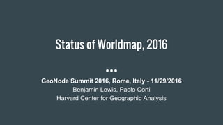
  • 1. Status of Worldmap, 2016 GeoNode Summit 2016, Rome, Italy - 11/29/2016 Benjamin Lewis, Paolo Corti Harvard Center for Geographic Analysis
  • 2. A brief history ● WorldMap was developed by Harvard CGA as a branch of GeoNode 1.2 and released in July 2011 as a public space for scholars and the public to upload and share spatial data ● Before WorldMap CGA developed several platforms with similar aims: AfricaMap (launched in 2007), Boston Research Map (sociology), VermontMap (geology), ParisMap (history) and ChinaMap ● Within a year WorldMap had about 12k datasets and 8k users ● Right now, after 5 years, there are about 20k users, 23k datasets and 7k maps. There are about 1,300 visitors per day and every month more than 400 new datasets are uploaded to the system ● It is such a popular platform that we have to deal with SEO spam!!! ● It was just deployed in production Hypermap Registry, that will let the users to search and load in their maps a plethora of remote services
  • 3. Large range of data categories Place Locations (4769) Boundaries (3543) Society & Demographics (2708) Structures (1572) Transportation (1072) Environmental Resources, Conservation (1049) Imagery & Base Maps (993) Earth Sciences (844) Planning & Cadastral Data (798) Health & Human Ecology (643) Economic Activities & Employment (640) Utilities & Infrastructure (636) Rivers, Streams, Lakes (510) Farming & Agriculture (416) Ecology & Biota (291) Elevation (234) Climate & Weather (159) Military Bases & Activities (151) Oceans (133)
  • 4. Some interesting map applications created on WorldMap
  • 5. Open Source Stack ● GeoNode (Django) ● PostgreSQL/PostGIS ● GeoServer ● GeoNetwork ● GeoExt ● Solr/Lucene ● Nginx, uwsgi, Tomcat ● RabbitMQ/Celery
  • 6. External Applications interacting with WorldMap ● Harvard Dataverse: open source web application to share, preserve, cite, explore and analyze research data ● MapWarper: a tool for digitally aligning (geo-rectifying) scanned historical maps ● HHypermap: a platform to manage and search thousands of remote map services ● GeoTweet Archive: a database with millions of geotweets harvested daily since 2012
  • 7. What is new? HHypermap ● A new powerful search interface has been developed ● The user interface is based on Harvard Hypermap, a system for building and maintaining a comprehensive registry of map services and that enables powerful search for data by time and space as well as by keyword
  • 8. What is next? WorldMap 2.6 ● Migrate the platform to GeoNode 2.6 (including GeoServer to latest version and pycsw to replace GeoNetwork) ● Migrate custom applications (Create Layers, Gazetteer…) to GeoNode 2.6 contrib applications ● Use docker for deployment workflows ● Enhance the test suite
  • 9. Applications that we will port from WorldMap to GeoNode ● Create Layers ● Gazetteer ● Map Notes ● Table Joins ● CSV import ● GeoServer PostGIS store sharding ● Map snapshots and revisions ● Hypermap Registry ● Feature Level Search (work in progress)
  • 13. Table Joins and CSV import
  • 14. GeoServer PostGIS data store sharding From a large GeoServer PostGIS data store we had to move to an horizontal partitioning architecture, with a shard data store for every month WM Data 2016 Feb 2016 May 2016 Jan 2016 Mar 2016 Apr 2016 Jun 2016 Aug 2016 Nov 2016 Jul 2016 Sep 2016 Oct 2016 Dic 2016 2015 2015 2015 2014 2015
  • 15. Map Snapshot and Revisions
  • 17. Deployed on Amazon AWS ● Scalable servers, right now: ○ Django EC2 m3.large ○ Postgres EC2 r3.xlarge ○ GeoServer EC2 m3.xlarge ○ HHypermap EC2 t2.medium ○ Solr EC2 r3.large ● Moving deployment workflows to Docker
  • 18. References ● Harvard University CGA: http://gis.harvard.edu/ ● WorldMap: http://worldmap.harvard.edu/ ● Harvard Hypermap public registry: http://hh.worldmap.harvard.edu/ ● HHypermap code repository: https://github.com/cga-harvard/HHypermap