13 ashish
•Transferir como PPTX, PDF•
2 gostaram•659 visualizações

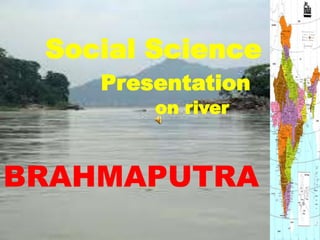
about Brahmaputra river

Recomendados
Mais conteúdo relacionado
Mais procurados
Mais procurados (19)
Destaque
Semelhante a 13 ashish
Semelhante a 13 ashish (20)
Mais de Bhati Gujjar
Último
Último (20)
13 ashish
- 2. INTRODUCTION TO BRAHMAPUTRA Brahmaputra River, Bengali Jamuna, Assamese Dihang, Tibetan Tsangpo, Chinese (Pinyin) Yarlung Zangbo Jiang, or (Wade-Giles romanization) Ya-lu-tsang-pu Chiang, major river of Central and South Asia. It flows some 1,800 miles (2,900 km) from its source in the Himalayas to its confluence with the Ganges (Ganga) River, after which the mingled waters of the two rivers empty into the Bay of Bengal. Along its course it passes through the Tibet Autonomous Region of China, the Indian states of Arunachal Pradesh and Assam, and Bangladesh. For most of its length, the river serves as an important inland waterway; it is not, however, navigable between the mountains of Tibet and the plains of India. In its lower course the river is both a creator and a destroyer— depositing huge quantities of fertile alluvial soil but also causing disastrous and frequent floods
- 3. ORIGIN OF THE BRAHMAPUTRA ; )Assamese: also called Tsangpo-Brahmaputra, is a transboundary river and one of the major rivers of Asia. The Brahmaputra ( With its origin in the Angsi Glacier, located on the northern side of the Himalayas in Burang County of China's Tibet Autonomous Region as the Yarlung Tsangpo River,[3] it flows across southern Tibet to break through the Himalayas in great gorges (including the Yarlung Tsangpo Grand Canyon) and into Arunachal Pradesh (India) where it is known as Dihang or Siang.It flows southwest through the Assam Valley as Brahmaputra and south through Bangladesh as the Jamuna (not to be mistaken with Yamuna of India). In the vast Ganges Delta it merges with the Padma, the main distributary of the Ganges, then the Meghna, before emptying into the Bay of Bengal.
- 4. About 1,800 miles (2,900 km) long, the Brahmaputra is an important river for irrigation and transportation. The average depth of the river is 124 feet (38 m) and maximum depth is 380 feet (120 m). The river is prone to catastrophic flooding in spring when the Himalayan snows melt. The average discharge of the river is about 19,300 cubic metres per second (680,000 cu ft/s), and floods can reach over 100,000 cubic metres per second (3,500,000 cu ft/s).[6] It is a classic example of a braided river and is highly susceptible to channel migration and avulsion.[7] It is also one of the few rivers in the world that exhibit a tidal bore. It is navigable for most of its length. The river drains the Himalaya east of the Indo-Nepal border, southern-central portion of the Tibetan plateau above the Ganges basin, south-eastern portion of Tibet, the Patkai-Bum hills, the northern slopes of the Meghalaya hills, the Assam plains and the northern portion of Bangladesh. The basin, especially south of Tibet is characterized by high levels of rainfall. Kangchenjunga (8,586m) is the only peak above 8,000m and the highest point within the Brahmaputra basin. The Brahmaputra's upper course was long unknown, and its identity with the Yarlung Tsangpo was only established by exploration in 1884–86. This river is often called TsangpoBrahmaputra river. The lower reaches are sacred to Hindus. While most rivers on the Indian subcontinent have female names, this river has a rare male name, as it means "son of Brahma" in Sanskrit (putra means "son").
- 5. THE BRAHMAPUTRA IN INDIA The Brahmaputra enters India in the state of Arunachal Pradesh, where it is called Siang. It makes a very rapid descent from its original height in Tibet, and finally appears in the plains, where it is called Dihang. It flows for about 35 kilometres (22 mi) and is joined by the Dibang River and the Lohit River at the head of the Assam Valley. Below the Lohit the river is called Brahmaputra, enters the state of Assam and becomes very wide—as wide as 10 kilometres (6.2 mi) in parts of Assam. It is joined in Sonitpur by the Kameng River (or Jia Bhoreli). Between Dibrugarh and Lakhimpur districts the river divides into two channels—the northern Kherkutia channel and the southern Brahmaputra channel. The two channels join again about 100 kilometres (62 mi) downstream forming the Majuli island, which was, until some time back,the largest river island in the world. At Guwahati, near the ancient pilgrimage centre of Hajo, the Brahmaputra cuts through the rocks of the Shillong Plateau, and is at its narrowest at 1 kilometre (1,100 yd) bank-to-bank. Due to the river's narrow width, the Battle of Saraighat was fought here in March 1671. The first rail-cum-road bridge[clarification needed] across the Brahmaputra was opened to traffic in April 1962 at Saraighat. The environment of the Brahmaputra floodplains in Assam have been described as the Brahmaputra Valley semi-evergreen forests ecoregion
- 6. BRAHMAPUTRA IN BAGLADESH In Bangladesh, the Brahmaputra is joined by the Teesta River (or Tista), one of its largest tributaries. Below the Teesta, the Brahmaputra splits into two distributary branches. The western branch, which contains the majority of the river's flow, continues due south as the Jamuna (Jomuna) to merge with the lower Ganges, called the Padma River (Pôdda). The eastern branch, formerly the larger but now much smaller, is called the lower or old Brahmaputra (Bromhoputro). It curves southeast to join the Meghna River near Dhaka. The Padma and Meghna converge near Chandpur and flow out into the Bay of Bengal. This final part of the river is called Meghna. In the past the course of the lower Brahmaputra was different and passed through the Jamalpur and Mymensingh districts. In a 7.5 magnitude earthquake on April 2, 1762, the main channel of the Brahmaputra at Bhahadurabad point was switched southwards and opened as Jamuna due to the result of tectonic uplift of the Madhupur tract.[10][11][12] The Ganges Delta, fed by the waters of numerous rivers, including the Ganges and Brahmaputra, is 59,570 square kilometres (23,000 sq mi) the largest river deltas in the world