SlideShare uma empresa Scribd logo
1 de 16
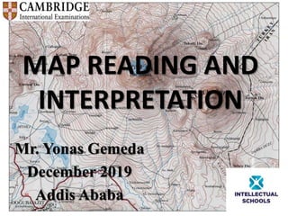
MAP READING AND
INTERPRETATION
Mr. Yonas Gemeda
December 2019
Addis Ababa
Content
Introduction
Relief representation on contour map
Drainage on map
The study of human made features on map
Geographical information systems (GIS)
 unit revision
Learning outcomes
• At the end of this unit, students will be able to:
Review the definition and properties of contour
lines
Realize how contour lines are used to represent
relief features on maps and types of contour
• Acquire the skills of drawing contour lines,
cross sections.
Introduction
Map
 What is map?
• A map is a drawing or graphical representation of the
land, as viewed from the air from a great height. This
perspective is called the "aerial view" or "map view." As
land bound creatures who usually walk across the land
rather than fly above it, the map view is not the natural
perspective for humans; rather, we have more of a "side
view" of the land surface.
Elements of map
• Dsgfjhk
• cgfdht
Elements
Relief representation on contour map
• Relief
The term relief refers to the way that the earth’s
surface arranged.
The relief feature of the earth is 3D. These are:
length
Breadth
And height
Cont’d
• These three dimensional features are
represented on two dimensional ,maps.
• Traditionally reliefs of earth surface showed
by:
Hachuring
Hill shading
Layer tinting
Form lines
Current
• These days they are replaced by contour lines.
• Contour lines
• Contour lines are also known as isohypes.
• They are imaginary lines which are drawn on
maps connecting places having the same
height above or below sea level.
Contour lines
• The term contour line is most commonly used
in cartography. However, the term isobath for
underwater depths on bathymetric maps and
isohypse for elevations are also used.
• The process of drawing contours on a map is
called isopletion.
Contour lines
Types of contour
• Three are three types of contour lines shown
on standard topographic maps. These are:
I. Index : starting at a zero elevation or mean
sea level, every fifth contour line is a heavier
line.
Each index contour line is numbered at some
points. This number is the elevation of that line.
Cont’d
II. Intermediate : the contour line falling
between the index contour lines are called
intermediate contour lines.
These lines are finer and do not have elevation
given.
There are four intermediate contour lines
between index contour lines.
Cont’d
III. Supplementary: these contour lines resemble
dashes.
They show changes elevation of at least one half
the contour interval.
Types

Mais conteúdo relacionado

Mais procurados

Different Types of Maps
Different Types of MapsDifferent Types of Maps
Different Types of Maps
cpbrown10
 

Mais procurados (20)

Types of Map Scales
Types of Map ScalesTypes of Map Scales
Types of Map Scales
 
Map Elements
Map ElementsMap Elements
Map Elements
 
Types of maps
Types of maps Types of maps
Types of maps
 
Cartography
CartographyCartography
Cartography
 
Types of maps
Types of mapsTypes of maps
Types of maps
 
Different Types of Maps
Different Types of MapsDifferent Types of Maps
Different Types of Maps
 
Maps Ppt
Maps PptMaps Ppt
Maps Ppt
 
Types of maps
Types of mapsTypes of maps
Types of maps
 
Parts of a Map
Parts of a MapParts of a Map
Parts of a Map
 
Map symbols
Map symbolsMap symbols
Map symbols
 
Map reading and interpretation
Map reading and interpretationMap reading and interpretation
Map reading and interpretation
 
Maps and globes
Maps and globesMaps and globes
Maps and globes
 
Types of maps
Types of mapsTypes of maps
Types of maps
 
topographic maps
topographic mapstopographic maps
topographic maps
 
Topographic Map
Topographic MapTopographic Map
Topographic Map
 
Elements of a map
Elements of a mapElements of a map
Elements of a map
 
Map Projection
Map ProjectionMap Projection
Map Projection
 
Toposheet interpretation
Toposheet interpretationToposheet interpretation
Toposheet interpretation
 
Map Projections
Map ProjectionsMap Projections
Map Projections
 
Maps ppt
Maps pptMaps ppt
Maps ppt
 

Semelhante a Map Reading and Interpretation

Chapter 3 gateway 123 combined
Chapter 3 gateway 123 combinedChapter 3 gateway 123 combined
Chapter 3 gateway 123 combined
MissST
 
Chapter 3 gateway 123
Chapter 3 gateway 123Chapter 3 gateway 123
Chapter 3 gateway 123
MissST
 
Topographic maps presentation_mine
Topographic maps presentation_mineTopographic maps presentation_mine
Topographic maps presentation_mine
misterbatroms
 

Semelhante a Map Reading and Interpretation (20)

Chapter 3 gateway 123 combined
Chapter 3 gateway 123 combinedChapter 3 gateway 123 combined
Chapter 3 gateway 123 combined
 
Contour maps: preparation and understanding.
Contour maps: preparation and understanding.Contour maps: preparation and understanding.
Contour maps: preparation and understanding.
 
Map projections and its types explanation and examples.pptx
Map projections and its types explanation and examples.pptxMap projections and its types explanation and examples.pptx
Map projections and its types explanation and examples.pptx
 
Chapter 3 gateway 123
Chapter 3 gateway 123Chapter 3 gateway 123
Chapter 3 gateway 123
 
What is Map.pptx
What is Map.pptxWhat is Map.pptx
What is Map.pptx
 
What is Map.pptx
What is Map.pptxWhat is Map.pptx
What is Map.pptx
 
1605005768-topograph (1).pdf
1605005768-topograph (1).pdf1605005768-topograph (1).pdf
1605005768-topograph (1).pdf
 
MAP PROJECTION.pdf
MAP PROJECTION.pdfMAP PROJECTION.pdf
MAP PROJECTION.pdf
 
Contour lines - Survey & Levelling
Contour lines - Survey & LevellingContour lines - Survey & Levelling
Contour lines - Survey & Levelling
 
Topographic maps presentation_mine
Topographic maps presentation_mineTopographic maps presentation_mine
Topographic maps presentation_mine
 
MAP PROJECTION
MAP PROJECTIONMAP PROJECTION
MAP PROJECTION
 
Maps-and-map-interpretation.docx
Maps-and-map-interpretation.docxMaps-and-map-interpretation.docx
Maps-and-map-interpretation.docx
 
map reading unit 1.pdf
map reading unit 1.pdfmap reading unit 1.pdf
map reading unit 1.pdf
 
Unit 2 Elements of a map.pdf
Unit 2 Elements of a map.pdfUnit 2 Elements of a map.pdf
Unit 2 Elements of a map.pdf
 
Cartography Unit_ 3.pptx
Cartography Unit_ 3.pptxCartography Unit_ 3.pptx
Cartography Unit_ 3.pptx
 
Contouring
ContouringContouring
Contouring
 
cartography PPT...pptx
cartography PPT...pptxcartography PPT...pptx
cartography PPT...pptx
 
Contour lines
Contour linesContour lines
Contour lines
 
height on maps contours
 height on maps contours height on maps contours
height on maps contours
 
Map projection
Map projection Map projection
Map projection
 

Mais de Yonas Gemeda

Mais de Yonas Gemeda (20)

Earthquakes and volcanoes
Earthquakes and volcanoesEarthquakes and volcanoes
Earthquakes and volcanoes
 
POPULATION STRUCTURE, DISTRIBUTION AND DENSITY
POPULATION STRUCTURE, DISTRIBUTION AND DENSITYPOPULATION STRUCTURE, DISTRIBUTION AND DENSITY
POPULATION STRUCTURE, DISTRIBUTION AND DENSITY
 
Urban Settlement and Urbanization
Urban Settlement and UrbanizationUrban Settlement and Urbanization
Urban Settlement and Urbanization
 
ROCKS and WEATHERING for As level Geography
ROCKS and WEATHERING  for As level GeographyROCKS and WEATHERING  for As level Geography
ROCKS and WEATHERING for As level Geography
 
ATMOSPHERE AND WEATHER for AS level students
ATMOSPHERE AND WEATHER for  AS level students ATMOSPHERE AND WEATHER for  AS level students
ATMOSPHERE AND WEATHER for AS level students
 
POPULATION DYNAMICS FOR IGCSE CAMBRIDGE
POPULATION DYNAMICS FOR IGCSE CAMBRIDGEPOPULATION DYNAMICS FOR IGCSE CAMBRIDGE
POPULATION DYNAMICS FOR IGCSE CAMBRIDGE
 
The globalization of industrial activity
The globalization of industrial activityThe globalization of industrial activity
The globalization of industrial activity
 
Regional development
Regional developmentRegional development
Regional development
 
Sources of population data
Sources of population dataSources of population data
Sources of population data
 
Human population and economic activities
Human population and economic activitiesHuman population and economic activities
Human population and economic activities
 
Hydrology and Fluvial Geo morphology for CAMBRIDGE AS level
Hydrology and Fluvial Geo morphology for CAMBRIDGE AS level Hydrology and Fluvial Geo morphology for CAMBRIDGE AS level
Hydrology and Fluvial Geo morphology for CAMBRIDGE AS level
 
EARTHQUAKES FOR CAMBRIDGE A LEVEL
EARTHQUAKES FOR CAMBRIDGE A LEVELEARTHQUAKES FOR CAMBRIDGE A LEVEL
EARTHQUAKES FOR CAMBRIDGE A LEVEL
 
VOLCANOES for CAMBRIDGE A LEVEL
VOLCANOES for CAMBRIDGE A LEVELVOLCANOES for CAMBRIDGE A LEVEL
VOLCANOES for CAMBRIDGE A LEVEL
 
Food production
Food productionFood production
Food production
 
Plate Boundaries
Plate BoundariesPlate Boundaries
Plate Boundaries
 
Approaches in Geograpgy
Approaches in GeograpgyApproaches in Geograpgy
Approaches in Geograpgy
 
Natural hazards
Natural hazardsNatural hazards
Natural hazards
 
Development
DevelopmentDevelopment
Development
 
LAND FORM OF TROPICAL ENVIRONMENT
LAND FORM OF TROPICAL ENVIRONMENTLAND FORM OF TROPICAL ENVIRONMENT
LAND FORM OF TROPICAL ENVIRONMENT
 
Tropical Climate
Tropical ClimateTropical Climate
Tropical Climate
 

Último

Spellings Wk 3 English CAPS CARES Please Practise
Spellings Wk 3 English CAPS CARES Please PractiseSpellings Wk 3 English CAPS CARES Please Practise
Spellings Wk 3 English CAPS CARES Please Practise
AnaAcapella
 
1029-Danh muc Sach Giao Khoa khoi 6.pdf
1029-Danh muc Sach Giao Khoa khoi  6.pdf1029-Danh muc Sach Giao Khoa khoi  6.pdf
1029-Danh muc Sach Giao Khoa khoi 6.pdf
QucHHunhnh
 
Salient Features of India constitution especially power and functions
Salient Features of India constitution especially power and functionsSalient Features of India constitution especially power and functions
Salient Features of India constitution especially power and functions
KarakKing
 
Jual Obat Aborsi Hongkong ( Asli No.1 ) 085657271886 Obat Penggugur Kandungan...
Jual Obat Aborsi Hongkong ( Asli No.1 ) 085657271886 Obat Penggugur Kandungan...Jual Obat Aborsi Hongkong ( Asli No.1 ) 085657271886 Obat Penggugur Kandungan...
Jual Obat Aborsi Hongkong ( Asli No.1 ) 085657271886 Obat Penggugur Kandungan...
ZurliaSoop
 
The basics of sentences session 3pptx.pptx
The basics of sentences session 3pptx.pptxThe basics of sentences session 3pptx.pptx
The basics of sentences session 3pptx.pptx
heathfieldcps1
 

Último (20)

Towards a code of practice for AI in AT.pptx
Towards a code of practice for AI in AT.pptxTowards a code of practice for AI in AT.pptx
Towards a code of practice for AI in AT.pptx
 
On National Teacher Day, meet the 2024-25 Kenan Fellows
On National Teacher Day, meet the 2024-25 Kenan FellowsOn National Teacher Day, meet the 2024-25 Kenan Fellows
On National Teacher Day, meet the 2024-25 Kenan Fellows
 
Unit-IV- Pharma. Marketing Channels.pptx
Unit-IV- Pharma. Marketing Channels.pptxUnit-IV- Pharma. Marketing Channels.pptx
Unit-IV- Pharma. Marketing Channels.pptx
 
Single or Multiple melodic lines structure
Single or Multiple melodic lines structureSingle or Multiple melodic lines structure
Single or Multiple melodic lines structure
 
FSB Advising Checklist - Orientation 2024
FSB Advising Checklist - Orientation 2024FSB Advising Checklist - Orientation 2024
FSB Advising Checklist - Orientation 2024
 
SKILL OF INTRODUCING THE LESSON MICRO SKILLS.pptx
SKILL OF INTRODUCING THE LESSON MICRO SKILLS.pptxSKILL OF INTRODUCING THE LESSON MICRO SKILLS.pptx
SKILL OF INTRODUCING THE LESSON MICRO SKILLS.pptx
 
General Principles of Intellectual Property: Concepts of Intellectual Proper...
General Principles of Intellectual Property: Concepts of Intellectual  Proper...General Principles of Intellectual Property: Concepts of Intellectual  Proper...
General Principles of Intellectual Property: Concepts of Intellectual Proper...
 
Spatium Project Simulation student brief
Spatium Project Simulation student briefSpatium Project Simulation student brief
Spatium Project Simulation student brief
 
ICT Role in 21st Century Education & its Challenges.pptx
ICT Role in 21st Century Education & its Challenges.pptxICT Role in 21st Century Education & its Challenges.pptx
ICT Role in 21st Century Education & its Challenges.pptx
 
Spellings Wk 3 English CAPS CARES Please Practise
Spellings Wk 3 English CAPS CARES Please PractiseSpellings Wk 3 English CAPS CARES Please Practise
Spellings Wk 3 English CAPS CARES Please Practise
 
1029-Danh muc Sach Giao Khoa khoi 6.pdf
1029-Danh muc Sach Giao Khoa khoi  6.pdf1029-Danh muc Sach Giao Khoa khoi  6.pdf
1029-Danh muc Sach Giao Khoa khoi 6.pdf
 
How to Give a Domain for a Field in Odoo 17
How to Give a Domain for a Field in Odoo 17How to Give a Domain for a Field in Odoo 17
How to Give a Domain for a Field in Odoo 17
 
ComPTIA Overview | Comptia Security+ Book SY0-701
ComPTIA Overview | Comptia Security+ Book SY0-701ComPTIA Overview | Comptia Security+ Book SY0-701
ComPTIA Overview | Comptia Security+ Book SY0-701
 
Understanding Accommodations and Modifications
Understanding  Accommodations and ModificationsUnderstanding  Accommodations and Modifications
Understanding Accommodations and Modifications
 
Unit-V; Pricing (Pharma Marketing Management).pptx
Unit-V; Pricing (Pharma Marketing Management).pptxUnit-V; Pricing (Pharma Marketing Management).pptx
Unit-V; Pricing (Pharma Marketing Management).pptx
 
Salient Features of India constitution especially power and functions
Salient Features of India constitution especially power and functionsSalient Features of India constitution especially power and functions
Salient Features of India constitution especially power and functions
 
Mehran University Newsletter Vol-X, Issue-I, 2024
Mehran University Newsletter Vol-X, Issue-I, 2024Mehran University Newsletter Vol-X, Issue-I, 2024
Mehran University Newsletter Vol-X, Issue-I, 2024
 
TỔNG ÔN TẬP THI VÀO LỚP 10 MÔN TIẾNG ANH NĂM HỌC 2023 - 2024 CÓ ĐÁP ÁN (NGỮ Â...
TỔNG ÔN TẬP THI VÀO LỚP 10 MÔN TIẾNG ANH NĂM HỌC 2023 - 2024 CÓ ĐÁP ÁN (NGỮ Â...TỔNG ÔN TẬP THI VÀO LỚP 10 MÔN TIẾNG ANH NĂM HỌC 2023 - 2024 CÓ ĐÁP ÁN (NGỮ Â...
TỔNG ÔN TẬP THI VÀO LỚP 10 MÔN TIẾNG ANH NĂM HỌC 2023 - 2024 CÓ ĐÁP ÁN (NGỮ Â...
 
Jual Obat Aborsi Hongkong ( Asli No.1 ) 085657271886 Obat Penggugur Kandungan...
Jual Obat Aborsi Hongkong ( Asli No.1 ) 085657271886 Obat Penggugur Kandungan...Jual Obat Aborsi Hongkong ( Asli No.1 ) 085657271886 Obat Penggugur Kandungan...
Jual Obat Aborsi Hongkong ( Asli No.1 ) 085657271886 Obat Penggugur Kandungan...
 
The basics of sentences session 3pptx.pptx
The basics of sentences session 3pptx.pptxThe basics of sentences session 3pptx.pptx
The basics of sentences session 3pptx.pptx
 

Map Reading and Interpretation

  • 1. MAP READING AND INTERPRETATION Mr. Yonas Gemeda December 2019 Addis Ababa
  • 2. Content Introduction Relief representation on contour map Drainage on map The study of human made features on map Geographical information systems (GIS)  unit revision
  • 3. Learning outcomes • At the end of this unit, students will be able to: Review the definition and properties of contour lines Realize how contour lines are used to represent relief features on maps and types of contour • Acquire the skills of drawing contour lines, cross sections.
  • 4. Introduction Map  What is map? • A map is a drawing or graphical representation of the land, as viewed from the air from a great height. This perspective is called the "aerial view" or "map view." As land bound creatures who usually walk across the land rather than fly above it, the map view is not the natural perspective for humans; rather, we have more of a "side view" of the land surface.
  • 5. Elements of map • Dsgfjhk • cgfdht
  • 7.
  • 8. Relief representation on contour map • Relief The term relief refers to the way that the earth’s surface arranged. The relief feature of the earth is 3D. These are: length Breadth And height
  • 9. Cont’d • These three dimensional features are represented on two dimensional ,maps. • Traditionally reliefs of earth surface showed by: Hachuring Hill shading Layer tinting Form lines
  • 10. Current • These days they are replaced by contour lines. • Contour lines • Contour lines are also known as isohypes. • They are imaginary lines which are drawn on maps connecting places having the same height above or below sea level.
  • 11. Contour lines • The term contour line is most commonly used in cartography. However, the term isobath for underwater depths on bathymetric maps and isohypse for elevations are also used. • The process of drawing contours on a map is called isopletion.
  • 13. Types of contour • Three are three types of contour lines shown on standard topographic maps. These are: I. Index : starting at a zero elevation or mean sea level, every fifth contour line is a heavier line. Each index contour line is numbered at some points. This number is the elevation of that line.
  • 14. Cont’d II. Intermediate : the contour line falling between the index contour lines are called intermediate contour lines. These lines are finer and do not have elevation given. There are four intermediate contour lines between index contour lines.
  • 15. Cont’d III. Supplementary: these contour lines resemble dashes. They show changes elevation of at least one half the contour interval.
  • 16. Types