SlideShare uma empresa Scribd logo
1 de 17
1 O ntwikkeling van MoVe  Rotterdam, 22 september 2010 Albert van Kempen  Xander Bakker
2 A chtergrond MoVe
3 M oVe  Vroeger:  het veld in met een kist vol…
4 M oVe  Nu:  alleen een tablet PC met maatwerk ArcGIS Mobile
M oVe  Foto 1: uitzetten van werk richting controleurs (ZZP-ers in het geval van DLG-Oost die op kantoor komen) 5
M oVe  Foto 2: aanplant van wilgen (tellen aantal wilgen) 6
M oVe  Foto 3: ontwikkeling kruidenrijk grasland (tellen inheemse plantensoorten) 7
8 P roject MoVe  ,[object Object],Werkverdeling, veldwerk en rapportage ,[object Object],Controle op data-integriteit, actuele data ,[object Object],35 controleurs, 26.000 beheerseenheden ,[object Object],Bevindingen registreren, geografie corrigeren, etc. ,[object Object],Voorheen 80.000 uur/jaar controle
9 W erkproces Veldcontroles toewijzen kantoorapplicatie Uitvoeren veldcontroles DLG Accorderen in kantoorapplicatie  Export naar Dienst Regelingen
10 M oVe  FILM: de praktijk http://www.youtube.com/watch?v=LsC4MZ488RE
11 M oVe  Navigeren De mobiele applicatie MoVe Zoeken Werkvoorraad Edit tools Administratieve mutaties
12 M oVe  Afwijkingen registreren Gestandaardiseerde invoer Foto’s toevoegen
13 Kantoor applicatie Beheer module MoVe Export M oVe  File server Maatwerk Synchronisatie Dynamische Kaartlagen (AGS services) Steekproef ArcGIS Server Oracle Statische Achtergronden SDC / MapCache AGM synchronisatie Featureclasses
14 M oVe Export Export rapportages ,[object Object]
Als scheduled task ‘s nachts
ArcGIS Server Rest API voor kaartenArcGIS Server
15 A rcGIS Mobile  ArcGIS Mobile 10: ,[object Object]

Mais conteúdo relacionado

Mais de Xander Bakker

Digital Elevation Models - WUR - Grontmij
Digital Elevation Models - WUR - GrontmijDigital Elevation Models - WUR - Grontmij
Digital Elevation Models - WUR - GrontmijXander Bakker
 
Some thoughts on DevSummit 2012 including comments and links (PDF)
Some thoughts on DevSummit 2012 including comments and links (PDF)Some thoughts on DevSummit 2012 including comments and links (PDF)
Some thoughts on DevSummit 2012 including comments and links (PDF)Xander Bakker
 
Evaluating the Height of Regional Dikes of HH Rijnland with LiDAR using ArcGI...
Evaluating the Height of Regional Dikes of HH Rijnland with LiDAR using ArcGI...Evaluating the Height of Regional Dikes of HH Rijnland with LiDAR using ArcGI...
Evaluating the Height of Regional Dikes of HH Rijnland with LiDAR using ArcGI...Xander Bakker
 
Characterizing regional dikes with LiDAR using ArcGIS 10 by Grontmij
Characterizing regional dikes with LiDAR using ArcGIS 10 by GrontmijCharacterizing regional dikes with LiDAR using ArcGIS 10 by Grontmij
Characterizing regional dikes with LiDAR using ArcGIS 10 by GrontmijXander Bakker
 
ArcGIS Mobile 10 Gas Leak Detection Application by Grontmij and Esri NL
ArcGIS Mobile 10 Gas Leak Detection Application by Grontmij and Esri NLArcGIS Mobile 10 Gas Leak Detection Application by Grontmij and Esri NL
ArcGIS Mobile 10 Gas Leak Detection Application by Grontmij and Esri NLXander Bakker
 
Esri DevSummit 2011 - Grontmij presentation
Esri DevSummit 2011 - Grontmij presentationEsri DevSummit 2011 - Grontmij presentation
Esri DevSummit 2011 - Grontmij presentationXander Bakker
 
ArcGIS Mobile 10 - Grontmij
ArcGIS Mobile 10 - GrontmijArcGIS Mobile 10 - Grontmij
ArcGIS Mobile 10 - GrontmijXander Bakker
 
Detecting Buildings in AHN2 LiDAR data with ArcGIS - Grontmij
Detecting Buildings in AHN2 LiDAR data with ArcGIS - GrontmijDetecting Buildings in AHN2 LiDAR data with ArcGIS - Grontmij
Detecting Buildings in AHN2 LiDAR data with ArcGIS - GrontmijXander Bakker
 

Mais de Xander Bakker (8)

Digital Elevation Models - WUR - Grontmij
Digital Elevation Models - WUR - GrontmijDigital Elevation Models - WUR - Grontmij
Digital Elevation Models - WUR - Grontmij
 
Some thoughts on DevSummit 2012 including comments and links (PDF)
Some thoughts on DevSummit 2012 including comments and links (PDF)Some thoughts on DevSummit 2012 including comments and links (PDF)
Some thoughts on DevSummit 2012 including comments and links (PDF)
 
Evaluating the Height of Regional Dikes of HH Rijnland with LiDAR using ArcGI...
Evaluating the Height of Regional Dikes of HH Rijnland with LiDAR using ArcGI...Evaluating the Height of Regional Dikes of HH Rijnland with LiDAR using ArcGI...
Evaluating the Height of Regional Dikes of HH Rijnland with LiDAR using ArcGI...
 
Characterizing regional dikes with LiDAR using ArcGIS 10 by Grontmij
Characterizing regional dikes with LiDAR using ArcGIS 10 by GrontmijCharacterizing regional dikes with LiDAR using ArcGIS 10 by Grontmij
Characterizing regional dikes with LiDAR using ArcGIS 10 by Grontmij
 
ArcGIS Mobile 10 Gas Leak Detection Application by Grontmij and Esri NL
ArcGIS Mobile 10 Gas Leak Detection Application by Grontmij and Esri NLArcGIS Mobile 10 Gas Leak Detection Application by Grontmij and Esri NL
ArcGIS Mobile 10 Gas Leak Detection Application by Grontmij and Esri NL
 
Esri DevSummit 2011 - Grontmij presentation
Esri DevSummit 2011 - Grontmij presentationEsri DevSummit 2011 - Grontmij presentation
Esri DevSummit 2011 - Grontmij presentation
 
ArcGIS Mobile 10 - Grontmij
ArcGIS Mobile 10 - GrontmijArcGIS Mobile 10 - Grontmij
ArcGIS Mobile 10 - Grontmij
 
Detecting Buildings in AHN2 LiDAR data with ArcGIS - Grontmij
Detecting Buildings in AHN2 LiDAR data with ArcGIS - GrontmijDetecting Buildings in AHN2 LiDAR data with ArcGIS - Grontmij
Detecting Buildings in AHN2 LiDAR data with ArcGIS - Grontmij
 

GIS conferentie 2010 MoVe ArcGIS Mobile - Grontmij

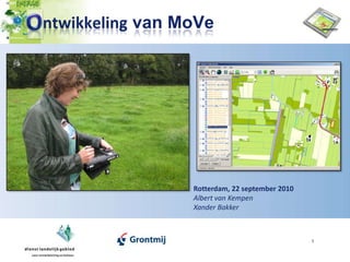
  • 1. 1 O ntwikkeling van MoVe Rotterdam, 22 september 2010 Albert van Kempen Xander Bakker
  • 3. 3 M oVe Vroeger: het veld in met een kist vol…
  • 4. 4 M oVe Nu: alleen een tablet PC met maatwerk ArcGIS Mobile
  • 5. M oVe Foto 1: uitzetten van werk richting controleurs (ZZP-ers in het geval van DLG-Oost die op kantoor komen) 5
  • 6. M oVe Foto 2: aanplant van wilgen (tellen aantal wilgen) 6
  • 7. M oVe Foto 3: ontwikkeling kruidenrijk grasland (tellen inheemse plantensoorten) 7
  • 8.
  • 9. 9 W erkproces Veldcontroles toewijzen kantoorapplicatie Uitvoeren veldcontroles DLG Accorderen in kantoorapplicatie Export naar Dienst Regelingen
  • 10. 10 M oVe FILM: de praktijk http://www.youtube.com/watch?v=LsC4MZ488RE
  • 11. 11 M oVe Navigeren De mobiele applicatie MoVe Zoeken Werkvoorraad Edit tools Administratieve mutaties
  • 12. 12 M oVe Afwijkingen registreren Gestandaardiseerde invoer Foto’s toevoegen
  • 13. 13 Kantoor applicatie Beheer module MoVe Export M oVe File server Maatwerk Synchronisatie Dynamische Kaartlagen (AGS services) Steekproef ArcGIS Server Oracle Statische Achtergronden SDC / MapCache AGM synchronisatie Featureclasses
  • 14.
  • 15. Als scheduled task ‘s nachts
  • 16. ArcGIS Server Rest API voor kaartenArcGIS Server
  • 17.
  • 18. Beter ondersteuning voor touch screens
  • 20.
  • 21. Ondersteuning voor relationships
  • 22. GPS post processing
  • 23. Silverlight API (Windows Phone 7)
  • 24.