SlideShare uma empresa Scribd logo
1 de 6
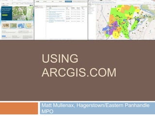
USING
ARCGIS.COM

Matt Mullenax, Hagerstown/Eastern Panhandle
MPO
What is ArcGIS.com?
   ESRI’s ArcGIS Online is a cloud-based,
    collaborative content management system for
    maps, apps, data and other geographic
    information.
   Allows non-programmers to deploy and share
    web maps containing their own GIS data for
    free through the ArcGIS.com map viewer.
ArcGIS.com Specifics
   Create a free ESRI global account.
   Number of mapping applications and amount
    of data limited to 2GB.
   These mapping applications can be shared
    with a group or the public through web
    browser, smart phone apps, social media and
    emails.
   Can also be embedded into websites.
   Use Mozilla Firefox or Google Chrome for best
    performance.
ArcGIS.com Specifics cont’d…
   Can import .shp (zipped), .csv/.txt, .gpx files,
    as well as content from ArcGIS Online
    (including base layers accessible on Desktop).
   Imported files cannot have >1,000 features (or
    250 addresses) and are projected on the fly.
   Layers editable for multiple authors, and edits
    are tracked.
   ArcGIS Desktop and ArcGIS Explorer
    (Desktop and Online) can access web maps.
DEMONSTRATIO
N
Questions?
Matt Mullenax, GISP
Hagerstown/Eastern Panhandle MPO
(304) 267-5118
mmullenax@hepmpo.net

Mais conteúdo relacionado

Destaque

Destaque (17)

SEPA - Esri UK Annual Conference 2016
SEPA - Esri UK Annual Conference 2016SEPA - Esri UK Annual Conference 2016
SEPA - Esri UK Annual Conference 2016
 
OECD Workshop: Measuring Business Impacts on People’s Well-being, Chris Pinney
OECD Workshop: Measuring Business Impacts on People’s Well-being, Chris PinneyOECD Workshop: Measuring Business Impacts on People’s Well-being, Chris Pinney
OECD Workshop: Measuring Business Impacts on People’s Well-being, Chris Pinney
 
Network Rail - Esri UK Annual Conference 2016
Network Rail - Esri UK Annual Conference 2016Network Rail - Esri UK Annual Conference 2016
Network Rail - Esri UK Annual Conference 2016
 
Atmos - Tom hartley - Modelling Bird Behaviour to Progress Wind Farm Development
Atmos - Tom hartley - Modelling Bird Behaviour to Progress Wind Farm DevelopmentAtmos - Tom hartley - Modelling Bird Behaviour to Progress Wind Farm Development
Atmos - Tom hartley - Modelling Bird Behaviour to Progress Wind Farm Development
 
Collector for ArcGIS
Collector for ArcGISCollector for ArcGIS
Collector for ArcGIS
 
Considering Optimism and Pessimism in Conservation
Considering Optimism and Pessimism in ConservationConsidering Optimism and Pessimism in Conservation
Considering Optimism and Pessimism in Conservation
 
Calculation of Species diversity and related indices
Calculation of Species diversity and related indicesCalculation of Species diversity and related indices
Calculation of Species diversity and related indices
 
Ordnance Survey - Esri UK Annual Conference 2016
Ordnance Survey - Esri UK Annual Conference 2016Ordnance Survey - Esri UK Annual Conference 2016
Ordnance Survey - Esri UK Annual Conference 2016
 
Marine Management Organisation with ArcGIS Online
Marine Management Organisation with ArcGIS OnlineMarine Management Organisation with ArcGIS Online
Marine Management Organisation with ArcGIS Online
 
Developing with the ArcGIS Platform - Esri UK Annual Conference 2016
Developing with the ArcGIS Platform - Esri UK Annual Conference 2016Developing with the ArcGIS Platform - Esri UK Annual Conference 2016
Developing with the ArcGIS Platform - Esri UK Annual Conference 2016
 
Esri Open House - Sovereign Housing
Esri Open House - Sovereign HousingEsri Open House - Sovereign Housing
Esri Open House - Sovereign Housing
 
Smart Mapping - How to Create Stunning Maps - Esri UK Annual Conference 2016
Smart Mapping - How to Create Stunning Maps - Esri UK Annual Conference 2016Smart Mapping - How to Create Stunning Maps - Esri UK Annual Conference 2016
Smart Mapping - How to Create Stunning Maps - Esri UK Annual Conference 2016
 
Ecological Literacy - A Foundation for Sustainability
Ecological Literacy - A Foundation for SustainabilityEcological Literacy - A Foundation for Sustainability
Ecological Literacy - A Foundation for Sustainability
 
UKHO - Simon Hampshire - Situational Awareness - Any Time, Any Place, Anywhere
UKHO - Simon Hampshire - Situational Awareness - Any Time, Any Place, AnywhereUKHO - Simon Hampshire - Situational Awareness - Any Time, Any Place, Anywhere
UKHO - Simon Hampshire - Situational Awareness - Any Time, Any Place, Anywhere
 
Megatrend 7: ENVIRONMENTAL degradation
Megatrend 7: ENVIRONMENTAL degradationMegatrend 7: ENVIRONMENTAL degradation
Megatrend 7: ENVIRONMENTAL degradation
 
Species Diversity Concepts
Species Diversity ConceptsSpecies Diversity Concepts
Species Diversity Concepts
 
Architecting the ArcGIS Platform
Architecting the ArcGIS PlatformArchitecting the ArcGIS Platform
Architecting the ArcGIS Platform
 

Mais de WV Assocation of Geospatial Professionals

Mais de WV Assocation of Geospatial Professionals (20)

Flood Risk Review (FRR) Meeting - Upper Monongahela Watershed
Flood Risk Review (FRR) Meeting - Upper Monongahela WatershedFlood Risk Review (FRR) Meeting - Upper Monongahela Watershed
Flood Risk Review (FRR) Meeting - Upper Monongahela Watershed
 
Conservation Innovation - Tools and Trends in GIS
Conservation Innovation - Tools and Trends in GISConservation Innovation - Tools and Trends in GIS
Conservation Innovation - Tools and Trends in GIS
 
High Accuracy Data Collection with Esri's Collector App
High Accuracy Data Collection with Esri's Collector AppHigh Accuracy Data Collection with Esri's Collector App
High Accuracy Data Collection with Esri's Collector App
 
Integrating Survey Data into a GIS
Integrating Survey Data into a GISIntegrating Survey Data into a GIS
Integrating Survey Data into a GIS
 
Implementation of Parcel Fabric in West Virginia
Implementation of Parcel Fabric in West VirginiaImplementation of Parcel Fabric in West Virginia
Implementation of Parcel Fabric in West Virginia
 
Proceedings for 2016 WV EPAN GIS Users Group Meeting
Proceedings for 2016 WV EPAN GIS Users Group MeetingProceedings for 2016 WV EPAN GIS Users Group Meeting
Proceedings for 2016 WV EPAN GIS Users Group Meeting
 
Evaluating Riparian Buffers of WV Landowners in Chesapeake Bay Drainage
Evaluating Riparian Buffers of WV Landowners in Chesapeake Bay Drainage Evaluating Riparian Buffers of WV Landowners in Chesapeake Bay Drainage
Evaluating Riparian Buffers of WV Landowners in Chesapeake Bay Drainage
 
2016 Agenda for WV EPAN Users Group Meeting
2016 Agenda for WV EPAN Users Group Meeting2016 Agenda for WV EPAN Users Group Meeting
2016 Agenda for WV EPAN Users Group Meeting
 
WV Local GIS Data Contributions to State/Federal Datasets
WV Local GIS Data Contributions to State/Federal DatasetsWV Local GIS Data Contributions to State/Federal Datasets
WV Local GIS Data Contributions to State/Federal Datasets
 
Agenda EPAN 2015
Agenda EPAN 2015Agenda EPAN 2015
Agenda EPAN 2015
 
Transitioning Applications to the Web App Builder
Transitioning Applications to the Web App BuilderTransitioning Applications to the Web App Builder
Transitioning Applications to the Web App Builder
 
Stormwater and GIS
Stormwater and GISStormwater and GIS
Stormwater and GIS
 
Pictometry Imagery for West Virginia
Pictometry Imagery for West VirginiaPictometry Imagery for West Virginia
Pictometry Imagery for West Virginia
 
Device Locational Accuracy
Device Locational AccuracyDevice Locational Accuracy
Device Locational Accuracy
 
WV Statewide Addressing and Mapping Update (SAMS-II)
WV Statewide Addressing and Mapping Update (SAMS-II)WV Statewide Addressing and Mapping Update (SAMS-II)
WV Statewide Addressing and Mapping Update (SAMS-II)
 
Agenda for WVAGP 2015 Annual Meeting
Agenda for WVAGP 2015 Annual MeetingAgenda for WVAGP 2015 Annual Meeting
Agenda for WVAGP 2015 Annual Meeting
 
WV 3D Elevation Program (3DEP) / BAA Overview
WV 3D Elevation Program (3DEP) / BAA OverviewWV 3D Elevation Program (3DEP) / BAA Overview
WV 3D Elevation Program (3DEP) / BAA Overview
 
WV National Hydrography Dataset (NHD) Update
WV National Hydrography Dataset (NHD) UpdateWV National Hydrography Dataset (NHD) Update
WV National Hydrography Dataset (NHD) Update
 
Three Rivers Quest (WV Water Research Institute)
Three Rivers Quest (WV Water Research Institute)Three Rivers Quest (WV Water Research Institute)
Three Rivers Quest (WV Water Research Institute)
 
Geospatial Initiatives: A National Perspective
 Geospatial Initiatives: A National Perspective Geospatial Initiatives: A National Perspective
Geospatial Initiatives: A National Perspective
 

Último

Artificial Intelligence: Facts and Myths
Artificial Intelligence: Facts and MythsArtificial Intelligence: Facts and Myths
Artificial Intelligence: Facts and Myths
Joaquim Jorge
 

Último (20)

Repurposing LNG terminals for Hydrogen Ammonia: Feasibility and Cost Saving
Repurposing LNG terminals for Hydrogen Ammonia: Feasibility and Cost SavingRepurposing LNG terminals for Hydrogen Ammonia: Feasibility and Cost Saving
Repurposing LNG terminals for Hydrogen Ammonia: Feasibility and Cost Saving
 
Powerful Google developer tools for immediate impact! (2023-24 C)
Powerful Google developer tools for immediate impact! (2023-24 C)Powerful Google developer tools for immediate impact! (2023-24 C)
Powerful Google developer tools for immediate impact! (2023-24 C)
 
A Domino Admins Adventures (Engage 2024)
A Domino Admins Adventures (Engage 2024)A Domino Admins Adventures (Engage 2024)
A Domino Admins Adventures (Engage 2024)
 
Exploring the Future Potential of AI-Enabled Smartphone Processors
Exploring the Future Potential of AI-Enabled Smartphone ProcessorsExploring the Future Potential of AI-Enabled Smartphone Processors
Exploring the Future Potential of AI-Enabled Smartphone Processors
 
A Year of the Servo Reboot: Where Are We Now?
A Year of the Servo Reboot: Where Are We Now?A Year of the Servo Reboot: Where Are We Now?
A Year of the Servo Reboot: Where Are We Now?
 
From Event to Action: Accelerate Your Decision Making with Real-Time Automation
From Event to Action: Accelerate Your Decision Making with Real-Time AutomationFrom Event to Action: Accelerate Your Decision Making with Real-Time Automation
From Event to Action: Accelerate Your Decision Making with Real-Time Automation
 
TrustArc Webinar - Unlock the Power of AI-Driven Data Discovery
TrustArc Webinar - Unlock the Power of AI-Driven Data DiscoveryTrustArc Webinar - Unlock the Power of AI-Driven Data Discovery
TrustArc Webinar - Unlock the Power of AI-Driven Data Discovery
 
presentation ICT roal in 21st century education
presentation ICT roal in 21st century educationpresentation ICT roal in 21st century education
presentation ICT roal in 21st century education
 
Workshop - Best of Both Worlds_ Combine KG and Vector search for enhanced R...
Workshop - Best of Both Worlds_ Combine  KG and Vector search for  enhanced R...Workshop - Best of Both Worlds_ Combine  KG and Vector search for  enhanced R...
Workshop - Best of Both Worlds_ Combine KG and Vector search for enhanced R...
 
Artificial Intelligence: Facts and Myths
Artificial Intelligence: Facts and MythsArtificial Intelligence: Facts and Myths
Artificial Intelligence: Facts and Myths
 
GenAI Risks & Security Meetup 01052024.pdf
GenAI Risks & Security Meetup 01052024.pdfGenAI Risks & Security Meetup 01052024.pdf
GenAI Risks & Security Meetup 01052024.pdf
 
The 7 Things I Know About Cyber Security After 25 Years | April 2024
The 7 Things I Know About Cyber Security After 25 Years | April 2024The 7 Things I Know About Cyber Security After 25 Years | April 2024
The 7 Things I Know About Cyber Security After 25 Years | April 2024
 
Strategies for Unlocking Knowledge Management in Microsoft 365 in the Copilot...
Strategies for Unlocking Knowledge Management in Microsoft 365 in the Copilot...Strategies for Unlocking Knowledge Management in Microsoft 365 in the Copilot...
Strategies for Unlocking Knowledge Management in Microsoft 365 in the Copilot...
 
Polkadot JAM Slides - Token2049 - By Dr. Gavin Wood
Polkadot JAM Slides - Token2049 - By Dr. Gavin WoodPolkadot JAM Slides - Token2049 - By Dr. Gavin Wood
Polkadot JAM Slides - Token2049 - By Dr. Gavin Wood
 
How to Troubleshoot Apps for the Modern Connected Worker
How to Troubleshoot Apps for the Modern Connected WorkerHow to Troubleshoot Apps for the Modern Connected Worker
How to Troubleshoot Apps for the Modern Connected Worker
 
Real Time Object Detection Using Open CV
Real Time Object Detection Using Open CVReal Time Object Detection Using Open CV
Real Time Object Detection Using Open CV
 
Tata AIG General Insurance Company - Insurer Innovation Award 2024
Tata AIG General Insurance Company - Insurer Innovation Award 2024Tata AIG General Insurance Company - Insurer Innovation Award 2024
Tata AIG General Insurance Company - Insurer Innovation Award 2024
 
Understanding Discord NSFW Servers A Guide for Responsible Users.pdf
Understanding Discord NSFW Servers A Guide for Responsible Users.pdfUnderstanding Discord NSFW Servers A Guide for Responsible Users.pdf
Understanding Discord NSFW Servers A Guide for Responsible Users.pdf
 
Scaling API-first – The story of a global engineering organization
Scaling API-first – The story of a global engineering organizationScaling API-first – The story of a global engineering organization
Scaling API-first – The story of a global engineering organization
 
Boost PC performance: How more available memory can improve productivity
Boost PC performance: How more available memory can improve productivityBoost PC performance: How more available memory can improve productivity
Boost PC performance: How more available memory can improve productivity
 

Using ArcGIS.com

  • 2. What is ArcGIS.com?  ESRI’s ArcGIS Online is a cloud-based, collaborative content management system for maps, apps, data and other geographic information.  Allows non-programmers to deploy and share web maps containing their own GIS data for free through the ArcGIS.com map viewer.
  • 3. ArcGIS.com Specifics  Create a free ESRI global account.  Number of mapping applications and amount of data limited to 2GB.  These mapping applications can be shared with a group or the public through web browser, smart phone apps, social media and emails.  Can also be embedded into websites.  Use Mozilla Firefox or Google Chrome for best performance.
  • 4. ArcGIS.com Specifics cont’d…  Can import .shp (zipped), .csv/.txt, .gpx files, as well as content from ArcGIS Online (including base layers accessible on Desktop).  Imported files cannot have >1,000 features (or 250 addresses) and are projected on the fly.  Layers editable for multiple authors, and edits are tracked.  ArcGIS Desktop and ArcGIS Explorer (Desktop and Online) can access web maps.
  • 6. Questions? Matt Mullenax, GISP Hagerstown/Eastern Panhandle MPO (304) 267-5118 mmullenax@hepmpo.net

Notas do Editor

  1. Wednesday May 9th, 9:10am Room 325 Brooks Hall WVU
  2. Great ArcGIS.com help files online at Esri’s site” http://help.arcgis.com/en/arcgisonline/help/index.html#/Overview/010q00000002000000/