EPAN09 - Welcome and Introductions
•Transferir como PPT, PDF•
0 gostou•285 visualizações

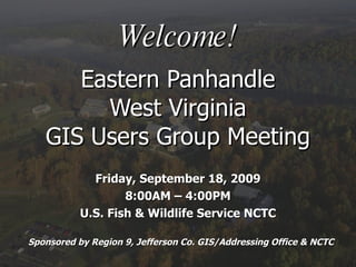
Eastern Panhandle West Virginia GIS Users Group Meeting; Friday, September 18, 2009; U.S. Fish & Wildlife Service NCTC. Sponsored by Region 9, Jefferson Co. GIS/Addressing Office & NCTC
![Sincerest Thank You to our Event Organizers ,[object Object],[object Object],[object Object],[object Object]](data:image/gif;base64,R0lGODlhAQABAIAAAAAAAP///yH5BAEAAAAALAAAAAABAAEAAAIBRAA7)
Recomendados
Mais conteúdo relacionado
Semelhante a EPAN09 - Welcome and Introductions
Semelhante a EPAN09 - Welcome and Introductions (18)
Mais de WV Assocation of Geospatial Professionals
Mais de WV Assocation of Geospatial Professionals (20)
EPAN09 - Welcome and Introductions
- 1. Welcome! Eastern Panhandle West Virginia GIS Users Group Meeting Friday, September 18, 2009 8:00AM – 4:00PM U.S. Fish & Wildlife Service NCTC Sponsored by Region 9, Jefferson Co. GIS/Addressing Office & NCTC
- 5. You are here Lunch is here
- 10. Demographics
- 15. AGENDA 8:00AM – 8:30AM Registration (Main Entry Auditorium Lobby) 8:30AM – 9:00AM Welcome & Introductions Glenn Gravatt, U.S. Fish & Wildlife Service Carol Crabtree, Region 9 Planning and Development Council Todd Fagan, Jefferson County GIS Office 9:00AM – 9:30AM GIS Consortiums: A Regional Solution Tony Simental, WV Office of State GIS Coordinator 9:30AM – 10:00AM Funding Your GI $ John Dubnansky, L. Robert Kimball & Associates, Inc. 10:00AM – 10:15AM BREAK (Refreshments provided by NCTC) 10:15AM – 10:45AM Understanding Google Earth and GIS Matthew Mullenax, Parsons Brinckerhoff 10:45AM – 11:15AM Using LiDAR to Map Sinkholes in Jefferson County, WV John Young, U.S. Geological Survey 11:15AM – 11:45AM Information Exchange Session Attendee participation forum 11:45AM – 1:00PM LUNCH (Provided onsite by Region 9) 1:00PM – 1:30PM What’s Your Angle? – Slope Modeling & Terrain Analysis Jessica Gormont, Jefferson County GIS Office Rachel Shirley, Shepherd University 1:30PM – 2:00PM Urban Tree Canopy Assessment in the Eastern Panhandle Frank Rodgers, Cacapon Institute 2:00PM – 2:15PM BREAK (Refreshments provided by NCTC) *** Winner of Map Gallery Competition Announced*** 2:15PM – 3:00PM Tips & Tricks for Using ArcGIS Online at 9.3.1 Drew Kinney and Rachel Weeden, ESRI 3:00PM – 4:00PM Optional Tour of NCTC Facilities
- 22. You are here Lunch is here Please return and be seated for our next presentation by 1:00 pm
- 23. AGENDA 8:00AM – 8:30AM Registration (Main Entry Auditorium Lobby) 8:30AM – 9:00AM Welcome & Introductions Glenn Gravatt, U.S. Fish & Wildlife Service Carol Crabtree, Region 9 Planning and Development Council Todd Fagan, Jefferson County GIS Office 9:00AM – 9:30AM GIS Consortiums: A Regional Solution Tony Simental, WV Office of State GIS Coordinator 9:30AM – 10:00AM Funding Your GI $ John Dubnansky, L. Robert Kimball & Associates, Inc. 10:00AM – 10:15AM BREAK (Refreshments provided by NCTC) 10:15AM – 10:45AM Understanding Google Earth and GIS Matthew Mullenax, Parsons Brinckerhoff 10:45AM – 11:15AM Using LiDAR to Map Sinkholes in Jefferson County, WV John Young, U.S. Geological Survey 11:15AM – 11:45AM Information Exchange Session Attendee participation forum 11:45AM – 1:00PM LUNCH (Provided onsite by Region 9) 1:00PM – 1:30PM What’s Your Angle? – Slope Modeling & Terrain Analysis Jessica Gormont, Jefferson County GIS Office Rachel Shirley, Shepherd University 1:30PM – 2:00PM Urban Tree Canopy Assessment in the Eastern Panhandle Frank Rodgers, Cacapon Institute 2:00PM – 2:15PM BREAK (Refreshments provided by NCTC) *** Winner of Map Gallery Competition Announced*** 2:15PM – 3:00PM Tips & Tricks for Using ArcGIS Online at 9.3.1 Drew Kinney and Rachel Weeden, ESRI 3:00PM – 4:00PM Optional Tour of NCTC Facilities
- 27. Thank You and We’ll See You Next Year!
Notas do Editor
- Please ask NCTC staff that are present to stand up (Glenn, Todd) Please ask Eastern Panhandle Regional Planning and Development Council Region 9 staff that are present to stand up (Carol Crabtree, Bette Kidwell) Please recognize my boss, Jeff Polczynski and County Commissioner, Lyn Widmyer for allowing us the freedom to network with the GIS community Please give our speakers today your attention and support Matt Mullenax deserves special recognition for helping out tremendously with agenda, planning, support, and PPT slides. He has been crucial to keeping this thing going.
- Rest rooms and Break area are both just outside the auditorium. We ask that you return to your seats promptly from breaks to be ready for our next speaker. Lunch will be in the Commons, just follow the crowd.
- We’re trying some new things this year…I hope you’ll tell us what you think of them. We have entries pinned up on the wall for everyone to review and judge. I believe Cartographers entering or winning in this year’s map gallery are eligible to receive points toward GISP certification. Two of the prizes today are provided by ESRI. One of our speakers, Drew Kinney, wrangled this one, so please show him some love. We’ll announce winners at our afternoon break
- Started by Marty Kaz 2 and ½ years ago. Continued by Eastern Panhandle Regional Planning and Development Council And volunteer local government help.
- We’ve been asked to circulate web resource pages. Your first stop should be the West Virginia GIS Tech Center. We have some Tech Center Staff in from Morgantown today. Please stand up and introduce yourselves to our users. In a kind of old-school interactive way, We’re inviting you to contribute your favorite sites to our hard copy community bulleting board. We’ve posted it up there with the maps. Please add anything that is missing and we’ll recirculate the list to our attendees.
- Another important site is that of the WVAGP. We have members in attendance today, in fact 4 or 5 board members. We almost have a quorum. Jennings Starcher is our Association President, I am the Vice President and Kurt Donaldson is our Secretary. Additional Board members are Tony Simental, our first speaker and Jennifer Selfridge. How many of the rest are members? Not too many hands, I see. I encourage you to visit the site, review some of our literature on the registration table and contact the AGP about becoming a member. Our State GIS Conference is next year in Huntington.
- “ the diversity of GIS applications and topics was great” was a recurring praise from your comments last year. This is the coolest thing about GIS, I think, the variety of applications. We all know how useful it can be in business, government, public safety, planning, transportation, environment, defense, education and demographics. And you can go all day naming more… Look at your contact lists and the first thing you may notice is the diversity of organizations represented in attendance. This chart gives you a breakdown.
- Jessica has mapped where all of us in attendance arrived from today. Did anyone come from a greater distance than St. Albans, WV to be here today? Greatest distance travelled gets our first door prize, 2010 Calendar of 1000 places to visit before you buy the farm.
- Now that you have some idea of our group’s composition and where we are coming from, let’s quickly introduce yourselves to the rest of us. Please be brief. We’ll have more time during our Information Exchange to delve into your GIS interests or questions.
- A couple final notes of importance: Some concerns from last year’s forum are still on our list of topics to address. Like lessons learned on projects involving public utilities, economic development, tax map integration, orthophotos, digital data submissions, and accuracy assessments These holdovers will be combined with your comments after today to begin formulating next year’s agenda. VERY IMPORTANT! Don’t forget to fill out the pink form and submit before you leave today.
- Please mute all electronic devices and give your full attention to each of our presenters.
- Leave room to read first BIO
- For the Atlas… What is the lowest point of elevation in the State of West Virginia? Potomac River at boundary with Virginia (elevation 240 feet)
- Your comments from last year’s forum had a lot to do with the presentations on our agenda today. Hopefully our event organizers are responsive to your concerns and present what you would like to see. ESRI invited to show off what’s new in 9.3.1 and John Dubnansky got us thinking creatively about funding our GIS.
- Tony gaves us examples of successful consortiums 3 presentations on sinkholes, slope and tree canopy protection Matt gave me the answer to anyone who asks me about Google Earth.
- This half hour was established to get more interaction with the users in the audience. We want to know what’s on your mind or what you are doing with GIS? One issue raised by e-mail by a surveyor who is not in attendance, I believe, is that of accuracy. It’s important for every user of mapping information, whether it’s GIS, AutoCAD, surveying, or internet maps to understand the accuracy of the source data. Don’t assume that it is 100% accurate, because it most likely is not! We strive for accuracy, but you have to understand the purpose of the map. Often times our local government maps, including tax maps, are not actual surveys and do not represent actual boundary lines. Unless a document is certified or metadata explains the appropriate use, You should use most of these maps as reference and planning tools, not legal documents to identify property lines. This is a common problem that can be helped through the use of accuracy assessments, map disclaimers and FGDC compliant metadata to communicate the intended purpose of your map or GIS data. If you don’t know the quality of the data, you either should use it conditionally as a reference or not use it all. That’s my opinion, I am inviting yours.
- From Mini Book of Facts West Virginia entered the union in 1863 as the 35 th State Please don’t forget to submit your ballots for our map gallery. We will announce those winners at our afternoon break.
- From Mini Book of Facts West Virginia entered the union in 1863 as the 35 th State
- Please give us a show of hands of how many plan to take advantage of our optional tour of NCTC led by USFWS staff?
- For the Vintage US Map Answer = 8% Keep that number in your head or write it down. Put your inclinometers, slide rules and compasses away for this one. You can only use dead reckoning. We’ll take the first correct answer for our last door prize when we return.
- Two texts donated by ESRI, Vienna Office. And one Raven Map of WV donated by Jefferson County GIS Office.