Bicycle and Pedestrian Planing in Southern Georgia
•Transferir como PPTX, PDF•
1 gostou•389 visualizações

The SGRC has worked in 18 counties to implement national award winning regional bicycle and pedestrian transportation strategies, including senior center walking maps, senior resource maps, trail assessments, complete streets best practice guide and policies to promote active, healthy lifestyles.

Recomendados
Mais conteúdo relacionado
Mais procurados
Mais procurados (20)
Destaque
Destaque (10)
Semelhante a Bicycle and Pedestrian Planing in Southern Georgia
Semelhante a Bicycle and Pedestrian Planing in Southern Georgia (20)
Mais de Valdosta-Lowndes Metropolitan Planning Organization
Mais de Valdosta-Lowndes Metropolitan Planning Organization (15)
Último
Último (20)
Bicycle and Pedestrian Planing in Southern Georgia
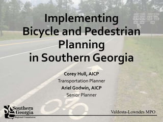
- 1. Valdosta-Lowndes MPO Implementing Bicycle and Pedestrian Planning in Southern Georgia Corey Hull, AICP Transportation Planner Ariel Godwin, AICP Senior Planner
- 2. Valdosta-Lowndes MPO SGRC Region VLMPO • 18 Counties • 406,000 People • Population is 51% rural • Land area is 98% rural • 13% of total state area
- 8. Valdosta-Lowndes MPO VISION: To develop safe and healthy transportation alternatives and a connected transportation network that promotes community pride and enhances local marketability.
- 9. Valdosta-Lowndes MPO Policies 1. Raise awareness 2. Encourage inventories 3. Encourage master plans 4. Connect activity centers 5. Integrated active transportation system 6. Identify funding sources 7. Connect facilities for health and economy 8. Ongoing maintenance 9. Connect existing facilities 10. Assessments, cost-benefit analysis 11. Bike racks in zoning codes 12. Bike racks on buses
- 12. Valdosta-Lowndes MPO 1. Distribute Educational Materials
- 14. Valdosta-Lowndes MPO 2. Form local partnerships Potential organizations: • 4-H • Boys and Girls Club • Boy/Girl Scouts • Bike advocacy groups and cycling clubs • Student organizations • Rotary/Lions/similar • Environmental groups • Runners’ clubs • Schools • Downtown redevelopment organizations etc.
- 15. Valdosta-Lowndes MPO 3. Distribute Data • 2010-14: 206 pedestrian crashes, 140 bike crashes, 15 pedestrian fatalities, 2 bike fatalities • 14,816 miles of roads • 357 miles of bike routes 0 100 200 300 400 500 600 700 2005-2009 2010-2014 Motor Vehicle Crashes Involving Bike/Pedestrian Southern Georgia, 2005-2014 Bicycle crashes Pedestrian crashes
- 16. Valdosta-Lowndes MPO 4. Assist with local efforts • Assessment of connectivity for an existing 2.3-mile rail trail • Best Practices recommendations for a community that does not yet have a greenway • Analysis of trail to become a US Bike Route, included video tour on YouTube
- 18. Valdosta-Lowndes MPO 5. Encourage and assist with local plans
- 20. Valdosta-Lowndes MPO 6. Assist local governments with projects/strategies/funding
- 21. Valdosta-Lowndes MPO 7. Model Regulations
- 23. Valdosta-Lowndes MPO 8. Connectivity List
- 24. Valdosta-Lowndes MPO 9. ROW Acquisition Photo: Michael Rivera
- 25. Valdosta-Lowndes MPO 10. Bike Racks on Buses
- 26. Valdosta-Lowndes MPO 11. Evaluate High Crash Corridors
- 28. Valdosta-Lowndes MPO 13. Build Infrastructure
- 31. Valdosta-Lowndes MPO Complete Streets Strategy
- 32. Valdosta-Lowndes MPO Active, Healthy Lifestyles Strategy
- 34. Valdosta-Lowndes MPO Questions? Corey Hull, AICP Transportation Planner Valdosta-Lowndes MPO chull@sgrc.us Ariel Godwin, AICP Senior Planner Southern Georgia Regional Commission agodwin@sgrc.us www.sgrc.us
Notas do Editor
- Introductions
- The Southern Georgia Regional Commission serves an 18-county area in the south central part of the state. There are a bit over four hundred thousand people in the region, and about half the population is in rural areas, with the remainder being mostly in smaller communities and a few larger communities. Valdosta is the largest city in the region. There’s one MPO, the Valdosta-Lowndes MPO. In terms of the land area, 98% of the land is rural, and the urbanized area and urban clusters make up only 2% of the total area. The population is 51% in rural areas, 49% in urban areas. The 18-county region comprises 13% of the total area of the state.
- The previous Bicycle and Pedestrian Plan, adopted in 2005, was overlay ambitious and not realistic. This plan was adopted along with the old SE RDC plan.
- It called for hundreds of miles of bike routes, to be completed in five years. At this time, we were still the South Georgia Regional Development Center, covering just a 9-county area. The map you see here is the proposed bike routes for that 9-county area. In 2009, we merged with the Southeast Georgia Regional Development Center to form the Southern Georgia Regional Commission. Would have resulted in more than 674 miles of bike and pedestrian infrastructure.
- In 2011, we merged the two bike/ped plans for those two regions to produce a new plan that reflected the 18-county area our organization was now serving.
- This new document was essentially just a merger of the two existing documents, but it provided a framework for addressing bike and pedestrian issues in the new planning region that had been created.
- In 2015, a new Bike Ped Plan was adopted, starting from scratch. This new plan has less emphasis on building infrastructure and more emphasis on policies and strategies.
- The current plan starts out with a vision to help guide the direction we want to go in our region. The vision is “To develop safe and healthy transportation alternatives and a connected transportation network that promotes community pride and enhances local marketability.” So we’ve got an emphasis on health—which is important because our region, like so many other places but especially rural areas and the Deep South—suffers from high rates of diseases that are associated, at least in part, with a lack of physical activity. The vision touches upon safety—that’s always important—and mentions a connected transportation network. Connectivity is very important, as we all know from those places where the sidewalk or bike path suddenly ends, leaving you to complete your trip on a less hospitable type of road. We mention community pride—if you’ve ever taken a long ride on a rail trail and seen the development and tourism that can grow in some of the very small communities the trail passes through, then you’ll probably understand the community pride element. And lastly, we mention local marketability: it’s so important to enhance the economies of our local communities and bring more people there. So this vision provides some really good guidance for where we want to see bike and ped planning go in our particular region.
- The new plan has 12 policies that I’ll summarize briefly here. 1. The first policy is to encourage awareness about biking, walking, sharing the road, and the benefits of active healthy lifestyles. 2. Encourage and assist local communities to develop and maintain inventories of all their existing bike and ped facilities. Know what you have. 3. Encourage local communities to make bicycle master plans. 4. Encourage implementation of bike/ped facilities along identified transportation corridors that connect major activity centers. 5. Promote and safe and efficient, integrated active transportation system through infrastructure, education, and enforcement. 6. Help local communities to identify funding sources for bike/ped facilities 7. Provide a safe bike/ped system that connects major public and private facilities, natural and cultural resources, parks and recreation facilities, and schools, in order to promote active lifestyles, economic development, and tourism. 8. Encourage local communities to evaluate and maintain their bike and ped facilities on an ongoing basis. 9. Connect existing bike and ped facilities – close the gaps 10. Encourage local communities to use assessments and cost-benefit analysis to justify large bike/ped projects. 11. Write incentives for including bike racks in new development projects into local zoning codes. (At least one of our jurisdictions has done this) 12. Investigate the potential to get bike racks on buses (although we don’t have much public transit in the region currently) So those are the adopted policies in the plan.
- The plan does have route recommendations, which you can see here. We have existing state bicycle routes marked in blue, red, and purple, then the bolder orange routes are the proposed routes that will connect some of our smaller communities.
- Most importantly of all, this new, current plan contains 14 implementation measures that are realistic and achievable. In fact, several of them have already been achieved. In the next several slides we’ll talk about these 14 implementation measures, what they are, and to what extent they have been implemented. Keeping in mind that the plan was only just adopted less than a year ago, we feel that we’ve really had great success in implementing it and that this plan represents a good approach for this kind of predominantly rural area, given the resources we have.
- Transition to Ariel: The first implementation measure is to distribute educational materials on bike and ped issues. We’ve already distributed a lot of educational materials since this plan was adopted. We have two main brochures that we give out: An overall guide to biking in southern Georgia, which includes a map and safety tips, and a brochure on biking the Georgia Grown Trail, which is an agri-tourism route that passes through our region. We also help to distribute other brochures about bike and ped issues, such as materials GDOT gives us. We spread awareness of bike/ped issues through Twitter and Facebook as part of our transportation planning outreach activities. On our website, we have a comprehensive listing of local and regional plans and bike/ped initiatives. Our evaluation measure for this strategy is the number of materials or events developed, distributed, or hosted. <CLICK> To date we have distributed a total of about 35,000 of these brochures combined, which we consider a very impressive number!
- Our Area Agency on Aging also publishes Senior Resource Maps, which include walking maps, and 1- and 2-mile walking route maps for about 20 of the cities in our region. This slide shows just a few of those. Walking routes start and end at the local senior center. We also have more detailed brochures on senior resources and walkability for four of our cities. And we have a partnership with Safe Routes to School to distribute educational materials.
- Our second strategy is to form partnerships with local organizations that will help to promote biking and walking. This is a list we have of potential organizations to form partnerships with. Our evaluation measure for this strategy is simply the number of partnerships formed. This list really just contains examples of any local organization that might take and interest in promoting biking and walking and with which a fruitful partnership might be formed. As you can see, a lot of these types of organizations already do their part to promote biking and walking as an integral part of their work.
- Our third strategy is to develop and distribute data relating to bike and ped issues. We provide technical assistance to local governments on our region for a wide variety of needs, including bike/ped data. We have an active GIS department that provides GIS data regarding trails, sidewalks, and bike routes. We also have access to GDOT databases and can provide data regarding bike and pedestrian crashes. This is a graphic that shows crashes involving cyclists and pedestrians in the region in two five-year periods. There has been a good reduction in the number of crashes. Our evaluation measure for this strategy is simply the data developed and distributed.
- Our fourth strategy is to encourage and assist with local bike and pedestrian facilities inventories, evaluations, and maintenance efforts. In recent years we have done bike and ped facility assessments for a few of our jurisdictions (the cities of Adel, Douglas, and Waycross); we’ve also done a greenway best practices report for the city of Tifton, and we’ve done analyses of three state bicycle routes to evaluate their potential for designation as US bicycle routes. For the City of Douglas Greenway Trail Connectivity Assessment, we did an evaluation of existing connectivity for a city that currently has an existing 2.3-mile rail trail and wants to make better use of it. The City of Douglas has about 11,000 people. We provided recommendations for improvements, including signage, crosswalks, bike lanes and many other things that would enhance the trail and make it easier for cyclists and pedestrians to get to and from it. The Tifton Area Greenway Best Practices Report was done for Tifton, a city of about 16,000 that does not currently have a greenway trail. This was a customized report of the best practices to be observed for implementing a greenway trail in Tifton, and it includes guidance on things like ROW acquisition, funding, trail development, and connectivity to get people to and from the trail. The Georgia State Bicycle Routes 10 and 20 Analysis, and also the Georgia State Bicycle Route 15 analysis, were aimed at evaluating these state bicycle routes with regard to their suitability for becoming part of the US Bicycle Route System. Our evaluation measure for this strategy is the number of inventories and/or evaluations conducted.
- These are the maps of Georgia Bicycle Routes 10 and 20 from that analysis, and some of the signage for those routes.
- Our fifth strategy is to encourage and assist with the development of local bicycle and pedestrian master plans. There is a bike/ped master plan for Valdosta and Lowndes County from 2007, which proposes bicycle and pedestrian projects, several of which have been implemented since that plan was adopted, such as new sidewalks on city streets that previously didn’t have any, an extension of a multi-use trail, and new bike lanes.
- This is the central part of the map of proposed projects from the Valdosta-Lowndes Bike Ped Plan. It includes a core walkable area, shown in gray, and proposed bike lanes, new sidewalks, and design standards for some streets. Some of these things have been implemented, especially several of the sidewalks. Our evaluation measure for this strategy is the number of bike and ped master plans adopted.
- Our sixth strategy is to assist local governments in identifying and developing local bike and ped projects, funding sources, and implementation strategies, such as Safe Routes to School. We developed a Safe Routes to School plan for the Cities of Willacoochee and Tifton. Our evaluation measure for this strategy is the number of bicycle and pedestrian projects developed. As you’ve seen from the previous slides, quite a few have been implemented in our region.
- Our seventh strategy is to develop Model Regulations relating to bike/ped facilities and laws, design standards and criteria, and encourage local communities to include bicycle and pedestrian requirements and incentives in new zoning and land use regulations. One thing we’ve done that serves this strategy very well is a Best Practices manual for Complete Streets in Rural Communities. This guide contains examples of appropriate bicycle and pedestrian accommodations in a variety of settings – residential areas, downtown commercial areas, and more.
- Here’s an example page from our best practices manual, showing bike and ped accommodation best practices in a central business district. It also contains best practices for commercial and industrial corridors, residential neighborhoods, suburban areas, and rural areas. We have also recently developed a model bike and ped ordinance for communities in our region. This model ordinance is written as a Complete Streets ordinance, using the recommendations provided by the National Complete Streets Coalition. Our evaluation measure for this strategy is the bike and ped regulations and requirements adopted by local communities.
- Our eighth strategy is to Develop and Publish a Regional Connectivity Opportunity List and assist local communities in evaluating potential multi‐purpose trail sites. One thing we’re doing for this: With the Georgia Grown trail we’re proposing on-road connections of agri tourism sites, so there’s potential for a lot more connectivity in that regard. This slide shows part of our Georgia Grown Trail biking map, which shows not only the official trail itself, but also recommended bike routes connecting to agri-tourism destinations. Some of the destinations include vineyards, wineries, farms offering tours, u-pick farms, places where you can buy local food, and several other types of agri-tourism attractions. Our evaluation measure for this strategy is the regional connectivity opportunity list itself, and/or the site evaluation assistance provided to local communities.
- Our ninth strategy is to Encourage and Assist Local Communities with the Development of a ROW Acquisition and Protection Program. We haven’t had many requests from local governments to do this, but Lowndes County did have us investigate the possibility of a rail trail connection to Florida, and we provided Tifton with some info as well regarding their abandoned rail corridor. This is a picture of an abandoned rail corridor in Lowndes County that could potentially connect up with a trail in northern Florida just across the state line. Our evaluation measure for this strategy is the number of ROW acquisitions and the protection programs developed.
- Our tenth strategy is to contact GDOT regarding installing bike racks on transit vehicles. The feasibility of a transit system in Valdosta is currently being studied. As soon as we have a transit system closer to implementation, we will planning on getting racks on those buses. Our evaluation measure for this strategy is simply the number of bike racks installed on transit vehicles.
- Our eleventh strategy is to Evaluate corridor maintenance and high bicycle and pedestrian accident frequency areas through the use of such things as Road Safety Audits, and other evaluation methods. We have done road safety audits in Valdosta (specifically in the area of Valdosta State University, where there a lot of pedestrians and one high-profile pedestrian fatality). We also do crash reports for the MPO area. Our evaluation measure for this strategy is the number of evaluations, road safety audits, and similar things conducted.
- Our twelfth strategy is to promote the use of traffic calming and other measures that lower automobile speeds. We haven’t done much specifically with traffic calming, but we promote safety generally, as, for example, in our Complete Streets best practices guide. Our evaluation measure for this strategy is the utilization of traffic calming measures on new and redeveloped roads.
- Our thirteenth strategy is to build and promote bike and pedestrian transportation infrastructure that links schools, neighborhoods, and activity centers, as well as planned transit services. Our 2040 transportation vision plan for the Valdosta-Lowndes MPO area includes an Active, Healthy Lifestyles Strategy that calls for more than $500,000 of investment by each government in the MPO area on infrastructure, education, and enforcement activities that promote active, healthy lifestyles. Our evaluation measure for this strategy is the number of new bike lanes and sidewalks that connect to existing facilities.
- Our fourteenth and final strategy is to Utilize assessments such as the World Health Organization’s online HEAT (Health Economic Assessment Tool) or a local Health Impact Assessment to support larger, local bicycle and pedestrian projects. Currently the VLMPO and SGRC are collaborating with VSU to conduct a health assessment of the region. The maps you see here are from the County Health Rankings website. Our region’s lowest ranking county is Clinch County, which ranks 154 out of 159 counties in overall health outcomes. Echols county is our highest ranking county, at number 50. Our evaluation measure for this strategy is the number of local governments utilizing the Health Economic Assessment Tool or Health Impact Assessments for local bike or pedestrian projects. This concludes our strategies from the southern Georgia bike and pedestrian plan.
- Transition back to Corey Our 2040 Transportation Vision Plan was adopted on 9/2/15.
- The plan includes a Complete Streets Strategy that requires all projects with federal funding to be complete streets. Complete Streets not only are for cars and bicycles and pedestrians, but trucks, buses, and utility infrastructure as well.
- The plan also includes an Active, Healthy Lifestyles Strategy that encourages local governments to spend more than $500,000 annually on education, enforcement and infrastructure for bicycle and pedestrian purposes. This is proportional to each jurisdiction size, and focuses on existing programs and partnerships with schools and other organizations.
- The SGRC won a NADO Excellence in Regional Transportation Award in 2014 for all of our transportation planning efforts around bicycle and pedestrian infrastructure. We are planning to continue this award winning program in the future. This goes to show just how much can be done in rural communities, and it may not be about building infrastructure, but more about education and safety.