Greg Lollback_Variation in biomass estimation among replicated PPBio PTER plots at the TERN SEQ Peri-urban Supersite
•
0 gostou•585 visualizações


Recomendados
Mais conteúdo relacionado
Mais procurados
Mais procurados (20)
Destaque
Destaque (13)
Mais de TERN Australia
Mais de TERN Australia (20)
Greg Lollback_Variation in biomass estimation among replicated PPBio PTER plots at the TERN SEQ Peri-urban Supersite
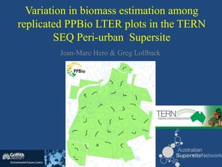
- 1. Variation in biomass estimation among replicated PPBio LTER plots in the TERN SEQ Peri-urban Supersite Jean-Marc Hero & Greg Lollback
- 2. Biomass • Aboveground Live Biomass (AGLB). • Measuring AGLB important: – Quantifying carbon stocks – A measure of productivity – Reflection of ecological processes • Biomass drivers in Australia: – Rainfall (Williams et al. 1996, Zerihun et al. 2006; Fensham et al. 2012) – Maximum ambient temperature (Fensham et al. 2012) – Soil depth (Fensham et al. 2012) – Land management (Fensham et al. 2012) – Fire (Burrows et al. 2002)
- 3. Variation • Important for any measure of central tendency and understanding patterns and processes. • How many samples to collect. • Nobody has measured variation in biomass in native Australian forest across the mesoscale (500-1500 ha) with intensive ground sampling. – Many forest patches of this size.
- 5. Vegetation 3 DBH classes uplands (Carolina de Castilho) 1-5 m (>1 cm DBH) 1-11 m (>10 cm DBH) 11-21 m (30 cm DBH) lowlands All researchers use the 250m transects & standardised sampling protocols. Transect width varies with the organism studied.
- 6. Study site summary • Peri-urban. • 32 x 250 m 1 ha plots. • Systematically placed throughout the 910 ha patch. • Generally native open forest dominated by Eucalypts and Corymbia species: – E.g. C. intermedia, C. trachyphloia E. acmenoides, E. carnea, E. racemosa, E. resinifera, E. tindaliae – + Allocasuarina littoralis, Angophora sp., Lophostemon sp., Melaleuca sp.
- 7. Estimating AGLB • DBH -> Biomass! • Allometric equations – Robust equations are better. • Most woody vegetation: AGLB = e(-2.3046 x 2.5243 x DBH) – Developed by Williams et al. (2005) • Banksia: AGLB = e(-2.26+2.5*DBH) – Developed by Westman & Rogers (1977)
- 8. Biomass at Karawatha for each plot 250 200 AGLB (tonnes/ha) 150 100 50 0 E2 E7 E6 E5 E4 E3 E1 B7 B4 B6 D7 D5 D4 D2 B5 B3 D3 D6 C7 C6 C5 C4 C3 A8 A7 F3 F5 F4 F6 A6 G5 G6 Plot Mean = 146.51 tonnes/ha. S.D. = 39.41
- 9. Biomass at Karawatha 250 12 200 150 10 Frequency of Occurrence (plots) 100 50 8 0 F3 F4 C6 F6 C3 G5 E2 E7 E4 E1 D7 D3 B7 B4 B6 B3 6 4 2 0 0-50 51-75 76-100 101-125 156-150 151-175 176-200 201-225 226-250 AGLB (t/ha) Many plots had a similar amount of biomass
- 10. Spatial relationships: correlogram of AGLB 0.2 P = 0.11 n = 27 0.15 0.1 P = 0.21 0.05 n = 128 P = 0.23 n = 106 Moran's I 0 -0.05 P = 0.47 P = 0.30 n = 95 n = 83 -0.1 -0.15 -0.2 P = 0.01 n = 37 -0.25 0 500 1000 1500 2000 2500 3000 Distance between plots (metres) PPBio plots at Karawatha are spatially independent in regard to AGLB
- 11. Spatial interpolation of AGLB = 133 487 tonnes of AGLB (>1 cm DBH)
- 12. Importance of replication: bootstrapping 150 149 148 147 Average AGLB (tonnes/ha) 146 145 144 143 142 141 140 2 3 4 5 6 7 8 9 10 11 12 13 14 15 16 17 18 19 20 21 22 23 24 25 26 27 28 29 30 31 32 Number of replicates Best to have >12 plots when measuring biomass at Karawatha
- 13. Relationship b/w biomass and the environment • Topographic variables: – Aspect, elevation, catchment area, moisture index, time since fire, fire frequency • Soil chemistry variables: – % silt and clay, K content, Ca content, Mg content, Na content, N content, pH, conductivity – Output as PCA axes
- 14. Environmental relationships Model AICc AICc Δ Weight r2 232.7 0.0 0.54 0.15 (-) Catchment Area Moisture Index - 235.2 2.5 0.15 0.13 Catchment Area Model 1: y = 157.094 - 10.519 ca Model 2: y = 153.39-9.7762ca + 0.5257mi No environmental models explain biomass estimates well.
- 15. Catchment area vs. Biomass 250 200 AGLB (tonnes/ha) 150 100 50 y = 157.1-10.5ca R2 = 0.15 0 0.0 1.0 2.0 3.0 4.0 5.0 Catchment area (km2) 250 200 AGLB (tonnes/ha) 150 100 y = 153.2+1.6ca 50 R2 = 0 0 0.0 1.0 2.0 3.0 4.0 5.0 Catchment area (km2)
- 16. Change of vegetation composition along gradient Plant composition varies with topography, but not biomass.
- 17. Summary • A systematic plot setup (n=32) was used to estimate AGLB within Karawatha Forest Park (910 ha), south Brisbane. • Plot spacing of 500 m was adequate in regard to estimating AGLB at Karawatha. • Replicated plots are needed to estimate biomass and understand ecological processes influencing biomass within LTER sites. • Biomass was poorly related to soil chemistry and topography at Karawatha. • Plant composition was strongly related to topography
- 18. Thank you • Students and staff at Griffith University – plot setup, maintenance and data collection. • TERN – funding.
Notas do Editor
- Above-ground living biomass is gaining increasing importance mainly because of the use of vegetation as carbon stocks. Measuring AGLB is a way to quantify carbon stocks.Biomass is also a measure of productivity and therefore is useful to economists and it is also a reflection of ecological processesMany drivers of biomass have been identified, however, most studies occur over a large scale.
- To estimate and extrapolate values, a measure of central tendency is often needed. However, a measure of variation around this value is just as important. With the estimation of biomass of large scales, the measure of variation is important.In an ecological context, a measure of variation can indicate how many samples are needed to answer a question.To my knowledge nobody has measured the variation in AGLB in native Australian forest across the mesoscale (500-1500 ha) using intensive ground sampling.This kind of study is important because their are many patches of this size in the Australian fragmented landscape.
- The study area is Karawatha Forest Park, which is located in south-eastern Brisbane.As can be seen from the Google Map, much of the park is surrounded by urban development. Within the park there are 32 plots where biomass was measured. The plots are systematically placed, with each start point being 500 m apart. This gives good coverage of the park and different vegetation types are found at different transects.For example, this F3 is open forest, B6 is Melaleuca swamp, B7 is dense mid-layer regrowth and C7 is more open woodland.
- To summarise, this study involved measuring tree DBH on 32 plots that were each 250 m long (1 ha)These plots were systematically placed throughout the 910 ha patch.The site was mostly surrounded by residential developmentThe forest itself could generally be described as native open forest that is dominated by Eucalypts and Corymbia species with other tree genera present as well.
- Biomass was estimated by taking the DBH of live trees with a DBH>1 cm.Following the previously mentioned hierarchical sampling regime.The DBH was converted to biomass by using allometric equations. For example:We chose to use robust equations, as many equations are too specific and developed with low sample sizes. This risks irrelevancy.The equations chosen follow Fensham et al. (2010), when he measured biomass of the Brisbane area.Equations used were:
- Here is a graph showing AGLB/ha for each plot within Karawatha. It can be seen that there are a few low values and a few high values and many values in between.
- This next graph highlights this distribution, with many plots having a 156-175 t/ha of biomass.
- Systematic design is good for looking at spatial relationships.Here we have a correlogram of Moran’s Index. Moran’s Index is a measure of spatial autocorrelation. E.g. Values that are similar and that are heaped close together spatially would have a Moran’s Index = 1. A range of values that are distributed randomly through space, would have a Moran’s Index = 0. Extreme overdispersion has a value = -1.P-values indicate if plots at a particular distance are spatially independent.The take away message here is at the 500 m distancing, as seem at Karawatha, biomass estimates are not spatially correlation.Usually, the distancing for PPBio is 1000 m, approximately here on the graph.
- Here is an interpolation map of AGLB at Karawatha.The interpolation method used was Simple Kriging with a spherical semivariogram.Note that the south-west corner of the park has low biomass. Three plots within the park have relatively high biomass.Overall, the interpolation predicts that there is 133 487 tonnes of AGLB with a DBH>1 cm within Karawatha.
- This is a plot that shows the influence of the number of replicates on the estimated mean biomass at Karawatha.This graph was produced by bootstrapping the biomass values 1000 times (with replacement) for a determined sample size. The red lines are the 95% confidence intervals, the black, dotted horizontal line is the original estimated mean biomass value from the 32 plots.While the confidence intervals are relatively small, it can be seen that they settle down around a sample size of 12, giving us a guide to how many samples are needed to estimate biomass at Karawatha.
- However, to look environmental variables drive biomass, you should have more than 12 plots. That’s why there are 32 plots at Karawatha.Linear analysis was used to investigate relationships between biomass and environmental variablesThe environmental variables include topographic variables and soil chemistry variablesThe soil chemisty variables were run through a PCA analysis and the 3 major axes were used for the linear regression.Fitting was achieved using the least squares method and AIC was used for model selection.
- Only two out of 18 models could seriously be considered. They involved landscape variables. Interestingly, biomass was negatively related to catchment area, but positively related to moisture index.Maybe a poor relationship because biomass varied little.
- Here is an image showing the biomass interpolation map and catchment area of each plot as dots.The plots in the south-western corner have relatively low biomass and high catchment area – doesn’t make sense.This area is regrowth. In 2004 an intense fire that burned for days swept through the SW block. Biomass at Karawatha is likely affected by anthropogenic activities.
- However, past studies have shown that vegetation composition changes across a topographic gradient