Digital Soil Mapping/ Pedomterics
•Transferir como PPTX, PDF•
2 gostaram•806 visualizações

Digital soil mapping uses statistical methods and environmental data to predict soil properties across continuous landscapes. It involves preparing soil data and predictor variables like climate, vegetation and remote sensing data. Predictor data is harmonized using techniques like principal components analysis. Soil data is also harmonized by estimating mean values at standard depth intervals. Regression models are selected to relate soil properties to predictors and create continuous prediction maps. Maps are validated and uncertainty is estimated using confidence intervals or bootstrapping. The process is implemented using the R programming language and specialized soil mapping packages.

Recomendados
Recomendados
Mais conteúdo relacionado
Mais procurados
Mais procurados (20)
Semelhante a Digital Soil Mapping/ Pedomterics
Semelhante a Digital Soil Mapping/ Pedomterics (20)
Mais de Soils FAO-GSP
Mais de Soils FAO-GSP (20)
Último
Último (20)
Digital Soil Mapping/ Pedomterics
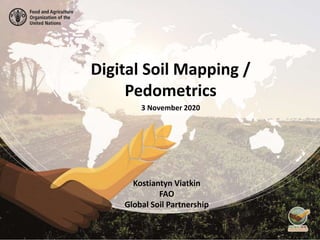
- 1. Digital Soil Mapping / Pedometrics 3 November 2020 Kostiantyn Viatkin FAO Global Soil Partnership
- 2. What is Digital Soil Mapping (DSM) / Pedometrics?
- 3. Soil mapping – creation of cartographic models of soils and soil properties
- 4. Pedometrics – application of mathematical and statistical methods for the study of the distribution and genesis of soils Soil mapping – creation of cartographic models of soils and soil properties
- 5. Pedometrics – application of mathematical and statistical methods for the study of the distribution and genesis of soils Digital Soil Mapping (pedometric mapping, predictive soil mapping) is data-driven generation of soil property and class maps that is based on use of statistical methods (T. Hengl, 2003) Soil mapping – creation of cartographic models of soils and soil properties DSM
- 6. Spatial phenomena Spatial phenomena can generally be thought of as either : ● discrete objects with clear boundaries (e.g. river, road, town) ● or as a continuous phenomenon that can be observed everywhere, but does not have natural boundaries (e.g. elevation, temperature, and air quality). A lake is a discrete object: it has clear boundaries Elevation is a continuous phenomena: it exists in every point
- 7. Spatial phenomena Question: ● Is soil a discrete or continuous phenomenon? ● Are soil properties (carbon, texture, pH, etc...) discrete or continuous? ● Are soil measurements discrete or continuous?
- 8. Spatial phenomena Answers: ● Soil is a continuous phenomenon. It covers almost all land surface. ● However we classify soils into discrete soil types that have boundaries
- 9. Spatial phenomena Answers: ● Most of the soil properties are continuous. They exist in every point of the soil. ● Soil measurements are discrete. We sample soil and measure soil properties in discrete locations.
- 10. We have: ● Discrete soil observations as point data in sampling locations We need: ● Continuous estimation of soil properties in every point of the land surface Task of the predictive soil mapping: ● To predict continuous soil properties (or soil classes) in every point of the land surface based on discrete measurements of soil sampling. But how to do it? Digital Mapping of Soil Properties
- 11. Vector Soil Maps
- 12. Gridded maps (rasters) 1 2 3 1 • Gridded maps (rasters) are optimal to represent continuous data, such as soil properties. • A raster is a regular grid of cells (pixels) with a value of soil property in each cell. • Raster resolution defines cell size and accuracy • Higher resolution = smaller cell size = better accuracy = bigger files = higher computational demands • E.g. cell size 1x1 km – it is good for global and national mapping. • Most common raster data format: GeoTiff (.tif, .tiff);
- 13. How to create a digital maps of soils properties?
- 15. V. Dokuchaev (1883): Genesis and evolution of soils is the result of the interaction of a number of environmental parameters: ● Climate ● Organisms ● Parent Material ● Relief ● Time Drivers of Soil Formation
- 16. State equation of soil formation Hans JENNY (1941): ● Conceptualization of soil as an state equation of soil formation. ● Soil and soil properties are a function of a number of environmental parameters named soil forming factors: S = ƒ(cl, o, r, p, t) CLORPT MODEL climate organisms relief parent material time
- 17. Digital Soil Mapping (DSM) Definition of Digital Soil Mapping (DSM) The creation and population of spatial soil information systems by numerical models inferring the spatial and temporal variations of soil types and soil properties from soil observations and knowledge and from related environmental variables (Lagacherie and McBratney, 2007). McBRATNEY, 2012: Conceptualization of forming factors. Soil and soil properties are a function of a number of environmental parameters named soil forming factors: S = ƒ(s, c, o, r, p, a, n)+ ε SCORPAN MODEL reliefsoil properties climate organisms parent material age locationsoil attribute to predict function residuals (errors)
- 18. Digital Soil Mapping Workflow Source : McBratney, 2015
- 19. Digital Soil Mapping Workflow Soil Data Predictors
- 20. How to do it on practice?
- 21. R – a powerful and versatile tool for DSM • R is a programming language which allows everyone to develop scripts with maximum flexibility; • It is free, enables the development of Science even for budget limited organizations; • Full access to algorithms; • Possibility to modify existing functions and packages; • Developed by a huge community of experts in many different fields; • More than 10,000 R packages available for download; • Lot’s of free learning material
- 22. R packages (examples) aqp ● Algorithms for quantitative pedology ● We will use it to restructure our soil dataset into a soil profile collection GSIF ● Tools, functions and sample datasets for digital soil mapping, e.g. depth harmonization raster ● Reading, writing, manipulating, analyzing and modeling of gridded spatial data (raster data) rgdal ● Provides access to the 'Geospatial' Data Abstraction Library ('GDAL') to projection/transformation operations from the 'PROJ.4' soilassesment ● Functions used in digital mapping of soil properties
- 23. Digital Soil Mapping in R • Relief • Climate • Vegetation • Geology • Remote sensing data 1. Prepare Predictors
- 24. Digital Soil Mapping in R 2. Harmonize Predictors Removing collinearity using Principal Components Analysis
- 25. Digital Soil Mapping in R 3. Prepare soil data • Identifiers • Coordinates • Depth layers (horizons) • Measured soil properties
- 26. Digital Soil Mapping in R 3. Prepare soil data See Lesson 2 – Data Organization and Software installation
- 27. Digital Soil Mapping in R 4. Harmonize soil data ● Profile data has soil parameters measured for every horizon (depth layer) ● We need to estimate mean value for target depth: e.g. 0-30cm, 30-100cm ● For that we can use equal-area splines. This technique is based on fitting continuous depth functions for modeling the variability of soil properties with depth. Depth harmonization
- 28. Digital Soil Mapping in R 4. Harmonize soil data Statistical distribution ● Normal distribution, also known as the Gaussian distribution, is a probability distribution that is symmetric about the mean, showing that data near the mean are more frequent in occurrence than data far from the mean. The Normal Distribution has: ● mean = median = mode ● symmetry about the center ● 50% of values less than the mean and 50% greater than the mean In statistical analyses it is often assumed that the data has normal distribution. If it does not, it may be useful to transform the data.
- 29. Digital Soil Mapping in R 5. Overlay soil data and predictors
- 30. Digital Soil Mapping in R 6. Select a regression model for mapping
- 31. Regression ● Regression a statistical method that allows us to summarize and study relationships between two variables: ● variable X, is regarded as the predictor, explanatory, or independent variable. ● variable Y, is regarded as the response, outcome, or dependent variable. The goal is to build a mathematical formula that defines Y as a function of the X variable. Once, we built a statistically significant model, it’s possible to use it for predicting future outcome on the basis of new X values.
- 32. Example: linear regression The mathematical formula of the linear regression can be written as follow: ● the best-fit regression line is in blue ● the intercept (b0) and the slope (b1) are shown in green ● the residuals (errors) - e are represented by vertical red lines Multiple linear regression can have several predictors (X variables):
- 33. Regression However, most relationships in nature are not linear! Relationships between soil properties and environmental factors can be very complicated and require a complex model.
- 34. Digital Soil Mapping in R 8. Validate the map Calculate map quality measures
- 35. Digital Soil Mapping in R 9. Estimate uncertainty ● Uncertainty is an acknowledgement of error: we are aware that our representation of reality may differ from reality and express this by being uncertain ● In the presence of uncertainty, we cannot identify a single, true values for each pixel of the map. ● But we can identify all possible values and a probability for each one - to characterise the uncertain variable with a probability distribution. ● If the distribution is normal, it is easy to construct a confidence interval, where e.g. we are certain with 95% confidence that the true value will be within 2 standard deviations from the mean (prediction)
- 36. Digital Soil Mapping in R 9. Create uncertainty maps If the distribution is not normal, confidence interval still can be constructed through bootstrapping. 95% confidence interval: We are certain that the 95% of the unknown values lie within the prediction width.
- 38. Thank you for your attention!