SlideShare uma empresa Scribd logo
1 de 70
CHAPTER THREE
THE TOPOGRAPHY OF ETHIOPIA AND THE
HORN
 The topography of Ethiopia is largely determined by
the geologic activities of the Cenozoic Era.
The uplifting of the Arabo-Ethiopian land mass
The outpouring, spreading and thick accumulation
of Trapean lava have given rise to an outward
sloping highland plateau and mountains.
Major faulting resulted in division of the plateau into
two broad units
Faulting elsewhere guided part of the course of
some rivers
formed depressions on which lakes were
subsequently created.
river dissection and roughening on the highlands,
and deposition on the lower areas
General Characteristics of the Ethiopian Physiography
 The Ethiopian landform is characterized by great
diversity.
There are flat-topped plateaus, high and rugged
mountains, deep river gorges and vast plains.
altitude ranges from 125m.b.s.l(Kobar Sink) to the
highest mountain(Mount Ras Dashen-4,620 m.a.s.l).
the altitudinal range in Ethiopia is about 4620m- (-
125m)= 4745m.
– Ethiopia has the largest proportion of elevated landmass
in the African continent.
– Ethiopian Highlands form the largest continuous area
of its elevation in the continent.
– described as the Roof of East Africa because of its
height and large area.
– proportion of Ethiopian land above 1,000 meters of is
50% of the total area.
– Proportion of land above 1,500 meters is about 44% of
the country. Half of this is more than 2,000 m.a.s.l.
– Most of the Ethiopian Highlands are part of the
central and northern Ethiopia, and extends into Eritrea.
– The highland core is encircled by semi-arid and
lowlands.
– Ethiopian Highlands are rugged mass of mountains
dissected by several rivers and ravines which have cut
deep gorges.
– The high plateau and mountain ranges are sources of
many rivers and streams that made the country the
“Water Tower of East Africa”.
• The diversity in topography is accompanied by differences
– in natural features (soil, climate, vegetation and wild life)
– in the socio-cultural and economic phenomena.
– the highlands have been significant throughout Ethiopian
history in the economic, cultural and political aspects.
 Highlands make up nearly 56% of the area of the Ethiopia.
 The remaining 44% of the area of Ethiopia is lowland.
 Highlands subdivided into:
 lower highland (1,000-2,000m.a.s.l), which make up 35%
 higher highland (>2,000 m.a.s.l) constituting nearly 22%.
Contrasting features between the Ethiopian highlands and lowlands
(by taking the 1,000 m for demarcation)
Features of Ethiopian highlands
 Moderate and high amount of
rainfall (>600 mm per year).
 Lower mean annual temperature
(<20 C).
 The climate is favorable for
biotic life.
 Rain-fed agriculture is possible.
 Free from tropical diseases.
 Attractive for human habitation
and densely settled.
Features of Ethiopian lowlands
 Fewer amounts of rainfall
 Higher temperature
 High prevalence of tropical
diseases
 Lower population densities.
 Pastoralist and semi-
pastoralist economic life
 Vast plain lands favorable for
irrigation agriculture
The Physiographic Divisions of Ethiopia
• Following the geologic processes of the Cenozoic Era,
three major physiographic units can be identified in
Ethiopia.
• These are:
a) The Western highlands and lowlands
b) The South-eastern (Eastern) highlands and lowlands
c) The Rift Valley
1. The Western Highlands and Lowlands
 includes all the area west of the Rift Valley.
 It extends from northern most point of Tigray to the Ethio-
Kenya boarder in the south.
 In the east it is bounded by the western escarpment of
the Rift Valley.
 Westward, the land gradually descends in altitude and
merges into western foothills and lowlands (along the
Sudan and South Sudan border).
 It makes up about 44% of the area of the country.
• This region is further subdivided into four groups of highlands
(76.3%) and four groups of lowlands (23.7%).
The Western Highlands
a) The Tigray Plateau
• Made up of highlands of Tigray.
• It extends from the Tekeze gorge in the south to the
central Eritrean highlands.
• The Tigrian plateau is separated from the Eritrean
plateau by the Mereb River.
• It lies to the southeast of the upper course of the
Mereb River and to the northeast of Tekeze River Gorge.
• It constitutes about 13% of the area of the region.
• It is an elongated highland with most of the land being
between 1,000 and 2,000 meters above sea level
• This plateau is drained by the right bank of the tributaries
of Tekeze .
• Long period of denudation has created residual features of
granite hills, rugged topography, and Ambas.
• There are high mountains in this plateau with elevations of
over 3000 m (Mount Tsibet (3988 m.a.s.l), Mount
Ambalage (3291 m.a.s.l), Mount Assimba (3248 m.a.s.l).
b. North Central Massifs
• It is the largest in the western highlands.
• Much of its northern and southern limit follows the
Abay and Tekeze gorges.
• The Abay, Tekeze and their tributaries have cut into this
region a maze of gorges, steep sided river valleys,
dividing the land into many isolated plateau blocks.
• Much of these plateau and tablelands are still capped by
the Trappean lava.
3/25/2023 Jimma University 22
Northern
Central
Highlands
Shewan
Plateau
Tigray
Plateau
Afar Triangle
Hararghe
Plateau
Arsi-Bale
Highlands
South West
Highlands
Tekeze LLs
Wabe-Shebelle
Lowlands
Gibe LLs
• It contains Lake Tana basin surrounded by plains of Fogera
and Dembia in the north and an upland plain in the south.
• It consists of the Gonder, Wello and Gojjam Massifs.
• 58% of the region is at an altitude of more than 2,000
meters, making it the second highest physiographic division.
• Out of the 26 mountain peaks with altitude of more than
4,000 m.a.s.l in Ethiopia, 19 mountain peaks are found in
this physiographic region.
• The most popular ones include
– Mount Ras Dashen (4,620 m.a.s.l), Mount
Weynobar/Ancua (4462 m.a.s.l), Mount KidusYared
(4453 m.a.s.l), and Mount Bwahit (4437 m.a.s.l) in
the Simen Mountain System.
– Mount Guna (4,231m.a.s.l) in the Debre Tabour
Mountain System, Abune Yoseph (4,260 m.a.s.l) in the
Lasta highlands of Wello and Mount Birhan (4,154
m.a.s.l) in the Choke Mountain System in Gojjam are
also part of Simen Mountain System.
• These mountains have steep cliffs and rugged terrain that
provide scenic views to climbers.
• The Mountain systems in Gonder and Gojjam are separated
from the eastern group of mountains in Wello by
impenetrable and deep gorges.
• At one point though, they are connected by Yeju Wadla
Delanta land bridge (ridge).
• This land bridge has been significant in history. It served
as a route of penetration by the Turks, Portuguese, and
Italians.
• The Tekezze and Abay, together with its tributaries, are the
main river that drains the region.
• Tekezze River has divided the North Central Massif area
into western and eastern massifs, which are connected by
the Yejju-Wadla-Dilanta plateau.
• The Western Group – form a water shade between Abay
(Lake Tana Basins) & Tekeze rivers with Mt. peaks Ras
Dejen (4620m) in Semen Massif and Ras Birhan (4154m)
in Choke Massif.
C. The Shewa Plateau/Central highlands
• It is bounded by the Rift Valley in the east and southeast,
by the Abay gorge in its northern western limit, and
Omo gorge in the south west.
• It occupies a central geographical position in Ethiopia.
• It is the smallest of the Western highlands (11% of the
area of the whole physiographic region).
• It has the largest proportion of elevated ground- nearly
¾ of its area is at an altitude of >2,000 m.as.l.
• It is drained outward in all directions by the
tributaries of Abay, Omo, and Awash and forms a water
divide/water shade b/n these three river basins.
• The tributaries of Abay are Guder, Muger, Jema etc. have
cut deep gorges and steep sided river valleys.
• The tributaries of Omo and Awash have dissected the
other sides of the plateau.
• The highest mountains in the Shewan plateau are
Mount Abuye-Meda (4,000 m.a.s.l) in Northern Shewa,
Mount Guraghe (3,721 meters) in the south .
• It forms the core/center of country’s historical, political,
cultural and economical entity due to its locational
advantages.
d. The South western Highlands
• This sub region consists of the highlands of Wellega,
Illuababora, Jimma, Kaffa, & Gamo and Gofa.
• The region is separated from the adjacent highlands by
the Abay and Omo river valleys.
• It extends from the Abay gorge in the north to the Kenya
border and Chew Bahir in the south.
3/25/2023 Jimma University 36
Northern
Central
Highlands
Shewan
Plateau
Tigray
Plateau
Afar Triangle
Hararghe
Plateau
Arsi-Bale
Highlands
South West
Highlands
Tekeze LLs
Wabe-Shebelle
Lowlands
Gibe LLs
• It accounts for about 22.7% of the area of the region.
• It is the second largest in the Western highlands.
• About 70% of its area is lies within 1,000-2,000 m.a.sl.
• It is the wettest region in Ethiopia.
• It is drained by Dabus, Deddessa (tributaries of Abay),
Baro, Akobo and the Ghibe/Omo rivers.
• The south western highlands are the most dissected and
rugged terrain of the country because of the numerous
streams.
• It is also the home of most numerous and diverse ethnic
linguistic groups in Ethiopia.
• With a height of 4,200 meters above sea level, Guge
Mountain is the highest peak in this physiographic
subdivision.
• Its drainage system accounts nearly half of the total
volume of water drained annually from the country.
• The highest forest coverage of the country is found in this
region.
• Unlike the other Western Highlands, this region is:
• The largest producer of coffee, spices, tea plantation
(Wushwush, Limu & Gumero), timbering, rubber trees
and other forest produces like honey
• The dwelling home for various ethnic groups
• Known for substantial livestock production .
The Western Lowlands
• These are the western foothills and border plains that
extend from Western Tigray in the north to southern
Gamo-Gofa in the South.
• Extends from Tekeze basin in the north to the Omo basin
in the south along the Ethio-Sudan/South Sudan borders.
• In certain places, ridges or part of the highlands protrude
into the lowlands, interrupting their continuity.
• They make 11% of the area of the physiographic
region.
• The general elevation ranges between 500 and 1000
meters above sea level.
• This physiographic sub-region is further subdivided
into four by the protruding ridges.
• These are Tekeze lowland, the Abay-Dinder lowland, the
Baro lowland, and the Ghibe lowland from north to
south.
• Since one or two rivers cross all of these lowlands,
irrigation agriculture is highly feasible.
• For example, the Baro lowland has an extensive flat area
suitable for mechanized agriculture.
• The lowlands are assumed their names based on the rivers
draining surface their lands.
• Except the Baro lowland, the western lowlands are
characterized by arid & semi-arid climate.
• As one moves northwards, the degree of aridity
increases, making rain-fed agriculture more difficult.
• Pastoral or semi-pastoral economic activities dominate the
area.
• The Ghibe/Omo lowland (the lower Ghibe/Omo Valley
and the northern Turkana basin), is classified in the
Western lowlands from its geographical location but
structurally it also belongs to the Rift Valley.
• It is an area which is both faulted and tectonically
depressed.
• In the Western lowlands, there are small but important
towns to agriculture, history, or are simply border towns
and frontier ports.
• These are Humera, Metema, Omedla, Kurmuk, Gambella etc.
2. The South Eastern Highlands and Associated Lowlands
• It is the second largest in terms of area.
• It accounts for about 37% of the total area of Ethiopia.
• The highlands make up 46% of the physiographic division
while the rest is lowland.
• The eastern escarpment of the Rift Valley makes the western
and the northern limit.
• From here, the land gradually descends southeastward into
the southeastern lowlands and then to the plains of Somalia.
• These are further subdivided into two units of highlands and
two units of extensive lowlands.
3/25/2023 Jimma University 46
Northern
Central
Highlands
Shewan
Plateau
Tigray
Plateau
Afar Triangle
Hararghe
Plateau
Arsi-Bale
Highlands
South West
Highlands
Tekeze LLs
Wabe-Shebelle
Lowlands
The South Eastern Highlands
A. The Arsi-Bale-Sidama Highlands
• These highlands are found to the east of the Lakes Region
• They are located in the south western section of the
physiographic region.
• They make up 28.5% of the area of the region and 62% of
the south - Eastern Highlands.
• The Arsi Highlands are made up of flat rolling uplands and
dissected mountains.
• The well known mountains in this area are Mount Kaka
(4,180 m.a.s.l), Mount Bada (4,139 m.a.s.l) and Mount
Chilalo (4,036 m.a.s.l).
• The highest mountain peaks in this region are Tulu-
Demtu (4,377 m.a.s.l) and Mount Batu (4,307 m.a.s.l).
• The Afro-Alpine summit of Senettie plateau is found on
the Bale highland.
• Erosion features belonging to Pleistocene glaciation but
later modified by fluvial processes are seen in the trough-
like gorges, hanging valleys, and depressions.
• The Bale highlands are separated from the Arsi highlands
by the head and main stream of Wabishebelle.
• Significant for the growth of cool-climate industrial crops
such as wheat and barely on large scale agribusiness
• The Sidama Highlands are separated from the Bale
Highlands by the Ghenale river.
• They occupy the southwestern corner of this region.
• Jemjem plateau is the prominent feature in the region.
• It is an important coffee growing area.
• The highest quality coffee in Ethiopia is produced in this
region.
• Peak points are Mts. Dello (3600m) in Guji & Guramb
(3400m).
• Inset/kocho is the staple food in the region.
• Rivers Wabishebelle and Ghenale along with their
tributaries have dissected this physiographic region.
• Specially, Weyb River, tributary of Ghenale, has cut an
underground passage (Sof Omar cave) through the
Mesozoic Limestone rocks.
B. The Hararghe Plateau
• It extends from the Chercher highlands in the south-west
to Jigjiga in the east.
• It makes up 38% of the South Eastern highlands and
17.4% of the whole physiographic region.
• It has the smallest proportion of upper highland(>2,000
m.a.s.l).
• It is a low lying and elongated region.
• Rising sharply from the Rift Valley floor, it immediately but
gently descends east and southeastward.
• The left-bank tributaries of Wabishebelle drain it.
• Much of the Trappean lava is removed and the Mesozoic
rocks are extensively exposed.
• The highest mountain here is Mount Gara-Muleta (3,381
m.a.s.l).
C. The Southeastern Lowlands
• Located in the southeastern part of the country and they
are the most extensive lowlands in Ethiopia.
• They make up 54% of the area of the physiographic
region and around one-fifth (20%) of the country.
• They include the plains of Ogaden, Elkere, and Borena.
• These extensive plains are interrupted here and there, by
low hills, low ridges, inselbergs and by shallow and broad
river valleys and depressions.
• The economic potential for this region includes
• animal husbandry
• irrigation agriculture
• exploitation of petroleum and natural gas
– Southeastward sloping plains characterize these
lowlands.
– Highly dispersed human & large livestock population.
– Mainly covered by Mesozoic Era sedimentation
– Have an average altitude is between 500-1000m
– Sparsely inhabited by pastoral and semi-pastoral
communities.
– These lowlands are little used and support very small
population because of the harsh climatic conditions.
• Its sub-divisions are two:
• Wabe-Shebelle lowland
– Parts of Somali region and Eastern Hararghe are drained by
Wabe-Shebelle river and its tributaries
– Known for cattle, sheep, goat and camel husbandry.
– Covers about 60% of the Eastern Lowlands
• Ghenale Lowland- Covers about 40% of the Eastern Lowlands.
– Comprises parts of Borena and Guji lowlands which are
drained by Ghenale river & its tributaries
– Known for the highest quality and quantity cattle & other
domestic animals production areas of Ethiopia.
3. The Rift Valley Physiographic Region
• The Rift Valley is a tectonically formed structural
depression.
• It is bounded by two major and more or less parallel
escarpments.
• The formation of the Rift Valley has separated the
Ethiopian Highlands and Lowlands in to two.
• It extends from the Afar triangle in the north to Chew
Bahir for about 1,700 km2
• It covers 18% of the area of Ethiopia.
• In the Afar Triangle, it is the widest and narrows down
to the south.
 Has a funnel shape, widening at Northeast and narrowing
the Southwest orientation.
 The most unstable part of the country as evidenced by
existence of hot springs, fumaroles, active volcanoes.
 Volcanic rocks, fluvial and lacustrine deposits cover the
floor.
• Altitude in the floor ranges from 125 m.b.s.l at Dallol
Depression, to as high as 2,000 m.a.s.l in the Lakes region.
• Because of its altitudinal variation and positional
differences;
– the climate also varies from warm, hot and dry to cool
and moderately moist conditions.
– the social and economic life reflects this pattern (places
sparsely inhabited by pastoralists and people practice
some rain-fed agriculture).
• Rift Valley is subdivided into 3 physiographic sub-regions.
– These are the Afar Triangle, the Main Ethiopian Rift
valley , and the Chew Bahir Rift.
i. The Afar Triangle
 The Afar Triangle is the largest and widest part of the Rift
Valley. It makes up 54% of the Rift Valley area.
 It is bounded by the high western and eastern
escarpments in the west and east respectively, and by
the Afar and Aisha Horst in the northeast.
 The area is generally of low altitude (300-700 meters).
 Its elevation drops uniformly from approximately 1,000
meters in the southwest to below sea level in the north
(Danakil depression).
• It hosts one of the most hostile environments on Earth.
(Max temp >50°C during summer wet season in Dallol).
• The area is characterized by
– faulted depressions (grabens), volcanic hills, active
volcanoes, volcanic ridges, lava fields.
– the Denakil Depression (Kobar Sink).
– Lakes (Abe, Asale, and Afrera) occupy some of these
basins.
– A larger part of it is covered by thick and extensive
salt plain.
– It has a colorful landscape, fault depression and active
volcanoes , which make it one of the tourist attraction
sites in Ethiopia.
– The Afar Triangle is generally hot and dry. Only its
southern part gets water from Awash.
• The economic importance of this region includes
– salt extraction
– irrigation along the Awash River
– electric potential from geothermal energy.
ii. The Main Ethiopian Rift/Central Rift
• This part of the Rift Valley is the narrowest belt and the
highest.
• It has an average width of 50-80 kilometers and
general elevation of 1,000-2,000 meters above sea level.
• It extends from Awash River in the north to Lake Chamo
in the south.
• It is bounded by the western and eastern escarpments.
• The prominent features are the numerous lakes formed
fault depressions.
• The floor in many places is dotted by cinder cones
and volcanic mountains.
• The big ones include Mount Fentale, Boseti-guda (near
Adama), Aletu (north of Lake Ziway) and Chebi (north
of Lake Hawasa).
• Because of altitude, the lakes region of the Main Ethiopian
Rift is generally milder and watery.
• Here rain-fed agriculture is practiced.
• Other resource bases include
– recreational value of the lakes,
– agricultural importance of some streams and lakes,
– the geothermal energy potential.
iii. The Chew Bahir Rift
• It is the smallest and the southern-most part of Rift Valley.
• Highlands of Konso and the surrounding highlands
separate it from the Main Ethiopian Rift to the north.
• It is the broad and shallow depression, which is a marshy
area covered by tall grass, into which the Segen and Woito
streams empty.
Impacts of Relief on Biophysical and Socio- economic
Conditions
Agricultural practices
• Choice of farming techniques- in rugged terrain mechanized
farming techniques are difficult to practice.
• Crop production- some corps (barley, wheat) are well
adapted to higher altitudes and others to low altitude
(sorghum, maize).
• The practice of animal husbandry- most horses and sheep are
reared in the higher altitudes and camels and goat are well
adapted to lower altitudes.
Settlement pattern
• Highlands of Ethiopia that experience a temperate
type of climate are mainly free from most of the tropical
diseases and so that are densely settled.
• Rugged and difficult terrain hinders the development of
settlement and its expansion.
• The highlands of Ethiopia are characterized by sedentary
life and permanent settlements while lowlands that are
inhabited by pastoralists have temporary settlements.
Transportation and communication
• The highly dissected and rugged topography:
– hindered the development of internal surface
transportation.
– makes infrastructure development and maintenance
costly.
– influenced TV and radio communications
– rendered rivers less navigable due to the waterfalls,
deep gorges and steep cliffs.
Hydroelectric power potential
• The great difference in altitude coupled with high rainfall
created suitable conditions for a very high potential for the
production of hydroelectric power in Ethiopia.
Socio-cultural feeling
• The rugged terrain as a result of excessive surface dissection
resulted in the long-term isolation of communities that led to the
occurrence of cultural diversity.
• People who live in the highlands have been identifying
themselves as degegnas (mountaineers) and those who live in the
lowlands as kollegnas (lowlanders).
Impacts on climate
• The climate of Ethiopia is a result of its tropical position and the
great altitudinal variation.
• Highlands with higher amount of rainfall and lower rate of evapo-
transpiration tend to be moisture surplus compared to the moisture
deficit lowlands.
Impacts on soil
• Steep mountain slopes have shallow and little developed soils,
unstable surface materials due to degradation processes.
Impacts on natural vegetation- Relief through its effect on
climate and hydrology affect the type of natural vegetation grown.

Mais conteúdo relacionado

Mais procurados

Ethiopian_Geography_and_the_horn_Improved_Nov2019.pptx.pdf
Ethiopian_Geography_and_the_horn_Improved_Nov2019.pptx.pdfEthiopian_Geography_and_the_horn_Improved_Nov2019.pptx.pdf
Ethiopian_Geography_and_the_horn_Improved_Nov2019.pptx.pdfazmerawAnna1
 
_Hawassa_Geography_book (1) (1)-1.pdf
_Hawassa_Geography_book (1) (1)-1.pdf_Hawassa_Geography_book (1) (1)-1.pdf
_Hawassa_Geography_book (1) (1)-1.pdfAbelGirma25
 
Anthropology Chapter 2 PPT.pdf
Anthropology Chapter 2 PPT.pdfAnthropology Chapter 2 PPT.pdf
Anthropology Chapter 2 PPT.pdfShegawAtirsaw
 
Evolution of tethys sea
Evolution of tethys seaEvolution of tethys sea
Evolution of tethys seaBadal Mathur
 
Anthropology ppt All.pdf
Anthropology ppt All.pdfAnthropology ppt All.pdf
Anthropology ppt All.pdfSebehadinKedir
 
History of Ethiopia & the Horn Unit 1 (1).pptx
History of Ethiopia & the Horn Unit 1 (1).pptxHistory of Ethiopia & the Horn Unit 1 (1).pptx
History of Ethiopia & the Horn Unit 1 (1).pptxTeamireabDesta
 
Introduction to Gada System-1.pptx
Introduction to Gada System-1.pptxIntroduction to Gada System-1.pptx
Introduction to Gada System-1.pptxKebede Lemu Bekelcha
 
Geomorpholgy: NATURE AND SCOPE
Geomorpholgy: NATURE AND SCOPEGeomorpholgy: NATURE AND SCOPE
Geomorpholgy: NATURE AND SCOPEApoorva Mathur
 
Anthropology Ch - 1 - 7 @freshman_course.pptx
Anthropology Ch - 1 - 7 @freshman_course.pptxAnthropology Ch - 1 - 7 @freshman_course.pptx
Anthropology Ch - 1 - 7 @freshman_course.pptxsender7
 

Mais procurados (20)

geography chapter 3.pdf
geography chapter 3.pdfgeography chapter 3.pdf
geography chapter 3.pdf
 
geography chapter 5.pdf
geography chapter 5.pdfgeography chapter 5.pdf
geography chapter 5.pdf
 
geography chapter 6.pdf
geography chapter 6.pdfgeography chapter 6.pdf
geography chapter 6.pdf
 
Chapter1- Geography of Ethiopia and the Horn (GeES 1011) freshman course
Chapter1- Geography of Ethiopia and the Horn (GeES 1011) freshman course Chapter1- Geography of Ethiopia and the Horn (GeES 1011) freshman course
Chapter1- Geography of Ethiopia and the Horn (GeES 1011) freshman course
 
Ethiopian_Geography_and_the_horn_Improved_Nov2019.pptx.pdf
Ethiopian_Geography_and_the_horn_Improved_Nov2019.pptx.pdfEthiopian_Geography_and_the_horn_Improved_Nov2019.pptx.pdf
Ethiopian_Geography_and_the_horn_Improved_Nov2019.pptx.pdf
 
ppt cha 1.pptx
ppt cha 1.pptxppt cha 1.pptx
ppt cha 1.pptx
 
_Hawassa_Geography_book (1) (1)-1.pdf
_Hawassa_Geography_book (1) (1)-1.pdf_Hawassa_Geography_book (1) (1)-1.pdf
_Hawassa_Geography_book (1) (1)-1.pdf
 
Capter 5 Climate of Ethiopia and the Horn GeES 1011.pdf
Capter 5 Climate of Ethiopia and the Horn GeES 1011.pdfCapter 5 Climate of Ethiopia and the Horn GeES 1011.pdf
Capter 5 Climate of Ethiopia and the Horn GeES 1011.pdf
 
Anthropology Chapter 2 PPT.pdf
Anthropology Chapter 2 PPT.pdfAnthropology Chapter 2 PPT.pdf
Anthropology Chapter 2 PPT.pdf
 
Ethiopia
Ethiopia Ethiopia
Ethiopia
 
Chapter Two.pptx
Chapter Two.pptxChapter Two.pptx
Chapter Two.pptx
 
Evolution of tethys sea
Evolution of tethys seaEvolution of tethys sea
Evolution of tethys sea
 
Chapter Three.pptx
Chapter Three.pptxChapter Three.pptx
Chapter Three.pptx
 
HISTORY UNIT FIVE.pptx
HISTORY UNIT FIVE.pptxHISTORY UNIT FIVE.pptx
HISTORY UNIT FIVE.pptx
 
Anthropology ppt All.pdf
Anthropology ppt All.pdfAnthropology ppt All.pdf
Anthropology ppt All.pdf
 
History of Ethiopia & the Horn Unit 1 (1).pptx
History of Ethiopia & the Horn Unit 1 (1).pptxHistory of Ethiopia & the Horn Unit 1 (1).pptx
History of Ethiopia & the Horn Unit 1 (1).pptx
 
Introduction to Gada System-1.pptx
Introduction to Gada System-1.pptxIntroduction to Gada System-1.pptx
Introduction to Gada System-1.pptx
 
Africa
Africa Africa
Africa
 
Geomorpholgy: NATURE AND SCOPE
Geomorpholgy: NATURE AND SCOPEGeomorpholgy: NATURE AND SCOPE
Geomorpholgy: NATURE AND SCOPE
 
Anthropology Ch - 1 - 7 @freshman_course.pptx
Anthropology Ch - 1 - 7 @freshman_course.pptxAnthropology Ch - 1 - 7 @freshman_course.pptx
Anthropology Ch - 1 - 7 @freshman_course.pptx
 

Semelhante a Chapter Three-1 (2)(1).pptx

GEO.G9 UNIT 1'[p;oilukyjmtrbgefvdcws;/OKIJUYNHBGTRVEDCWSIUK6YJ5TH4GREFWKUJYHG...
GEO.G9 UNIT 1'[p;oilukyjmtrbgefvdcws;/OKIJUYNHBGTRVEDCWSIUK6YJ5TH4GREFWKUJYHG...GEO.G9 UNIT 1'[p;oilukyjmtrbgefvdcws;/OKIJUYNHBGTRVEDCWSIUK6YJ5TH4GREFWKUJYHG...
GEO.G9 UNIT 1'[p;oilukyjmtrbgefvdcws;/OKIJUYNHBGTRVEDCWSIUK6YJ5TH4GREFWKUJYHG...MequanentMengistu1
 
AFRICA - THE CENTRAL CONTINENT 2.pptx
AFRICA - THE CENTRAL CONTINENT 2.pptxAFRICA - THE CENTRAL CONTINENT 2.pptx
AFRICA - THE CENTRAL CONTINENT 2.pptxMVHerwadkarschool
 
Geog. of africa.ppt shortened
Geog. of africa.ppt shortenedGeog. of africa.ppt shortened
Geog. of africa.ppt shortenedamymurray1
 
Geog. of africa
Geog. of africaGeog. of africa
Geog. of africaamymurray1
 
Rivers in west asia and north africa
Rivers in west asia and north africaRivers in west asia and north africa
Rivers in west asia and north africarakshanda
 
Physical geography of africa i
Physical geography of africa iPhysical geography of africa i
Physical geography of africa iJean L. Moore
 
Physical geography of africa i
Physical geography of africa iPhysical geography of africa i
Physical geography of africa iJean L. Moore
 
PRESENTATION_ON_PHYSICAL_DIVISIONS_OF_IN.pptx
PRESENTATION_ON_PHYSICAL_DIVISIONS_OF_IN.pptxPRESENTATION_ON_PHYSICAL_DIVISIONS_OF_IN.pptx
PRESENTATION_ON_PHYSICAL_DIVISIONS_OF_IN.pptxanuragmishra949810
 
ITFT- egypt physical
ITFT- egypt physicalITFT- egypt physical
ITFT- egypt physicalAruna Poddar
 
Africa Grade 6 Social Studies
Africa Grade 6 Social StudiesAfrica Grade 6 Social Studies
Africa Grade 6 Social StudiesRene Lafayette
 
Physical features of india
Physical features of indiaPhysical features of india
Physical features of indiaUday Pal
 

Semelhante a Chapter Three-1 (2)(1).pptx (20)

GEO.G9 UNIT 1'[p;oilukyjmtrbgefvdcws;/OKIJUYNHBGTRVEDCWSIUK6YJ5TH4GREFWKUJYHG...
GEO.G9 UNIT 1'[p;oilukyjmtrbgefvdcws;/OKIJUYNHBGTRVEDCWSIUK6YJ5TH4GREFWKUJYHG...GEO.G9 UNIT 1'[p;oilukyjmtrbgefvdcws;/OKIJUYNHBGTRVEDCWSIUK6YJ5TH4GREFWKUJYHG...
GEO.G9 UNIT 1'[p;oilukyjmtrbgefvdcws;/OKIJUYNHBGTRVEDCWSIUK6YJ5TH4GREFWKUJYHG...
 
AFRICA - THE CENTRAL CONTINENT 2.pptx
AFRICA - THE CENTRAL CONTINENT 2.pptxAFRICA - THE CENTRAL CONTINENT 2.pptx
AFRICA - THE CENTRAL CONTINENT 2.pptx
 
Geography of Asia
Geography of Asia Geography of Asia
Geography of Asia
 
Geog. of africa.ppt shortened
Geog. of africa.ppt shortenedGeog. of africa.ppt shortened
Geog. of africa.ppt shortened
 
Asia
AsiaAsia
Asia
 
Benua afrika
Benua afrikaBenua afrika
Benua afrika
 
Benua afrika
Benua afrikaBenua afrika
Benua afrika
 
Africa
AfricaAfrica
Africa
 
Geog. of africa
Geog. of africaGeog. of africa
Geog. of africa
 
Continents
ContinentsContinents
Continents
 
Rivers in west asia and north africa
Rivers in west asia and north africaRivers in west asia and north africa
Rivers in west asia and north africa
 
Physical geography of africa i
Physical geography of africa iPhysical geography of africa i
Physical geography of africa i
 
Physical geography of africa i
Physical geography of africa iPhysical geography of africa i
Physical geography of africa i
 
PRESENTATION_ON_PHYSICAL_DIVISIONS_OF_IN.pptx
PRESENTATION_ON_PHYSICAL_DIVISIONS_OF_IN.pptxPRESENTATION_ON_PHYSICAL_DIVISIONS_OF_IN.pptx
PRESENTATION_ON_PHYSICAL_DIVISIONS_OF_IN.pptx
 
ITFT- egypt physical
ITFT- egypt physicalITFT- egypt physical
ITFT- egypt physical
 
Africa Grade 6 Social Studies
Africa Grade 6 Social StudiesAfrica Grade 6 Social Studies
Africa Grade 6 Social Studies
 
Physical features of india
Physical features of indiaPhysical features of india
Physical features of india
 
Africa
AfricaAfrica
Africa
 
AFRICA PPT.pdf
AFRICA PPT.pdfAFRICA PPT.pdf
AFRICA PPT.pdf
 
Africa (Geography)
Africa (Geography)Africa (Geography)
Africa (Geography)
 

Último

Web & Social Media Analytics Previous Year Question Paper.pdf
Web & Social Media Analytics Previous Year Question Paper.pdfWeb & Social Media Analytics Previous Year Question Paper.pdf
Web & Social Media Analytics Previous Year Question Paper.pdfJayanti Pande
 
Python Notes for mca i year students osmania university.docx
Python Notes for mca i year students osmania university.docxPython Notes for mca i year students osmania university.docx
Python Notes for mca i year students osmania university.docxRamakrishna Reddy Bijjam
 
Presentation by Andreas Schleicher Tackling the School Absenteeism Crisis 30 ...
Presentation by Andreas Schleicher Tackling the School Absenteeism Crisis 30 ...Presentation by Andreas Schleicher Tackling the School Absenteeism Crisis 30 ...
Presentation by Andreas Schleicher Tackling the School Absenteeism Crisis 30 ...EduSkills OECD
 
Russian Escort Service in Delhi 11k Hotel Foreigner Russian Call Girls in Delhi
Russian Escort Service in Delhi 11k Hotel Foreigner Russian Call Girls in DelhiRussian Escort Service in Delhi 11k Hotel Foreigner Russian Call Girls in Delhi
Russian Escort Service in Delhi 11k Hotel Foreigner Russian Call Girls in Delhikauryashika82
 
This PowerPoint helps students to consider the concept of infinity.
This PowerPoint helps students to consider the concept of infinity.This PowerPoint helps students to consider the concept of infinity.
This PowerPoint helps students to consider the concept of infinity.christianmathematics
 
Unit-IV- Pharma. Marketing Channels.pptx
Unit-IV- Pharma. Marketing Channels.pptxUnit-IV- Pharma. Marketing Channels.pptx
Unit-IV- Pharma. Marketing Channels.pptxVishalSingh1417
 
Key note speaker Neum_Admir Softic_ENG.pdf
Key note speaker Neum_Admir Softic_ENG.pdfKey note speaker Neum_Admir Softic_ENG.pdf
Key note speaker Neum_Admir Softic_ENG.pdfAdmir Softic
 
PROCESS RECORDING FORMAT.docx
PROCESS      RECORDING        FORMAT.docxPROCESS      RECORDING        FORMAT.docx
PROCESS RECORDING FORMAT.docxPoojaSen20
 
1029-Danh muc Sach Giao Khoa khoi 6.pdf
1029-Danh muc Sach Giao Khoa khoi  6.pdf1029-Danh muc Sach Giao Khoa khoi  6.pdf
1029-Danh muc Sach Giao Khoa khoi 6.pdfQucHHunhnh
 
ICT role in 21st century education and it's challenges.
ICT role in 21st century education and it's challenges.ICT role in 21st century education and it's challenges.
ICT role in 21st century education and it's challenges.MaryamAhmad92
 
ICT Role in 21st Century Education & its Challenges.pptx
ICT Role in 21st Century Education & its Challenges.pptxICT Role in 21st Century Education & its Challenges.pptx
ICT Role in 21st Century Education & its Challenges.pptxAreebaZafar22
 
Application orientated numerical on hev.ppt
Application orientated numerical on hev.pptApplication orientated numerical on hev.ppt
Application orientated numerical on hev.pptRamjanShidvankar
 
Introduction to Nonprofit Accounting: The Basics
Introduction to Nonprofit Accounting: The BasicsIntroduction to Nonprofit Accounting: The Basics
Introduction to Nonprofit Accounting: The BasicsTechSoup
 
Beyond the EU: DORA and NIS 2 Directive's Global Impact
Beyond the EU: DORA and NIS 2 Directive's Global ImpactBeyond the EU: DORA and NIS 2 Directive's Global Impact
Beyond the EU: DORA and NIS 2 Directive's Global ImpactPECB
 
Measures of Central Tendency: Mean, Median and Mode
Measures of Central Tendency: Mean, Median and ModeMeasures of Central Tendency: Mean, Median and Mode
Measures of Central Tendency: Mean, Median and ModeThiyagu K
 
The basics of sentences session 3pptx.pptx
The basics of sentences session 3pptx.pptxThe basics of sentences session 3pptx.pptx
The basics of sentences session 3pptx.pptxheathfieldcps1
 
Advanced Views - Calendar View in Odoo 17
Advanced Views - Calendar View in Odoo 17Advanced Views - Calendar View in Odoo 17
Advanced Views - Calendar View in Odoo 17Celine George
 
Unit-V; Pricing (Pharma Marketing Management).pptx
Unit-V; Pricing (Pharma Marketing Management).pptxUnit-V; Pricing (Pharma Marketing Management).pptx
Unit-V; Pricing (Pharma Marketing Management).pptxVishalSingh1417
 
Measures of Dispersion and Variability: Range, QD, AD and SD
Measures of Dispersion and Variability: Range, QD, AD and SDMeasures of Dispersion and Variability: Range, QD, AD and SD
Measures of Dispersion and Variability: Range, QD, AD and SDThiyagu K
 

Último (20)

Web & Social Media Analytics Previous Year Question Paper.pdf
Web & Social Media Analytics Previous Year Question Paper.pdfWeb & Social Media Analytics Previous Year Question Paper.pdf
Web & Social Media Analytics Previous Year Question Paper.pdf
 
Python Notes for mca i year students osmania university.docx
Python Notes for mca i year students osmania university.docxPython Notes for mca i year students osmania university.docx
Python Notes for mca i year students osmania university.docx
 
Presentation by Andreas Schleicher Tackling the School Absenteeism Crisis 30 ...
Presentation by Andreas Schleicher Tackling the School Absenteeism Crisis 30 ...Presentation by Andreas Schleicher Tackling the School Absenteeism Crisis 30 ...
Presentation by Andreas Schleicher Tackling the School Absenteeism Crisis 30 ...
 
Russian Escort Service in Delhi 11k Hotel Foreigner Russian Call Girls in Delhi
Russian Escort Service in Delhi 11k Hotel Foreigner Russian Call Girls in DelhiRussian Escort Service in Delhi 11k Hotel Foreigner Russian Call Girls in Delhi
Russian Escort Service in Delhi 11k Hotel Foreigner Russian Call Girls in Delhi
 
This PowerPoint helps students to consider the concept of infinity.
This PowerPoint helps students to consider the concept of infinity.This PowerPoint helps students to consider the concept of infinity.
This PowerPoint helps students to consider the concept of infinity.
 
Unit-IV- Pharma. Marketing Channels.pptx
Unit-IV- Pharma. Marketing Channels.pptxUnit-IV- Pharma. Marketing Channels.pptx
Unit-IV- Pharma. Marketing Channels.pptx
 
Key note speaker Neum_Admir Softic_ENG.pdf
Key note speaker Neum_Admir Softic_ENG.pdfKey note speaker Neum_Admir Softic_ENG.pdf
Key note speaker Neum_Admir Softic_ENG.pdf
 
PROCESS RECORDING FORMAT.docx
PROCESS      RECORDING        FORMAT.docxPROCESS      RECORDING        FORMAT.docx
PROCESS RECORDING FORMAT.docx
 
1029-Danh muc Sach Giao Khoa khoi 6.pdf
1029-Danh muc Sach Giao Khoa khoi  6.pdf1029-Danh muc Sach Giao Khoa khoi  6.pdf
1029-Danh muc Sach Giao Khoa khoi 6.pdf
 
Mehran University Newsletter Vol-X, Issue-I, 2024
Mehran University Newsletter Vol-X, Issue-I, 2024Mehran University Newsletter Vol-X, Issue-I, 2024
Mehran University Newsletter Vol-X, Issue-I, 2024
 
ICT role in 21st century education and it's challenges.
ICT role in 21st century education and it's challenges.ICT role in 21st century education and it's challenges.
ICT role in 21st century education and it's challenges.
 
ICT Role in 21st Century Education & its Challenges.pptx
ICT Role in 21st Century Education & its Challenges.pptxICT Role in 21st Century Education & its Challenges.pptx
ICT Role in 21st Century Education & its Challenges.pptx
 
Application orientated numerical on hev.ppt
Application orientated numerical on hev.pptApplication orientated numerical on hev.ppt
Application orientated numerical on hev.ppt
 
Introduction to Nonprofit Accounting: The Basics
Introduction to Nonprofit Accounting: The BasicsIntroduction to Nonprofit Accounting: The Basics
Introduction to Nonprofit Accounting: The Basics
 
Beyond the EU: DORA and NIS 2 Directive's Global Impact
Beyond the EU: DORA and NIS 2 Directive's Global ImpactBeyond the EU: DORA and NIS 2 Directive's Global Impact
Beyond the EU: DORA and NIS 2 Directive's Global Impact
 
Measures of Central Tendency: Mean, Median and Mode
Measures of Central Tendency: Mean, Median and ModeMeasures of Central Tendency: Mean, Median and Mode
Measures of Central Tendency: Mean, Median and Mode
 
The basics of sentences session 3pptx.pptx
The basics of sentences session 3pptx.pptxThe basics of sentences session 3pptx.pptx
The basics of sentences session 3pptx.pptx
 
Advanced Views - Calendar View in Odoo 17
Advanced Views - Calendar View in Odoo 17Advanced Views - Calendar View in Odoo 17
Advanced Views - Calendar View in Odoo 17
 
Unit-V; Pricing (Pharma Marketing Management).pptx
Unit-V; Pricing (Pharma Marketing Management).pptxUnit-V; Pricing (Pharma Marketing Management).pptx
Unit-V; Pricing (Pharma Marketing Management).pptx
 
Measures of Dispersion and Variability: Range, QD, AD and SD
Measures of Dispersion and Variability: Range, QD, AD and SDMeasures of Dispersion and Variability: Range, QD, AD and SD
Measures of Dispersion and Variability: Range, QD, AD and SD
 

Chapter Three-1 (2)(1).pptx

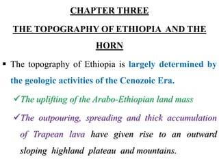
  • 1. CHAPTER THREE THE TOPOGRAPHY OF ETHIOPIA AND THE HORN  The topography of Ethiopia is largely determined by the geologic activities of the Cenozoic Era. The uplifting of the Arabo-Ethiopian land mass The outpouring, spreading and thick accumulation of Trapean lava have given rise to an outward sloping highland plateau and mountains.
  • 2. Major faulting resulted in division of the plateau into two broad units Faulting elsewhere guided part of the course of some rivers formed depressions on which lakes were subsequently created. river dissection and roughening on the highlands, and deposition on the lower areas
  • 3. General Characteristics of the Ethiopian Physiography  The Ethiopian landform is characterized by great diversity. There are flat-topped plateaus, high and rugged mountains, deep river gorges and vast plains. altitude ranges from 125m.b.s.l(Kobar Sink) to the highest mountain(Mount Ras Dashen-4,620 m.a.s.l). the altitudinal range in Ethiopia is about 4620m- (- 125m)= 4745m.
  • 4.
  • 5. – Ethiopia has the largest proportion of elevated landmass in the African continent. – Ethiopian Highlands form the largest continuous area of its elevation in the continent. – described as the Roof of East Africa because of its height and large area. – proportion of Ethiopian land above 1,000 meters of is 50% of the total area. – Proportion of land above 1,500 meters is about 44% of the country. Half of this is more than 2,000 m.a.s.l.
  • 6.
  • 7. – Most of the Ethiopian Highlands are part of the central and northern Ethiopia, and extends into Eritrea. – The highland core is encircled by semi-arid and lowlands. – Ethiopian Highlands are rugged mass of mountains dissected by several rivers and ravines which have cut deep gorges. – The high plateau and mountain ranges are sources of many rivers and streams that made the country the “Water Tower of East Africa”.
  • 8.
  • 9. • The diversity in topography is accompanied by differences – in natural features (soil, climate, vegetation and wild life) – in the socio-cultural and economic phenomena. – the highlands have been significant throughout Ethiopian history in the economic, cultural and political aspects.  Highlands make up nearly 56% of the area of the Ethiopia.  The remaining 44% of the area of Ethiopia is lowland.  Highlands subdivided into:  lower highland (1,000-2,000m.a.s.l), which make up 35%  higher highland (>2,000 m.a.s.l) constituting nearly 22%.
  • 10.
  • 11. Contrasting features between the Ethiopian highlands and lowlands (by taking the 1,000 m for demarcation) Features of Ethiopian highlands  Moderate and high amount of rainfall (>600 mm per year).  Lower mean annual temperature (<20 C).  The climate is favorable for biotic life.  Rain-fed agriculture is possible.  Free from tropical diseases.  Attractive for human habitation and densely settled. Features of Ethiopian lowlands  Fewer amounts of rainfall  Higher temperature  High prevalence of tropical diseases  Lower population densities.  Pastoralist and semi- pastoralist economic life  Vast plain lands favorable for irrigation agriculture
  • 12. The Physiographic Divisions of Ethiopia • Following the geologic processes of the Cenozoic Era, three major physiographic units can be identified in Ethiopia. • These are: a) The Western highlands and lowlands b) The South-eastern (Eastern) highlands and lowlands c) The Rift Valley
  • 13.
  • 14. 1. The Western Highlands and Lowlands  includes all the area west of the Rift Valley.  It extends from northern most point of Tigray to the Ethio- Kenya boarder in the south.  In the east it is bounded by the western escarpment of the Rift Valley.  Westward, the land gradually descends in altitude and merges into western foothills and lowlands (along the Sudan and South Sudan border).
  • 15.  It makes up about 44% of the area of the country. • This region is further subdivided into four groups of highlands (76.3%) and four groups of lowlands (23.7%).
  • 16. The Western Highlands a) The Tigray Plateau • Made up of highlands of Tigray. • It extends from the Tekeze gorge in the south to the central Eritrean highlands. • The Tigrian plateau is separated from the Eritrean plateau by the Mereb River. • It lies to the southeast of the upper course of the Mereb River and to the northeast of Tekeze River Gorge.
  • 17.
  • 18. • It constitutes about 13% of the area of the region. • It is an elongated highland with most of the land being between 1,000 and 2,000 meters above sea level • This plateau is drained by the right bank of the tributaries of Tekeze . • Long period of denudation has created residual features of granite hills, rugged topography, and Ambas. • There are high mountains in this plateau with elevations of over 3000 m (Mount Tsibet (3988 m.a.s.l), Mount Ambalage (3291 m.a.s.l), Mount Assimba (3248 m.a.s.l).
  • 19.
  • 20.
  • 21. b. North Central Massifs • It is the largest in the western highlands. • Much of its northern and southern limit follows the Abay and Tekeze gorges. • The Abay, Tekeze and their tributaries have cut into this region a maze of gorges, steep sided river valleys, dividing the land into many isolated plateau blocks. • Much of these plateau and tablelands are still capped by the Trappean lava.
  • 22. 3/25/2023 Jimma University 22 Northern Central Highlands Shewan Plateau Tigray Plateau Afar Triangle Hararghe Plateau Arsi-Bale Highlands South West Highlands Tekeze LLs Wabe-Shebelle Lowlands Gibe LLs
  • 23. • It contains Lake Tana basin surrounded by plains of Fogera and Dembia in the north and an upland plain in the south. • It consists of the Gonder, Wello and Gojjam Massifs. • 58% of the region is at an altitude of more than 2,000 meters, making it the second highest physiographic division. • Out of the 26 mountain peaks with altitude of more than 4,000 m.a.s.l in Ethiopia, 19 mountain peaks are found in this physiographic region.
  • 24.
  • 25. • The most popular ones include – Mount Ras Dashen (4,620 m.a.s.l), Mount Weynobar/Ancua (4462 m.a.s.l), Mount KidusYared (4453 m.a.s.l), and Mount Bwahit (4437 m.a.s.l) in the Simen Mountain System. – Mount Guna (4,231m.a.s.l) in the Debre Tabour Mountain System, Abune Yoseph (4,260 m.a.s.l) in the Lasta highlands of Wello and Mount Birhan (4,154 m.a.s.l) in the Choke Mountain System in Gojjam are also part of Simen Mountain System.
  • 26.
  • 27. • These mountains have steep cliffs and rugged terrain that provide scenic views to climbers. • The Mountain systems in Gonder and Gojjam are separated from the eastern group of mountains in Wello by impenetrable and deep gorges. • At one point though, they are connected by Yeju Wadla Delanta land bridge (ridge). • This land bridge has been significant in history. It served as a route of penetration by the Turks, Portuguese, and Italians.
  • 28.
  • 29.
  • 30. • The Tekezze and Abay, together with its tributaries, are the main river that drains the region. • Tekezze River has divided the North Central Massif area into western and eastern massifs, which are connected by the Yejju-Wadla-Dilanta plateau. • The Western Group – form a water shade between Abay (Lake Tana Basins) & Tekeze rivers with Mt. peaks Ras Dejen (4620m) in Semen Massif and Ras Birhan (4154m) in Choke Massif.
  • 31. C. The Shewa Plateau/Central highlands • It is bounded by the Rift Valley in the east and southeast, by the Abay gorge in its northern western limit, and Omo gorge in the south west. • It occupies a central geographical position in Ethiopia. • It is the smallest of the Western highlands (11% of the area of the whole physiographic region). • It has the largest proportion of elevated ground- nearly ¾ of its area is at an altitude of >2,000 m.as.l.
  • 32.
  • 33. • It is drained outward in all directions by the tributaries of Abay, Omo, and Awash and forms a water divide/water shade b/n these three river basins. • The tributaries of Abay are Guder, Muger, Jema etc. have cut deep gorges and steep sided river valleys. • The tributaries of Omo and Awash have dissected the other sides of the plateau. • The highest mountains in the Shewan plateau are Mount Abuye-Meda (4,000 m.a.s.l) in Northern Shewa, Mount Guraghe (3,721 meters) in the south .
  • 34.
  • 35. • It forms the core/center of country’s historical, political, cultural and economical entity due to its locational advantages. d. The South western Highlands • This sub region consists of the highlands of Wellega, Illuababora, Jimma, Kaffa, & Gamo and Gofa. • The region is separated from the adjacent highlands by the Abay and Omo river valleys. • It extends from the Abay gorge in the north to the Kenya border and Chew Bahir in the south.
  • 36. 3/25/2023 Jimma University 36 Northern Central Highlands Shewan Plateau Tigray Plateau Afar Triangle Hararghe Plateau Arsi-Bale Highlands South West Highlands Tekeze LLs Wabe-Shebelle Lowlands Gibe LLs
  • 37. • It accounts for about 22.7% of the area of the region. • It is the second largest in the Western highlands. • About 70% of its area is lies within 1,000-2,000 m.a.sl. • It is the wettest region in Ethiopia. • It is drained by Dabus, Deddessa (tributaries of Abay), Baro, Akobo and the Ghibe/Omo rivers. • The south western highlands are the most dissected and rugged terrain of the country because of the numerous streams.
  • 38.
  • 39. • It is also the home of most numerous and diverse ethnic linguistic groups in Ethiopia. • With a height of 4,200 meters above sea level, Guge Mountain is the highest peak in this physiographic subdivision. • Its drainage system accounts nearly half of the total volume of water drained annually from the country. • The highest forest coverage of the country is found in this region.
  • 40. • Unlike the other Western Highlands, this region is: • The largest producer of coffee, spices, tea plantation (Wushwush, Limu & Gumero), timbering, rubber trees and other forest produces like honey • The dwelling home for various ethnic groups • Known for substantial livestock production . The Western Lowlands • These are the western foothills and border plains that extend from Western Tigray in the north to southern Gamo-Gofa in the South.
  • 41. • Extends from Tekeze basin in the north to the Omo basin in the south along the Ethio-Sudan/South Sudan borders. • In certain places, ridges or part of the highlands protrude into the lowlands, interrupting their continuity. • They make 11% of the area of the physiographic region. • The general elevation ranges between 500 and 1000 meters above sea level.
  • 42. • This physiographic sub-region is further subdivided into four by the protruding ridges. • These are Tekeze lowland, the Abay-Dinder lowland, the Baro lowland, and the Ghibe lowland from north to south. • Since one or two rivers cross all of these lowlands, irrigation agriculture is highly feasible. • For example, the Baro lowland has an extensive flat area suitable for mechanized agriculture.
  • 43. • The lowlands are assumed their names based on the rivers draining surface their lands. • Except the Baro lowland, the western lowlands are characterized by arid & semi-arid climate. • As one moves northwards, the degree of aridity increases, making rain-fed agriculture more difficult. • Pastoral or semi-pastoral economic activities dominate the area.
  • 44. • The Ghibe/Omo lowland (the lower Ghibe/Omo Valley and the northern Turkana basin), is classified in the Western lowlands from its geographical location but structurally it also belongs to the Rift Valley. • It is an area which is both faulted and tectonically depressed. • In the Western lowlands, there are small but important towns to agriculture, history, or are simply border towns and frontier ports. • These are Humera, Metema, Omedla, Kurmuk, Gambella etc.
  • 45. 2. The South Eastern Highlands and Associated Lowlands • It is the second largest in terms of area. • It accounts for about 37% of the total area of Ethiopia. • The highlands make up 46% of the physiographic division while the rest is lowland. • The eastern escarpment of the Rift Valley makes the western and the northern limit. • From here, the land gradually descends southeastward into the southeastern lowlands and then to the plains of Somalia. • These are further subdivided into two units of highlands and two units of extensive lowlands.
  • 46. 3/25/2023 Jimma University 46 Northern Central Highlands Shewan Plateau Tigray Plateau Afar Triangle Hararghe Plateau Arsi-Bale Highlands South West Highlands Tekeze LLs Wabe-Shebelle Lowlands
  • 47. The South Eastern Highlands A. The Arsi-Bale-Sidama Highlands • These highlands are found to the east of the Lakes Region • They are located in the south western section of the physiographic region. • They make up 28.5% of the area of the region and 62% of the south - Eastern Highlands. • The Arsi Highlands are made up of flat rolling uplands and dissected mountains.
  • 48. • The well known mountains in this area are Mount Kaka (4,180 m.a.s.l), Mount Bada (4,139 m.a.s.l) and Mount Chilalo (4,036 m.a.s.l). • The highest mountain peaks in this region are Tulu- Demtu (4,377 m.a.s.l) and Mount Batu (4,307 m.a.s.l). • The Afro-Alpine summit of Senettie plateau is found on the Bale highland. • Erosion features belonging to Pleistocene glaciation but later modified by fluvial processes are seen in the trough- like gorges, hanging valleys, and depressions.
  • 49.
  • 50. • The Bale highlands are separated from the Arsi highlands by the head and main stream of Wabishebelle. • Significant for the growth of cool-climate industrial crops such as wheat and barely on large scale agribusiness • The Sidama Highlands are separated from the Bale Highlands by the Ghenale river. • They occupy the southwestern corner of this region. • Jemjem plateau is the prominent feature in the region. • It is an important coffee growing area.
  • 51. • The highest quality coffee in Ethiopia is produced in this region. • Peak points are Mts. Dello (3600m) in Guji & Guramb (3400m). • Inset/kocho is the staple food in the region. • Rivers Wabishebelle and Ghenale along with their tributaries have dissected this physiographic region. • Specially, Weyb River, tributary of Ghenale, has cut an underground passage (Sof Omar cave) through the Mesozoic Limestone rocks.
  • 52. B. The Hararghe Plateau • It extends from the Chercher highlands in the south-west to Jigjiga in the east. • It makes up 38% of the South Eastern highlands and 17.4% of the whole physiographic region. • It has the smallest proportion of upper highland(>2,000 m.a.s.l). • It is a low lying and elongated region. • Rising sharply from the Rift Valley floor, it immediately but gently descends east and southeastward.
  • 53. • The left-bank tributaries of Wabishebelle drain it. • Much of the Trappean lava is removed and the Mesozoic rocks are extensively exposed. • The highest mountain here is Mount Gara-Muleta (3,381 m.a.s.l). C. The Southeastern Lowlands • Located in the southeastern part of the country and they are the most extensive lowlands in Ethiopia. • They make up 54% of the area of the physiographic region and around one-fifth (20%) of the country.
  • 54. • They include the plains of Ogaden, Elkere, and Borena. • These extensive plains are interrupted here and there, by low hills, low ridges, inselbergs and by shallow and broad river valleys and depressions. • The economic potential for this region includes • animal husbandry • irrigation agriculture • exploitation of petroleum and natural gas
  • 55. – Southeastward sloping plains characterize these lowlands. – Highly dispersed human & large livestock population. – Mainly covered by Mesozoic Era sedimentation – Have an average altitude is between 500-1000m – Sparsely inhabited by pastoral and semi-pastoral communities. – These lowlands are little used and support very small population because of the harsh climatic conditions.
  • 56. • Its sub-divisions are two: • Wabe-Shebelle lowland – Parts of Somali region and Eastern Hararghe are drained by Wabe-Shebelle river and its tributaries – Known for cattle, sheep, goat and camel husbandry. – Covers about 60% of the Eastern Lowlands • Ghenale Lowland- Covers about 40% of the Eastern Lowlands. – Comprises parts of Borena and Guji lowlands which are drained by Ghenale river & its tributaries – Known for the highest quality and quantity cattle & other domestic animals production areas of Ethiopia.
  • 57. 3. The Rift Valley Physiographic Region • The Rift Valley is a tectonically formed structural depression. • It is bounded by two major and more or less parallel escarpments. • The formation of the Rift Valley has separated the Ethiopian Highlands and Lowlands in to two. • It extends from the Afar triangle in the north to Chew Bahir for about 1,700 km2 • It covers 18% of the area of Ethiopia.
  • 58. • In the Afar Triangle, it is the widest and narrows down to the south.  Has a funnel shape, widening at Northeast and narrowing the Southwest orientation.  The most unstable part of the country as evidenced by existence of hot springs, fumaroles, active volcanoes.  Volcanic rocks, fluvial and lacustrine deposits cover the floor. • Altitude in the floor ranges from 125 m.b.s.l at Dallol Depression, to as high as 2,000 m.a.s.l in the Lakes region.
  • 59. • Because of its altitudinal variation and positional differences; – the climate also varies from warm, hot and dry to cool and moderately moist conditions. – the social and economic life reflects this pattern (places sparsely inhabited by pastoralists and people practice some rain-fed agriculture). • Rift Valley is subdivided into 3 physiographic sub-regions. – These are the Afar Triangle, the Main Ethiopian Rift valley , and the Chew Bahir Rift.
  • 60. i. The Afar Triangle  The Afar Triangle is the largest and widest part of the Rift Valley. It makes up 54% of the Rift Valley area.  It is bounded by the high western and eastern escarpments in the west and east respectively, and by the Afar and Aisha Horst in the northeast.  The area is generally of low altitude (300-700 meters).  Its elevation drops uniformly from approximately 1,000 meters in the southwest to below sea level in the north (Danakil depression).
  • 61. • It hosts one of the most hostile environments on Earth. (Max temp >50°C during summer wet season in Dallol). • The area is characterized by – faulted depressions (grabens), volcanic hills, active volcanoes, volcanic ridges, lava fields. – the Denakil Depression (Kobar Sink). – Lakes (Abe, Asale, and Afrera) occupy some of these basins. – A larger part of it is covered by thick and extensive salt plain.
  • 62. – It has a colorful landscape, fault depression and active volcanoes , which make it one of the tourist attraction sites in Ethiopia. – The Afar Triangle is generally hot and dry. Only its southern part gets water from Awash. • The economic importance of this region includes – salt extraction – irrigation along the Awash River – electric potential from geothermal energy.
  • 63. ii. The Main Ethiopian Rift/Central Rift • This part of the Rift Valley is the narrowest belt and the highest. • It has an average width of 50-80 kilometers and general elevation of 1,000-2,000 meters above sea level. • It extends from Awash River in the north to Lake Chamo in the south. • It is bounded by the western and eastern escarpments. • The prominent features are the numerous lakes formed fault depressions.
  • 64. • The floor in many places is dotted by cinder cones and volcanic mountains. • The big ones include Mount Fentale, Boseti-guda (near Adama), Aletu (north of Lake Ziway) and Chebi (north of Lake Hawasa). • Because of altitude, the lakes region of the Main Ethiopian Rift is generally milder and watery. • Here rain-fed agriculture is practiced.
  • 65. • Other resource bases include – recreational value of the lakes, – agricultural importance of some streams and lakes, – the geothermal energy potential. iii. The Chew Bahir Rift • It is the smallest and the southern-most part of Rift Valley. • Highlands of Konso and the surrounding highlands separate it from the Main Ethiopian Rift to the north. • It is the broad and shallow depression, which is a marshy area covered by tall grass, into which the Segen and Woito streams empty.
  • 66. Impacts of Relief on Biophysical and Socio- economic Conditions Agricultural practices • Choice of farming techniques- in rugged terrain mechanized farming techniques are difficult to practice. • Crop production- some corps (barley, wheat) are well adapted to higher altitudes and others to low altitude (sorghum, maize). • The practice of animal husbandry- most horses and sheep are reared in the higher altitudes and camels and goat are well adapted to lower altitudes.
  • 67. Settlement pattern • Highlands of Ethiopia that experience a temperate type of climate are mainly free from most of the tropical diseases and so that are densely settled. • Rugged and difficult terrain hinders the development of settlement and its expansion. • The highlands of Ethiopia are characterized by sedentary life and permanent settlements while lowlands that are inhabited by pastoralists have temporary settlements.
  • 68. Transportation and communication • The highly dissected and rugged topography: – hindered the development of internal surface transportation. – makes infrastructure development and maintenance costly. – influenced TV and radio communications – rendered rivers less navigable due to the waterfalls, deep gorges and steep cliffs.
  • 69. Hydroelectric power potential • The great difference in altitude coupled with high rainfall created suitable conditions for a very high potential for the production of hydroelectric power in Ethiopia. Socio-cultural feeling • The rugged terrain as a result of excessive surface dissection resulted in the long-term isolation of communities that led to the occurrence of cultural diversity. • People who live in the highlands have been identifying themselves as degegnas (mountaineers) and those who live in the lowlands as kollegnas (lowlanders).
  • 70. Impacts on climate • The climate of Ethiopia is a result of its tropical position and the great altitudinal variation. • Highlands with higher amount of rainfall and lower rate of evapo- transpiration tend to be moisture surplus compared to the moisture deficit lowlands. Impacts on soil • Steep mountain slopes have shallow and little developed soils, unstable surface materials due to degradation processes. Impacts on natural vegetation- Relief through its effect on climate and hydrology affect the type of natural vegetation grown.