The Bay Way Plan 2009
•
1 gostou•4,012 visualizações

The document is a strategic implementation and marketing plan for the Long Island South Shore Bayway. It provides background on previous research and reports about the natural, cultural, and recreational resources of the south shore region. It then outlines components of the plan, including refining interpretive themes, identifying capital improvement projects, and developing a marketing strategy to create awareness of the Bayway network and effectively tell the story of the Long Island South Shore Estuary Reserve. The plan aims to develop the Bayway into a recognizable asset that encourages enjoyment of the reserve while promoting stewardship of resources.

Recomendados
Mais conteúdo relacionado
Mais procurados
Mais procurados (15)
Semelhante a The Bay Way Plan 2009
Semelhante a The Bay Way Plan 2009 (20)
Mais de Save The Great South Bay
Mais de Save The Great South Bay (20)
Último
Último (20)
The Bay Way Plan 2009
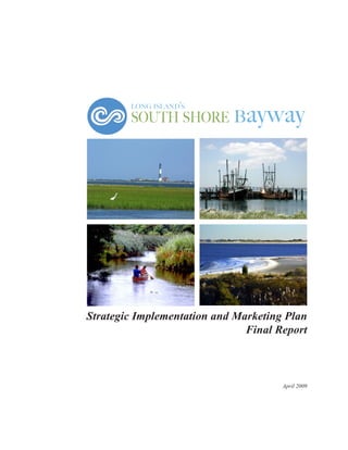
- 1. long island’s ayway south shore b Strategic Implementation and Marketing Plan Final Report April 2009
- 2. Acknowledgements Long Island’s South Shore Bayway Strategic Implementation and Marketing Plan was prepared for the Long Island South Shore Estuary Reserve Council and the New York State Department of State, Division of Coastal Resources, with financial assistance from the New York State Environmental Protection Fund and the U.S. Department of Commerce, National Oceanic and Atmospheric Administration, Office of Ocean and Coastal Resource Management, under the Coastal Zone Management Act of 1972, as amended. Many individuals and organizations contributed to completing this report. The Long Island South Shore Estuary Reserve Office expresses its appreciation to the members of the project advisory committee for their invaluable experience, knowledge, guidance, and support: Ellen Kelly, Committee Chair, Incorporated Village of Freeport Long Island Maritime Museum Maureen Dolan-Murphy, Citizens Campaign for the Environment Reserve Council Citizens Advisory Committee Mike Eagan, Reserve Council, Captree Boatman’s Association Dave Griese, Fire Island Lighthouse Preservation Society Lesley Kane, Islip Town Leasholders Association Joseph Kayal, Reserve Council Citizens Advisory Committee Gary Lawton, New York State Office of Parks and Historic Preservation, Long Island Region Elizabeth O’ Connor, Sea Kayaking Skills and Adventure Paula Valentine, National Park Service, Fire Island National Seashore New York State Department of State, Division of Coastal Resources George R. Stafford, Director Nancy Kunz, Dennis Mildner, Nancy Rucks Long Island South Shore Estuary Reserve Office: Jeffrey D. Fullmer, Director Project Staff: Patrice Benneward, Lou Siegel Former Staff: Clare O’Reilly, Michelle Pluzynski
- 3. Long Island’s South Shore Bayway: Strategic Implementation and Marketing Plan Final Report Prepared for: South Shore Estuary Reserve Council New York State Department of State Division of Coastal Resources 41 State Street Albany, NY 12231 (518) 474-6000 coastal@dos.state.ny.us http://www.nyswaterfronts.com and South Shore Estuary Reserve Office 300 Woodcleft Avenue Freeport, New York 11520 (516) 470-BAYS sser@dos.state.ny.us http://www.estuary.cog.ny.us Prepared by: Dodson Associates, Ltd. Landscape Architects & Planners Ashfield, Massachusetts In Association with: Smith & Jones Marketing Consultants Troy, New York and River Street Planning & Development Troy, New York April 2009
- 5. TABLE OF CONTENTS INTRODUCTION .................................. 1 BAYWAY BACKGROUND Previous Research and Reports ................ 4 Coastal Resources Interpretive Program ..... 6 Cultural Resources Survey ........................ 8 Historical Perspective ................................. 8 Major Maritime Centers ............................. 11 Secondary Maritime Centers ....................... 24 Potential Secondary Maritime Centers ...... 37 Conclusion ................................................. 38 Bayway Themes..................................... 39 Maritime Heritage/Cultural ....................... 39 Protecting the Coast/Natural ....................... 40 Enjoying the Estuary/Recreational ............. 40 IMPLEMENTATION Bayway Destinations ................................. 42 Recognized Destinations ............................. 42 Potential Destinations ................................. 44 Bayway Connectors ................................. 46 Recognized Connectors ............................... 46 Potential Connectors ................................... 47 Areas of Special Interest .......................... 54 Capital Improvement Plan ....................... 58 Goals ........................................................ 58 Representative Bayway Capital Improvement Projects ........................ 70 Project Partners and Funding Sources .......... 84 MARKETING PLAN ............................. 85 Road Show ............................................... 85 Public Relations ......................................... 85 Website ..................................................... 86 Drive to Web Campaign .......................... 87 Collateral Piece .......................................... 88 Educational Outreach .............................. 89 Signage/Way-finding ................................ 90 Special Events .......................................... 91 Potential Merchandising .......................... 91 BIBLIOGRAPHY .................................... 93 APPENDIX A: Maps Cultural Resources Survey Map Bayway Destinations Map Bayway Connectors Map Bayway Areas of Special Interest Map APPENDIX B: Partnerships and Funding APPENDIX C: Nomination Forms
- 6. Picture a network of trails, scenic roads and bike lanes leading to the beautiful waters of Long Island’s south shore bays... Imagine a coordinated system of signs, exhibits and street improvements leading the way to the shoreline... Envision exploring the bays, barrier beaches and tributaries alone in a kayak or with friends on a sunset cruise... Picture Long Islanders and visitors better connected with the beauty, history and natural splendor of the South Shore Estuary... You are experiencing the Long Island South Shore Bayway!
- 7. INTRODUCTION The Long Island South Shore Estuary Reserve is a 500 square-mile region of shallow bays, marshes, and freshwater streams on the south shore of Long Island. This rich, scenic tidal landscape has been associated with Long Island’s economy, quality of life, and identity for centuries. But over the past 50 years, significant increases in human population have changed the relationship between people and the natural environment, reducing public access to the water and impacting the quality of the natural environment. To help overcome these problems and to foster renewed appreciation of and access to the estuarine environment, the members of the South Shore Estuary Reserve Council, a partnership of government and non-government groups chaired by the New York State Secretary of State, are working together to promote restoration, stewardship, and enjoyment of the Reserve’s living resources and maritime traditions. With technical assistance from the New York State Department of State, the Reserve Council prepared a Comprehensive Inlet Fishing Pier, Captree State Park. Management Plan (CMP) in 2001. The CMP establishes a consensus-based blueprint for the protection and restoration of the estuary’s natural, cultural, and economic-related resources and recommends actions to improve water quality, restore and protect living resources, expand public use and enjoyment, sustain and expand the estuary-related economy, and increase education, outreach and stewardship of the Reserve. The CMP also describes the unique characteristics of key locations within the Reserve where there are concentrations of water-dependent activities and identifies them as Maritime Centers. Finally, it establishes three major Reserve themes—Maritime Heritage, Protecting the Coast, and Enjoying the Estuary—to use as a basis for the management and interpretation of the Reserve’s human commnities and diverse habitats. In 2004, the Reserve Council completed a visioning process for enhancing public use, enjoyment and stewardship of the Reserve based on the goals described in the CMP—and the South Shore Bayway concept was born. The Council envisioned an enlightening, fun, and easy-to-navigate network of recreational, historic, cultural, and naturally beautiful maritime destinations that would encourage people to promote and explore the Reserve, raise public awareness about the natural and cultural resources within the Reserve, and encourage stewardship of Reserve resources. Meetings with key regional stakeholders and extensive research followed. The Bayway Vision below, paraphrased from A Vision for the South Shore Bayway, developed from this process: The Bayway will be an interwoven network of existing maritime centers, parks, historic and cultural sites, community centers, and waterfronts used by pedestrians, bicyclists, boaters, and motorists. Coordinated and cohesive signs will interpret key estuary features, Strategic Implementation and Marketing Plan page 1
- 8. offer self-guided tours, and orient Bayway residents and visitors to the many resources of the region. Trails, sidewalks, local streets, and highways will be safe. Community character will be enhanced. Scenic roads and scenic areas will be recognized. The shoreline will be accessible. There will be adequate parking, pedestrian amenities, Major Maritime Centers generally support a and boating facilities. The needs of wide range of water-dependent uses. They generally many user groups—from the young to are large enough to be tourist destinations and the elderly, from waders, swimmers, and reflect maritime interpretive themes and activities appropriate for both local and regional audiences (see divers to canoeists,kayakers, sailors, page 9). and many others—will be met. The health of the estuary will be protected for Secondary Maritime Centers are geographically future generations to enjoy through onsmaller in size than Major Maritime centers, more going preservation, enhancement, and likely to attract local rather than regional visitors, monitoring. and often supportive of only one or two major waterThe Maritime Centers described in the CMP are the foundation of the Bayway network. The Bayway Vision also described certain locations and transportation routes as Destinations and Connectors. The ultimate goal is for the Bayway to advance the implementation recommendations in the CMP by encompassing as many of the maritimerelated active and passive parks, land and water trail systems, cultural and historic sites, working and recreational waterfronts, scenic roads and vistas, and natural areas in the Reserve as possible. dependent activities (see page 22). Bayway Destinations are locations within the Reserve that contain significant cultural, natural, or recreational resources that help interpret that story of the Reserve (see page 40). Bayway Connectors are transportation routes that create a network of land and water trails, bike paths, historic parkways, rail lines, and waterways linking Maritime Centers, Destinations, and Areas Special Interest (see page 44). Areas of Special Interest include the open, natural areas of the Reserve which feature special natural, scenic and environmental character. These areas do not fall into either the Destination or Connector category because they cover a broader geographic area rather than a specific location (see page 52). Once the Reserve Council developed a concise vision for the Bayway, it recommended that a Strategic Implementation and Marketing Plan (Plan) be prepared to move from vision to reality. The result is this document: a blueprint for creating a dynamic, cohesive network of cultural centers, recreational activities, and interpretive programs and exhibits that promotes enjoyment of the Reserve and supports the long-term stewardship of Reserve resources. The Plan contains the following components: • Cultural Resources Survey: Based on the information resulting from preparing these components, the major Bayway themes previously identified in the CMP were refined into several subthemes that more definitively address the cultural landscape, natural beauty, wildlife habitats, and recreational activities that are publicly accessible within the Reserve. The refined themes organize the vast natural, cultural, and recreational resources that Page 2 South Shore Estuary Reserve: Bayway
- 9. make up the Bayway; highlight the interpretive potential of the Reserve; and indicate how stewardship can be incorporated into the protection and use of Reserve resources. They were an invaluable aid in shaping the Plan and in helping to evaluate more activities and interpretive opportunities that can, potentially, be included in the Bayway network. As a result of this focus, the Plan recommends recognition of one additional secondary maritime center, 42 new Destinations, and 22 new Connectors; creation of another category for certain Areas of Special Interest unique to the Reserve; and supports recognition of more Destinations and Connectors over time (see nomination form, Appendix C). • Capital Improvement Plan: Because design guidelines and capital improvements in Bayway communities support appropriate public access and enhance the maritime character of the Reserve, the Plan also identifies general and site-specific projects and the potential partnerships and funding sources that may make them achievable. The projects included are the types of improvements that best support the Bayway Vision by making the Bayway—and the Reserve, itself—safe, accessible, sustainable, aesthetically pleasing, and structurally sound. They are summarized in a table at the end of the Capital Improvement section. • Marketing Plan: Because creating awareness of the Bayway through visual exposure and effectively telling the Reserve story are critical for the ultimate success of the Bayway Vision, the Plan outlines marketing, media, and educational strategies that employ the Internet, printed materials, and other promotional possibilities. Implementation of the Plan will ensure that the Bayway evolves into a valuable, recognizable asset to the people who visit and live on the south shore of Long Island and helps identify the south shore as a distinct maritime region. A comprehensive network of linked maritime centers, destinations, connectors, and areas of special interest will encourage enjoyment of the Reserve while simultaneously promoting stewardship of natural and cultural resources. Over time, the Bayway will become a well known feature of the south shore, linking coastal communities, water-dependent businesses, public recreational venues, natural areas, and historic sites. The Plan provides the tools necessary to realize these goals and suggests how the Bayway can respond to changing needs and conditions by incorporating new destinations and transportation routes into the Bayway network. Western Bays of the Long Island South Shore Estuary Reserve. Strategic Implementation and Marketing Plan page 3
- 10. BAYWAY BACKGROUND PREVIOUS RESEARCH AND REPORTS The Plan builds on previous research and reports that identify the resources of the south shore region These previous studies provide guidelines for developing an integrated, coordinated interpretive and wayside sign system and address how local governments can maximize the natural, cultural, and scenic resources of New York State waterfronts. The material covers a wide range of topics, from historic resources and development patterns to open space and maritime history. Taken together, this body of work illustrates, defines, and inventories the vast resources found within the Reserve and documents the diverse initiatives that have been undertaken to protect and preserve them, laying the groundwork for developing specific strategies to protect and manage these resources. Of specific interest to the completion of the Strategic Implementation and Marketing Plan (Plan) were the Maritime Centers of the South Shore Estuary Reserve (1999); Historical Development Patterns (1999); Historic, Cultural and Scenic Resources: Parts 1 and 2 (1997); Public Access and Recreation (1999); Open Space Preservation Study (2000); and Comprehensive Management Plan (2001). The Comprehensive Management Plan (CMP) was conceived to address the health and protection of the estuary while allowing for the public’s enjoyment of its treasures. It contains recommendations for the care and improvement of shellfish, birds, and wildlife habitats and identifies definitive strategies for water quality improvements. The CMP also addresses the importance of preserving open space, historic landmarks, and scenic views and Cover, Comprehensive Management Plan. vistas. Providing educational opportunities and more public access to the Reserve also are recommended. Sustaining and expanding areas with concentrations of water-dependent businesses are proposed as a means of boosting the area’s economy and protecting its maritime heritage. In 2005, a Scenic Resources Inventory was prepared for the South Shore Estuary Reserve Council by Dodson Associates. The scenic resources of Long Island’s south shore coastal area are an essential part of the region’s identity. This document, through a thorough and methodical inventory, is an important step in developing a strategy for the protection of the south shore’s valuable scenic resources. Its preparation was made possible by the 1981 New York State enabling legislation that created the Coastal Management Program and the policies that manage and protect scenic resources of statewide significance. Page 4 South Shore Estuary Reserve: Bayway
- 11. Long Island Traditions, an organization dedicated to preserving Long Island’s cultural heritage, completed the South Shore Estuary Maritime Survey Report in 2004. The report includes an extensive survey of existing historic buildings between the hamlets of Oakdale and Brookhaven. The executive summary provides an historic overview of the water-related industries and activities that helped to shape Long Island as we know it today. Folklorists Nancy Solomon, the Director of Long Island Traditions, and John Eilertsen, Ph.D., the Executive Director of Bridgehampton Historical Society, completed Cultural Resources of Waterfront Communities: A Guide for Planners in 1995 to assist local communities with long-term planning strategies along the waterfront. The report offers guidelines for documenting waterfront cultural resources, and a narrative about Bay Shore serves as a case study. The New York State Department of State, Division of Coastal Resources (DOS/DCR) also has been in the forefront of planning initiatives that can help local communities promote their waterfronts. In 2004, DOS/DCR published a guidebook entitled Making the Most of Your Waterfront: Enhancing Waterfronts to Revitalize Communities that addresses how municipalities can make the most of the natural, cultural, and scenic resources that are abundant along New York waterfronts. An associated DOS/DCR initiative, the Local Waterfront Revitalization Program (LWRP), provides an additional way for communities to develop and implement waterfront visions that provide access and enjoyment while simultaneously protecting valuable natural and cultural resources. For a complete listing of all documents and materials used for the development of the Bayway Strategic Implementation and Marketing Plan (Plan) see the Bibliography at the end of the Plan. Strategic Implementation and Marketing Plan Brown River Shipyard; Maritime Survey Report, Long Island Traditions. page 5
- 12. NEW YORK STATE COASTAL RESOURCES INTERPRETIVE PROGRAM The New York State Department of State, Division of Coastal Resources, developed the New York State Coastal Resources Interpretive Program (NYSCRIP) in 2003. NYSCRIP uses illustrative signage to interpret local, regional, and significant New York State coastal resources. Municipalities and other institutions, agencies, and organizations within the South Shore Bayway are encouraged to participate in NYSCRIP. All interpretive signage installed along the Bayway that receives funding and support through the New York State Department of State must follow NYSCRIP’s prescribed Design Guidelines (http://www.nyswaterfronts. com/downloads/pdfs/NYSCRIP_FINAL_ VERS_1_27_03.pdf). Through the installation of NYSCRIP signage, Bayway visitors and residents will have access to information about how the human and natural environment interrelate and how appreciation of coastal resources sustains the regional economy, which relies on a healthy and productive estuary environment. NYSCRIP’s unified signage design provides visual continuity among sign locations throughout the State and connects people from different regions of the State's waterfronts. The NYSCRIP Design Guidelines address two types of interpretive signage: a three-sided kiosk and low profile signs or panels. For South Shore Bayway kiosks, a local panel provides an overview of the community in which the kiosk is located, a regional panel provides information about the South Shore Estuary Reserve, and a third unifying panel relates the community to other New York State coasts and A kiosk installed along the Bayway under the New York waterways. Generally, one kiosk is installed State Coastal Resource Interpretive Sign Program. in a community in a high-pedestrian traffic destination, such as a Maritime Center, public pier, or urban park. Low profile signs generally are installed at destinations such as parks, beaches, and nature centers, as well as along promenades and trails. Kiosks and low-profile signage interpret coastal resources under one of the following themes: Living on the Coast/Waterfront – Coasts and waterfronts are habitats for plants, animals and humans. This theme explores the natural rhythms of life along both natural and developed coastlines. Page 6 South Shore Estuary Reserve: Bayway
- 13. Working on the Coast/Waterfront – Many waterfronts have been developed for economic purposes. While some people depend on natural resources to harvest fish and shellfish, others operate marinas, move cargo, process fish, or cater to tourism. This theme explores the many economic uses that depend on a waterfront location. Enjoying the Coast/Waterfront – Coasts and waterfronts provide a great variety of recreational opportunities. This theme celebrates public uses such as swimming, fishing, boating, hiking, wildlife observation, and passive pursuits that provide human relaxation and rejuvenation. Protecting the Coast/Waterfront – Coastal and waterfront resources are worth protecting. This theme is used to illustrate the measures that should be taken or have been accomplished to enhance, restore, or protect sensitive habitats and other important sites so that these sites may remain safe and naturally productive. Natural Coasts/Waterfront – From plants and animals to intricately balanced wetlands and constantly shifting shorelines, this theme explores the natural beauty and complexity of coastal and waterfront resources. Historic Coasts/Waterfronts – Important cultural and historic stories and landmarks are found along New York’s waterfronts. This theme celebrates historic resources dating to pre-colonization that became the birthplace of the New York State and fostered its maritime heritage and culture. NYSCRIP provides a clear process for a community to plan interpretive signs that reflect that community’s unique identity or features. It outlines the responsibilities of the project manager, graphic designer, and interpretive text writer. In addition, NYSCRIP provides guidance for selecting appropriate locations for sign installation, estimating fabrication costs, developing interpretive concepts, conducting research, fleshing out graphic and text layout, finalizing design specifications, conducting pre-fabrication color tests, and completing an inspection of the fabricated signs. NYSCRIP signage projects are eligible for 50/50 matching grant awards under the New York State Environmental Protection Fund Local Waterfront Revitalization Program. Funding is available on an annual basis to qualified local governments for discrete stand-alone signag projects that include all NYSCRIP project aspects. NYSCRIP kiosks have been installed in the South Shore Bayway Maritime Centers of Freeport, Bay Shore, and Patchogue, each of which are Destinations recognized by the Reserve Council. There are numerous signs in the design and planning stage in the communities of Hempstead, East Rockaway, Oyster Bay, Babylon, Islip, Brookhaven, Patchogue, and Southampton that will implement the recommendations of the South Shore Bayway Strategic Implementation and Marketing Plan. Additional work is potentially needed to develop a NYSCRIP guide specifically for South Shore Bayway interpretive signs funded through New York State, as well as a regionwide implementation action strategy to determine the best match of themes with specific sites. Funding should be allocated from the Environmental Protection Fund Open Space account to achieve region-wide objectives. Strategic Implementation and Marketing Plan page 7
- 14. CULTURAL RESOURCES SURVEY The Cultural Resources Survey prepared for the Plan inventories many cultural-related resources identified within the boundaries of the Reserve by the consultants, (see Cultural Resources Survey Map, Appendix A) and builds on previous work completed by the Reserve Council and Reserve partners. It focuses on the six major maritime centers and 14 secondary maritime centers identified in the technical reports prepared for the CMP. The diverse water-dependent and waterrelated uses that continue to reflect the distinct maritime tradition of the Reserve are closely examined, as these resources provide significant opportunities to encourage stewardship through interpretation and education The Bayway concept is rooted in an appreciation Point Lookout . of the value of the maritime centers and the maritime heritage of the south shore that they reflect. Through implementation of the Plan, the Reserve Council intends to promote public access to these resources and to inspire stewardship of them. Whether at a boat launch, historic site, beach, foot trail, bike path, nature preserve, or a host of other venues, the Bayway will offer south shore visitors and residents a memorable recreational and educational experience. Historical Perspective The rich maritime heritage of the south shore of Long Island reflects the history, settlement patterns, and economic struggles of the nation from the pre-colonial period to the present day. From small agricultural hamlets to major seaports and shellfishing centers, the waterfront communities within the Reserve are clear examples of the traditions and cycles that shaped the United States. The breadth and diversity of natural resources that distinguishes the south shore coast provided a unique setting and wealth of opportunities for the original Native American inhabitants and, later, for settlers from Europe. This legacy can still be detected in the culture, architecture, and natural features found in many Reserve communities—but it is frequently fragile and in danger of being lost. East Rockaway; Beers Atlas of Long Island, 1873. Early Settlement and Maritime Industries The south shore of Long Island was originally inhabited by Native Americans whose livelihood depended largely on the marine environment. Settlers from other parts of Long Island, the mainland, and Europe eventually followed. During the colonial period, most residents survived Page 8 South Shore Estuary Reserve: Bayway
- 15. through subsistence farming. An abundance of salt hay on nearby marshes and barrier islands provided grazing, bedding, and feed for livestock. Agriculture remained a strong economic factor in the region throughout the 17th and 18th centuries. By the late 1800s, fin fishing and shellfishing began to drive the economy. Local residents working the waterways, who later came to be known as baymen, harvested oysters, scallops, clams, and other marine resources for sale to wholesale markets in New York City and beyond. Over time, maritime businesses associated with the fishing industry Ferry in Bay Shore; Suffolk County Long Island in Early arose, such as processing and packing plants Photographs 1867-1951. and wholesale seafood markets. The baymen developed a unique localized culture that included construction of small, rustic buildings on barrier islands and marshes. These structures, known as bay houses, provided places to stop overnight during fishing and waterfowl hunting expeditions. Although bay houses initially contained no heat or indoor plumbing, wood stoves and outhouses often were added over time. Several historic bay houses survive and can be observed from some vantage points within the Reserve. Some of these structures are still used by working baymen, while others are now occupied as recreational retreats. Many of the surviving bay houses are maintained by descendants of the baymen who built the original structures. Many presentday occupants continue to maintain the cultural traditions of their ancestors. As maritime activity increased, a boatbuilding industry developed along the south shore. Started primarily by baymen building their own fishing boats, the industry increased over time in response to a demand for larger, oceanLittle Goose Island, Seaford, 2003. going vessels and began producing schooners, ferries, and sailing yachts for clients in New York City and beyond. Boatbuilding and shipbuilding also produced accessory businesses, such as sail making, in the area. Urban Expansion and Resort Development The late 1800s brought with it an influx of seasonal residents and tourists, mostly from New York City. The newcomers sought fresh air and an alternative to the hustle and bustle of an urban lifestyle, particularly in the summer. Wealthy families pioneered the movement. Attracted by Strategic Implementation and Marketing Plan page 9
- 16. abundant resources along the south shore, they built estates and established hunting and fishing lodges including Meadowcroft in Sayville, owned by Theodore Roosevelt’s cousin John Ellis Roosevelt; Idle Hour in Oakdale, owned by William K. Vanderbilt, the financier and railroad tycoon; Indian Neck Hall in Oakdale, owned by Frederick Gilbert Bourne, President of the Singer Sewing Machine Company; and the William Floyd Estate, the ancestral home of the Revolutionary War general and signer of the Declaration of Independance. Meadowcroft survives as part of the Suffolk County park system; Idle Hour is part of Dowling College; Indian Neck Hall is part of St. John’s University; the William Floyd Estate is part of Fire Island National Seashore. The arrival of rail service in the 1860s opened the region to an influx of people from all walks of life. For the first time, tourists and seasonal residents could travel between New York City and Long Island with relative ease. Captree State Park and Fire Island Inlet. After completion of the South Shore Railroad in 1864, the tourist industry boomed. Large waterfront hotels with formal dining facilities, private beaches, walkways to the nearest bays, evening concerts, and other amenities rose along the coast. Suddenly, use of the water was seen as a recreational amenity rather than as a form of subsistence. Modest summer homes began to appear on the waterfront, and recreational activities, such as pleasure boating, duck hunting, and sailboat racing, became popular among both year-round and seasonal residents. Many yacht clubs formed, and public fishing piers and swimming beaches were developed to serve the growing population. Suburbanization and the Modern Era The first major migration of people from New York City to Long Island occurred during the late 19th century. Suburban developments began to appear on the waterfront, along the rail line, and on estates that were divided into smaller lots to accommodate a demand for modest, year-round homes. This population trend continued throughout the first half of the 20th century and exploded at mid-century, when vast numbers of World War II veterans and their families settled throughout Long Island. Many of their children remained to raise their own families. The steady increase in population throughout the 20th century stimulated an intense need for recreational amenities. In the 1920s, Robert Moses, New York State’s first park commissioner, envisioned a massive, interconnected public park and highway system for Long Island. Corresponding with the development of the automobile, the system he set in motion provided access to a significant portion of the barrier islands, particularly Jones Island and Fire Island. Rail service, along with ferry terminals in several villages, combined with the parkway system, soon made Fire Island a national tourist destination. Page 10 South Shore Estuary Reserve: Bayway
- 17. In 1938, a severe hurricane ripped across Long Island, destroying many of the hotels and residences that had been constructed up to that time. Fire Island and other barrier beaches were especially hard hit, but the allure of the south shore—and the coastal environment of the barrier islands in particular—remained strong, and year-round and seasonal development continued. During the second half of the 20th century, open land on the south shore was developed at a rapid rate. The resulting suburbanization changed many of the natural qualities that had supported the agricultural and water-dependent economies of the region, and many of the natural and scenic features that had drawn people to the south shore eroded. The commercial shellfishing industry in particular, although strong throughout much of the 20th century, has been dramatically reduced in recent decades due to the depletion of shellfish and shellfish habitat. Slowly, the traditional maritime industries practiced by baymen and the local businesses that supported them have been reduced in scope and replaced by recreational fishing and boating. Today, baymen continue to fish and hunt in the bays of the south shore, but they now share the water with large numbers of recreational boaters. Each of the major maritime centers and secondary maritime centers recognized by the Reserve Council reflects these influences. Yet, each has a unique character of its own. As the economic climate and land uses have changed along the south shore, it has become important to document the maritime heritage of the region by protecting the natural and cultural resources that remain. Designation of historic sites, natural areas, wildlife habitats, and scenic vistas as parks, preserves, or landmarks has saved some of these resources and protected the beauty and character of the region. From boatyards that were founded in the 19th century and that still operate today to commercial fishing fleets that supply today’s restaurants and markets, there remain many strong cultural links to the past that can be identified and interpreted. Many of these important resources are located within the maritime centers, while others can be found only a short distance away. Major Maritime Centers Major maritime centers generally support a wide range of water-dependent uses. They generally are large enough to be tourist destinations and reflect maritime interpretive themes and activities appropriate for both local and regional audiences. The CMP recognizes six major maritime centers in Nassau and Suffolk counties. These centers are gateways to many natural and cultural Bay Houses on Neds Creek, 1989; Martha Cooper. destinations in the vicinity and offer many opportunities for reaching the bays and waterways of the Reserve at beaches, nature preserves, boat launches, fishing piers, and public marinas. A brief history of each maritime center, from early settlement through present day, follows. Strategic Implementation and Marketing Plan page 11
- 18. The Village of Freeport This maritime center is located in the Town of Hempstead, Nassau County, and encompasses Freeport Creek, Woodcleft Canal, Hudson Canal and their immediate surrounding areas. Settlement One of the oldest settled areas in the Reserve, Freeport was originally called Great South Woods and later Raynortown, for Edward Raynor who settled in the area in 1659. Early development centered on Freeport Creek, near Hempstead Bay. The creek was soon used to power mills that supplied the growing community with flour. In 1853, residents voted to rename the area Freeport, a variation of Free Port, the name used by ship captains, who, during colonial times, landed their cargo without paying customs duties. The extensive coastal plain surrounding the settlement provided fertile land for pasture and ample opportunity to harvest salt hay. The population increased as the abundance of oysters, clams, and fish in nearby waters became apparent. The availability of rail service in the mid 19th century ushered in a new era of tourism and suburbanization. Over time, most farmland and working waterfronts yielded to permanent residential development or tourism. The Woodcleft and Hudson canals were dredged, and many acres of waterfront marshland were filled in, creating the coastline that is recognizable today. Over time, the character of the Freeport waterfront changed from a Map Sources: Most data available from NYS GIS Clearinghouse; distinctly working marine area to a Bayway Destination Points (S) digitized by Dodson Associates, waterfront mix of commercial and Ltd. from May 2007 list of South Shore Estuary Reserve online recreational activities, while surrounding list of recognized destinations. farmland yielded to suburbanization. Commerce and Industry Grist mills and paper mills located along Freeport Creek were among the earliest businesses to be established in Freeport. Easy access to nearby bays provided ample opportunity for a budding shellfish industry founded largely on the oyster harvest. During the 18th and early 19th centuries, deep-sea fishing and boat-building businesses were established on Woodcleft and Hudson canals. Related businesses, such as sail-making and shellfish processing plants, developed, as well. Page 12 South Shore Estuary Reserve: Bayway
- 19. By the mid-19th century, Freeport was a booming commercial fishing port and a principal boatbuilding center. During the 20th century, its boat-building industry supplied vessels to many clients, including small to mid-sized ships for the United States Navy and United States Coast Guard. Many Freeport businesses dating to the 19th century and earlier remained active throughout much of the 20th century. They were joined by water-dependent recreational businesses, including marinas, recreational boat repair and maintenance facilities, yacht dealers, and charter fishing operators. Although some commercial fishing operations remain, businesses that serve recreational users dominate today’s working The Freeport River. waterfront. Recreation Freeport traces its roots as a significant recreational center for maritime activities to the suburbanization that began with the arrival of rail service in the mid 19th century. Today, it is a thriving port for pleasure boating and charter boat fishing. The Nautical Mile, along Woodcleft Canal, is the hub of the waterfront, just as it was a century ago. Today, however, its focus is on waterfront tourism, with many restaurants, markets, and recreational boat slips found along the canal. The Village has implemented a variety of projects to enhance public enjoyment and access to the waterfront and to maintain the maritime character of the area through educational exhibits, interpretive signage, and new waterfront parks and pedestrian walkways. Nearby Cow Meadow County Park and Preserve, the Town of Hempstead Marina, and the Village of Freeport’s recently constructed Sea Breeze Park offer water access, spectacular views, and opportunities to enjoy the maritime character of the Reserve. Also nearby, the Freeport Historical Society presents exhibits and houses an extensive local history archive. Freeport: Map of Long Island, Hyde & Company, 1896. Strategic Implementation and Marketing Plan page 13
- 20. Village of Babylon Located in the Town of Babylon, Suffolk County, this maritime center occupies the area between Carlls River in the west and Sampawams Creek in the east. Settlement Accessibility to Great South Bay and the Atlantic Ocean has defined the Village of Babylon for centuries. Originally referred to as Huntington South, Handsome Avenue Babylon. the land was purchased from the Sumpwam Indians in 1670. Finfish and shellfish were abundant in nearby waters. Streams would soon provide power for mills that produced grain, lumber, and paper. Salt hay attracted farmers, who traveled to the area from Huntington, on the north shore of Long Island, and stayed temporarily to harvest the salt hay that was used to feed cattle. The first permanent homes were located between Carlls River and Sampawams Creek. Settlement began in earnest after 1700. Inns, markets, and other businesses rose to serve visiting farmers and, later, travelers who would stop over en-route to Southampton from New York City, a trip that took about three days. By 1800, Babylon was a hub of activity. Nathaniel Conklin built a home for his mother on the northeast corner of Main Street and Deer Park Avenue in 1803. Legend has it that Nat’s mother was unhappy with the home’s proximity to a nearby tavern and compared the community to the biblical Babylon. The home now stands on the northwest side of Deer Park Avenue, where it was moved in 1871 Baymen plied local waters and eventually established settlements of bay houses on nearby islands. The village became a thriving resort area when rail service arrived in the mid 19th century. Eleven hotels once could be found in the vicinity, Map Sources: Most data available from NYS GIS Clearinghouse; and a trolley ran from the train station Bayway Destination Points (S) digitized by Dodson Associates, to the steamship dock, where ferries Ltd. from May 2007 list of South Shore Estuary Reserve online sailed to Fire Island beaches. By the end list of recognized destinations. of the 19th century, development lined Sampawam Creek and extended north Page 14 South Shore Estuary Reserve: Bayway
- 21. along Deer Park Avenue. Following World War II, the Village burst with activity, as veterans arrived and established year-round residences. Commerce and Industry Summer resort growth prompted a shift from commercial fishing to recreation and tourism. Hotels, including the Swan, Watson, and Argyle, once lined Fire Island Avenue and Main Street. Ferries took visitors from Sampawams Mouth of Sampawams Creek, Babylon, 2003. Point to Fire Island for fishing and swimming. Pleasure boating and recreational fishing increased in popularity. Accessory maritime businesses, including restaurants, markets, and marinas, sprang up, as well, primarily along the west side of Sampawams Creek. Recreation A demand for recreational activities and amenities was soon met. Private yacht and fishing clubs were founded, including the Wa-Wa-Yanda Fishing Club on Captree Island East and the Babylon Yacht Club (still in operation). Today, recreational fishing is a popular activity made possible by the close proximity of Fire Island Inlet and access to the Atlantic Ocean. Today, the Village of Babylon is known as both a working waterfront and a tourist destination with a variety of waterfront restaurants and marinas. Among the facilities in the area are Cedar Beach Marina, the Sport Fishing Education Center operated by Cornell Cooperative Extension of Suffolk County at Cedar Beach Marina, and Belmont Lake State Park. The 400acre state park offers row boat rentals, fishing, and hiking. Sampawams Creek, Babylon; U.S. Dept. of Agriculture aerial photograph, 1938. Strategic Implementation and Marketing Plan page 15
- 22. The Hamlet of Bay Shore This maritime center is located in the Town of Islip, Suffolk County, and encompasses the Watchogue Creek and Penataquit Creek area. Settlement The Secatogue Indians, a subgroup of the Algonquins, were the first inhabitants of Penataquit, today known as Bay Shore. John Mowbray, who hailed from Southampton, received a patent for the land in 1708. Around the time of the American Revolution, the area was known for boatbuilding. By the 19th century, Bay Shore had become a gateway to Fire Island and a summer destination for wealthy families. When rail service arrived in the mid-19th century, hotel development increased. An 1896 Map of Long Island shows several hotels located in the center of the community on South Country Road, also known as Montauk Highway. Rail service also stimulated a boom in summer estates along the coast. By the 20th century, with easier commuting to and from New York City via rail and automobile, the number of permanent residents living in Bay Shore swelled. In the early 1900s, many estates were subdivided into smaller lots, particularly in the neighboring Village of Brightwaters and along Lawrence Creek. This pattern of suburban development continued in Bay Shore and its environs throughout the 20th century. Commerce and Industry During the 19th century, Bay Shore thrived as a popular resort community with a working waterfront, ferry service to Fire Island, a strong business district along Main Street, and marinas along Map Sources: Most data available from NYS GIS Clearinghouse; Penataquit Creek and Watchogue Creek. Bayway Destination Points (S) digitized by Dodson Associates, Ltd. from May 2007 list of South Shore Estuary Reserve online list of recognized destinations. Page 16 South Shore Estuary Reserve: Bayway
- 23. Recreation Today, Bay Shore offers a mix of marinas, commercial fishing operations, and boat yards, and there is ferry service to Fire Island—making Bay Shore a major gateway to Fire Island communities and to Fire Island National Seashore. Docks, both public and private, and waterfront restaurants are located on Ocean Avenue and along Watchogue Creek. Bay Shore Marina, a Town of Islip facility located on Watchogue Creek is, arguably, the largest public marine facility in the Reserve. Many elements of Bay Shore’s past are evident, including historic homes and bay houses. Other historic sites, include the Bay Shore Railroad Station; the American Legion Soldiers and Sailors Memorial; the Brewster Ship Yard; Sagtikos Manor, a Suffolk County site operated as a colonial estate; and Gardiner County Park, a 300 acre site adjacent to Sagtikos Manor that was purchased by Suffolk County in 1971. Penataquit and Watchogue creeks, Bay Shore; U.S. Dept of Agriculture aerial photograph, 1938. Bay Shore Creek; RootsWeb, www.rootsweb.com. Strategic Implementation and Marketing Plan page 17
- 24. The Hamlet of Sayville This maritime center is located in the Town of Islip, Suffolk County, and encompasses the Browns Creek area. Settlement Members of the Algonquin Nation’s Secatogue tribe originally inhabited the area that came to be known as Sayville. In 1683, William Nicoll purchased a 50,000 acre tract of land that included present-day Sayville. He named the tract Islip Grange, after his ancestral home in England. John Edwards, a tailor from Easthampton, built the first house in Sayville in 1761. Little development followed until 1786, when a group of Congregationalists arrived. The mid-19th century brought a large influx of Dutch settlers to nearby West Sayville, but Sayville remained largely rural. A summer community of wealthy families developed during the late 19th century. Summer estates were constructed along Handsome Avenue, Edwards Avenue, and other thoroughfares. One of better known estates, Meadowcroft, located on Middle Road, belonged to Theodore Roosevelt’s cousin, John Ellis Roosevelt. The early 20th century ushered in another significant period of growth. By the 1920s, many estates had been sold and divided into smaller residential parcels. For example, in 1920, The Anchorage, a six-acre estate built in 1892 on Greene Avenue by the Hayward family, was sold and subdivided into 16 lots. The pace of such subdivisions increased throughout the 20th century as the demand for residential land grew. Page 18 Map Sources: Most data available from NYS GIS Clearinghouse; Bayway Destination Points (S) digitized by Dodson Associates, Ltd. from May 2007 list of South Shore Estuary Reserve online list of recognized destinations. Question-mark points digitized from examination of Hagstrom Atlas: Suffolk County 2004, Nassau County 2001. South Shore Estuary Reserve: Bayway
- 25. Commerce and Industry During the late 18th and early 19th centuries, the woodlands in and around Sayville were a major source of fuel and lumber for New York City. Sayville also developed a reputation as a major boatbuilding center, with several yards operating on Browns River Road. Sayville was known for the building and sailing of catboats, a small, highly-regarded recreational sailboat. Boatbuilding continued into the 20th century with the construction of yachts and pleasure boats for many clients located outside the area. After the opening of the railroad in the 1860s, resort hotels were constructed on Foster Avenue, Candee Avenue, and Handsome Avenue. With the resort industry came restaurants, shops, and maritime activities, including ferry service to Fire Island. From its opening in 1901 until it burned down in 1961, the Sayville Opera House served the south shore as a regional center for the arts. Recreation Yachting was a popular pastime Boat race on the Great South Bay; East on the Great South Bay. throughout the 19th century. Among the yacht clubs formed were the Sayville Yacht Club (1901) and the Wet Pants Sailing Association (c.1920), both in operation today. The Wet Pants Sailing Association remains at its original location on Browns River Road. The Sayville Yacht Club has relocated from Sayville to Blue Point but retains its original name. Today, Sayville offers a public beach for swimming in Great South Bay, along with a playground and tennis courts, at town-owned facilities located on Foster Avenue. Fire Island communities and Fire Island National Seashore’s Sailors Haven and Sunken Forest can be reached via ferry service at the foot of River Road. Roosevelt County Park and the Sayville Historical Society museum at the Edwards Homestead on Edwards Street are nearby. Brown’s River, Sayville, 2003. Strategic Implementation and Marketing Plan page 19
- 26. The Village of Patchogue This maritime center, located in the Town of Brookhaven, Suffolk County, encompasses the area surrounding the Patchogue River south of Division Street. Settlement Patchogue was a forested wilderness until 1759, when Humphrey Avery sold a portion of his woodland between the Patchogue River and Swan Neck River to Leoffer d’Leofferda. Saw, grist, cotton, and paper mills were then built along the shores of the area’s many tributaries. These mills established Patchogue as a major manufacturing center and, later, a major port on the south shore. Although there was farming in the uplands, most early residents made a living by harvesting finfish and shellfish from Great Patchogue River, Patchogue, 2003. South Bay In the late 19th and early 20th centuries, wealthy families built summer homes and established large estates in Patchogue to escape the heat and congestion of New York City. Much of this housing stock was converted to year-round use during in the 1930s. This trend from seasonal to permanent residences continued as rail service and the automobile permitted people to move farther from the city. Urban expansion and suburbanization during the 20th century prompted the breakup of many estates. Although many of Patchogue’s summer homes were modified for year-round use, a high degree of architectural integrity has been maintained. Many Victorian-style homes dating from the early 1900s can be seen on Ocean Avenue, Cedar Avenue, and Maiden Lane. Smith Boat Builders, Patchogue; Suffolk County Long Island in Early Photographs 1867-1951. Page 20 Commerce and Industry Austin Roe built the first hotel in 1808 on East Main Street. The South Shore Estuary Reserve: Bayway
- 27. Roes went on to build other hotels in the busy seaport, including the Eagle Hotel. After rail service arrived around 1869, other much larger hotels were built in the waterfront area. They included the Clifton Hotel at the end of Bay Avenue, the Mascot Hotel at the end of Ocean Avenue, the Newins Hotel and Pavilion on Bay Avenue, and the Central Hotel on West Main Street. The Newins Hotel catered to local residents, opening its beach to the public. The Central Hotel catered to water fowl hunting or “gunners.” Typical amenities included formal dining facilities, walkways to the bay, private beaches, and evening concerts. Before rail service arrived at mid-century, most residents and merchants traveled by boat. By the 1870s several boatyards were operating in the vicinity, including the Weeks boat yard on River Road. Franklin Weeks purchased the land for the yard in small increments. By 1928, the family held all of the present property (approximately 5 acres). The business is one of the oldest, continuously operating boat yards in the nation, and the family continues to operate the yard. Gil Smith, who operated a boatbuilding shop on the east side of the Patchogue River near West Avenue and Amity Street from the late 1800s until the mid-1930s, was, Map Sources: Most data available from NYS GIS Clearinghouse; Bayway Destination Points (S) digitized by Dodson Associates, arguably, the best known boat builder in Ltd. from May 2007 list of South Shore Estuary Reserve online list Patchogue. Smith built recreational cat of recognized destinations. Question-mark points digitized from boats, custom sailboats crafted for use examination of Hagstrom Atlas: Suffolk County 2004, Nassau in shallow bays. Many of Smith’s boats County 2001. were used in yacht races and were renowned for their speed and maneuverability. Rowboat rental businesses, along with canvas shops, sailmakers, and fishing outfitters, were previously found along the bay. Boat storage facilities have historically occupied the east and west banks of the Patchogue River, a trend that can still be observed. Shellfishing was a major industry from the late 1800s until the 1970s. The oyster industry peaked Strategic Implementation and Marketing Plan page 21
- 28. around 1900. However, the number of baymen working Great South Bay out of Patchogue and other south shore communities continued to grow due to the advent of small motorized boats. The Hurricane of 1938 altered the ecology of Great South Bay, decimating the wild oyster population and ending independent oystering as a viable means of making a living. As a result, most baymen switched to clamming and fin fishing. Lace mill, 1905; Images of America: Patchogue. Recreation Many visitors to Patchogue hired local residents as hunting and fishing guides, and many organizations that sponsored contests and recreational activities were formed. The South Bay Yacht Club, which sponsored sailing regattas and outings to the nearby Fire Island was located at the end of Cedar Avenue. Other local clubs sponsored fishing derbies, ice boat races, and various contests for local residents. Patchogue has a long tradition of recreational fishing, primarily along the shoreline and near inlets connecting the bay to the ocean. Anglers clubs continue to be an important mechanism for local residents to learn about fishing techniques. Local organizations include the Lady Reelers Fishing Club and the Patchogue Fishing Club, which were founded in the 1950s. In the early 1900s, Patchogue was a popular destination for bicyclists, or “wheelman,” from Brooklyn, Queens, and other locations. Today, Patchogue is a seaport vibrant with restaurants and water views. The dock at Sandspit Park serves as a major gateway to the Fire Island community of Davis Park. Also on the Patchogue River since 1978, Fire Island National Seashore has operated its headquarters and ferry service to the Seashore’s Watch Hill facilities and the Otis Pike Fire Island High Dune Wilderness, the only federally designated wilderness area in New York State. Nearby, Shorefront Park, on Smith Street, provides beach access and a softball field. Page 22 South Shore Estuary Reserve: Bayway
- 29. The Shinnecock Canal Located in the Town of Southampton, Suffolk County, this maritime center encompasses the area surrounding the Shinnecock Canal from Great Peconic Bay to Shinnecock Bay. Settlement Long before the canal was conceived, members of the Shinnecock Nation portaged their canoes from Peconic Bay to Shinnecock Bay at this spot, a narrow isthmus they called Merosuck. In 1640, a group of settlers from Lynn, Massachusetts, purchased land from the Shinnecocks and founded the Town of Southampton—and the Merosuck area came to be known as Canoe Place. At first, development was slow and limited to Newton Road, where the Canoe Place Inn stood along with few nearby homes. The Shinnecock Canal opened in 1892, and the 20th century ushered in a period of increasingly robust commercial and residential development. The Shinnecock Nation still owns approximately 1,200 acres in the area, including reservation land on Shinnecock and Peconic bays near the northwest end of the canal. Commerce and Industry The only operating navigational lock system on Long Island and the oldest continuously operating lock system in the state, the Shinnecock Canal connects Peconic Bay and Shinnecock Bay. Map Sources: Most data available from NYS GIS Clearinghouse; Boaters from Long Island Sound and Bayway Destination Points (S) digitized by Dodson Associates, Peconic Bay can enter Shinnecock Bay Ltd. from May 2007 list of South Shore Estuary Reserve online and the Reserve via the north end of the list of recognized destinations. canal without having to navigate around Montauk Point. They can then follow the Long Island Intracoastal Water Channel, which begins at the southern end of the canal, and goes westward through Moriches Bay, Great South Bay, South Oyster Bay, and Hempstead Bay to the western boundary of the Reserve at East Rockaway Inlet. The largest concentration of water dependent uses in the Town of Southampton is found in the Shinnecock Canal vicinity. Strategic Implementation and Marketing Plan page 23
- 30. Recreation Many restaurants, marinas, hotels, charter fishing operators, and commercial fishing businesses can be found in the Shinnecock Canal vicinity. The Town of Southampton has purchased much of the land along the west side of the canal to develop as a public park and marina. Meschutt County Park, at the northeast corner of the canal on Dunes Road, offers direct beach access, a boat launch, and a playground. Marina facilities, Shinnecock Canal, Town of Southampton. Meschutt County Park, Town of Southampton. Secondary Maritime Centers The CMP describes secondary maritime centers as geographically smaller in size than major maritime centers, more likely to attract local rather than regional visitors, and often supportive of only one or two major water-dependent businesses and activities. Fourteen such maritime centers are currently recognized. A description of their settlement patterns, maritime heritage, and key water-dependent uses follows. The Hamlet of Oceanside This maritime center is located in the Town of Hempstead, Nassau County, and encompasses a primarily industrial portion of the community between Hog Channel and the Long Beach Branch of the Long Island Rail Road. Settlement There is evidence that Native Americans lived in the Oceanside area during the pre-colonial period. In the 1640s, settlers from Connecticut arrived. Oceanside remained a small hamlet throughout the 18th century. Major growth began with the arrival of rail service and built to a crescendo in the 1950s with an influx of World War II veterans. Page 24 Ted’s Fishing Station, Bayside Drive, Point Lookout. South Shore Estuary Reserve: Bayway
- 31. Commerce and Industry Access to the Atlantic Ocean, as well as proximity to rail service, provided the infrastructure for Oceanside to develop as an industrial shipping port. Today, Oceanside is a port for the storage and distribution of petroleum and the only industrialized maritime center in the Reserve. Storage and distribution facilities for petroleum products are located on the east side of Hog Island Channel near the Long Beach Branch of the Long Island Rail Road, the Barnum Island Channel, and the intersection of Lawson and Daly boulevards. The area is locally known as “Oil City.” A number of nonwater dependent industrial uses also are found near the Oceanside waterfront. According to the U.S. Army Corps of engineers, medium-sized tankers with an average length of 250 feet make more than 500 trips annually to Oceanside terminals, delivering about 7.8 million barrels of petroleum products that are then Oceanside Maritime Center; Microsoft Virtual Earth, distributed throughout Long Island. maps.live.com. Recreation Although largely industrial, the Oceanside waterfront includes some scattered boat berths and marina facilities serving recreational and commercial vessels. Marina facilities are on the Hog Island Channel and East Rockaway Channel, including some in a residential area near Weidner Avenue. Some substantial wetlands, including North Meadow and East Meadow, are located west of Hog Island Channel; they make up a significant part of West Hempstead Bay. There are several parks in the vicinity, including the Oceanside Marine Nature Study Area on Slice Drive. The Hamlet of Point Lookout Located in the Town of Hempstead, Nassau County, this maritime center occupies the eastern end of Long Beach Island; it is surrounded by water on all sides except the west, where it is bounded by Malibu Beach Park. Settlement Due to its proximity to the Jones Inlet, Point Lookout was settled primarily by baymen as a stopover and fishing spot. Originally only accessible by ferry from Freeport, and with no sewer facilities or public water supply, the area developed slowly. An 1896 Map of Long Island shows only 10 cottages on the south side of the island along the ocean and the Point Lookout Hotel on the north side by the bay. Year-round development began in the 1930s after construction of the Loop Parkway. Today, Point Lookout is a small residential community. Strategic Implementation and Marketing Plan page 25
- 32. Commerce and Industry The commercial fishing fleet that operates out of Point Lookout is, arguably, the largest commercial fishing fleet in the Reserve. Point Lookout is a desirable location for the fleet because of the community’s proximity to Reynolds Channel and Jones Inlet, which provide direct deepwater access to the Atlantic Ocean. Point Lookout also supports a surf clam industry, including processing plants and commercial markets. There are also wholesale and retail fish markets, packing companies, and seafood restaurants. Recreation Point Lookout is a home base for several charter fishing operations, including Scotty’s and Ted’s fishing stations on Bayside Drive. For recreational boaters and fishermen, the Town of Hempstead operates the East and West marinas located on the Loop Parkway. A public fishing pier is located at West Marina. Several charter and party vessels operate from East Marina. Malibu Beach and Park, a Town of Hempstead facility, borders much of Point Lookout at its west. The Lido Beach Marine Conservation Area, is also managed by the Town of Hempstead, further west of the hamlet; it offers pedestrian trails and views of Hempstead Bay tidal marshes and shorebird habitat. The Hamlet of Merrick This maritime center is located in the Town of Hempstead, Nassau County. It includes the enclave of water dependent facilities in a densely developed residential area adjoining Merrick and Carmans Coves on East Hempstead Bay. Settlement Merrick developed as a small trading center that could be reached easily through Jones Inlet. Development occurred mostly on the waterfront. In the 1860s, a Methodist camp stood at Merrick and Camp avenues. Although the camp is long gone, its circular streets and development pattern are still distinguishable in contemporary street patterns. A significant population boom did not occur until after World War II. Commerce and Industry Recreational boating was a primary economic activity in Merrick throughout the 19th and 20th centuries. Maritime businesses, including marinas, boatyards, and restaurants, developed on Whaleneck Drive along Carman’s Cove. The Sunrise Yacht Club, a private boating establishment, also Hempstead Bay, Merrick, 2003. operates on Whaleneck Drive. Page 26 South Shore Estuary Reserve: Bayway
- 33. Recreation Waterfront parks include town-operated Newbridge Road Park and Norman J. Levy Park and Preserve. The Merrick Road Park Golf Club is located on Merrick Bay at Clubhouse Road. The Hamlet of Seaford This maritime center, located in the Town of Hempstead, Nassau County, encompasses the area between Cedar and Seamans Creeks. Settlement Seaford is and has historically been primarily a residential community. Maps from 1873 and 1896 indicate that settlement was concentrated at the northern end of Seaford Creek and along Montauk Highway, also known as South Country Road. During the 20th century, Seaford expanded north along Cedar and Seamans creeks to Merrick Road. Many homes have private docks on manmade canals. The area designated as the secondary maritime center was largely undeveloped until the 20th century. Commerce and Industry As noted above, Seaford developed primarily as a residential community. Seaford Creek, Seaford, 2003. Recreation Seaford hosts a recreational boating community served by maritime businesses along Island Channel Road and Ocean Avenue, where there are some marina facilities. It is adjacent to Jones Beach Causeway, which provides access to Jones Beach State Park via automobile and includes a bicycle path. Many people walk, skate, or bike to Jones Beach from Cedar Creek Park on Merrick Road, a Nassau County facility east of Wantagh Avenue. A fishing pier and Seamans Neck Park, a Town of Hempstead facility on South Seamans Neck Road, provide access to Seamans and Seaford creeks. The Village of Amityville Located in the Town of Babylon, Suffolk County, this maritime center includes the area in the vicinity of Narrasketuck, Amityville, and Woods Creeks. Settlement Settled in the 17th century by farmers who grazed livestock and harvested salt hay in the vicinity, Amityville developed slowly throughout the 18th and 19th centuries. The arrival of rail service stimulated additional population growth, and the community expanded with residential development along the shore and creeks. Strategic Implementation and Marketing Plan page 27
- 34. Commerce and Industry Shellfishing and boat building soon joined farming as major economic activities. By the turn of the 20th century, several hotels lined Albany Avenue, including the Kings and Wrights hotels and the Fountain House. These hotels and other businesses catered to summer visitors and tourists. In the 20th century, Paul Ketcham, Sr., built a specialty boat for local waters called the Ketcham Skiff. Starting in the 1940s, Paul and his son made more than 70 of these boats. The Ketcham Boatyard is still operates and is run by Paul Ketcham, Jr. Recreation Pleasure boating was a major recreational activity in Amityville throughout the 19th and 20th centuries. The Unqua-Corinthian Yacht Club, incorporated in 1900, still operates on Great South Bay near Bayside Park at the southern end of Richmond Avenue. Several marinas and boatyards are located on Clocks Avenue along Narrasketuck Creek. There also is water access at the Municipal Beach Complex, which includes a beach, boat ramp and fishing pier, located at the end of South Bayview Avenue. Creek in Amityville; ePodunk, www.Epodunk.com. Village of Lindenhurst This maritime center, located in the Town of Babylon, Suffolk County, includes the area around Neguntatogue Creek. Settlement During the pre-colonial period, the Secatogue and Massapequa Indians hunted in the Lindenhurst vicinity. The area now known as Lindenhurst was first settled in the late-17th century by farmers from Huntington, located to the north, who came for the salt hay that they could harvest. It continued to develop as a farming community throughout the 18th century. The arrival of rail service stimulated a period of residential growth. In the 1870s, a large number of German immigrants settled in the area. They built schools, churches, and many businesses. The population boomed during the 1950s and 1960s. Commerce and Industry Marina facilities, waterfront restaurants, and boat sales and repair facilities are located along the western side of Neguntatogue Creek. Commercial maritime activities have been driven largely by recreational boating, and Lindenhurst arguably supports the highest concentration of recreational vessels in the Town of Babylon. Page 28 South Shore Estuary Reserve: Bayway
- 35. Recreation Pleasure boating is the primary marine-related activity in Lindenhurst. The town-owned Venetian Shores Park on Granada Parkway includes facilities for fishing, swimming, and picnicking, as well as a boat launch, playground, and ball fields. Hamlet of West Babylon Located in the Town of Babylon, Suffolk County, this maritime center includes the west side of West Babylon Creek area along Bergen Avenue. Settlement West Babylon grew slowly as a small resort community along West Babylon Creek throughout much of the late 19th and early 20th centuries. Several canals were cut into Santapogue Point at that time, and Neguntatogue Creek, Lindenhurst Maritime Center, 2003. more permanent residential development followed. Commerce and Industry West Babylon does not have a sustained tradition of commercial marine activity. In 1924, Jack Bulk, an immigrant from the Netherlands, purchased the 19th century Bergen Estate, and converted it into a tulip farm. Throughout the 20th century, the hamlet developed a reputation for growing tulips. A windmill built on the farm around 1929 became a regional icon, and the community held a tulip festival every spring. The farm, located at the junction of Montauk Highway and Bergen Avenue, closed in 1981. Recreation Today, a small marina and waterfront restaurant operate on the west side of West Babylon Creek at the end of Bergen Avenue. Great South Bay can be seen at the south end of Bergen Avenue and the Bergen Point Country Golf Club. The east side of the creek, including the Santapogue Point area, is a densely developed residential neighborhood. West Babylon Maritime Center; Microsoft Virtual Earth, maps.live.com. Strategic Implementation and Marketing Plan page 29
- 36. Captree Boat Basin and Vicinity Located in the Towns of Babylon and Islip, Suffolk County, this maritime center is at the eastern tip of Jones Island, near the Fire Island Inlet. Settlement The western end of Fire Island and the eastern end of Jones Island now terminate in the Captree Boat Basin vicinity, creating Fire Island Inlet and a passage from the bays of the south shore to the Atlantic Ocean. Fire Island Inlet has migrated more than five miles between 1826, when the Fire Island Lighthouse was constructed, and 1941, when the inlet was stabilized. Several lowlying bay islands also are located in the Captree Boat Basin area. They include Captree Island, Havemeyer Island, Oak Island, and Sexton Island (see Appendix A, Areas of Special Interest Map). Captree Island East was settled by baymen in the late 18th and early 19th centuries. The baymen leased the land from the Town of Islip, harvested salt hay, used the island as a base for fishing and hunting, and constructed bay houses. Of the many bay houses that were once located on Captree Island, about 15 remain on Captree Island East. At end of the 19th century, Captree Island was still accessible only by boat. Today, Robert Moses Causeway bisects the island and links it to the mainland. The bridge completed by 1954 connects Captree and Jones islands. The bridge completed in 1964 connects the causeway to the western tip of Fire Island. The causeway provides access to Robert Moses State Park on Fire Island and Captree State Park on Jones Island. Commerce and Industry Located on a man-made channel in Captree State Park, the Boat Basin is adjacent to Fire Island Inlet. According to the Maritime Centers Technical Report, the largest fleet of charter fishing and excursion boats Fisherman’s Walk, Captree Boat Basin. in the Reserve can be found at this location. Recreation Captree State Park offers open boat fishing and charter boat services, fishing piers, a beach, boat ramp, picnic area, and comfort stations. Nearby on Fire Island, Robert Moses State Park contains five miles of ocean beach for swimming, fishing, and surfing; fishing piers, picnic areas, and an 18-hole pitch and putt golf course; and access to the Fire Island Lighthouse and visitor center and museum from Parking Field 5. Page 30 South Shore Estuary Reserve: Bayway
- 37. Orowoc Creek This maritime center is located in the Town of Islip, Suffolk County, and encompasses the Athasca Road peninsula and extends west to Degnon Boulevard. Settlement Orowoc Creek is located on the border of the hamlets of Bay Shore and Islip and empties into Great South Bay at Great Cove. It is one of the few Reserve tributaries that extends as far north as Montauk Highway. The land around Orowoc Creek was originally cultivated as farmland. In the 19th century, a commercial area developed on the east side of the creek and estates developed along the west side. Significant residential growth occurred during the 20th century. Commerce and Industry According to the Maritime Centers Technical Report, Orowoc Creek is one of the most historic commercial fishing areas on Long Island. During the 19th century, the harvesting and processing of Blue Point Oysters and Doxsee Clams was a major economic activity; Great Cove is referred to as Doxsees Cove on the 1853 Chace Map of Suffolk County. During this period, the Doxsee family owned and operated a clam canning factory that shipped to all parts of the United States. The Chace Map indicates that the Doxees owned a large tract of land on the west side of the southern portion of the river. Later in the century, according to the 1896 Atlas of Suffolk County, the Doxsee family owned land farther north along the creek near Montauk Highway. Several paper mills, boatyards, and lumberyards could be found along the creek during the 19th century. By 1896, Bob Doxsee and Fishing Boat; Long Island Traditions, estates that had been located on the west www.longislandtraditions.org. side of the creek had been replaced by commercial enterprises, such as the Islip Lumber Yard. During the early 20th century, land use at the mouth of the creek near Great South Bay shifted from marine-related activities to residential development. However, some water-related uses continued along the northern portion of the creek near Montauk Highway. Recreation Many accomplished skippers from the area acquired sailing experience on Great South Bay during the 1800s, including Leander Jeffrey, Nathaniel O. Clock, and Hank Haff, who all went on to become America’s Cup winners. With a record rivaled today only by Dennis Connor, Captain Haff, who won four America’s Cup races between 1881 and 1885 as either captain or tactician, was inducted into the America’s Cup Hall of Fame in 2004. The population boom of the late 19th and early 20th centuries stimulated an interest in recreational boating. Yachts were built at shipyards on the creek and sailed out of the Olympic Club on nearby Awixa Creek. Pleasure Strategic Implementation and Marketing Plan page 31
- 38. boating remains the primary recreational activity in Orowoc Creek. There are several commercial maritime businesses related to boating and boat maintenance, as well as two public boat launches and town docks on the east side of the creek at Maple and Raymond Streets. The Hamlet of West Sayville Located in the Town of Islip, Suffolk County, this maritime center encompasses the bay front bounded by Suffolk County Park and Golf Course on the west and Green Creek on the east. Settlement Settled as a suburb of Sayville, much of the area known today as West Sayville was owned for centuries by the Greene family. In the mid-19th century, the Greenes sold a significant portion of their holdings to Dutch immigrants, who began oystering in the area. Subsequent development occurred primarily on the western shore of Green Creek and on Atlantic Avenue. The area still contains many homes occupied by baymen. Development continued throughout the late 19th and 20th centuries, with a significant boom during the second half of the 20th century. Commerce and Industry West Sayville became a major center for harvesting and packing oysters. Dutch oystermen and their descendants dominated the industry. Jacob Ockers, who established a business at the end of Atlantic Avenue, was arguably the most successful and well known of the group. The enterprise he founded later achieved international renown as the Blue Points Company, named for the type of oyster harvested from the 13,000 acres of Great South Bay bottomland which it owned. The Hurricane of 1938 smothered the oyster beds in sand and ended oystering in Great South Bay and the region, ushering in a new era of clam harvesting. Clam houses, along with associated processing, canning and shipping facilities, were prevalent along Green Creek well into the 20th century. Many commercial shellfish operations on West and Atlantic avenues operated until the late 20th century, and many working baymen are still based in West Sayville. Several structures on Atlantic Avenue once used as oyster houses survive and have been converted to other uses. West Sayville Maritime Center, Microsoft Virtual Earth, maps.live.com. In 2002, the majority of the Blue Points underwater land was donated to the Nature Conservancy. The Nature Conservancy purchased the remaining acreage in 2004 and has seeded more than 250,000 hard clams on these bottomlands in an ongoing ecosystem restoration project. Page 32 South Shore Estuary Reserve: Bayway
- 39. Bluepoints Oyster Company; The Sayville Library Historic Image Collection, www.sayville.suffolk.lib.ny.us. Recreation The Town of Islip operates a public dock and marina at the end of West Avenue. There also are commercial boat storage and marine-related facilities. The West Sayville Golf Club is located on the former Bourne Estate; its clubhouse was the estate mansion. The Long Island Maritime Museum is housed in what was once the Bourne Estate carriage house. The collection contains many historic boats, oyster houses, a bayman’s cottage, and artifacts. Green Creek County Park is located on Green Creek at Clyde Street. The Hamlet of Center Moriches Located in the Town of Brookhaven, Suffolk County, this maritime center encompasses the area along Mud, Senix, Areskonk, and Orchard Neck Creeks. Settlement Center Moriches developed primarily as a summer retreat for the wealthy. Estates and large summer homes with private water access were built along the shores of Mud, Senix, Areskonk, and Orchard Neck creeks. Many of these large parcels have been maintained to the present. The Masury Estate (c. 1898), was located at the end of Old Neck Road. The estate’s ballroom building survives on a 1.5 acre parcel owned by the Holiday Beach Property Owners Association; it serves as the group’s clubhouse and is on the New York State and National registers of historic places. The 1896 Hyde & Company Map of Long Island shows two large hotels on Moriches Bay at the end of Union Avenue. Later maps show the Moriches Yacht Club at this location. Commerce and Industry As noted above, Center oriches developed primarily as a summer retreat. Recreation Today, many private docks line the Mud, Senix, Areskonk, and Orchard Neck creeks. A town dock is located at the end of Union Avenue on Areskonk Mud and Senix Creeks, Center Moriches; U.S. Creek. A public boat launch is available at Laura Lee Dept. of Agriculture aerial photograph, 1938. Strategic Implementation and Marketing Plan page 33
- 40. Park on Orchard Neck Creek, east of the maritime center. Bellview Beach offers public swimming on Moriches Bay at Laura Lee Drive. The Terrell River County Nature Preserve, a 260 acre site located on Moriches Bay and adjacent to the Terrell River, offers opportunities for birding, hiking, biking, and horseback riding. The Haven’s House Museum on Chet Sweezy Lane near the nature preserve houses the Moriches Bay Historical Society. The William Floyd Estate, a federally landmarked site under the jurisdiction of Fire Island National Seashore, is located west of the maritime center in nearby Mastic Beach. The Hamlet of East Moriches The East Moriches Maritime Center, located in the Town of Brookhaven, Suffolk County, encompasses Tuthill Cove, Hart Cove, and portions of Maple and Atlantic Avenues. Settlement East Moriches was first inhabited by Native Americans. During the colonial period, it was an agricultural hamlet. The pace of development was slow until the population boom of the late 19th and 20th centuries, when estates and homes with large lots dominated. Today the low density residential development pattern remains, and the shorelines of the coves retain much of their historic character. Commerce and Industry Commercial development began with grist and paper mills and expanded to include duck farming. According to A Brief History of East Moriches, the Postcard, “The House by the Sea,” East Moriches. community became a tourist destination in the late 19th century. Several hotels are indicated on the 1896 Hyde & Company Map of Long Island, including the Beach View Hotel and the Tuttle Point House. Both were located on Tuthill Cove overlooking Moriches Bay. Many of the hotels built in East Moriches during the late 19th and early 20th centuries were destroyed by the Hurricane of 1938. Recreation The coves of East Moriches contain many private docks. Commercial marinas operating on Atlantic Avenue and Maple Street cater to recreational boating. A town boat launch on Hart Cove at Maple Avenue provides access to Moriches Bay for crabbing and fishing, as well as boating. Additional boat launching facilities are available on Moriches Island Road. The United States Coast Guard maintains a station on the promontory between Tuthill Cove and Hart Cove. Page 34 South Shore Estuary Reserve: Bayway
- 41. Seatuck Cove This maritime center is located in the Towns of Brookhaven and Southampton, Suffolk County. It comprises a relatively small area of commercial marine development in the Hamlet of Eastport at the mouth of the East River, which drains first into Seatuck Cove and then into Moriches Bay. Settlement Many small farms operated in the Seatuck Cove and the East River vicinity throughout the 18th and 19th centuries. The arrival of rail service in the late 19th century and the end of World War II triggered two major residential development booms. Commerce and Industry Duck farming, along with its environmental challenges (particularly on water quality), gradually came to dominate the agricultural economy of the area. According to the 1995 Town of Southampton Comprehensive Dock, South Bay Avenue, Seatuck Cove. Plan, by 1915, thirty of the 90 duck farms operating in Suffolk County were located along the East River and other creeks of Eastport. Today, few commercial duck farms remain. Recreation Use of the waterfront in the Seatuck Cove and East River area is primarily recreational. The Town of Southampton dock is located at the end of Bay Avenue at the mouth of East River. Shinnecock Inlet Located in the Town of Southampton, Suffolk County, this maritime center sits just west of the inlet on the bay side of Westhampton Beach Island. County Park East, Shinnecock Inlet, Town of Southampton. Strategic Implementation and Marketing Plan Settlement The narrow barrier islands along Long Island’s south shore are continually shaped and reshaped by storms, surf, and currents, discouraging permanent settlement in many areas. From time to time, these natural forces open and close inlets that connect the Atlantic Ocean with the bays between the barrier islands and the mainland. Such inlets maintain water quality by permitting the bays to flush. They also create access to the open ocean. page 35
- 42. From the mid-17th century, several attempts were made by settlers from nearby communities to dig through the barrier island in the vicinity of the today’s Shinnecock Inlet. The current inlet was created by the Hurricane of 1938, a legendary storm that destroyed property, claimed lives, and reconfigured the Atlantic coast into a shape that can still be recognized today. According to the United States Army Corps of Engineers Coastal Engineering Manual published in 2002, the breach may have occurred at a spot where the Shinnecock and Peconic Bay Canal Company had excavated in 1896. A jetty built to help stabilize the inlet in the 1940s and periodic dredging keep the inlet open. Shinnecock Inlet prior to the hurricane of September,1938; U.S. Dept of Agriculture aerial photograph, 1938. Commerce and Industry Before the breach created the inlet, the area was part of a long, narrow barrier island known for a lifesaving station that is documented on many period maps. Once the inlet was sufficiently stabilized in the 1950s, a vibrant commercial fishing industry developed. Today, Shinnecock Inlet is a short cut to the Atlantic Ocean for boaters from the eastern bays of the Reserve, and the Peconic Bay, via the Shinnecock Canal (see page 21). A large commercial fishing fleet, second on the south shore only to Point Lookout, operates out of the inlet through an agreement with the Town of Southampton. According to Fishing Ports of the Mid-Atlantic, the fleet contains about 30 boats, and the chief catch is squid. The U. S. Coast Guard maintains a station at the end of Ponquogue Point near the Old Ponquogue Bridge. Recreation Shinnecock Inlet County Park East contains a municipal dock, commercial dock, local fisherman’s cooperative, and a private marina. The park, includes a long stretch of ocean beach and a public fishing pier. The Town of Southampton operates Ponquogue Beach across from the Ponquogue Bridge on Beach Road. A public boat launch, fishing access, scuba diving area, natural area with interpretive materials, picnic area, and handicapped accessible gazebo are available across from the town beach at Old Ponquogue Bridge Marine Park. Page 36 South Shore Estuary Reserve: Bayway
- 43. Potential Secondary Maritime Centers Based on the research conducted for the Cultural Resources Survey, an additional secondary maritime center is recommended for recognition by the Reserve Council. Village of East Rockaway This proposed secondary maritime center is in the Town of Hempstead, Nassau County, and includes the area located along the East Rockaway Channel and Mill River to Atlantic Avenue. Settlement East Rockaway developed as a maritime trading center in the 17th century due to its proximity to New York City via the East Rockaway Inlet, once known as the Hog Inlet. Seventeenthcentury and 18th-century, settlements formed around East Rockaway Creek and grew steadily for nearly three centuries. Development peaked shortly before the arrival of rail service north of East Rockaway, which shifted commerce from the water to rail. Thereafter, East Rockaway developed a recreational and residential character. Later, construction of the Long Beach Branch of the railroad brought rail service closer to East Rockaway, stimulating more noncommercial development. Commerce and Industry John Haviland opened the first mill in East Rockaway in 1688 on East Rockaway Creek (today, it’s known as the Mill River). The shipment of livestock and goods to and from New York City soon became an important component of the economy. Mills, bakeries, lumber yards, and shipyards along Mill River served the many farmers and sailors drawn to the area. Beginning in the early 19th century until the 1920s, the Davison family operated a lumber yard in the vicinity. The old lumber mill building has since been moved, and part of the mill site currently operates as Davison’s Boat Yard. In the 1860s, the availability of rail service north of East Rockaway diminished the role of marine commerce and the importance of the East Rockaway as a trading port. Thereafter, East Rockaway developed an economy based more on recreational and residential services. Talfor Boat Basin, East Rockaway. Recreation East Rockaway offers many amenities, including parks, restaurants, and marine-related businesses. Most water-related recreational activities are centered around Talfor Boat Basin, a public plaza and promenade, located on East Rockaway Creek where the Haviland Mill once stood. Completed by the village with state funding in 2005, the park offers public docking facilities, a fishing pier, a paved plaza and pavilion area, public gardens, and a boardwalk at the water’s edge. The Haviland Mill now stands nearby at Memorial Park on Woods Avenue, where it was moved, and is operated by the village as the Old Grist Mill Museum. Strategic Implementation and Marketing Plan page 37
- 44. Conclusion The extensive cultural resources within the maritime centers reflect the maritime traditions and activities that shaped the region. Although the original patterns of settlement and early subsistence economies are similar across the Reserve, each maritime center retains its own unique character. Throughout the 19th and 20th centuries, particularly, some communities became known for maritime-related industries, such as boatbuilding or shellfishing, or were developed primarily as resorts for visitors from New York. Communities such as Freeport, Patchogue, Sayville and Amityville were boatbuilding centers, for example, while others, such as West Sayville and Orowoc Creek, were known primarily for shellfish harvesting and processing. By the turn of the 20th century, many communities were better known for their summer homes, wealthy visitors, and recreational boating opportunities than for industry. Babylon and other hamlets or villages that had been major centers for working baymen also became summer retreats, and their economies shifted from primarily commercial marine industries to primarily tourism and recreation. The post World War II population boom brought profound changes to Long Island’s south shore, shifting the economy from Oyster Fleet; Maritime Survey Report, Long Island maritime-related businesses to recreation- Traditions. related businesses. Access to the water for the enjoyment of a variety of recreational activities became a driving economic force. Most maritime centers promote these uses today. They offer residents and visitors access to ocean and bay beaches, fishing piers, wildlife habitat, scenic vistas, boat launches, and marinas. In addition, nearby facilities at Fire Island National Seashore and the New York State and local parks include many acres of scenic, natural, and historic areas. Many of these facilities reflect the cultural heritage and historic landscape from which the maritime traditions of the Reserve grew and which make the Reserve one of the most unique cultural landscapes in the nation. The preservation of the distinct maritime character of the communities in the Reserve is an essential component of protecting Long Island’s maritime heritage and cultural resources. The improvements outlined in this SIMP are complimentary and have been compiled to help achieve this goal. The Reserve Council hopes they will help to preserve and revitalize the unique coastal character of Reserve communities for many future generations. For a map of many of the cultural resources in the Reserve mentioned in this document, see Appendix A: Cultural Map. Page 38 South Shore Estuary Reserve: Bayway
- 45. BAYWAY THEMES As can be seen from the Cultural Resources Survey, the Reserve is rich in natural, scenic, and historic resources linked by shared maritime traditions. The Bayway is envisioned as a network of maritime centers, destinations, connectors, and Areas of Special interest through which people can experience and enjoy these resources. Long Island Maritime Museum, West Sayville. To help achieve this goal, the Reserve Council developed and adopted three major Bayway Themes—Maritime Heritage, Protecting the Coast, and Enjoying the Estuary—that organize the Bayway network into cohesive areas of interest reflecting the many ways people can use and appreciate the Bayway and that help visitors and residents of the Reserve develop an understanding of the critical natural and scenic resources in this valuable estuarine environment. For the purposes of strategic planning, the three major themes have been further refined based on the findings of the Cultural Resources Survey and relevant document review. The themes and subthemes are crafted to be consistent with the NYS Coastal Resources Interpretive Program (NYSCRIP). Maritime Heritage/Cultural The south shore of Long Island has a rich maritime history that is recognizable throughout the region in its village centers, working waterfronts, natural systems and wildlife areas, and historic and cultural institutions. This unique mix of resources provides an opportunity for residents and visitors to understand and appreciate the maritime resources that provided food, shelter, and recreational opportunities for many generations of Long Islanders. Sub-themes: • Historic Settlement Patterns: Native American English and European Colonization Summer Estates / Resort Development Suburbanization / Post-WWII Boom • Commerce and Industry: Shellfishing / Fin fishing Boat Building Baymen / Bay Houses • Historic Leisure Activities: Hunting / Fishing Boating Beaches / Water Access Public Parks / Tourism Parkways Strategic Implementation and Marketing Plan page 39
- 46. Protecting the Coast/ Natural The 500 square miles of tidal estuaries constituting Long Island’s south shore bays are the heart and soul of the Bayway. This vast network of marshes, bays, sandflats, barrier beaches, and rivers offers tremendous potential for expanded public waterfront access, low impact recreation, and education in coordination with continued conservation of fragile marine resources. The environmental health and scenic integrity of Long Island is of utmost importance to the Reserve. Increasing population and development pressures continually threaten to undermine the water quality, wildlife habitat, and scenic character of the region. It is critical that residents and visitors to the Reserve become informed about the issues that threaten the resources that make the Long Island’s south shore so unique. Marshland, Western Bays, Town of Hempstead. • Protecting Scenic Quality • Stewardship • Public Access to the Estuary Sub-themes: • Environmental Education: • Improving Water Quality • Pollution and Run-off Control • Protecting Marshland, Sensitive Areas and Habitats • Preserving Wildlife Corridors Enjoying the Estuary/ Recreational Millions of people flock to the south shore bays and barrier islands annually to enjoy the recreational, natural, scenic, and cultural resources that the Reserve has to offer. Within the region, there are diverse activities and attractions for all ages, lifestyles, and ability levels. From boating along the shore and tributaries of the Reserve to lounging at the beach, fishing in the surf, or sailing on the bays, people can find many ways to relax and enjoy the many wonders found in the Reserve. Sub-themes: • Water Access and Use: Marinas and Yacht Clubs Piers Beaches • Public Parks and Preserves: Active Recreation: Sports Fields Golf Courses Hiking, Horseback Riding, Cross Country Skiing and Page 40 Paddler enjoying a Great South Bay creek. South Shore Estuary Reserve: Bayway
- 47. Water Trails Fly Fishing Passive Recreation: Bird Watching and Wildlife Watching Scenic Tours • Tourism: Maritime Heritage Economic Generators Village Centers Eco Tours Interpretive Programs Nature Centers Strategic Implementation and Marketing Plan page 41
- 48. IMPLEMENTATION The following implementation strategy outlines an approach that will begin to achieve the Bayway Vision, an interwoven network of maritime centers, destinations, connectors, and areas of special interest based on information gathered in the Cultural Resources Survey (see pages 6 to 36) and on Bayway Themes (see pages 37 to 39). The strategy includes key capital improvements that will enhance the Bayway and identifies potential partnerships and funding opportunities that may make these improvements possible. New destinations, connectors, and areas of special interest can be nominated by an individual, municipality, government agency, non-profit, or community organization. The Reserve Council then reviews the nomination application for compatibility with adopted Bayway guiding principles and acts on the nomination (see nomination form, Appendix C). DESTINATIONS Bayway destinations are locations within the Reserve that contain significant cultural, natural, or recreational resources that help interpret that story of the Reserve; they offer the opportunity to increase public understanding and appreciation of the natural and human history of the region. There are currently 42 Bayway destinations recognized by the Reserve Council. They have been broken down into categories that best illustrate Bayway themes. Although many destinations could have been included in more than one category, each is listed only one time. For a map of the recognized and proposed Bayway destinations listed below, see Appendix A: Bayway Destination Map. Recognized Destinations Maritime Heritage/ Cultural East Rockaway Grist Mill Museum, Village of East Sayville Historical Society Farmhouse; Maritime Rockaway, Town of Hempstead, Nassau County Survey Report, Long Island Traditions. Sagtikos Manor, West Bay Shore, Town of Islip, Suffolk County Fire Island Lighthouse, Fire Island National Seashore, Town of Islip, Suffolk County Bayard Cutting Arboretum State Park, Great River, Town of Islip, Suffolk County Long Island Maritime Museum, West Sayville, Town of Islip, Suffolk County Patchogue River Maritime Center, Village of Patchogue, Town of Brookhaven, Suffolk County Bellport-Brookhaven Historical Society, Village of Bellport, Town of Brookhaven, Suffolk County Carman’s River Maritime Center, Hamlet of Brookhaven, Town of Brookhaven, Suffolk County William Floyd Estate, Fire Island National Seashore, Town of Brookhaven, Suffolk County Page 42 South Shore Estuary Reserve: Bayway