
Recomendados
Mais conteúdo relacionado
Mais procurados
Mais procurados (20)
Semelhante a _Copy of Survey Maps New G43 S_7, S_10.pdf
Semelhante a _Copy of Survey Maps New G43 S_7, S_10.pdf (20)
Mais de SaloniJain911024
Último
Último (20)
_Copy of Survey Maps New G43 S_7, S_10.pdf
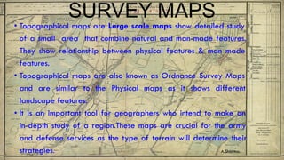
- 1. SURVEY MAPS • Topographical maps are Large scale maps show detailed study of a small area that combine natural and man-made features. They show relationship between physical features & man made features. • Topographical maps are also known as Ordnance Survey Maps and are similar to the Physical maps as it shows different landscape features. • It is an important tool for geographers who intend to make an in-depth study of a region.These maps are crucial for the army and defense services as the type of terrain will determine their strategies. A.Sharma.
- 2. Map No G43 S/7 The new map numbering is based on IMW ie. International Map of the World. It starts from equator so India series lies from C as A begins from equator. The number G denotes Rajasthan Abu district has 24 squares where each square is further subdivided into 16 squares Maps G43 S/7 and G43 S/10
- 3. G 43 S /10
- 4. G 43 S/7
- 5. COLOURS IN THE TOPO SHEET. Apart from the conventional signs and symbols different colours are used to show distributed of different topographical features and land use.
- 6. COLOURS The conventional signs and symbols represent relief features and human activities. Besides these certain hindi terms are also seen in the topographical maps.
- 7. COMPASS DIRECTIONS Directions form important element of a map. Total we have 8 Cardinal directions. The four points North,South,East & West are known as Cardinal Points. Another set of four directions between these cardinal points are: North-East (NE) South-East (SE) North-West (NW) South- West (SW)
- 8. DIRECTIONS A What is the compass direction of A from B. ANS- ? B What is the compass direction of B from A. ANS- ?
- 9. GRID REFERENCE The National Grid system (Vertical & Horizontal lines) used in Topographical maps consists of network of lines on topographical sheets running from north to south as Eastings and east to west as Northings. These lines are Red in colour. In a map two figure eastings and northings are printed at intervals of 1 km along the north and east edge of the map.
- 10. GRID REFERENCE
- 11. GRIDS Northings ●Horizontal lines running from east to west are called northings since they indicate a distance north of the origin of the grid reference. ●Northing increase numerically as we go northwards. ●Northings are always quoted after the Eastings when giving a grid reference.
- 12. GRIDS Grids are used to identify locations A four figure grid reference helps to identify area. A six figure grid reference helps to identify location. Eastings- ●Vertical lines running from north to south are called eastings since they indicate a distance east of the origin of the Grid reference. ●Eastings are always quoted first.
- 13. FOUR FIGURE GRID REFERENCE NORTHINGS EASTINGS
- 14. GRIDS Four Figure Grid Reference The first two figures are the eastings and the last two figures are the northings. The crossing point of the eastings and the northings is taken as the originating point.
- 15. DRAINAGE PATTERN • Dendritic pattern -The tributaries join the main river to form a pattern like a tree with branches. • Radial pattern- It is seen in highland region where rivers radiate from the central point in all directions. • Trellis pattern- In this pattern the stream flows parallel to each other and then join the main river at right angles. • Disappearing pattern- This indicates dry conditions , the streams flow over sandy soil and suddenly disappear underground. Intermittent • Intermittent pattern- The streams in sandy area disappear and again reappear shown as dash lines
- 17. RADIAL PATTERN
- 18. TRELLIS PATTERN
- 19. Seasonal stream with a channel of water. Seasonal stream
- 21. Scales • R.F= Distance on the Map_______________ Distance on the ground in the same unit • Graphical/ linear scale- A straight line is divided into equal parts (primary and secondary divisions) to show the marking represents on the actual ground.
- 22. SCALES • Scale= ratio of map distance of any two points to the corresponding ground distance of these two points. • Types of scale: • Verbal/ statement scale- 2cm to 1 kms in this, the Scale is expressed in words as a statement. • Representative fraction- R.F -1: 50,000 so 1 unit map distance is equivalent to 50,000 units on the ground.
- 23. SETTLEMENT PATTERN Settlement pattern refers to the arrangement of houses and other buildings in an area as seen from above. • Nucleated settlement- The houses are closely spaced or clustered together.It can be called compact too.
- 25. SETTLEMENT PATTERN • Linear settlement- Houses are usually stretched out along a road,river or railway line. • Scattered/ dispersed settlement- It is generally found in rural areas where population is sparse so houses are scattered over a large area.
- 28. HEIGHT Contours- Lines that join places with same height above mean sea level. Contour Interval- The difference in height between two consecutive contours. Spot height- .520 It indicates height of the point above mean sea level. The dot with number is written in black. .200 Triangulated height- It is the point that is accurately surveyed and calculated shown as triangle 340 the mountain peak is indicated this way..Δ 200 Bench Mark- A bench mark is written as BM and followed by a number. It is etched in stone or also shown in the building to indicate accurate height and serves as a reference for the surveyors. . . BM 633 . BM 63
- 29. Height Relative Height- The relative height is written as ‘r’ with a number indicating the relative height of the feature for eg 10r against a sand dune means the relative height of the sand dune is 10 metres to the surrounding area. A.Sharma
- 30. TRANSPORT Every settlement is connected by a mode of transportation. A topo sheet depicts railway lines in black with braod gauge and metre gauge. Other roadways are in red colour.