SlideShare uma empresa Scribd logo
1 de 30
Extending RHEM from Hillslopes to Watersheds
and Large Areas with AGWA/KINEROS2
David Goodrich, Haiyan Wei, Mariano Hernandez, Ken Spaeth, Mary
Nichols, Shea Burns, Phil Guertin, Carl Unkrich
Overview
• KINEROS2 – background
• AGWA Overview and Rangeland
Modeling Tools
• RHEM Parameters
• From NRI
• From remote sensing
• Hydrology, erosion, sediment transport
• Event or continuous (< minute time steps)
• Approximate watershed by cascade of overland flow elements
(planar or curvilinear), channels, impoundments
• Physically-based kinematic interactive routing – infiltration,
overland flow, erosion, and sediment transport
Kinematic Runoff and Erosion Model (KINEROS2)
https://www.tucson.ars.ag.gov/kineros/
rainfall intensity (i)
infiltration (f)
Finite difference
step length (dx)
fi
x
Q
t
h -=

+


channel element
Excess Runoff From an Overland Flow Model Element
- KINEROS2 /
RHEM
Q
q
Zones of aggregation
and degradation can be
identified in detailed
output
New Features and Capabilities
• Incorporation of the Rangeland Hydrology and Erosion Model
(RHEM) and a dynamic (non-steady state) version of the Water
Erosion Prediction Project Model (DWEPP) into KINEROS2.
– Detailed representation of hillslope elements (geometry, soil,
vegetation)
– DWEPP parameters are available for most cultivated agriculture
– RHEM parameters coming with ESD and STM models
– Seamless integration between hillslope erosion modeling and
sediment transport in channels
– Caution: 1-D channel erosion and transport is quite simple
(bank collapse, armoring not treated)
– Make a distinction between
large area modeling (many
hillslopes within a watershed)
and large watershed modeling
(sediment yield at outlet)
Southwest Watershed Research Center Tucson - Tombstone, AZ
EXAMPLE: KINEROS2 / RHEM Simulations
Compare sediment yields from different plant
community parameterizations on a small
watershed using K2 - RHEM
Approach
• Parameterize a small watershed for RHEM
• Use RHEM parameterization equations with values
from NRI data for 3 plant communities
• Use observed data from storm events that produced
sizeable sediment yields
• Run RHEM and compare results from different plant
community parameterizations
Southwest Watershed Research Center Tucson - Tombstone, AZ
K2 - RHEM Watershed Simulation – 8/6/2006 Event
0
20
40
60
80
100
120
140
1600
10
20
30
40
50
60
70
0 10 20 30 40 50 60
Rainfall(mm/hr)
Outflow(mm/hr)
Time (min)
Precip
Natives
Shrubs
Lehmann
0
20
40
60
80
100
120
140
1600
2
4
6
8
10
12
0 10 20 30 40 50 60
Rainfall(mm/hr)
Sedigraph(kg/s)
Time (min)
Precip
Natives
Shrubs
Lehmann
Lehmann vs Natives Shrubs vs Natives
Runoff (mm / hr) Sediment (kg / s)
Watershed ID: 73
Area
Slope Profile (Geometric)
Width
Slope Length
Effective Hyd. Cond.
Rock Volume (Infiltration)
Soil Suction
Porosity
Max saturation
Runoff friction factor (Hydraulic)
Erosion friction factor
Conc. Flow Erosion Coef. (Engelund-
Critical Shear Stress Hansen
Splash & Sheet Erosion Coef. Erosion)
Particle Size Distribution
Interception
N
Watershed - Large Area Application of KINEROS2
・ Topography (USGS 10 m DEM)
・ Soils for texture class – (SSURGO)
・ For RHEM need
 % plant form types
 % Foliar cover
 % Basal plant cover
 % Rock cover
 % Litter cover
 % Cyptogram cover
Parameters needed for each
hillslope model element
Pre – RHEM Formulation
For K2 – RHEM Formulation need:
Motivation for the development of AGWA – Automated
Geospatial Watershed Assessment Tool
AGWA – Background - Basics
• An automated GIS interface for watershed modeling (hydrology,
erosion, WQ) designed for resource managers
• Applicable to ungauged / gauged watersheds
• Operates with nationally available data (DEM, Soils, Land Cover)
• Simple, direct method for model parameterization
• Investigate the impacts of land cover change
- Identify sensitive, “at-risk” areas
- Assess impacts of management (e.g. growth, fire, mulch)
• Provide repeatable results for relative change assessments
• Must have good rainfall-runoff observations for quantitative
predictions
• Three established watershed/hillslope models for multiple scales
- KINEROS2
- SWAT
- RHEM / DWEPP (hillslope runoff and erosion within KINEROS2)
- 4000+ Reg. users; 10,500+ downloads, 170 countries; >250
citations
Watershed Characterization
(model elements)
+
Land
Cover
Soils
Rain
(Observed or
Design Storm)
Results
Run model
and import
results
Intersect model
elements with
Watershed Delineation
using Digital Elevation
Model (DEM)
Sediment yield (t/ha)Sediment discharge (kg/s)
Water yield (mm)Channel Scour (mm)
Transmission loss (mm)Peak flow (m3/s or mm/hr)
Channel Disch. (m3/day)Sediment yield (kg)
Percolation (mm)Runoff (mm or m3)
ET (mm)Plane Infiltration (mm)
Precipitation (mm)Channel Infiltration (m3/km)
SWAT OutputsKINEROS Outputs
AGWA Conceptual Design:
Inputs and Outputs
Output results that can be displayed in AGWA
Hillslope
Visualization of Results
Color-ramping of results
for each element to
show spatial variability
Calculate and view
differences between
model runs
Multiple simulation runs
for a given watershed
Channel simulation
differences also
displayed
8
Hydrograph/Sedigra
ph for overland and
channel elements
Data for AGWA Parameterization
• Digital Elevation Model
- Usually USGS 10m – 30m DEM will work
fine in western terrains in large watersheds
- LIDAR can be used
• Soils
- USDA STATSGO – nationally available;
SSURGO where available
- FAO soils globally
• Land Use - Land Cover (NLCD, ReGAP, ESD)
• Weather
- If not using design storms - “good” rainfall
data is essential in time/space (more later)
• Management Information
- Where and what
- Information must be provided by user!
(i.e. burn severity map)
Topography
Land Cover
Soils
o
Representative Slope Profile and Flow Length
• Calculate a weighted length for each flow path
• Lr is the representative flow length
• Calculate a weight grid
for every cell on the
hillslope
• Calculate a weighted
slope for each cell - Si
NRI Pt
(Flanagan et al. 2011)
o
Representative Slope Profile and Flow Length
NRI Pt
• AGWA/RHEM
Calculates a
weighted length
and slope for each
flow path using
DEM
(Flanagan et al. ‘11)
1374
1376
1378
1380
1382
1384
1386
1388
1390
1392
0 100 200 300 400 500 600 700 800 900 1000
Hillslope Profile (Element 61)
AGWA/Flanagan (S=1.6%)
Visual Slope Profile (S=1.5%)
Uniform Slope (S=1.8%) L = 50m
web RHEM Gen. Profile (S=1.7%)
Ele. 61 At NRI point
estimate uniform
slope, L = 50 m
(used in RCA)
Most natural
hillslope proflie
have lower slopes
at ridge and toe.
Digitize 3 flow
paths from ridge
Using web RHEM
to match general
hillslope profile
Sediment Yield vs Soil Loss (total for all elements)
Uniform S - HRC Unif. S - ATL Complex S - HRC Comp. S - ALT
SedimentYieldandSoilLoss(tons/ha/year)
0
3
6
Sediment Yield
Soil Loss
Point: Differences in soil loss & sediment yield due to slope shape
(uniform vs complex) dominate differences due to change in ecosite
cover condition
AGWA Rangeland Management Toolkit
• Use of vegetation data for model parameterization
– Vegetation Monitoring Data
– Rangeland Health Data
– NRCS Ecological Site Descriptions
– Management treatment effects
• Land cover modification
– Use to incorporate rangeland improvements
• Stock ponds / reservoirs
• Buffer strips
• Post-Fire effects
• Multi-watershed analysis
Post-Fire % Change
} Or a Combination
Land-Cover Modification Tool
Allows user to specify type and location of land-cover
alterations by either drawing a polygon on the display, or
specifying selected features from a polygon map (i.e. a
pasture).
Types of Land-Cover Changes:
• Change entire user-defined area to new land cover (uniform)
• Change land-cover type to another (random or
patchy/fractal)
• Can specify % success of change due to practice (e.g.
Shrub management and removal)
Large Area Application of RHEM
• AGWA will –
• Delineate drainage area
• Discretize drainage area into hillslopes
• Derive the complex slope profile of the hillslopes
• AGWA tools will –
• Allow incorporation of BMPs
• Assess management scenarios
• Transition to different ESD state
Key to Extending RHEM to Watershed Scales
・Obtaining RHEM parameters over large areas:
- % plant form present - % Foliar cover - % Basal cover
- % Rock cover - % Litter cover - % Cyptogram cover
・ HOW? (NRI, ESD & STM, ReGAP, remote sensing, ??)
HUC – 12 Boundary
0 – 10 % INCREASE
25 – 30 % decrease
40 – 50 %
decrease
0 – 10 % DECREASE
n = 3577 hillslope
model elements
Example: Cienega Ck. CEAP Assessment (198 mi2)
% Change in Sediment Yield from Pre-Conservation Condition (‘92) to Post-Cons. (2006)
RHEM derived from NRI & PLANTS database by Ecological Site
for three time periods: Historic Ref Cond., Pre- & Post Cons. Spending
Ecological Sites
Loamy Upland 12-16” p.z.
Allotments
Until machine readable ESD and STM are available nationally what
can be done to obtain RHEM parameters over large areas?
 How can NRI and local NRCS observations be utilized ?
 Could a expansion factor be developed using EcoSites and visual
interpretation of aerial/satellite imagery + AGWA cover change
tool?
 Can multi-band remote sensing assist ?
**
*
NRCS Field Pt. #1
NRCS Field Pt. #2
From Matt Jones
2018 SRM meeting
Remotely Sensed (Landsat) Veg. Cover
 Provides cover estimates
throughout the year (~16-day
intervals, 30 x 30 m) from 1984
to present
 For plant phenology in SW can
use early summer image for
shrub (mesquite canopy cover-
CC) using SAVI and fall image
for total CC post monsoon with
SATVI
 Can then subtract the two
images to estimate non-shrub
green and senescent
cciTNC = 0.69(ccg) + 9.24
R2
= 0.40*
cciARS = 0.37(ccg) + 45.08
R2
= 0.47*
0
10
20
30
40
50
60
70
80
90
100
0 10 20 30 40 50 60 70 80 90 100
Ground-Measured Foliar Canopy Cover (%)
Image-BasedFoliarCanopyCover(%)
TNC
ARS
Linear
(ARS)* Value is statistically significant (P ≤ 0.05).
1-to-1
(All data)
(ARS data only)
1991 2007 2008 2011
CC (%)
1991 2007 2008 2011
CC (%)
Shrub Canopy CoverHollifield-Collins
Foliar Cover to Litter and Basal
 For some ES,
defensible
regression
between foliar
cover and % litter
and % basal have
been found using
NRI data
 Allows higher
temporal
frequency of
RHEM parameter
than NRI collects
% change in SY from ’92 to ‘07
% change in SY from ’92 to ‘09
% change in SY from ’92 to ‘11
Negative % change in SY => a decrease
-80 - 75
-5 - 0
50 - 250
Southwest Watershed Research Center Tucson - Tombstone, AZ
Conclusions and Next Steps
• AGWA is ready to ingest national EcoSite and State & Transition
Model data to automatically derive RHEM parameters for modeling
multiple hillslopes over large areas when it becomes available
• In the meantime -
• The AGWA Land Cover Change tool can be used to evaluate the
hydrologic/erosion effects of management scenarios over large areas
• Remote sensing (RS) can be used to effectively
• Track the changes in foliar cover over time
• Quantify shrub and non-shrub foliar cover changes from
• Mechanical brush removal and fire
• Next steps
• With more NRI points attempt to build better regressions relating
foliar cover to litter and basal cover for more ecosites.
• Explore how RS & ES could be used to develop an image of states
within a simplified STM model for that ES
THANK YOU - Questions
I’d like to hear your thoughts and suggestions on obtaining
RHEM parameters over large areas
Dave Goodrich
Dave.Goodrich@ars.usda.gov
AGWA Training (free) at Univ. of Arizona
(Typically Oct. and March)
https://www.tucson.ars.ag.gov/kineros/
https://www.tucson.ars.ag.gov/agwa/
1991 2007 2009 2011
CC (%)
1991 2007 2009 2011
CC (%)
exclosure
grazed
pasture
Exclosure Burn - 2009 Grazed
1991
2007
2009
2011
 Prescribed burn in 2009
outlined by blue
polygon
 Drought in summer
monsoon in 2009
 No grazing in exclosure
 If letters above bars are
different they are
statistically different at
the (P=0.05) level
Ecosites &
SWReGAP
(lumped)
classes
 Mechanical
grubbing in 2010 in
5 areas
 2011 wildfires in
green outline
covering the corral
and NE portion of
the mule treatment
areas
1991
2007
2009
2011
Remotely Sensed (Landsat) Veg. Cover
 Provides cover estimates
throughout the year (~16-day
intervals, 30 x 30 m) from 1984
to present
 For plant phenology in SW can
use early summer image for
shrub (mesquite canopy cover-
CC) using SAVI and fall image
for total CC post monsoon with
SATVI
 Can then subtract the two
images to estimate non-shrub
green and senescent
cciTNC = 0.69(ccg) + 9.24
R2
= 0.40*
cciARS = 0.37(ccg) + 45.08
R2
= 0.47*
0
10
20
30
40
50
60
70
80
90
100
0 10 20 30 40 50 60 70 80 90 100
Ground-Measured Foliar Canopy Cover (%)
Image-BasedFoliarCanopyCover(%)
TNC
ARS
Linear
(ARS)* Value is statistically significant (P ≤ 0.05).
1-to-1
(All data)
(ARS data only)
1991 2007 2008 2011
CC (%)
1991 2007 2008 2011
CC (%)
Shrub Canopy Cover
Stock Tanks
• A common rangeland management is the installation of
stock ponds to provide water to livestock. Stock ponds
can also be viewed as storm water retention structures
and sediment basins, common best management
practices for flood and water quality mitigation.

Mais conteúdo relacionado

Mais procurados

APPLICATIONS OF ARC SWAT MODEL FOR HYDROLOGICAL MODELLING
APPLICATIONS OF ARC SWAT MODEL FOR HYDROLOGICAL MODELLINGAPPLICATIONS OF ARC SWAT MODEL FOR HYDROLOGICAL MODELLING
APPLICATIONS OF ARC SWAT MODEL FOR HYDROLOGICAL MODELLING
Abhiram Kanigolla
 
Kite Hill Senior Design Final Presentation Fall 2015
Kite Hill Senior Design Final Presentation Fall 2015Kite Hill Senior Design Final Presentation Fall 2015
Kite Hill Senior Design Final Presentation Fall 2015
Ashleigh Hough
 
Assessing the ability of SWAT as a water quality model in the Lake Victoria b...
Assessing the ability of SWAT as a water quality model in the Lake Victoria b...Assessing the ability of SWAT as a water quality model in the Lake Victoria b...
Assessing the ability of SWAT as a water quality model in the Lake Victoria b...
Timo Brussée
 
FR4.L10.2: A MICROWAVE SCATTERING MODEL OF VEGETATED SURFACES BASED ON BOR/DD...
FR4.L10.2: A MICROWAVE SCATTERING MODEL OF VEGETATED SURFACES BASED ON BOR/DD...FR4.L10.2: A MICROWAVE SCATTERING MODEL OF VEGETATED SURFACES BASED ON BOR/DD...
FR4.L10.2: A MICROWAVE SCATTERING MODEL OF VEGETATED SURFACES BASED ON BOR/DD...
grssieee
 

Mais procurados (19)

APPLICATIONS OF ARC SWAT MODEL FOR HYDROLOGICAL MODELLING
APPLICATIONS OF ARC SWAT MODEL FOR HYDROLOGICAL MODELLINGAPPLICATIONS OF ARC SWAT MODEL FOR HYDROLOGICAL MODELLING
APPLICATIONS OF ARC SWAT MODEL FOR HYDROLOGICAL MODELLING
 
SEG14_Wednesday_lr 8
SEG14_Wednesday_lr 8SEG14_Wednesday_lr 8
SEG14_Wednesday_lr 8
 
Using Computer-simulated hydrological model (SWAT) to estimate the ground-wat...
Using Computer-simulated hydrological model (SWAT) to estimate the ground-wat...Using Computer-simulated hydrological model (SWAT) to estimate the ground-wat...
Using Computer-simulated hydrological model (SWAT) to estimate the ground-wat...
 
Hydrologic Assessment in a Middle Narmada Basin, India using SWAT Model
Hydrologic Assessment in a Middle Narmada Basin, India using SWAT ModelHydrologic Assessment in a Middle Narmada Basin, India using SWAT Model
Hydrologic Assessment in a Middle Narmada Basin, India using SWAT Model
 
Swat & modflow
Swat & modflowSwat & modflow
Swat & modflow
 
Erosion and runoff evaluation
Erosion and runoff evaluationErosion and runoff evaluation
Erosion and runoff evaluation
 
IRJET- Estimation of Surface Runoff using Curve Number Method- A Geospatial A...
IRJET- Estimation of Surface Runoff using Curve Number Method- A Geospatial A...IRJET- Estimation of Surface Runoff using Curve Number Method- A Geospatial A...
IRJET- Estimation of Surface Runoff using Curve Number Method- A Geospatial A...
 
Kite Hill Senior Design Final Presentation Fall 2015
Kite Hill Senior Design Final Presentation Fall 2015Kite Hill Senior Design Final Presentation Fall 2015
Kite Hill Senior Design Final Presentation Fall 2015
 
Effectiveness Analysis of Best Management Practices by SWAT for Appropriate C...
Effectiveness Analysis of Best Management Practices by SWAT for Appropriate C...Effectiveness Analysis of Best Management Practices by SWAT for Appropriate C...
Effectiveness Analysis of Best Management Practices by SWAT for Appropriate C...
 
Assessing the ability of SWAT as a water quality model in the Lake Victoria b...
Assessing the ability of SWAT as a water quality model in the Lake Victoria b...Assessing the ability of SWAT as a water quality model in the Lake Victoria b...
Assessing the ability of SWAT as a water quality model in the Lake Victoria b...
 
Narayan Shrestha [Calibration and Validation of SWAT Model for Low Lying Wate...
Narayan Shrestha [Calibration and Validation of SWAT Model for Low Lying Wate...Narayan Shrestha [Calibration and Validation of SWAT Model for Low Lying Wate...
Narayan Shrestha [Calibration and Validation of SWAT Model for Low Lying Wate...
 
SWAT Toulouse 2013 Presentation
SWAT Toulouse 2013 PresentationSWAT Toulouse 2013 Presentation
SWAT Toulouse 2013 Presentation
 
Masters Thesis Defense Presentation
Masters Thesis Defense PresentationMasters Thesis Defense Presentation
Masters Thesis Defense Presentation
 
Integrated hydro-geological risk for Mallero basin (Alpine Italy) – part 2: h...
Integrated hydro-geological risk for Mallero basin (Alpine Italy) – part 2: h...Integrated hydro-geological risk for Mallero basin (Alpine Italy) – part 2: h...
Integrated hydro-geological risk for Mallero basin (Alpine Italy) – part 2: h...
 
Application of GIS and MODFLOW to Ground Water Hydrology- A Review
Application of GIS and MODFLOW to Ground Water Hydrology- A ReviewApplication of GIS and MODFLOW to Ground Water Hydrology- A Review
Application of GIS and MODFLOW to Ground Water Hydrology- A Review
 
T7: Flood Risk Assessment Using GIS Tools
T7: Flood Risk Assessment Using GIS ToolsT7: Flood Risk Assessment Using GIS Tools
T7: Flood Risk Assessment Using GIS Tools
 
IRJET- A Review of Synthetic Hydrograph Methods for Design Storm
IRJET-  	  A Review of Synthetic Hydrograph Methods for Design StormIRJET-  	  A Review of Synthetic Hydrograph Methods for Design Storm
IRJET- A Review of Synthetic Hydrograph Methods for Design Storm
 
FR4.L10.2: A MICROWAVE SCATTERING MODEL OF VEGETATED SURFACES BASED ON BOR/DD...
FR4.L10.2: A MICROWAVE SCATTERING MODEL OF VEGETATED SURFACES BASED ON BOR/DD...FR4.L10.2: A MICROWAVE SCATTERING MODEL OF VEGETATED SURFACES BASED ON BOR/DD...
FR4.L10.2: A MICROWAVE SCATTERING MODEL OF VEGETATED SURFACES BASED ON BOR/DD...
 
Websim
WebsimWebsim
Websim
 

Semelhante a Extending rhem from hillslopes to watersheds

Evaluation Of Low Impact Developments (LID)
Evaluation Of Low Impact Developments (LID)Evaluation Of Low Impact Developments (LID)
Evaluation Of Low Impact Developments (LID)
Dawit A. Melaku
 
Hydrology/Hydraulic Model for South Boston CSO Project
Hydrology/Hydraulic Model for South Boston CSO Project Hydrology/Hydraulic Model for South Boston CSO Project
Hydrology/Hydraulic Model for South Boston CSO Project
dingfangliu
 
M.S. Capstone Seminar
M.S. Capstone SeminarM.S. Capstone Seminar
M.S. Capstone Seminar
shirabay
 
2D Attenuation Model
2D Attenuation Model2D Attenuation Model
2D Attenuation Model
gaw001
 
Birr - Identifying Critical Portions of the Landscape
Birr - Identifying Critical Portions of the LandscapeBirr - Identifying Critical Portions of the Landscape
Birr - Identifying Critical Portions of the Landscape
Jose A. Hernandez
 

Semelhante a Extending rhem from hillslopes to watersheds (20)

July 29-330-Dennis Flanagan
July 29-330-Dennis FlanaganJuly 29-330-Dennis Flanagan
July 29-330-Dennis Flanagan
 
Gis
GisGis
Gis
 
Ragain Sess1 102209
Ragain Sess1 102209Ragain Sess1 102209
Ragain Sess1 102209
 
Use of UAV for Hydrological Monitoring
Use of UAV for Hydrological MonitoringUse of UAV for Hydrological Monitoring
Use of UAV for Hydrological Monitoring
 
Environmental Management Modeling Activities at Los Alamos National Laborator...
Environmental Management Modeling Activities at Los Alamos National Laborator...Environmental Management Modeling Activities at Los Alamos National Laborator...
Environmental Management Modeling Activities at Los Alamos National Laborator...
 
REMOTE SENSING & GIS APPLICATIONS IN WATERSHED MANAGEMENT
REMOTE SENSING & GIS APPLICATIONS IN WATERSHED MANAGEMENT REMOTE SENSING & GIS APPLICATIONS IN WATERSHED MANAGEMENT
REMOTE SENSING & GIS APPLICATIONS IN WATERSHED MANAGEMENT
 
Water and Productivity Impacts for the NBDC
Water and Productivity Impacts for the NBDCWater and Productivity Impacts for the NBDC
Water and Productivity Impacts for the NBDC
 
CE573_Poster2
CE573_Poster2CE573_Poster2
CE573_Poster2
 
Final Ppt.pdf
Final Ppt.pdfFinal Ppt.pdf
Final Ppt.pdf
 
Evaluation Of Low Impact Developments (LID)
Evaluation Of Low Impact Developments (LID)Evaluation Of Low Impact Developments (LID)
Evaluation Of Low Impact Developments (LID)
 
9/8 THUR 10:45 | Statewide Regional Evacuation Study Program 4
9/8 THUR 10:45 | Statewide Regional Evacuation Study Program 49/8 THUR 10:45 | Statewide Regional Evacuation Study Program 4
9/8 THUR 10:45 | Statewide Regional Evacuation Study Program 4
 
The Development of a Catchment Management Modelling System for the Googong Re...
The Development of a Catchment Management Modelling System for the Googong Re...The Development of a Catchment Management Modelling System for the Googong Re...
The Development of a Catchment Management Modelling System for the Googong Re...
 
The Role of Semantics in Harmonizing YOPP Observation and Model Data
The Role of Semantics in Harmonizing YOPP Observation and Model DataThe Role of Semantics in Harmonizing YOPP Observation and Model Data
The Role of Semantics in Harmonizing YOPP Observation and Model Data
 
Hydrology/Hydraulic Model for South Boston CSO Project
Hydrology/Hydraulic Model for South Boston CSO Project Hydrology/Hydraulic Model for South Boston CSO Project
Hydrology/Hydraulic Model for South Boston CSO Project
 
M.S. Capstone Seminar
M.S. Capstone SeminarM.S. Capstone Seminar
M.S. Capstone Seminar
 
Watershed management: Role of Geospatial Technology
Watershed management: Role of Geospatial TechnologyWatershed management: Role of Geospatial Technology
Watershed management: Role of Geospatial Technology
 
WATERSHED CATCHMENT.pptx
WATERSHED CATCHMENT.pptxWATERSHED CATCHMENT.pptx
WATERSHED CATCHMENT.pptx
 
Understanding Who is AT RISK - Flood extent modelling
Understanding Who is AT RISK - Flood extent modellingUnderstanding Who is AT RISK - Flood extent modelling
Understanding Who is AT RISK - Flood extent modelling
 
2D Attenuation Model
2D Attenuation Model2D Attenuation Model
2D Attenuation Model
 
Birr - Identifying Critical Portions of the Landscape
Birr - Identifying Critical Portions of the LandscapeBirr - Identifying Critical Portions of the Landscape
Birr - Identifying Critical Portions of the Landscape
 

Mais de Soil and Water Conservation Society

Mais de Soil and Water Conservation Society (20)

September 1 - 0939 - Catherine DeLong.pptx
September 1 - 0939 - Catherine DeLong.pptxSeptember 1 - 0939 - Catherine DeLong.pptx
September 1 - 0939 - Catherine DeLong.pptx
 
September 1 - 830 - Chris Hay
September 1 - 830 - Chris HaySeptember 1 - 830 - Chris Hay
September 1 - 830 - Chris Hay
 
August 31 - 0239 - Yuchuan Fan
August 31 - 0239 - Yuchuan FanAugust 31 - 0239 - Yuchuan Fan
August 31 - 0239 - Yuchuan Fan
 
August 31 - 0216 - Babak Dialameh
August 31 - 0216 - Babak DialamehAugust 31 - 0216 - Babak Dialameh
August 31 - 0216 - Babak Dialameh
 
August 31 - 0153 - San Simon
August 31 - 0153 - San SimonAugust 31 - 0153 - San Simon
August 31 - 0153 - San Simon
 
August 31 - 0130 - Chuck Brandel
August 31 - 0130 - Chuck BrandelAugust 31 - 0130 - Chuck Brandel
August 31 - 0130 - Chuck Brandel
 
September 1 - 1139 - Ainis Lagzdins
September 1 - 1139 - Ainis LagzdinsSeptember 1 - 1139 - Ainis Lagzdins
September 1 - 1139 - Ainis Lagzdins
 
September 1 - 1116 - David Whetter
September 1 - 1116 - David WhetterSeptember 1 - 1116 - David Whetter
September 1 - 1116 - David Whetter
 
September 1 - 1053 - Matt Helmers
September 1 - 1053 - Matt HelmersSeptember 1 - 1053 - Matt Helmers
September 1 - 1053 - Matt Helmers
 
September 1 - 1030 - Chandra Madramootoo
September 1 - 1030 - Chandra MadramootooSeptember 1 - 1030 - Chandra Madramootoo
September 1 - 1030 - Chandra Madramootoo
 
August 31 - 1139 - Mitchell Watkins
August 31 - 1139 - Mitchell WatkinsAugust 31 - 1139 - Mitchell Watkins
August 31 - 1139 - Mitchell Watkins
 
August 31 - 1116 - Shiv Prasher
August 31 - 1116 - Shiv PrasherAugust 31 - 1116 - Shiv Prasher
August 31 - 1116 - Shiv Prasher
 
August 31 - 1053 - Ehsan Ghane
August 31 - 1053 - Ehsan GhaneAugust 31 - 1053 - Ehsan Ghane
August 31 - 1053 - Ehsan Ghane
 
August 31 - 1030 - Joseph A. Bubcanec
August 31 - 1030 - Joseph A. BubcanecAugust 31 - 1030 - Joseph A. Bubcanec
August 31 - 1030 - Joseph A. Bubcanec
 
September 1 - 130 - McBride
September 1 - 130 - McBrideSeptember 1 - 130 - McBride
September 1 - 130 - McBride
 
September 1 - 0216 - Jessica D'Ambrosio
September 1 - 0216 - Jessica D'AmbrosioSeptember 1 - 0216 - Jessica D'Ambrosio
September 1 - 0216 - Jessica D'Ambrosio
 
September 1 - 0153 - Mike Pniewski
September 1 - 0153 - Mike PniewskiSeptember 1 - 0153 - Mike Pniewski
September 1 - 0153 - Mike Pniewski
 
September 1 - 0130 - Johnathan Witter
September 1 - 0130 - Johnathan WitterSeptember 1 - 0130 - Johnathan Witter
September 1 - 0130 - Johnathan Witter
 
August 31 - 1139 - Melisa Luymes
August 31 - 1139 - Melisa LuymesAugust 31 - 1139 - Melisa Luymes
August 31 - 1139 - Melisa Luymes
 
August 31 - 1116 - Hassam Moursi
August 31 - 1116 - Hassam MoursiAugust 31 - 1116 - Hassam Moursi
August 31 - 1116 - Hassam Moursi
 

Último

Call Now ☎ Russian Call Girls Connaught Place @ 9899900591 # Russian Escorts ...
Call Now ☎ Russian Call Girls Connaught Place @ 9899900591 # Russian Escorts ...Call Now ☎ Russian Call Girls Connaught Place @ 9899900591 # Russian Escorts ...
Call Now ☎ Russian Call Girls Connaught Place @ 9899900591 # Russian Escorts ...
kauryashika82
 

Último (20)

Call Girls in Sakinaka Agency, { 9892124323 } Mumbai Vashi Call Girls Serivce...
Call Girls in Sakinaka Agency, { 9892124323 } Mumbai Vashi Call Girls Serivce...Call Girls in Sakinaka Agency, { 9892124323 } Mumbai Vashi Call Girls Serivce...
Call Girls in Sakinaka Agency, { 9892124323 } Mumbai Vashi Call Girls Serivce...
 
Call Girls Budhwar Peth Call Me 7737669865 Budget Friendly No Advance Booking
Call Girls Budhwar Peth Call Me 7737669865 Budget Friendly No Advance BookingCall Girls Budhwar Peth Call Me 7737669865 Budget Friendly No Advance Booking
Call Girls Budhwar Peth Call Me 7737669865 Budget Friendly No Advance Booking
 
Booking open Available Pune Call Girls Parvati Darshan 6297143586 Call Hot I...
Booking open Available Pune Call Girls Parvati Darshan  6297143586 Call Hot I...Booking open Available Pune Call Girls Parvati Darshan  6297143586 Call Hot I...
Booking open Available Pune Call Girls Parvati Darshan 6297143586 Call Hot I...
 
Hot Call Girls |Delhi |Preet Vihar ☎ 9711199171 Book Your One night Stand
Hot Call Girls |Delhi |Preet Vihar ☎ 9711199171 Book Your One night StandHot Call Girls |Delhi |Preet Vihar ☎ 9711199171 Book Your One night Stand
Hot Call Girls |Delhi |Preet Vihar ☎ 9711199171 Book Your One night Stand
 
VIP Model Call Girls Hadapsar ( Pune ) Call ON 8005736733 Starting From 5K to...
VIP Model Call Girls Hadapsar ( Pune ) Call ON 8005736733 Starting From 5K to...VIP Model Call Girls Hadapsar ( Pune ) Call ON 8005736733 Starting From 5K to...
VIP Model Call Girls Hadapsar ( Pune ) Call ON 8005736733 Starting From 5K to...
 
Kondhwa ( Call Girls ) Pune 6297143586 Hot Model With Sexy Bhabi Ready For ...
Kondhwa ( Call Girls ) Pune  6297143586  Hot Model With Sexy Bhabi Ready For ...Kondhwa ( Call Girls ) Pune  6297143586  Hot Model With Sexy Bhabi Ready For ...
Kondhwa ( Call Girls ) Pune 6297143586 Hot Model With Sexy Bhabi Ready For ...
 
CSR_Tested activities in the classroom -EN
CSR_Tested activities in the classroom -ENCSR_Tested activities in the classroom -EN
CSR_Tested activities in the classroom -EN
 
Call Now ☎ Russian Call Girls Connaught Place @ 9899900591 # Russian Escorts ...
Call Now ☎ Russian Call Girls Connaught Place @ 9899900591 # Russian Escorts ...Call Now ☎ Russian Call Girls Connaught Place @ 9899900591 # Russian Escorts ...
Call Now ☎ Russian Call Girls Connaught Place @ 9899900591 # Russian Escorts ...
 
BOOK Call Girls in (Dwarka) CALL | 8377087607 Delhi Escorts Services
BOOK Call Girls in (Dwarka) CALL | 8377087607 Delhi Escorts ServicesBOOK Call Girls in (Dwarka) CALL | 8377087607 Delhi Escorts Services
BOOK Call Girls in (Dwarka) CALL | 8377087607 Delhi Escorts Services
 
Call Girls Service Pune ₹7.5k Pick Up & Drop With Cash Payment 8005736733 Cal...
Call Girls Service Pune ₹7.5k Pick Up & Drop With Cash Payment 8005736733 Cal...Call Girls Service Pune ₹7.5k Pick Up & Drop With Cash Payment 8005736733 Cal...
Call Girls Service Pune ₹7.5k Pick Up & Drop With Cash Payment 8005736733 Cal...
 
Call Girls In Okhla DELHI ~9654467111~ Short 1500 Night 6000
Call Girls In Okhla DELHI ~9654467111~ Short 1500 Night 6000Call Girls In Okhla DELHI ~9654467111~ Short 1500 Night 6000
Call Girls In Okhla DELHI ~9654467111~ Short 1500 Night 6000
 
Booking open Available Pune Call Girls Yewalewadi 6297143586 Call Hot Indian...
Booking open Available Pune Call Girls Yewalewadi  6297143586 Call Hot Indian...Booking open Available Pune Call Girls Yewalewadi  6297143586 Call Hot Indian...
Booking open Available Pune Call Girls Yewalewadi 6297143586 Call Hot Indian...
 
Booking open Available Pune Call Girls Budhwar Peth 6297143586 Call Hot Indi...
Booking open Available Pune Call Girls Budhwar Peth  6297143586 Call Hot Indi...Booking open Available Pune Call Girls Budhwar Peth  6297143586 Call Hot Indi...
Booking open Available Pune Call Girls Budhwar Peth 6297143586 Call Hot Indi...
 
VVIP Pune Call Girls Koregaon Park (7001035870) Pune Escorts Nearby with Comp...
VVIP Pune Call Girls Koregaon Park (7001035870) Pune Escorts Nearby with Comp...VVIP Pune Call Girls Koregaon Park (7001035870) Pune Escorts Nearby with Comp...
VVIP Pune Call Girls Koregaon Park (7001035870) Pune Escorts Nearby with Comp...
 
Call Girls Talegaon Dabhade Call Me 7737669865 Budget Friendly No Advance Boo...
Call Girls Talegaon Dabhade Call Me 7737669865 Budget Friendly No Advance Boo...Call Girls Talegaon Dabhade Call Me 7737669865 Budget Friendly No Advance Boo...
Call Girls Talegaon Dabhade Call Me 7737669865 Budget Friendly No Advance Boo...
 
Call Girls Moshi Call Me 7737669865 Budget Friendly No Advance Booking
Call Girls Moshi Call Me 7737669865 Budget Friendly No Advance BookingCall Girls Moshi Call Me 7737669865 Budget Friendly No Advance Booking
Call Girls Moshi Call Me 7737669865 Budget Friendly No Advance Booking
 
Proposed Amendments to Chapter 15, Article X: Wetland Conservation Areas
Proposed Amendments to Chapter 15, Article X: Wetland Conservation AreasProposed Amendments to Chapter 15, Article X: Wetland Conservation Areas
Proposed Amendments to Chapter 15, Article X: Wetland Conservation Areas
 
NO1 Verified kala jadu karne wale ka contact number kala jadu karne wale baba...
NO1 Verified kala jadu karne wale ka contact number kala jadu karne wale baba...NO1 Verified kala jadu karne wale ka contact number kala jadu karne wale baba...
NO1 Verified kala jadu karne wale ka contact number kala jadu karne wale baba...
 
VIP Model Call Girls Bhosari ( Pune ) Call ON 8005736733 Starting From 5K to ...
VIP Model Call Girls Bhosari ( Pune ) Call ON 8005736733 Starting From 5K to ...VIP Model Call Girls Bhosari ( Pune ) Call ON 8005736733 Starting From 5K to ...
VIP Model Call Girls Bhosari ( Pune ) Call ON 8005736733 Starting From 5K to ...
 
VVIP Pune Call Girls Moshi WhatSapp Number 8005736733 With Elite Staff And Re...
VVIP Pune Call Girls Moshi WhatSapp Number 8005736733 With Elite Staff And Re...VVIP Pune Call Girls Moshi WhatSapp Number 8005736733 With Elite Staff And Re...
VVIP Pune Call Girls Moshi WhatSapp Number 8005736733 With Elite Staff And Re...
 

Extending rhem from hillslopes to watersheds

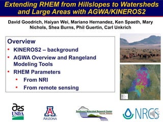
  • 1. Extending RHEM from Hillslopes to Watersheds and Large Areas with AGWA/KINEROS2 David Goodrich, Haiyan Wei, Mariano Hernandez, Ken Spaeth, Mary Nichols, Shea Burns, Phil Guertin, Carl Unkrich Overview • KINEROS2 – background • AGWA Overview and Rangeland Modeling Tools • RHEM Parameters • From NRI • From remote sensing
  • 2. • Hydrology, erosion, sediment transport • Event or continuous (< minute time steps) • Approximate watershed by cascade of overland flow elements (planar or curvilinear), channels, impoundments • Physically-based kinematic interactive routing – infiltration, overland flow, erosion, and sediment transport Kinematic Runoff and Erosion Model (KINEROS2) https://www.tucson.ars.ag.gov/kineros/
  • 3. rainfall intensity (i) infiltration (f) Finite difference step length (dx) fi x Q t h -=  +   channel element Excess Runoff From an Overland Flow Model Element - KINEROS2 / RHEM Q q Zones of aggregation and degradation can be identified in detailed output
  • 4. New Features and Capabilities • Incorporation of the Rangeland Hydrology and Erosion Model (RHEM) and a dynamic (non-steady state) version of the Water Erosion Prediction Project Model (DWEPP) into KINEROS2. – Detailed representation of hillslope elements (geometry, soil, vegetation) – DWEPP parameters are available for most cultivated agriculture – RHEM parameters coming with ESD and STM models – Seamless integration between hillslope erosion modeling and sediment transport in channels – Caution: 1-D channel erosion and transport is quite simple (bank collapse, armoring not treated) – Make a distinction between large area modeling (many hillslopes within a watershed) and large watershed modeling (sediment yield at outlet)
  • 5. Southwest Watershed Research Center Tucson - Tombstone, AZ EXAMPLE: KINEROS2 / RHEM Simulations Compare sediment yields from different plant community parameterizations on a small watershed using K2 - RHEM Approach • Parameterize a small watershed for RHEM • Use RHEM parameterization equations with values from NRI data for 3 plant communities • Use observed data from storm events that produced sizeable sediment yields • Run RHEM and compare results from different plant community parameterizations
  • 6. Southwest Watershed Research Center Tucson - Tombstone, AZ K2 - RHEM Watershed Simulation – 8/6/2006 Event 0 20 40 60 80 100 120 140 1600 10 20 30 40 50 60 70 0 10 20 30 40 50 60 Rainfall(mm/hr) Outflow(mm/hr) Time (min) Precip Natives Shrubs Lehmann 0 20 40 60 80 100 120 140 1600 2 4 6 8 10 12 0 10 20 30 40 50 60 Rainfall(mm/hr) Sedigraph(kg/s) Time (min) Precip Natives Shrubs Lehmann Lehmann vs Natives Shrubs vs Natives Runoff (mm / hr) Sediment (kg / s)
  • 7. Watershed ID: 73 Area Slope Profile (Geometric) Width Slope Length Effective Hyd. Cond. Rock Volume (Infiltration) Soil Suction Porosity Max saturation Runoff friction factor (Hydraulic) Erosion friction factor Conc. Flow Erosion Coef. (Engelund- Critical Shear Stress Hansen Splash & Sheet Erosion Coef. Erosion) Particle Size Distribution Interception N Watershed - Large Area Application of KINEROS2 ・ Topography (USGS 10 m DEM) ・ Soils for texture class – (SSURGO) ・ For RHEM need  % plant form types  % Foliar cover  % Basal plant cover  % Rock cover  % Litter cover  % Cyptogram cover Parameters needed for each hillslope model element Pre – RHEM Formulation For K2 – RHEM Formulation need: Motivation for the development of AGWA – Automated Geospatial Watershed Assessment Tool
  • 8. AGWA – Background - Basics • An automated GIS interface for watershed modeling (hydrology, erosion, WQ) designed for resource managers • Applicable to ungauged / gauged watersheds • Operates with nationally available data (DEM, Soils, Land Cover) • Simple, direct method for model parameterization • Investigate the impacts of land cover change - Identify sensitive, “at-risk” areas - Assess impacts of management (e.g. growth, fire, mulch) • Provide repeatable results for relative change assessments • Must have good rainfall-runoff observations for quantitative predictions • Three established watershed/hillslope models for multiple scales - KINEROS2 - SWAT - RHEM / DWEPP (hillslope runoff and erosion within KINEROS2) - 4000+ Reg. users; 10,500+ downloads, 170 countries; >250 citations
  • 9. Watershed Characterization (model elements) + Land Cover Soils Rain (Observed or Design Storm) Results Run model and import results Intersect model elements with Watershed Delineation using Digital Elevation Model (DEM) Sediment yield (t/ha)Sediment discharge (kg/s) Water yield (mm)Channel Scour (mm) Transmission loss (mm)Peak flow (m3/s or mm/hr) Channel Disch. (m3/day)Sediment yield (kg) Percolation (mm)Runoff (mm or m3) ET (mm)Plane Infiltration (mm) Precipitation (mm)Channel Infiltration (m3/km) SWAT OutputsKINEROS Outputs AGWA Conceptual Design: Inputs and Outputs Output results that can be displayed in AGWA Hillslope
  • 10. Visualization of Results Color-ramping of results for each element to show spatial variability Calculate and view differences between model runs Multiple simulation runs for a given watershed Channel simulation differences also displayed 8 Hydrograph/Sedigra ph for overland and channel elements
  • 11. Data for AGWA Parameterization • Digital Elevation Model - Usually USGS 10m – 30m DEM will work fine in western terrains in large watersheds - LIDAR can be used • Soils - USDA STATSGO – nationally available; SSURGO where available - FAO soils globally • Land Use - Land Cover (NLCD, ReGAP, ESD) • Weather - If not using design storms - “good” rainfall data is essential in time/space (more later) • Management Information - Where and what - Information must be provided by user! (i.e. burn severity map) Topography Land Cover Soils
  • 12. o Representative Slope Profile and Flow Length • Calculate a weighted length for each flow path • Lr is the representative flow length • Calculate a weight grid for every cell on the hillslope • Calculate a weighted slope for each cell - Si NRI Pt (Flanagan et al. 2011)
  • 13. o Representative Slope Profile and Flow Length NRI Pt • AGWA/RHEM Calculates a weighted length and slope for each flow path using DEM (Flanagan et al. ‘11) 1374 1376 1378 1380 1382 1384 1386 1388 1390 1392 0 100 200 300 400 500 600 700 800 900 1000 Hillslope Profile (Element 61) AGWA/Flanagan (S=1.6%) Visual Slope Profile (S=1.5%) Uniform Slope (S=1.8%) L = 50m web RHEM Gen. Profile (S=1.7%) Ele. 61 At NRI point estimate uniform slope, L = 50 m (used in RCA) Most natural hillslope proflie have lower slopes at ridge and toe. Digitize 3 flow paths from ridge Using web RHEM to match general hillslope profile
  • 14. Sediment Yield vs Soil Loss (total for all elements) Uniform S - HRC Unif. S - ATL Complex S - HRC Comp. S - ALT SedimentYieldandSoilLoss(tons/ha/year) 0 3 6 Sediment Yield Soil Loss Point: Differences in soil loss & sediment yield due to slope shape (uniform vs complex) dominate differences due to change in ecosite cover condition
  • 15. AGWA Rangeland Management Toolkit • Use of vegetation data for model parameterization – Vegetation Monitoring Data – Rangeland Health Data – NRCS Ecological Site Descriptions – Management treatment effects • Land cover modification – Use to incorporate rangeland improvements • Stock ponds / reservoirs • Buffer strips • Post-Fire effects • Multi-watershed analysis Post-Fire % Change } Or a Combination
  • 16. Land-Cover Modification Tool Allows user to specify type and location of land-cover alterations by either drawing a polygon on the display, or specifying selected features from a polygon map (i.e. a pasture). Types of Land-Cover Changes: • Change entire user-defined area to new land cover (uniform) • Change land-cover type to another (random or patchy/fractal) • Can specify % success of change due to practice (e.g. Shrub management and removal) Large Area Application of RHEM • AGWA will – • Delineate drainage area • Discretize drainage area into hillslopes • Derive the complex slope profile of the hillslopes • AGWA tools will – • Allow incorporation of BMPs • Assess management scenarios • Transition to different ESD state
  • 17. Key to Extending RHEM to Watershed Scales ・Obtaining RHEM parameters over large areas: - % plant form present - % Foliar cover - % Basal cover - % Rock cover - % Litter cover - % Cyptogram cover ・ HOW? (NRI, ESD & STM, ReGAP, remote sensing, ??) HUC – 12 Boundary 0 – 10 % INCREASE 25 – 30 % decrease 40 – 50 % decrease 0 – 10 % DECREASE n = 3577 hillslope model elements Example: Cienega Ck. CEAP Assessment (198 mi2) % Change in Sediment Yield from Pre-Conservation Condition (‘92) to Post-Cons. (2006) RHEM derived from NRI & PLANTS database by Ecological Site for three time periods: Historic Ref Cond., Pre- & Post Cons. Spending
  • 18. Ecological Sites Loamy Upland 12-16” p.z. Allotments Until machine readable ESD and STM are available nationally what can be done to obtain RHEM parameters over large areas?  How can NRI and local NRCS observations be utilized ?  Could a expansion factor be developed using EcoSites and visual interpretation of aerial/satellite imagery + AGWA cover change tool?  Can multi-band remote sensing assist ? ** * NRCS Field Pt. #1 NRCS Field Pt. #2
  • 19. From Matt Jones 2018 SRM meeting
  • 20. Remotely Sensed (Landsat) Veg. Cover  Provides cover estimates throughout the year (~16-day intervals, 30 x 30 m) from 1984 to present  For plant phenology in SW can use early summer image for shrub (mesquite canopy cover- CC) using SAVI and fall image for total CC post monsoon with SATVI  Can then subtract the two images to estimate non-shrub green and senescent cciTNC = 0.69(ccg) + 9.24 R2 = 0.40* cciARS = 0.37(ccg) + 45.08 R2 = 0.47* 0 10 20 30 40 50 60 70 80 90 100 0 10 20 30 40 50 60 70 80 90 100 Ground-Measured Foliar Canopy Cover (%) Image-BasedFoliarCanopyCover(%) TNC ARS Linear (ARS)* Value is statistically significant (P ≤ 0.05). 1-to-1 (All data) (ARS data only) 1991 2007 2008 2011 CC (%) 1991 2007 2008 2011 CC (%) Shrub Canopy CoverHollifield-Collins
  • 21. Foliar Cover to Litter and Basal  For some ES, defensible regression between foliar cover and % litter and % basal have been found using NRI data  Allows higher temporal frequency of RHEM parameter than NRI collects % change in SY from ’92 to ‘07 % change in SY from ’92 to ‘09 % change in SY from ’92 to ‘11 Negative % change in SY => a decrease -80 - 75 -5 - 0 50 - 250
  • 22. Southwest Watershed Research Center Tucson - Tombstone, AZ Conclusions and Next Steps • AGWA is ready to ingest national EcoSite and State & Transition Model data to automatically derive RHEM parameters for modeling multiple hillslopes over large areas when it becomes available • In the meantime - • The AGWA Land Cover Change tool can be used to evaluate the hydrologic/erosion effects of management scenarios over large areas • Remote sensing (RS) can be used to effectively • Track the changes in foliar cover over time • Quantify shrub and non-shrub foliar cover changes from • Mechanical brush removal and fire • Next steps • With more NRI points attempt to build better regressions relating foliar cover to litter and basal cover for more ecosites. • Explore how RS & ES could be used to develop an image of states within a simplified STM model for that ES
  • 23. THANK YOU - Questions I’d like to hear your thoughts and suggestions on obtaining RHEM parameters over large areas Dave Goodrich Dave.Goodrich@ars.usda.gov AGWA Training (free) at Univ. of Arizona (Typically Oct. and March) https://www.tucson.ars.ag.gov/kineros/ https://www.tucson.ars.ag.gov/agwa/
  • 24.
  • 25. 1991 2007 2009 2011 CC (%) 1991 2007 2009 2011 CC (%) exclosure grazed pasture Exclosure Burn - 2009 Grazed 1991 2007 2009 2011  Prescribed burn in 2009 outlined by blue polygon  Drought in summer monsoon in 2009  No grazing in exclosure  If letters above bars are different they are statistically different at the (P=0.05) level
  • 27.  Mechanical grubbing in 2010 in 5 areas  2011 wildfires in green outline covering the corral and NE portion of the mule treatment areas 1991 2007 2009 2011
  • 28.
  • 29. Remotely Sensed (Landsat) Veg. Cover  Provides cover estimates throughout the year (~16-day intervals, 30 x 30 m) from 1984 to present  For plant phenology in SW can use early summer image for shrub (mesquite canopy cover- CC) using SAVI and fall image for total CC post monsoon with SATVI  Can then subtract the two images to estimate non-shrub green and senescent cciTNC = 0.69(ccg) + 9.24 R2 = 0.40* cciARS = 0.37(ccg) + 45.08 R2 = 0.47* 0 10 20 30 40 50 60 70 80 90 100 0 10 20 30 40 50 60 70 80 90 100 Ground-Measured Foliar Canopy Cover (%) Image-BasedFoliarCanopyCover(%) TNC ARS Linear (ARS)* Value is statistically significant (P ≤ 0.05). 1-to-1 (All data) (ARS data only) 1991 2007 2008 2011 CC (%) 1991 2007 2008 2011 CC (%) Shrub Canopy Cover
  • 30. Stock Tanks • A common rangeland management is the installation of stock ponds to provide water to livestock. Stock ponds can also be viewed as storm water retention structures and sediment basins, common best management practices for flood and water quality mitigation.