SlideShare uma empresa Scribd logo
1 de 51
BCS – SoC Conference 2016 : Mapping at the Edge
QGIS ESSEN 2.14
(and beyond…)
BCS – SoC Conference 2016 : Mapping at the Edge
Ross McDonald
GIS Data Coordinator
Angus Council
mcdonaldr@angus.gov.uk
@mixedbredie
#qgis #bcssoc16
BCS – SoC Conference 2016 : Mapping at the Edge
QGIS
/kju: djis/ or kew-jiss
a free and open source geographic
information system
(with top end cartographic tools...)
BCS – SoC Conference 2016 : Mapping at the Edge
QGIS Factoids
First source code written 2002
304 devs committed 34000 changes in 838,000 lines of
code
111 developers committed 5927 changes in the last 12
months
increasing year-on-year contributions
229 person years of effort at an estimated cost of $12.5m
See Openhub.net for more
BCS – SoC Conference 2016 : Mapping at the Edge
So, Essen…
BCS – SoC Conference 2016 : Mapping at the Edge
LTR – Long Term (Support)
Release
Support for a year
Stability for larger organisations
Better continuity and less disruption
Back-ported bug fixes and enhancements
BCS – SoC Conference 2016 : Mapping at the Edge
HOW RELEASES WORK
BCS – SoC Conference 2016 : Mapping at the Edge
WHAT’S IN THE BOX?
BCS – SoC Conference 2016 : Mapping at the Edge
RENDERING TOOLS, ANALYTICAL
TOOLS, MAP PRODUCTION
TOOLS, PLUGINS, EDITING AND
DIGITISING TOOLS, DATABASE
TOOLS, SCRIPTING TOOLS,
BUTTONS, WIDGETS, MORE
BUTTONS
BCS – SoC Conference 2016 : Mapping at the Edge
CONSUME DATA
All supported OGR vector formats
Spatial databases
All supported GDAL raster formats
OGC compliant web services
BCS – SoC Conference 2016 : Mapping at the Edge
MANAGE DATA
Read and write to your database of choice
Export to just about any format inc. CAD
Save associated styles with the layer in the database
Create custom forms for data capture and editing
Edit, snap and trace features with digitising tools
BCS – SoC Conference 2016 : Mapping at the Edge
ANALYSE DATA
Plugins for GRASS, R, SAGA and fTools
The Processing Toolbox
Batch processing
Drag 'n drop modeller
BCS – SoC Conference 2016 : Mapping at the Edge
PRINT COMPOSER
Custom templates
Multiple map layouts
(on multiple composers)
Atlas generation
Dynamic legends, guides, insets, overviews and
graticules
BCS – SoC Conference 2016 : Mapping at the Edge
PLUGINS!
603 at the last count, extending QGIS in all areas
Check out QGIS2web, QGIS2ThreeJS, TimeManager
BCS – SoC Conference 2016 : Mapping at the Edge
INTERACTIVE 3D OUTPUT
BCS – SoC Conference 2016 : Mapping at the Edge
PYTHON
BCS – SoC Conference 2016 : Mapping at the Edge
CARTOGRAPHIC TOOLS
BCS – SoC Conference 2016 : Mapping at the Edge
LABELLING
"cartographic" placement
rendering order
complex rule based labelling
See Nyall Dawson's blog
BCS – SoC Conference 2016 : Mapping at the Edge
CARTOGRAPHIC PLACEMENT
2. top left 7. top (rightish) 1. top right
6. middle left 5. middle right
4. bottom left 8. bottom (leftish) 3. bottom right
BCS – SoC Conference 2016 : Mapping at the Edge
OS datasets come with
useful attributes
font
font height
orientation
anchor position
QGIS wants to maximise
# labels on display
Priority can be data
defined
BCS – SoC Conference 2016 : Mapping at the Edge
OBSTACLE ONLY LAYERS
a non-labelled layer as
obstacle for labels in
another layer
Examples by Nyall Dawson
BCS – SoC Conference 2016 : Mapping at the Edge
POLYGON OBSTACLES
Choose between interiors or boundaries
Examples by Nyall Dawson
BCS – SoC Conference 2016 : Mapping at the Edge
OTHER LABEL FEATURES
Fit labels in polygon
Label every feature part
Limit labels to ### features
Rule based labelling
BCS – SoC Conference 2016 : Mapping at the Edge
SYMBOLOGY
Choice of renderer
Choice of symbol layer type
Blending
Draw effects
Save as QML/SLD/QLR
BCS – SoC Conference 2016 : Mapping at the Edge
Diagram by Tim Sutton, Kartoza
BCS – SoC Conference 2016 : Mapping at the Edge
2.5D RENDERER
and Single, Categorised, Graduated, Rule-based,
point displacement, heat map, inverted polygons
BCS – SoC Conference 2016 : Mapping at the Edge
RULE BASED RENDERING
Assign features to a class based on attribute
Use the data to define the style
Use the map scale to show/hide or generalise
features
BCS – SoC Conference 2016 : Mapping at the Edge
BLENDING
Dodge, burn,
lighten, multiply…
BCS – SoC Conference 2016 : Mapping at the Edge
DRAW EFFECTS
Drop shadows and glows
Blurs
Transformations
Stacked effects
BCS – SoC Conference 2016 : Mapping at the Edge
SAVE AND SHARE STYLES
Save styles with the data
In the database
In a layer package
BCS – SoC Conference 2016 : Mapping at the Edge
NEW IN NØDEBO
See
https://www.youtube.com/GKg2SHmBExs
on how to pronouce Nødebo.
BCS – SoC Conference 2016 : Mapping at the Edge
LIVE STYLE DOCK
Select a layer, press F7
Edit symbology
Edit labels
Save multiple styles per layer
History
Thanks to Nathan Woodrow https://nathanw.net/
BCS – SoC Conference 2016 : Mapping at the Edge
Using data-defined styles
BCS – SoC Conference 2016 : Mapping at the Edge
Single / categorised /
graduated
BCS – SoC Conference 2016 : Mapping at the Edge
Use the histogram, Luke!
BCS – SoC Conference 2016 : Mapping at the Edge
Whoopsie? Nae bother, pal!
BCS – SoC Conference 2016 : Mapping at the Edge
Oh, it does raster too
BCS – SoC Conference 2016 : Mapping at the Edge
PRINT COMPOSER
Composer manager with
Multiple compositions with
Multiple layouts with
Insets and overviews.
Templates
Grids and guides
Atlas generator
Variables
BCS – SoC Conference 2016 : Mapping at the Edge
MULTIPLE LAYOUTS
BCS – SoC Conference 2016 : Mapping at the Edge
EXPORTING YOUR #cartowin
Save as image, SVG, PDF or
Generate an Atlas
Use your data to generate a series of maps
BCS – SoC Conference 2016 : Mapping at the Edge
VARIABLES
QGIS has dynamic variables.
There are different variables in different places.
You can create @custom_variables
BCS – SoC Conference 2016 : Mapping at the Edge
QGIS ESSEN 2.14
(and beyond…)
BCS – SoC Conference 2016 : Mapping at the Edge
QGIS RESOURCES
QGIS Map
Design: Gretchen Peterson
and Anita Graser
qgis.org,
gis.stackexchange.com and
mailing lists
QGIS UK user
group: qgis.uk and G+
group and @qgisuk
BCS – SoC Conference 2016 : Mapping at the Edge
Thank you
Ross McDonald
Angus Council
mcdonaldr@angus.gov.uk
@mixedbredie
LinkedIn: http://bit.ly/1yWAY5J

Mais conteúdo relacionado

Mais de Ross McDonald

Data capture with Leaflet and OpenStreetMap
Data capture with Leaflet and OpenStreetMapData capture with Leaflet and OpenStreetMap
Data capture with Leaflet and OpenStreetMapRoss McDonald
 
Them thar hills: shadin', texturin', blendin'
Them thar hills: shadin', texturin', blendin'Them thar hills: shadin', texturin', blendin'
Them thar hills: shadin', texturin', blendin'Ross McDonald
 
QGIS plugin for parallel processing in terrain analysis
QGIS plugin for parallel processing in terrain analysisQGIS plugin for parallel processing in terrain analysis
QGIS plugin for parallel processing in terrain analysisRoss McDonald
 
Mapping narrative: QGIS in the humanities classrom
Mapping narrative: QGIS in the humanities classromMapping narrative: QGIS in the humanities classrom
Mapping narrative: QGIS in the humanities classromRoss McDonald
 
QGIS server: the good, the not-so-good and the ugly
QGIS server: the good, the not-so-good and the uglyQGIS server: the good, the not-so-good and the ugly
QGIS server: the good, the not-so-good and the uglyRoss McDonald
 
QGIS UK Thank you for coming
QGIS UK Thank you for comingQGIS UK Thank you for coming
QGIS UK Thank you for comingRoss McDonald
 
Decision support tools for forestry using open source software
Decision support tools for forestry using open source softwareDecision support tools for forestry using open source software
Decision support tools for forestry using open source softwareRoss McDonald
 
Installing QGIS on a network
Installing QGIS on a networkInstalling QGIS on a network
Installing QGIS on a networkRoss McDonald
 
Liam Mason QGIS Geoserver SLD
Liam Mason QGIS Geoserver SLDLiam Mason QGIS Geoserver SLD
Liam Mason QGIS Geoserver SLDRoss McDonald
 
Phil Bartie QGIS PLPython
Phil Bartie QGIS PLPythonPhil Bartie QGIS PLPython
Phil Bartie QGIS PLPythonRoss McDonald
 
John Stevenson Volcanoes and FOSS4G Edinburgh
John Stevenson Volcanoes and FOSS4G EdinburghJohn Stevenson Volcanoes and FOSS4G Edinburgh
John Stevenson Volcanoes and FOSS4G EdinburghRoss McDonald
 
Roger Garbett - QGIS Print Composer
Roger Garbett - QGIS Print ComposerRoger Garbett - QGIS Print Composer
Roger Garbett - QGIS Print ComposerRoss McDonald
 
Matt Walsh thinkWhere_QGIS_usergroup_pyqt
Matt Walsh thinkWhere_QGIS_usergroup_pyqtMatt Walsh thinkWhere_QGIS_usergroup_pyqt
Matt Walsh thinkWhere_QGIS_usergroup_pyqtRoss McDonald
 
Ross mc donald_qgis_ug_intro
Ross mc donald_qgis_ug_introRoss mc donald_qgis_ug_intro
Ross mc donald_qgis_ug_introRoss McDonald
 
Ross McDonald - PgRouting in QGIS
Ross McDonald - PgRouting in QGISRoss McDonald - PgRouting in QGIS
Ross McDonald - PgRouting in QGISRoss McDonald
 
Ross McDonald's Mixing it up on the East Side
Ross McDonald's Mixing it up on the East SideRoss McDonald's Mixing it up on the East Side
Ross McDonald's Mixing it up on the East SideRoss McDonald
 
QGIS UK: Developing with QGIS - What is possible (Lutra Consulting)
QGIS UK: Developing with QGIS - What is possible (Lutra Consulting)QGIS UK: Developing with QGIS - What is possible (Lutra Consulting)
QGIS UK: Developing with QGIS - What is possible (Lutra Consulting)Ross McDonald
 
QGIS UK: QGIS and Cartography (OS)
QGIS UK: QGIS and Cartography (OS)QGIS UK: QGIS and Cartography (OS)
QGIS UK: QGIS and Cartography (OS)Ross McDonald
 
QGIS UK: QGIS Evangelism (thinkWhere)
QGIS UK: QGIS Evangelism (thinkWhere)QGIS UK: QGIS Evangelism (thinkWhere)
QGIS UK: QGIS Evangelism (thinkWhere)Ross McDonald
 
QGIS UK: Introduction and feedback
QGIS UK: Introduction and feedbackQGIS UK: Introduction and feedback
QGIS UK: Introduction and feedbackRoss McDonald
 

Mais de Ross McDonald (20)

Data capture with Leaflet and OpenStreetMap
Data capture with Leaflet and OpenStreetMapData capture with Leaflet and OpenStreetMap
Data capture with Leaflet and OpenStreetMap
 
Them thar hills: shadin', texturin', blendin'
Them thar hills: shadin', texturin', blendin'Them thar hills: shadin', texturin', blendin'
Them thar hills: shadin', texturin', blendin'
 
QGIS plugin for parallel processing in terrain analysis
QGIS plugin for parallel processing in terrain analysisQGIS plugin for parallel processing in terrain analysis
QGIS plugin for parallel processing in terrain analysis
 
Mapping narrative: QGIS in the humanities classrom
Mapping narrative: QGIS in the humanities classromMapping narrative: QGIS in the humanities classrom
Mapping narrative: QGIS in the humanities classrom
 
QGIS server: the good, the not-so-good and the ugly
QGIS server: the good, the not-so-good and the uglyQGIS server: the good, the not-so-good and the ugly
QGIS server: the good, the not-so-good and the ugly
 
QGIS UK Thank you for coming
QGIS UK Thank you for comingQGIS UK Thank you for coming
QGIS UK Thank you for coming
 
Decision support tools for forestry using open source software
Decision support tools for forestry using open source softwareDecision support tools for forestry using open source software
Decision support tools for forestry using open source software
 
Installing QGIS on a network
Installing QGIS on a networkInstalling QGIS on a network
Installing QGIS on a network
 
Liam Mason QGIS Geoserver SLD
Liam Mason QGIS Geoserver SLDLiam Mason QGIS Geoserver SLD
Liam Mason QGIS Geoserver SLD
 
Phil Bartie QGIS PLPython
Phil Bartie QGIS PLPythonPhil Bartie QGIS PLPython
Phil Bartie QGIS PLPython
 
John Stevenson Volcanoes and FOSS4G Edinburgh
John Stevenson Volcanoes and FOSS4G EdinburghJohn Stevenson Volcanoes and FOSS4G Edinburgh
John Stevenson Volcanoes and FOSS4G Edinburgh
 
Roger Garbett - QGIS Print Composer
Roger Garbett - QGIS Print ComposerRoger Garbett - QGIS Print Composer
Roger Garbett - QGIS Print Composer
 
Matt Walsh thinkWhere_QGIS_usergroup_pyqt
Matt Walsh thinkWhere_QGIS_usergroup_pyqtMatt Walsh thinkWhere_QGIS_usergroup_pyqt
Matt Walsh thinkWhere_QGIS_usergroup_pyqt
 
Ross mc donald_qgis_ug_intro
Ross mc donald_qgis_ug_introRoss mc donald_qgis_ug_intro
Ross mc donald_qgis_ug_intro
 
Ross McDonald - PgRouting in QGIS
Ross McDonald - PgRouting in QGISRoss McDonald - PgRouting in QGIS
Ross McDonald - PgRouting in QGIS
 
Ross McDonald's Mixing it up on the East Side
Ross McDonald's Mixing it up on the East SideRoss McDonald's Mixing it up on the East Side
Ross McDonald's Mixing it up on the East Side
 
QGIS UK: Developing with QGIS - What is possible (Lutra Consulting)
QGIS UK: Developing with QGIS - What is possible (Lutra Consulting)QGIS UK: Developing with QGIS - What is possible (Lutra Consulting)
QGIS UK: Developing with QGIS - What is possible (Lutra Consulting)
 
QGIS UK: QGIS and Cartography (OS)
QGIS UK: QGIS and Cartography (OS)QGIS UK: QGIS and Cartography (OS)
QGIS UK: QGIS and Cartography (OS)
 
QGIS UK: QGIS Evangelism (thinkWhere)
QGIS UK: QGIS Evangelism (thinkWhere)QGIS UK: QGIS Evangelism (thinkWhere)
QGIS UK: QGIS Evangelism (thinkWhere)
 
QGIS UK: Introduction and feedback
QGIS UK: Introduction and feedbackQGIS UK: Introduction and feedback
QGIS UK: Introduction and feedback
 

Último

Factors to Consider When Choosing Accounts Payable Services Providers.pptx
Factors to Consider When Choosing Accounts Payable Services Providers.pptxFactors to Consider When Choosing Accounts Payable Services Providers.pptx
Factors to Consider When Choosing Accounts Payable Services Providers.pptxKatpro Technologies
 
08448380779 Call Girls In Friends Colony Women Seeking Men
08448380779 Call Girls In Friends Colony Women Seeking Men08448380779 Call Girls In Friends Colony Women Seeking Men
08448380779 Call Girls In Friends Colony Women Seeking MenDelhi Call girls
 
Tata AIG General Insurance Company - Insurer Innovation Award 2024
Tata AIG General Insurance Company - Insurer Innovation Award 2024Tata AIG General Insurance Company - Insurer Innovation Award 2024
Tata AIG General Insurance Company - Insurer Innovation Award 2024The Digital Insurer
 
2024: Domino Containers - The Next Step. News from the Domino Container commu...
2024: Domino Containers - The Next Step. News from the Domino Container commu...2024: Domino Containers - The Next Step. News from the Domino Container commu...
2024: Domino Containers - The Next Step. News from the Domino Container commu...Martijn de Jong
 
Histor y of HAM Radio presentation slide
Histor y of HAM Radio presentation slideHistor y of HAM Radio presentation slide
Histor y of HAM Radio presentation slidevu2urc
 
Automating Google Workspace (GWS) & more with Apps Script
Automating Google Workspace (GWS) & more with Apps ScriptAutomating Google Workspace (GWS) & more with Apps Script
Automating Google Workspace (GWS) & more with Apps Scriptwesley chun
 
CNv6 Instructor Chapter 6 Quality of Service
CNv6 Instructor Chapter 6 Quality of ServiceCNv6 Instructor Chapter 6 Quality of Service
CNv6 Instructor Chapter 6 Quality of Servicegiselly40
 
Presentation on how to chat with PDF using ChatGPT code interpreter
Presentation on how to chat with PDF using ChatGPT code interpreterPresentation on how to chat with PDF using ChatGPT code interpreter
Presentation on how to chat with PDF using ChatGPT code interpreternaman860154
 
Real Time Object Detection Using Open CV
Real Time Object Detection Using Open CVReal Time Object Detection Using Open CV
Real Time Object Detection Using Open CVKhem
 
What Are The Drone Anti-jamming Systems Technology?
What Are The Drone Anti-jamming Systems Technology?What Are The Drone Anti-jamming Systems Technology?
What Are The Drone Anti-jamming Systems Technology?Antenna Manufacturer Coco
 
IAC 2024 - IA Fast Track to Search Focused AI Solutions
IAC 2024 - IA Fast Track to Search Focused AI SolutionsIAC 2024 - IA Fast Track to Search Focused AI Solutions
IAC 2024 - IA Fast Track to Search Focused AI SolutionsEnterprise Knowledge
 
08448380779 Call Girls In Diplomatic Enclave Women Seeking Men
08448380779 Call Girls In Diplomatic Enclave Women Seeking Men08448380779 Call Girls In Diplomatic Enclave Women Seeking Men
08448380779 Call Girls In Diplomatic Enclave Women Seeking MenDelhi Call girls
 
Raspberry Pi 5: Challenges and Solutions in Bringing up an OpenGL/Vulkan Driv...
Raspberry Pi 5: Challenges and Solutions in Bringing up an OpenGL/Vulkan Driv...Raspberry Pi 5: Challenges and Solutions in Bringing up an OpenGL/Vulkan Driv...
Raspberry Pi 5: Challenges and Solutions in Bringing up an OpenGL/Vulkan Driv...Igalia
 
Apidays Singapore 2024 - Building Digital Trust in a Digital Economy by Veron...
Apidays Singapore 2024 - Building Digital Trust in a Digital Economy by Veron...Apidays Singapore 2024 - Building Digital Trust in a Digital Economy by Veron...
Apidays Singapore 2024 - Building Digital Trust in a Digital Economy by Veron...apidays
 
GenCyber Cyber Security Day Presentation
GenCyber Cyber Security Day PresentationGenCyber Cyber Security Day Presentation
GenCyber Cyber Security Day PresentationMichael W. Hawkins
 
Powerful Google developer tools for immediate impact! (2023-24 C)
Powerful Google developer tools for immediate impact! (2023-24 C)Powerful Google developer tools for immediate impact! (2023-24 C)
Powerful Google developer tools for immediate impact! (2023-24 C)wesley chun
 
Mastering MySQL Database Architecture: Deep Dive into MySQL Shell and MySQL R...
Mastering MySQL Database Architecture: Deep Dive into MySQL Shell and MySQL R...Mastering MySQL Database Architecture: Deep Dive into MySQL Shell and MySQL R...
Mastering MySQL Database Architecture: Deep Dive into MySQL Shell and MySQL R...Miguel Araújo
 
Handwritten Text Recognition for manuscripts and early printed texts
Handwritten Text Recognition for manuscripts and early printed textsHandwritten Text Recognition for manuscripts and early printed texts
Handwritten Text Recognition for manuscripts and early printed textsMaria Levchenko
 
Strategies for Unlocking Knowledge Management in Microsoft 365 in the Copilot...
Strategies for Unlocking Knowledge Management in Microsoft 365 in the Copilot...Strategies for Unlocking Knowledge Management in Microsoft 365 in the Copilot...
Strategies for Unlocking Knowledge Management in Microsoft 365 in the Copilot...Drew Madelung
 
Scaling API-first – The story of a global engineering organization
Scaling API-first – The story of a global engineering organizationScaling API-first – The story of a global engineering organization
Scaling API-first – The story of a global engineering organizationRadu Cotescu
 

Último (20)

Factors to Consider When Choosing Accounts Payable Services Providers.pptx
Factors to Consider When Choosing Accounts Payable Services Providers.pptxFactors to Consider When Choosing Accounts Payable Services Providers.pptx
Factors to Consider When Choosing Accounts Payable Services Providers.pptx
 
08448380779 Call Girls In Friends Colony Women Seeking Men
08448380779 Call Girls In Friends Colony Women Seeking Men08448380779 Call Girls In Friends Colony Women Seeking Men
08448380779 Call Girls In Friends Colony Women Seeking Men
 
Tata AIG General Insurance Company - Insurer Innovation Award 2024
Tata AIG General Insurance Company - Insurer Innovation Award 2024Tata AIG General Insurance Company - Insurer Innovation Award 2024
Tata AIG General Insurance Company - Insurer Innovation Award 2024
 
2024: Domino Containers - The Next Step. News from the Domino Container commu...
2024: Domino Containers - The Next Step. News from the Domino Container commu...2024: Domino Containers - The Next Step. News from the Domino Container commu...
2024: Domino Containers - The Next Step. News from the Domino Container commu...
 
Histor y of HAM Radio presentation slide
Histor y of HAM Radio presentation slideHistor y of HAM Radio presentation slide
Histor y of HAM Radio presentation slide
 
Automating Google Workspace (GWS) & more with Apps Script
Automating Google Workspace (GWS) & more with Apps ScriptAutomating Google Workspace (GWS) & more with Apps Script
Automating Google Workspace (GWS) & more with Apps Script
 
CNv6 Instructor Chapter 6 Quality of Service
CNv6 Instructor Chapter 6 Quality of ServiceCNv6 Instructor Chapter 6 Quality of Service
CNv6 Instructor Chapter 6 Quality of Service
 
Presentation on how to chat with PDF using ChatGPT code interpreter
Presentation on how to chat with PDF using ChatGPT code interpreterPresentation on how to chat with PDF using ChatGPT code interpreter
Presentation on how to chat with PDF using ChatGPT code interpreter
 
Real Time Object Detection Using Open CV
Real Time Object Detection Using Open CVReal Time Object Detection Using Open CV
Real Time Object Detection Using Open CV
 
What Are The Drone Anti-jamming Systems Technology?
What Are The Drone Anti-jamming Systems Technology?What Are The Drone Anti-jamming Systems Technology?
What Are The Drone Anti-jamming Systems Technology?
 
IAC 2024 - IA Fast Track to Search Focused AI Solutions
IAC 2024 - IA Fast Track to Search Focused AI SolutionsIAC 2024 - IA Fast Track to Search Focused AI Solutions
IAC 2024 - IA Fast Track to Search Focused AI Solutions
 
08448380779 Call Girls In Diplomatic Enclave Women Seeking Men
08448380779 Call Girls In Diplomatic Enclave Women Seeking Men08448380779 Call Girls In Diplomatic Enclave Women Seeking Men
08448380779 Call Girls In Diplomatic Enclave Women Seeking Men
 
Raspberry Pi 5: Challenges and Solutions in Bringing up an OpenGL/Vulkan Driv...
Raspberry Pi 5: Challenges and Solutions in Bringing up an OpenGL/Vulkan Driv...Raspberry Pi 5: Challenges and Solutions in Bringing up an OpenGL/Vulkan Driv...
Raspberry Pi 5: Challenges and Solutions in Bringing up an OpenGL/Vulkan Driv...
 
Apidays Singapore 2024 - Building Digital Trust in a Digital Economy by Veron...
Apidays Singapore 2024 - Building Digital Trust in a Digital Economy by Veron...Apidays Singapore 2024 - Building Digital Trust in a Digital Economy by Veron...
Apidays Singapore 2024 - Building Digital Trust in a Digital Economy by Veron...
 
GenCyber Cyber Security Day Presentation
GenCyber Cyber Security Day PresentationGenCyber Cyber Security Day Presentation
GenCyber Cyber Security Day Presentation
 
Powerful Google developer tools for immediate impact! (2023-24 C)
Powerful Google developer tools for immediate impact! (2023-24 C)Powerful Google developer tools for immediate impact! (2023-24 C)
Powerful Google developer tools for immediate impact! (2023-24 C)
 
Mastering MySQL Database Architecture: Deep Dive into MySQL Shell and MySQL R...
Mastering MySQL Database Architecture: Deep Dive into MySQL Shell and MySQL R...Mastering MySQL Database Architecture: Deep Dive into MySQL Shell and MySQL R...
Mastering MySQL Database Architecture: Deep Dive into MySQL Shell and MySQL R...
 
Handwritten Text Recognition for manuscripts and early printed texts
Handwritten Text Recognition for manuscripts and early printed textsHandwritten Text Recognition for manuscripts and early printed texts
Handwritten Text Recognition for manuscripts and early printed texts
 
Strategies for Unlocking Knowledge Management in Microsoft 365 in the Copilot...
Strategies for Unlocking Knowledge Management in Microsoft 365 in the Copilot...Strategies for Unlocking Knowledge Management in Microsoft 365 in the Copilot...
Strategies for Unlocking Knowledge Management in Microsoft 365 in the Copilot...
 
Scaling API-first – The story of a global engineering organization
Scaling API-first – The story of a global engineering organizationScaling API-first – The story of a global engineering organization
Scaling API-first – The story of a global engineering organization
 

BCS_SOC_2016_rossmcdonald_qgis_maptools

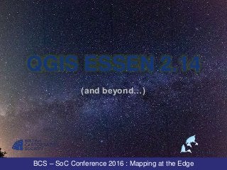
  • 1. BCS – SoC Conference 2016 : Mapping at the Edge QGIS ESSEN 2.14 (and beyond…)
  • 2. BCS – SoC Conference 2016 : Mapping at the Edge Ross McDonald GIS Data Coordinator Angus Council mcdonaldr@angus.gov.uk @mixedbredie #qgis #bcssoc16
  • 3. BCS – SoC Conference 2016 : Mapping at the Edge QGIS /kju: djis/ or kew-jiss a free and open source geographic information system (with top end cartographic tools...)
  • 4. BCS – SoC Conference 2016 : Mapping at the Edge QGIS Factoids First source code written 2002 304 devs committed 34000 changes in 838,000 lines of code 111 developers committed 5927 changes in the last 12 months increasing year-on-year contributions 229 person years of effort at an estimated cost of $12.5m See Openhub.net for more
  • 5. BCS – SoC Conference 2016 : Mapping at the Edge So, Essen…
  • 6. BCS – SoC Conference 2016 : Mapping at the Edge LTR – Long Term (Support) Release Support for a year Stability for larger organisations Better continuity and less disruption Back-ported bug fixes and enhancements
  • 7. BCS – SoC Conference 2016 : Mapping at the Edge HOW RELEASES WORK
  • 8. BCS – SoC Conference 2016 : Mapping at the Edge WHAT’S IN THE BOX?
  • 9. BCS – SoC Conference 2016 : Mapping at the Edge RENDERING TOOLS, ANALYTICAL TOOLS, MAP PRODUCTION TOOLS, PLUGINS, EDITING AND DIGITISING TOOLS, DATABASE TOOLS, SCRIPTING TOOLS, BUTTONS, WIDGETS, MORE BUTTONS
  • 10. BCS – SoC Conference 2016 : Mapping at the Edge CONSUME DATA All supported OGR vector formats Spatial databases All supported GDAL raster formats OGC compliant web services
  • 11. BCS – SoC Conference 2016 : Mapping at the Edge MANAGE DATA Read and write to your database of choice Export to just about any format inc. CAD Save associated styles with the layer in the database Create custom forms for data capture and editing Edit, snap and trace features with digitising tools
  • 12. BCS – SoC Conference 2016 : Mapping at the Edge ANALYSE DATA Plugins for GRASS, R, SAGA and fTools The Processing Toolbox Batch processing Drag 'n drop modeller
  • 13. BCS – SoC Conference 2016 : Mapping at the Edge PRINT COMPOSER Custom templates Multiple map layouts (on multiple composers) Atlas generation Dynamic legends, guides, insets, overviews and graticules
  • 14. BCS – SoC Conference 2016 : Mapping at the Edge PLUGINS! 603 at the last count, extending QGIS in all areas Check out QGIS2web, QGIS2ThreeJS, TimeManager
  • 15. BCS – SoC Conference 2016 : Mapping at the Edge INTERACTIVE 3D OUTPUT
  • 16. BCS – SoC Conference 2016 : Mapping at the Edge PYTHON
  • 17. BCS – SoC Conference 2016 : Mapping at the Edge CARTOGRAPHIC TOOLS
  • 18. BCS – SoC Conference 2016 : Mapping at the Edge LABELLING "cartographic" placement rendering order complex rule based labelling See Nyall Dawson's blog
  • 19. BCS – SoC Conference 2016 : Mapping at the Edge CARTOGRAPHIC PLACEMENT 2. top left 7. top (rightish) 1. top right 6. middle left 5. middle right 4. bottom left 8. bottom (leftish) 3. bottom right
  • 20. BCS – SoC Conference 2016 : Mapping at the Edge OS datasets come with useful attributes font font height orientation anchor position QGIS wants to maximise # labels on display Priority can be data defined
  • 21. BCS – SoC Conference 2016 : Mapping at the Edge OBSTACLE ONLY LAYERS a non-labelled layer as obstacle for labels in another layer Examples by Nyall Dawson
  • 22. BCS – SoC Conference 2016 : Mapping at the Edge POLYGON OBSTACLES Choose between interiors or boundaries Examples by Nyall Dawson
  • 23. BCS – SoC Conference 2016 : Mapping at the Edge OTHER LABEL FEATURES Fit labels in polygon Label every feature part Limit labels to ### features Rule based labelling
  • 24. BCS – SoC Conference 2016 : Mapping at the Edge SYMBOLOGY Choice of renderer Choice of symbol layer type Blending Draw effects Save as QML/SLD/QLR
  • 25. BCS – SoC Conference 2016 : Mapping at the Edge Diagram by Tim Sutton, Kartoza
  • 26. BCS – SoC Conference 2016 : Mapping at the Edge 2.5D RENDERER and Single, Categorised, Graduated, Rule-based, point displacement, heat map, inverted polygons
  • 27. BCS – SoC Conference 2016 : Mapping at the Edge RULE BASED RENDERING Assign features to a class based on attribute Use the data to define the style Use the map scale to show/hide or generalise features
  • 28. BCS – SoC Conference 2016 : Mapping at the Edge BLENDING Dodge, burn, lighten, multiply…
  • 29. BCS – SoC Conference 2016 : Mapping at the Edge
  • 30. BCS – SoC Conference 2016 : Mapping at the Edge
  • 31. BCS – SoC Conference 2016 : Mapping at the Edge DRAW EFFECTS Drop shadows and glows Blurs Transformations Stacked effects
  • 32. BCS – SoC Conference 2016 : Mapping at the Edge
  • 33. BCS – SoC Conference 2016 : Mapping at the Edge
  • 34. BCS – SoC Conference 2016 : Mapping at the Edge
  • 35. BCS – SoC Conference 2016 : Mapping at the Edge
  • 36. BCS – SoC Conference 2016 : Mapping at the Edge SAVE AND SHARE STYLES Save styles with the data In the database In a layer package
  • 37. BCS – SoC Conference 2016 : Mapping at the Edge NEW IN NØDEBO See https://www.youtube.com/GKg2SHmBExs on how to pronouce Nødebo.
  • 38. BCS – SoC Conference 2016 : Mapping at the Edge LIVE STYLE DOCK Select a layer, press F7 Edit symbology Edit labels Save multiple styles per layer History Thanks to Nathan Woodrow https://nathanw.net/
  • 39. BCS – SoC Conference 2016 : Mapping at the Edge Using data-defined styles
  • 40. BCS – SoC Conference 2016 : Mapping at the Edge Single / categorised / graduated
  • 41. BCS – SoC Conference 2016 : Mapping at the Edge Use the histogram, Luke!
  • 42. BCS – SoC Conference 2016 : Mapping at the Edge Whoopsie? Nae bother, pal!
  • 43. BCS – SoC Conference 2016 : Mapping at the Edge Oh, it does raster too
  • 44. BCS – SoC Conference 2016 : Mapping at the Edge PRINT COMPOSER Composer manager with Multiple compositions with Multiple layouts with Insets and overviews. Templates Grids and guides Atlas generator Variables
  • 45. BCS – SoC Conference 2016 : Mapping at the Edge
  • 46. BCS – SoC Conference 2016 : Mapping at the Edge MULTIPLE LAYOUTS
  • 47. BCS – SoC Conference 2016 : Mapping at the Edge EXPORTING YOUR #cartowin Save as image, SVG, PDF or Generate an Atlas Use your data to generate a series of maps
  • 48. BCS – SoC Conference 2016 : Mapping at the Edge VARIABLES QGIS has dynamic variables. There are different variables in different places. You can create @custom_variables
  • 49. BCS – SoC Conference 2016 : Mapping at the Edge QGIS ESSEN 2.14 (and beyond…)
  • 50. BCS – SoC Conference 2016 : Mapping at the Edge QGIS RESOURCES QGIS Map Design: Gretchen Peterson and Anita Graser qgis.org, gis.stackexchange.com and mailing lists QGIS UK user group: qgis.uk and G+ group and @qgisuk
  • 51. BCS – SoC Conference 2016 : Mapping at the Edge Thank you Ross McDonald Angus Council mcdonaldr@angus.gov.uk @mixedbredie LinkedIn: http://bit.ly/1yWAY5J

Notas do Editor

  1. Hello and thank you for coming to find out about my favourite desktop GIS, QGIS. I’ll be talking about QGIS Essen and some of the features in Nodebo. It’s going to be a whistle stop tour through features new and old.
  2. I am Ross McDonald, the GIS coordinator at Angus Council on the east coast of Scotland north of Dundee. Together with my colleague Roger we manage about 55 GIS power users on QGIS, half a dozen on ArcGIS and about 300 on our web GIS.
  3. Over the last few years we switched out a lot of proprietary software and replaced it with an open source stack based on Postgresql, PostGIS, QGIS and Geoserver.
  4. It is an established project 14 years old. It's just about the largest open source development team in the world. Some of you may have heard Steven Feldman's talk - there's no such thing as a free lunch. And there isn't - although it is free to download and use, there has been a huge cost in people's time (and own finances) developing QGIS and it is only through sponsorship and donation of more people's time and money that QGIS gets better and better.
  5. QGIS releases are named after places where a gathering of developers have hacked and worked on the project to make it the tool of choice for many. I'll be talking about Essen and some of the new features in Nodebo.
  6. The long term support release was created by the development team after requests from the community for something that didn't break paradigms every four months. Something easier to manage in large organisations but still supported with fixes and enhancements.
  7. There is the stable LTR series - 2.14 - and the stable latest series - 2.16 - and the bleeding edge master release leading up towards the version 3 release. Slide taken from Oslandia’s presentation at FOSS4G 2016.
  8. So, what do you get with a default install of QGIS?
  9. Everything you can expect to see in a fully featured desktop GIS package and more. And free. And open.
  10. What does all this open source goodness let us do? It can consume data in any format supported by GDAL and OGR
  11. It allows you to manage your data in all those supported formats but it works best with a database out back.
  12. QGIS has built in support for other geo-spatial toolkits through the Processing toolbox including batch processing and a drag ‘n drop modeller.
  13. Once you’ve added your data, morphed it into the correct format and done your analytics you can print out your results using the Print Composer. This is one part of QGIS that has come along in leaps and bounds and if you’ve not used it in a couple years you should try it again.
  14. QGIS is extensible through plugins – some are built in and others are available from the repository – there are a lot to choose from. QGIS2WEB by Tom Chadwin TimeManager by Anita Graser and others Qgiss2threejs by Minoru Akagi
  15. Qgis2three js example.
  16. But what cartographic tools are there at hand?
  17. There is a powerful labelling engine inside with a huge number of configuration options available – Nyall Dawson does a lot of work on this part of QGIS and it is improving all the time. Nyall Dawson and Nathan Woodrow amongst others do a lot of work on making QGIS output high quality.
  18. If you work with Ordnance Survey data and QGIS then you can leverage all the additional attribution the Carto Design team (https://www.ordnancesurvey.co.uk/resources/carto-design/) have added to their datasets with the data defined options within QGIS.
  19. QGIS also allows you set a layer as an obstacle to labels – in this example we don’t want the labels covering the railway lines so set the lines as an obstacle to the labelled layer. Examples from Nyall Dawson’s blog
  20. You can do the same with area boundaries – only place the label inside a polygon and don’t let it cross an edge.
  21. All this functionality and more help make automated labelling in QGIS very good – you will still get those use cases where nothing but hand crafted label placement will do and QGIS will let you do that too.
  22. QGIS offers you all the styling tools and function you need in a GIS and some that would normally only find in a graphics package.
  23. Play with pixel values to blend your layers together.
  24. Blend mode set to multiply – i.e. multiply the pixel values of this layer with the layers underneath. Let’s add another layer – a hill shaded image.
  25. You’ll need to play about with the brightness, saturation and transparency to get it just right.
  26. Draws effects is another new feature that allows you to add inner or outer shadows and/or inner of outer glows to your features.
  27. Let’s combine some layers with blend modes and draw effects – a vanilla base map
  28. Some vegetation classification data overlaid
  29. Blend the vegetation layer
  30. Add some outer drop shadows and an inner glow
  31. Once you’ve done all the hard work creating your custom style you can save and share those styles. We save layer styles in our database so that all users get the same look and feel when they load a layer. If you use spatialite databases then you can save the style with the data too. Or as a layer file or layer package which are file based.
  32. All these features I’ve shown you are available in Essen but Nodebo has some new features that make workflows much slicker.
  33. Animated gifs by Nathan Woodrow
  34. Animated gifs by Nathan Woodrow
  35. Animated gifs by Nathan Woodrow
  36. Animated gifs by Nathan Woodrow
  37. Animated gifs by Nathan Woodrow
  38. The QGIS Print Composer gives you a composer manager to handle multiple compositions with multiple layouts
  39. If you want to go deep then you can dive into using QGIS variables and even create your own. You could, for example, take the user’s name and contact details and assign them to variables that are then automatically embedded in a custom template and will appear on all maps that are printed.
  40. But that’s enough for now. If you want to find out more then …
  41. QGIS map design is a new book just out the goes into detail with all the mapping tools I’ve mentioned. For help check the docs or gis.stackexchange.com and the mailing lists. Find a QGIS user group near you and meet up or join the Google+ group.
  42. Thank you. All maps contain Ordnance Survey data. Crown copyright and database rights 2016. 100023404.