
Recomendados
Mais conteúdo relacionado
Mais procurados
Mais procurados (20)
Semelhante a 428836159-Presentation-on-Mumbai-Ahmadabad-High-Speed-Rail-Project.pptx
Semelhante a 428836159-Presentation-on-Mumbai-Ahmadabad-High-Speed-Rail-Project.pptx (20)
Último
Último (20)
428836159-Presentation-on-Mumbai-Ahmadabad-High-Speed-Rail-Project.pptx
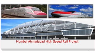
- 1. 1 Mumbai Ahmadabad High Speed Rail Project
- 2. Rationale and Background •The growing transport needs of the country requires construction of High Speed Railway (HSR) in India. •Any Railway System having speed potential in excess of 200 kmph are considered as High Speed Railway. •The MAHSR project started in 2012 with initial discussions between Govt. of India and Govt. of Japan. Feasibility study undertaken by Japanese consultants in December 2013 and report submitted in July 2015. The project has been approved by Government of India vide CCEA/31/2015 dated. 09.12.2015
- 3. Rationale and Background •National High Speed Rail Corporation (NHSRCL), A Special Purpose Vehicle under Ministry of Railways, Govt. of India was set up with partnership of Govt of Maharashtra and Govt. Of Gujarat on 12th February 2016. •On 14th September 2017, Hon’ble Prime Minister of India, Shri Narendra Modi and Hon’ble Prime Minister of Japan Shri Shinzo Abe laid the foundation stone for first HSR project between Mumbai and Ahmedabad. •All out efforts are being made to complete the Project by 15th August 2022.
- 4. Sabarmati Mumbai Delhi Sabarmati Ahmedabad Anand Vadodara Bharuch Surat Bilimora Vapi Boisar Virar Thane Mumbai Legend Capital Majorcities * DNH: Dadra & Nagar Haveli Gujarat Maharashtra Stations: 12 ( 8 in Gujarat & 4 in Maharashtra) All elevated except Mumbai (underground) Gujarat: 349.03 Km (8 districts) DNH* : 4.30 Km (1 UT) Maharashtra: 154.76 Km (3 districts) Travel Time: 2.07 Hrs (limited Stops) 2.58 Hrs (all stops) COST: 1,08000 CRORES (including all escalation, Interest during Construction, taxes/duties) Total Length: 508.09 Km 460.3 Km Viaducts (90.6%) 9.22 Km Bridges (1.8%) 25.87 Km Tunneling (5.1%) (Longest Tunnel: 21 Km with 7 Km undersea) 12.9 Km Cut/Fill (2.5%) GAUGE: Standard 1435 mm SPEED: 350 Km/h (design), 320 Km/h (operating) GENERAL OVERVIEW OF PROJECT
- 5. SALIENT FEATURES: TECHNICAL Project Component Description Project Cost INR 1.08 Lakh Crores Funding Agency JICA & MoR, and State Governments (Maharashtra and Gujarat) Total Land Requirement 1415.75 Ha. Total Length 508.17 km Elevated Viaduct 469.53 km (9.22 kms Bridges) Embankment (Cut/Fill) 12.9 Kms Right of Way (ROW) 17.5 m Tunnels 25.87 kms (8 Nos.) Longest Tunnel 21 km (7.0 kms Undersea) Tunnel Construction Technology TBM & NATM Railway Crossings 25 locations Maintenance Depots 7 Rolling Stock Depots 2 - Thane and Sabarmati. Construction Yards At every 25 km Track Gauge Standard (1,435 mm) Maximum Design Speed 350 km/hr Maximum Operation Speed 320 km/hr Number of Lines Double Track Distance between Track Centre 4.5 m No . Stations Ch. (Km) 1 BKC, Mumbai 0.000 2 Thane 27.950 3 Virar 65.170 4 Boisar 104.207 5 Vapi 167.940 6 Bilimora 216.580 7 Surat 264.580 8 Bharuch 323.110 9 Vadodara 397.060 10 Anand 447.380 11 Ahmedabad 500.190 12 Sabarmati 505.750 Travel Time : 2.07 Hrs (Limited Stops 2.58 Hrs (all stops)
- 6. • Reduction in travel time between Mumbai and Ahmedabad from 6.5 hrs to 2.5 hrs. • High carrying capacity of about 750 passenger per train. • Major connectivity boost to less developed areas, potential for development of new production bases and townships along the corridor. • Boost to construction industry, technological enhancement of Railways, long term infrastructure development. • Creation of temporary and permanent employment. • Decongestion of existing rail, road, and air traffic between Mumbai and Ahmedabad • Reduction in Green house gas emissions due to more efficient transport option mode Project Benefits
- 7. Key Alternatives chosen include: • Route optimization and depot siting to avoid / minimize environmentally and socially sensitive areas (such as forests and mangroves, sanctuaries, hospitals, schools, densely populated areas, etc.) • Embankment option changed to Viaduct, thus substantially reducing RoW and subsequent Land Acquisition requirement • Elevated viaduct ensures continuity within spans, across the alignment (LHS and RHS) without any physical severance for local community as well as livestock • Japanese Shinkansen technology chosen, which is one of the most optimal among HSR, as regards noise emissions and energy efficiency Project Alternatives
- 8. SALIENT FEATURES: OPERATIONAL TRAIN OPERATION PLAN (Source: Feasibility Study) Year 2023 2033 2043 2053 Train Configuration 10 10/16 16 16 Number of Rakes 24 24 +11 44 71 Number of Trains (per day/one-direction) 35 51 64 105 Train Capacity 750 750/1250 1250 1250 Traffic Volume (day/one direction) 17,900 31,700 56,800 92,900 Number of Trains (per day/hour/one-direction) Peak Hour: 3 4 6 8 Off peak: 2 3 3 6 Operational Control Centre: Sabarmati Maintenance Depot/Workshop (Rolling Stock): Thane, Sabarmati 4
- 9. Inspection Light Maintenance Heavy Maintenance Others (Period) Daily (48 h) Regular (30 days) Bogie (18 months) General (36 months) Special & Breakdown Thane Depot √ √ √ Sabarmati Depot & Workshop √ √ √ √ √ • Power supply: 12 Traction substations, 2 Depot substations and 16 Distribution sub stations (12 Stations, 2 Depots & 2 Tunnel) • OHE: 2X25 KV, Heavy Compound Catenary System • Signalling: DS- ATC similar to Shinkansen • Fitted with Disaster Prevention System for safe operation. • State of the art High Speed Railway Training Institute at Vadodara • Annual Energy requirements (Trains, Stations etc) -1100 million units 5 SALIENT FEATURES: MAINTENANCE MAINTENANCE SCHEDULE
- 10. Shinkansen E7 Series JR East X Construction Methodology: Tunnel/ Via-duct Adopted • Tunnel about 25-40 meters below ground level, • Elevated viaducts ensures continuity within spans, across the alignment (LHS& RHS) without any physical severance. “THERE IS NO BIFURCATION OF FOREST LAND”
- 11. Typical Cross Section in Tunnel & Via Duct
- 12. ALIGNMENT STUDY •Minimum Radius (Horizontal): 6000m for 320 km/h •Minimum Radius (Vertical): 25000m •Over Head Clearance:7.7 m •Maintainability of Asset Technical •Future Expansion to new area •Connectivity with existing important places •Development potential Operational •Location of station, River Bridges •Minimum Disturbance to Forest & Wild Life •Minimum Interference with existing structures i.e. highway, metro, Location of Bridges Obligatory Points
- 15. S.N. Alignment Alternative-1 (Tunnel) Alternative -2 (Via Duct) Alternative -3 (Along IR) 1 Proposed Terminal Bandra Kurla Complex (Business Center) Bandra Kurla Complex (Business Center) Lokmanya Tilak (IR station) 2 Passenger Connectivity Connected With Metro 2B, Metro 3, Metro 8 (proposed), Airport (Santacruz Chembur Link Road) Connected With Metro 2B, Metro 8 (proposed), Airport (Santacruz Chembur Link Road) Connected with Lokmanya Tilak Station of IR 3 Possibility of future extension Possible connection with Pune, Nagpur Possible connection with Pune, Nagpur Possible connection with Pune, Nagpur 4 Development Potential Very High Due to Integration with IFSC Very High Due to Integration with IFSC Low, Since terminal is heavily populated Most Feasible Alignment: Operational Issues
- 16. S. N. Alignment Alternative-1 (Tunnel) Alternative -2 (Via Duct) Alternative -3 (Along IR) 1 Horizontal Curve Min 6000R Min 6000R Radius 1500 R 2 Vertical Curve 25000 m 25000 m 25000 m 3 Infringement with Ex/ Pro Structure Metro 5, Metro 4 Metro 2B, Metro 5, Metro 4, Eastern Expressway, CSMT Kalyan Line- 2 locations, Trans Harbour 2 locations and other flyovers • 22 different locations of Road Over Bridges & Foot Over Bridge 4 Speed Potential Speed Potential: 320 km/h Speed Potential: 320 km/h Speed Potential: 110 km/h Most Feasible Alignment: Technical Aspects
- 17. S.N. Alignment Alternative-1 (Tunnel) Alternative -2 (Via Duct) Alternative -3 (Along IR) 1 Wild Life Alignment Passes through ESZ and PA of TCFS, ESZ of SGNP & TWLS. The alignment also touches PA 0f TWLS (0.11 Ha). The construction is proposed as under ground tunnel in TCFS, thus minimal impact on wild life. Alignment Passes through ESZ and PA of TCFS, ESZ of SGNP & TWLS. The alignment also touches PA of TWLS (0.11 Ha). Alignment Passes over existing alignment of IR thus completely avoiding the TCFS. 2 Wildlife The alignment is along existing PWD road while passing through ESZ of TWLS & SGNP.A wildlife overpass & underpass will also be provided, as per suggestion of NBWL, to bridge lost connectivity of SGNP & TWLS. 3 Forest The alignment passes through Reserved Forest, Protected Forest, Private Forest etc. at various locations. Most Feasible Alignment: Obligatory Points
- 18. Finalization of Alignment • A detailed study of 3 alternatives has been done during feasibility study by dedicated team of Engineers and Technicians of NHSRCL & Japanese Consultants. • Minimum use of forest land, minimal disturbance to wild life and human habitation were considered.
- 19. FINALIZED ALIGNMENT Alt-2 & 3 (Viaduct/ IR) Alt-1 (Tunnel)
- 20. MAHSR Alignment in Thane District – Ch: 7.043 to Ch: 46.700 (39.657 Km)
- 21. MAHSR Alignment in Palghar District – Ch:46.700 to CH:155.642 (108.942 Km)
- 22. Thanks…. 36