United Kingdom (UK) and Ireland Map PowerPoint

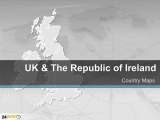
Download this editable PowerPoint map of the United Kingdom (UK) and The Republic of Ireland at http://www.24point0.com/ppt-shop/united-kingdom-ireland-powerpoint-maps This set of 23 slides contains outline maps showing major cities and towns of the United Kingdom, Wales, Scotland and Ireland. The maps are easy to use and you can change colors, shadows, fonts, texts and backgrounds. Do you make your presentations in Apple Keynote? Check out our map slide custom designed in Keynote at http://www.muezart.com/keynote-slides-united-kingdom-republic-ireland-map.html This PPT slide set of the United Kingdom (UK) and The Republic of Ireland contains maps of England, Scotland, Wales, Northern Ireland and the Republic of Ireland. Capital cities and other major cities are highlighted in separate slides. You can use the bar graph slides to present statistical information about the country. Add an artistic appeal to your PowerPoint presentations by using the thumbtacks and pointers given in colors of the flags.

Recomendados
Recomendados
Mais conteúdo relacionado
Último
Último (20)
Destaque
Destaque (20)
United Kingdom (UK) and Ireland Map PowerPoint
- 2. United Kingdom & The Republic of Ireland Countries SCOTLAND NORTHERN IRELAND ENGLAND REPUBLIC OF IRELAND WALES
- 3. United Kingdom & The Republic of Ireland Major Cities Aberdeen Glasgow Dundee Edinburgh Lisburn Newcastle Belfast Armagh Manchester Newry Liverpool Drogheda Gallway Leeds Scheffield Dublin Norwich Bangor Limerick Waterford Birmingham Cork Newport St. David’s Swansea London Cardiff Southampton Plymouth Ipswich
- 4. United Kingdom & The Republic of Ireland Non Data Driven Insert text
- 7. DOWNLOAD our maps and diagrams and discover the advantages of native PowerPoint images. Crisp and Clear: much sharper than clip art Change size without loss of resolution Change color to all or part of an image Remove parts of an image to highlight Combine images to create something new
- 8. Makeovers Fast From This To This Customer Discovery Step-by-Step Product Hypothesis Customer and Problem Hypothesis Distribution and Pricing Hypothesis Demand creation Hypothesis Market type Hypothesis Competitive Hypothesis Test “Product” Hypothesis Friendly first Contacts Problem Presentation Customer Understanding Market Knowledge Test “Product” Hypothesis First reality cheack Verity the Problem “Product” Presentation Verify the Product Yet more Customer Visits Verity the Business Model Second Reality cheack Iterate or Exit 1st Advisory Board Verify
- 9. You Can Do So Much MORE… Compare Clear and Sharp Resolution Resize without loss Combine parts Change colors Separate parts Be creative
- 10. Change colors Change size Separate pieces
- 11. About us Launched in June 2004, Chillibreeze Solutions Pvt. Ltd. is a content and design service provider catering to the needs of a global clientele. We offer a wide range of content writing and design services and are constantly coming up with new and innovative ways to help our customers. We have expanded our range of services by offering specific, niche products and services through our group websites. www.chillibreeze.com Offering content writing and editing services to customers across the globe. www.24point0.com Specializing in PowerPoint Presentation support to consultants across the globe. Selling Products at: http://www.24point0.com/ppt-shop/ www.muezart.com Specialized in Apple Keynote Presentation. www.kizee.com Specialized in PowerPoint Infographic. shop.chillibreeze.com eProduct Store. Contact us: support@24point0.com