NJDOT Fuel Stops Map Coordinates
•Transferir como PPTX, PDF•
1 gostou•3,369 visualizações

1) The document discusses providing GPS coordinates for NJ state employee fuel stops after cost cutting limited other fueling options for state vehicles. 2) It evaluates solutions like returning to gas credit cards, providing coordinates on state phones, or files for personal GPSes. The best solution is having a private provider create coordinates and a download site. 3) The private provider created coordinates for all 72 fuel stops, an RSS feed, WordPress pages for each stop, and a downloadable GPS file, successfully testing the solution.

Recomendados
Recomendados
Mais conteúdo relacionado
Semelhante a NJDOT Fuel Stops Map Coordinates
Semelhante a NJDOT Fuel Stops Map Coordinates (14)
Mais de Patrick McCarthy
Mais de Patrick McCarthy (9)
Último
Último (20)
NJDOT Fuel Stops Map Coordinates
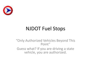
- 1. NJDOT Fuel Stops “Only Authorized Vehicles Beyond This Point” Guess what? If you are driving a state vehicle, you are authorized.
- 3. Why create the map coordinates for the 72 employee fuel stops published on the NJ State public web site? • Cost cutting measures by the Governor has limited other means of fueling state cars used by state employees, e.g. public display of cutting gas credit cards. • Information regarding the location of employee fuel stops has been diminished, e.g. the green booklet that used to be in state care glove box is no longer printed.
- 4. Why GPS map coordinates of state employee fuel stops? • State employees required to use the state fuel sites. • Site locations are not well documented. • Calling for directions produces mixed results.
- 5. Possible solutions to locating state employee fuel stops. 1. Return to the use of Gulf credit cards 2. Provide workers the map coordinates in EZ Navagator on their state cell phones, 3. State provides workers with map coordinate files for their personal GPS receivers. 4. Private provider to create the map coordinates and a public site download to personal GPS receivers.
- 6. Assessment of possible solutions 1. Return to Gulf cards: Not politically viable 2. Access to VZ Navigator: Against OIT policy 3. State provides files : State does not have map coordinates to direct drivers to the proper place on GPS maps. 4. Purchase a readymade solution from a private provider.
- 7. The readymade solution • Map coordinates to direct drivers to the proper place on GPS maps • RSS feed from the state public web page for updates to the list of fuel sites • Wordpress pages, one for each fuel site, allowing users to comment on the fuel site • Map coordinates downloadable to a personal GPS
- 8. The readymade solution status: • All the map coordinates have been created • State public site RSS feed has been created • All the fuel sites have WordPress pages • Generic downloadable file has been created, (Garmin specific file has been created) • Download of the GPS file and upload to a personal GPS receiver successfully tested
- 9. Why did I do this project? • Received a GPS receiver as a present. • Thought it would be simple to upload the state fuel sites from DOT data. • The DOT data was misleading, sending users through locked gates and cross country to get to the state fuel pumps. • Used Google Earth to “fly” over the DOT sites and find the fuel stops • Reconciled the DOT sites with a GPS map.
- 11. Lodi Yard Satellite View
- 12. Lodi Yard in Mapquest
- 13. Lodi Yard in GPS
- 15. YouTube Video excerpts (continued)
- 16. YouTube Video excerpts (continued) Governor Corzine shreds the first of more than 1,000 state-issued credit cards previously used by state employees to fill up state vehicles at commercial gas stations. State employees will now be required to fill up state owned vehicles at state-operated stations around New Jersey saving the state about $0.70 a gallon or about $240,000 a year. New Jersey saved $25 million this year by purchasing in bulk. Gasoline is just one example.