

Recomendados
Mais conteúdo relacionado
Semelhante a My Country(Armenia)
Semelhante a My Country(Armenia) (20)
Mais de Ohanyan Educational Complex
Mais de Ohanyan Educational Complex (20)
My Country(Armenia)
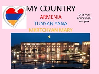
- 1. MY COUNTRY ARMENIA TUNYAN YANA MKRTCHYAN MARY Ohanyan educational complex
- 4. GARNI • The settlement has an ancient history, and is best known for the Hellenistic Garni temple. The area was first occupied in the 3rd millennium BC along easily defensible terrain at one of the bends of the Azat River. In the 8th century BC the area was conquered by the Urartian King Argishti I. The fortification at Garni was erected probably sometime in the 3rd century BC as a summer residence for the Armenian Orontid and Artaxiad royal dynasties. Later around the 1st century BC the fortress of Garni became the last refuge of King Mithridates of Armenia and where he and his family were assassinated by his son-in-law and nephew Rhadamistus. The fortress was eventually sacked in 1386 by Timur Lenk. In 1679 an earthquake devastated the area destroying the temple. • Much of the population descends from people settled in the population exchange of 1829–1830 that followed the Treaty of Turkmenchay between Russia and Persia.
- 7. GARNI • Garni is notable for its fortress complex with the 1st century AD Garni Temple, Surb Astvatsatsin Church, Mashtots Hayrapet Church, a ruined 4th century single-aisle church, a ruined Tukh Manuk Shrine, Saint Sargis Shrine, and a Queen Katranide Shrine. • Nearby is the Garni Gorge with well preserved basalt columns, carved out by the Goght River. This portion of the gorge is typically referred to as the "Symphony of the Stones". It is most easily reached via a road that leads left down the gorge just before reaching the temple of Garni. Another road leads to the gorge through the village, down a cobblestone road, and into the valley. • Once in the valley, turning right will lead to Garni Gorge, an 11th century medieval bridge, and the "Symphony of the Stones". Taking a left will lead along the river past a fish hatchery, up to the Khosrov State Reserve, and a little further Havuts Tar Monastery (which may be seen from the temple). Within the reserve is also Aghjots Vank of the 13th c., a church of S. Stepanos and the fortress of Kakavaberd. Garni lies along the road to the UNESCO World Heritage Site of Geghard Monastery (further 7 km southeast).
- 9. KHOR VIRAP • The Khor Virap (Armenian: Խոր Վիրապ, meaning deep pit or "deep well") is an Armenian Apostolic Church monastery located in the Ararat plain in Armenia, near the border with Turkey, about 8 kilometres (5.0 mi) south of Artashat, Ararat Province.[1][2] The monastery was host to a theological seminary and was the residence of Armenian Catholicos. • Khor Virap's notability as a monastery and pilgrimage site is attributed to the fact that Grigor Lusavorich, who later becameSaint Gregory the Illuminator, was initially imprisoned here for 13 years by King Tiridates III of Armenia. Saint Gregory subsequently became the king's religious mentor, and they led the proselytizing activity in the country. In the year 301, Armenia was the first country in the world to be declared a Christian nation.[1][4][5] A chapel was initially built in 642 AD at the site of Kirat Virap by Nerses III the Builder as a mark of veneration to Saint Gregory. Over the centuries, it was repeatedly rebuilt. In 1662, the larger chapel known as the "St. Astvatsatsin" (Holy Mother of God) was built around the ruins of the old chapel, the monastery, the refectory and the cells of the monks. Now, regular Church services are held in this church. It is probably the most visited pilgrimage site in Armenia.
- 12. GEGHARD • The monastery of Geghard (Armenian: Գեղարդ, meaning spear) is a unique architectural construction in the Kotaykprovince of Armenia, being partially carved out of the adjacent mountain, surrounded by cliffs. It is listed as a UNESCOWorld Heritage Site. • While the main chapel was built in 1215, the monastery complex was founded in the 4th century by Gregory the Illuminator at the site of a sacred spring inside a cave. The monastery had thus been originally named Ayrivank, meaning "the Monastery of the Cave". The name commonly used for the monastery today, Geghard, or more fully Geghardavank( ), meaning "the Monastery of the Spear", originates from Գեղարդավանք the spear which had wounded Jesus at the Crucifixion, allegedly brought to Armenia by Apostle Jude, called here Thaddeus, and stored amongst many other relics. Now it is displayed in the Echmiadzin treasury. • The spectacular towering cliffs surrounding the monastery are part of the Azat river gorge, and are included together with the monastery in the World Heritage Site listing. Some of the churches within the monastery complex are entirely dug out of the cliff rocks, others are little more than caves, while others are elaborate structures, with both architecturally complex walled sections and rooms deep inside the cliff. The combination, together with numerous engraved and free-standingkhachkars is a unique sight, being one of the most frequented tourist destinations in Armenia. • Most visitors to Geghard also choose to visit the nearby Garni temple, a Parthenon-like structure located further down the Azat river. Visiting both sites in one trip is so common that they are often referred to in unison as Garni-Geghard.
- 14. HAGHARTSIN • Haghartsin (Armenian: Հաղարծին) is a 13th century monastery located near the town of Dilijan in the Tavush Province ofArmenia. It was built between the 10th and 14th century (in the 12th under Khachatur of Taron); much of it under the patronage of the Bagratuni Dynasty.
- 17. LAKE SEVAN • Lake Sevan (Armenian: Սևանա լիճ Sevana lich) is the largest lake in Armenia and the Caucasus region. It is one of the largest fresh-water high-altitude lakes in the world. • Lake Sevan is situated in the central part of the Republic of Armenia, inside the Gegharkunik Province, at the altitude of 1,900m above sea level. The total surface area of its basin is about 5,000 km2 , the lake itself is 940 km2 , and the volume is 34.0 bln cubic metres. It is fed by 28 rivers and streams. Only 10% of the outgoing water is drained by the Hrazdan (Razdan) river, while the remaining 90% evaporates. • Before human intervention dramatically changed the Lake Sevan ecosystem, the lake was 95 metres deep, covered an area of 1,360 km² (5% of Armenia's entire area), had a volume of 58 km³ and a perimeter of 260 km. The lake surface was at an altitude of 1,916 m above sea level.
- 20. EJMIATSIN Echmiadzin is the center of the Armenian Church. It is where the Catholicos Of All Armenians lives, and the location of the Ejmiatsin Cathedral.The cathedral, built in 480, is located in a walled compound with gardens and various structures. The word "Ejmiatsin" means The coming of the only-begotten, and the cathedral was built on the very spot Grigor Luysavorich (St. Gregory the Illuminator) dreamt Jesus Himself descended to from heaven to show him where He wanted the church to be built. It is a scenic place to visit. The main church structure is pretty large, however the majority of the interior is dedicated to uses other than worship and the area you enter is much smaller than the size of the entire complex. It is a traditional Armenian design with a belfry and a number of rotundas. Most of the exterior is plain until you make it around to the entrance which is intricately carved and very beautiful. You must not leave until you get into the Manoogian Museum. (Entrance through the large arch across from the cathedral entrance) This structure contains numerous cool paintings, souvenirs, religious artifacts, and illuminated manuscripts so insist on seeing it. Another secret is a fire pit beneath the altar. This is where pagans worshipped fire before Christianity. It is in the small museum in the main cathedral, with the entrance to the right of the altar. There are some religious artifacts in display cases, but you usually need to ask to be shown the fire worshipping pit, at which time a small donation is hinted at. Above the door which descends into the fire pit area is the lance ("Geghard") which is said to have pierced Christ's side. The original structure was added to so much over the years that not much remains now. There was an even earlier church on the same site which was supposed to have been built when Armenia was converted to Christianity. However, Ejmiatsin was yet the oldest church in the USSR. Make sure to wander around the gardens to get a look at the carvings and khatchkars. There is a nice gift shop by the entrance to the compound. The traffic square adjacent to the compound is ringed with very nice models of some Armenian churches throughout the country. -Raffi Kojian
- 23. Kecharis Monastery • Kecharis (Armenian: Կեչառիս) is a 11-13th-century monastery, located 60 km from Yerevan, in the ski resort town ofTsakhkadzor in Armenia. Nestled in the Bambak mountains, Kecharis was founded by a Pahlavuni prince in the 11th century, and construction continued until the middle of the 13th century. In the 12th and 13th centuries, Kecharis was a major religious center of Armenia and a place of higher education. Today, the monastery has been fully restored and is clearly visible from the ski slopes.
- 26. KARABAKH • Karabakh (Armenian: Ղարաբաղ Gharabagh or , Արցախ Artsakh; Azerbaijani: Qarabağ) is a geographic region in present-day southwestern Azerbaijan and eastern Armenia, extending from the highlands of the Lesser Caucasus down to the lowlands between the rivers Kura and Aras. It includes three regions: Highland Karabakh (historical Artsakh, present-day Nagorno-Karabakh), Lowland Karabakh (the southern Kura-steppes), and a part of Syunik.
- 28. • The word "Karabakh" is generally said to originate from Turkic and Persian, literally meaning "black garden".[ An alternative theory, proposed by Bagrat Ulubabyan, is that it has a Turkic-Armenian origin, meaning "Greater Baghk", a reference to Ktish-Baghk (later: Dizak), one of the principalities of Artsakh during the eleventh to thirteenth centuries. • The placename is first mentioned in the Georgian Chronicles (Kartlis Tskhovreba), as well in Persian sources from the thirteenth and fourteenth centuries.
- 30. FOODS
- 32. ARMENIA
- 34. END