
Recomendados
Recomendados
Mais conteúdo relacionado
Mais de OceanCityGazette
Mais de OceanCityGazette (20)
Último
Último (20)
Cape May County weather briefing 2-25-13
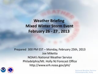
- 1. Weather Briefing Mixed Winter Storm Event February 26 - 27 , 2013 Prepared 300 PM EST – Monday, February 25th, 2013 Joe Miketta NOAA’s National Weather Service Philadelphia/Mt. Holly NJ Forecast Office http://www.erh.noaa.gov/phi/ National Weather Service Philadelphia/Mt. Holly
- 2. Purpose of Briefing • Briefing #1 for event. • Promote situational awareness for emergency management community & partners • Provide guidance for planning efforts • Briefing applies to Mount Holly service area – shaded in green on map National Weather Service Philadelphia/Mt. Holly
- 3. Executive Summary • Precipitation is expected to move in from the southwest Tuesday afternoon just before or during the afternoon commute. Mostly rain is expected everywhere into the early evening hours, with a changeover to frozen precipitation north and west of the Philadelphia metro area. Specifically : •All rain is expected south and east of I-95 •A mixture of rain…freezing rain…and sleet is possible in southeast PA and central NJ (away from the coast), with no significant accumulation •A prolonged period of freezing rain…sleet and snow is possible north of the I-78 corridor Tuesday night. Between ¼ and ½ inch of ice accumulation is possible in the highest elevations in this area, with up to 4 inches of snow. Winter Storm Watches have been issued . See maps on following 4 pages. Most of the afternoon commute should be ok. • 1 to 1.5 inches of rain is expected in some areas, so urban and small stream flooding is a possibility, generally south of the I-78 corridor. • Southeast winds will increase steadily on Tuesday afternoon to the 15 to 25 mph range, with gusts up to 45 MPH. These winds will be distributed across the Mount Holly CWA, and will continue through most of the Tuesday overnight hours. • With a strong onshore flow and full moon, tidal flooding is a concern on the ocean front, Delaware Bay, tidal Delaware River, and Raritan Bay. There is a lower probability of flooding along the eastern shore of the Chesapeake Bay. • Another briefing package will be issued around noon on Tuesday. •For the latest forecast & warning information, monitor our website at: • http://www.erh.noaa.gov/phi/ National Weather Service Philadelphia/Mt. Holly
- 4. Winter Storm Watch (Blue Counties) for Tuesday Afternoon through Wednesday Morning National Weather Service Philadelphia/Mt. Holly
- 5. 0.4 to 0.6 inches (green area). Ice Accumulation Forecast through Wednesday morning National Weather Service Philadelphia/Mt. Holly
- 6. Snow forecast – through Wednesday morning. National Weather Service Philadelphia/Mt. Holly
- 7. Liquid – Equivalent Precipitation Expected through 1 PM Thursday National Weather Service Philadelphia/Mt. Holly
- 8. Questions? • For the latest information, visit our website at http://www.erh.noaa.gov/phi/ • Our latest briefing package is available from our website at: • http://www.erh.noaa.gov/phi/briefing/packages/current_briefing.pdf • If you wish to be notified when a briefing package is issued, you can follow us on social media where we post the notice. • You can 'friend' us on Facebook at: US National Weather Service Philadelphia/Mount Holly • You can follow us on Twitter at: @NWS_MountHolly • If you have any questions, please contact us. • Gary.Szatkowski@noaa.gov – Office 609-261-6602 x222 • Joseph.Miketta@noaa.gov – Office 609-261-6602 x223 National Weather Service Philadelphia/Mt. Holly