SlideShare uma empresa Scribd logo
1 de 22
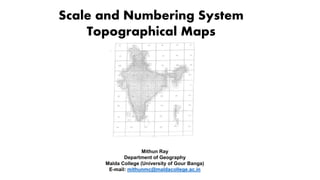
Scale and Numbering System
Topographical Maps
Mithun Ray
Department of Geography
Malda College (University of Gour Banga)
E-mail: mithunmc@maldacollege.ac.in
Topographic Map
Represents the relief of a
region projected on a
horizontal or plane surface. It
also shows features like roads,
railways, canals, water
courses, towns, villages and so
on.
Information on
Topographical Maps
 Name of State and District
 Location in terms of latitude and Longitude
 Scale
 Magnetic declination
 Conventional signs
 Date of issue and revision of toposheet.
 Type of landforms such as general slope, hills, valleys etc.
 Drainage – Important rivers and tributaries , drainage pattern
 Vegetation – Type of forest and type of trees and their distribution.
 Forest location and area covered
 Land Use cultivated land, waste land and other uses
 Means of irrigation – Canal, wells and tanks etc
 Communication – Railway, roadways, Bridges, cart track, Telephone lines,
Transmission lines, airport, seaport etc.
 Settlement – Urban centers, their sizes, rural settlement their pattern
Who prepares Topo Map in India ?
Survey of India, The National Survey and Mapping
Organization of the country under the Department of
Science & Technology, is the OLDEST SCIENTIFIC
DEPARTMENT OF THE GOVT. OF INDIA. It was set up in
1767 and has evolved rich traditions over the years. In its
assigned role as the nation's Principal Mapping Agency,
Survey of India bears a special responsibility to ensure that
the country's domain is explored and mapped suitably,
provide base maps for expeditious and integrated
development and ensure that all resources contribute with
their full measure to the progress, prosperity and security of
our country now and for generations to come.
Scale and Numbering System
Indian Topographical System
India and Adjacent Country Series
International Map of the World Series
India and Adjacent Country Series
4⁰N to 40⁰ N
44⁰E to 124⁰E
Total 136 segments
106 segments surveyed
52 grids (40-92) lie in
India
72,73, 78,79 lie in
West Bengal
NAME SCALE EXTENSION
CONTOUR
INTERVAL
REFERENCE
NUMBER
(EXAMPLE)
MILLION SHEET 1:10,00,000 4⁰ × 4⁰ 500 m 73
DEGREE SHEET 1:2,50,000 1⁰ × 1⁰ 100 m 73 P
QUADRANT
SHEET
1:1,00,000 30′ × 30′ 50 m 73P/SE
15′ SHEET 1:50,000 15′ × 15′ 20 m 73D/16
SPECIAL SHEET
1:25,000 7′ 30″ × 7′ 30″ 10 m 73 D/16/SE
1:25,000 5′ × 7′ 30″ 10 m 73 D/16/1
LAYOUT
MILLION SHEET
SCALE EXTENSION
CONTOUR
INTERVAL
REFERENCE
NUMBER
(EXAMPLE)
1:10,00,000 4⁰ × 4⁰ 500 m 73
DEGREE SHEET SCALE EXTENSION CONTOUR INTERVAL
REFERENCE NUMBER
(EXAMPLE)
1:2,50,000 1⁰ × 1⁰ 100 m 73 P
QUADRANT SHEET
NAME SCALE EXTENSION CONTOUR INTERVAL
REFERENCE
NUMBER (EXAMPLE)
QUADRANT SHEET 1:1,00,000 30′ × 30′ 50 m 73P/SE
15′ SHEET
NAME SCALE EXTENSION CONTOUR INTERVAL
REFERENCE NUMBER
(EXAMPLE)
15′ SHEET 1:50,000 15′ × 15′ 20 m 73D/16
SPECIAL SHEET
NAME SCALE EXTENSION CONTOUR INTERVAL
REFERENCE NUMBER
(EXAMPLE)
SPECIAL SHEET
1:25,000 7′ 30″ × 7′ 30″ 10 m 73 D/16/SE
1:25,000 5′ × 7′ 30″ 10 m 73 D/16/1
India and Adjacent Country
Series
SOURCE: SARKAR, A. (2015): PRACTICAL GEOGRAPHY- A
SYSTEMATIC APPROACH
AREA
1:50,000 = 700 SQ KM
1:25,000 = 175 SQ KM
1⁰ = 111.2 km (69.1 mile)
International Map of the World Series
(Open Series)
Open Series Maps have been introduced as per the National Map Policy of
2005 by Survey of India. The OSM numbering system based on
International Map of the World (IMW) is used. The 'International Map of
the World (IMW)' was a project which started in 1913 to create a complete
map of the world as per internationally agreed and consistent specifications
NAME SCALE EXTENSION
CONTOUR
INTERVAL
REFERENCE
NUMBER
(EXAMPLE)
MILLION SHEET 1:10,00,000 6⁰ × 4⁰ 500 m D50
DEGREE SHEET 1:2,50,000 1⁰ × 1⁰ 100 m D50G
15′ SHEET 1:50,000 15′ × 15′ 20 m D50G10
QUADRANT
SHEET
1:25,000 7′30″ × 7′30″
D50G10SE
3′ SHEET 1:10,000 3′ × 3′ D50G10X
LAYOUT
 The first letter is either 'N' or 'S' to denote the
hemisphere (North/South) with respect to the
equator.
 A second letter denotes the 4°
latitude band with alphabet
increasing as latitude moves away
from equator. So sheets between
12°N to 8°N would be 'NC' and
between 4°S to 8°S would be 'SB'.
https://deeppradhan.heliohost.org/gis/map-numbering/imw.htm
 The next number denotes the 6°
longitude band with numbering starting
at 1 from 180°W (i.e. 1 between 180°W
and 174°W) going on to 60 (i.e. between
174°E-180°E). So sheet between 72° to
78°E and 12°N to 8°N will be 'NC-43'.
Similarly between 132°W to 126°W and
4°S to 8°S would be 'SB-9'. The longitude
band span increased to 12° from 60°
latitude and to 24° from 76° latitude due
to the decrease in physical span of
longitude band.
 Each 6°×4° rectangle is further subdivided into 24 squares of
1°×1°. Each square is indicated serially by an alphabet
increasing first towards east and then towards south,
starting with 'A'.
So for sheet between 74° to 75°E and 11°N to
10°N we get 'NC-43I'
For sheet between 128°W to 127°W and 6°S to
7°S we get 'SB-9Q'
https://deeppradhan.heliohost.org/gis/map-numbering/imw.htm
This Power Point Presentation (PPT) has been
prepared only to deliver the lecture. The
materials (Maps, Diagrams and Images) used in
this presentation have been collected and
compiled by the presenter from various
academic blogs, research papers, books etc.
THANK YOU

Mais conteúdo relacionado

Mais procurados

Aerial photography.pptx
Aerial photography.pptxAerial photography.pptx
Aerial photography.pptxPramoda Raj
 
Geometry and types of aerial photographs
Geometry and types of aerial photographsGeometry and types of aerial photographs
Geometry and types of aerial photographsPooja Kumari
 
Types of aerial photographs
Types of aerial photographsTypes of aerial photographs
Types of aerial photographsHARITHANAIR15
 
Remote Sensing Platforms and Sensors
Remote Sensing Platforms and SensorsRemote Sensing Platforms and Sensors
Remote Sensing Platforms and SensorsUday kumar Devalla
 
Types Drainage pattern presentation
Types Drainage pattern presentationTypes Drainage pattern presentation
Types Drainage pattern presentationKamrul Islam Karim
 
Geographic coordinate system & map projection
Geographic coordinate system & map projectionGeographic coordinate system & map projection
Geographic coordinate system & map projectionvishalkedia119
 
Aerial photographs and their interpretation
Aerial photographs and their interpretationAerial photographs and their interpretation
Aerial photographs and their interpretationSumant Diwakar
 
Indian remote sensing satellites
Indian  remote  sensing  satellitesIndian  remote  sensing  satellites
Indian remote sensing satellitesPramoda Raj
 
Thermal Remote Sensing
Thermal Remote SensingThermal Remote Sensing
Thermal Remote SensingRohit Kumar
 
Fundamental concepts of geomorphology
Fundamental concepts of geomorphologyFundamental concepts of geomorphology
Fundamental concepts of geomorphologyvenkatesh venky
 
Remote Sensing Platforms and Its types
Remote Sensing Platforms and Its typesRemote Sensing Platforms and Its types
Remote Sensing Platforms and Its typesSenthamizhan M
 
Remote sensing - Sensors, Platforms and Satellite orbits
Remote sensing - Sensors, Platforms and Satellite orbitsRemote sensing - Sensors, Platforms and Satellite orbits
Remote sensing - Sensors, Platforms and Satellite orbitsAjay Singh Lodhi
 
Multispectral remote sensing
Multispectral remote sensingMultispectral remote sensing
Multispectral remote sensingDharmendera Meena
 
Remote sensing and image interpretation
Remote sensing and image interpretationRemote sensing and image interpretation
Remote sensing and image interpretationMd. Nazir Hossain
 

Mais procurados (20)

Aerial photography.pptx
Aerial photography.pptxAerial photography.pptx
Aerial photography.pptx
 
Geometry and types of aerial photographs
Geometry and types of aerial photographsGeometry and types of aerial photographs
Geometry and types of aerial photographs
 
Digital Elevation Model (DEM)
Digital Elevation Model (DEM)Digital Elevation Model (DEM)
Digital Elevation Model (DEM)
 
Types of aerial photographs
Types of aerial photographsTypes of aerial photographs
Types of aerial photographs
 
DTM
DTMDTM
DTM
 
Remote Sensing Platforms and Sensors
Remote Sensing Platforms and SensorsRemote Sensing Platforms and Sensors
Remote Sensing Platforms and Sensors
 
GIS Map Projection
GIS Map ProjectionGIS Map Projection
GIS Map Projection
 
Types Drainage pattern presentation
Types Drainage pattern presentationTypes Drainage pattern presentation
Types Drainage pattern presentation
 
Geographic coordinate system & map projection
Geographic coordinate system & map projectionGeographic coordinate system & map projection
Geographic coordinate system & map projection
 
Spot satellite
Spot satelliteSpot satellite
Spot satellite
 
Aerial photographs and their interpretation
Aerial photographs and their interpretationAerial photographs and their interpretation
Aerial photographs and their interpretation
 
Indian remote sensing satellites
Indian  remote  sensing  satellitesIndian  remote  sensing  satellites
Indian remote sensing satellites
 
Thermal Remote Sensing
Thermal Remote SensingThermal Remote Sensing
Thermal Remote Sensing
 
Digital elevation model in GIS
Digital elevation model in GISDigital elevation model in GIS
Digital elevation model in GIS
 
Fundamental concepts of geomorphology
Fundamental concepts of geomorphologyFundamental concepts of geomorphology
Fundamental concepts of geomorphology
 
Remote Sensing Platforms and Its types
Remote Sensing Platforms and Its typesRemote Sensing Platforms and Its types
Remote Sensing Platforms and Its types
 
Remote sensing
Remote sensingRemote sensing
Remote sensing
 
Remote sensing - Sensors, Platforms and Satellite orbits
Remote sensing - Sensors, Platforms and Satellite orbitsRemote sensing - Sensors, Platforms and Satellite orbits
Remote sensing - Sensors, Platforms and Satellite orbits
 
Multispectral remote sensing
Multispectral remote sensingMultispectral remote sensing
Multispectral remote sensing
 
Remote sensing and image interpretation
Remote sensing and image interpretationRemote sensing and image interpretation
Remote sensing and image interpretation
 

Semelhante a Numbering system of topographical map

Numbering System of Indian SOI Topographical Sheets.pdf
Numbering System of Indian SOI Topographical Sheets.pdfNumbering System of Indian SOI Topographical Sheets.pdf
Numbering System of Indian SOI Topographical Sheets.pdfRanaVinay1
 
how to present map along with global positioning system
how to present map along with global positioning systemhow to present map along with global positioning system
how to present map along with global positioning systemmrinmoy28
 
Mapwork calculations
Mapwork calculationsMapwork calculations
Mapwork calculationsfenslin
 
Project 2- traversing
Project 2- traversingProject 2- traversing
Project 2- traversingseenyee
 
Project 2- traversing
Project 2- traversingProject 2- traversing
Project 2- traversingseenyee
 
FCP 3 - Map Reading - CFSGT Putland - Mar 10
FCP 3 - Map Reading - CFSGT Putland - Mar 10FCP 3 - Map Reading - CFSGT Putland - Mar 10
FCP 3 - Map Reading - CFSGT Putland - Mar 10715 Squadron
 
INTRODUCTION TO SURVEYING
INTRODUCTION TO SURVEYINGINTRODUCTION TO SURVEYING
INTRODUCTION TO SURVEYINGfarhana saiyed
 
Forestsurveying and engineering
Forestsurveying and engineeringForestsurveying and engineering
Forestsurveying and engineeringiqbalforestry
 
Social Science Skills for Years 9-11
Social Science Skills for Years 9-11Social Science Skills for Years 9-11
Social Science Skills for Years 9-11Henry Hollis
 
Ss report 2
Ss report 2Ss report 2
Ss report 2Shen Sin
 
1 How does a topographic map show the shape of the land sur.pdf
1 How does a topographic map show the shape of the land sur.pdf1 How does a topographic map show the shape of the land sur.pdf
1 How does a topographic map show the shape of the land sur.pdfcbholla1
 
Fpt 3163 water_science_chapter_4_level_survey
Fpt 3163 water_science_chapter_4_level_surveyFpt 3163 water_science_chapter_4_level_survey
Fpt 3163 water_science_chapter_4_level_surveyRione Drevale
 
Delineating faults using multi-trace seismic attributes: Example from offshor...
Delineating faults using multi-trace seismic attributes: Example from offshor...Delineating faults using multi-trace seismic attributes: Example from offshor...
Delineating faults using multi-trace seismic attributes: Example from offshor...iosrjce
 
Mapwork skills.pptx
Mapwork skills.pptxMapwork skills.pptx
Mapwork skills.pptxKarl Mberema
 
International Journal of Engineering and Science Invention (IJESI)
International Journal of Engineering and Science Invention (IJESI)International Journal of Engineering and Science Invention (IJESI)
International Journal of Engineering and Science Invention (IJESI)inventionjournals
 
Chapter 1 units,physicalquantities and vectors
Chapter 1   units,physicalquantities and vectorsChapter 1   units,physicalquantities and vectors
Chapter 1 units,physicalquantities and vectorsPaouloDe
 

Semelhante a Numbering system of topographical map (20)

Numbering System of Indian SOI Topographical Sheets.pdf
Numbering System of Indian SOI Topographical Sheets.pdfNumbering System of Indian SOI Topographical Sheets.pdf
Numbering System of Indian SOI Topographical Sheets.pdf
 
how to present map along with global positioning system
how to present map along with global positioning systemhow to present map along with global positioning system
how to present map along with global positioning system
 
Mapwork calculations
Mapwork calculationsMapwork calculations
Mapwork calculations
 
Project 2- traversing
Project 2- traversingProject 2- traversing
Project 2- traversing
 
Project 2- traversing
Project 2- traversingProject 2- traversing
Project 2- traversing
 
FCP 3 - Map Reading - CFSGT Putland - Mar 10
FCP 3 - Map Reading - CFSGT Putland - Mar 10FCP 3 - Map Reading - CFSGT Putland - Mar 10
FCP 3 - Map Reading - CFSGT Putland - Mar 10
 
INTRODUCTION TO SURVEYING
INTRODUCTION TO SURVEYINGINTRODUCTION TO SURVEYING
INTRODUCTION TO SURVEYING
 
Forestsurveying and engineering
Forestsurveying and engineeringForestsurveying and engineering
Forestsurveying and engineering
 
Social Science Skills for Years 9-11
Social Science Skills for Years 9-11Social Science Skills for Years 9-11
Social Science Skills for Years 9-11
 
Ss report 2
Ss report 2Ss report 2
Ss report 2
 
Map reading
Map readingMap reading
Map reading
 
1 How does a topographic map show the shape of the land sur.pdf
1 How does a topographic map show the shape of the land sur.pdf1 How does a topographic map show the shape of the land sur.pdf
1 How does a topographic map show the shape of the land sur.pdf
 
1 ijsrms 02516 (1)
1 ijsrms 02516 (1)1 ijsrms 02516 (1)
1 ijsrms 02516 (1)
 
Fpt 3163 water_science_chapter_4_level_survey
Fpt 3163 water_science_chapter_4_level_surveyFpt 3163 water_science_chapter_4_level_survey
Fpt 3163 water_science_chapter_4_level_survey
 
GEODESIA
GEODESIAGEODESIA
GEODESIA
 
Delineating faults using multi-trace seismic attributes: Example from offshor...
Delineating faults using multi-trace seismic attributes: Example from offshor...Delineating faults using multi-trace seismic attributes: Example from offshor...
Delineating faults using multi-trace seismic attributes: Example from offshor...
 
Mapwork skills.pptx
Mapwork skills.pptxMapwork skills.pptx
Mapwork skills.pptx
 
International Journal of Engineering and Science Invention (IJESI)
International Journal of Engineering and Science Invention (IJESI)International Journal of Engineering and Science Invention (IJESI)
International Journal of Engineering and Science Invention (IJESI)
 
Ss report 2
Ss report 2Ss report 2
Ss report 2
 
Chapter 1 units,physicalquantities and vectors
Chapter 1   units,physicalquantities and vectorsChapter 1   units,physicalquantities and vectors
Chapter 1 units,physicalquantities and vectors
 

Mais de Mithun Ray

Population Resource relationship
Population Resource relationshipPopulation Resource relationship
Population Resource relationshipMithun Ray
 
Factors influencing spatial distribution and density of population
Factors influencing spatial distribution and density of populationFactors influencing spatial distribution and density of population
Factors influencing spatial distribution and density of populationMithun Ray
 
Determination of Soil Type by Ternary Diagram textural plotting
Determination of Soil Type by Ternary Diagram textural plottingDetermination of Soil Type by Ternary Diagram textural plotting
Determination of Soil Type by Ternary Diagram textural plottingMithun Ray
 
Scope and content of population geography
Scope and content of population geographyScope and content of population geography
Scope and content of population geographyMithun Ray
 
Mechanism of Plate Tectonics and Resultant Landforms
Mechanism of Plate Tectonics and Resultant LandformsMechanism of Plate Tectonics and Resultant Landforms
Mechanism of Plate Tectonics and Resultant LandformsMithun Ray
 
Internal Structure of Earth
Internal Structure of Earth Internal Structure of Earth
Internal Structure of Earth Mithun Ray
 
Geological Time Scale
Geological Time ScaleGeological Time Scale
Geological Time ScaleMithun Ray
 
Population Growth in India
Population Growth in India Population Growth in India
Population Growth in India Mithun Ray
 
Population Policy in India
Population Policy in IndiaPopulation Policy in India
Population Policy in IndiaMithun Ray
 
Branches of Geography
Branches of Geography Branches of Geography
Branches of Geography Mithun Ray
 
Meaning and Definition of Geography
Meaning and Definition of Geography Meaning and Definition of Geography
Meaning and Definition of Geography Mithun Ray
 

Mais de Mithun Ray (15)

Population Resource relationship
Population Resource relationshipPopulation Resource relationship
Population Resource relationship
 
Sampling
SamplingSampling
Sampling
 
Factors influencing spatial distribution and density of population
Factors influencing spatial distribution and density of populationFactors influencing spatial distribution and density of population
Factors influencing spatial distribution and density of population
 
Fold
FoldFold
Fold
 
Determination of Soil Type by Ternary Diagram textural plotting
Determination of Soil Type by Ternary Diagram textural plottingDetermination of Soil Type by Ternary Diagram textural plotting
Determination of Soil Type by Ternary Diagram textural plotting
 
EIA
EIAEIA
EIA
 
Scope and content of population geography
Scope and content of population geographyScope and content of population geography
Scope and content of population geography
 
Mechanism of Plate Tectonics and Resultant Landforms
Mechanism of Plate Tectonics and Resultant LandformsMechanism of Plate Tectonics and Resultant Landforms
Mechanism of Plate Tectonics and Resultant Landforms
 
Isostasy
IsostasyIsostasy
Isostasy
 
Internal Structure of Earth
Internal Structure of Earth Internal Structure of Earth
Internal Structure of Earth
 
Geological Time Scale
Geological Time ScaleGeological Time Scale
Geological Time Scale
 
Population Growth in India
Population Growth in India Population Growth in India
Population Growth in India
 
Population Policy in India
Population Policy in IndiaPopulation Policy in India
Population Policy in India
 
Branches of Geography
Branches of Geography Branches of Geography
Branches of Geography
 
Meaning and Definition of Geography
Meaning and Definition of Geography Meaning and Definition of Geography
Meaning and Definition of Geography
 

Último

Activity 01 - Artificial Culture (1).pdf
Activity 01 - Artificial Culture (1).pdfActivity 01 - Artificial Culture (1).pdf
Activity 01 - Artificial Culture (1).pdfciinovamais
 
Beyond the EU: DORA and NIS 2 Directive's Global Impact
Beyond the EU: DORA and NIS 2 Directive's Global ImpactBeyond the EU: DORA and NIS 2 Directive's Global Impact
Beyond the EU: DORA and NIS 2 Directive's Global ImpactPECB
 
Unit-IV; Professional Sales Representative (PSR).pptx
Unit-IV; Professional Sales Representative (PSR).pptxUnit-IV; Professional Sales Representative (PSR).pptx
Unit-IV; Professional Sales Representative (PSR).pptxVishalSingh1417
 
Food Chain and Food Web (Ecosystem) EVS, B. Pharmacy 1st Year, Sem-II
Food Chain and Food Web (Ecosystem) EVS, B. Pharmacy 1st Year, Sem-IIFood Chain and Food Web (Ecosystem) EVS, B. Pharmacy 1st Year, Sem-II
Food Chain and Food Web (Ecosystem) EVS, B. Pharmacy 1st Year, Sem-IIShubhangi Sonawane
 
The basics of sentences session 2pptx copy.pptx
The basics of sentences session 2pptx copy.pptxThe basics of sentences session 2pptx copy.pptx
The basics of sentences session 2pptx copy.pptxheathfieldcps1
 
PROCESS RECORDING FORMAT.docx
PROCESS      RECORDING        FORMAT.docxPROCESS      RECORDING        FORMAT.docx
PROCESS RECORDING FORMAT.docxPoojaSen20
 
Web & Social Media Analytics Previous Year Question Paper.pdf
Web & Social Media Analytics Previous Year Question Paper.pdfWeb & Social Media Analytics Previous Year Question Paper.pdf
Web & Social Media Analytics Previous Year Question Paper.pdfJayanti Pande
 
How to Give a Domain for a Field in Odoo 17
How to Give a Domain for a Field in Odoo 17How to Give a Domain for a Field in Odoo 17
How to Give a Domain for a Field in Odoo 17Celine George
 
Basic Civil Engineering first year Notes- Chapter 4 Building.pptx
Basic Civil Engineering first year Notes- Chapter 4 Building.pptxBasic Civil Engineering first year Notes- Chapter 4 Building.pptx
Basic Civil Engineering first year Notes- Chapter 4 Building.pptxDenish Jangid
 
2024-NATIONAL-LEARNING-CAMP-AND-OTHER.pptx
2024-NATIONAL-LEARNING-CAMP-AND-OTHER.pptx2024-NATIONAL-LEARNING-CAMP-AND-OTHER.pptx
2024-NATIONAL-LEARNING-CAMP-AND-OTHER.pptxMaritesTamaniVerdade
 
psychiatric nursing HISTORY COLLECTION .docx
psychiatric  nursing HISTORY  COLLECTION  .docxpsychiatric  nursing HISTORY  COLLECTION  .docx
psychiatric nursing HISTORY COLLECTION .docxPoojaSen20
 
Introduction to Nonprofit Accounting: The Basics
Introduction to Nonprofit Accounting: The BasicsIntroduction to Nonprofit Accounting: The Basics
Introduction to Nonprofit Accounting: The BasicsTechSoup
 
Class 11th Physics NEET formula sheet pdf
Class 11th Physics NEET formula sheet pdfClass 11th Physics NEET formula sheet pdf
Class 11th Physics NEET formula sheet pdfAyushMahapatra5
 
Z Score,T Score, Percential Rank and Box Plot Graph
Z Score,T Score, Percential Rank and Box Plot GraphZ Score,T Score, Percential Rank and Box Plot Graph
Z Score,T Score, Percential Rank and Box Plot GraphThiyagu K
 
Python Notes for mca i year students osmania university.docx
Python Notes for mca i year students osmania university.docxPython Notes for mca i year students osmania university.docx
Python Notes for mca i year students osmania university.docxRamakrishna Reddy Bijjam
 
Explore beautiful and ugly buildings. Mathematics helps us create beautiful d...
Explore beautiful and ugly buildings. Mathematics helps us create beautiful d...Explore beautiful and ugly buildings. Mathematics helps us create beautiful d...
Explore beautiful and ugly buildings. Mathematics helps us create beautiful d...christianmathematics
 
Measures of Central Tendency: Mean, Median and Mode
Measures of Central Tendency: Mean, Median and ModeMeasures of Central Tendency: Mean, Median and Mode
Measures of Central Tendency: Mean, Median and ModeThiyagu K
 
Unit-IV- Pharma. Marketing Channels.pptx
Unit-IV- Pharma. Marketing Channels.pptxUnit-IV- Pharma. Marketing Channels.pptx
Unit-IV- Pharma. Marketing Channels.pptxVishalSingh1417
 

Último (20)

Activity 01 - Artificial Culture (1).pdf
Activity 01 - Artificial Culture (1).pdfActivity 01 - Artificial Culture (1).pdf
Activity 01 - Artificial Culture (1).pdf
 
Beyond the EU: DORA and NIS 2 Directive's Global Impact
Beyond the EU: DORA and NIS 2 Directive's Global ImpactBeyond the EU: DORA and NIS 2 Directive's Global Impact
Beyond the EU: DORA and NIS 2 Directive's Global Impact
 
Unit-IV; Professional Sales Representative (PSR).pptx
Unit-IV; Professional Sales Representative (PSR).pptxUnit-IV; Professional Sales Representative (PSR).pptx
Unit-IV; Professional Sales Representative (PSR).pptx
 
Food Chain and Food Web (Ecosystem) EVS, B. Pharmacy 1st Year, Sem-II
Food Chain and Food Web (Ecosystem) EVS, B. Pharmacy 1st Year, Sem-IIFood Chain and Food Web (Ecosystem) EVS, B. Pharmacy 1st Year, Sem-II
Food Chain and Food Web (Ecosystem) EVS, B. Pharmacy 1st Year, Sem-II
 
The basics of sentences session 2pptx copy.pptx
The basics of sentences session 2pptx copy.pptxThe basics of sentences session 2pptx copy.pptx
The basics of sentences session 2pptx copy.pptx
 
PROCESS RECORDING FORMAT.docx
PROCESS      RECORDING        FORMAT.docxPROCESS      RECORDING        FORMAT.docx
PROCESS RECORDING FORMAT.docx
 
Web & Social Media Analytics Previous Year Question Paper.pdf
Web & Social Media Analytics Previous Year Question Paper.pdfWeb & Social Media Analytics Previous Year Question Paper.pdf
Web & Social Media Analytics Previous Year Question Paper.pdf
 
How to Give a Domain for a Field in Odoo 17
How to Give a Domain for a Field in Odoo 17How to Give a Domain for a Field in Odoo 17
How to Give a Domain for a Field in Odoo 17
 
INDIA QUIZ 2024 RLAC DELHI UNIVERSITY.pptx
INDIA QUIZ 2024 RLAC DELHI UNIVERSITY.pptxINDIA QUIZ 2024 RLAC DELHI UNIVERSITY.pptx
INDIA QUIZ 2024 RLAC DELHI UNIVERSITY.pptx
 
Basic Civil Engineering first year Notes- Chapter 4 Building.pptx
Basic Civil Engineering first year Notes- Chapter 4 Building.pptxBasic Civil Engineering first year Notes- Chapter 4 Building.pptx
Basic Civil Engineering first year Notes- Chapter 4 Building.pptx
 
2024-NATIONAL-LEARNING-CAMP-AND-OTHER.pptx
2024-NATIONAL-LEARNING-CAMP-AND-OTHER.pptx2024-NATIONAL-LEARNING-CAMP-AND-OTHER.pptx
2024-NATIONAL-LEARNING-CAMP-AND-OTHER.pptx
 
psychiatric nursing HISTORY COLLECTION .docx
psychiatric  nursing HISTORY  COLLECTION  .docxpsychiatric  nursing HISTORY  COLLECTION  .docx
psychiatric nursing HISTORY COLLECTION .docx
 
Introduction to Nonprofit Accounting: The Basics
Introduction to Nonprofit Accounting: The BasicsIntroduction to Nonprofit Accounting: The Basics
Introduction to Nonprofit Accounting: The Basics
 
Class 11th Physics NEET formula sheet pdf
Class 11th Physics NEET formula sheet pdfClass 11th Physics NEET formula sheet pdf
Class 11th Physics NEET formula sheet pdf
 
Z Score,T Score, Percential Rank and Box Plot Graph
Z Score,T Score, Percential Rank and Box Plot GraphZ Score,T Score, Percential Rank and Box Plot Graph
Z Score,T Score, Percential Rank and Box Plot Graph
 
Python Notes for mca i year students osmania university.docx
Python Notes for mca i year students osmania university.docxPython Notes for mca i year students osmania university.docx
Python Notes for mca i year students osmania university.docx
 
Explore beautiful and ugly buildings. Mathematics helps us create beautiful d...
Explore beautiful and ugly buildings. Mathematics helps us create beautiful d...Explore beautiful and ugly buildings. Mathematics helps us create beautiful d...
Explore beautiful and ugly buildings. Mathematics helps us create beautiful d...
 
Measures of Central Tendency: Mean, Median and Mode
Measures of Central Tendency: Mean, Median and ModeMeasures of Central Tendency: Mean, Median and Mode
Measures of Central Tendency: Mean, Median and Mode
 
Unit-IV- Pharma. Marketing Channels.pptx
Unit-IV- Pharma. Marketing Channels.pptxUnit-IV- Pharma. Marketing Channels.pptx
Unit-IV- Pharma. Marketing Channels.pptx
 
Mehran University Newsletter Vol-X, Issue-I, 2024
Mehran University Newsletter Vol-X, Issue-I, 2024Mehran University Newsletter Vol-X, Issue-I, 2024
Mehran University Newsletter Vol-X, Issue-I, 2024
 

Numbering system of topographical map

  • 1. Scale and Numbering System Topographical Maps Mithun Ray Department of Geography Malda College (University of Gour Banga) E-mail: mithunmc@maldacollege.ac.in
  • 2. Topographic Map Represents the relief of a region projected on a horizontal or plane surface. It also shows features like roads, railways, canals, water courses, towns, villages and so on.
  • 3. Information on Topographical Maps  Name of State and District  Location in terms of latitude and Longitude  Scale  Magnetic declination  Conventional signs  Date of issue and revision of toposheet.  Type of landforms such as general slope, hills, valleys etc.  Drainage – Important rivers and tributaries , drainage pattern  Vegetation – Type of forest and type of trees and their distribution.  Forest location and area covered  Land Use cultivated land, waste land and other uses  Means of irrigation – Canal, wells and tanks etc  Communication – Railway, roadways, Bridges, cart track, Telephone lines, Transmission lines, airport, seaport etc.  Settlement – Urban centers, their sizes, rural settlement their pattern
  • 4. Who prepares Topo Map in India ? Survey of India, The National Survey and Mapping Organization of the country under the Department of Science & Technology, is the OLDEST SCIENTIFIC DEPARTMENT OF THE GOVT. OF INDIA. It was set up in 1767 and has evolved rich traditions over the years. In its assigned role as the nation's Principal Mapping Agency, Survey of India bears a special responsibility to ensure that the country's domain is explored and mapped suitably, provide base maps for expeditious and integrated development and ensure that all resources contribute with their full measure to the progress, prosperity and security of our country now and for generations to come.
  • 5. Scale and Numbering System Indian Topographical System India and Adjacent Country Series International Map of the World Series
  • 6. India and Adjacent Country Series 4⁰N to 40⁰ N 44⁰E to 124⁰E Total 136 segments 106 segments surveyed 52 grids (40-92) lie in India 72,73, 78,79 lie in West Bengal
  • 7. NAME SCALE EXTENSION CONTOUR INTERVAL REFERENCE NUMBER (EXAMPLE) MILLION SHEET 1:10,00,000 4⁰ × 4⁰ 500 m 73 DEGREE SHEET 1:2,50,000 1⁰ × 1⁰ 100 m 73 P QUADRANT SHEET 1:1,00,000 30′ × 30′ 50 m 73P/SE 15′ SHEET 1:50,000 15′ × 15′ 20 m 73D/16 SPECIAL SHEET 1:25,000 7′ 30″ × 7′ 30″ 10 m 73 D/16/SE 1:25,000 5′ × 7′ 30″ 10 m 73 D/16/1 LAYOUT
  • 9. DEGREE SHEET SCALE EXTENSION CONTOUR INTERVAL REFERENCE NUMBER (EXAMPLE) 1:2,50,000 1⁰ × 1⁰ 100 m 73 P
  • 10. QUADRANT SHEET NAME SCALE EXTENSION CONTOUR INTERVAL REFERENCE NUMBER (EXAMPLE) QUADRANT SHEET 1:1,00,000 30′ × 30′ 50 m 73P/SE
  • 11. 15′ SHEET NAME SCALE EXTENSION CONTOUR INTERVAL REFERENCE NUMBER (EXAMPLE) 15′ SHEET 1:50,000 15′ × 15′ 20 m 73D/16
  • 12. SPECIAL SHEET NAME SCALE EXTENSION CONTOUR INTERVAL REFERENCE NUMBER (EXAMPLE) SPECIAL SHEET 1:25,000 7′ 30″ × 7′ 30″ 10 m 73 D/16/SE 1:25,000 5′ × 7′ 30″ 10 m 73 D/16/1
  • 13. India and Adjacent Country Series SOURCE: SARKAR, A. (2015): PRACTICAL GEOGRAPHY- A SYSTEMATIC APPROACH
  • 14. AREA 1:50,000 = 700 SQ KM 1:25,000 = 175 SQ KM 1⁰ = 111.2 km (69.1 mile)
  • 15. International Map of the World Series (Open Series) Open Series Maps have been introduced as per the National Map Policy of 2005 by Survey of India. The OSM numbering system based on International Map of the World (IMW) is used. The 'International Map of the World (IMW)' was a project which started in 1913 to create a complete map of the world as per internationally agreed and consistent specifications
  • 16. NAME SCALE EXTENSION CONTOUR INTERVAL REFERENCE NUMBER (EXAMPLE) MILLION SHEET 1:10,00,000 6⁰ × 4⁰ 500 m D50 DEGREE SHEET 1:2,50,000 1⁰ × 1⁰ 100 m D50G 15′ SHEET 1:50,000 15′ × 15′ 20 m D50G10 QUADRANT SHEET 1:25,000 7′30″ × 7′30″ D50G10SE 3′ SHEET 1:10,000 3′ × 3′ D50G10X LAYOUT
  • 17.  The first letter is either 'N' or 'S' to denote the hemisphere (North/South) with respect to the equator.  A second letter denotes the 4° latitude band with alphabet increasing as latitude moves away from equator. So sheets between 12°N to 8°N would be 'NC' and between 4°S to 8°S would be 'SB'. https://deeppradhan.heliohost.org/gis/map-numbering/imw.htm  The next number denotes the 6° longitude band with numbering starting at 1 from 180°W (i.e. 1 between 180°W and 174°W) going on to 60 (i.e. between 174°E-180°E). So sheet between 72° to 78°E and 12°N to 8°N will be 'NC-43'. Similarly between 132°W to 126°W and 4°S to 8°S would be 'SB-9'. The longitude band span increased to 12° from 60° latitude and to 24° from 76° latitude due to the decrease in physical span of longitude band.
  • 18.  Each 6°×4° rectangle is further subdivided into 24 squares of 1°×1°. Each square is indicated serially by an alphabet increasing first towards east and then towards south, starting with 'A'. So for sheet between 74° to 75°E and 11°N to 10°N we get 'NC-43I' For sheet between 128°W to 127°W and 6°S to 7°S we get 'SB-9Q' https://deeppradhan.heliohost.org/gis/map-numbering/imw.htm
  • 19.
  • 20.
  • 21. This Power Point Presentation (PPT) has been prepared only to deliver the lecture. The materials (Maps, Diagrams and Images) used in this presentation have been collected and compiled by the presenter from various academic blogs, research papers, books etc.