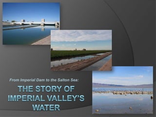
From Imperial Dam to the Salton Sea: The story of Imperial Valley's water
•
8 gostaram•17,675 visualizações


Recomendados
Mais conteúdo relacionado
Mais procurados
Mais procurados (20)
Destaque
Destaque (20)
Semelhante a From Imperial Dam to the Salton Sea: The story of Imperial Valley's water
Semelhante a From Imperial Dam to the Salton Sea: The story of Imperial Valley's water (20)
Último
Último (20)
From Imperial Dam to the Salton Sea: The story of Imperial Valley's water
- 1. From Imperial Dam to the Salton Sea: THE STORY OF IMPERIAL VALLEY’S WATER
- 2. An Exclusive Presentation by: Chris Austin Maven’s Manor Productions www.MavensManor.com With special thanks to: Doug Cox, Merlon Kidwell & Vito Palumbo at Imperial Dam; Vince Brooke, Kevin Kelley and Tony DeZego at Imperial Irrigation District Khaled M. Bali at the U. C. Cooperative Extension – Imperial County Candace Nelson at the Imperial County Farm Bureau © Chris Austin, Mavens Manor Productions, 2011 All Rights Reserved
- 3. A NOTE FROM THE AUTHOR This slideshow follows the path of the water and highlights the infrastructure as it flows from the Colorado River through the Imperial Valley and ultimately into the Salton Sea, documenting the system that makes the agricultural bounty of the Imperial Valley possible and sustains the Salton Sea in the process. It is not intended to be a complete discussion of the issues facing the region which are complex and wide-ranging, and, as in all California water issues, none that come with any easy answers. Instead, the goal here is to provide an educational backbone that will serve as a springboard to discussion and contemplation of those greater issues, which the reader is encouraged to explore through the use of the active hyperlinks from within the presentation itself, the extensive resource pages at the end, or on one’s own. -Chris Austin
- 4. The Imperial Dam straddles the California-Arizona border just north of Yuma, Arizona. It is the last diversion facility in the United States before the Colorado River enters Mexico. Click here to view this location on a Google Map Imperial Dam & All-American Canal Headworks Photo by Chris Austin
- 5. All-American Canal, below Imperial Dam Photo by Chris Austin A cubic-foot per second is about the volume of a basketball, so that would be 15,155 basketballs per second floating by! The Imperial Dam is the headworks for the All-American Canal, which at 160 feet wide and a capacity of 15,155 cubic feet per second, is the largest irrigation canal in the world.
- 6. Colorado River above Imperial Dam Photo by Chris Austin The Imperial Dam diverts about 90% of the river’s water that reaches it.
- 7. Imperial Dam Photo by Chris Austin The amount of water diverted averages 5.5 million acre-feet per year, or roughly about a third of the flow of the Colorado River. How does this facility handle such a enormous amount of water? And where does it all go? *Average of the years 2008-2010, per Bureau of Reclamation
- 8. More than half of the water is used to irrigate the nearly half-million acres of productive farmland in California’s Imperial Valley, the largest year-round irrigated area in the United States. In the winter months, much of the domestically-grown vegetables in the nation’s supermarkets originate from the Imperial Valley. View a map of the Imperial Irrigation District’s service area here: http://www.iid.com/Modules/ShowDocument.aspx?documentid=4680 Photos on this slide by Chris Austin
- 9. Water diverted here also serves 55,000 acres in Arizona’s Yuma Valley and 78,000 acres in California’s Coachella Valley. Photos on this slide by Chris Austin
- 10. Pilot Knob Power Plant on the Yuma Canal (offshoot of the All American Canal). Photo courtesy of the Bureau of Reclamation And most of the Mexico’s allocation of Colorado River water travels through the All-American Canal and is returned to the river through the Pilot Knob Powerplant near Yuma, generating hydropower in the process.
- 11. Photo courtesy of the Imperial Irrigation District The Imperial Dam was constructed between 1935 and 1938 and was authorized as part of the Boulder Canyon Project Act of 1928.
- 12. Photo courtesy of the Imperial Irrigation District Before the project was authorized, the Imperial Valley had been receiving water through a canal built in the early 1900s that skirted the Algodones Dunes to the south, briefly crossing into Mexican territory. But without any dams built along its course, the flow of the river was highly variable, alternating from drought conditions to flood conditions. In addition, the route through Mexico proved problematic.
- 13. Also authorized by the Boulder Canyon Act was the construction on the All-American Canal, which began in 1934 with the canal delivering water to the Imperial Valley for the first time in 1940. Photo courtesy of the Bureau of Reclamation
- 14. Photo courtesy of the Bureau of Reclamation The construction of the 80-mile long unlined canal included digging across 14 miles of sand dunes.
- 15. As relief for Imperial Valley farmers and citizens suffering from the Great Depression, 250 men and 1,000 head of horses and mules were put to work on the canal.
- 16. Picture by Bureau of Reclamation, 1939 Courtesy of the Library of Congress With the construction of Imperial Dam, Hoover Dam, and the All-American Canal, the Imperial Valley now had a reliable water supply and protection from flooding. But also included in the system’s design was a unique facility that would help the farmers deal with another persistent problem: the river’s excessive sediment load.
- 17. The Colorado River has always carried an enormous load of silt and sediment as it tumbles out of the Rocky Mountains and across the plateau, the result of ongoing geological processes that have carved out the numerous dramatic cliffs and canyons of the Southwest for millions of years.
- 18. http://www.flickr.com/photos/willemvanbergen/277907878/ At times, this silt and sediment can equal as much as 30% of the flow of the river. Grand Canyon, Arizona Photo by Willem van Bergen
- 19. Photo courtesy of the Imperial Irrigation District The excessive silt loads had long plagued the farmers of the Imperial Valley, clogging the irrigation works from the canals to the farmer’s laterals, requiring frequent and expensive dredging.
- 20. Photo courtesy of the Library of Congress http://www.loc.gov/pictures/resource/cph.3a37935/ Imperial dam, All-American Canal Project, Calif. and Ariz., Feb. 22, 1939. View upstream along channels 2, 3, 4 To combat the problem, three large settling basins were built to remove the sediment before the water enters the All-American Canal. At the time of construction, it was the largest desilting works in the world.
- 21. Even though the construction of the upstream dams on the Colorado River has reduced the silt load somewhat, periodic dredging in front of the dam is still required. Photo courtesy of the Bureau of Reclamation
- 22. Imperial Irrigation District Headquarters Imperial, California Photo by Chris Austin The Imperial Dam and the All-American Canal system are operated and maintained by the Imperial Irrigation District under the direction of the Bureau of Reclamation. The costs are shared by the water users and various agencies receiving the water. Visit the Imperial Irrigation District online at http://www.iid.com/
- 23. Imperial Dam Control Room Photo by Chris Austin Engineers in the control room at Imperial Dam control the operation of all the gates and turnouts at the dam and along the All-American Canal.
- 24. Photo by Chris Austin The system can also be controlled and monitored from the Water Control Center at Imperial Irrigation District’s headquarters in the town of Imperial. Learn more about IID’s Water Control Center here: http://www.iid.com/index.aspx?page=171.
- 25. Imperial Dam is 3475 feet long. It is a slab-and-buttress (or buttress) dam, a type of dam construction commonly used in wide valleys such as this. Photo courtesy of the Bureau of Reclamation
- 26. A slab-and-buttress dam has a sloping slab facing upstream that is supported by buttresses or walls on the downstream side. The water pushes against the buttress dam, but the buttresses push back and prevent the dam from tipping over. Learn more about the construction of buttress dams by clicking here: http://www.dur.ac.uk/~des0www4/cal/dams/conc/concf18.htm
- 27. Overflow weir Photo courtesy of the Bureau of Reclamation The purpose of the dam is to raise the level of the river 25 feet, high enough for the water to flow into the All-American Canal and the Gila Gravity Canal.
- 28. The central overflow weir is a hollow section 1,198 feet long and 31 feet high that contains a gravel ballast for stability. The weir rests on a 12-foot layer of compacted earth on top of the gravel bed of the Colorado River. A weir is a is a small overflow dam used to alter the flow characteristics of a river or stream. Learn more about weirs here: http://en.wikipedia.org/wiki/Weir Photo courtesy of the Bureau of Reclamation
- 29. Here is how water is moved around the facility. Gila Gravity Canal Headworks/Intake All-American Canal Headworks/Intake Colorado River Overflow Weir Desilting Basins California Sluiceway (the remainder of the Colorado River) Output to the All-American Canal Photo courtesy of the Bureau of Reclamation
- 30. Photo by Chris Austin When the water arrives at the headworks for the All-American Canal, it first goes through the trash racks to remove debris.
- 31. Photo courtesy of the Bureau of Reclamation A trash gantry on a rail system cleans the racks and deposits the trash into railcars to be hauled away. Photo by Chris Austin
- 32. The water then flows through four gates that are 75 feet long and 22 feet high. Photo courtesy of the Bureau of Reclamation
- 33. Photo by Chris Austin The gates are cylinder-shaped and designed to be opened as much as 8 feet. They can be locally or remotely controlled.
- 34. Photo by Chris Austin Photo by Chris Austin Anode Anodes Anodes are used extensively throughout the facility to prevent corrosion of the steel gates and structures due to oxidation from exposure to the air and the salts in the water. The anode supplies an electrical charge that suppresses the electro-chemical reaction, causing the anode to corrode rather than the structure it is protecting. This is called “cathodic protection”. Learn more about it here: http://en.wikipedia.org/wiki/Cathodic_protection
- 35. Photo by Chris Austin Photo by Chris Austin The gates empty into four channels with vertical concrete walls between them. Three of the channels carry water to the desilting basins. The fourth channel can bypass the basins if needed.
- 36. Photo by Chris Austin The water drops down 2 feet as it moves away from the dam toward the desilting basins. The velocity of the water is maintained to keep the sediments suspended until the water reaches the basin.
- 37. Water enters the basin through a long tapered channel in the center that is designed to evenly distribute the water. Click here to see LIFE Magazine’s photo gallery of the desilting works under construction in it’s October 1938 issue. Photo courtesy of the Bureau of Reclamation
- 38. Photo by Chris Austin While in the basin, the water slows down, allowing the silt and sediment to sink to the bottom. The water remains in the basin for about 18 minutes.
- 39. Photo by Chris Austin The clear water near the surface flows over weirs into channels leading toward the All-American Canal ….
- 40. Photo courtesy of the Bureau of Reclamation … while large, slowly rotating scrapers on the bottom of each basin collect the sediment.
- 41. Photo by Chris Austin The accumulated sediments are then discharged to the California Sluiceway, which is what is left of the Colorado River after it meets Imperial Dam. The water in the sluiceway will travel down the river channel and ultimately on to Mexico.
- 42. Photo by Chris Austin Some water is released into the sluiceway to move the flows along.
- 43. In order to keep a disproportionate amount of sediment from entering the Mexican irrigation system, a channel with a large settling basin is located along the river downstream from Imperial Dam. Periodic dredging is necessary. Photo courtesy of the Bureau of Reclamation
- 44. Laguna Dam Photo by Chris Austin Further downstream from Imperial Dam along the river is Laguna Dam. Completed in 1905 by the Bureau of Reclamation, the dam was the original diversion point for the Yuma Project. Since the construction of Imperial Dam, Laguna Dam is no longer used for water diversions.
- 45. Laguna Reservoir, above Laguna Dam Photo by Chris Austin Now, Laguna Dam is used for regulation of the sluicing flows that are released from Imperial Dam. The water is stored behind Laguna Dam and released over an extended period of time and is part of the water delivered to Mexico to fulfill treaty obligations.
- 46. Photo courtesy of the Bureau of Reclamation Before the All-American canal crosses the California-Arizona border, it first provides water to the Bard Irrigation District and the Yuma Main Canal.
- 47. The All-American Canal flows 82 miles from Imperial Dam to Imperial Valley entirely by gravity, crossing the Algodones Dunes on a route that roughly parallels the U.S. Mexican border, terminating on the west side of the valley. Photo courtesy of the Bureau of Reclamation View a map and operational diagram of the Lower Colorado River here: http://www.iid.com/Modules/ShowDocument.aspx?documentid=25
- 48. Photo by Chris Austin The portions of the unlined canal that traverse the Algodones dunes were highly porous and seepage had always been a concern. The lost water has been estimated to be as much as 67,700 acre-feet per year.
- 49. As part of the Quantification Settlement Agreement (QSA), a provision was included to line a 23-mile section of the All-American Canal. The project was paid for by the State of California and the San Diego County Water Authority with the conserved water to primarily be transferred to San Diego. Learn more about the Quantification Settlement by clicking here, or by clicking here.
- 50. Because the Imperial Valley is entirely dependent upon the All-American Canal for water, it was imperative that the canal remain in service during the lining project. To accommodate this requirement, a new parallel canal was constructed alongside the existing earthen canal. Photo courtesy of GOMACO Corporation, Ida Grove, IA
- 51. Photo courtesy of GOMACO Corporation, Ida Grove, IA Over 30 million tons of material were excavated to create the path for the new canal.
- 52. Photo courtesy of GOMACO Corporation, Ida Grove, IA The paving train was designed to pave the canal in two passes and was capable of working as fast as 5 feet per minute.
- 53. Diagram courtesy of GOMACO Corporation, Ida Grove, IA The paving train consisted of three machines: - a paver, a water stop machine, and a work bridge/curing machine.
- 54. The first machine in the chain was the paving machine. Concrete was dumped into a distribution system utilizing a paddle system with baffles to move the concrete down the slope. The machine is designed to pave at different slope angles, different canal widths, a full canal prism or even flatwork if necessary. The second in line was the water stop machine. This machine placed material into the canal every 15 feet give the concrete some flexibility to allow for soil movement or other conditions. The material also provides a seal to prevent the canal from leaking. The final machine was the work bridge/curing machine, where workers fixed any left-over imperfections on the concrete and then applied a white curing compound. Photos courtesy of GOMACO Corporation, Ida Grove, IA
- 55. Seepage from the unlined canal still in operation was a problem. Wells were placed every 100 feet along the route to keep the water below the canal prism. These wells also supplied water needed for construction purposes. Photo courtesy of GOMACO Corporation, Ida Grove, IA
- 56. Photo courtesy of GOMACO Corporation, Ida Grove, IA Construction required interfacing the new canal with the existing canal at freeway underpasses and tie-ins to power plants.
- 57. At these transitions, the canal was split longitudinally in half, and while half the canal prism was being paved, a sheet metal dam was constructed to keep water from the existing canal from flooding the new canal. Find out more about the All-American Canal lining project here: http://www.gomaco.com/resources/worldstories/world36_2/intro_1.html Photo courtesy of Vince Brooke
- 58. Photo by Chris Austin The canal lining project was completed in 2010. The All-American Canal lining project was controversial as the seepage from the unlined canal recharged the aquifer in the nearby Mexicali Valley. Find out more here: http://aquadoc.typepad.com/waterwired/files/eps_v2n2_Neir_Campana.pdf
- 59. The All-American Canal drops 175 feet as it flows to the Imperial Valley, and hydropower plants have been extensively developed along the main canal and its branches. Hydropower utilizes the power of water flowing down to spin the blades of the turbine and create electricity. Learn more about hydropower here: http://science.howstuffworks.com/environmental/energy/hydropower-plant.htm
- 60. Pilot Knob Powerplant Photo by Chris Austin Hydropower generation accounts for 17.75% of the electrical power sold by the Imperial Irrigation District.
- 61. After crossing the dunes, the All-American Canal arrives in the Imperial Valley. At a point called Drop 1, the Coachella Canal branches off, traveling 123 miles northwest to reach the Coachella Valley. Also at Drop 1 is the inlet canal for the newly completed Warren Brock Reservoir that will help to conserve water in the Colorado River system. Coachella Canal Intake canal to the Drop 2 Reservoir Photo by Chris Austin
- 62. Every Wednesday, IID’s watermaster submits a water order to the Bureau of Reclamation based on historical and current water demand. Reclamation then schedules water releases from dams on the Colorado River to meet orders from water users. Since it takes four days for the water to travel from Hoover Dam to Imperial Dam, and given that there is no water storage at Imperial Dam, orders can only be adjusted three to four days in advance of delivery.
- 63. Photo courtesy of the Bureau of Reclamation Drop 2 Reservoir However, during the time the water is in transit, changing conditions can alter the demand for the water. Previously, this water would have been lost to Mexico due to lack of storage in the system, but the new Warren H. Brock Reservoir (formerly known as Drop 2 Reservoir) was built to capture these flows.
- 64. Photo courtesy of the Bureau of Reclamation The new reservoir will conserve an estimated 70,000 acre-feet per year, making that water available for use in the Imperial Valley.
- 65. Diagram courtesy of the Bureau of Reclamation This diagram shows how water is moved in and out of the reservoir. Click here to learn more about the Warren H. Brock (or Drop 2) Reservoir Project.
- 66. East Highline Canal Central Main Canal Westside Main Canal Water is distributed to the Imperial Valley through three main canals. Combined, these canals are 230 miles long. View a map of the IID’s irrigation canals here: http://www.iid.com/Modules/ShowDocument.aspx?documentid=27
- 67. Photo by Chris Austin From these main canals, 167 smaller lateral canals transport the water another 1438 miles …
- 68. Photo by Chris Austin … to approximately 5,600 delivery gates that serve the half-million acres of farmland within Imperial Irrigation District’s territory.
- 69. While a remote system controls the main canals, most lateral headings are controlled by zanjeros, who are responsible for opening and closing delivery gates for the farmers, as well as adjusting the smaller laterals. Photo courtesy of the Imperial Irrigation District
- 70. Photo by Chris Austin The Imperial Valley’s favorable climate, fertile soils, and ample water rights make it one of the most productive agricultural areas in the United States.
- 71. More than 100 different crops are grown here. View Imperial County Agricultural Reports here: http://www.co.imperial.ca.us/ag/Departments/agricultural_crop_&_livestock_reports.htm
- 72. Imperial County Fair exhibit, 1942 Photo courtesy of the Library of Congress The Imperial Valley has long been known as “America’s Winter Garden”. During the winter months when conditions elsewhere are too cold for growing, the Imperial Valley is in peak production, growing much of the fresh produce found in the nation’s supermarkets.
- 73. Photo by Chris Austin The Imperial Valley’s top agricultural commodity is cattle; it is ranked third among California counties in cattle production and has the largest number of feedlot and fed-cattle capacity in California.
- 74. Photo by Chris Austin Alfalfa is the number one agronomic crop with over 112,912 acres in production in 2009. The largest alfalfa growing region in the world, the majority of the alfalfa grown here is baled for shipment to California dairies.
- 75. The Imperial Valley produces 1.6 million tons of hay and other forage crops annually, and is a vital producer for the domestic and international markets. Get an overview of Imperial County Agriculture here: Or visit the Imperial County Farm Bureau online at: http://www.icfb.net/
- 76. Photo by Chris Austin As part of its system, the Imperial Irrigation District maintains an extensive gravity flow drainage system. The 1456 miles of drainage ditches are used to collect excess surface flow (or tailwater) from agricultural fields, subsurface drainage discharges, and operational discharges from canals and laterals.
- 77. Surface runoff, or tailwater, refers to the water running off of the lower end of the field as part of normal surface irrigation practices. Tailwater most often occurs with surface irrigation methods, and is necessary to allow enough infiltration time to adequately irrigate the lower end of the field. Under certain conditions, this tailwater can be reused. Imperial Irrigation District rules require tailwater not to exceed 15% in most cases. Find out more about Imperial Irrigation District tailwater rules here: http://www.iid.com/index.aspx?page=139
- 78. To improve water efficiency on gravity-irrigated fields, the fields are often leveled precisely using a laser-leveling system capable of precision-leveling the field to a desired slope, or even no slope. This provides for a better distribution of water across the field, making it more water efficient and reducing tailwater and subsurface runoff. How does it work? A laser transmitter is set up to produce a horizontal laser plane. This is received by a sensor located on the top of the scraper which sends a signal to the tractor telling it to raise or lower the scraper, thereby either pulling or dropping the right amount of dirt to make the field level. You can find out more about laser leveling here: http://www.knowledgebank.irri.org/landprep/index.php/laser-leveling-mainmenu-84
- 79. While tailwater can be reused, subsurface drainage water cannot. Subsurface drainage systems (sometimes called “tile drainage systems”) are in place under nearly all the Imperial Valley farmland, and are necessary for controlling salinity and achieving a favorable salt balance for crop production. A tile drainage system is a network of underground pipes that allow subsurface water to move out from between soil particles and into the tile line, where it then empties into a drainage ditch.
- 82. Photo courtesy of the Bureau of Reclamation About 1/3rd of the water delivered to the Imperial Valley will ultimately end up in the Salton Sea. While water conservation practices can improve water use efficiency, this drainage water cannot be completely eliminated.
- 83. As an agricultural drainage reservoir, the Salton Sea serves an important purpose for the productive agricultural valleys that surround it. Nearly all of the entire inflow to the Sea is agricultural runoff from the Imperial and Mexicali Valleys, and to a much lesser extent, the Coachella Valley. Virtually all of the runoff is ultimately derived from the Colorado River. Photo courtesy of the Bureau of Reclamation
- 84. Photo courtesy of the Bureau of Reclamation With all the demands on the Colorado River, it no longer reaches the Sea of Cortez in most years. In addition, over 90 percent of California’s wetlands have been lost to development.
- 85. As one of the few remaining wetlands left, many birds have come to rely on the Salton Sea. It has become an important wintering and staging area for migratory birds along the Pacific Flyway, as well as permanent habitat for many species, some of them endangered. Photo by Chris Austin
- 86. Bird populations on any given day number at least in the low hundreds of thousands, but can number in the low millions during the winter months.
- 87. Photo by Chris Austin Dubbed by some scientists as "California's crown jewel of avian biodiversity", more than 380 species of birds have been recorded at the Sonny Bono Salton Sea National Wildlife Refuge, the largest number of species found on any national wildlife refuge in the West. Visit the Sonny Bono Salton Sea National Wildlife Refuge online: http://www.fws.gov/saltonsea/
- 88. Photo by Chris Austin The Salton Sea is a terminal lake, meaning it has no outlets. The water that sustains the sea brings with it salt from the Colorado River and from the fields, and water can only leave through evaporation. The Sea is 25 percent saltier than the ocean and getting saltier every day.
- 89. Photo by Chris Austin Currently, the amount of water flowing into the Sea and the rate of evaporation are roughly equal. However, as part of the QSA, the Imperial Irrigation District agreed to transfer up to 300,000 acre-feet of Colorado River water per year to urban Southern California water agencies. In the long-term, the water for this transfer is to come from improved agricultural water efficiency in the Imperial Valley, which will in turn reduce the amount of water flowing into the Sea. Learn more about the Quantification Settlement by clicking here, or by clicking here.
- 90. Photo by Chris Austin As the inflows to the Sea decrease, the Sea will shrink, become saltier, and expose tens of thousands of acres of lakebed to dust storms that could potentially rival those at Owens Lake. The increasing salinity of the Sea will eventually destroy the fishery, eliminating the source of food for fish-eating bird species, and the foraging habitat and nesting grounds will be left behind by the receding water, reducing the bird’s ability to find food and exposing them to increased predation.
- 91. During the QSA negotiations, the state agreed to assume most of the financial responsibilities for mitigating negative environmental impacts of the water transfer and for restoration efforts at the Sea. While the state selected a plan in 2008, efforts at the state level have languished due to financing and administrative issues. In addition, legal challenges to the QSA persist, with the real possibility of the agreement being invalidated. Photo by Chris Austin
- 92. One agency working towards restoration and revitalization of the Sea is the Salton Sea Authority, a Joint Powers Authority formed to work with California state agencies, federal agencies, and the Republic of Mexico to develop plans to improve water quality, stabilize water elevation, and enhance recreational and economic development potential of the Sea. Photo courtesy of the Salton Sea Authority Visit the Salton Sea Authority online at: http://www.saltonsea.ca.gov/ Photo courtesy of the Salton Sea Authority
- 93. Photo courtesy of the Salton Sea Authority While many projects are currently underway, much more needs to be done. Find out what the Salton Sea Authority is doing to improve conditions at the Sea by clicking here: http://www.saltonsea.ca.gov/ourplan.html
- 94. The Imperial Dam and the All-American Canal system delivers one-fifth of the flow of the Colorado River to the Imperial Valley, one of the nation’s most productive agricultural areas. Photo by Chris Austin
- 95. Photo by Chris Austin Imperial Valley farmers use that water to produce food and fiber for the nation and for the world, something they have been doing for over 100 years.
- 96. Water conservation measures enacted within the Imperial Valley as part of the QSA Agreement will reduce inflows into the Salton Sea, and plans for its restoration are languishing. An important habitat for birds, the Sea faces an uncertain future. Photo by Chris Austin
- 97. Photo by Chris Austin This presentation is just the beginning, the first of a three-part presentation that will take a historical and system-oriented look at the Imperial Valley and the Salton Sea.
- 98. From this … … to this … … the next installment will cover the story of the Imperial Valley, from the pioneer days to the present, and take a look at all of the resources of the region …
- 99. Photo by Chris Austin … including the valley’s incredible renewable energy potential.
- 100. Photo by Chris Austin An integral part of the system, the Salton Sea has it’s own story to tell, one of boom, bust, and dead fish, a story that will be told in the third and final installment.
- 101. TECHNICAL/OPERATIONAL RESOURCES From the Bureau of Reclamation: Imperial Diversion Dam: http://www.usbr.gov/projects/Facility.jsp?fac_Name=Imperial+Diversion+Dam All-American Canal: http://www.usbr.gov/projects/Project.jsp?proj_Name=Boulder+Canyon+Project++-+All-American+Canal+System Warren H. Brock (Drop 2) Reservoir: http://www.usbr.gov/lc/region/programs/drop2reservoir.html From the Imperial Irrigation District: Facilities: Imperial Dam: http://www.iid.com/index.aspx?page=174 Senator Wash: http://www.iid.com/index.aspx?page=175 All-American Canal: http://www.iid.com/index.aspx?page=176 Operations: Water Control Center: http://www.iid.com/index.aspx?page=171 Irrigation & Water Scheduling: http://www.iid.com/index.aspx?page=168 Or visit Imperial Irrigation District online: http://www.iid.com
- 102. HISTORICAL RESOURCES LIFE Magazine, October 31, 1938: Pictorial essay on the construction of the desilting works of the All-American Canal, from Google Books: Click here (or Google search “Life 1938 All American Canal”) Popular Mechanics, December 1946: Article on the machinery used to dig canals in the desert, including the All-American Canal, from Google Books: Click here (or Google search “Popular Mechanics December 1946 canal digging machines”) Desert Magazine, November 1938: Article on Imperial Dam &All-American Canal construction: Click here (or Google Search “Desert Magazine 1938 All American Canal”) All-American Canal – Boulder Canyon Project, historical essay from the Bureau of Reclamation: http://www.usbr.gov/projects//ImageServer?imgName=Doc_1262724516142.pdf
- 103. IMPERIAL COUNTY RESOURCES Imperial County Farm Bureau: http://www.icfb.net/ Imperial County Agriculture Overview, from the University of California Cooperative Extension: http://ceimperial.ucdavis.edu/files/96429.pdf Agricultural Crop and Livestock Reports for Imperial County: http://www.co.imperial.ca.us/ag/Departments/agricultural%20crop%20&%20livestock%20reports.htm Imperial Vision Action Network, a community organization that protects the environment and well-being of residents in Imperial County: http://www.ivanonline.org/ QSA RESOURCES Quantification Settlement Agreement webpage from the San Diego County Water Authority: http://www.sdcwa.org/quantification-settlement-agreement QSA Litigation Bulletin (April 2009) from the County of Imperial: http://www.co.imperial.ca.us/PdfDocuments/QSALitigationBulletin.pdf History of the QSA and related agreements, webpage from the Imperial Irrigation District: http://www.iid.com/index.aspx?page=206
- 104. SALTON SEA RESOURCES Reports: Restoring the Salton Sea, a Legislative Analyst Office report: http://www.lao.ca.gov/2008/rsrc/salton_sea/salton_sea_01-24-08.pdf The Future of the Salton Sea with no restoration project, from the Pacific Institute: Summary: http://www.pacinst.org/reports/saltonsea/execsumm.pdf Full report:http://www.pacinst.org/reports/saltonsea/report.pdf Agency websites: The Salton Sea Authority: http://www.saltonsea.ca.gov/ Salton Sea Ecosystem Restoration Program, from Department of Water Resources: http://www.water.ca.gov/saltonsea/ Salton Sea Restoration, from the Bureau of Reclamation: http://www.usbr.gov/lc/region/programs/saltonsea.html Educational Resources: Salton Sea 101, from the Salton Sea Authority: http://www.saltonsea.ca.gov/about/ssa101.htm#Its%20the%20Salt Salton Sea webpage from the Redlands Institute: http://www.institute.redlands.edu/salton/about/default.aspx Geology of the Salton Trough: http://fire.biol.wwu.edu/trent/alles/GeologySaltonTrough.pdf The Salton Sea, extensive resource page by San Diego State University: http://www.sci.sdsu.edu/salton/SaltonSeaHomePage.html The Basin-Delta Mothersite, extensive resource page by San Diego State University: http://www.sci.sdsu.edu/salton/SaltonBasinHomePage.html
- 105. This exclusive presentation by: Chris Austin Maven’s Manor Productions See more of my presentations online at: www. MavensManor.com Follow me on my photoblog at: http://mavensphotoblog.wordpress.com/ Learn more about California water issues and follow the latest water news at: Aquafornia.com © Chris Austin, Mavens Manor Productions, 2011, All Rights Reserved
- 106. Also available online Follow the path California’s first water project, learn a bit of it’s history and find out how the Los Angeles Aqueduct works by clicking here. How is electricity generated and delivered to our homes? Click here to find out! Hottest, driest, lowest. Death Valley is all of these. Check out the wonders of Death Valley by clicking here. In the world of California water, we’re always arguing about the Delta. What is the Delta and why is it important? Find out by clicking here.
- 107. Thank you for looking!