SlideShare uma empresa Scribd logo
1 de 54
Baixar para ler offline
Presentation to:
November 12, 2009
4th Annual SAME Technical Forum
Colorado School of Mines Student Center
LiDAR Technology and
Geospatial Services
Merrick & Company
 Corporate Headquarters: Aurora, Colorado
 Founded in 1955, incorporated in 1959
 Primary Services:
• Architecture
• Civil Engineering
• Facilities Engineering
• GeoSpatial Solutions (GSS)
• Process Engineering
 > 450 employees at 9 national & 2 int’l offices
 FY09 Revenue = $102M
 Ownership: Private (employee-owned)
What is LiDAR?
Why use LiDAR?
Examples of LiDAR Data
LiDAR Processing Software
LiDAR Products and
Applications
Types of LiDAR Collections
Multi-Sensor Fusion
The future of LiDAR and
Geospatial Services
Agenda
What is LiDAR?
Light Detection And Ranging
 An ultra efficient technology used to collect
three dimensional elevation data from
ground or aerial based acquisitions
 The technology of using pulses of laser
(light) striking the surfaces of the earth
and measuring the time of pulse return
 Used for very rapid collections of highly
accurate XYZ digital map data
 LiDAR acquisition system includes:
 Laser emitter and detector - both occur at a rapid
rate (hundreds of thousands a time per second)
 Scanning system to distribute the laser shots
across the ground or target, typically in a
somewhat evenly dispersed pattern
 GPS (Global Positioning System) for XYZ
 IMU (Inertial Measurement Unit) for ΩΦΚ
LiDAR
LiDAR
Cost effective method for
collecting millions to
billions of elevation points
Technology includes:
Airborne GPS
Inertial Measurement Unit
Limited ground control
Pulsed laser detection
technology
LiDAR
LiDAR
Cost effective method for
collecting millions to
billions of elevation points
Technology includes:
Airborne GPS
Inertial Measurement Unit
Limited ground control
Pulsed laser detection
technology
LiDAR
Cost effective method for
collecting millions to
billions of elevation points
Technology includes:
Airborne GPS
Inertial Measurement Unit
Limited ground control
Pulsed laser detection
technology
LiDAR
How LiDAR Works
1. Laser pulse leaves plane
How points are created:
1. Laser pulse leaves plane
2. Pulse reflects off objects
How points are created:
How LiDAR Works
1. Laser pulse leaves plane
2. Pulse reflects off objects
3. Return pulses collected
How points are created:
How LiDAR Works
1. Laser pulse leaves plane
2. Pulse reflects off objects
3. Return pulses collected
5. Returns processed with
GPS and IMU information to
form very accurate XYZ data
How points are created:
4. Time of laser shot “trip”
is calculated and converted
into range (i.e. distance)
How LiDAR Works
Benefits of LiDAR
Traditional
photogrammetric
collection
Angle of incidence
Leaf-off preferred
Few ground points in
obscured areas
Different contour
accuracy specification
(1/2 tree stand height)
Stereo
model
Stereo
model
Ground points collected
Laser
swath
Laser
swath
Ground points collected
LiDAR Collection
Advantages
Angle of incidence
Leaf-off not required
Ground points in stand
areas
Above ground feature
returns also collected for
additional applications
Benefits of LiDAR
LiDAR System Equipment
 LiDAR
 Merrick uses three types:
 ALS40 (52 KHz per sec)
 ALS50 (85 KHz per sec)
 ALS50-II+ (150 KHz per sec)
 Swath width capable of up to 75 degrees
 Capable of scanning up to 70 times per second
 Includes an IMU (inertial measurement unit)
 Altitudes up to 6,100 meters AGL
 Flight navigation system
 Aircraft
 GPS
LiDAR System Configurations
With Merrick’s Digital Aerial
Camera System (DACS)
With multi-sensor payload
Uses For LiDAR Data
Floodplain management
Topographic surveys
Hydrological modeling
Viewshed analysis
All facets of 3D planning
Pre or post construction
visibility analysis
Cell tower placement
Forest management
Powerline corridor
obstruction management
Supply surface to orthorectify imagery to and
make as accurate as possible
Ground elevation measurements which will be
used to generate contour deliverables
Building, tree, or any other vertical feature
model with accurate elevation
3D data for modeling purposes to be used by
police, fire, emergency management, defense,
etc.
Slope, erosion, landslide, etc. prediction
modeling and analysis
Building, vegetation, powerline, roadway, etc.
inventory and assessment
 Better than:
 Free DEM data
 Photogrametrically compiled DTM data
 Faster collection than ground crew survey
data
 Cheaper than other competing forms of
DEM collection
 No film to loose or damage
 Accuracy (+/- 0.25’ or better)
 Vegetation Penetration
 Can collect in between trees better than
stereo models
 Collects ancillary data about trees,
buildings, powerlines, etc.
 Acquisition Efficiencies
 Collects millions/billions of XYZ data
 Not constrained by typical sun angle
window for imagery collection
 possibility of multiple shifts throughout
24-hr day
 avoids daytime weather issues
 avoid air traffic in congested areas
 More detail (resolution) than any other
type of collection
Why use LiDAR?
17,677 Square Miles of
LiDAR @ 1.4 m GSD
LiDAR compared to a USGS DEM
30m USGS DEM of Story, WY
Data courtesy of USDA-NRCS
LiDAR compared to a USGS DEM
LiDAR DEM of Story, WY
Data courtesy of USDA-NRCS
San Diego
San Francisco
Golden Gate Bridge
Imagery – Classification - Elevation
• Color by:
- Elevation
- Intensity
- Classification
- Flightline
LiDAR Color Visualization
• View by:
- Point cloud
- 2D orthographic
- 3D perspective
- TIN rendered
LiDAR Viewing Capabilities
• Orthographic
display and a
cross section
window
simultaneously
• The cross section
can be switched to
a line profile view
LiDAR Cross Section & Profiling
• Auto classification
(a.k.a. batch
filtering) is used to
separate the ground
from the above
ground features
• Manual editing is
used to clean up
anything that the
automated
processes did not do
correctly
LiDAR Auto Classification
LiDAR Vegetation Penetration
LiDAR Vegetation Penetration Data Examples
Above ground features
Ground (bare earth)
Both
3D Breakline Example
TIN surface with no breaklines TIN surface with breaklines
Orthophoto / Contours Breakline Example
Hydrological Modeling from LiDAR
1. Orthophoto
2. LiDAR TIN
3. LiDAR bare
earth
4. LiDAR
hillshade
5. Hydrological
model
• Contour display tool
- Renders with point,
TIN, and/or ortho
display in 2D or 3D
- Selectable settings:
• Intervals
• Indexes
• Minimum contour
lengths
• Contour by
flightlines
• Classifications to
use for contour
generation
• Contours can be exported
to CAD, GIS, etc.
LiDAR Contour Capabilities
Highly Accurate Contour Maps
LiDAR Automated Building Classification
• Automated building
classification will filter
out structures from other
canopy or above ground
features
• The tool works with a
from and to classification
• The result can be viewed
in point or TIN form,
with an ortho
background, and in 2D
orthographic or 3D
perspective views
Floodplain Mapping
LiDAR DEM
± 1’
10m DEM
± 7’
Above
Uncertain
Below
Images Courtesy of Puget Sound LiDAR Consortium
Vegetation Mapping
Area shown is part of the Special Recreation Management Area Near Elko, NV
Source: BLM Nevada State Office.
Watershed Analysis
Feature Classification
Powerline Analysis
Railroads
Classified LiDAR and Bathymetry
Classified LiDAR:
•Green – above ground
•Tan – bare earth
•Blue – points in water
•Blue line - Thalweg
Seamless Bare-earth LiDAR
and bathymetric data
3D Image Draped Over LiDAR
Helicopter LiDAR
Mobile LiDAR
Terrestrial LiDAR
Multi-Sensor Suite
EO Imager
Merrick & Company DACS II
 7216 x 5472 pixel array, Visible
 Field-of-View: 34° degrees
 Ground Resolution @ 2500 ft AGL: 0.07 m
Source: USA
Hyperspectral Imager
AISA Eagle, Hawk, Dual
 Spectral Range: 400-2400 nm (2.9 nm FWHM)
 Field-of-view: 40° degrees
 Ground Resolution @ 2500 ft AGL: 0.60 m
 Includes algorithms to facilitate target
detection and identification
Source: Finland
3D Imaging Laser
Leica ALS50-II+ Airborne LiDAR
 Ground Resolution @ 2500 ft
AGL: 1.31 m
 Scan Angle Range: 45° degrees
 Scan Rate: 5 – 160 scans/second
 Eye safe operation above 200 m
Source: Switzerland
Thermal Imager
ITRES TABI 320
 Spectral Range: 8-12 µm
 Field-of-View: 48°
degrees
 Ground Resolution
 @ 2500 ft AGL: 2.12 m
Source: Canada
Final
Derived
Raster
and/or
Vector
Products
Spatial Data
Fusion
Engine
Attribute Assignment
Vector Processing
Feature Extraction
Variable Weighting
Object Classification
Multi-Sensor Data Fusion
HSI Imagery HSI Image Classification HSI Image Spatial
Query
Thermal Imagery Thermal Image
Classification
Thermal Image Spatial
Query
EO Imagery EO Image Spatial Query
LiDAR LiDAR Auto Filter LiDAR Spatial Query (3D)
EO Image
Classification
The Future of LiDAR and Geospatial Services
Courtesy of Riegl USA
The Future of LiDAR and Geospatial Services
Courtesy of Riegl USA
The Future of LiDAR and Geospatial Services
2D profile
path
3D i-beam
3D modeling of i-beams with
very accurate elevations are
extracted by extruding the 2D
profile along a path.
Courtesy of Riegl USA
The Future of LiDAR and Geospatial Services
Courtesy of Riegl USA
Thank You For Your Time

Mais conteúdo relacionado

Mais procurados

History of remote sensing
History of remote sensingHistory of remote sensing
History of remote sensingSumant Diwakar
 
GEOGRAPHICAL INFORMATION SYSTEM (GIS)
GEOGRAPHICAL INFORMATION SYSTEM (GIS)GEOGRAPHICAL INFORMATION SYSTEM (GIS)
GEOGRAPHICAL INFORMATION SYSTEM (GIS)Siva Mbbs
 
Microwave remote sensing
Microwave remote sensingMicrowave remote sensing
Microwave remote sensingRohit Kumar
 
Commonly used ground truth equipments
Commonly used ground truth equipmentsCommonly used ground truth equipments
Commonly used ground truth equipmentsHimangshuKalita10
 
Presentation on the background theory of InSAR
Presentation on the background theory of InSARPresentation on the background theory of InSAR
Presentation on the background theory of InSARSERC at Carleton College
 
GIS application in Defense
GIS application in DefenseGIS application in Defense
GIS application in DefensePARNIKA GUPTA
 
Remote Sensing: Image Classification
Remote Sensing: Image ClassificationRemote Sensing: Image Classification
Remote Sensing: Image ClassificationKamlesh Kumar
 
How to download Sentinel 2 satellite data
How to download Sentinel 2 satellite dataHow to download Sentinel 2 satellite data
How to download Sentinel 2 satellite dataGowtham Gollapalli
 
Digital image processing
Digital image processingDigital image processing
Digital image processinglakhveer singh
 
Image enhancement technique digital image analysis, in remote sensing ,P K MANI
Image enhancement technique  digital image analysis, in remote sensing ,P K MANIImage enhancement technique  digital image analysis, in remote sensing ,P K MANI
Image enhancement technique digital image analysis, in remote sensing ,P K MANIP.K. Mani
 

Mais procurados (20)

Components of GIS
Components of GISComponents of GIS
Components of GIS
 
History of remote sensing
History of remote sensingHistory of remote sensing
History of remote sensing
 
Microwave remote sensing
Microwave remote sensingMicrowave remote sensing
Microwave remote sensing
 
Introduction to GIS
Introduction to GISIntroduction to GIS
Introduction to GIS
 
introduction-of-GNSS-1
introduction-of-GNSS-1introduction-of-GNSS-1
introduction-of-GNSS-1
 
GEOGRAPHICAL INFORMATION SYSTEM (GIS)
GEOGRAPHICAL INFORMATION SYSTEM (GIS)GEOGRAPHICAL INFORMATION SYSTEM (GIS)
GEOGRAPHICAL INFORMATION SYSTEM (GIS)
 
Land cover and Land Use
Land cover and Land UseLand cover and Land Use
Land cover and Land Use
 
Optical remote sensing
Optical remote sensingOptical remote sensing
Optical remote sensing
 
Microwave remote sensing
Microwave remote sensingMicrowave remote sensing
Microwave remote sensing
 
Microwave remote sensing
Microwave remote sensingMicrowave remote sensing
Microwave remote sensing
 
Commonly used ground truth equipments
Commonly used ground truth equipmentsCommonly used ground truth equipments
Commonly used ground truth equipments
 
Presentation on the background theory of InSAR
Presentation on the background theory of InSARPresentation on the background theory of InSAR
Presentation on the background theory of InSAR
 
Digital image processing
Digital image processingDigital image processing
Digital image processing
 
GIS application in Defense
GIS application in DefenseGIS application in Defense
GIS application in Defense
 
SPOT
SPOTSPOT
SPOT
 
Remote Sensing: Image Classification
Remote Sensing: Image ClassificationRemote Sensing: Image Classification
Remote Sensing: Image Classification
 
How to download Sentinel 2 satellite data
How to download Sentinel 2 satellite dataHow to download Sentinel 2 satellite data
How to download Sentinel 2 satellite data
 
Gps
GpsGps
Gps
 
Digital image processing
Digital image processingDigital image processing
Digital image processing
 
Image enhancement technique digital image analysis, in remote sensing ,P K MANI
Image enhancement technique  digital image analysis, in remote sensing ,P K MANIImage enhancement technique  digital image analysis, in remote sensing ,P K MANI
Image enhancement technique digital image analysis, in remote sensing ,P K MANI
 

Semelhante a LiDAR Technology and Geospatial Services

Lidar final ppt
Lidar final pptLidar final ppt
Lidar final pptrsarnagat
 
Unmanned Aerial Systems for Precision Mapping
Unmanned Aerial Systems for Precision MappingUnmanned Aerial Systems for Precision Mapping
Unmanned Aerial Systems for Precision MappingUAS Colorado
 
LiDER ACTIVE MICROWACE REMOTE SENSING
LiDER ACTIVE MICROWACE REMOTE SENSINGLiDER ACTIVE MICROWACE REMOTE SENSING
LiDER ACTIVE MICROWACE REMOTE SENSINGSyedSamiulHaque
 
Lidar : light detection and rangeing
Lidar : light detection and rangeingLidar : light detection and rangeing
Lidar : light detection and rangeingRahul Bhagore
 
bc_fp_lidar_pres_moskal.ppt
bc_fp_lidar_pres_moskal.pptbc_fp_lidar_pres_moskal.ppt
bc_fp_lidar_pres_moskal.pptFatima891926
 
Lidarpptbysharath copy-140316044543-phpapp01
Lidarpptbysharath copy-140316044543-phpapp01Lidarpptbysharath copy-140316044543-phpapp01
Lidarpptbysharath copy-140316044543-phpapp01bhanu kushangala
 
Lidar- light detection and ranging
Lidar- light detection and rangingLidar- light detection and ranging
Lidar- light detection and rangingKarthick Subramaniam
 
LiDAR and its application in civil engineering
LiDAR  and its application in civil engineeringLiDAR  and its application in civil engineering
LiDAR and its application in civil engineeringchippi babu
 
light-detection-and-ranging(lidar)
 light-detection-and-ranging(lidar) light-detection-and-ranging(lidar)
light-detection-and-ranging(lidar)sandeep reddy
 
LiDAR Aided Decision Making
LiDAR Aided Decision MakingLiDAR Aided Decision Making
LiDAR Aided Decision MakingLidar Blog
 
LIDAR - What it is, How it works, and How it is used in Robotics.pptx
LIDAR - What it is, How it works, and How it is used in Robotics.pptxLIDAR - What it is, How it works, and How it is used in Robotics.pptx
LIDAR - What it is, How it works, and How it is used in Robotics.pptx277192
 
LIDAR - What it is, How it works, and How it is used in Robotics.pptx
LIDAR - What it is, How it works, and How it is used in Robotics.pptxLIDAR - What it is, How it works, and How it is used in Robotics.pptx
LIDAR - What it is, How it works, and How it is used in Robotics.pptx277192
 
What is LiDAR_ A Guide to its Technical Aspects.pdf
What is LiDAR_ A Guide to its Technical Aspects.pdfWhat is LiDAR_ A Guide to its Technical Aspects.pdf
What is LiDAR_ A Guide to its Technical Aspects.pdfAnil
 
LiDAR Technology | LiDAR systems
LiDAR Technology | LiDAR systemsLiDAR Technology | LiDAR systems
LiDAR Technology | LiDAR systemsTechwave
 
Laser ScanningLaser scanning is an emerging data acquisition techn.pdf
Laser ScanningLaser scanning is an emerging data acquisition techn.pdfLaser ScanningLaser scanning is an emerging data acquisition techn.pdf
Laser ScanningLaser scanning is an emerging data acquisition techn.pdfanjaniar7gallery
 

Semelhante a LiDAR Technology and Geospatial Services (20)

Lidar
LidarLidar
Lidar
 
Lidar final ppt
Lidar final pptLidar final ppt
Lidar final ppt
 
Unmanned Aerial Systems for Precision Mapping
Unmanned Aerial Systems for Precision MappingUnmanned Aerial Systems for Precision Mapping
Unmanned Aerial Systems for Precision Mapping
 
LiDER ACTIVE MICROWACE REMOTE SENSING
LiDER ACTIVE MICROWACE REMOTE SENSINGLiDER ACTIVE MICROWACE REMOTE SENSING
LiDER ACTIVE MICROWACE REMOTE SENSING
 
Lidar : light detection and rangeing
Lidar : light detection and rangeingLidar : light detection and rangeing
Lidar : light detection and rangeing
 
bc_fp_lidar_pres_moskal.ppt
bc_fp_lidar_pres_moskal.pptbc_fp_lidar_pres_moskal.ppt
bc_fp_lidar_pres_moskal.ppt
 
LIDAR
LIDARLIDAR
LIDAR
 
LIDAR
LIDARLIDAR
LIDAR
 
Lidarpptbysharath copy-140316044543-phpapp01
Lidarpptbysharath copy-140316044543-phpapp01Lidarpptbysharath copy-140316044543-phpapp01
Lidarpptbysharath copy-140316044543-phpapp01
 
Lidar- light detection and ranging
Lidar- light detection and rangingLidar- light detection and ranging
Lidar- light detection and ranging
 
LiDAR and its application in civil engineering
LiDAR  and its application in civil engineeringLiDAR  and its application in civil engineering
LiDAR and its application in civil engineering
 
Lidar and sensing
Lidar and sensingLidar and sensing
Lidar and sensing
 
light-detection-and-ranging(lidar)
 light-detection-and-ranging(lidar) light-detection-and-ranging(lidar)
light-detection-and-ranging(lidar)
 
LiDAR Aided Decision Making
LiDAR Aided Decision MakingLiDAR Aided Decision Making
LiDAR Aided Decision Making
 
LIDAR - What it is, How it works, and How it is used in Robotics.pptx
LIDAR - What it is, How it works, and How it is used in Robotics.pptxLIDAR - What it is, How it works, and How it is used in Robotics.pptx
LIDAR - What it is, How it works, and How it is used in Robotics.pptx
 
LIDAR - What it is, How it works, and How it is used in Robotics.pptx
LIDAR - What it is, How it works, and How it is used in Robotics.pptxLIDAR - What it is, How it works, and How it is used in Robotics.pptx
LIDAR - What it is, How it works, and How it is used in Robotics.pptx
 
What is LiDAR_ A Guide to its Technical Aspects.pdf
What is LiDAR_ A Guide to its Technical Aspects.pdfWhat is LiDAR_ A Guide to its Technical Aspects.pdf
What is LiDAR_ A Guide to its Technical Aspects.pdf
 
Light Detection and Ranging Technology for Energy Sector
Light Detection and Ranging Technology for Energy Sector Light Detection and Ranging Technology for Energy Sector
Light Detection and Ranging Technology for Energy Sector
 
LiDAR Technology | LiDAR systems
LiDAR Technology | LiDAR systemsLiDAR Technology | LiDAR systems
LiDAR Technology | LiDAR systems
 
Laser ScanningLaser scanning is an emerging data acquisition techn.pdf
Laser ScanningLaser scanning is an emerging data acquisition techn.pdfLaser ScanningLaser scanning is an emerging data acquisition techn.pdf
Laser ScanningLaser scanning is an emerging data acquisition techn.pdf
 

Mais de MattBethel1

2023_ASPRS_LiDAR_Division_Update.pdf
2023_ASPRS_LiDAR_Division_Update.pdf2023_ASPRS_LiDAR_Division_Update.pdf
2023_ASPRS_LiDAR_Division_Update.pdfMattBethel1
 
Automated LiDAR Data Quality Control
Automated LiDAR Data Quality ControlAutomated LiDAR Data Quality Control
Automated LiDAR Data Quality ControlMattBethel1
 
Sensor Integration and Data Fusion from a High Definition Helicopter Mapping ...
Sensor Integration and Data Fusion from a High Definition Helicopter Mapping ...Sensor Integration and Data Fusion from a High Definition Helicopter Mapping ...
Sensor Integration and Data Fusion from a High Definition Helicopter Mapping ...MattBethel1
 
High Performance Computing for LiDAR Data Production
High Performance Computing for LiDAR Data ProductionHigh Performance Computing for LiDAR Data Production
High Performance Computing for LiDAR Data ProductionMattBethel1
 
ASPRS LiDAR Division Update with a focus on quantifying horizontal sampling d...
ASPRS LiDAR Division Update with a focus on quantifying horizontal sampling d...ASPRS LiDAR Division Update with a focus on quantifying horizontal sampling d...
ASPRS LiDAR Division Update with a focus on quantifying horizontal sampling d...MattBethel1
 
AIRBORNE LIDAR POINT DENSITY
AIRBORNE LIDAR POINT DENSITYAIRBORNE LIDAR POINT DENSITY
AIRBORNE LIDAR POINT DENSITYMattBethel1
 
The Forest and the Trees - Enhanced Resolution and Efficiency featuring Galax...
The Forest and the Trees - Enhanced Resolution and Efficiency featuring Galax...The Forest and the Trees - Enhanced Resolution and Efficiency featuring Galax...
The Forest and the Trees - Enhanced Resolution and Efficiency featuring Galax...MattBethel1
 
Airborne LiDAR – Traditional Nadir Versus Oblique Perspectives
Airborne LiDAR – Traditional Nadir Versus Oblique PerspectivesAirborne LiDAR – Traditional Nadir Versus Oblique Perspectives
Airborne LiDAR – Traditional Nadir Versus Oblique PerspectivesMattBethel1
 

Mais de MattBethel1 (8)

2023_ASPRS_LiDAR_Division_Update.pdf
2023_ASPRS_LiDAR_Division_Update.pdf2023_ASPRS_LiDAR_Division_Update.pdf
2023_ASPRS_LiDAR_Division_Update.pdf
 
Automated LiDAR Data Quality Control
Automated LiDAR Data Quality ControlAutomated LiDAR Data Quality Control
Automated LiDAR Data Quality Control
 
Sensor Integration and Data Fusion from a High Definition Helicopter Mapping ...
Sensor Integration and Data Fusion from a High Definition Helicopter Mapping ...Sensor Integration and Data Fusion from a High Definition Helicopter Mapping ...
Sensor Integration and Data Fusion from a High Definition Helicopter Mapping ...
 
High Performance Computing for LiDAR Data Production
High Performance Computing for LiDAR Data ProductionHigh Performance Computing for LiDAR Data Production
High Performance Computing for LiDAR Data Production
 
ASPRS LiDAR Division Update with a focus on quantifying horizontal sampling d...
ASPRS LiDAR Division Update with a focus on quantifying horizontal sampling d...ASPRS LiDAR Division Update with a focus on quantifying horizontal sampling d...
ASPRS LiDAR Division Update with a focus on quantifying horizontal sampling d...
 
AIRBORNE LIDAR POINT DENSITY
AIRBORNE LIDAR POINT DENSITYAIRBORNE LIDAR POINT DENSITY
AIRBORNE LIDAR POINT DENSITY
 
The Forest and the Trees - Enhanced Resolution and Efficiency featuring Galax...
The Forest and the Trees - Enhanced Resolution and Efficiency featuring Galax...The Forest and the Trees - Enhanced Resolution and Efficiency featuring Galax...
The Forest and the Trees - Enhanced Resolution and Efficiency featuring Galax...
 
Airborne LiDAR – Traditional Nadir Versus Oblique Perspectives
Airborne LiDAR – Traditional Nadir Versus Oblique PerspectivesAirborne LiDAR – Traditional Nadir Versus Oblique Perspectives
Airborne LiDAR – Traditional Nadir Versus Oblique Perspectives
 

Último

Connect Wave/ connectwave Pitch Deck Presentation
Connect Wave/ connectwave Pitch Deck PresentationConnect Wave/ connectwave Pitch Deck Presentation
Connect Wave/ connectwave Pitch Deck PresentationSlibray Presentation
 
Search Engine Optimization SEO PDF for 2024.pdf
Search Engine Optimization SEO PDF for 2024.pdfSearch Engine Optimization SEO PDF for 2024.pdf
Search Engine Optimization SEO PDF for 2024.pdfRankYa
 
New from BookNet Canada for 2024: BNC CataList - Tech Forum 2024
New from BookNet Canada for 2024: BNC CataList - Tech Forum 2024New from BookNet Canada for 2024: BNC CataList - Tech Forum 2024
New from BookNet Canada for 2024: BNC CataList - Tech Forum 2024BookNet Canada
 
Transcript: New from BookNet Canada for 2024: BNC CataList - Tech Forum 2024
Transcript: New from BookNet Canada for 2024: BNC CataList - Tech Forum 2024Transcript: New from BookNet Canada for 2024: BNC CataList - Tech Forum 2024
Transcript: New from BookNet Canada for 2024: BNC CataList - Tech Forum 2024BookNet Canada
 
Ensuring Technical Readiness For Copilot in Microsoft 365
Ensuring Technical Readiness For Copilot in Microsoft 365Ensuring Technical Readiness For Copilot in Microsoft 365
Ensuring Technical Readiness For Copilot in Microsoft 3652toLead Limited
 
Unraveling Multimodality with Large Language Models.pdf
Unraveling Multimodality with Large Language Models.pdfUnraveling Multimodality with Large Language Models.pdf
Unraveling Multimodality with Large Language Models.pdfAlex Barbosa Coqueiro
 
"Federated learning: out of reach no matter how close",Oleksandr Lapshyn
"Federated learning: out of reach no matter how close",Oleksandr Lapshyn"Federated learning: out of reach no matter how close",Oleksandr Lapshyn
"Federated learning: out of reach no matter how close",Oleksandr LapshynFwdays
 
"ML in Production",Oleksandr Bagan
"ML in Production",Oleksandr Bagan"ML in Production",Oleksandr Bagan
"ML in Production",Oleksandr BaganFwdays
 
SIP trunking in Janus @ Kamailio World 2024
SIP trunking in Janus @ Kamailio World 2024SIP trunking in Janus @ Kamailio World 2024
SIP trunking in Janus @ Kamailio World 2024Lorenzo Miniero
 
WordPress Websites for Engineers: Elevate Your Brand
WordPress Websites for Engineers: Elevate Your BrandWordPress Websites for Engineers: Elevate Your Brand
WordPress Websites for Engineers: Elevate Your Brandgvaughan
 
Artificial intelligence in cctv survelliance.pptx
Artificial intelligence in cctv survelliance.pptxArtificial intelligence in cctv survelliance.pptx
Artificial intelligence in cctv survelliance.pptxhariprasad279825
 
Bun (KitWorks Team Study 노별마루 발표 2024.4.22)
Bun (KitWorks Team Study 노별마루 발표 2024.4.22)Bun (KitWorks Team Study 노별마루 발표 2024.4.22)
Bun (KitWorks Team Study 노별마루 발표 2024.4.22)Wonjun Hwang
 
Vector Databases 101 - An introduction to the world of Vector Databases
Vector Databases 101 - An introduction to the world of Vector DatabasesVector Databases 101 - An introduction to the world of Vector Databases
Vector Databases 101 - An introduction to the world of Vector DatabasesZilliz
 
"LLMs for Python Engineers: Advanced Data Analysis and Semantic Kernel",Oleks...
"LLMs for Python Engineers: Advanced Data Analysis and Semantic Kernel",Oleks..."LLMs for Python Engineers: Advanced Data Analysis and Semantic Kernel",Oleks...
"LLMs for Python Engineers: Advanced Data Analysis and Semantic Kernel",Oleks...Fwdays
 
Install Stable Diffusion in windows machine
Install Stable Diffusion in windows machineInstall Stable Diffusion in windows machine
Install Stable Diffusion in windows machinePadma Pradeep
 
Are Multi-Cloud and Serverless Good or Bad?
Are Multi-Cloud and Serverless Good or Bad?Are Multi-Cloud and Serverless Good or Bad?
Are Multi-Cloud and Serverless Good or Bad?Mattias Andersson
 
Anypoint Exchange: It’s Not Just a Repo!
Anypoint Exchange: It’s Not Just a Repo!Anypoint Exchange: It’s Not Just a Repo!
Anypoint Exchange: It’s Not Just a Repo!Manik S Magar
 
My INSURER PTE LTD - Insurtech Innovation Award 2024
My INSURER PTE LTD - Insurtech Innovation Award 2024My INSURER PTE LTD - Insurtech Innovation Award 2024
My INSURER PTE LTD - Insurtech Innovation Award 2024The Digital Insurer
 
DevoxxFR 2024 Reproducible Builds with Apache Maven
DevoxxFR 2024 Reproducible Builds with Apache MavenDevoxxFR 2024 Reproducible Builds with Apache Maven
DevoxxFR 2024 Reproducible Builds with Apache MavenHervé Boutemy
 
AI as an Interface for Commercial Buildings
AI as an Interface for Commercial BuildingsAI as an Interface for Commercial Buildings
AI as an Interface for Commercial BuildingsMemoori
 

Último (20)

Connect Wave/ connectwave Pitch Deck Presentation
Connect Wave/ connectwave Pitch Deck PresentationConnect Wave/ connectwave Pitch Deck Presentation
Connect Wave/ connectwave Pitch Deck Presentation
 
Search Engine Optimization SEO PDF for 2024.pdf
Search Engine Optimization SEO PDF for 2024.pdfSearch Engine Optimization SEO PDF for 2024.pdf
Search Engine Optimization SEO PDF for 2024.pdf
 
New from BookNet Canada for 2024: BNC CataList - Tech Forum 2024
New from BookNet Canada for 2024: BNC CataList - Tech Forum 2024New from BookNet Canada for 2024: BNC CataList - Tech Forum 2024
New from BookNet Canada for 2024: BNC CataList - Tech Forum 2024
 
Transcript: New from BookNet Canada for 2024: BNC CataList - Tech Forum 2024
Transcript: New from BookNet Canada for 2024: BNC CataList - Tech Forum 2024Transcript: New from BookNet Canada for 2024: BNC CataList - Tech Forum 2024
Transcript: New from BookNet Canada for 2024: BNC CataList - Tech Forum 2024
 
Ensuring Technical Readiness For Copilot in Microsoft 365
Ensuring Technical Readiness For Copilot in Microsoft 365Ensuring Technical Readiness For Copilot in Microsoft 365
Ensuring Technical Readiness For Copilot in Microsoft 365
 
Unraveling Multimodality with Large Language Models.pdf
Unraveling Multimodality with Large Language Models.pdfUnraveling Multimodality with Large Language Models.pdf
Unraveling Multimodality with Large Language Models.pdf
 
"Federated learning: out of reach no matter how close",Oleksandr Lapshyn
"Federated learning: out of reach no matter how close",Oleksandr Lapshyn"Federated learning: out of reach no matter how close",Oleksandr Lapshyn
"Federated learning: out of reach no matter how close",Oleksandr Lapshyn
 
"ML in Production",Oleksandr Bagan
"ML in Production",Oleksandr Bagan"ML in Production",Oleksandr Bagan
"ML in Production",Oleksandr Bagan
 
SIP trunking in Janus @ Kamailio World 2024
SIP trunking in Janus @ Kamailio World 2024SIP trunking in Janus @ Kamailio World 2024
SIP trunking in Janus @ Kamailio World 2024
 
WordPress Websites for Engineers: Elevate Your Brand
WordPress Websites for Engineers: Elevate Your BrandWordPress Websites for Engineers: Elevate Your Brand
WordPress Websites for Engineers: Elevate Your Brand
 
Artificial intelligence in cctv survelliance.pptx
Artificial intelligence in cctv survelliance.pptxArtificial intelligence in cctv survelliance.pptx
Artificial intelligence in cctv survelliance.pptx
 
Bun (KitWorks Team Study 노별마루 발표 2024.4.22)
Bun (KitWorks Team Study 노별마루 발표 2024.4.22)Bun (KitWorks Team Study 노별마루 발표 2024.4.22)
Bun (KitWorks Team Study 노별마루 발표 2024.4.22)
 
Vector Databases 101 - An introduction to the world of Vector Databases
Vector Databases 101 - An introduction to the world of Vector DatabasesVector Databases 101 - An introduction to the world of Vector Databases
Vector Databases 101 - An introduction to the world of Vector Databases
 
"LLMs for Python Engineers: Advanced Data Analysis and Semantic Kernel",Oleks...
"LLMs for Python Engineers: Advanced Data Analysis and Semantic Kernel",Oleks..."LLMs for Python Engineers: Advanced Data Analysis and Semantic Kernel",Oleks...
"LLMs for Python Engineers: Advanced Data Analysis and Semantic Kernel",Oleks...
 
Install Stable Diffusion in windows machine
Install Stable Diffusion in windows machineInstall Stable Diffusion in windows machine
Install Stable Diffusion in windows machine
 
Are Multi-Cloud and Serverless Good or Bad?
Are Multi-Cloud and Serverless Good or Bad?Are Multi-Cloud and Serverless Good or Bad?
Are Multi-Cloud and Serverless Good or Bad?
 
Anypoint Exchange: It’s Not Just a Repo!
Anypoint Exchange: It’s Not Just a Repo!Anypoint Exchange: It’s Not Just a Repo!
Anypoint Exchange: It’s Not Just a Repo!
 
My INSURER PTE LTD - Insurtech Innovation Award 2024
My INSURER PTE LTD - Insurtech Innovation Award 2024My INSURER PTE LTD - Insurtech Innovation Award 2024
My INSURER PTE LTD - Insurtech Innovation Award 2024
 
DevoxxFR 2024 Reproducible Builds with Apache Maven
DevoxxFR 2024 Reproducible Builds with Apache MavenDevoxxFR 2024 Reproducible Builds with Apache Maven
DevoxxFR 2024 Reproducible Builds with Apache Maven
 
AI as an Interface for Commercial Buildings
AI as an Interface for Commercial BuildingsAI as an Interface for Commercial Buildings
AI as an Interface for Commercial Buildings
 

LiDAR Technology and Geospatial Services

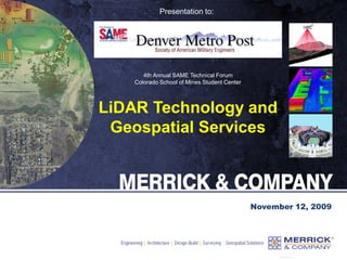
  • 1. Presentation to: November 12, 2009 4th Annual SAME Technical Forum Colorado School of Mines Student Center LiDAR Technology and Geospatial Services
  • 2. Merrick & Company  Corporate Headquarters: Aurora, Colorado  Founded in 1955, incorporated in 1959  Primary Services: • Architecture • Civil Engineering • Facilities Engineering • GeoSpatial Solutions (GSS) • Process Engineering  > 450 employees at 9 national & 2 int’l offices  FY09 Revenue = $102M  Ownership: Private (employee-owned)
  • 3. What is LiDAR? Why use LiDAR? Examples of LiDAR Data LiDAR Processing Software LiDAR Products and Applications Types of LiDAR Collections Multi-Sensor Fusion The future of LiDAR and Geospatial Services Agenda
  • 4. What is LiDAR? Light Detection And Ranging  An ultra efficient technology used to collect three dimensional elevation data from ground or aerial based acquisitions  The technology of using pulses of laser (light) striking the surfaces of the earth and measuring the time of pulse return  Used for very rapid collections of highly accurate XYZ digital map data  LiDAR acquisition system includes:  Laser emitter and detector - both occur at a rapid rate (hundreds of thousands a time per second)  Scanning system to distribute the laser shots across the ground or target, typically in a somewhat evenly dispersed pattern  GPS (Global Positioning System) for XYZ  IMU (Inertial Measurement Unit) for ΩΦΚ
  • 5. LiDAR LiDAR Cost effective method for collecting millions to billions of elevation points Technology includes: Airborne GPS Inertial Measurement Unit Limited ground control Pulsed laser detection technology
  • 6. LiDAR LiDAR Cost effective method for collecting millions to billions of elevation points Technology includes: Airborne GPS Inertial Measurement Unit Limited ground control Pulsed laser detection technology
  • 7. LiDAR Cost effective method for collecting millions to billions of elevation points Technology includes: Airborne GPS Inertial Measurement Unit Limited ground control Pulsed laser detection technology LiDAR
  • 8. How LiDAR Works 1. Laser pulse leaves plane How points are created:
  • 9. 1. Laser pulse leaves plane 2. Pulse reflects off objects How points are created: How LiDAR Works
  • 10. 1. Laser pulse leaves plane 2. Pulse reflects off objects 3. Return pulses collected How points are created: How LiDAR Works
  • 11. 1. Laser pulse leaves plane 2. Pulse reflects off objects 3. Return pulses collected 5. Returns processed with GPS and IMU information to form very accurate XYZ data How points are created: 4. Time of laser shot “trip” is calculated and converted into range (i.e. distance) How LiDAR Works
  • 12. Benefits of LiDAR Traditional photogrammetric collection Angle of incidence Leaf-off preferred Few ground points in obscured areas Different contour accuracy specification (1/2 tree stand height) Stereo model Stereo model Ground points collected
  • 13. Laser swath Laser swath Ground points collected LiDAR Collection Advantages Angle of incidence Leaf-off not required Ground points in stand areas Above ground feature returns also collected for additional applications Benefits of LiDAR
  • 14. LiDAR System Equipment  LiDAR  Merrick uses three types:  ALS40 (52 KHz per sec)  ALS50 (85 KHz per sec)  ALS50-II+ (150 KHz per sec)  Swath width capable of up to 75 degrees  Capable of scanning up to 70 times per second  Includes an IMU (inertial measurement unit)  Altitudes up to 6,100 meters AGL  Flight navigation system  Aircraft  GPS
  • 15. LiDAR System Configurations With Merrick’s Digital Aerial Camera System (DACS) With multi-sensor payload
  • 16. Uses For LiDAR Data Floodplain management Topographic surveys Hydrological modeling Viewshed analysis All facets of 3D planning Pre or post construction visibility analysis Cell tower placement Forest management Powerline corridor obstruction management Supply surface to orthorectify imagery to and make as accurate as possible Ground elevation measurements which will be used to generate contour deliverables Building, tree, or any other vertical feature model with accurate elevation 3D data for modeling purposes to be used by police, fire, emergency management, defense, etc. Slope, erosion, landslide, etc. prediction modeling and analysis Building, vegetation, powerline, roadway, etc. inventory and assessment
  • 17.  Better than:  Free DEM data  Photogrametrically compiled DTM data  Faster collection than ground crew survey data  Cheaper than other competing forms of DEM collection  No film to loose or damage  Accuracy (+/- 0.25’ or better)  Vegetation Penetration  Can collect in between trees better than stereo models  Collects ancillary data about trees, buildings, powerlines, etc.  Acquisition Efficiencies  Collects millions/billions of XYZ data  Not constrained by typical sun angle window for imagery collection  possibility of multiple shifts throughout 24-hr day  avoids daytime weather issues  avoid air traffic in congested areas  More detail (resolution) than any other type of collection Why use LiDAR? 17,677 Square Miles of LiDAR @ 1.4 m GSD
  • 18. LiDAR compared to a USGS DEM 30m USGS DEM of Story, WY Data courtesy of USDA-NRCS
  • 19. LiDAR compared to a USGS DEM LiDAR DEM of Story, WY Data courtesy of USDA-NRCS
  • 24. • Color by: - Elevation - Intensity - Classification - Flightline LiDAR Color Visualization
  • 25. • View by: - Point cloud - 2D orthographic - 3D perspective - TIN rendered LiDAR Viewing Capabilities
  • 26. • Orthographic display and a cross section window simultaneously • The cross section can be switched to a line profile view LiDAR Cross Section & Profiling
  • 27. • Auto classification (a.k.a. batch filtering) is used to separate the ground from the above ground features • Manual editing is used to clean up anything that the automated processes did not do correctly LiDAR Auto Classification
  • 30. LiDAR Vegetation Penetration Data Examples Above ground features Ground (bare earth) Both
  • 31. 3D Breakline Example TIN surface with no breaklines TIN surface with breaklines
  • 32. Orthophoto / Contours Breakline Example
  • 33. Hydrological Modeling from LiDAR 1. Orthophoto 2. LiDAR TIN 3. LiDAR bare earth 4. LiDAR hillshade 5. Hydrological model
  • 34. • Contour display tool - Renders with point, TIN, and/or ortho display in 2D or 3D - Selectable settings: • Intervals • Indexes • Minimum contour lengths • Contour by flightlines • Classifications to use for contour generation • Contours can be exported to CAD, GIS, etc. LiDAR Contour Capabilities
  • 36. LiDAR Automated Building Classification • Automated building classification will filter out structures from other canopy or above ground features • The tool works with a from and to classification • The result can be viewed in point or TIN form, with an ortho background, and in 2D orthographic or 3D perspective views
  • 37. Floodplain Mapping LiDAR DEM ± 1’ 10m DEM ± 7’ Above Uncertain Below Images Courtesy of Puget Sound LiDAR Consortium
  • 38. Vegetation Mapping Area shown is part of the Special Recreation Management Area Near Elko, NV Source: BLM Nevada State Office.
  • 43. Classified LiDAR and Bathymetry Classified LiDAR: •Green – above ground •Tan – bare earth •Blue – points in water •Blue line - Thalweg Seamless Bare-earth LiDAR and bathymetric data
  • 44. 3D Image Draped Over LiDAR
  • 48. Multi-Sensor Suite EO Imager Merrick & Company DACS II  7216 x 5472 pixel array, Visible  Field-of-View: 34° degrees  Ground Resolution @ 2500 ft AGL: 0.07 m Source: USA Hyperspectral Imager AISA Eagle, Hawk, Dual  Spectral Range: 400-2400 nm (2.9 nm FWHM)  Field-of-view: 40° degrees  Ground Resolution @ 2500 ft AGL: 0.60 m  Includes algorithms to facilitate target detection and identification Source: Finland 3D Imaging Laser Leica ALS50-II+ Airborne LiDAR  Ground Resolution @ 2500 ft AGL: 1.31 m  Scan Angle Range: 45° degrees  Scan Rate: 5 – 160 scans/second  Eye safe operation above 200 m Source: Switzerland Thermal Imager ITRES TABI 320  Spectral Range: 8-12 µm  Field-of-View: 48° degrees  Ground Resolution  @ 2500 ft AGL: 2.12 m Source: Canada
  • 49. Final Derived Raster and/or Vector Products Spatial Data Fusion Engine Attribute Assignment Vector Processing Feature Extraction Variable Weighting Object Classification Multi-Sensor Data Fusion HSI Imagery HSI Image Classification HSI Image Spatial Query Thermal Imagery Thermal Image Classification Thermal Image Spatial Query EO Imagery EO Image Spatial Query LiDAR LiDAR Auto Filter LiDAR Spatial Query (3D) EO Image Classification
  • 50. The Future of LiDAR and Geospatial Services Courtesy of Riegl USA
  • 51. The Future of LiDAR and Geospatial Services Courtesy of Riegl USA
  • 52. The Future of LiDAR and Geospatial Services 2D profile path 3D i-beam 3D modeling of i-beams with very accurate elevations are extracted by extruding the 2D profile along a path. Courtesy of Riegl USA
  • 53. The Future of LiDAR and Geospatial Services Courtesy of Riegl USA
  • 54. Thank You For Your Time