
Recomendados
Recomendados
Mais conteúdo relacionado
Mais procurados
Mais procurados (18)
Semelhante a GIS For Wildfire
Semelhante a GIS For Wildfire (20)
Mais de Shanake Dissanayake
Último
Último (20)
GIS For Wildfire
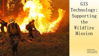
- 1. GIS Technology: Supporting the Wildfire Mission D.M.M Shanake H.W.W Karunarathne H.M Samarapperume
- 2. • Wildfire management plans cannot be effectively developed without comprehensive hazard and risk analysis that identify the potential wildfire impact and values at risk. • An effective hazard assessment requires access to the appropriate data, which may include historical records, vegetation, soils, elevations, imagery, resource values, and weather patterns. • It is difficult to synthesize and analyze complex data to effectively developing a Proper Information System, which being geographically Related.
- 3. • The complexity of wildfires requires the best tools possible for safer, smarter, and more efficient response. • GIS streamlines this process by integrating, storing, and analyzing all the data necessary to quickly response to a hazardous situation. • Wild land firefighters often find it difficult or impossible to maintain complete situational awareness such as smoke, Understand terrain, unreliable radio communications. • GIS can provide situational awareness for personnel on the scene and in supervisory positions.
- 5. • GIS provides information that incorporates multiple datasets to help, define safe and achievable objectives. • A GIS- enabled display supplies situational awareness through the fusion of data on vegetation, resource values, fuel inventories, topography, GPS, and so on. • During fire suppression operations, a GIS-based situational awareness display enables operations personnel to quickly see and understand values at risk, safety zones, escape routes, risk assessments, fuel breaks, predicted spread, and so on.
- 6. • Examples of how GIS provides accurate situational awareness Maintaining and displaying the status of emergency and nonemergency events. Designating and mapping incident locations/perimeters. Displaying key incident facilities. Incident base. Evacuation sites. Staging areas. Drop points. Division and branch boundaries. Heliports/Helispots. Temporary medical facilities.
- 7. • Maintaining and displaying the status of incident resources. • Displaying predicted perimeter growth models. • Importing and displaying incident updates and damage assessments from other mobile devices (real-time). • Displaying and Analyzing appropriate action plan maps for Incidents.
- 8. • GIS is used to model wildfire intensity, growth and determine critical areas. • These GIS models can also be used in training exercises to determine appropriate actions in hazardous areas. • The System can also use for Managing large numbers of different types of resources wild land fire management. • Resources can include fire suppression as well as civilian assets. • Can integrated into GIS and made accessible based on location.
- 9. • GIS applications can provide powerful support for tactical operations. They are deployed on all types of mobile ex: handheld devices • Mobile GIS software included. • Mobile situational awareness for field personnel. • Understand Landscape and access Identification. • Damage assessment. • Rehabilitation.
- 11. • Technology will never replace human decision makers. However, it can fill many gaps, which enables better decision making under stressful, time- sensitive conditions. It allows fire personnel to make more accurate, safer, and better coordinated decisions. Today, GIS provides a system that supports all aspects of the wildfire mission.
- 12. Thank You