Katelyn Tarrio MAS 2017
•
1 gostou•424 visualizações

Presentation at Massachusetts Sustainable Communities and Campuses Conference on March 17, 2017

Recomendados
Mais conteúdo relacionado
Mais procurados
Mais procurados (11)
Destaque
Destaque (20)
Semelhante a Katelyn Tarrio MAS 2017
Semelhante a Katelyn Tarrio MAS 2017 (20)
Mais de GWT
Mais de GWT (20)
Último
Último (20)
Katelyn Tarrio MAS 2017
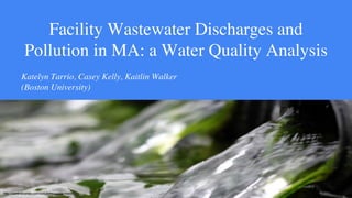
- 1. Facility Wastewater Discharges and Pollution in MA: a Water Quality Analysis Katelyn Tarrio, Casey Kelly, Kaitlin Walker (Boston University) http://www.econse.com/solutions/waste-water/
- 3. Research objectives • Identify facilities that could be contributing to a waterbody impairment via permit violation —Analyze trends at these sites ➢ Pollutant types ➢ Annual pollutant loads ➢ Compliance history • Note areas for future research Charles River Pollution Control Facility (Google Earth)
- 4. Methods 1. Use DMR pollutant loading tool to identify/filter facilities 2. Map sites alongside impaired waterbodies (MassDEP’s 2014 Integrated List of Waters 305b/303d) 3. Assess facility-specific trends from EPA’s Discharge Monitoring Report (DMR) and Enforcement and Compliance History Online (ECHO)
- 5. Results Facility Town Westfield Wastewater Treatment Plant Westfield Westerly Wastewater Treatment Facility Marlborough Charles River Wastewater Treatment Facility Medway Massachusetts Correctional Institution (MCI) Norfolk/Walpole New Bedford Wastewater Treatment Facility New Bedford
- 6. Westfield Wastewater Treatment Facility 0 5000 10000 15000 20000 25000 30000 35000 40000 45000 2012 2013 2014 2015 2016 Poundsperyear(lb/yr) Year Nitrogen (as Ammonia) Load Total pounds discharged Maximum allowable load
- 7. Charles River Wastewater Treatment Facility 0 1000 2000 3000 4000 5000 6000 7000 2012 2013 2014 2015 2016 Poundsperyear(lb/yr) Year Phosphorus Load Total pounds discharged Maximum allowable load
- 8. MA Correctional Institution (Norfolk/Walpole) 0 20 40 60 80 100 120 2012 2013 2014 2015 2016 Poundsperyear(lb/yr) Year Aluminum Load Total pounds discharged Maximum allowable load
- 9. New Bedford Wastewater Treatment Facility * = Over limit at some time during year 0 1000000 2000000 3000000 4000000 5000000 6000000 2012 2013* 2014* 2015* 2016* Poundsperyear(lb/yr) Year Total suspended solids load Total pounds discharged Maximum allowable load
- 10. Westerly Wastewater Treatment Facility 0 1000 2000 3000 4000 5000 6000 2012 2013* 2014 2015 2016* Poundsperyear(lb/yr) Year Phosphorus Load Total pounds discharged Maximum allowable load * = Over limit at some time during year
- 11. Conclusion and Future Work Major findings: • Pollutant trends: some facilities consistently in violation • 26% of sites discharging to impaired waters have expired permits • Demonstrates a practical, visual method of water quality analysis Ø Moving forward: data clarification and community engagement
- 12. Thank You