Robert Banick, GFDRR, Observe, a new OSM data collection app | SotM Asia 2017

State of the Map Asia (SotM-Asia) is the annual regional conference of OpenStreetMap (OSM) organized by OSM communities in Asia. First SotM-Asia was organized in Jakarta, Indonesia in 2015, and the second was organized in Manila, Philippines in 2016. This year’s conference, third in the series, was organized in Kathmandu, Nepal on September 23 – 24, 2017 at Park Village Resort, Budhanilkantha, Kathmandu, Nepal. We brought nearly 200 Open Mapping enthusiasts from Asia and beyond to this year’s SotM-Asia. The event provided an opportunity to share knowledge and experience among mappers; expand their network; and generate ideas to expand map coverage and effective use of OSM data in Asian continent. We chose ‘from creation to use of OSM data’ as the theme of this year’s conference, emphasizing on the effective use of OSM data. We also brought together a government panel from four different countries in this year’s SotM-Asia. We believe this event will deepen the bond and enhance collaboration among OSM communities across Asia. More information about the conference can be found on: http://stateofthemap.asia.

Recomendados
Recomendados
Mais conteúdo relacionado
Mais de Kathmandu Living Labs
Mais de Kathmandu Living Labs (20)
Último
Último (20)
Robert Banick, GFDRR, Observe, a new OSM data collection app | SotM Asia 2017
- 2. Open, user friendly app, that allows users to collect detailed map point data, OSM or otherwise, in offline areas and bring that data back into OSM and organizations’ private databases.
- 3. Who Am I?
- 5. • Our focus: Disaster resilience and disaster management • Our method: Collect open data, create open source tools, work with open communities like yourselves. Connect everything back to governments and development agencies
- 6. • Past projects: Ramani Huria, KLL, OpenDRI Sri Lanka, and many others! • Past software: GeoNode, InaSAFE, ThinkHazard!
- 7. Why Observe?
- 8. • Offline functionality • Path to peer-to-peer • iD data presets in the field • Mixed OSM and organization data • Structured surveys and focused editing • Map oriented What Observe Provides
- 9. Offline Functionality Observe provides users with the ability to add data to any map based point, OSM or otherwise in an offline environment. Data collected is simply stored to the mobile phone. This allows users to work in the field for as long as they want with no risk of lost data.
- 10. 2-Way Syncing Our method of syncing involves both pulling new data from the desktop app and pushing data to it automatically, at the same time. Having this also helps mitigate data loss.
- 11. “Observations” • Observe allows any piece of data to be attached to any map point, OSM or otherwise. • Observations are not limited to their size (an observation could be a full survey or just a simple note). • There is no limit to the number of observations a point could have, allowing for things like time series data.
- 12. The Details
- 13. WARNING: BETA
- 14. We built both a desktop and mobile application to meet the needs of users working in offline environments.
- 15. Focus on simplicity and the user experience.
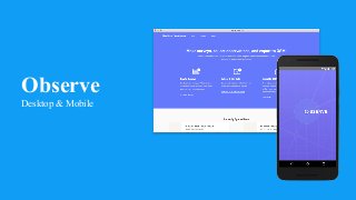
- 16. The Desktop App
- 18. Features (surveys) • Specify and download maps + OSM data for an area of interest • Upload custom surveys (XLSForm specifications) • Edit available OSM fields (YAML format) • Sync data to mobile phones in the field and gather data from mobile phones
- 19. Features (data) • Filter data • Export data back to OSM and/or organization in all your favorite formats • Separate OSM data and private data from within the same survey
- 20. The Future Because this product is built as an electron app, this gives us an easy path to be able to sync with the cloud in the near future. So, integration between remote cloud management, field survey managers and users in the field.
- 21. Mobile App
- 22. Features • Filter available points by geography / attribute • Add observations to any point, OSM or otherwise • View observations - both your own and others • Store offline data until wifi is available • Sync new surveys and areas of interest with desktop app • See how complete a survey observation is
- 24. Focused Editing
- 25. How they’re built • React Native - use lots of tools from JS ecosystem (OSM P2P and others) • P2P • Mapbox GL - better map user experience than previous data collection apps • JS Node • Electron • P2P Mobile App Desktop App
- 26. Pain Points • React Native - introduces lots of abstractions between JS and Android that causes issues. • Performance – not good enough yet.
- 27. Next Steps
- 28. • Make it real - see how it’s used • Make it faster • Make the electron app work in the cloud • Enable P2P functionality • Fully enable offline functionality • Lines / polygons • Can we make this a general purpose OSM “power” editing app? Our Roadmap