SlideShare uma empresa Scribd logo
1 de 85
• Geologic Time Scale:
• Its History and Development
Scottish geologist James Hutton (1726-1797) set the stage
for the development of the geologic time scale in the late
18th century with the publication of his Theory of the Earth
(1785). In it, Hutton advanced "uniformitarianism," a
geological doctrine which basically assumes that current
geologic processes, occurring at the same rates observed
today, in the same manner, account for all of Earth's
geological features, a principle later championed by British
geologist Sir Charles Lyell (1797-1875). Next, British civil
engineer, surveyor and amateur geologist William Smith
(1769-1839) made the discovery that fossils are found
buried in a definite order. The geologic time scale was
developed shortly thereafter.
• Geologic Time Scale
• The earth's crust consists of many layers of
sedimentary rock (called "strata"). Geologists
assume that each layer represents a long period
of time, typically millions of years. This is
actually a secondary assumption based upon
the primary assumption of Uniformitarianism.
These layers of sedimentary rock contain billions
of fossil remains and some of these fossils are
unique to certain layers. The layers are
catalogued and arbitrarily arranged into a
specific order (not necessarily the order in which
they are found). This order reflects the
assumption of macro-evolution (the widely held
notion that all life is related and has descended
from a common ancestor).
• A variety of fossils from each layer of strata have been
chosen to be what are called "index fossils". Index fossils
are how we date the sedimentary rock layers.
Paleontologists assume the age of an index fossil by the
stage of evolutionary history the fossil is assumed to be
in. They guess how long it would take for one kind of life
to evolve into another kind of life and then date the
fossils and rocks accordingly. Once again, this is a
circular argument. "And this poses something of a
problem: If we date the rocks by the fossils, how can we
then turn around and talk about the patterns of
evolutionary change through time in the fossil record?"
(Niles Eldridge, Time Frames, 1985, p. 52)
• Geologic Time Scale: Circular Reasoning
• The geologic time scale employs yet another circular argument.
We determine the age of the rock by the assumed age of the index
fossils it contains, then, to determine the age of all the other fossils
in the same layer of rock, The succession of organisms has been
determined by a study of their remains embedded in the rocks, and
the relative ages of the rocks are determined by the remains of
organisms that they contain." (R. H. Rastall, "Geology",
Encyclopedia Britannica, vol. 10, 1954, p. 168)
• The remains of a once-living organism, generally taken to be one
that lived prior to the end of the last glacial period, i.e. fossils are
older than 10 000 years. The term includes skeletons, tracks,
impressions, trails, borings and casts. Fossils are usually found in
consolidated rock, but not always (e.g. woolly mammoths living 20
000 years ago were recovered from the frozen tundra of Siberia).
In its original sense, fossil meant anything dug up from the earth,
including ores, precious stones, etc. The modern use of the word
dates from the late 17th century.
Geological time scale
• The earth's crust consists of many layers of sedimentary rock
(called "strata"). Geologists assume that each layer
represents a long period of time, typically millions of years.
Scottish geologist James Hutton (1726-1797) set the stage for
the development of the geologic time scale in the late 18th
century with the publication of his Theory of the Earth (1785).
• The geologic time scale provides a system of chronologic
measurement relating stratigraphy to time that is used by
geologists, paleontologists and other earth scientists to
describe the timing and relationships between events that
have occurred during the history of the Earth.
• It is a period of time covering the physical formation and
development of Earth, especially the period prior to human
history.
• Evidence from radiometric dating indicates that the Earth is
about 4.570 billion years old.
William Smith's monograph on identifying strata based on fossils
(The remains of a once-living organism is called fossil)
Chalk Layers in Cyprus - showing sedimentary layering
• ice age
Any geologic period during which thick ice sheets cover vast areas of land.
Such periods of large-scale glaciation may last several million years and
drastically reshape surface features of entire continents. A number of
major ice ages have occurred throughout the Earth's history; the most
recent periods were during the Pleistocene Epoch (1.8 million–10,000
years ago).
• Pollination is only a
stage towards
fertilization (the
meeting of the male
and female sex
cells). The male sex
cell is inside the
pollen grain which is
on the surface of the
stigma. The female
sex cell (the ovule) is
inside the carpel in a
different part of the
flower.
• The living pollen grain of an angiosperm has a wall that
is made up of two layers. The outer layer is called the
exine and is composed of a very unusual substance,
sporopollenin.
• The inner layer, or intine, of the pollen wall is made of
cellulose and is very similar in construction to an
ordinary plant cell wall. During fossilization only the
resistant sporopollenin-containing exine remains, and it
is this that carries the characteristic form and sculpture
which permits the identification of pollen grains.
• Sporopollenin and sporopollenin-like materials are found
in the spores of such widely separated groups as algae,
fungi, pteridophytes and angiosperms. Their chemical
stability means they survive even in ancient fossils, and
a substance which appears similar to modern
sporopollenin has been recovered from some of the
oldest sedimentary rocks in the world.
Trilete spore
Temporina globate(a) Corrugatisporites turpitus Tricolpites tressireticulatus Dyadoporonites sp(f) Dyadoporonites sp(f)
Pollens
Octaplata palanaensis(a) Octaplata palanaensis(a)
Dyadoporonites sp(f) Dyadoporonites sp(f) Dyadoporonites sp(f)
Dyadoporonites sp(f) Corrugatisporites turpitus(p) Striatriletes sp(p) Polypodiisporites sp.(p) Striatriletes indicus(p)
Aegicerus sp
Heritiera sp Aegicerus comiculatum
Xylicarpus sp Phoenix paludosa
Lumnitzera racemosa
• Sporopollenin is a
major component of
the tough outer (exine)
walls of spores and
pollen grains. It is
chemically very stable
and is usually well
preserved in soils and
sediments. The exine
layer is often intricately
sculptured in species-
specific patterns (see
image at right),
allowing material
recovered from (for
example) lake
sediments to provide
useful information
about plant and fungal
populations in the
past.
• Modern dating methods
• Radiometric dating has been carried out since
1905 when it was invented by Ernest Rutherford
as a method by which one might determine the
age of the Earth. In the century since then the
techniques have been greatly improved and
expanded.[14] Dating can now be performed on
samples as small as a billionth of a gram using a
mass spectrometer. The mass spectrometer
was invented in the 1940s and began to be used
in radiometric dating in the 1950s.
• Uranium-lead dating method
• The uranium-lead radiometric dating scheme has been refined to
the point that the error margin in dates of rocks can be as low as
less than two million years in two-and-a-half billion years. An error
margin of 2–5 % has been achieved on younger Mesozoic rocks.
• Uranium-lead dating is often performed on the mineral zircon
(ZrSiO4).
• Samarium-neodymium dating method
• This involves the alpha-decay of 147Sm to 143Nd with a half life of
1.06 x 10¹¹ years. Accuracy levels of less than twenty million years
in two-and-a-half billion years are achievable.
• Potassium-argon dating method
• This involves electron capture or positron decay of potassium-40 to
argon-40. Potassium-40 has a half-life of 1.3 billion years, and so
this method is applicable to the oldest rocks. Radioactive
potassium-40 is common in micas, feldspars, and hornblendes,
though the closure temperature is fairly low in these materials, about
125°C (mica) to 450°C (hornblende).
• Rubidium-strontium dating method
This is based on the beta decay of rubidium-87 to strontium-87, with
a half-life of 50 billion years. This scheme is used to date old
igneous and metamorphic rocks, and has also been used to date
lunar samples. Closure temperatures are so high that they are not a
concern. Rubidium-strontium dating is not as precise as the
uranium-lead method, with errors of 30 to 50 million years for a 3-
billion-year-old sample.
• Uranium-thorium dating method
• A relatively short-range dating technique is
based on the decay of uranium-234 into thorium-
230, a substance with a half-life of about 80,000
years. It is accompanied by a sister process, in
which uranium-235 decays into protactinium-
231, which has a half-life of 34,300 years.
• While uranium is water-soluble, thorium and
protactinium are not, and so they are selectively
precipitated into ocean-floor sediments, from
which their ratios are measured. The scheme
has a range of several hundred thousand years.
• Radiocarbon dating method
• Carbon-14 is a radioactive isotope of carbon, with a half-life of 5,730
years, which is very short compared with those above. In other
radiometric dating methods, the heavy parent isotopes were
synthesized in the explosions of massive stars that scattered
materials through the universe, to be formed into planets and other
stars. The parent isotopes have been decaying since that time, and
so any parent isotope with a short half-life should be extinct by now.
Carbon–14 is an exception. It is continuously created through
collisions of neutrons generated by cosmic rays with nitrogen in the
upper atmosphere. The carbon-14 ends up as a trace component in
atmospheric carbon dioxide (CO2).
• An organism acquires carbon during its lifetime. Plants acquire it
through photosynthesis, and animals acquire it from consumption of
plants and other animals. When an organism dies, it ceases to take
in new carbon-14, and the existing isotope decays with a
characteristic half-life (5730 years). The proportion of carbon-14 left
when the remains of the organism are examined provides an
indication of the time elapsed since its death. The carbon–14 dating
limit lies around 58,000 to 62,000 years.
• The rate of creation of carbon-14 appears to be roughly constant, as
cross-checks of carbon–14 dating with other dating methods show it
gives consistent results. However, local eruptions of volcanoes or
other events that give off large amounts of carbon dioxide can
reduce local concentrations of carbon–14 and give inaccurate dates.
The releases of carbon dioxide into the biosphere as a
consequence of industrialization have also depressed the proportion
of carbon-14 by a few percent; conversely, the amount of carbon-14
was increased by above-ground nuclear bomb tests that were
conducted into the early 1960s. Also, an increase in the solar wind
or the Earth's magnetic field above the current value would depress
the amount of carbon-14 created in the atmosphere. These effects
are corrected for by the calibration of the radiocarbon dating scale.
Chlorine-36 dating method
• Large amounts of otherwise rare 36Cl were produced by irradiation
of seawater during atmospheric detonations of nuclear weapons
between 1952 and 1958. The residence time of 36Cl in the
atmosphere is about 1 week. Thus, as an event marker of 1950s
water in soil and ground water, 36Cl is also useful for dating waters
less than 50 years before the present. 36Cl has seen use in other
areas of the geological sciences, including dating ice and
sediments.
• Fission track dating method
• Apatite crystals are widely used in fission track dating.
• This involves inspection of a polished slice of a material to
determine the density of "track" markings left in it by the
spontaneous fission of uranium-238 impurities. The uranium content
of the sample has to be known, but that can be determined by
placing a plastic film over the polished slice of the material, and
bombarding it with slow neutrons. This causes induced fission of
235U, as opposed to the spontaneous fission of 238U. The fission
tracks produced by this process are recorded in the plastic film. The
uranium content of the material can then be calculated from the
number of tracks and the neutron flux.
• This scheme has application over a wide range of geologic dates.
For dates up to a few million years micas, tektites (glass fragments
from volcanic eruptions), and meteorites are best used. Older
materials can be dated using zircon, apatite, titanite, epidote and
garnet which have a variable amount of uranium content.[26]
Because the fission tracks are healed by temperatures over about
200°C the technique has limitations as well as benefits. The
technique has potential applications for detailing the thermal history
of a deposit.
• Plate tectonic Theory
• The rigid lithospheric slabs or rigid and solid crustal layers are
tectonically called ‘plates’. The whole mechanism of the
evolution, nature and motion of plates and resultant reactions
is called plate tectonics. Moving over the weak asthenosphere,
individual lithospheric plates glide slowly over the surface of
the globe: much as a pack of ice of the Arctic Ocean drifts
under the dragging force of currents and winds.
• Plate tectonic theory, a great scientific achievement of the
decade of 1960s, is based on two major scientific concepts:
(1) the concept of continental drift and (2) the concept of sea-
floor spreading. Six major and 20 minor plates are identified so
far (Eurasian plate, Indo-Australian plate, American plate,
Pacific plate, African plate, Antarctic plate).
• These slabs rest upon a layer of heated, pliable rock called the
asthenosphere, which flows slowly like hot tar. A popular
theory is that the movement of the thick, molten material in the
asthenosphere forces the upper plates to shift, sink, or rise.
• The basic concept behind plate tectonics is simply that heat
rises. Hot air rises above cool air, and warm water currents
flow above cold water. The same is true of the heated rock
below the earth’s surface. The asthenosphere’s molten
material, or magma, pushes upwards, while cooler,
hardened matter sinks deeper into the mantle.
• Hot material in the mantle rises to the base of the
lithosphere, where it than moves laterally, cools, and
descends to become reheated, so the cycle begins again.
The regular flow circuit of rising warm fluid and sinking cold
fluid, roughly circular motion, is called a convection current.
• Sinking rock eventually reaches the extremely hot
temperatures of the lower asthenosphere, heats up, and
begins to rise again.. At diverging plate boundaries and at
hot spots in the otherwise solid lithosphere, molten material
wells up to the surface, forming a new crust.
Number of Plates in the Earth
• Major plates
• Depending on how they are defined, there are usually seven or eight
• "major" plates:
• African Plate
• Antarctic Plate
• Indo-Australian Plate, sometimes subdivided into:
– Indian Plate
– Australian Plate
• Eurasian Plate
• North American Plate
• South American Plate
• Pacific Plate
• Minor plates
• There are dozens of smaller plates, the seven largest of which are:
• Arabian Plate
• Caribbean Plate
• Juan de Fuca Plate
• Cocos Plate
• Nazca Plate
• Philippine Sea Plate
• Scotia Plate
Plate tectonics: The main features are:
1. The Earth's surface is made up of a series of large plates (like pieces of a giant
jigsaw puzzle).
2. These plates are in constant motion travelling at a few centimetres per year.
3. The ocean floors are continually moving, spreading from the centre and sinking at
the edges.
4. Convection currents beneath the plates move the plates in different directions.
The source of heat driving the convection currents is radioactive decay which is
happening deep in the Earth.
• Convection Currents
• Very slow convection currents flow in this plastic
layer, and these currents provide horizontal
forces on the plates of the lithosphere much as
convection in a pan of boiling water causes a
piece of cork on the surface of the water to be
pushed sideways
It may be mentioned that the term plate was first used by Canadian
geophysicist J.T.Wilson in 1965. He postulated a ‘paving stone’
hypothesis wherein the oceanic crust was considered to be newly
formed at mid-oceanic ridges and destroyed at the trenches. It may
be highlighted that the plate margins are most important because
all tectonic activities occur along the plate margins e.g. seismic
events, vulcanicity, mountain building, faulting etc.
1. Constructive Plate Margins: These are also called as “divergent
plate margins” or accreting plate margins. These represent zones
of divergence where there is continuous upwelling of molten
material (lava) and thus new oceanic crust is continuously formed.
In fact, oceanic plates split apart along the mid-oceanic ridges and
move in opposite directions.
2. Destructive Plate Margins: These are also called “ convergent plate
margins” or “ consuming plate margins” because two plates move
towards each other or two plate converge along a line and leading
edge of one plate overrides the other plate and the overridden
plate is subducted or thrust into the mantle and thus part of the
crust (plate ) is lost in the mantle.
3. Conservative Plate Margins: These are also called as shear plate
margins. Here, two plates pass or slide past one another along
transform faults and the thrust crust is neither created nor
destroyed.
Plate Boundaries
• Plate boundaries do not necessarily match
the coastlines of continents. A plate can
consist of continental crust, oceanic crust,
or both. In most cases, continents are part
of larger plates that extend for hundreds of
miles offshore. Many plate boundaries are
far out in the middle of the ocean. There
are three types of plate boundaries:
divergent, convergent, and transform.
• Iceland is splitting along the
Mid-Atlantic Ridge - a
divergent boundary between
the North American and
Eurasian Plates. As North
America moves westward
and Eurasia eastward, new
crust is created on both sides
of the diverging boundary.
While the creation of new
crust adds mass to Iceland
on both sides of the
boundary, it also creates a rift
along the boundary. Iceland
will inevitably break apart into
two separate land masses at
some point in the future, as
the Atlantic waters eventually
rush in to fill the widening and
deepening space between.
• When an oceanic plate pushes into
and subducts under a continental
plate, the overriding continental plate
is lifted up and a mountain range is
created. Even though the oceanic
plate as a whole sinks smoothly and
continuously into the subduction
trench, the deepest part of the
subducting plate breaks into smaller
pieces. These smaller pieces
become locked in place for long
periods of time before moving
suddenly and generating large
earthquakes. Such earthquakes are
often accompanied by uplift of the
land by as much as a few meters.
When two oceanic plates converge
one is usually subducted under the
other and in the process a deep
oceanic trench is formed. The
Marianas Trench, for example, is a
deep trench created as the result of
the Phillipine Plate subducting under
the Pacific Plate.
• When two continents meet head-on, neither is subducted
because the continental rocks are relatively light and, like
two colliding icebergs, resist downward motion. Instead,
the crust tends to buckle and be pushed upward or
sideways. The collision of India into Asia 50 million years
ago caused the Eurasian Plate to crumple up and override
the Indian Plate. After the collision,- the slow continuous
convergence of the two plates over millions of years
pushed up the Himalayas and the Tibetan Plateau to their
present heights. Most of this growth occurred during the
past 10 million years.
Divergent Plate boundary
Oceanic-Oceanic
Continent-Continent
The concept of sea-floor spreading was first
propounded by Prof. Harry Hess of the Princeton
University in the year 1960. He discovered that
the mid-oceanic ridges were situated on the
rising thermal convection currents coming up
from the mantle. The oceanic crust moves in
opposite directions from mid-oceanic ridges.
These molten lavas cool down and solidify to
form new crust along the trailing ends of
divergent plates (oceanic crust). Thus, there is
continuous creation of new crust along the mid-
oceanic ridges and the expanding crust (plates)
are destroyed along the oceanic trenches.
These facts proves that the continents and
ocean basins are in constant motion.
• Sea-floor spreading is the
process in which the ocean floor is
extended when two plates move
apart. As the plates move apart,
the rocks break and form a crack
between the plates. Earthquakes
occur along the plate boundary.
Magma rises through the cracks
and seeps out onto the ocean
floor like a long, thin, undersea
volcano.
•
• As magma meets the water, it
cools and solidifies, adding to the
edges of the sideways-moving
plates. As magma piles up along
the crack, a long chain of
mountains forms gradually on the
ocean floor. This chain is called
an oceanic ridge.
• Sea-floor spreading:
• The rocks nearest the
ridge were relatively
young, but the rocks
aged as the distance
from the ridge increased.
In addition, marine
sediment was thicker
and older further from
the ridge, whereas the
ridge itself had virtually
no deposits of sediment.
These observations,
added to those of the
heat flow at the ridge,
confirmed the creation of
new crust at mid-ocean
ridges and the
mechanism of seafloor
spreading.
• As the rift valley expands two
continental plates have been
constructed from the original one. The
molten rock continues to push the crust
apart creating new crust as it does.
This is an example of a divergent plate
boundary (where the plates move away from
each other). The Atlantic Ocean was created by
this process. The mid-Atlantic Ridge is an area
where new sea floor is being created.
As the rift valley expands, water collects
forming a sea. The Mid-Atlantic Ridge is
now 2,000 metres above the adjacent
sea floor, which is at a depth of about
6,000 metres below sea level.
The sea floor continues to spread
and the plates get bigger and
bigger. This process can be seen
all over the world and produces
about 17 square kilometres of new
plate every year.
• Since World War ll, various ocean scientific data were collected and
analyzed but no unifying view emerged until the 1960s when the
seafloor spreading mechanism was first proposed based on data
from the Atlantic Ocean.
• New seafloor forms along the mid-Atlantic Ridge and pushes the
older Atlantic seafloor farther away from each other, thereby,
increasing the size of the Atlantic Ocean floor, and hence the Atlantic
Ocean basin.
• By implication, any continent attched to the edge of that ocean basin
will be pushed apart too.
Sea floor Spreading.
The boundaries where the plates move apart are 'constructive' because
new crust is being formed and added to the ocean floor. The ocean floor
gradually extends and thus the size of these plates increases. As these
plates get bigger, others become smaller as they melt back into the
Earth in the process called subduction.
The new rock at the edge has no sediments like the sand or mud,
since it is formed only recently. Farther away from the ridge, sand and
mud gradually settle on it, in an ever-thickening blanket. The oldest
rocks may have 14,000 feet of sand and other sediments resting on top
of it.
An example of an oceanic ridge is the Mid-Atlantic Ridge. It is one
part of a system of mid-oceanic ridges that stretches for 50,000 miles
through the world's oceans. The underwater mountains of the ridge may
not be more than two miles higher than the surrounding sea floor.
On the whole, sea-floor spreading is basically volcanic, but it is a
slow and regular process, without the explosive outbursts of the
volcanoes on land.
• Most transform faults are
found on the ocean floor.
They commonly offset active
spreading ridges, producing
zig-zag plate margins, and
are generally defined by
shallow earthquakes. A few,
however, occur on land. The
San Andreas fault zone in
California is a transform fault
that connects the East
Pacific Rise, a divergent
boundary to the south, with
the South Gorda -- Juan de
Fuca -- Explorer Ridge,
another divergent boundary
to the north.
The Earth's crust is divided into huge, thick plates that drift atop
the soft mantle. The plates are made of rock and are from 80 to
400 miles (50 to 250 km) thick. They move both horizontally and
vertically. Over long periods of time, the plates also change in
size as their margins are added to, crushed together, or pushed
back into the Earth's mantle.
Subduction
• The Marianas Trench, just east of the Mariana Islands in the
western Pacific, is the deepest seafloor depression in the world at
11,033 metres (36,198 feet). The Marianas Trench is one of many
deepwater trenches formed by the geologic process of subduction.
During subduction, the edges of plates are subducted, or forced
under, other plates. Ocean crust is drawn down into the mantle and
partially melted.
• An important effect of the melting of subducted ocean crust is the
production of new magma. When subducted ocean crust melts, the
magma that forms may rise from the plane of subduction deep
within the mantle, erupting on the earth’s surface. Eruption of
magma melted by subduction has created long, arc-shaped chains
of volcanic islands, such as Japan, the Philippines, and the
Aleutians. Where an oceanic plate is subducted beneath continental
crust, the magma produced by subductive melting erupts from
volcanoes situated among long, linear mountain chains, such as the
Andes in South America.
• Earthquakes can occur at these plate margins, shifting
plates by up to 5 metres (about 15 feet) at once. Such
faults exist in Chile, Japan, Taiwan, the Philippines,
New Zealand, and Sumatra. When two continental plates
collide, the crust from both plates thrusts upwards,
creating mountain chains. The collision of India with the
Asian continent formed the Himalayas. In fact, the
mountain range is still growing in height today because
India and Asia are still converging.
• At a transform boundary, plates move past each other in
opposite directions. Little volcanic activity accompanies
transform boundaries, but large, shallow earthquakes
can occur. The San Andreas Fault in California (USA), is
the most famous example of this type of boundary. Mid-
ocean ridges are offset by hundreds of small transforms.
• After molten rock reaches the seafloor as
lava, deep ocean water quickly cools and
consolidates the material. To make room
for this continual addition of new crust, the
plates on either side of the ridge must
constantly move apart. In the North
Atlantic, the rate of movement of each
plate is only about 1 to 2 centimetres (0.4
to 0.8 of an inch) per year. In the Pacific,
the rate can be more than 10 centimetres
(about 4 inches) annually.
• Additional evidence for plate tectonics came in
the 1950s and 1960s. During this period,
scientists discovered that all rock fragments
maintain a set magnetic pattern based on when
the rocks formed. Geophysicists also learned
that the earth’s magnetic field had reversed
between north and south dozens of times over
millions of years. With this knowledge, they
examined both sides of ocean ridges and found
that the rocks on one side of the ridge produced
a mirror-image geomagnetic pattern of the rocks
on the other side.
• Continental Drift Theory
• In 1915, the German geologist and meteorologist Alfred Wegener first
proposed the theory of continental drift, which states that parts of the
Earth's crust slowly drift atop a liquid core.
Wegener hypothesized that there was a gigantic supercontinent 200 million
years ago, which he named Pangaea, meaning "All-earth". Sometime in
the past, there was one giant landmass called Pangaea (all land), that was
sorrounded by one giant ocean called Panthalassa. About 200 million
years ago, Pangaea broke up into smaller continents and these continents
have since "drifted" to their present positions.
• Alfred Wegener first thought of this idea by noticing that the
different large landmasses of the Earth almost fit together
like a jigsaw. America fit closely to Africa and Europe, and
Antarctica, Australia, India and Madagascar fitted next to
the tip of Southern Africa. Wegener proposed this in 1912,
but it wasn't considered to be sufficient evidence in itself.
He analysed either side of the Atlantic Ocean for rock type,
geological structures and fossils. He noticed that there was
a significant similarity.
• From 1912, Wegener publicly advocated the theory of "
continental drift", arguing that all the continents were once
joined together in a single landmass and have drifted apart.
• In 1915, in The Origin of Continents and Oceans (Die
Entstehung der Kontinente und Ozeane), Wegener
published the theory that there had once been a giant
continent, he named "Pangaea" (meaning "All-Lands" or
"All-Earth") and drew together evidence from various fields.
Expanded editions during the 1920s presented the
accumulating evidence.
• Pangaea started to break up into two smaller supercontinents, called
Laurasia and Gondwanaland, during the late Triassic. It formed the
continents Gondwanaland and Laurasia, separated by the Tethys Sea.
By the end of the Cretaceous period, the continents were separating
into land masses that look like our modern-day continents.
Evidences:
In accordance with the scientific method, he proceeded to search for
supporting evidences. Among the most compelling evidences he presented
are:
The Fit of the Continents. Wegener noticed that the western coastline of
Africa and eastern coastline of South America appear to strongly match each
other in a way that suggested it could be due to a profound process, beyond
and above mere coincidence. In other words, if the continents were moved to
be positioned side by side, they would fit like a jigsaw puzzle.
Wegener also presented some fossil evidences. One was an animal fossil
and the other was a plant fossil. Mesosaurus was an aquatic dinosaur closely
related to the modern Alligator. The fossil remains are only found near the
eastern side of South America and the adjoining western side of Africa when
the two continents are positioned side by side. Hence, Wegener concluded
that the best explanation for this unusual occurence is that the two continents
were once joined together (or the same landmass), before Mesosuarus
became extinct, until they fractured and drifted away from each other.
Opposing scientists argued that there must have been a land bridge linking
South America and Africa. But no such evidence for a land bridge across the
south Atlantic Ocean has been observed since.
• The other fossil evidence was a common fern tree that is now extinct
called Glossopteris. Glossopteris trees were very widespread in tropical
and subtropical areas during the Paleozoic era. Their remains are now
strewn across the south Atlantic, on the Continents of Africa and South
America.
• Wegener was a meteorologist, so he was particularly interested in
searching for evidences from ancient climates (or paleoclimate). There
are extensive glacial sediments in southern Africa, southeastern South
America, india, and western Australia. These are sediments that exist
only in areas that used to be coverd by glaciers. Although these are
mostly tropical and subtropical lands today, it shows that in the past they
were in much colder latitudes but have since drifted away from those
"cold" latitudes.
• Fossils of plants that formed coal beds indicate that they are typically
tropical trees. But most coal deposits today are on continents located in
colder climates including Antarctica. Wegener's conclusion was that
those continents with the coal deposits were located in tropical latitudes
when the coals beds were being formed. Afterwards, those continents
drifted away from their former positions.
Glossopteris, a tree-like plant from
the Permian Period through the
Triassic Period. It had tongue-
shaped leaves and was about 12 ft
(3.7 m) tall. It was the dominant plant
of Gondwana.
• Eduard Suess was an Austrian
geologist who first realized that
there had once been a land
bridge connecting South
America, Africa, India,
Australia, and Antarctica. He
named this large land mass
Gondwanaland (named after a
district in India where the fossil
plant Glossopteris was found).
This was the southern
supercontinent formed after
Pangaea broke up during the
Jurassic period. Suess based
his deductions on the fossil
plant Glossopteris, which is
found throughout India, South
America, southern Africa,
Australia, and Antarctica.
If you look at the continental boundaries there is much overlap of fossil
assemblages, structures, and rock types up to the time in geologic history when
the plate split apart.
• If you look at glacial deposits from the
past, before the split, there is also
overlap.
• Wegener also used mountain ranges that match across continents.
The Appalachian Mountains trend northeast on the east coast of North
America, and ends abruptly on the coast of Newfoundland, Canada.
When the continents are reassembled into Pangea, the Appalachians
continue uninterrupted into the Caledonides Mountains in Scotland,
Norway, and Sweden. These are mountain ranges that are presently
separated by the Atlantic Ocean.
• In spite of all the evidences presented, Wegener had one major
problem. He could not scientifically explain the mechanism of motion.
By what means could massive chunks of the earth move around?
Wegener's attempt to explain the possible mechanisms of continental
drift was ridiculed as unscientific:
– Centrifugal force due to the earth's rotation pulling continents
westward.
– Tidal drag of the moon pulling continents westward.
– The icebreaker hypothesis claimed that the continents are like
modern icebreaker ships that break through the weaker ocean
crust as the continents drift.
• The age of the sea-floor also supports sea-floor spreading. If sea-
floor spreading operates, the youngest oceanic crust should be
found at the ridges and progressively older crust should be found in
moving away from the ridges towards the continents. This is the
case. The oldest known ocean floor is dated at about 200 million
years, indicating that older ocean floor has been destroyed through
subduction at deep-sea trenches.
• It took exploration of the ocean floor to discover sea-floor spreading,
the mechanism for the movement of continents that Alfred Wegener
lacked. The hypothesis of continental drift gained renewed interest
and, when combined with sea-floor spreading, led to the theory of
plate tectonics. The history of thought about the movement of
continents provides a wonderful example of how hypotheses such
as continental drift and sea-floor spreading are thoroughly tested
before a new theory emerges. For an overview of the history of plate
tectonics, see Tarbuck and Lutgens (1994).
• Fossils of Mesosaurus (one of the first marine reptiles, even older
than the dinosaurs) were found in both South America and South
Africa. These finds, plus the study of sedimentation and the fossil
plant Glossopteris in these southern continents led Alexander
duToit, a South African scientist, to bolster the idea of the past
existence of a supercontinent in the southern hemisphere,
Eduard Suess's Gondwanaland. This lent further support to A.
Wegener's Continental Drift Theory
Plate Boundaries Fit
Plate tectonics was first
proposed in the 1800's by
Antonio Snyder-Pellegrini
based on the fact that the
continents of the Earth fit
together like pieces of a
jigsaw puzzle. Based on
the fit, he proposed that the
continents were once
together, forming a single
large landmass.
• Evidence for continental drift is now extensive. Simila
fossils
are found around different continent shores, suggest
Mesosaurus
, a freshwater reptile rather like a small crocodile, fou
Brazil and South Africa
, are one example; another is the discovery of fossils
reptile Lystrosaurus from rocks
of the same age from locations in
South America, Africa, and Antarctica
. There is also living evidence — the same animals b
earthworm
found in South America and South Africa.
Continental drift
The Triassic Period
248 - 206 million years ago
The Jurassic Period
206-144 million years ago
The Cretaceous Period
144-65 million years ago
• Continental Drift theory:
• The theory of plate tectonics was not widely accepted until the
1960s and 1970s. Before that time, most scientists believed the
earth’s continents and oceans to be stationary. At the beginning of
the 20th century, German meteorologist Alfred Wegener suggested
that all continents had been part of one huge supercontinent,
Pangaea. According to Wegener, about 200 million years ago
Pangaea broke into separate plates that slowly drifted away from
each other, leading to today’s continental arrangement.
• One of Wegener’s most convincing pieces of evidence was the
almost perfect fit between the eastern coast of South America and
the western coast of Africa. To support his theory, he pointed out
that rock formations on opposite sides of the Atlantic—in Brazil and
West Africa—match in age, type, and structure. Also, the formations
often contain fossils of the same terrestrial creatures, indicating that
South America and Africa must have previously been connected.
• In subsequent years, scientific discoveries steadily began to support
the fundamental aspects of Wegener’s theory. Geologists
demonstrated the existence of the slowly moving asthenosphere,
underlying the crust at depths of 50 to 150 kilometres (30 to 80
miles). In addition, scientists in the 1920s used sonar, an echo-
sounding device, to determine ocean depths and map the seafloor.
They concluded that the Mid-Atlantic Ridge, detected in the 19th
century, was part of a worldwide ocean ridge system.
• Bangladesh is divided into two major tectonic units: i)
Stable Pre-Cambrian Platform in the northwest, and ii)
Geosynclinal basin in the southeast. A third unit, a
narrow northeast-southwest trending zone called the
hinge zone separates the above two units almost
through the middle of the country. This hinge zone is
currently known as palaeo continental slope.
Stable Pre-Cambrian Platform in Bangladesh, Stable Pre-
Cambrian Platform refers to the stable shelf of the bengal basin. In
Bangladesh part of the Bengal Basin, the stable shelf can be divided
into three major zones. They are Dinajpur slope, Rangpur Saddle
and Bogra slope. It is composed of continental crust overlain by
Cretaceous (144 to 66 million years ago) to Recent sediment.
However, in isolated basins on the stable shelf, there is Permo-
Carboniferous (360 million years to 245 million years ago)
sediments with considerable amount of coal. The thickness of
sedimentary column on the stable shelf of Bengal Basin varies from
less then 200m to 8,000m.
• foreland basins, which occur on the plate that is subducted or
underthrust during plate collision (i.e. the outer arc of the orogen)
• Examples include the North Alpine Foreland Basin of Europe, or the
Ganges Basin of Asia
• Foreland basins form because as the mountain belt grows, it exerts
a significant mass on the Earth’s crust, which causes it to bend, or
flex, downwards. This occurs so that the weight of the mountain belt
can be compensated by isostasy at the upflex of the forebulge.
• Foreland basin systems:
• The wedge-top sits on top of the moving thrust sheets and contains
all the sediments charging from the active tectonic thrust wedge.
• The foredeep is the thickest sedimentary zone and thickens toward
the orogen. Sediments are deposited via distal fluvial, lacustrine,
deltaic, and marine depositional systems.
• The forebulge and backbulge are the thinnest and most distal zones
and are not always present. When present, they are defined by
regional unconformities as well as aeolian and shallow-marine
deposits.
• Geosynclinal Basin the geosynclinal basin in the
southeast is characterised by the huge thickness
(maximum of about 20 km near the basin centre) of clastic
sedimentary rocks, mostly sandstone and shale of Tertiary
age. It occupies the greater Dhaka-Faridpur-Noakhali-
Sylhet [Silet]-Comilla [Kumilla]-Chittagong areas.
Geosyncline a part of the earth crust that sank deeply through time.
Its length may extend for several thousand kilometres and may
contain sediments thousands of metres thick, representing millions of
years of deposition. A geosyncline generally forms along continental
edges, and is destroyed during periods of crustal deformation, which
often produces folded mountain ranges. Bengal Geosyncline is one of
the world's largest geosyncline that includes the bengal basin and the
bay of bengal. The evolution of the Bengal Basin started in the
Permo-Carboniferous with the sedimentation in the faulted Gondwana
Basins. The break up of the Gondwanaland in the Cretaceous Period
and the marine transgression led to the sedimentation in the Bengal
Geosyncline.
• In geology, a trough generally refers to a linear structural
depression that extends laterally over a distance, while being less
steep than a trench. A trough can be a narrow basin or a geologic
rift. There are various oceanic troughs, troughs found under
oceans.
• A fold can be divided into hinge and limb portions. The
limbs are the flanks of the fold and the hinge is where
the flanks join together. The hinge point is the point of
minimum radius of curvature for a fold. The crest of the
fold is the highest point of the fold surface, and the
trough is the lowest point.
For Bangladesh, the most important one is the Cenozoic era,
because most of the sedimentary layers as well as the geological
structures of the country were formed during this era.
The Cenozoic tectonic evolution of Bangladesh mainly took place at
the end of the Eocene, Middle Miocene, close of the Pliocene and the
early Pleistocene.
During the early Tertiary period (Palaeocene and Eocene epochs)
most of Bangladesh was under open marine condition, which
resulted in the formation of fossiliferous limestone and shale with
some sandstone.
During the late Tertiary period (Oligocene, Miocene and Pliocene
epochs) the open sea retreated to the south in response to the uplift
of the himalayas in the north and river systems built out a large
deltaic land that formed the backbone of the present bengal delta.
Huge successions of alternating sandstone and shale layers now
found on the surface and in the subsurface of eastern and southern
Bangladesh were formed in this delta environment during the Tertiary
period.
• Bengal Basin a term used to describe both a surface
physiographic feature and a geological feature deep
underground. The first is familiar to geographers and the
other to geologists. The geological feature is a
downwarping of the basement rocks beneath central and
southern Bangladesh under pressure of sediments laid
down since the Cretaceous age (63 to 135 million years
before the present). This Basin represents the most
important of the three tectonic divisions of the country.
The deep Basin began forming when Late Cretaceous
orogeny caused the rise of the Arakan Yoma mountains
along the eastern border of Bangladesh, and formed the
Assam Gulf. This Gulf apparently had an ecosystem
conductive to the profuse growth of phyto- and zoo-
planktons and benthic organisms.
• The Earth's Magnetic Field — The Earth's magnetic field is
thought to arise from the movement of liquid iron in the outer core
as the planet rotates. The field behaves as if a permanent magnet
were located near the center of the Earth, inclined about 11 degrees
from the geographic axis of rotation (Fig. 4). Note that magnetic
north (as measured by a compass) differs from geographic north,
which corresponds to the planet's axis of rotation.
• Placing a bar magnet beneath a piece of paper with iron filings on it
will create a pattern as the filings align themselves with the magnetic
field generated by the magnet. The Earth's magnetic field is similar
to that generated by a simple bar magnet. At present, the lines of
force of the Earth's magnetic field are arranged as shown in Figure
4; the present orientation of the Earth's magnetic field is referred to
as normal polarity. In the early 1960s, geophysicists discovered
that the Earth's magnetic field periodically reverses; i.e. the north
magnetic pole becomes the south pole and vice versa. Hence, the
Earth has experienced periods of reversed polarity alternating with
times (like now) of normal polarity. Although the magnetic field
reverses at these times, the physical Earth does not move or
change its direction of rotation.
• Basaltic lavas contain iron-bearing minerals such as magnetite
which act like compasses. That is, as these iron-rich minerals
cool below their Curie point, they become magnetized in the
direction of the surrounding magnetic field. Studies of ancient
magnetism (paleomagnetism) recorded in rocks of different
ages provide a record of when the Earth's magnetic field
reversed its polarity.
Return to top
•
• During World War II, sensitive instruments called
magnetometers were developed to help detect steel-hulled
submarines. When research scientists used magnetometers to
study the ocean floor, they discovered a surprising pattern.
Measurements of magnetic variations showed that, in many
areas, alternating bands of rocks recording normal and reversed
polarity were arranged symmetrically about mid-ocean ridges
(Fig. 5).
• In 1963, F. Vine and D.H. Matthews reasoned that, as basaltic
magma rises to form new ocean floor at a mid-ocean spreading
center, it records the polarity of the magnetic field existing at the
time magma crystallized. As spreading pulls the new oceanic
crust apart, stripes of approximately the same size should be
carried away from the ridge on each side (Fig. 5). Basaltic
magma forming at mid-ocean ridges serves as a kind of "tape
recorder", recording the Earth's magnetic field as it reverses
through time. If this idea is correct, alternating stripes of normal
and reversed polarity should be arranged symmetrically about
mid-ocean spreading centers. The discovery of such magnetic
stripes provided powerful evidence that sea-floor spreading
occurs.

Mais conteúdo relacionado

Mais procurados

The geological time scale
The geological time scaleThe geological time scale
The geological time scale
ssealey
 
Geologic time scale
Geologic time scaleGeologic time scale
Geologic time scale
lschmidt1170
 
Geologic Time
Geologic TimeGeologic Time
Geologic Time
Teach5ch
 
The geologic time scale
The geologic time scaleThe geologic time scale
The geologic time scale
mrcoyleteach
 

Mais procurados (20)

Geological Time Scale
Geological Time ScaleGeological Time Scale
Geological Time Scale
 
Geological time scale
Geological time scaleGeological time scale
Geological time scale
 
Geological time scale
Geological time scaleGeological time scale
Geological time scale
 
Geological time scale
Geological time scaleGeological time scale
Geological time scale
 
Geological Time Scale
Geological Time ScaleGeological Time Scale
Geological Time Scale
 
The geological time scale
The geological time scaleThe geological time scale
The geological time scale
 
Geologic time scale
Geologic time scaleGeologic time scale
Geologic time scale
 
Geologic Time
Geologic TimeGeologic Time
Geologic Time
 
Geologic time scale
Geologic time scaleGeologic time scale
Geologic time scale
 
Stratigraphy
StratigraphyStratigraphy
Stratigraphy
 
Geological timescale
Geological timescaleGeological timescale
Geological timescale
 
the geological time scale
the geological time scalethe geological time scale
the geological time scale
 
Geological time scale- Haeden to Recent
Geological time scale- Haeden to RecentGeological time scale- Haeden to Recent
Geological time scale- Haeden to Recent
 
Geology Time Scale
Geology Time ScaleGeology Time Scale
Geology Time Scale
 
Geological Time Scale
Geological Time ScaleGeological Time Scale
Geological Time Scale
 
Geological Time
Geological TimeGeological Time
Geological Time
 
The geological time scale
The geological time scaleThe geological time scale
The geological time scale
 
Geologic Time
Geologic TimeGeologic Time
Geologic Time
 
Geologic time table- GRADE 11
Geologic time table- GRADE 11Geologic time table- GRADE 11
Geologic time table- GRADE 11
 
The geologic time scale
The geologic time scaleThe geologic time scale
The geologic time scale
 

Semelhante a Time scale and plate techtonic theory-Geomorhology Chapter

_'2.12,13 Geologic Time and Relative Ages ' .pptx
_'2.12,13  Geologic Time and Relative Ages ' .pptx_'2.12,13  Geologic Time and Relative Ages ' .pptx
_'2.12,13 Geologic Time and Relative Ages ' .pptx
MOHAMADKAMAL35
 
9a. Geological Time (2)
9a. Geological Time (2)9a. Geological Time (2)
9a. Geological Time (2)
rjhoage
 
ELScie-Dating-of-Rocks-and-Geologic-Time.pptx
ELScie-Dating-of-Rocks-and-Geologic-Time.pptxELScie-Dating-of-Rocks-and-Geologic-Time.pptx
ELScie-Dating-of-Rocks-and-Geologic-Time.pptx
AriesCadavedo
 
Els history of the earth for learner
Els history of the earth for learnerEls history of the earth for learner
Els history of the earth for learner
Harriet Gallentes
 
History of earth
History of earthHistory of earth
History of earth
martalpz
 
generalgeologygeochronolgyandageofearth-171230100743 (1).pdf
generalgeologygeochronolgyandageofearth-171230100743 (1).pdfgeneralgeologygeochronolgyandageofearth-171230100743 (1).pdf
generalgeologygeochronolgyandageofearth-171230100743 (1).pdf
ssuser5300ee
 
geologictimescale-100620233836-phpapp01-161007091843 (1).pdf
geologictimescale-100620233836-phpapp01-161007091843 (1).pdfgeologictimescale-100620233836-phpapp01-161007091843 (1).pdf
geologictimescale-100620233836-phpapp01-161007091843 (1).pdf
StarletMG
 

Semelhante a Time scale and plate techtonic theory-Geomorhology Chapter (20)

_'2.12,13 Geologic Time and Relative Ages ' .pptx
_'2.12,13  Geologic Time and Relative Ages ' .pptx_'2.12,13  Geologic Time and Relative Ages ' .pptx
_'2.12,13 Geologic Time and Relative Ages ' .pptx
 
9a. Geological Time (2)
9a. Geological Time (2)9a. Geological Time (2)
9a. Geological Time (2)
 
ELScie-Dating-of-Rocks-and-Geologic-Time.pptx
ELScie-Dating-of-Rocks-and-Geologic-Time.pptxELScie-Dating-of-Rocks-and-Geologic-Time.pptx
ELScie-Dating-of-Rocks-and-Geologic-Time.pptx
 
Ii. e. history of the earth
Ii. e. history of the earthIi. e. history of the earth
Ii. e. history of the earth
 
Geologic Time.pptx
Geologic Time.pptxGeologic Time.pptx
Geologic Time.pptx
 
IntroductiontoGeology.ppt
IntroductiontoGeology.pptIntroductiontoGeology.ppt
IntroductiontoGeology.ppt
 
Week 3_Geologic Time.pptx
Week 3_Geologic Time.pptxWeek 3_Geologic Time.pptx
Week 3_Geologic Time.pptx
 
Els history of the earth for learner
Els history of the earth for learnerEls history of the earth for learner
Els history of the earth for learner
 
Unit 4 - Fossils and Geologic Time (2017/2018)
Unit 4 - Fossils and Geologic Time (2017/2018)Unit 4 - Fossils and Geologic Time (2017/2018)
Unit 4 - Fossils and Geologic Time (2017/2018)
 
Chapter 2- Geology of Ethiopia and the Horn (GeES 1011).pptx
Chapter 2- Geology of Ethiopia and the Horn  (GeES 1011).pptxChapter 2- Geology of Ethiopia and the Horn  (GeES 1011).pptx
Chapter 2- Geology of Ethiopia and the Horn (GeES 1011).pptx
 
How Old is Stuff?
How Old is Stuff?How Old is Stuff?
How Old is Stuff?
 
geotime.pptx
geotime.pptxgeotime.pptx
geotime.pptx
 
Geological Time Scale.pptx
Geological Time Scale.pptxGeological Time Scale.pptx
Geological Time Scale.pptx
 
Stratigraphy
StratigraphyStratigraphy
Stratigraphy
 
History of earth
History of earthHistory of earth
History of earth
 
Ch12 earthandlifehistorysection3
Ch12 earthandlifehistorysection3Ch12 earthandlifehistorysection3
Ch12 earthandlifehistorysection3
 
generalgeologygeochronolgyandageofearth-171230100743 (1).pdf
generalgeologygeochronolgyandageofearth-171230100743 (1).pdfgeneralgeologygeochronolgyandageofearth-171230100743 (1).pdf
generalgeologygeochronolgyandageofearth-171230100743 (1).pdf
 
geochronolgy and age of earth
geochronolgy and age of  earthgeochronolgy and age of  earth
geochronolgy and age of earth
 
Geological time Scale
Geological time  Scale Geological time  Scale
Geological time Scale
 
geologictimescale-100620233836-phpapp01-161007091843 (1).pdf
geologictimescale-100620233836-phpapp01-161007091843 (1).pdfgeologictimescale-100620233836-phpapp01-161007091843 (1).pdf
geologictimescale-100620233836-phpapp01-161007091843 (1).pdf
 

Mais de Kaium Chowdhury

Ruth allington geoscientists and sustainability tues pm
Ruth allington geoscientists and sustainability tues pmRuth allington geoscientists and sustainability tues pm
Ruth allington geoscientists and sustainability tues pm
Kaium Chowdhury
 

Mais de Kaium Chowdhury (20)

Environmental pollution
Environmental pollutionEnvironmental pollution
Environmental pollution
 
Environmental degradation
Environmental degradationEnvironmental degradation
Environmental degradation
 
Climatic hazards of bangladeh
Climatic hazards of bangladehClimatic hazards of bangladeh
Climatic hazards of bangladeh
 
Climate & temperature; climatic hazard
Climate & temperature; climatic hazardClimate & temperature; climatic hazard
Climate & temperature; climatic hazard
 
Energy sources
Energy sourcesEnergy sources
Energy sources
 
Energy sources, geography
Energy sources, geographyEnergy sources, geography
Energy sources, geography
 
Energy resources, Geography
Energy resources, GeographyEnergy resources, Geography
Energy resources, Geography
 
Sustainability, Sustainable Development
Sustainability, Sustainable DevelopmentSustainability, Sustainable Development
Sustainability, Sustainable Development
 
Ruth allington geoscientists and sustainability tues pm
Ruth allington geoscientists and sustainability tues pmRuth allington geoscientists and sustainability tues pm
Ruth allington geoscientists and sustainability tues pm
 
Resource, Geography
Resource, GeographyResource, Geography
Resource, Geography
 
Introduction to sustainability
Introduction to sustainabilityIntroduction to sustainability
Introduction to sustainability
 
Global warming-Climate Geography
Global warming-Climate GeographyGlobal warming-Climate Geography
Global warming-Climate Geography
 
Criticism and assumption cristtaler
Criticism and assumption   cristtalerCriticism and assumption   cristtaler
Criticism and assumption cristtaler
 
Central place theory-Human Geography
Central place theory-Human GeographyCentral place theory-Human Geography
Central place theory-Human Geography
 
Temperature radiation climatology-Climatology Chapter
Temperature radiation climatology-Climatology ChapterTemperature radiation climatology-Climatology Chapter
Temperature radiation climatology-Climatology Chapter
 
ITCZ-Climatology Chapter
ITCZ-Climatology ChapterITCZ-Climatology Chapter
ITCZ-Climatology Chapter
 
ITCZ-1, Climatology Chapter-Climatology Chapter
ITCZ-1, Climatology Chapter-Climatology ChapterITCZ-1, Climatology Chapter-Climatology Chapter
ITCZ-1, Climatology Chapter-Climatology Chapter
 
Insolation and temperature
Insolation and temperatureInsolation and temperature
Insolation and temperature
 
Coriolis force and winds of the atmosphere -Climatology Chapter
Coriolis force and winds of the atmosphere -Climatology ChapterCoriolis force and winds of the atmosphere -Climatology Chapter
Coriolis force and winds of the atmosphere -Climatology Chapter
 
Climatology-Climatology Chapter
Climatology-Climatology ChapterClimatology-Climatology Chapter
Climatology-Climatology Chapter
 

Último

Último (20)

NO1 Top Black Magic Specialist In Lahore Black magic In Pakistan Kala Ilam Ex...
NO1 Top Black Magic Specialist In Lahore Black magic In Pakistan Kala Ilam Ex...NO1 Top Black Magic Specialist In Lahore Black magic In Pakistan Kala Ilam Ex...
NO1 Top Black Magic Specialist In Lahore Black magic In Pakistan Kala Ilam Ex...
 
Mehran University Newsletter Vol-X, Issue-I, 2024
Mehran University Newsletter Vol-X, Issue-I, 2024Mehran University Newsletter Vol-X, Issue-I, 2024
Mehran University Newsletter Vol-X, Issue-I, 2024
 
Sociology 101 Demonstration of Learning Exhibit
Sociology 101 Demonstration of Learning ExhibitSociology 101 Demonstration of Learning Exhibit
Sociology 101 Demonstration of Learning Exhibit
 
Holdier Curriculum Vitae (April 2024).pdf
Holdier Curriculum Vitae (April 2024).pdfHoldier Curriculum Vitae (April 2024).pdf
Holdier Curriculum Vitae (April 2024).pdf
 
Beyond_Borders_Understanding_Anime_and_Manga_Fandom_A_Comprehensive_Audience_...
Beyond_Borders_Understanding_Anime_and_Manga_Fandom_A_Comprehensive_Audience_...Beyond_Borders_Understanding_Anime_and_Manga_Fandom_A_Comprehensive_Audience_...
Beyond_Borders_Understanding_Anime_and_Manga_Fandom_A_Comprehensive_Audience_...
 
Micro-Scholarship, What it is, How can it help me.pdf
Micro-Scholarship, What it is, How can it help me.pdfMicro-Scholarship, What it is, How can it help me.pdf
Micro-Scholarship, What it is, How can it help me.pdf
 
Understanding Accommodations and Modifications
Understanding  Accommodations and ModificationsUnderstanding  Accommodations and Modifications
Understanding Accommodations and Modifications
 
HMCS Max Bernays Pre-Deployment Brief (May 2024).pptx
HMCS Max Bernays Pre-Deployment Brief (May 2024).pptxHMCS Max Bernays Pre-Deployment Brief (May 2024).pptx
HMCS Max Bernays Pre-Deployment Brief (May 2024).pptx
 
COMMUNICATING NEGATIVE NEWS - APPROACHES .pptx
COMMUNICATING NEGATIVE NEWS - APPROACHES .pptxCOMMUNICATING NEGATIVE NEWS - APPROACHES .pptx
COMMUNICATING NEGATIVE NEWS - APPROACHES .pptx
 
How to Manage Global Discount in Odoo 17 POS
How to Manage Global Discount in Odoo 17 POSHow to Manage Global Discount in Odoo 17 POS
How to Manage Global Discount in Odoo 17 POS
 
Python Notes for mca i year students osmania university.docx
Python Notes for mca i year students osmania university.docxPython Notes for mca i year students osmania university.docx
Python Notes for mca i year students osmania university.docx
 
SOC 101 Demonstration of Learning Presentation
SOC 101 Demonstration of Learning PresentationSOC 101 Demonstration of Learning Presentation
SOC 101 Demonstration of Learning Presentation
 
Unit 3 Emotional Intelligence and Spiritual Intelligence.pdf
Unit 3 Emotional Intelligence and Spiritual Intelligence.pdfUnit 3 Emotional Intelligence and Spiritual Intelligence.pdf
Unit 3 Emotional Intelligence and Spiritual Intelligence.pdf
 
General Principles of Intellectual Property: Concepts of Intellectual Proper...
General Principles of Intellectual Property: Concepts of Intellectual  Proper...General Principles of Intellectual Property: Concepts of Intellectual  Proper...
General Principles of Intellectual Property: Concepts of Intellectual Proper...
 
Sensory_Experience_and_Emotional_Resonance_in_Gabriel_Okaras_The_Piano_and_Th...
Sensory_Experience_and_Emotional_Resonance_in_Gabriel_Okaras_The_Piano_and_Th...Sensory_Experience_and_Emotional_Resonance_in_Gabriel_Okaras_The_Piano_and_Th...
Sensory_Experience_and_Emotional_Resonance_in_Gabriel_Okaras_The_Piano_and_Th...
 
Food safety_Challenges food safety laboratories_.pdf
Food safety_Challenges food safety laboratories_.pdfFood safety_Challenges food safety laboratories_.pdf
Food safety_Challenges food safety laboratories_.pdf
 
On National Teacher Day, meet the 2024-25 Kenan Fellows
On National Teacher Day, meet the 2024-25 Kenan FellowsOn National Teacher Day, meet the 2024-25 Kenan Fellows
On National Teacher Day, meet the 2024-25 Kenan Fellows
 
Wellbeing inclusion and digital dystopias.pptx
Wellbeing inclusion and digital dystopias.pptxWellbeing inclusion and digital dystopias.pptx
Wellbeing inclusion and digital dystopias.pptx
 
Accessible Digital Futures project (20/03/2024)
Accessible Digital Futures project (20/03/2024)Accessible Digital Futures project (20/03/2024)
Accessible Digital Futures project (20/03/2024)
 
Interdisciplinary_Insights_Data_Collection_Methods.pptx
Interdisciplinary_Insights_Data_Collection_Methods.pptxInterdisciplinary_Insights_Data_Collection_Methods.pptx
Interdisciplinary_Insights_Data_Collection_Methods.pptx
 

Time scale and plate techtonic theory-Geomorhology Chapter

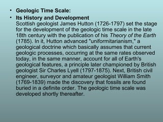
  • 1. • Geologic Time Scale: • Its History and Development Scottish geologist James Hutton (1726-1797) set the stage for the development of the geologic time scale in the late 18th century with the publication of his Theory of the Earth (1785). In it, Hutton advanced "uniformitarianism," a geological doctrine which basically assumes that current geologic processes, occurring at the same rates observed today, in the same manner, account for all of Earth's geological features, a principle later championed by British geologist Sir Charles Lyell (1797-1875). Next, British civil engineer, surveyor and amateur geologist William Smith (1769-1839) made the discovery that fossils are found buried in a definite order. The geologic time scale was developed shortly thereafter.
  • 2. • Geologic Time Scale • The earth's crust consists of many layers of sedimentary rock (called "strata"). Geologists assume that each layer represents a long period of time, typically millions of years. This is actually a secondary assumption based upon the primary assumption of Uniformitarianism. These layers of sedimentary rock contain billions of fossil remains and some of these fossils are unique to certain layers. The layers are catalogued and arbitrarily arranged into a specific order (not necessarily the order in which they are found). This order reflects the assumption of macro-evolution (the widely held notion that all life is related and has descended from a common ancestor).
  • 3. • A variety of fossils from each layer of strata have been chosen to be what are called "index fossils". Index fossils are how we date the sedimentary rock layers. Paleontologists assume the age of an index fossil by the stage of evolutionary history the fossil is assumed to be in. They guess how long it would take for one kind of life to evolve into another kind of life and then date the fossils and rocks accordingly. Once again, this is a circular argument. "And this poses something of a problem: If we date the rocks by the fossils, how can we then turn around and talk about the patterns of evolutionary change through time in the fossil record?" (Niles Eldridge, Time Frames, 1985, p. 52)
  • 4. • Geologic Time Scale: Circular Reasoning • The geologic time scale employs yet another circular argument. We determine the age of the rock by the assumed age of the index fossils it contains, then, to determine the age of all the other fossils in the same layer of rock, The succession of organisms has been determined by a study of their remains embedded in the rocks, and the relative ages of the rocks are determined by the remains of organisms that they contain." (R. H. Rastall, "Geology", Encyclopedia Britannica, vol. 10, 1954, p. 168) • The remains of a once-living organism, generally taken to be one that lived prior to the end of the last glacial period, i.e. fossils are older than 10 000 years. The term includes skeletons, tracks, impressions, trails, borings and casts. Fossils are usually found in consolidated rock, but not always (e.g. woolly mammoths living 20 000 years ago were recovered from the frozen tundra of Siberia). In its original sense, fossil meant anything dug up from the earth, including ores, precious stones, etc. The modern use of the word dates from the late 17th century.
  • 5. Geological time scale • The earth's crust consists of many layers of sedimentary rock (called "strata"). Geologists assume that each layer represents a long period of time, typically millions of years. Scottish geologist James Hutton (1726-1797) set the stage for the development of the geologic time scale in the late 18th century with the publication of his Theory of the Earth (1785). • The geologic time scale provides a system of chronologic measurement relating stratigraphy to time that is used by geologists, paleontologists and other earth scientists to describe the timing and relationships between events that have occurred during the history of the Earth. • It is a period of time covering the physical formation and development of Earth, especially the period prior to human history. • Evidence from radiometric dating indicates that the Earth is about 4.570 billion years old.
  • 6. William Smith's monograph on identifying strata based on fossils (The remains of a once-living organism is called fossil)
  • 7. Chalk Layers in Cyprus - showing sedimentary layering
  • 8.
  • 9.
  • 10.
  • 11.
  • 12. • ice age Any geologic period during which thick ice sheets cover vast areas of land. Such periods of large-scale glaciation may last several million years and drastically reshape surface features of entire continents. A number of major ice ages have occurred throughout the Earth's history; the most recent periods were during the Pleistocene Epoch (1.8 million–10,000 years ago).
  • 13. • Pollination is only a stage towards fertilization (the meeting of the male and female sex cells). The male sex cell is inside the pollen grain which is on the surface of the stigma. The female sex cell (the ovule) is inside the carpel in a different part of the flower.
  • 14. • The living pollen grain of an angiosperm has a wall that is made up of two layers. The outer layer is called the exine and is composed of a very unusual substance, sporopollenin. • The inner layer, or intine, of the pollen wall is made of cellulose and is very similar in construction to an ordinary plant cell wall. During fossilization only the resistant sporopollenin-containing exine remains, and it is this that carries the characteristic form and sculpture which permits the identification of pollen grains. • Sporopollenin and sporopollenin-like materials are found in the spores of such widely separated groups as algae, fungi, pteridophytes and angiosperms. Their chemical stability means they survive even in ancient fossils, and a substance which appears similar to modern sporopollenin has been recovered from some of the oldest sedimentary rocks in the world.
  • 16. Temporina globate(a) Corrugatisporites turpitus Tricolpites tressireticulatus Dyadoporonites sp(f) Dyadoporonites sp(f) Pollens Octaplata palanaensis(a) Octaplata palanaensis(a) Dyadoporonites sp(f) Dyadoporonites sp(f) Dyadoporonites sp(f) Dyadoporonites sp(f) Corrugatisporites turpitus(p) Striatriletes sp(p) Polypodiisporites sp.(p) Striatriletes indicus(p)
  • 17. Aegicerus sp Heritiera sp Aegicerus comiculatum Xylicarpus sp Phoenix paludosa Lumnitzera racemosa
  • 18. • Sporopollenin is a major component of the tough outer (exine) walls of spores and pollen grains. It is chemically very stable and is usually well preserved in soils and sediments. The exine layer is often intricately sculptured in species- specific patterns (see image at right), allowing material recovered from (for example) lake sediments to provide useful information about plant and fungal populations in the past.
  • 19. • Modern dating methods • Radiometric dating has been carried out since 1905 when it was invented by Ernest Rutherford as a method by which one might determine the age of the Earth. In the century since then the techniques have been greatly improved and expanded.[14] Dating can now be performed on samples as small as a billionth of a gram using a mass spectrometer. The mass spectrometer was invented in the 1940s and began to be used in radiometric dating in the 1950s.
  • 20.
  • 21. • Uranium-lead dating method • The uranium-lead radiometric dating scheme has been refined to the point that the error margin in dates of rocks can be as low as less than two million years in two-and-a-half billion years. An error margin of 2–5 % has been achieved on younger Mesozoic rocks. • Uranium-lead dating is often performed on the mineral zircon (ZrSiO4).
  • 22. • Samarium-neodymium dating method • This involves the alpha-decay of 147Sm to 143Nd with a half life of 1.06 x 10¹¹ years. Accuracy levels of less than twenty million years in two-and-a-half billion years are achievable. • Potassium-argon dating method • This involves electron capture or positron decay of potassium-40 to argon-40. Potassium-40 has a half-life of 1.3 billion years, and so this method is applicable to the oldest rocks. Radioactive potassium-40 is common in micas, feldspars, and hornblendes, though the closure temperature is fairly low in these materials, about 125°C (mica) to 450°C (hornblende). • Rubidium-strontium dating method This is based on the beta decay of rubidium-87 to strontium-87, with a half-life of 50 billion years. This scheme is used to date old igneous and metamorphic rocks, and has also been used to date lunar samples. Closure temperatures are so high that they are not a concern. Rubidium-strontium dating is not as precise as the uranium-lead method, with errors of 30 to 50 million years for a 3- billion-year-old sample.
  • 23. • Uranium-thorium dating method • A relatively short-range dating technique is based on the decay of uranium-234 into thorium- 230, a substance with a half-life of about 80,000 years. It is accompanied by a sister process, in which uranium-235 decays into protactinium- 231, which has a half-life of 34,300 years. • While uranium is water-soluble, thorium and protactinium are not, and so they are selectively precipitated into ocean-floor sediments, from which their ratios are measured. The scheme has a range of several hundred thousand years.
  • 24. • Radiocarbon dating method • Carbon-14 is a radioactive isotope of carbon, with a half-life of 5,730 years, which is very short compared with those above. In other radiometric dating methods, the heavy parent isotopes were synthesized in the explosions of massive stars that scattered materials through the universe, to be formed into planets and other stars. The parent isotopes have been decaying since that time, and so any parent isotope with a short half-life should be extinct by now. Carbon–14 is an exception. It is continuously created through collisions of neutrons generated by cosmic rays with nitrogen in the upper atmosphere. The carbon-14 ends up as a trace component in atmospheric carbon dioxide (CO2). • An organism acquires carbon during its lifetime. Plants acquire it through photosynthesis, and animals acquire it from consumption of plants and other animals. When an organism dies, it ceases to take in new carbon-14, and the existing isotope decays with a characteristic half-life (5730 years). The proportion of carbon-14 left when the remains of the organism are examined provides an indication of the time elapsed since its death. The carbon–14 dating limit lies around 58,000 to 62,000 years.
  • 25. • The rate of creation of carbon-14 appears to be roughly constant, as cross-checks of carbon–14 dating with other dating methods show it gives consistent results. However, local eruptions of volcanoes or other events that give off large amounts of carbon dioxide can reduce local concentrations of carbon–14 and give inaccurate dates. The releases of carbon dioxide into the biosphere as a consequence of industrialization have also depressed the proportion of carbon-14 by a few percent; conversely, the amount of carbon-14 was increased by above-ground nuclear bomb tests that were conducted into the early 1960s. Also, an increase in the solar wind or the Earth's magnetic field above the current value would depress the amount of carbon-14 created in the atmosphere. These effects are corrected for by the calibration of the radiocarbon dating scale. Chlorine-36 dating method • Large amounts of otherwise rare 36Cl were produced by irradiation of seawater during atmospheric detonations of nuclear weapons between 1952 and 1958. The residence time of 36Cl in the atmosphere is about 1 week. Thus, as an event marker of 1950s water in soil and ground water, 36Cl is also useful for dating waters less than 50 years before the present. 36Cl has seen use in other areas of the geological sciences, including dating ice and sediments.
  • 26. • Fission track dating method • Apatite crystals are widely used in fission track dating. • This involves inspection of a polished slice of a material to determine the density of "track" markings left in it by the spontaneous fission of uranium-238 impurities. The uranium content of the sample has to be known, but that can be determined by placing a plastic film over the polished slice of the material, and bombarding it with slow neutrons. This causes induced fission of 235U, as opposed to the spontaneous fission of 238U. The fission tracks produced by this process are recorded in the plastic film. The uranium content of the material can then be calculated from the number of tracks and the neutron flux. • This scheme has application over a wide range of geologic dates. For dates up to a few million years micas, tektites (glass fragments from volcanic eruptions), and meteorites are best used. Older materials can be dated using zircon, apatite, titanite, epidote and garnet which have a variable amount of uranium content.[26] Because the fission tracks are healed by temperatures over about 200°C the technique has limitations as well as benefits. The technique has potential applications for detailing the thermal history of a deposit.
  • 27. • Plate tectonic Theory • The rigid lithospheric slabs or rigid and solid crustal layers are tectonically called ‘plates’. The whole mechanism of the evolution, nature and motion of plates and resultant reactions is called plate tectonics. Moving over the weak asthenosphere, individual lithospheric plates glide slowly over the surface of the globe: much as a pack of ice of the Arctic Ocean drifts under the dragging force of currents and winds. • Plate tectonic theory, a great scientific achievement of the decade of 1960s, is based on two major scientific concepts: (1) the concept of continental drift and (2) the concept of sea- floor spreading. Six major and 20 minor plates are identified so far (Eurasian plate, Indo-Australian plate, American plate, Pacific plate, African plate, Antarctic plate). • These slabs rest upon a layer of heated, pliable rock called the asthenosphere, which flows slowly like hot tar. A popular theory is that the movement of the thick, molten material in the asthenosphere forces the upper plates to shift, sink, or rise.
  • 28. • The basic concept behind plate tectonics is simply that heat rises. Hot air rises above cool air, and warm water currents flow above cold water. The same is true of the heated rock below the earth’s surface. The asthenosphere’s molten material, or magma, pushes upwards, while cooler, hardened matter sinks deeper into the mantle. • Hot material in the mantle rises to the base of the lithosphere, where it than moves laterally, cools, and descends to become reheated, so the cycle begins again. The regular flow circuit of rising warm fluid and sinking cold fluid, roughly circular motion, is called a convection current. • Sinking rock eventually reaches the extremely hot temperatures of the lower asthenosphere, heats up, and begins to rise again.. At diverging plate boundaries and at hot spots in the otherwise solid lithosphere, molten material wells up to the surface, forming a new crust.
  • 29.
  • 30. Number of Plates in the Earth • Major plates • Depending on how they are defined, there are usually seven or eight • "major" plates: • African Plate • Antarctic Plate • Indo-Australian Plate, sometimes subdivided into: – Indian Plate – Australian Plate • Eurasian Plate • North American Plate • South American Plate • Pacific Plate • Minor plates • There are dozens of smaller plates, the seven largest of which are: • Arabian Plate • Caribbean Plate • Juan de Fuca Plate • Cocos Plate • Nazca Plate • Philippine Sea Plate • Scotia Plate
  • 31. Plate tectonics: The main features are: 1. The Earth's surface is made up of a series of large plates (like pieces of a giant jigsaw puzzle). 2. These plates are in constant motion travelling at a few centimetres per year. 3. The ocean floors are continually moving, spreading from the centre and sinking at the edges. 4. Convection currents beneath the plates move the plates in different directions. The source of heat driving the convection currents is radioactive decay which is happening deep in the Earth.
  • 32. • Convection Currents • Very slow convection currents flow in this plastic layer, and these currents provide horizontal forces on the plates of the lithosphere much as convection in a pan of boiling water causes a piece of cork on the surface of the water to be pushed sideways
  • 33. It may be mentioned that the term plate was first used by Canadian geophysicist J.T.Wilson in 1965. He postulated a ‘paving stone’ hypothesis wherein the oceanic crust was considered to be newly formed at mid-oceanic ridges and destroyed at the trenches. It may be highlighted that the plate margins are most important because all tectonic activities occur along the plate margins e.g. seismic events, vulcanicity, mountain building, faulting etc. 1. Constructive Plate Margins: These are also called as “divergent plate margins” or accreting plate margins. These represent zones of divergence where there is continuous upwelling of molten material (lava) and thus new oceanic crust is continuously formed. In fact, oceanic plates split apart along the mid-oceanic ridges and move in opposite directions. 2. Destructive Plate Margins: These are also called “ convergent plate margins” or “ consuming plate margins” because two plates move towards each other or two plate converge along a line and leading edge of one plate overrides the other plate and the overridden plate is subducted or thrust into the mantle and thus part of the crust (plate ) is lost in the mantle. 3. Conservative Plate Margins: These are also called as shear plate margins. Here, two plates pass or slide past one another along transform faults and the thrust crust is neither created nor destroyed. Plate Boundaries
  • 34. • Plate boundaries do not necessarily match the coastlines of continents. A plate can consist of continental crust, oceanic crust, or both. In most cases, continents are part of larger plates that extend for hundreds of miles offshore. Many plate boundaries are far out in the middle of the ocean. There are three types of plate boundaries: divergent, convergent, and transform.
  • 35. • Iceland is splitting along the Mid-Atlantic Ridge - a divergent boundary between the North American and Eurasian Plates. As North America moves westward and Eurasia eastward, new crust is created on both sides of the diverging boundary. While the creation of new crust adds mass to Iceland on both sides of the boundary, it also creates a rift along the boundary. Iceland will inevitably break apart into two separate land masses at some point in the future, as the Atlantic waters eventually rush in to fill the widening and deepening space between.
  • 36. • When an oceanic plate pushes into and subducts under a continental plate, the overriding continental plate is lifted up and a mountain range is created. Even though the oceanic plate as a whole sinks smoothly and continuously into the subduction trench, the deepest part of the subducting plate breaks into smaller pieces. These smaller pieces become locked in place for long periods of time before moving suddenly and generating large earthquakes. Such earthquakes are often accompanied by uplift of the land by as much as a few meters. When two oceanic plates converge one is usually subducted under the other and in the process a deep oceanic trench is formed. The Marianas Trench, for example, is a deep trench created as the result of the Phillipine Plate subducting under the Pacific Plate.
  • 37. • When two continents meet head-on, neither is subducted because the continental rocks are relatively light and, like two colliding icebergs, resist downward motion. Instead, the crust tends to buckle and be pushed upward or sideways. The collision of India into Asia 50 million years ago caused the Eurasian Plate to crumple up and override the Indian Plate. After the collision,- the slow continuous convergence of the two plates over millions of years pushed up the Himalayas and the Tibetan Plateau to their present heights. Most of this growth occurred during the past 10 million years.
  • 39. The concept of sea-floor spreading was first propounded by Prof. Harry Hess of the Princeton University in the year 1960. He discovered that the mid-oceanic ridges were situated on the rising thermal convection currents coming up from the mantle. The oceanic crust moves in opposite directions from mid-oceanic ridges. These molten lavas cool down and solidify to form new crust along the trailing ends of divergent plates (oceanic crust). Thus, there is continuous creation of new crust along the mid- oceanic ridges and the expanding crust (plates) are destroyed along the oceanic trenches. These facts proves that the continents and ocean basins are in constant motion.
  • 40. • Sea-floor spreading is the process in which the ocean floor is extended when two plates move apart. As the plates move apart, the rocks break and form a crack between the plates. Earthquakes occur along the plate boundary. Magma rises through the cracks and seeps out onto the ocean floor like a long, thin, undersea volcano. • • As magma meets the water, it cools and solidifies, adding to the edges of the sideways-moving plates. As magma piles up along the crack, a long chain of mountains forms gradually on the ocean floor. This chain is called an oceanic ridge.
  • 41. • Sea-floor spreading: • The rocks nearest the ridge were relatively young, but the rocks aged as the distance from the ridge increased. In addition, marine sediment was thicker and older further from the ridge, whereas the ridge itself had virtually no deposits of sediment. These observations, added to those of the heat flow at the ridge, confirmed the creation of new crust at mid-ocean ridges and the mechanism of seafloor spreading.
  • 42. • As the rift valley expands two continental plates have been constructed from the original one. The molten rock continues to push the crust apart creating new crust as it does. This is an example of a divergent plate boundary (where the plates move away from each other). The Atlantic Ocean was created by this process. The mid-Atlantic Ridge is an area where new sea floor is being created. As the rift valley expands, water collects forming a sea. The Mid-Atlantic Ridge is now 2,000 metres above the adjacent sea floor, which is at a depth of about 6,000 metres below sea level. The sea floor continues to spread and the plates get bigger and bigger. This process can be seen all over the world and produces about 17 square kilometres of new plate every year.
  • 43.
  • 44. • Since World War ll, various ocean scientific data were collected and analyzed but no unifying view emerged until the 1960s when the seafloor spreading mechanism was first proposed based on data from the Atlantic Ocean. • New seafloor forms along the mid-Atlantic Ridge and pushes the older Atlantic seafloor farther away from each other, thereby, increasing the size of the Atlantic Ocean floor, and hence the Atlantic Ocean basin. • By implication, any continent attched to the edge of that ocean basin will be pushed apart too.
  • 45. Sea floor Spreading. The boundaries where the plates move apart are 'constructive' because new crust is being formed and added to the ocean floor. The ocean floor gradually extends and thus the size of these plates increases. As these plates get bigger, others become smaller as they melt back into the Earth in the process called subduction. The new rock at the edge has no sediments like the sand or mud, since it is formed only recently. Farther away from the ridge, sand and mud gradually settle on it, in an ever-thickening blanket. The oldest rocks may have 14,000 feet of sand and other sediments resting on top of it. An example of an oceanic ridge is the Mid-Atlantic Ridge. It is one part of a system of mid-oceanic ridges that stretches for 50,000 miles through the world's oceans. The underwater mountains of the ridge may not be more than two miles higher than the surrounding sea floor. On the whole, sea-floor spreading is basically volcanic, but it is a slow and regular process, without the explosive outbursts of the volcanoes on land.
  • 46. • Most transform faults are found on the ocean floor. They commonly offset active spreading ridges, producing zig-zag plate margins, and are generally defined by shallow earthquakes. A few, however, occur on land. The San Andreas fault zone in California is a transform fault that connects the East Pacific Rise, a divergent boundary to the south, with the South Gorda -- Juan de Fuca -- Explorer Ridge, another divergent boundary to the north.
  • 47.
  • 48. The Earth's crust is divided into huge, thick plates that drift atop the soft mantle. The plates are made of rock and are from 80 to 400 miles (50 to 250 km) thick. They move both horizontally and vertically. Over long periods of time, the plates also change in size as their margins are added to, crushed together, or pushed back into the Earth's mantle.
  • 49. Subduction • The Marianas Trench, just east of the Mariana Islands in the western Pacific, is the deepest seafloor depression in the world at 11,033 metres (36,198 feet). The Marianas Trench is one of many deepwater trenches formed by the geologic process of subduction. During subduction, the edges of plates are subducted, or forced under, other plates. Ocean crust is drawn down into the mantle and partially melted. • An important effect of the melting of subducted ocean crust is the production of new magma. When subducted ocean crust melts, the magma that forms may rise from the plane of subduction deep within the mantle, erupting on the earth’s surface. Eruption of magma melted by subduction has created long, arc-shaped chains of volcanic islands, such as Japan, the Philippines, and the Aleutians. Where an oceanic plate is subducted beneath continental crust, the magma produced by subductive melting erupts from volcanoes situated among long, linear mountain chains, such as the Andes in South America.
  • 50. • Earthquakes can occur at these plate margins, shifting plates by up to 5 metres (about 15 feet) at once. Such faults exist in Chile, Japan, Taiwan, the Philippines, New Zealand, and Sumatra. When two continental plates collide, the crust from both plates thrusts upwards, creating mountain chains. The collision of India with the Asian continent formed the Himalayas. In fact, the mountain range is still growing in height today because India and Asia are still converging. • At a transform boundary, plates move past each other in opposite directions. Little volcanic activity accompanies transform boundaries, but large, shallow earthquakes can occur. The San Andreas Fault in California (USA), is the most famous example of this type of boundary. Mid- ocean ridges are offset by hundreds of small transforms.
  • 51. • After molten rock reaches the seafloor as lava, deep ocean water quickly cools and consolidates the material. To make room for this continual addition of new crust, the plates on either side of the ridge must constantly move apart. In the North Atlantic, the rate of movement of each plate is only about 1 to 2 centimetres (0.4 to 0.8 of an inch) per year. In the Pacific, the rate can be more than 10 centimetres (about 4 inches) annually.
  • 52. • Additional evidence for plate tectonics came in the 1950s and 1960s. During this period, scientists discovered that all rock fragments maintain a set magnetic pattern based on when the rocks formed. Geophysicists also learned that the earth’s magnetic field had reversed between north and south dozens of times over millions of years. With this knowledge, they examined both sides of ocean ridges and found that the rocks on one side of the ridge produced a mirror-image geomagnetic pattern of the rocks on the other side.
  • 53. • Continental Drift Theory • In 1915, the German geologist and meteorologist Alfred Wegener first proposed the theory of continental drift, which states that parts of the Earth's crust slowly drift atop a liquid core. Wegener hypothesized that there was a gigantic supercontinent 200 million years ago, which he named Pangaea, meaning "All-earth". Sometime in the past, there was one giant landmass called Pangaea (all land), that was sorrounded by one giant ocean called Panthalassa. About 200 million years ago, Pangaea broke up into smaller continents and these continents have since "drifted" to their present positions.
  • 54. • Alfred Wegener first thought of this idea by noticing that the different large landmasses of the Earth almost fit together like a jigsaw. America fit closely to Africa and Europe, and Antarctica, Australia, India and Madagascar fitted next to the tip of Southern Africa. Wegener proposed this in 1912, but it wasn't considered to be sufficient evidence in itself. He analysed either side of the Atlantic Ocean for rock type, geological structures and fossils. He noticed that there was a significant similarity. • From 1912, Wegener publicly advocated the theory of " continental drift", arguing that all the continents were once joined together in a single landmass and have drifted apart. • In 1915, in The Origin of Continents and Oceans (Die Entstehung der Kontinente und Ozeane), Wegener published the theory that there had once been a giant continent, he named "Pangaea" (meaning "All-Lands" or "All-Earth") and drew together evidence from various fields. Expanded editions during the 1920s presented the accumulating evidence.
  • 55.
  • 56.
  • 57.
  • 58. • Pangaea started to break up into two smaller supercontinents, called Laurasia and Gondwanaland, during the late Triassic. It formed the continents Gondwanaland and Laurasia, separated by the Tethys Sea. By the end of the Cretaceous period, the continents were separating into land masses that look like our modern-day continents.
  • 59.
  • 60. Evidences: In accordance with the scientific method, he proceeded to search for supporting evidences. Among the most compelling evidences he presented are: The Fit of the Continents. Wegener noticed that the western coastline of Africa and eastern coastline of South America appear to strongly match each other in a way that suggested it could be due to a profound process, beyond and above mere coincidence. In other words, if the continents were moved to be positioned side by side, they would fit like a jigsaw puzzle. Wegener also presented some fossil evidences. One was an animal fossil and the other was a plant fossil. Mesosaurus was an aquatic dinosaur closely related to the modern Alligator. The fossil remains are only found near the eastern side of South America and the adjoining western side of Africa when the two continents are positioned side by side. Hence, Wegener concluded that the best explanation for this unusual occurence is that the two continents were once joined together (or the same landmass), before Mesosuarus became extinct, until they fractured and drifted away from each other. Opposing scientists argued that there must have been a land bridge linking South America and Africa. But no such evidence for a land bridge across the south Atlantic Ocean has been observed since.
  • 61.
  • 62. • The other fossil evidence was a common fern tree that is now extinct called Glossopteris. Glossopteris trees were very widespread in tropical and subtropical areas during the Paleozoic era. Their remains are now strewn across the south Atlantic, on the Continents of Africa and South America. • Wegener was a meteorologist, so he was particularly interested in searching for evidences from ancient climates (or paleoclimate). There are extensive glacial sediments in southern Africa, southeastern South America, india, and western Australia. These are sediments that exist only in areas that used to be coverd by glaciers. Although these are mostly tropical and subtropical lands today, it shows that in the past they were in much colder latitudes but have since drifted away from those "cold" latitudes. • Fossils of plants that formed coal beds indicate that they are typically tropical trees. But most coal deposits today are on continents located in colder climates including Antarctica. Wegener's conclusion was that those continents with the coal deposits were located in tropical latitudes when the coals beds were being formed. Afterwards, those continents drifted away from their former positions.
  • 63. Glossopteris, a tree-like plant from the Permian Period through the Triassic Period. It had tongue- shaped leaves and was about 12 ft (3.7 m) tall. It was the dominant plant of Gondwana. • Eduard Suess was an Austrian geologist who first realized that there had once been a land bridge connecting South America, Africa, India, Australia, and Antarctica. He named this large land mass Gondwanaland (named after a district in India where the fossil plant Glossopteris was found). This was the southern supercontinent formed after Pangaea broke up during the Jurassic period. Suess based his deductions on the fossil plant Glossopteris, which is found throughout India, South America, southern Africa, Australia, and Antarctica.
  • 64. If you look at the continental boundaries there is much overlap of fossil assemblages, structures, and rock types up to the time in geologic history when the plate split apart.
  • 65. • If you look at glacial deposits from the past, before the split, there is also overlap.
  • 66. • Wegener also used mountain ranges that match across continents. The Appalachian Mountains trend northeast on the east coast of North America, and ends abruptly on the coast of Newfoundland, Canada. When the continents are reassembled into Pangea, the Appalachians continue uninterrupted into the Caledonides Mountains in Scotland, Norway, and Sweden. These are mountain ranges that are presently separated by the Atlantic Ocean. • In spite of all the evidences presented, Wegener had one major problem. He could not scientifically explain the mechanism of motion. By what means could massive chunks of the earth move around? Wegener's attempt to explain the possible mechanisms of continental drift was ridiculed as unscientific: – Centrifugal force due to the earth's rotation pulling continents westward. – Tidal drag of the moon pulling continents westward. – The icebreaker hypothesis claimed that the continents are like modern icebreaker ships that break through the weaker ocean crust as the continents drift.
  • 67. • The age of the sea-floor also supports sea-floor spreading. If sea- floor spreading operates, the youngest oceanic crust should be found at the ridges and progressively older crust should be found in moving away from the ridges towards the continents. This is the case. The oldest known ocean floor is dated at about 200 million years, indicating that older ocean floor has been destroyed through subduction at deep-sea trenches. • It took exploration of the ocean floor to discover sea-floor spreading, the mechanism for the movement of continents that Alfred Wegener lacked. The hypothesis of continental drift gained renewed interest and, when combined with sea-floor spreading, led to the theory of plate tectonics. The history of thought about the movement of continents provides a wonderful example of how hypotheses such as continental drift and sea-floor spreading are thoroughly tested before a new theory emerges. For an overview of the history of plate tectonics, see Tarbuck and Lutgens (1994).
  • 68. • Fossils of Mesosaurus (one of the first marine reptiles, even older than the dinosaurs) were found in both South America and South Africa. These finds, plus the study of sedimentation and the fossil plant Glossopteris in these southern continents led Alexander duToit, a South African scientist, to bolster the idea of the past existence of a supercontinent in the southern hemisphere, Eduard Suess's Gondwanaland. This lent further support to A. Wegener's Continental Drift Theory Plate Boundaries Fit Plate tectonics was first proposed in the 1800's by Antonio Snyder-Pellegrini based on the fact that the continents of the Earth fit together like pieces of a jigsaw puzzle. Based on the fit, he proposed that the continents were once together, forming a single large landmass.
  • 69.
  • 70. • Evidence for continental drift is now extensive. Simila fossils are found around different continent shores, suggest Mesosaurus , a freshwater reptile rather like a small crocodile, fou Brazil and South Africa , are one example; another is the discovery of fossils reptile Lystrosaurus from rocks of the same age from locations in South America, Africa, and Antarctica . There is also living evidence — the same animals b earthworm found in South America and South Africa. Continental drift
  • 71. The Triassic Period 248 - 206 million years ago The Jurassic Period 206-144 million years ago The Cretaceous Period 144-65 million years ago
  • 72.
  • 73. • Continental Drift theory: • The theory of plate tectonics was not widely accepted until the 1960s and 1970s. Before that time, most scientists believed the earth’s continents and oceans to be stationary. At the beginning of the 20th century, German meteorologist Alfred Wegener suggested that all continents had been part of one huge supercontinent, Pangaea. According to Wegener, about 200 million years ago Pangaea broke into separate plates that slowly drifted away from each other, leading to today’s continental arrangement. • One of Wegener’s most convincing pieces of evidence was the almost perfect fit between the eastern coast of South America and the western coast of Africa. To support his theory, he pointed out that rock formations on opposite sides of the Atlantic—in Brazil and West Africa—match in age, type, and structure. Also, the formations often contain fossils of the same terrestrial creatures, indicating that South America and Africa must have previously been connected. • In subsequent years, scientific discoveries steadily began to support the fundamental aspects of Wegener’s theory. Geologists demonstrated the existence of the slowly moving asthenosphere, underlying the crust at depths of 50 to 150 kilometres (30 to 80 miles). In addition, scientists in the 1920s used sonar, an echo- sounding device, to determine ocean depths and map the seafloor. They concluded that the Mid-Atlantic Ridge, detected in the 19th century, was part of a worldwide ocean ridge system.
  • 74.
  • 75.
  • 76. • Bangladesh is divided into two major tectonic units: i) Stable Pre-Cambrian Platform in the northwest, and ii) Geosynclinal basin in the southeast. A third unit, a narrow northeast-southwest trending zone called the hinge zone separates the above two units almost through the middle of the country. This hinge zone is currently known as palaeo continental slope. Stable Pre-Cambrian Platform in Bangladesh, Stable Pre- Cambrian Platform refers to the stable shelf of the bengal basin. In Bangladesh part of the Bengal Basin, the stable shelf can be divided into three major zones. They are Dinajpur slope, Rangpur Saddle and Bogra slope. It is composed of continental crust overlain by Cretaceous (144 to 66 million years ago) to Recent sediment. However, in isolated basins on the stable shelf, there is Permo- Carboniferous (360 million years to 245 million years ago) sediments with considerable amount of coal. The thickness of sedimentary column on the stable shelf of Bengal Basin varies from less then 200m to 8,000m.
  • 77.
  • 78. • foreland basins, which occur on the plate that is subducted or underthrust during plate collision (i.e. the outer arc of the orogen) • Examples include the North Alpine Foreland Basin of Europe, or the Ganges Basin of Asia • Foreland basins form because as the mountain belt grows, it exerts a significant mass on the Earth’s crust, which causes it to bend, or flex, downwards. This occurs so that the weight of the mountain belt can be compensated by isostasy at the upflex of the forebulge. • Foreland basin systems: • The wedge-top sits on top of the moving thrust sheets and contains all the sediments charging from the active tectonic thrust wedge. • The foredeep is the thickest sedimentary zone and thickens toward the orogen. Sediments are deposited via distal fluvial, lacustrine, deltaic, and marine depositional systems. • The forebulge and backbulge are the thinnest and most distal zones and are not always present. When present, they are defined by regional unconformities as well as aeolian and shallow-marine deposits.
  • 79. • Geosynclinal Basin the geosynclinal basin in the southeast is characterised by the huge thickness (maximum of about 20 km near the basin centre) of clastic sedimentary rocks, mostly sandstone and shale of Tertiary age. It occupies the greater Dhaka-Faridpur-Noakhali- Sylhet [Silet]-Comilla [Kumilla]-Chittagong areas. Geosyncline a part of the earth crust that sank deeply through time. Its length may extend for several thousand kilometres and may contain sediments thousands of metres thick, representing millions of years of deposition. A geosyncline generally forms along continental edges, and is destroyed during periods of crustal deformation, which often produces folded mountain ranges. Bengal Geosyncline is one of the world's largest geosyncline that includes the bengal basin and the bay of bengal. The evolution of the Bengal Basin started in the Permo-Carboniferous with the sedimentation in the faulted Gondwana Basins. The break up of the Gondwanaland in the Cretaceous Period and the marine transgression led to the sedimentation in the Bengal Geosyncline.
  • 80. • In geology, a trough generally refers to a linear structural depression that extends laterally over a distance, while being less steep than a trench. A trough can be a narrow basin or a geologic rift. There are various oceanic troughs, troughs found under oceans. • A fold can be divided into hinge and limb portions. The limbs are the flanks of the fold and the hinge is where the flanks join together. The hinge point is the point of minimum radius of curvature for a fold. The crest of the fold is the highest point of the fold surface, and the trough is the lowest point.
  • 81.
  • 82. For Bangladesh, the most important one is the Cenozoic era, because most of the sedimentary layers as well as the geological structures of the country were formed during this era. The Cenozoic tectonic evolution of Bangladesh mainly took place at the end of the Eocene, Middle Miocene, close of the Pliocene and the early Pleistocene. During the early Tertiary period (Palaeocene and Eocene epochs) most of Bangladesh was under open marine condition, which resulted in the formation of fossiliferous limestone and shale with some sandstone. During the late Tertiary period (Oligocene, Miocene and Pliocene epochs) the open sea retreated to the south in response to the uplift of the himalayas in the north and river systems built out a large deltaic land that formed the backbone of the present bengal delta. Huge successions of alternating sandstone and shale layers now found on the surface and in the subsurface of eastern and southern Bangladesh were formed in this delta environment during the Tertiary period.
  • 83. • Bengal Basin a term used to describe both a surface physiographic feature and a geological feature deep underground. The first is familiar to geographers and the other to geologists. The geological feature is a downwarping of the basement rocks beneath central and southern Bangladesh under pressure of sediments laid down since the Cretaceous age (63 to 135 million years before the present). This Basin represents the most important of the three tectonic divisions of the country. The deep Basin began forming when Late Cretaceous orogeny caused the rise of the Arakan Yoma mountains along the eastern border of Bangladesh, and formed the Assam Gulf. This Gulf apparently had an ecosystem conductive to the profuse growth of phyto- and zoo- planktons and benthic organisms.
  • 84. • The Earth's Magnetic Field — The Earth's magnetic field is thought to arise from the movement of liquid iron in the outer core as the planet rotates. The field behaves as if a permanent magnet were located near the center of the Earth, inclined about 11 degrees from the geographic axis of rotation (Fig. 4). Note that magnetic north (as measured by a compass) differs from geographic north, which corresponds to the planet's axis of rotation. • Placing a bar magnet beneath a piece of paper with iron filings on it will create a pattern as the filings align themselves with the magnetic field generated by the magnet. The Earth's magnetic field is similar to that generated by a simple bar magnet. At present, the lines of force of the Earth's magnetic field are arranged as shown in Figure 4; the present orientation of the Earth's magnetic field is referred to as normal polarity. In the early 1960s, geophysicists discovered that the Earth's magnetic field periodically reverses; i.e. the north magnetic pole becomes the south pole and vice versa. Hence, the Earth has experienced periods of reversed polarity alternating with times (like now) of normal polarity. Although the magnetic field reverses at these times, the physical Earth does not move or change its direction of rotation.
  • 85. • Basaltic lavas contain iron-bearing minerals such as magnetite which act like compasses. That is, as these iron-rich minerals cool below their Curie point, they become magnetized in the direction of the surrounding magnetic field. Studies of ancient magnetism (paleomagnetism) recorded in rocks of different ages provide a record of when the Earth's magnetic field reversed its polarity. Return to top • • During World War II, sensitive instruments called magnetometers were developed to help detect steel-hulled submarines. When research scientists used magnetometers to study the ocean floor, they discovered a surprising pattern. Measurements of magnetic variations showed that, in many areas, alternating bands of rocks recording normal and reversed polarity were arranged symmetrically about mid-ocean ridges (Fig. 5). • In 1963, F. Vine and D.H. Matthews reasoned that, as basaltic magma rises to form new ocean floor at a mid-ocean spreading center, it records the polarity of the magnetic field existing at the time magma crystallized. As spreading pulls the new oceanic crust apart, stripes of approximately the same size should be carried away from the ridge on each side (Fig. 5). Basaltic magma forming at mid-ocean ridges serves as a kind of "tape recorder", recording the Earth's magnetic field as it reverses through time. If this idea is correct, alternating stripes of normal and reversed polarity should be arranged symmetrically about mid-ocean spreading centers. The discovery of such magnetic stripes provided powerful evidence that sea-floor spreading occurs.