SlideShare uma empresa Scribd logo
1 de 13
Baixar para ler offline
A LANDSCAPE DESIGN FOR
D I N O S AU R F O OT P R I N T S R E S E RVAT I O N
THE TRUSTEES OF RESERVATIONS • JORDAN CLARK • FALL 2014 • CONWAY SCHOOL OF LANDSCAPE DESIGN
Alandscapedesignfor
DINOSAURFOOTPRINTSRESERVATION
TheTrusteesofReservations
Rte.5,Holyoke,MA01040
Designer:JordanClark
Fall,2014
1/12
332S.DeerfieldRoad|POBox179|Conway,MA01341
413-369-4044www.csld.edu
North
Notforconstruction.Partofastudentprojectandnotbasedonalegalsurvey.
ProjectOverview
PROJECT OVERVIEW
Nestled snugly on eight steep, mostly wooded
acres on the western bank of the Connecticut River,
Dinosaur Footprints Reservation (DFR) is a geological
and cultural landmark featuring at its center a
sandstone outcrop imprinted with early Jurassic
dinosaur tracks. Located on the northern fringe of
Holyoke, MA, The Trustees of Reservations (TTOR)
property is squeezed between busy Route 5 and a
stretch of railroad tracks. Currently, it serves as a
point of interest for school groups and passersby
as well as a popular draw for local riverfront access.
In addition to its unique cultural and recreational
function, the site also hosts a handful of state-listed
rare plants.
A central tension of this project lies between the
maintenance of the reservation as an accessible
place for human enjoyment and the preservation of
the site’s ecological functions.
Project program
The objective of this project is twofold: to improve
the overall visitor experience at Dinosaur Footprints
Reservation while effectively stewarding the site’s
natural resources, including the dinosaur tracks and
rare plant species.
The landscape and management of the reservation
can foster a positive visitor experience by offering
a place that is perceived as safe and welcoming,
coherent and navigable. Such a place serves as a
destination with a wide array of opportunities to
learn, to play, and to rest.
To enable a more engaging and satisfying visitor
experience, The Trustees would like gathering areas
suitable for reflection and education, expanded
views into and out of the site, a solution to the
eyesore represented by the concrete retaining wall
that runs along the property, and a more deliberate
and coherent navigation framework and visual
aesthetic. Additionally, they would like to maintain
rare plant habitat on-site and manage water flow to
prevent erosion in problem areas.
Stewarding
natural
resources
Creating a
satisfying visitor
experience
The
thoughtful
design
combines
functions
INDEX OF SHEETS
1.	 Project Overview
2.	 Context
3.	 Existing Conditions
4.	 Views Analysis
5.	 Access & Circulation Analysis
6.	 Slopes & Drainage Analysis
7.	 Vegetation & River Resource Analyses
8.	 Summary Analysis
9.	 Design Alternatives
10.	 Final Design Plan
11.	 Final Design Details
12.	 Plant Recommendations
Alandscapedesignfor
DINOSAURFOOTPRINTSRESERVATION
TheTrusteesofReservations
Rte.5,Holyoke,MA01040
Designer:JordanClark
Fall,2014
2/12
332S.DeerfieldRoad|POBox179|Conway,MA01341
413-369-4044www.csld.edu
North
Notforconstruction.Partofastudentprojectandnotbasedonalegalsurvey.
Context
CONTEXT
Dinosaur Discoveries
The Connecticut River Valley is home to the first known dinosaur
tracks to be discovered in North America, and the collection of
fossil sites in the region played a key role in the early study of
dinosaurs. What is now Dinosaur Footprints Reservation provided
some of the first evidence of the existence of these prehistoric
beasts.
The sandstone slab sitting just off US Route 5 at Dinosaur
Footprints Reservation features
hundreds of impressions from early
Jurassic-era dinosaurs, first studied
by Amherst College Professor Edward
Hitchcock in the 1830s. The location
of the footprints was well-known to
paleontologists in the 19th century,
during which it became a key site in the
creation of “ichnology,” the study of
fossilized footprints. Today it continues
to be a popular location among
scientists
The footprints from at least four distinct two-legged dinosaur
species (including a likely ancestor to Tyrannosaurus Rex), along
with other trace fossils and ripple marks, are thought to be around
200 million years old. Though the footprints (and others like them
nearby) now lie in the Connecticut River Valley, the creatures that
left them were walking in a swampy subtropical mudflat on the
supercontinent Pangaea.
The footprints were rediscovered in the following century during
the construction of what is now U.S. Route 5, shortly after which
the land on which they sit was acquired by The Trustees of
Reservations for its preservation for the public. The route of the old
country road replaced by Route 5 is still apparent on the site — a
relatively flat strip that runs through the otherwise steep terrain.
Chunks of the broken-up old road can be easily found less than a
foot from the surface in many places.
Conserved, though fragmented
The immediate setting of Dinosaur Footprints Reservation echoes
its broader surroundings. It lies within a mosaic of conserved land
that includes much of the Mount Tom and Mount Holyoke ranges,
and it is part of the Silvio O. Conte National Wildlife Refuge, whose
goal is to protect the ecological diversity of the Connecticut River
watershed. Despite its importance to the broader ecosystem, it is
constrained by surrounding development and fragmented by the
major transportation corridors that run through it.
A popular but remote spot
The reservation sits just off the major connecting route for car and
bike traffic between Holyoke (pop. 41,000; city center is 3 miles
away) and Northampton (pop. 29,000; 7 miles away). Despite its
proximity to large population centers, it is still a relatively out-
of-the-way destination for all but those with access to a car. Bike
paths run along Route 5 (there are no bike racks on-site) and buses
will stop at the reservation, but there is no official stop.
The portion of rock outcrop that juts into the river across the train
tracks from DFR property has long been a popular river access
point among locals, as Holyoke center provides no access to the
river that runs through it. Also, perhaps due to its secluded setting,
it has had a reputation in the past for playing host to illicit nighttime
activities. During visiting hours (dawn to dusk), there are occasional
reported thefts of items left in cars parked at the reservation,
though Holyoke’s police department has confirmed that such
incidents have greatly decreased in the past several years.
C
O
N
N
EC
TIC
U
T
RIVER
MT. TOM
DINOSAUR FOOTPRINTS
RESERVATION
INTERSTATE 91
U.S. RTE. 5
(NORTHAMPTON ST.)
Edward Hitchcock
The riverfront adjacent Dinosaur Footprints Reservation is a popular local attraction. Bing Maps Image
Bing Maps Image
Alandscapedesignfor
DINOSAURFOOTPRINTSRESERVATION
TheTrusteesofReservations
Rte.5,Holyoke,MA01040
Designer:JordanClark
Fall,2014
3/12
332S.DeerfieldRoad|POBox179|Conway,MA01341
413-369-4044www.csld.edu
North
Notforconstruction.Partofastudentprojectandnotbasedonalegalsurvey.
ExistingConditions
N
EXISTING SITE CONDITIONS
Parking lot
Intermittent
stream
Riverfront
rock outcrop
C O N N E C T I C U T
R I V E R
Bing Maps Image
Project
scope
Footprints
location
N0 10 20 40ft.
DINOSAUR FOOTPRINTS
DECIDUOUS HARDWOOD
FOREST
WOODCHIP PATH
CONCRETERETAINING
W
ALL
SUMAC STAND
DECIDUOUS HARDWOOD
FOREST
PARKING
BOSTON&MAINERAILROAD
U.S.ROUTE5
DINOSAUR FOOTPRINTS RESERVATION
PROPERTY
U.S. ROUTE 5 LAND FROM THE TRAIN TRACKS TO THE
RIVERFRONT IS NOT OWNED BY DFR
Dinosaur Footprints Reservation sits
on a narrow 8-acre strip of land along
the western edge of the Connecticut
River. Steep and mostly forested with a
central open area surrounding the rock
outcrop that features the dinosaur
footprints, the property is squeezed
between U.S. Route 5 on its western
border and a railroad on its eastern
edge, cutting it off from direct contact
with the river. The focal area for this
project is the middle third of the
property (shown here).
The major section of sandstone
outcrop directly abuts the retaining
wall of Route 5. This concrete wall,
about 12 feet tall at its tallest, blocks
some noise and views from the
busy road above, but its monolithic
presence adds little to the visitor
experience and may invite vandalism.
The steep terrain throughout the site
presents challenges for accessibility.
The woodchip path from the parking
lot down to the dinosaur footprints
area is mostly greater than 10 percent
grade, double the acceptable grade for
handrail-free access. The slopes also
contribute to erosion across paths in
some areas.
Currently a single maintained path
leads to the dinosaur footprints,
while a secondary trail cuts through
the woods toward the river. This
compacted soil and rock outcrop
trail is heavily used by those visiting
the site primarily for river access. An
information kiosk greets visitors in
English and Spanish at the point of
entry, and another sign featuring
details about the dinosaur footprints
stands at the end of the main path, just
before the forest opening.
A A’
A
A’
Alandscapedesignfor
DINOSAURFOOTPRINTSRESERVATION
TheTrusteesofReservations
Rte.5,Holyoke,MA01040
Designer:JordanClark
Fall,2014
4/12
332S.DeerfieldRoad|POBox179|Conway,MA01341
413-369-4044www.csld.edu
North
Notforconstruction.Partofastudentprojectandnotbasedonalegalsurvey.
ViewsAnalysis
VIEWS ANALYSIS
Upon arrival at the Dinosaur Footprints
Reservation parking and entry area, views
to the interior are limited. The dense forest
growth that envelops the path leading to the
dinosaur footprints lends a sense of mystery
about what lies further ahead. It does not,
however, offer the visitor any glimpse of
the destination, which can make visitors
feel unsafe. Openings in the woods can be
comforting both when a person is in them and
when one can look into them. Therefore, to
create a more more enticing and reassuring
landscape, thinning and limbing up trees
along the main path to open up views may be
necessary.
Thick vegetation (mostly woody shrubs) in the
central section also obstructs any views to the
nearby river from on-site. Paring back some of
this growth to open up views could provide a
new area of interest near the location of the
dinosaur footprints.
The concrete retaining wall provides a barrier
to the bustle of the road above, but in the
context of the forest and dinosaur footprints,
it is an eyesore that tends to invite vandalism.
However, the wall presents an opportunity for
a mural that could tie into TTOR’s interpretive
plans for the site.
Thick vegetation creates inviting enclosed spaces and provides a
diversity of surroundings within the reservation, but obstructed views
can cause frustration and safety concerns. A concrete retaining wall
separatestheinteriorfromtheadjacentbusyroad,butitsappearance
clashes with the reservation’s natural setting.
From the open area around the dinosaur footprints, views of the
river are blocked by vegetation.
Autumn gives a glimpse of the river views possible from on-site.
The retaining wall provides separation from the busy road above,
but it detracts from the natural surroundings.
Just across the train tracks, the rock outcrop jutting into the river
affords stunning views
THE RETAINING WALL
IS AN EYESORE WITHIN
THE PROPERTY
DENSE WOODS
BLOCK VIEWS
FROM THE
ENTRANCE
THICK
VEGETATION
OBSCURES
VIEWS TO
THE RIVER
N0 10 20 40ft.
BARRIERS TO VIEW
NEGATIVE VIEWS
A
A
B
C D
E
E
D
F
F
B
At the entrance, views down the path are restricted. The forest encloses the path to the footprints before opening up.
C
Alandscapedesignfor
DINOSAURFOOTPRINTSRESERVATION
TheTrusteesofReservations
Rte.5,Holyoke,MA01040
Designer:JordanClark
Fall,2014
5/12
332S.DeerfieldRoad|POBox179|Conway,MA01341
413-369-4044www.csld.edu
North
Notforconstruction.Partofastudentprojectandnotbasedonalegalsurvey.
Access&Circulation
Analysis
LocatedalongamajortrafficroutethreemilesnorthofHolyokecenter,
the reservation is a consistent draw for visitors, who come either to
compare footprint sizes with dinosaurs or to access the riverfront.
Due to its proximity to Holyoke and its position
along the Connecticut River, DFR serves as an
informal river access point for kayakers and
fisherfolk; direct river access is unavailable
in the center of Holyoke. Accessing the river
requires crossing the railroad tracks along the
eastern border of the property, which is illegal
and a possible liability issue for TTOR. Currently
an informal path draws visitors to the train
tracks and down toward the river.
Parking for approximately seven vehicles is
available at the entrance along Route 5. When
buses bring school groups, however, parking is
not sufficient.
Current pedestrian circulation within the park
is somewhat ill-defined, with a branch off the
main path leading down toward the river,
where a sign advises against crossing the train
tracks. The layout of the area surrounding the
dinosaur footprints tends to impose a linear
progression toward the end of the footprints
slab, with no apparent option for continued
exploration. A more satisfying arrangement
might involve looping circulation to
accommodate the visitor’s desire to continue
exploring.
ACCESS & CIRCULATION ANALYSIS
The sign on the left is the only advertisement for the reservation,
just off a 45-mph road. The entrance kiosk provides bilingual site
information, including a map of the reservation.
A sign at the base of the dinosaur footprints area greets visitors.
The far end of the dinosaur footprints slab is a dead end. A more thoughtful site
layout might encourage continued exploration beyond that point.
At DFR, the allure of what lies beyond the rail-
road is both an asset and a liability.
P
CAR
-BUS-BIKE
HOLYOKE(2mi.)
NORTHAM
PTON
(6.5mi.)
DINOSAUR FOOTPRINTS
RIVERFRONT
ACCESS
RAILROAD
Visitors are officially informed that crossing the train tracks is
illegal, but there is no physical barrier to doing so.
MAIN ATTRACTION
BARRIER TO ACCESS
N0 10 20 40ft.
Alandscapedesignfor
DINOSAURFOOTPRINTSRESERVATION
TheTrusteesofReservations
Rte.5,Holyoke,MA01040
Designer:JordanClark
Fall,2014
6/12
332S.DeerfieldRoad|POBox179|Conway,MA01341
413-369-4044www.csld.edu
North
Notforconstruction.Partofastudentprojectandnotbasedonalegalsurvey.
Slopes&Drainage
Analysis
Most of reservation sits on slopes of greater
than 15% grade, with pockets of less steep
terrain occurring primarily through the center
of the site, along what was once a country
road. A seating area would require a relatively
level surface, which could necessitate some
regrading.
Most of the existing woodchip path connecting
the parking lot to the dinosaur footprints area
is greater than 10% grade; an accessible path
without handrails would require regrading to
under 5%, as well as surface hardening.
There is evidence of erosion on paths across
downhill grades, such as the area where
the path forks and the lower portions of
the compacted soil footpaths. Rerouting
water flow around paths will be important
for maintaining the integrity of the soils and
walking areas.
SLOPES & DRAINAGE ANALYSIS
Gullies erode away compacted soil paths. Sheet flow across the trail fork is causing erosion.
The site’s steep slopes present accessibility problems for visitors, while
maintenance challenges arise where erosion and soggy conditions
cause damage to paths.
AREAS OF EROSION
SOGGY AREA AT
END OF PATH
Water flow creates soggy conditions at the bottom of the path.
SLOPES >15%
SLOPES 5-15%
SLOPES <5%
WATER FLOW
DINOSAUR FOOTPRINTS RESERVATION
PROPERTY
A section of Dinosaur Footprints Reservation, through the central portion of the site, shows significant slopes from west to east.
U.S. ROUTE 5 LAND FROM THE TRAIN TRACKS TO THE
RIVERFRONT IS OFF DFR PROPERTY
N0 10 20 40ft.
Alandscapedesignfor
DINOSAURFOOTPRINTSRESERVATION
TheTrusteesofReservations
Rte.5,Holyoke,MA01040
Designer:JordanClark
Fall,2014
7/12
332S.DeerfieldRoad|POBox179|Conway,MA01341
413-369-4044www.csld.edu
North
Notforconstruction.Partofastudentprojectandnotbasedonalegalsurvey.
Vegetation&River
ResourceAnalyses
Three distinct plant communities
Red oak/sugar maple transition forest, about
60 years old, covers most of the site, except
for the cleared area surrounding the dinosaur
footprints. The forest comprises mostly white
and red oaks, red and sugar maples, and
mature hickories, with a smattering of tree
species commonly found along rivers, includ-
ing hackberry, sycamore, and cottonwood.
Thin soils over bedrock limit the size and type
of trees growing here. The understory is of
varied density, and much of the shrub layer is
made up of exotic invasives such as Morrow’s
honeysuckle; however, native shrubs including
blueberries, gray dogwood, and Carolina rose,
as well as wood aster, false Solomon’s seal, and
Virginia creeper in relatively open sections are
also present.
Rocky outcrop communities host DFR’s two
main attractions—the large area of exposed
sandstone along the road retaining wall that
contains dinosaur tracks and the outcrop that
juts into the river, to the east of the railroad
(not TTOR property). Crevices in the rock
with shallow soil pockets provide the habitat
for these communities. At least three state-
listed rare plants have been reported on these
spots. Tradescant’s aster (Symphyotrichum
tradescantii) and upland white aster
(Oligoneuron album) both grow in crevices near
the river, while false pennyroyal (Trichostema
brachiatum) is found in the open area around
the rock outcrops on DFR property.
Maintained grassland and early successional
areas surround the footprints slab, as a result
of the recent removal of a dense thicket of
invasive shrubs. Various grasses, increasingly
dense patches of staghorn sumac, and a few
scattered young Eastern red cedars grow in the
shallow-to-bedrock soils.
State-listed rare plants on-site
Considered endangered in Massachusetts (but
secure globally), false pennyroyal (Trichostema
brachiatum) is an herbaceous annual in the
mint family that prefers open sunny exposures
on disturbed sandy soil or rock outcrop. At the
DFR, it can be found on and around the areas
of exposed bedrock. TTOR has been actively
encouraging its population expansion on-site,
and has conducted an aggressive campaign
against invasive plants that encroach on its
habitat. Otherwise, its main threat to existence
is shade. To this end, TTOR has maintained an
open area around the rock outcrops.
Design directions:
Given T. brachiatum’s protected status in
Massachusetts, any design should include
provisions for the long-term survival of the
plant, either in its current location or nearby.
For any design that calls for added vegetation,
care should taken to match plant species to
microclimate, sun and moisture conditions, as
well as surrounding vegetation.
Should a design call for new plant communities,
only native plants or non-natives that pose no
invasive potential in the area are to be used.
In the creation of novel plant communities,
it is essential to be a mindful agent of plant
dispersal.
VEGETATION &
RIVER RESOURCE ANALYSES
Though constrained by the transportation corridors that define its
property boundaries, the reservation provides a diverse habitat along
the Connecticut River that features three distinct plant communities
and a handful of regionally rare plants.
Rocky outcrop community Red oak/sugar maple transition forest Maintained grassland & early successional
communities
Yearly invasive control is conducted on-site.
RED OAK/SUGAR MAPLE TRANSITION
FOREST
ROCKY OUTCROP
COMMUNITIES
MAINTAINED GRASSLAND &
EARLY SUCCESSIONAL COMMUNITIES
REPORTED OCCURRENCES
OF FALSE PENNYROYAL
200’ RIVER RESOURCE AREA
False pennyroyal
N0 10 20 40ft.
Alandscapedesignfor
DINOSAURFOOTPRINTSRESERVATION
TheTrusteesofReservations
Rte.5,Holyoke,MA01040
Designer:JordanClark
Fall,2014
8/12
332S.DeerfieldRoad|POBox179|Conway,MA01341
413-369-4044www.csld.edu
North
Notforconstruction.Partofastudentprojectandnotbasedonalegalsurvey.
SummaryAnalysis
SUMMARY ANALYSIS
DENSE
GROWTH
BLOCKS
RIVER
VIEWS
DENSE WOODS
BLOCK VIEWS
TO THE
INTERIOR
DECIDUOUS FOREST;
RELATIVELY UNUSED
DECIDUOUS FOREST;
RELATIVELY UNUSED
OPEN AREA
SURROUNDING
DINOSAUR
FOOTPRINTS
RIVER ROCK
OUTCROP:
OFF PROPERTY,
A BIG VISITOR
DRAW
ENTRANCE
& PATH
ENTRANCE AND INITIAL EXPERIENCE
A single, six-foot-wide sign in the grassy median along Route 5 announces the reservation; for
a 45-mph road, this is short notice.
Visitors are greeted with a bilingual informational kiosk at the trail head. Signs warn of theft
in the parking lot; the separation of the parking lot from the dinosaur footprints area and the
lack of visibility to the interior can decrease the perception of safety. Views from the parking
lot only extend halfway down the 400-foot trail.
The woodchip-covered trail from the parking lot is too steep to be considered universally
accessible. An ADA-compliant path (5% grade without handrails) would require significant
regrading and resurfacing.
DENSE WOODS BLOCK VIEWS TO THE INTERIOR
The forest’s thick canopy envelops the path beginning about halfway down the hill, giving a
sense of mystery to the site. The wooded enclosure can serve as a pleasant, even enticing,
feature, but the restricted views may also contribute to a visitor’s perceived lack of safety.
Thinning trees in this area to increase visibility can help one get a better understanding of
what lies within the reservation, while also maintaining some of the element of mystery that
invites exploration.
OPEN AREA SURROUNDING THE DINOSAUR FOOTPRINTS
Most of the visitor activity on the property is concentrated in this zone; groups gather here
and visitors walk on the rock outcrop to compare their footprints with those left by the dino-
saurs.
Given the sun conditions (this zone is the sunniest patch on the property) and the prevalence
of rock outcrop, the one rare plant species found on-site grows mostly in this area. At this
point, the confluence of human activity and rare species growth has not proven detrimental
to the plant, which grows in disturbed shallow soils. Most threatening to its survival are shade
and competition from invasive plants.
The concrete retaining wall abuts the rock outcrop, buffering both views and noise from the
road above, but also standing as an eyesore next to the natural features of the property.
OFF-PROPERTY RIVER ROCK OUTCROP
Apart from the dinosaur footprints, the rock outcrop that juts into the river is the site’s
biggest visitor draw. It is known locally as the first river access point north of Holyoke center.
Arriving at the riverfront, however, requires crossing the railroad tracks, which is illegal. No
formal barrier prohibits this crossing, though as the tracks are converted for higher-speed
passenger rail, this situation may change.
HEAVY
TRAFFIC
DENSE VEGETATION BLOCKS VIEWS FROM THE PROPERTY TO THE RIVER
Despite the reservation’s proximity to the riverfront, visitors who wish for a view of the river
must cross the train tracks, because a thick pocket of vegetation grows between the open
area and the train tracks. Replacing this woody shrub vegetation with a shorter-growing plant
mix would open up a sight line to the river from within the property.
EROSION
ON PATH
N0 10 20 40ft.
Alandscapedesignfor
DINOSAURFOOTPRINTSRESERVATION
TheTrusteesofReservations
Rte.5,Holyoke,MA01040
Designer:JordanClark
Fall,2014
9/12
332S.DeerfieldRoad|POBox179|Conway,MA01341
413-369-4044www.csld.edu
North
Notforconstruction.Partofastudentprojectandnotbasedonalegalsurvey.
DesignAlternatives
DESIGN ALTERNATIVES
The regraded path to the dinosaur tracks is ADA compliant; interpretive elements along the path and on
the landing help set visitor expectations.
An expanded trails network allows exploration & variety of experience.
Expanded bedrock areas, exposed in phases, generate renewed interest and increase habitat area for
rare species.
The retaining wall becomes an asset: vines add texture, color, and coherence; a locally-designed mural
can engage the community.
A river viewing area visually connects the site to its broader context and affords the opportunity to make
use of incoming views from passenger rail cars.
MAYBE LATER, VELOCIRAPTOR JURASSIC PARK: THE PARK
Dinosaur Footprints Reservation, in this iteration, focuses on transporting visitors to the ancient past. A
variety of plant types, arranged thematically, serve as snapshots along the evolutionary history of plants
since the days of the dinosaurs.
This is a more formal layout than the other designs; visitors journey through distinct groupings of vegeta-
tion, large and small, in a guided fashion.
This is most effectively accomplished as collaborative effort with local organizations or universities.
DINOSAUR
FOOTPRINTS
Alandscapedesignfor
DINOSAURFOOTPRINTSRESERVATION
TheTrusteesofReservations
Rte.5,Holyoke,MA01040
Designer:JordanClark
Fall,2014
10/12
332S.DeerfieldRoad|POBox179|Conway,MA01341
413-369-4044www.csld.edu
North
Notforconstruction.Partofastudentprojectandnotbasedonalegalsurvey.
FinalDesignPlan
FINAL DESIGN PLAN
•	Thinned trees in the wooded area
between the main path and the western
edge of the property increase visual
access. The remaining distribution of
trees lend both mystery and legibility to
the landscape.
•	Uphill swales and a small culvert direct
the flow of stormwater away from its
current erosive path where the trail splits.
A small depression planted with water-
loving plants mitigates soggy conditions
at the end of the woodchip path.
•	An outdoor room under the tree canopy,
enclosed by dense understory vegetation
and featuring an amphitheater at the
forest edge provides a shaded gathering
space with seating for up to thirty
people. This space could also serve as an
interpretive zone to prepare visitors for
the dinosaur footprints experience.
•	The re-routed secondary path, previously
a shortcut to the river access point,
funnels visitors into the center of the site.
•	Creeping vines and a mural cover the
concrete retaining wall that forms the
property’s western border, giving a more
comforting sense of enclosure to the
open area.
•	Bench seating at a river overlook, flanked
by shade-giving trees, provides another
resting spot. Native grasses populate
the slope down toward the train tracks,
offering a full view of the riverfront where
once overgrown shrubs formed a visual
barrier.
•	Added vegetation throughout diversifies
the plant population, and selection of
species with prehistoric connections
(ferns, horsetail, dawn redwood, ginkgo,
etc.) help to visually transport the visitor
to another era. In the open center the
edge of the forest extends to feature
dawn redwoods surrounded by an
evolving mid-successional understory of
ferns, sweet fern, and other evocative
plantings.
A
B
C
D
C
B
B
A
E
F
E
F
G
Enhanced views from the entrance to the site’s interior reinforce the perception of
safety,whileanon-sitevistaoftheriverprovidesanadditionalattraction.Anoutdoor
room under the tree canopy offers a shaded place to rest that can accommodate
groups, while the retaining wall becomes a pleasing feature befitting the landscape.
Swales mitigate erosion and boggy ground on problematic areas of the main path,
and a trail loop facilitates coherent circulation within the reservation.
D
U.S. ROUTE 5
GINKGO
NATIVE GRASS
MEADOW
C O N N E C T I C U T R I V E R
DAWN
REDWOOD
WITH PLANTED
UNDERSTORY
TRAIL LOOP
THROUGH
WOODS
REVEGETATION OF
FORMER TRAIL
OUTDOOR ROOM
WITH AMPHITHEATER
THINNED TREES
RIVER OVERLOOK
AMPHITHEATER PATH THINNED TREES
DINOSAUR FOOTPRINTS RIVER OVERLOOK &
NATIVE GRASS MEADOW
DAWN REDWOOD & FERN UNDERSTORY
A A’
B B’
N0 10 20 40ft.
G
Alandscapedesignfor
DINOSAURFOOTPRINTSRESERVATION
TheTrusteesofReservations
Rte.5,Holyoke,MA01040
Designer:JordanClark
Fall,2014
11/12
332S.DeerfieldRoad|POBox179|Conway,MA01341
413-369-4044www.csld.edu
North
Notforconstruction.Partofastudentprojectandnotbasedonalegalsurvey.
FinalDesignDetails
FINAL DESIGN DETAILS
Shaded amphitheater
An outdoor room with an amphitheater under the tree canopy sits at the edge of the open area
containing the dinosaur footprints. Three levels of seating, each six feet deep and raised sixteen
inches tall, can accommodate up to thirty people. Stone slabs stabilize the edges of each level
and provide firm seating material, while woodchips fill in the path and the remainder of the flat
areas. A dense mix of vegetation ushers the visitor into the outdoor room and forms an enclosure
around the amphitheater.
Regrading
Some regrading is necessary to create the terraces of the amphitheater. The top levels of the
amphitheater and the bottom of the opening require fill, while the lower levels of the amphithe-
ater require some excavation. Where soil is excavated, it should be used for any fill necessary to
minimize the use of off-site materials. See grading plan below.
6’
16”
seats
Understory
plantings
Main path
A seating area with a vista of the river over a native grass meadow is flanked by shade-giving trees. Fern and shrubby understory highlight a large dawn
redwood at the center of the sunny open area.
A
A’
Thinned and limbed up trees between the main path and the retaining wall (covered with Virginia creeper vines) enable views from the parking lot
into the property. Horsetails growing in a swale at the end of the path mitigate soggy conditions.
A A’
Grading plan for amphitheater
SWALE WITH HORSETAILS
STONE SEATING
WOODCHIP
GROUND COVER
Amphitheater
Alandscapedesignfor
DINOSAURFOOTPRINTSRESERVATION
TheTrusteesofReservations
Rte.5,Holyoke,MA01040
Designer:JordanClark
Fall,2014
12/12
332S.DeerfieldRoad|POBox179|Conway,MA01341
413-369-4044www.csld.edu
North
Notforconstruction.Partofastudentprojectandnotbasedonalegalsurvey.
PlantRecomendations
PLANT RECOMMENDATIONS Scientific Name Common Name Sun Tolerance Moisture Tolerance Form
Schizachyrium scoparium Little bluestem sun/partial shade dry grass
Andropogon gerardii Big bluestem sun/partial shade moist grass
Sorghastrum nutans Indiangrass sun/shade dry/moist grass
Eragrostis spectabilis Purple lovegrass sun moist grass
Panicum virgatum Switchgrass sun/partial shade dry/moist grass
Sporobolus heterolepis Prairie dropseed sun dry grass
Scientific Name Common Name Sun Tolerance Moisture Tolerance Form
Comptonia peregrina Sweet fern sun/partial shade dry shrub
Osmunda claytoniana Interrupted fern shade moist
Pteridium aquilinum Bracken fern shade/partial shade dry/moist herb
Cornus racemosa Gray dogwood sun/shade moist shrub
Viburnum spp. Viburnums sun/partial shade dry/moist
Metasequoia glyptostroboides Dawn redwood sun dry/moist tree
Scientific Name Common Name Sun Tolerance Moisture Tolerance Form
Equisetum spp. Horsetail partial moist herb
Eurybia divaricata White wood aster sun or dry shade dry herb
Onoclea sensibilis Sensitive fern shade/partial shade moist (drier if shaded) herb
Polygonatum biflorum var.
commutatum
Giant Solomon’s
seal shade/partial sun moist herb
Gaylussacia baccata Huckleberry sun/shade dry/moist shrub
Matteuccia struthiopteris Ostrich fern shade/partial shade moist herb
Osmundastrum cinnamomeum Cinnamon fern sun/shade moist herb
Amelanchier spp. Serviceberry sun/shade dry shrub
NATIVE GRASS MEADOW
On the sunny, relatively steep eastern edge of the property below the river overlook, a mix of native grasses
lends a soft and pleasing texture to the opening and allows views of the Connecticut River.
EXTENDED FOREST EDGE
Where the forest edge stops just east of the footprints slab, an understory dominated by sun- and dry-tolerant
ferns accentuates the featured dawn redwood, an ancient, endangered tree that until the last century was
thought extinct. This spot receives partial to full sun, with shallow, well drained soils.
Scientific Name Common Name Sun Tolerance Moisture Tolerance Form
Parthenocissus quinquefolia Virginia creeper partial shade/full sun dry/moist vine
Lycopodium spp. Clubmosses shade/partial shade dry/moist ground cover
Ginkgo biloba Ginkgo sun dry/moist tree
Echinacea tennesseensis Tenn. coneflower sun/shade dry herb
Allium cernuum nodding onion full/partial sun moist herb
Rhus typhina Staghorn sumac sun/shade dry woody shrub
FOREST UNDERSTORY AND EDGE
In the understory around the amphitheater, dense plots of shrubs and ferns define the edges of the gathering
space. A cluster of horsetails along the soggy end of the main path soaks up moisture and is a distinctive
addition to the prehistoric planting theme. A similar thick swath of understory vegetation covers what was
previously a steep path toward the river.
GENERAL PLANT PALETTE
The native vine Virginia creeper climbs the retaining wall, covering its facade and adding brilliant color in the
fall. An attractive ginkgo tree shades the river overlook. Tennessee coneflower, a rare herb with delicate pink
flowers, can accent the false pennyroyal population along rocky outcrops. Dense stands of staghorn sumac,
already well-established on-site, lend a tropical-esque look to forest edges and open grassy areas.
A
B
C
A
B
C
Equisetum/Horsetail
The dinosaur footprints found on this
site are approximately 200 million
years old—a time frame that can be
difficult to comprehend. Plants with
connections to prehistoric eras can
serve as visual aids in making this jour-
ney back in time. Ferns, horsetails, and
ancient trees such as ginkgo and dawn
redwood complement the dinosaur
footprints as tangible snapshots back
into the evolutionary history of the
planet. A rolling native grass meadow
on the property’s eastern edge affords
prospect of the Connecticut River be-
low. Virginia creeper meanders along
the concrete retaining wall to hide its
unsightly appearance.
Dawn redwood Ginkgo
Virginia creeper Sweet-fern Bracken fern
Sensitive fern Gray dogwood Little bluestem
All images are courtesy of wildflower.org unless otherwise noted.
wikimedia.orgwikimedia.org
A
C
B

Mais conteúdo relacionado

Mais procurados

Rc401 construction jennings intro
Rc401 construction jennings introRc401 construction jennings intro
Rc401 construction jennings intro
Greg Jennings
 
SLIPP All-Committee Meeting: Shoreline Update 12-April-2012
SLIPP All-Committee Meeting: Shoreline Update 12-April-2012SLIPP All-Committee Meeting: Shoreline Update 12-April-2012
SLIPP All-Committee Meeting: Shoreline Update 12-April-2012
Erin Vieira
 
Rothwell_Country_Park_Management_Plan_20
Rothwell_Country_Park_Management_Plan_20Rothwell_Country_Park_Management_Plan_20
Rothwell_Country_Park_Management_Plan_20
Shiloh Covey
 
Clean Rivers, Clean Lake 8 -- New Projects on KK and Menomonee Rivers -- Dave...
Clean Rivers, Clean Lake 8 -- New Projects on KK and Menomonee Rivers -- Dave...Clean Rivers, Clean Lake 8 -- New Projects on KK and Menomonee Rivers -- Dave...
Clean Rivers, Clean Lake 8 -- New Projects on KK and Menomonee Rivers -- Dave...
Sweet Water
 
Er&amp;M Slideshow
Er&amp;M SlideshowEr&amp;M Slideshow
Er&amp;M Slideshow
grnthumb07
 
Santee experimental forest wetland restoration
Santee experimental forest wetland restorationSantee experimental forest wetland restoration
Santee experimental forest wetland restoration
MadisonSocha
 
Sunrise Park Vegetative Management Report
Sunrise Park Vegetative Management ReportSunrise Park Vegetative Management Report
Sunrise Park Vegetative Management Report
spillman44
 

Mais procurados (20)

Rc401 construction jennings intro
Rc401 construction jennings introRc401 construction jennings intro
Rc401 construction jennings intro
 
Launcelot Way Project Completion
Launcelot Way Project CompletionLauncelot Way Project Completion
Launcelot Way Project Completion
 
Willamette River Basin Inundation Mapping - Brandt
Willamette River Basin Inundation Mapping - BrandtWillamette River Basin Inundation Mapping - Brandt
Willamette River Basin Inundation Mapping - Brandt
 
SLIPP All-Committee Meeting: Shoreline Update 12-April-2012
SLIPP All-Committee Meeting: Shoreline Update 12-April-2012SLIPP All-Committee Meeting: Shoreline Update 12-April-2012
SLIPP All-Committee Meeting: Shoreline Update 12-April-2012
 
Kerwin Abinoja - ENVE341 Research Poster November 2015 (Assessing River Recov...
Kerwin Abinoja - ENVE341 Research Poster November 2015 (Assessing River Recov...Kerwin Abinoja - ENVE341 Research Poster November 2015 (Assessing River Recov...
Kerwin Abinoja - ENVE341 Research Poster November 2015 (Assessing River Recov...
 
Field Rep Assessments
Field Rep AssessmentsField Rep Assessments
Field Rep Assessments
 
Rothwell_Country_Park_Management_Plan_20
Rothwell_Country_Park_Management_Plan_20Rothwell_Country_Park_Management_Plan_20
Rothwell_Country_Park_Management_Plan_20
 
Jamaica Bay Rockaway Parks Conservancy Update
Jamaica Bay Rockaway Parks Conservancy UpdateJamaica Bay Rockaway Parks Conservancy Update
Jamaica Bay Rockaway Parks Conservancy Update
 
The urban wetland protection against rising sea levels in skanör falsterbo
The urban wetland  protection against rising sea levels in skanör falsterboThe urban wetland  protection against rising sea levels in skanör falsterbo
The urban wetland protection against rising sea levels in skanör falsterbo
 
Sunset cove restoration project -update
Sunset cove restoration project -updateSunset cove restoration project -update
Sunset cove restoration project -update
 
Army Corps of Engineers Report on Restoration Planning in Jamaica bay
Army Corps of Engineers Report on Restoration Planning in Jamaica bayArmy Corps of Engineers Report on Restoration Planning in Jamaica bay
Army Corps of Engineers Report on Restoration Planning in Jamaica bay
 
WRWA Water Quality Projects and Improvements @ Head of Westport
WRWA Water Quality Projects and Improvements @ Head of WestportWRWA Water Quality Projects and Improvements @ Head of Westport
WRWA Water Quality Projects and Improvements @ Head of Westport
 
Abbe Sess10 101309
Abbe Sess10 101309Abbe Sess10 101309
Abbe Sess10 101309
 
Clean Rivers, Clean Lake 8 -- New Projects on KK and Menomonee Rivers -- Dave...
Clean Rivers, Clean Lake 8 -- New Projects on KK and Menomonee Rivers -- Dave...Clean Rivers, Clean Lake 8 -- New Projects on KK and Menomonee Rivers -- Dave...
Clean Rivers, Clean Lake 8 -- New Projects on KK and Menomonee Rivers -- Dave...
 
Autumnwood Park Pond Retrofit Project
Autumnwood Park Pond Retrofit ProjectAutumnwood Park Pond Retrofit Project
Autumnwood Park Pond Retrofit Project
 
Er&amp;M Slideshow
Er&amp;M SlideshowEr&amp;M Slideshow
Er&amp;M Slideshow
 
Coyote Creek Historical Ecological Study
Coyote Creek Historical Ecological StudyCoyote Creek Historical Ecological Study
Coyote Creek Historical Ecological Study
 
Santee experimental forest wetland restoration
Santee experimental forest wetland restorationSantee experimental forest wetland restoration
Santee experimental forest wetland restoration
 
Sunrise Park Vegetative Management Report
Sunrise Park Vegetative Management ReportSunrise Park Vegetative Management Report
Sunrise Park Vegetative Management Report
 
Picture Canyon
Picture CanyonPicture Canyon
Picture Canyon
 

Destaque (7)

Dinosaur Slideshow
Dinosaur SlideshowDinosaur Slideshow
Dinosaur Slideshow
 
Dinosaur Ppt Project
Dinosaur Ppt ProjectDinosaur Ppt Project
Dinosaur Ppt Project
 
What About Dinosaurs?
What About Dinosaurs?What About Dinosaurs?
What About Dinosaurs?
 
Dinosaurs
DinosaursDinosaurs
Dinosaurs
 
Dinosaur Types
Dinosaur TypesDinosaur Types
Dinosaur Types
 
Dinosaur Facts Ppt
Dinosaur Facts PptDinosaur Facts Ppt
Dinosaur Facts Ppt
 
Dinosaurs ppt with info
Dinosaurs ppt with infoDinosaurs ppt with info
Dinosaurs ppt with info
 

Semelhante a 2014A_Clark_FallFinalSetHigh

Inspiring Journeys Case Statement
Inspiring Journeys Case StatementInspiring Journeys Case Statement
Inspiring Journeys Case Statement
Kim Mills
 
Stanley park case study
Stanley park case studyStanley park case study
Stanley park case study
tarabosch
 
Brochure_Cortes_Map_Final_Otdr_Show_v20140217
Brochure_Cortes_Map_Final_Otdr_Show_v20140217Brochure_Cortes_Map_Final_Otdr_Show_v20140217
Brochure_Cortes_Map_Final_Otdr_Show_v20140217
Shane Stevens
 
Reefton Final Project
Reefton Final ProjectReefton Final Project
Reefton Final Project
Tracy Mezger
 
View Royal Open House Boards Final
View Royal Open House Boards FinalView Royal Open House Boards Final
View Royal Open House Boards Final
Keltie Chamberlain
 
Eugene field206 2016_09_22
Eugene field206 2016_09_22Eugene field206 2016_09_22
Eugene field206 2016_09_22
Sea Grant
 
Rankin_CulturalResourcesBrief
Rankin_CulturalResourcesBriefRankin_CulturalResourcesBrief
Rankin_CulturalResourcesBrief
Caitlin Rankin
 

Semelhante a 2014A_Clark_FallFinalSetHigh (20)

Inspiring Journeys Case Statement
Inspiring Journeys Case StatementInspiring Journeys Case Statement
Inspiring Journeys Case Statement
 
Dorset coast
Dorset coastDorset coast
Dorset coast
 
Coastal Landscapes and How they Must Adapt to Climate Change
Coastal Landscapes and How they Must Adapt to Climate ChangeCoastal Landscapes and How they Must Adapt to Climate Change
Coastal Landscapes and How they Must Adapt to Climate Change
 
Stanley park case study
Stanley park case studyStanley park case study
Stanley park case study
 
NostalgicOutdoors™- Crater Lake- Visitor Guide
NostalgicOutdoors™- Crater Lake- Visitor GuideNostalgicOutdoors™- Crater Lake- Visitor Guide
NostalgicOutdoors™- Crater Lake- Visitor Guide
 
Brochure_Cortes_Map_Final_Otdr_Show_v20140217
Brochure_Cortes_Map_Final_Otdr_Show_v20140217Brochure_Cortes_Map_Final_Otdr_Show_v20140217
Brochure_Cortes_Map_Final_Otdr_Show_v20140217
 
Reefton Final Project
Reefton Final ProjectReefton Final Project
Reefton Final Project
 
View Royal Open House Boards Final
View Royal Open House Boards FinalView Royal Open House Boards Final
View Royal Open House Boards Final
 
National Park
National ParkNational Park
National Park
 
Amazing Things to See In California
Amazing Things to See In CaliforniaAmazing Things to See In California
Amazing Things to See In California
 
14 Top Rated Tourist Attractions in The USA
14 Top Rated Tourist Attractions in The USA14 Top Rated Tourist Attractions in The USA
14 Top Rated Tourist Attractions in The USA
 
Shannon_portfolio
Shannon_portfolioShannon_portfolio
Shannon_portfolio
 
Eugene field206 2016_09_22
Eugene field206 2016_09_22Eugene field206 2016_09_22
Eugene field206 2016_09_22
 
Lake Michelle submerged salt marsh secret
Lake Michelle submerged salt marsh secretLake Michelle submerged salt marsh secret
Lake Michelle submerged salt marsh secret
 
NostalgicOutdoors™- Rocky Mountain National Park TRIP PLANNER
NostalgicOutdoors™- Rocky Mountain National Park TRIP PLANNERNostalgicOutdoors™- Rocky Mountain National Park TRIP PLANNER
NostalgicOutdoors™- Rocky Mountain National Park TRIP PLANNER
 
Rankin_CulturalResourcesBrief
Rankin_CulturalResourcesBriefRankin_CulturalResourcesBrief
Rankin_CulturalResourcesBrief
 
Urban eco-constructs_Port Philip bay ecocenter_presentation_20th may 2007
Urban eco-constructs_Port Philip bay ecocenter_presentation_20th may 2007Urban eco-constructs_Port Philip bay ecocenter_presentation_20th may 2007
Urban eco-constructs_Port Philip bay ecocenter_presentation_20th may 2007
 
Memorial Park Tomorrow March 2015
Memorial Park Tomorrow March 2015Memorial Park Tomorrow March 2015
Memorial Park Tomorrow March 2015
 
BocaRaton
BocaRatonBocaRaton
BocaRaton
 
DEIS IV.B. Community Character Visual
DEIS IV.B. Community Character VisualDEIS IV.B. Community Character Visual
DEIS IV.B. Community Character Visual
 

2014A_Clark_FallFinalSetHigh

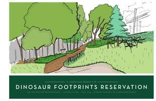
  • 1. A LANDSCAPE DESIGN FOR D I N O S AU R F O OT P R I N T S R E S E RVAT I O N THE TRUSTEES OF RESERVATIONS • JORDAN CLARK • FALL 2014 • CONWAY SCHOOL OF LANDSCAPE DESIGN
  • 2. Alandscapedesignfor DINOSAURFOOTPRINTSRESERVATION TheTrusteesofReservations Rte.5,Holyoke,MA01040 Designer:JordanClark Fall,2014 1/12 332S.DeerfieldRoad|POBox179|Conway,MA01341 413-369-4044www.csld.edu North Notforconstruction.Partofastudentprojectandnotbasedonalegalsurvey. ProjectOverview PROJECT OVERVIEW Nestled snugly on eight steep, mostly wooded acres on the western bank of the Connecticut River, Dinosaur Footprints Reservation (DFR) is a geological and cultural landmark featuring at its center a sandstone outcrop imprinted with early Jurassic dinosaur tracks. Located on the northern fringe of Holyoke, MA, The Trustees of Reservations (TTOR) property is squeezed between busy Route 5 and a stretch of railroad tracks. Currently, it serves as a point of interest for school groups and passersby as well as a popular draw for local riverfront access. In addition to its unique cultural and recreational function, the site also hosts a handful of state-listed rare plants. A central tension of this project lies between the maintenance of the reservation as an accessible place for human enjoyment and the preservation of the site’s ecological functions. Project program The objective of this project is twofold: to improve the overall visitor experience at Dinosaur Footprints Reservation while effectively stewarding the site’s natural resources, including the dinosaur tracks and rare plant species. The landscape and management of the reservation can foster a positive visitor experience by offering a place that is perceived as safe and welcoming, coherent and navigable. Such a place serves as a destination with a wide array of opportunities to learn, to play, and to rest. To enable a more engaging and satisfying visitor experience, The Trustees would like gathering areas suitable for reflection and education, expanded views into and out of the site, a solution to the eyesore represented by the concrete retaining wall that runs along the property, and a more deliberate and coherent navigation framework and visual aesthetic. Additionally, they would like to maintain rare plant habitat on-site and manage water flow to prevent erosion in problem areas. Stewarding natural resources Creating a satisfying visitor experience The thoughtful design combines functions INDEX OF SHEETS 1. Project Overview 2. Context 3. Existing Conditions 4. Views Analysis 5. Access & Circulation Analysis 6. Slopes & Drainage Analysis 7. Vegetation & River Resource Analyses 8. Summary Analysis 9. Design Alternatives 10. Final Design Plan 11. Final Design Details 12. Plant Recommendations
  • 3. Alandscapedesignfor DINOSAURFOOTPRINTSRESERVATION TheTrusteesofReservations Rte.5,Holyoke,MA01040 Designer:JordanClark Fall,2014 2/12 332S.DeerfieldRoad|POBox179|Conway,MA01341 413-369-4044www.csld.edu North Notforconstruction.Partofastudentprojectandnotbasedonalegalsurvey. Context CONTEXT Dinosaur Discoveries The Connecticut River Valley is home to the first known dinosaur tracks to be discovered in North America, and the collection of fossil sites in the region played a key role in the early study of dinosaurs. What is now Dinosaur Footprints Reservation provided some of the first evidence of the existence of these prehistoric beasts. The sandstone slab sitting just off US Route 5 at Dinosaur Footprints Reservation features hundreds of impressions from early Jurassic-era dinosaurs, first studied by Amherst College Professor Edward Hitchcock in the 1830s. The location of the footprints was well-known to paleontologists in the 19th century, during which it became a key site in the creation of “ichnology,” the study of fossilized footprints. Today it continues to be a popular location among scientists The footprints from at least four distinct two-legged dinosaur species (including a likely ancestor to Tyrannosaurus Rex), along with other trace fossils and ripple marks, are thought to be around 200 million years old. Though the footprints (and others like them nearby) now lie in the Connecticut River Valley, the creatures that left them were walking in a swampy subtropical mudflat on the supercontinent Pangaea. The footprints were rediscovered in the following century during the construction of what is now U.S. Route 5, shortly after which the land on which they sit was acquired by The Trustees of Reservations for its preservation for the public. The route of the old country road replaced by Route 5 is still apparent on the site — a relatively flat strip that runs through the otherwise steep terrain. Chunks of the broken-up old road can be easily found less than a foot from the surface in many places. Conserved, though fragmented The immediate setting of Dinosaur Footprints Reservation echoes its broader surroundings. It lies within a mosaic of conserved land that includes much of the Mount Tom and Mount Holyoke ranges, and it is part of the Silvio O. Conte National Wildlife Refuge, whose goal is to protect the ecological diversity of the Connecticut River watershed. Despite its importance to the broader ecosystem, it is constrained by surrounding development and fragmented by the major transportation corridors that run through it. A popular but remote spot The reservation sits just off the major connecting route for car and bike traffic between Holyoke (pop. 41,000; city center is 3 miles away) and Northampton (pop. 29,000; 7 miles away). Despite its proximity to large population centers, it is still a relatively out- of-the-way destination for all but those with access to a car. Bike paths run along Route 5 (there are no bike racks on-site) and buses will stop at the reservation, but there is no official stop. The portion of rock outcrop that juts into the river across the train tracks from DFR property has long been a popular river access point among locals, as Holyoke center provides no access to the river that runs through it. Also, perhaps due to its secluded setting, it has had a reputation in the past for playing host to illicit nighttime activities. During visiting hours (dawn to dusk), there are occasional reported thefts of items left in cars parked at the reservation, though Holyoke’s police department has confirmed that such incidents have greatly decreased in the past several years. C O N N EC TIC U T RIVER MT. TOM DINOSAUR FOOTPRINTS RESERVATION INTERSTATE 91 U.S. RTE. 5 (NORTHAMPTON ST.) Edward Hitchcock The riverfront adjacent Dinosaur Footprints Reservation is a popular local attraction. Bing Maps Image Bing Maps Image
  • 4. Alandscapedesignfor DINOSAURFOOTPRINTSRESERVATION TheTrusteesofReservations Rte.5,Holyoke,MA01040 Designer:JordanClark Fall,2014 3/12 332S.DeerfieldRoad|POBox179|Conway,MA01341 413-369-4044www.csld.edu North Notforconstruction.Partofastudentprojectandnotbasedonalegalsurvey. ExistingConditions N EXISTING SITE CONDITIONS Parking lot Intermittent stream Riverfront rock outcrop C O N N E C T I C U T R I V E R Bing Maps Image Project scope Footprints location N0 10 20 40ft. DINOSAUR FOOTPRINTS DECIDUOUS HARDWOOD FOREST WOODCHIP PATH CONCRETERETAINING W ALL SUMAC STAND DECIDUOUS HARDWOOD FOREST PARKING BOSTON&MAINERAILROAD U.S.ROUTE5 DINOSAUR FOOTPRINTS RESERVATION PROPERTY U.S. ROUTE 5 LAND FROM THE TRAIN TRACKS TO THE RIVERFRONT IS NOT OWNED BY DFR Dinosaur Footprints Reservation sits on a narrow 8-acre strip of land along the western edge of the Connecticut River. Steep and mostly forested with a central open area surrounding the rock outcrop that features the dinosaur footprints, the property is squeezed between U.S. Route 5 on its western border and a railroad on its eastern edge, cutting it off from direct contact with the river. The focal area for this project is the middle third of the property (shown here). The major section of sandstone outcrop directly abuts the retaining wall of Route 5. This concrete wall, about 12 feet tall at its tallest, blocks some noise and views from the busy road above, but its monolithic presence adds little to the visitor experience and may invite vandalism. The steep terrain throughout the site presents challenges for accessibility. The woodchip path from the parking lot down to the dinosaur footprints area is mostly greater than 10 percent grade, double the acceptable grade for handrail-free access. The slopes also contribute to erosion across paths in some areas. Currently a single maintained path leads to the dinosaur footprints, while a secondary trail cuts through the woods toward the river. This compacted soil and rock outcrop trail is heavily used by those visiting the site primarily for river access. An information kiosk greets visitors in English and Spanish at the point of entry, and another sign featuring details about the dinosaur footprints stands at the end of the main path, just before the forest opening. A A’ A A’
  • 5. Alandscapedesignfor DINOSAURFOOTPRINTSRESERVATION TheTrusteesofReservations Rte.5,Holyoke,MA01040 Designer:JordanClark Fall,2014 4/12 332S.DeerfieldRoad|POBox179|Conway,MA01341 413-369-4044www.csld.edu North Notforconstruction.Partofastudentprojectandnotbasedonalegalsurvey. ViewsAnalysis VIEWS ANALYSIS Upon arrival at the Dinosaur Footprints Reservation parking and entry area, views to the interior are limited. The dense forest growth that envelops the path leading to the dinosaur footprints lends a sense of mystery about what lies further ahead. It does not, however, offer the visitor any glimpse of the destination, which can make visitors feel unsafe. Openings in the woods can be comforting both when a person is in them and when one can look into them. Therefore, to create a more more enticing and reassuring landscape, thinning and limbing up trees along the main path to open up views may be necessary. Thick vegetation (mostly woody shrubs) in the central section also obstructs any views to the nearby river from on-site. Paring back some of this growth to open up views could provide a new area of interest near the location of the dinosaur footprints. The concrete retaining wall provides a barrier to the bustle of the road above, but in the context of the forest and dinosaur footprints, it is an eyesore that tends to invite vandalism. However, the wall presents an opportunity for a mural that could tie into TTOR’s interpretive plans for the site. Thick vegetation creates inviting enclosed spaces and provides a diversity of surroundings within the reservation, but obstructed views can cause frustration and safety concerns. A concrete retaining wall separatestheinteriorfromtheadjacentbusyroad,butitsappearance clashes with the reservation’s natural setting. From the open area around the dinosaur footprints, views of the river are blocked by vegetation. Autumn gives a glimpse of the river views possible from on-site. The retaining wall provides separation from the busy road above, but it detracts from the natural surroundings. Just across the train tracks, the rock outcrop jutting into the river affords stunning views THE RETAINING WALL IS AN EYESORE WITHIN THE PROPERTY DENSE WOODS BLOCK VIEWS FROM THE ENTRANCE THICK VEGETATION OBSCURES VIEWS TO THE RIVER N0 10 20 40ft. BARRIERS TO VIEW NEGATIVE VIEWS A A B C D E E D F F B At the entrance, views down the path are restricted. The forest encloses the path to the footprints before opening up. C
  • 6. Alandscapedesignfor DINOSAURFOOTPRINTSRESERVATION TheTrusteesofReservations Rte.5,Holyoke,MA01040 Designer:JordanClark Fall,2014 5/12 332S.DeerfieldRoad|POBox179|Conway,MA01341 413-369-4044www.csld.edu North Notforconstruction.Partofastudentprojectandnotbasedonalegalsurvey. Access&Circulation Analysis LocatedalongamajortrafficroutethreemilesnorthofHolyokecenter, the reservation is a consistent draw for visitors, who come either to compare footprint sizes with dinosaurs or to access the riverfront. Due to its proximity to Holyoke and its position along the Connecticut River, DFR serves as an informal river access point for kayakers and fisherfolk; direct river access is unavailable in the center of Holyoke. Accessing the river requires crossing the railroad tracks along the eastern border of the property, which is illegal and a possible liability issue for TTOR. Currently an informal path draws visitors to the train tracks and down toward the river. Parking for approximately seven vehicles is available at the entrance along Route 5. When buses bring school groups, however, parking is not sufficient. Current pedestrian circulation within the park is somewhat ill-defined, with a branch off the main path leading down toward the river, where a sign advises against crossing the train tracks. The layout of the area surrounding the dinosaur footprints tends to impose a linear progression toward the end of the footprints slab, with no apparent option for continued exploration. A more satisfying arrangement might involve looping circulation to accommodate the visitor’s desire to continue exploring. ACCESS & CIRCULATION ANALYSIS The sign on the left is the only advertisement for the reservation, just off a 45-mph road. The entrance kiosk provides bilingual site information, including a map of the reservation. A sign at the base of the dinosaur footprints area greets visitors. The far end of the dinosaur footprints slab is a dead end. A more thoughtful site layout might encourage continued exploration beyond that point. At DFR, the allure of what lies beyond the rail- road is both an asset and a liability. P CAR -BUS-BIKE HOLYOKE(2mi.) NORTHAM PTON (6.5mi.) DINOSAUR FOOTPRINTS RIVERFRONT ACCESS RAILROAD Visitors are officially informed that crossing the train tracks is illegal, but there is no physical barrier to doing so. MAIN ATTRACTION BARRIER TO ACCESS N0 10 20 40ft.
  • 7. Alandscapedesignfor DINOSAURFOOTPRINTSRESERVATION TheTrusteesofReservations Rte.5,Holyoke,MA01040 Designer:JordanClark Fall,2014 6/12 332S.DeerfieldRoad|POBox179|Conway,MA01341 413-369-4044www.csld.edu North Notforconstruction.Partofastudentprojectandnotbasedonalegalsurvey. Slopes&Drainage Analysis Most of reservation sits on slopes of greater than 15% grade, with pockets of less steep terrain occurring primarily through the center of the site, along what was once a country road. A seating area would require a relatively level surface, which could necessitate some regrading. Most of the existing woodchip path connecting the parking lot to the dinosaur footprints area is greater than 10% grade; an accessible path without handrails would require regrading to under 5%, as well as surface hardening. There is evidence of erosion on paths across downhill grades, such as the area where the path forks and the lower portions of the compacted soil footpaths. Rerouting water flow around paths will be important for maintaining the integrity of the soils and walking areas. SLOPES & DRAINAGE ANALYSIS Gullies erode away compacted soil paths. Sheet flow across the trail fork is causing erosion. The site’s steep slopes present accessibility problems for visitors, while maintenance challenges arise where erosion and soggy conditions cause damage to paths. AREAS OF EROSION SOGGY AREA AT END OF PATH Water flow creates soggy conditions at the bottom of the path. SLOPES >15% SLOPES 5-15% SLOPES <5% WATER FLOW DINOSAUR FOOTPRINTS RESERVATION PROPERTY A section of Dinosaur Footprints Reservation, through the central portion of the site, shows significant slopes from west to east. U.S. ROUTE 5 LAND FROM THE TRAIN TRACKS TO THE RIVERFRONT IS OFF DFR PROPERTY N0 10 20 40ft.
  • 8. Alandscapedesignfor DINOSAURFOOTPRINTSRESERVATION TheTrusteesofReservations Rte.5,Holyoke,MA01040 Designer:JordanClark Fall,2014 7/12 332S.DeerfieldRoad|POBox179|Conway,MA01341 413-369-4044www.csld.edu North Notforconstruction.Partofastudentprojectandnotbasedonalegalsurvey. Vegetation&River ResourceAnalyses Three distinct plant communities Red oak/sugar maple transition forest, about 60 years old, covers most of the site, except for the cleared area surrounding the dinosaur footprints. The forest comprises mostly white and red oaks, red and sugar maples, and mature hickories, with a smattering of tree species commonly found along rivers, includ- ing hackberry, sycamore, and cottonwood. Thin soils over bedrock limit the size and type of trees growing here. The understory is of varied density, and much of the shrub layer is made up of exotic invasives such as Morrow’s honeysuckle; however, native shrubs including blueberries, gray dogwood, and Carolina rose, as well as wood aster, false Solomon’s seal, and Virginia creeper in relatively open sections are also present. Rocky outcrop communities host DFR’s two main attractions—the large area of exposed sandstone along the road retaining wall that contains dinosaur tracks and the outcrop that juts into the river, to the east of the railroad (not TTOR property). Crevices in the rock with shallow soil pockets provide the habitat for these communities. At least three state- listed rare plants have been reported on these spots. Tradescant’s aster (Symphyotrichum tradescantii) and upland white aster (Oligoneuron album) both grow in crevices near the river, while false pennyroyal (Trichostema brachiatum) is found in the open area around the rock outcrops on DFR property. Maintained grassland and early successional areas surround the footprints slab, as a result of the recent removal of a dense thicket of invasive shrubs. Various grasses, increasingly dense patches of staghorn sumac, and a few scattered young Eastern red cedars grow in the shallow-to-bedrock soils. State-listed rare plants on-site Considered endangered in Massachusetts (but secure globally), false pennyroyal (Trichostema brachiatum) is an herbaceous annual in the mint family that prefers open sunny exposures on disturbed sandy soil or rock outcrop. At the DFR, it can be found on and around the areas of exposed bedrock. TTOR has been actively encouraging its population expansion on-site, and has conducted an aggressive campaign against invasive plants that encroach on its habitat. Otherwise, its main threat to existence is shade. To this end, TTOR has maintained an open area around the rock outcrops. Design directions: Given T. brachiatum’s protected status in Massachusetts, any design should include provisions for the long-term survival of the plant, either in its current location or nearby. For any design that calls for added vegetation, care should taken to match plant species to microclimate, sun and moisture conditions, as well as surrounding vegetation. Should a design call for new plant communities, only native plants or non-natives that pose no invasive potential in the area are to be used. In the creation of novel plant communities, it is essential to be a mindful agent of plant dispersal. VEGETATION & RIVER RESOURCE ANALYSES Though constrained by the transportation corridors that define its property boundaries, the reservation provides a diverse habitat along the Connecticut River that features three distinct plant communities and a handful of regionally rare plants. Rocky outcrop community Red oak/sugar maple transition forest Maintained grassland & early successional communities Yearly invasive control is conducted on-site. RED OAK/SUGAR MAPLE TRANSITION FOREST ROCKY OUTCROP COMMUNITIES MAINTAINED GRASSLAND & EARLY SUCCESSIONAL COMMUNITIES REPORTED OCCURRENCES OF FALSE PENNYROYAL 200’ RIVER RESOURCE AREA False pennyroyal N0 10 20 40ft.
  • 9. Alandscapedesignfor DINOSAURFOOTPRINTSRESERVATION TheTrusteesofReservations Rte.5,Holyoke,MA01040 Designer:JordanClark Fall,2014 8/12 332S.DeerfieldRoad|POBox179|Conway,MA01341 413-369-4044www.csld.edu North Notforconstruction.Partofastudentprojectandnotbasedonalegalsurvey. SummaryAnalysis SUMMARY ANALYSIS DENSE GROWTH BLOCKS RIVER VIEWS DENSE WOODS BLOCK VIEWS TO THE INTERIOR DECIDUOUS FOREST; RELATIVELY UNUSED DECIDUOUS FOREST; RELATIVELY UNUSED OPEN AREA SURROUNDING DINOSAUR FOOTPRINTS RIVER ROCK OUTCROP: OFF PROPERTY, A BIG VISITOR DRAW ENTRANCE & PATH ENTRANCE AND INITIAL EXPERIENCE A single, six-foot-wide sign in the grassy median along Route 5 announces the reservation; for a 45-mph road, this is short notice. Visitors are greeted with a bilingual informational kiosk at the trail head. Signs warn of theft in the parking lot; the separation of the parking lot from the dinosaur footprints area and the lack of visibility to the interior can decrease the perception of safety. Views from the parking lot only extend halfway down the 400-foot trail. The woodchip-covered trail from the parking lot is too steep to be considered universally accessible. An ADA-compliant path (5% grade without handrails) would require significant regrading and resurfacing. DENSE WOODS BLOCK VIEWS TO THE INTERIOR The forest’s thick canopy envelops the path beginning about halfway down the hill, giving a sense of mystery to the site. The wooded enclosure can serve as a pleasant, even enticing, feature, but the restricted views may also contribute to a visitor’s perceived lack of safety. Thinning trees in this area to increase visibility can help one get a better understanding of what lies within the reservation, while also maintaining some of the element of mystery that invites exploration. OPEN AREA SURROUNDING THE DINOSAUR FOOTPRINTS Most of the visitor activity on the property is concentrated in this zone; groups gather here and visitors walk on the rock outcrop to compare their footprints with those left by the dino- saurs. Given the sun conditions (this zone is the sunniest patch on the property) and the prevalence of rock outcrop, the one rare plant species found on-site grows mostly in this area. At this point, the confluence of human activity and rare species growth has not proven detrimental to the plant, which grows in disturbed shallow soils. Most threatening to its survival are shade and competition from invasive plants. The concrete retaining wall abuts the rock outcrop, buffering both views and noise from the road above, but also standing as an eyesore next to the natural features of the property. OFF-PROPERTY RIVER ROCK OUTCROP Apart from the dinosaur footprints, the rock outcrop that juts into the river is the site’s biggest visitor draw. It is known locally as the first river access point north of Holyoke center. Arriving at the riverfront, however, requires crossing the railroad tracks, which is illegal. No formal barrier prohibits this crossing, though as the tracks are converted for higher-speed passenger rail, this situation may change. HEAVY TRAFFIC DENSE VEGETATION BLOCKS VIEWS FROM THE PROPERTY TO THE RIVER Despite the reservation’s proximity to the riverfront, visitors who wish for a view of the river must cross the train tracks, because a thick pocket of vegetation grows between the open area and the train tracks. Replacing this woody shrub vegetation with a shorter-growing plant mix would open up a sight line to the river from within the property. EROSION ON PATH N0 10 20 40ft.
  • 10. Alandscapedesignfor DINOSAURFOOTPRINTSRESERVATION TheTrusteesofReservations Rte.5,Holyoke,MA01040 Designer:JordanClark Fall,2014 9/12 332S.DeerfieldRoad|POBox179|Conway,MA01341 413-369-4044www.csld.edu North Notforconstruction.Partofastudentprojectandnotbasedonalegalsurvey. DesignAlternatives DESIGN ALTERNATIVES The regraded path to the dinosaur tracks is ADA compliant; interpretive elements along the path and on the landing help set visitor expectations. An expanded trails network allows exploration & variety of experience. Expanded bedrock areas, exposed in phases, generate renewed interest and increase habitat area for rare species. The retaining wall becomes an asset: vines add texture, color, and coherence; a locally-designed mural can engage the community. A river viewing area visually connects the site to its broader context and affords the opportunity to make use of incoming views from passenger rail cars. MAYBE LATER, VELOCIRAPTOR JURASSIC PARK: THE PARK Dinosaur Footprints Reservation, in this iteration, focuses on transporting visitors to the ancient past. A variety of plant types, arranged thematically, serve as snapshots along the evolutionary history of plants since the days of the dinosaurs. This is a more formal layout than the other designs; visitors journey through distinct groupings of vegeta- tion, large and small, in a guided fashion. This is most effectively accomplished as collaborative effort with local organizations or universities. DINOSAUR FOOTPRINTS
  • 11. Alandscapedesignfor DINOSAURFOOTPRINTSRESERVATION TheTrusteesofReservations Rte.5,Holyoke,MA01040 Designer:JordanClark Fall,2014 10/12 332S.DeerfieldRoad|POBox179|Conway,MA01341 413-369-4044www.csld.edu North Notforconstruction.Partofastudentprojectandnotbasedonalegalsurvey. FinalDesignPlan FINAL DESIGN PLAN • Thinned trees in the wooded area between the main path and the western edge of the property increase visual access. The remaining distribution of trees lend both mystery and legibility to the landscape. • Uphill swales and a small culvert direct the flow of stormwater away from its current erosive path where the trail splits. A small depression planted with water- loving plants mitigates soggy conditions at the end of the woodchip path. • An outdoor room under the tree canopy, enclosed by dense understory vegetation and featuring an amphitheater at the forest edge provides a shaded gathering space with seating for up to thirty people. This space could also serve as an interpretive zone to prepare visitors for the dinosaur footprints experience. • The re-routed secondary path, previously a shortcut to the river access point, funnels visitors into the center of the site. • Creeping vines and a mural cover the concrete retaining wall that forms the property’s western border, giving a more comforting sense of enclosure to the open area. • Bench seating at a river overlook, flanked by shade-giving trees, provides another resting spot. Native grasses populate the slope down toward the train tracks, offering a full view of the riverfront where once overgrown shrubs formed a visual barrier. • Added vegetation throughout diversifies the plant population, and selection of species with prehistoric connections (ferns, horsetail, dawn redwood, ginkgo, etc.) help to visually transport the visitor to another era. In the open center the edge of the forest extends to feature dawn redwoods surrounded by an evolving mid-successional understory of ferns, sweet fern, and other evocative plantings. A B C D C B B A E F E F G Enhanced views from the entrance to the site’s interior reinforce the perception of safety,whileanon-sitevistaoftheriverprovidesanadditionalattraction.Anoutdoor room under the tree canopy offers a shaded place to rest that can accommodate groups, while the retaining wall becomes a pleasing feature befitting the landscape. Swales mitigate erosion and boggy ground on problematic areas of the main path, and a trail loop facilitates coherent circulation within the reservation. D U.S. ROUTE 5 GINKGO NATIVE GRASS MEADOW C O N N E C T I C U T R I V E R DAWN REDWOOD WITH PLANTED UNDERSTORY TRAIL LOOP THROUGH WOODS REVEGETATION OF FORMER TRAIL OUTDOOR ROOM WITH AMPHITHEATER THINNED TREES RIVER OVERLOOK AMPHITHEATER PATH THINNED TREES DINOSAUR FOOTPRINTS RIVER OVERLOOK & NATIVE GRASS MEADOW DAWN REDWOOD & FERN UNDERSTORY A A’ B B’ N0 10 20 40ft. G
  • 12. Alandscapedesignfor DINOSAURFOOTPRINTSRESERVATION TheTrusteesofReservations Rte.5,Holyoke,MA01040 Designer:JordanClark Fall,2014 11/12 332S.DeerfieldRoad|POBox179|Conway,MA01341 413-369-4044www.csld.edu North Notforconstruction.Partofastudentprojectandnotbasedonalegalsurvey. FinalDesignDetails FINAL DESIGN DETAILS Shaded amphitheater An outdoor room with an amphitheater under the tree canopy sits at the edge of the open area containing the dinosaur footprints. Three levels of seating, each six feet deep and raised sixteen inches tall, can accommodate up to thirty people. Stone slabs stabilize the edges of each level and provide firm seating material, while woodchips fill in the path and the remainder of the flat areas. A dense mix of vegetation ushers the visitor into the outdoor room and forms an enclosure around the amphitheater. Regrading Some regrading is necessary to create the terraces of the amphitheater. The top levels of the amphitheater and the bottom of the opening require fill, while the lower levels of the amphithe- ater require some excavation. Where soil is excavated, it should be used for any fill necessary to minimize the use of off-site materials. See grading plan below. 6’ 16” seats Understory plantings Main path A seating area with a vista of the river over a native grass meadow is flanked by shade-giving trees. Fern and shrubby understory highlight a large dawn redwood at the center of the sunny open area. A A’ Thinned and limbed up trees between the main path and the retaining wall (covered with Virginia creeper vines) enable views from the parking lot into the property. Horsetails growing in a swale at the end of the path mitigate soggy conditions. A A’ Grading plan for amphitheater SWALE WITH HORSETAILS STONE SEATING WOODCHIP GROUND COVER Amphitheater
  • 13. Alandscapedesignfor DINOSAURFOOTPRINTSRESERVATION TheTrusteesofReservations Rte.5,Holyoke,MA01040 Designer:JordanClark Fall,2014 12/12 332S.DeerfieldRoad|POBox179|Conway,MA01341 413-369-4044www.csld.edu North Notforconstruction.Partofastudentprojectandnotbasedonalegalsurvey. PlantRecomendations PLANT RECOMMENDATIONS Scientific Name Common Name Sun Tolerance Moisture Tolerance Form Schizachyrium scoparium Little bluestem sun/partial shade dry grass Andropogon gerardii Big bluestem sun/partial shade moist grass Sorghastrum nutans Indiangrass sun/shade dry/moist grass Eragrostis spectabilis Purple lovegrass sun moist grass Panicum virgatum Switchgrass sun/partial shade dry/moist grass Sporobolus heterolepis Prairie dropseed sun dry grass Scientific Name Common Name Sun Tolerance Moisture Tolerance Form Comptonia peregrina Sweet fern sun/partial shade dry shrub Osmunda claytoniana Interrupted fern shade moist Pteridium aquilinum Bracken fern shade/partial shade dry/moist herb Cornus racemosa Gray dogwood sun/shade moist shrub Viburnum spp. Viburnums sun/partial shade dry/moist Metasequoia glyptostroboides Dawn redwood sun dry/moist tree Scientific Name Common Name Sun Tolerance Moisture Tolerance Form Equisetum spp. Horsetail partial moist herb Eurybia divaricata White wood aster sun or dry shade dry herb Onoclea sensibilis Sensitive fern shade/partial shade moist (drier if shaded) herb Polygonatum biflorum var. commutatum Giant Solomon’s seal shade/partial sun moist herb Gaylussacia baccata Huckleberry sun/shade dry/moist shrub Matteuccia struthiopteris Ostrich fern shade/partial shade moist herb Osmundastrum cinnamomeum Cinnamon fern sun/shade moist herb Amelanchier spp. Serviceberry sun/shade dry shrub NATIVE GRASS MEADOW On the sunny, relatively steep eastern edge of the property below the river overlook, a mix of native grasses lends a soft and pleasing texture to the opening and allows views of the Connecticut River. EXTENDED FOREST EDGE Where the forest edge stops just east of the footprints slab, an understory dominated by sun- and dry-tolerant ferns accentuates the featured dawn redwood, an ancient, endangered tree that until the last century was thought extinct. This spot receives partial to full sun, with shallow, well drained soils. Scientific Name Common Name Sun Tolerance Moisture Tolerance Form Parthenocissus quinquefolia Virginia creeper partial shade/full sun dry/moist vine Lycopodium spp. Clubmosses shade/partial shade dry/moist ground cover Ginkgo biloba Ginkgo sun dry/moist tree Echinacea tennesseensis Tenn. coneflower sun/shade dry herb Allium cernuum nodding onion full/partial sun moist herb Rhus typhina Staghorn sumac sun/shade dry woody shrub FOREST UNDERSTORY AND EDGE In the understory around the amphitheater, dense plots of shrubs and ferns define the edges of the gathering space. A cluster of horsetails along the soggy end of the main path soaks up moisture and is a distinctive addition to the prehistoric planting theme. A similar thick swath of understory vegetation covers what was previously a steep path toward the river. GENERAL PLANT PALETTE The native vine Virginia creeper climbs the retaining wall, covering its facade and adding brilliant color in the fall. An attractive ginkgo tree shades the river overlook. Tennessee coneflower, a rare herb with delicate pink flowers, can accent the false pennyroyal population along rocky outcrops. Dense stands of staghorn sumac, already well-established on-site, lend a tropical-esque look to forest edges and open grassy areas. A B C A B C Equisetum/Horsetail The dinosaur footprints found on this site are approximately 200 million years old—a time frame that can be difficult to comprehend. Plants with connections to prehistoric eras can serve as visual aids in making this jour- ney back in time. Ferns, horsetails, and ancient trees such as ginkgo and dawn redwood complement the dinosaur footprints as tangible snapshots back into the evolutionary history of the planet. A rolling native grass meadow on the property’s eastern edge affords prospect of the Connecticut River be- low. Virginia creeper meanders along the concrete retaining wall to hide its unsightly appearance. Dawn redwood Ginkgo Virginia creeper Sweet-fern Bracken fern Sensitive fern Gray dogwood Little bluestem All images are courtesy of wildflower.org unless otherwise noted. wikimedia.orgwikimedia.org A C B