
Recomendados
Recomendados
Mais conteúdo relacionado
Mais procurados
Mais procurados (20)
Destaque
Destaque (20)
Semelhante a GreenwayFund
Semelhante a GreenwayFund (20)
GreenwayFund
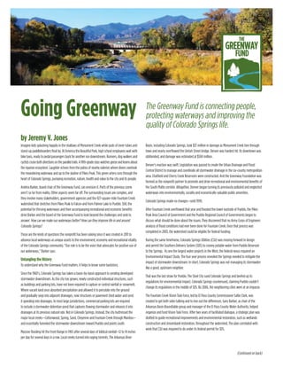
- 1. Going Greenway by Jeremy V. Jones The Greenway Fund is connecting people, protecting waterways and improving the quality of Colorado Springs life. Imagine kids splashing happily in the shallows of Monument Creek while pods of inner tubes and stand-up paddleboarders float by. At America the Beautiful Park, high school employees wait with bike taxis, ready to pedal passengers back for another run downstream. Runners, dog walkers and cyclistscruisebothdirectionsontheparalleltrails.Afifth-gradeclasswatchesgeeseandlearnsabout the riparian ecosystem. Laughter echoes from the patios of nearby eateries where diners overlook the meandering waterway and up to the skyline of Pikes Peak. This green artery runs through the heart of Colorado Springs, pumping recreation, nature, health and value to the city and its people. Andrea Barker, board chair of the Greenway Fund, can envision it. Parts of the previous scene aren’t so far from reality. Other aspects seem far off. The surrounding issues are complex, and they involve many stakeholders, government agencies and the 927-square-mile Fountain Creek watershed that stretches from Pikes Peak to Falcon and from Palmer Lake to Pueblo. Still, the potential for thriving waterways and their accompanying recreational and economic benefits drive Barker and the board of the Greenway Fund to look beyond the challenges and seek to answer: How can we make our waterways better? How can they improve life in and around Colorado Springs? Those are the kinds of questions the nonprofit has been asking since it was created in 2011 to advance local waterways as unique assets to the environment, economy and recreational vitality of the Colorado Springs community. “Our role is to be the voice that advocates for positive use of our waterways,” Barker says. Untangling the History To understand why the Greenway Fund matters, it helps to know some backstory. Since the 1960’s, Colorado Springs has taken a basin-by-basin approach to sending developed stormwater downstream. As the city has grown, newly constructed individual structures, such as buildings and parking lots, have not been required to capture or control rainfall or snowmelt. Where vacant land once absorbed precipitation and allowed it to percolate into the ground and gradually seep into adjacent drainages, now structures or pavement shed water and send it speeding into drainages. In most large jursidictions, commercial parking lots are required to include a stormwater detention pond that captures flowing stormwater and releases it into drainages at its previous natural rate. Not in Colorado Springs. Instead, the city buttressed the major local creeks—Cottonwood, Spring, Sand, Cheyenne and Fountain Creek through Manitou— and essentially funneled the stormwater downstream toward Pueblo and points south. Massive flooding hit the Front Range in 1965 after several days of biblical rainfall—12 to 14 inches per day for several days in a row. Local creeks turned into raging torrents. The Arkansas River Basin, including Colorado Springs, took $37 million in damage as Monument Creek tore through town and nearly overflowed the Uintah Street bridge. Denver was hardest hit. Its downtown was obliterated, and damage was estimated at $504 million. Denver’s reaction was swift. Legislation was passed to create the Urban Drainage and Flood Control District to manage and coordinate all stormwater drainage in the six-county metropolitan area. Chatfield and Cherry Creek Reservoirs were constructed. And the Greenway Foundation was formed as the nonprofit partner to promote and drive recreational and environmental benefits of the South Platte corridor. Altogether, Denver began turning its previously polluted and neglected waterways into environmentally, socially and economically valuable public amenities. Colorado Springs made no changes—until 1999. After Fountain Creek overflowed that year and flooded the lower eastside of Pueblo, the Pikes Peak Area Council of Government and the Pueblo Regional Council of Governments began to discuss what should be done about the issues. They discovered that no Army Corps of Engineers analysis of flood conditions had ever been done for Fountain Creek. Once that process was completed in 2003, the watershed could be eligible for federal funding. During the same timeframe, Colorado Springs Utilities (CSU) was moving forward to design and permit the Southern Delivery System (SDS) to convey potable water from Pueblo Reservoir to the Springs. As one the largest water projects in the West, the federal nexus required an Environmental Impact Study. The four year process revealed the Springs needed to mitigate the impact of stormwater downstream. In short, Colorado Springs was not managing its stormwater like a good, upstream neighbor. That was the last straw for Pueblo. The Steel City sued Colorado Springs and beefed up its regulations for environmental impact. Colorado Springs countersued, claiming Pueblo couldn’t change its regulations in the middle of SDS. By 2006, the neighboring cities were at an impasse. The Fountain Creek Vision Task Force, led by El Paso County Commissioner Sallie Clark, was created to get both sides talking and to iron out the differences. Gary Barber, as chair of the Arkansas Basin Roundtable group and manager of the El Paso County Water Authority, helped organize and fund Vision Task Force. After two years of facilitated dialogue, a strategic plan was drafted to guide recreational improvements and environmental restoration, such as wetlands construction and streambank restoration, throughout the watershed. The plan correlated with work that CSU was required to do under its federal permit for SDS. (Continued on back)
- 2. Going Greenway Continued | The Greenway Fund is connecting people, protecting waterways and improving the quality of Colorado Springs life. In addition, CSU had agreed during SDS negotiations to pay $50 million over five years to fix everything broken in the watershed below the Springs’ city limit to Pueblo. That money would begin flowing once the water in SDS did too, possibly as early as 2015—they just needed a government entity to give it to. So Pueblo Democrats and El Paso County Republicans joined hands and went to the state legislature in 2009 to establish the Fountain Creek Watershed Flood Control and Greenway District. It was directly modeled after Denver’s Urban Drainage district and tasked to regionally manage stormflow and drainage. Given the success of the Denver model and its partnership with the Greenway Foundation, a similar partnerhip was pursued. To that end, the Greenway Fund was formed in 2011 as the nonprofit partner to raise awareness and money for maximizing the recreational benefits of the waterways. The Pikes Peak Community Foundation sponsored the nonprofit. El Pomar Foundation offered logistical support through its Fellows. And the 10-member board, with Gary Barber at the helm, went to work Early Success The one-two punch of the Greenway Fund’s mission is its grassroots advocacy combined with its efforts to secure funding through grants and gifts. The organization can both receive and give donations. That’s good news for donors who can receive tax credits for large financial gifts—and for partnering organizations. “We’re eligible for grant dollars that the government is not, and the government is eligible for grant dollars that we’re not, so you cover both sides by having that partnership,” says Barber, who is still a board member. The Greenway Fund’s first big success has been driving the Legacy Loop toward completion. The 9.75-mile continuous ring of trails around downtown Colorado Springs links parks and waterways and serves as a hub for the city’s entire trail network. Although several trail connections and underpasses are still underway, the Greenway Fund has been able to secure Parks Department support, City Council approval and community partnerships to focus on completion of the Legacy Loop. It’s a project over 100 years in the making, promoted in Charles Mulford Robinson’s A City Beautiful Dream, The 1912 Vision for Colorado Springs. “Our city flag hints at it with the green ring,” Barker says. “The good news for us is that the guy who founded this town, General William Palmer, had the vision to make it a park,” Barber says. “Up in Denver, it was an industrial wasteland. They had to actually go in and acquire the land and clean up the mess and deal with toxic stuff. So we got a head start there. Most of our drainage way is already publicly owned and publicly accessible. We just need to take better care of it.” The Greenway Fund has also been the driver behind Creekside at America the Beautiful Park. The newly developed wetlands and interpretive area will feature new trails and beach access to connect people to Fountain Creek and its ecosystem. The area is scheduled to be completed by summer 2015. “The whole idea is for kids to be able to get their feet wet instead of keeping them away with berms,” Barker says. Green Potential Barker says there’s much work to be done, and many of the challenges involve overcoming the concrete channels within area creeks and shifting future design perspectives and plans. “Our creeks and waterways have huge potential to be amenities,” Barker says. “Unfortunately, we continue to treat them as infrastructure pipelines or ditches.” “Our job is to turn these liabilities into community assets,” Barber adds. Barker gets excited talking about the potential for better fatbiking access in waterways such as Sand Creek and Jimmy Camp Creek, especially when winter creates courses of shallow ice and sand bars. But will the Springs see the same kind of thriving riverwalks or whitewater parks that have spurred urban revitalization in cities across the nation? Possibly. But the leaders of the Greenway Fund prefer to focus on maximizing the unique potential of Springs’ waterways rather than trying to replicate another urban water system. “I would like to see us bring more of Colorado into Colorado Springs,” Barker says. “Let’s get more natural corridors with wider areas to have greenways throughout the city while still protecting the infrastructure of our bridges.” With the North Reclamation Plant on Monument Creek near Garden of the Gods Road providing clean effluent and a steady flow, Barber says there’s plenty of water for a tubing park. And it might even work as a kayaking run 10 or 12 days a year after big rains. “You could connect UCCS with downtown via an aesthetic riparian corridor and recreational facility that gets you all the way to America the Beautiful Park,” Barber says. “It can be the gem of the downtown.” Whatever the improvements, much of the challenge is fostering a value shift among city leaders and engineers and connecting public will. The 19th century model of development was to tame the west, drain the swamps and turn the desert green. In the 21st century, the ideal is to build wetlands, leave desert as wilderness and design urban and suburban development to work cohesively with nature. “That value shift is a difficult one for a city that’s been around 150 years and says, ‘We came out on the railroad to tame the West—now we want to untame the river?’” Barber says. “That’s why this model works. You have a partnership. You bring both perspectives to every dialogue.” “People protecting the waterways creates more green, and the green connects back to the people,” Barker says. “It’s a continuous loop that improves the quality of the environment around our waterways and the quality of life for us all.”