GI2010 symposium-fencik (+kliment+tuchyna)
•
0 gostou•615 visualizações

The document summarizes the current state of building a spatial data infrastructure in Slovakia. Key points include: 1) New legislation established a coordination council and national infrastructure for spatial information. 2) The council consists of public authorities and works to coordinate INSPIRE themes. 3) A pilot metadata service has been implemented by the Slovak Environmental Agency to support metadata editing, search, and viewing. 4) Monitoring and reporting tools are being developed including an online form and application to capture data from public authorities.

Recomendados
Recomendados
Mais conteúdo relacionado
Destaque
Destaque (20)
Mais de IGN Vorstand
Mais de IGN Vorstand (20)
Último
Último (20)
GI2010 symposium-fencik (+kliment+tuchyna)
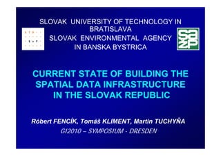
- 1. SLOVAK UNIVERSITY OF TECHNOLOGY IN BRATISLAVA SLOVAK ENVIRONMENTAL AGENCY IN BANSKA BYSTRICA CURRENT STATE OF BUILDING THE SPATIAL DATA INFRASTRUCTURE IN THE SLOVAK REPUBLIC Róbert FENCÍK, Tomáš KLIMENT, Martin TUCHYŇA GI2010 – SYMPOSIUM - DRESDEN
- 2. CONTENTS Legislation Coordination council Metadata and Discovery service Monitoring and Reporting
- 3. LEGISLATION Act No. 3/2010 on National Infrastructure for Spatial Information (NIPI) • prepared by the Ministry of Environment (ME) of the Slovak Republic (SR) • adopted on 2nd December 2009 • with effect from 1st February 2010
- 4. COORDINATION COUNCIL • established as advisory body for the minister of ME • has started work from April 2010 • consists of the public (responsible) authorities
- 5. COORDINATION COUNCIL MINISTRY COORDINATION COUNCIL MI SR MA SR MP SR MD SR ME SR Working groups MH SR MCRD SR MTPT SR SAŽP SHMÚ SO SR AGCC SR ... ŠGÚ DŠ ŠOP Local authorities Third parties VÚVH SVP Association of Towns and Villages ...
- 6. COORDINATION COUNCIL identified public authorities (see following table) for each INSPIRE theme
- 7. METADATA and DISCOVERY SERVICE Slovak Environmental Agency (SEA) has implemented pilot metainformation solution • METAINFORMATION CATALOGUE (EDITOR) – Standards ISO 19115/19119/19139, OGC CSW 2.0.2 • Simple, thematic and advance metadata search
- 9. METADATA EDITOR - validation
- 10. SIMPLE SEARCH
- 11. THEMATIC SEARCH INSPIRE THEMES
- 12. ADVANCE SEARCH
- 13. METADATA VIEW
- 14. MONITORING AND REPORTING Process of monitoring and the report creation • Creating tools – online form and application for processing of provided information • Data capturing from public authorities • Calculation of indicators • Processing and creation of the report and sending for validation and marking up to ME
- 16. MONITORING AND REPORTING Online form for public authorieties
- 17. MONITORING AND REPORTING Online form – 1st part, spatial data and services
- 18. MONITORING AND REPORTING Online form - 2nd part, information for reporting
- 19. AWARENESS RISING SK INSPIRE related information access points • INSPIRE@SK Website – http://inspire.enviroportal.sk/ • INSPIRE Forum – http://inspire-forum.jrc.ec.europa.eu/ • Geoinformatika.SK – http://www.geoinformatika.sk • GeoFórum – http://www.geodezia.org/
- 20. REFERENCES • http://inspire.enviroportal.sk • http://geo.enviroportal.sk/nipi/ • http://www.sazp.sk • http://www.enviroportal.sk • http://inspire-forum.jrc.ec.europa.eu/ • http://www.geoinformatika.sk • http://www.geodezia.org/