The Defence enterprise - Esri norsk BK 2014
•
1 gostou•831 visualizações

Using Esri collaboration tools to create, edit and share knowledge across the defence enterprise. A discussion and demonstration of the tools, templates and solutions available.

Recomendados
Recomendados
Mais conteúdo relacionado
Mais procurados
Mais procurados (20)
Semelhante a The Defence enterprise - Esri norsk BK 2014
Semelhante a The Defence enterprise - Esri norsk BK 2014 (20)
Mais de Geodata AS
Mais de Geodata AS (20)
Último
Último (20)
The Defence enterprise - Esri norsk BK 2014
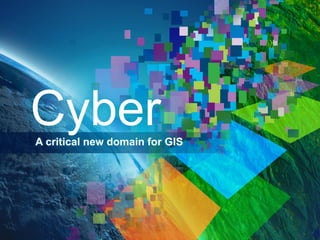
- 1. Cyber A critical new domain for GIS
- 2. GIS Is a Platform Enabling Web GIS Everywhere Desktop Web Device Simple Integrated Open Portal Server Online Content and Services Available in the Cloud . . . . . . and On-Premises
- 3. GIS – Accessible from Any Client Desktop Simple Integrated Open Portal Web Device
- 4. GIS – Powered by Services Simple Integrated Open Portal Server Online Content and Services
- 5. GIS – Organizes Content and Manages Access Simple Integrated Open Portal
- 6. GIS Supports the Enterprise Knowledge Workers Executive Access Operations Work Anywhere Enterprise Integration GIS Professional GIS Making Mapping and GIS Available Across Your Organization Transforming the Role of GIS
- 7. Web GIS Integrates Organizations and People Breaking Down the Barriers Creating New Relationships Sharing Information . . . . . . Supporting Collaborative Approaches
- 8. The Cyber Supply Line: A Geospatial Approach to Cybersecurity
- 9. Cyberspace Re-Considered It’s Mappable Social / Persona Layer Device Layer Logical Network Layer Physical Network Layer Geographic Layer • Each device in cyberspace is owned by someone (no ‘global commons’) • Electro-mechanical devices exist in space-time and interact with physical events • Geography is required to integrate and align cyberspace with other data
- 10. Solution Strategy Executives / Commanders Enterprise - focused IT Infrastructure Device-Focused Awareness Operations Process-focused Recovery Prevention Cyber Security Event-focused Response Protection
- 11. The Cyber Supply Line A vector of devices Mission Data Flow LAN Bldg Net WAN Cyber Supply Line Campus #1 LAN Bldg Net Campus #2 1. Cyber Supply Line (CSL) is a consistent path through the infrastructure 2. CSL focuses resources on only the devices that are critical 3. Managing data flows is similar to traffic routing
- 12. Effect Propagation Multi-Level Model of Data Flow Maintain Data Flow Mission Assurance
- 13. Cyber Demo
- 14. Solution Strategy Integrate Cyber into existing Operational Pictures J6/CIO Group Command Group CTO CEO/CDR COO/J3 CIO Service-Oriented Architectures/Cloud Dynamic View Static View (behavior) (structure) Apps Apps Apps Net Status (J6) Net Arch (J6) Facilities/CIP (J4) Multi-Domain Info & Ops (J2/J3) Apps Local Area Network Customer’s Existing Data & Apps Power Physical Security Sensors Weather Buildings Wide Area Network CCTV Social Media Threats & Warning Apps Geospatial GEOINT
- 15. Cyber Summary: • Cyber Supply Line concept • Improved • Shared Mission Effectiveness Situational Awareness • Departmental Collaboration
- 16. Questions?