ground penetrating radar
•Transferir como PPTX, PDF•
36 gostaram•13,838 visualizações

GPR systems work by sending a tiny pulse of energy into a material via an antenna. An integrated computer records the strength and time required for the return of any reflected signals. Subsurface variations will create reflections that are picked up by the system and stored on digital media. These reflections are produced by a variety of material such as geological structure differences and man-made objects like pipes and wire.

Recomendados
Mais conteúdo relacionado
Mais procurados
Mais procurados (20)
Semelhante a ground penetrating radar
Semelhante a ground penetrating radar (20)
Último
Último (20)
ground penetrating radar
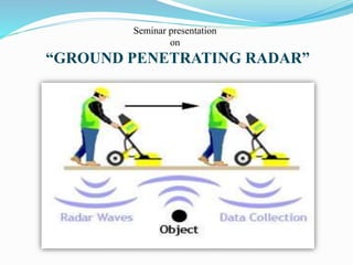
- 1. Seminar presentation on “GROUND PENETRATING RADAR”
- 2. Contents: 1. Introduction 2. Components of GPR 3. GPR working principle 4. Reflected signal 5. GPR depth determination 6. How deep can GPR go into ground? 7. GPR received signal and graphic profile display 8. Advantages 9. Applications 10. Conclusion 11. References
- 3. Introduction: RADAR → Radio Detection and Ranging. Detect target in free space Determine the range Ground-penetrating radar (GPR) is a geophysical method that uses radar pulses to image the subsurface. GPR finding and detecting buried object. GPR can be used in a variety of media, including rock, soil, ice, fresh water, pavements and structures. It can detect objects, changes in material, and voids and cracks. Probing into soil to detect pipelines and tanks and detect thickness of soil.
- 4. Components of GPR: 1. Transmitting and receiving unit 2. Control unit 3. Display unit 4. Power supplies
- 5. GPR Working Principle: An EM pulse is sent through an antenna, penetrating into the surveyed material. A portion of the energy is reflected back to the antenna when an interface between materials of dissimilar dielectric constant is encountered.
- 6. Reflected Signal: The amount of reflected energy at an interface is governed by: r r 1 2 r r 1 2 1,2 where ρ1,2 is the reflection coefficient and εr1 and εr2 are the dielectric constants. Typical Dielectric Constants: Material Relative permittivity Air 1 Asphalt: dry 2-4 Clay 2-40 Dry sand 3-5 Concrete: dry 4-10 Fresh water 80 Metals ∞
- 7. GPR Depth Determination: The reflected signal has information on: how quickly the signal traveled how much was attenuated These quantities depend on spatial configuration and materials. The depth of a layer is given by: D = (5.9t)/sqrt. of(Er) D = depth of target (inch.) t = wave travel time (nanosecond) 5.9 = a constant incorporating speed of light and unit conversions Er = dielectric constant of subsurface material
- 8. How deep can GPR go into ground?: It depend upon two condition: The type of soil or rock in the GPR survey area. The frequency of the antenna used. Low frequency systems are more penetrating but data resolution is lower. High frequency systems have limited penetration but offer a much higher resolution. Antenna Frequency Maximum Penetration Depth Appropriate Application 1500 MHz 0.5 m Rebar mapping and concrete evaluation. 900 MHz 1 m Pipe and void detection or assessing concrete thickness. 400 MHz 4 m Utility surveys, pavement evaluation, storage tank detection and assessing structural integrity 270 MHz 6m Utility surveys, geology and archaeology
- 9. GPR Received signal and graphic profile display:
- 10. Advantages: Extremely accurate Fast Not needed to drilling and digging selected area Real time targeting Non-destructive Non-intrusive Digital media storage Easy to operate Safe
- 11. Applications: In the Earth sciences it is used to study bedrock, soils, groundwater, and ice. Military uses include detection of mines, unexploded ordnance, and tunnels. locating clandestine graves and buried evidence. the other main applications for ground penetration radars to locate underground utilities.
- 12. Conclusion: GPR has been developed into a sophisticated technique that can provide detailed images of the near surface. As opposed to other locating techniques that are capable of detecting only metallic or conductive utilities and underground targets, GPR can locate and characterize both metallic and non-metallic subsurface features. It is completely non-intrusive, non-destructive and safe.
- 13. References : vashov, S. I.; Razevig, V. V.; Vasiliev, I. A.; Zhuravlev, A. V.; Bechtel, T. D.; Capineri, L. (2011). "Holographic Subsurface Radar of RASCAN Type: Development and Application". IEEE Journal of Selected Topics in Applied Earth Observation and Remote Sensing 4 (4): 763–778. doi:10.1109/JSTARS.2011.2161755. Retrieved 26 September 2013. ETSI EG 202 730 V1.1.1 (2009–09), "Electromagnetic compatibility and Radio spectrum Matters (ERM); Code of Practice in respect of the control, use and application of Ground Probing Radar (GPR) and Wall Probing Radar (WPR) systems and equipment Wilson, M. G. C.; Henry, G.; Marshall, T. R. (2006). "A review of the alluvial diamond industry and the gravels of the North West Province, South Africa". South African Journal of Geology (Geological Society of South Africa) 109 (3): 301–314 Daniels DJ (ed.) (2004). Ground Penetrating Radar (2nd ed.). Knoval (Institution of Engineering and Technology). pp. 1–4. ISBN 978-0-86341-360-5