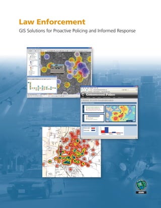
Law Enforcement: GIS Solutions for Proactive Policing and Informed Response
•
1 gostou•974 visualizações


Recomendados
Recomendados
Mais conteúdo relacionado
Mais de Esri
Mais de Esri (20)
Último
Último (20)
Law Enforcement: GIS Solutions for Proactive Policing and Informed Response
- 2. Applying GIS Technology to Law Enforcement The Geographic Advantage for Proactive Policing and Informed Response Law enforcement means problem solving. As a commander, an officer responding to a scene, or an analyst piecing together elements of a crime pattern or trend, you make critical decisions every day. These decisions have a direct impact on citizens and on fellow law enforcement personnel. Geographic information system (GIS) technology can provide the geographic advantage for law enforcement enterprise informa- tion systems by turning data into actionable knowledge. A GIS combines layers of data about a location to give you a better understanding of that location and what is occurring around it. The data and information you combine depends on your purpose, whether realigning response zones for better resource allocation, analyzing crimes to detect emerging pat- terns, examining the best locations to conduct surveillance for a recent crime series, or establishing a perimeter for a crime scene or natural disaster. GIS technology dynamically combines many layers in a relevant display, getting the right data and informa- tion into the hands of those who need it. The Hartford, Connecticut, Police Department uses ArcGIS ® and ModelBuilder™ to support intelligence-led policing. This has allowed the department to effectively change, in a positive manner, its community policing initiatives at the neighborhood level. Incident Analysis Gang Hazards Resource Allocation Offender Tracking Facility Monitoring Station Locations Crime density and hot spot analysis by the Lincoln, Nebraska, Real World Police Department.
- 3. GIS for Intelligence-Led Policing Prevent and Respond Safely and Effectively A new trend is emerging among forward-thinking agencies, with the power of GIS transforming the way police protect and serve your communities. GIS provides an information-based method supporting all roles and aspects of law enforcement. Field Personnel Field personnel can access intelligent information from their mobile devices to identify suspicious activity, enhance field inves- tigations, access suspect information, and easily perform crime analysis. ArcGIS is used to determine the risk level of sex offender activity in Riverside County, California. Law enforcement can use GIS solutions to • Determine optimal locations for deploying resources. • Analyze the dynamics of an incident in progress to make informed decisions and operational adjustments. • Identify and examine suspicious activity and threats. • Enhance officer safety and effectiveness by providing information and awareness of repeat incidents. • Target repeat 911 call locations. • Perform resource analysis and allocation. The Arizona Counter Terrorism Information Center applies GIS for critical infrastructure assessment and protection. • Develop a crime scene log to ensure the integrity of an investigation. • Exchange information with a neighboring jurisdiction or a Incident Commanders jurisdiction half a world away. Incident commanders can use GIS to understand trends, make critical decisions when crime spikes, and collaborate with other law enforcement agencies. Crime and Intelligence Analysts A crime or intelligence analyst can use sophisticated tools to support better operational decisions and to address short-term tactical and long-term strategic issues. Chief of Police or Sheriff GIS can provide a chief or sheriff with a comprehensive view for long-term decision making. They can also look at predictive crime models for developing comprehensive strategic plans to support personnel. Twenty-four-hour crime density for a three-month period; total number of crimes = 375. By the South Georgia Regional Development Center.
- 4. GIS and the Law Enforcement Enterprise Working across Agencies, Jurisdictions, and Borders At the core of an enterprise GIS platform is the ability to use a geographic approach throughout the organization to work more efficiently and effectively in meeting the challenges you face. Better data management leads to better resource management. Knowing more about crimes and hazards or threats creates more opportunities for proactive policing and crime prevention. New methods to target crime can identify new operational needs. From the desktop to the field, you can benefit by applying the geographic advantage to the law enforcement enterprise. The Redlands, California, Police Department uses ArcGIS to display a density hot spot analysis of auto thefts. Enterprise GIS supports the law enforcement mission by providing the foundation to address four key needs: ArcGIS Server – ArcGIS Explorer • Operational Awareness—Supporting a comprehensive, ArcInfo/Partner Solutions Executive Dashboard relevant view into your agency’s activities Partner Solutions ArcGIS Desktop – ArcGIS Server/ Routing • Information Integration and Analysis—Managing data Operational Awareness effectively and reducing information overload Information Integration and Analysis Analysis Crime Tracking • Strategic and Tactical Planning—Creating more ArcGIS Server AVL/ opportunities for proactive policing through analytic tools Field Mobility • Field Mobility—Providing a platform for data and Awareness information exchange into and out of the field Field Intelligence Analysis Mobile/Partner Solutions Law Enforcement Data Fusion/ Partner Solutions Data Model ArcGIS Server – ArcGIS Server/ Integration MDT/MDC Strategic and Tactical Planning Resource Community COMPSTAT Management Corrections ArcGIS Server ArcGIS Desktop – ArcGIS Desktop – ArcInfo ArcGIS Server Information Core Key Technology and Systems Business Business Approach Framework Capabilities Solutions
- 5. The Enterprise Geographic Advantage Turning Data into Actionable Intelligence ESRI® software and technology is used by law enforcement agen- Financial and Electronic Crimes cies in hundreds of applications throughout the world, with ESRI • Monitor and highlight clusters of suspicious transactions and ESRI business partners providing GIS solutions for every need. involving potential credit card fraud and food stamp fraud. • Model flows of financial activity between individuals to spot potential criminal dealings or terrorist activity. • Develop intelligent tools to spot sudden changes in a suspect’s financial picture. Criminal Intelligence and Analysis • Analyze crime patterns and provide geographic profiling. • Map crime and law enforcement timelines and activity flows. • Perform strategic analysis by mapping threat assessment and flagging areas of concern. Public Information • Share information with the general public about emerging problems or threats. • Enlist the support and feedback of community watch and Critical infrastructure identification and risk assessment can be citizen advisory councils. performed using ArcGIS. • Advise the public of convicted sex offenders residing in their communities. Crime and Investigative Analysis Corrections, Probation, and Parole • Leverage and fuse spatial data to a wide variety of traditional • Map crime patterns and trends among the inmate population. law enforcement data sources. • Visualize networks and associations among inmates that foster • Provide contextual information for a more informed response. crime problems. • Identify and link related or seemingly unrelated crime patterns • Identify resource gaps and support effective reallocation and trends. processes. CompStat and Accountability Methods • Implement plans to reduce crime and improve quality of life. • Support collaboration through informed problem solving for all levels of law enforcement. • Ensure coordination and eliminate duplicative efforts. Community Policing • Integrate demographic, housing, business, and other data for understanding neighborhoods. • Site community policing outreach offices in proximity to populations at risk. • Perform a multitude of tasks and analyses using historical socioeconomic data. E-911/Communications • Quickly locate and map emergency call locations. • Display the current locations of public safety vehicles for efficient dispatch. The Lincoln, Nebraska, Police Department uses ArcGIS to perform • Display public safety resource locations for incident 3D density analysis of narcotics-related crimes. management and command and control.
- 6. ArcGIS : The Complete Enterprise GIS ® Whether you need to perform spatial analysis, manage large Desktop GIS amounts of spatial data, or produce cartographically appeal- ArcGIS Desktop Server GIS ® ArcGIS Engine ing maps to aid in decision making, ArcGIS® allows you to use ArcGIS Explorer ArcGIS Server one common platform to meet all your GIS needs. And because ArcGIS Image Server ArcGIS is built using technology standards, it will integrate well with your existing systems. ArcGIS ArcGIS is a complete system for authoring, serving, and using geographic information. It is an integrated collection of GIS Mobile GIS software products for building and deploying a complete GIS ArcGIS Mobile ArcPad ® wherever it is needed—on desktops or servers or in custom applications, over the Web, or in the field. Online GIS ArcGIS Online SM ESRI Data Community Data Learn more about GIS for public safety at TM StreetMap Premium TM www.esri.com/publicsafety. ESRI Data & Maps ESRI Regional Offices Minneapolis Olympia 651-454-0600 360-754-4727 St. Louis Boston 636-949-6620 Philadelphia 978-777-4543 610-644-3374 ESRI 380 New York Street Redlands, California 92373-8100 USA Washington, D.C. Phone: 909-793-2853 703-506-9515 Fax: 909-793-5953 E-mail: info@esri.com California 909-793-2853 Charlotte ext. 1-1906 704-541-9810 Denver 303-449-7779 San Antonio 210-499-1044 For More Information 1-800-GIS-XPRT (1-800-447-9778) Outside the United States, contact your local ESRI distributor. www.esri.com For the number of your distributor, Locate an ESRI value-added reseller call ESRI at 909-793-2853, near you at ext. 1-1235, or visit our Web site at www.esri.com/resellers www.esri.com/distributors No. GS-35F-5086H Copyright © 2008 ESRI. All rights reserved. ESRI, the ESRI globe logo, ArcGIS, ArcEditor, ArcView, ArcPad, ArcScene, ArcMap, ArcInfo, ModelBuilder, Community, StreetMap, The Geographic Advantage, 111247 @esri.com, and www.esri.com are trademarks, registered trademarks, or service marks of ESRI in the United States, the European Community, or certain other jurisdictions. Other companies and products INLD12M4/08dh mentioned herein may be trademarks or registered trademarks of their respective trademark owners. Printed in USA