Summer 2007 The Survivior Newsletter ~ Desert Survivors
•
1 gostou•1,374 visualizações

This article discusses the formation of desert pavements through the accumulation of dust over long periods of time, rather than through wind erosion as commonly believed. Desert pavements form as fine dust particles slowly accumulate beneath gravel surfaces, causing the gravel to float upwards over thousands of years. Studies show it can take over 50,000 years to form a strong, interlocking pavement and pavements in some areas of Australia may be over 1 million years old. The accumulation of dust beneath pavements challenges common misconceptions about their formation process and highlights how slowly they develop.
![Letters
S H O RT TA K E S
Don’t Mess With
Virtual Wilderness
[The following email exchange was for-
warded to the editor, whose guess is
that the facility pictured is a biometric
border security station.]
June 14, 2007
Directors and General Counsel:
I am forwarding an e-mail and attachment
sent to me by a firm that wants to use a jpg
image from the DS website that ended up
being archived somewhere on the web.
The guy called me and said he was patent-
ing a product to be sold to and used by the
U.S. Army in Afghanistan. It looks like a
jail. The image in the background appears
to be a portion of the homepage image of Image of commercial product superimposed on photograph from DS website
Death Valley that we formerly had on our
website (at least somebody likes it!). I told Mountain Peak
him NO. My response to him is also for- June 14, 2007 3:44 p.m.
warded. Mishap
Mr. Dorsey:
Steve Tabor October 5, 2007
This e-mail will serve as a formal response
to your request to use the image you refer The caption to the picture found on page 2
June 13, 2007 to as “RENDER11.jpg” that you have of the Spring 2007 Survivor, is wrong. The
taken from Desert Survivors material that peak in the picture is Montgomery peak,
Subj:Using your Desert Survivors web not Boundary peak, although one can just
you found on the World-Wide Web.
image for project barely see the northern shoulder of Bound-
Desert Survivors expressly forbids you to
ary behind Montgomery in the photo.
To: President of Desert Survivors, use in publication or otherwise this image
or any other image that you derive from us Richie Schwarz, New York, NY
Steve, via web search or any other means. Desert
Survivors expressly disapproves of the pur- [Corrected caption is printed below.
Per my message yesterday, we would like to pose for use of this material that you have -Editor]
use your image as a background plate for a represented to us. You are hereby ordered
product rendering. I felt your permission to cease and desist any attempt(s) to pub-
would be required before we proceed. lish material that you have derived from
Attached is the image and it's use.
Desert Survivors for this or any purpose.
For sake of our client, could the use be
I will duplicate this instruction in writing
kept between the two of us? It is for a
patent on a new product. Thank you for and send it to you by postal mail. Copies
your courtesy, we appreciate it! Have a nice of this letter and e-mail have been sent to
day. our General Counsel, as has a forward of
Judy Kendall
the image you have sent to me as the object
Sincerely, of your communication.
Tyler J. Dorsey
Trial Technology/Graphic Specialist Steve Tabor
Video Discovery, Inc. Montgomery Peak as seen from
President
Cleveland, OH Benton Hot Springs
Desert Survivors
Cover: The Sump, western Nevada; see page 22. Photo by Bill Johansson.
2 The Survivor Summer 2007](data:image/gif;base64,R0lGODlhAQABAIAAAAAAAP///yH5BAEAAAAALAAAAAABAAEAAAIBRAA7)
Recomendados
Mais conteúdo relacionado
Mais procurados
Destaque
Destaque (9)
Último
Último (20)
Summer 2007 The Survivior Newsletter ~ Desert Survivors
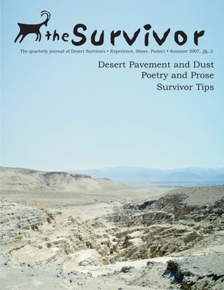
- 1. the Survivor The quarterly journal of Desert Survivors • Experience, Share, Protect • Summer 2007, 26, 2 Desert Pavement and Dust Poetry and Prose Survivor Tips
- 2. Letters S H O RT TA K E S Don’t Mess With Virtual Wilderness [The following email exchange was for- warded to the editor, whose guess is that the facility pictured is a biometric border security station.] June 14, 2007 Directors and General Counsel: I am forwarding an e-mail and attachment sent to me by a firm that wants to use a jpg image from the DS website that ended up being archived somewhere on the web. The guy called me and said he was patent- ing a product to be sold to and used by the U.S. Army in Afghanistan. It looks like a jail. The image in the background appears to be a portion of the homepage image of Image of commercial product superimposed on photograph from DS website Death Valley that we formerly had on our website (at least somebody likes it!). I told Mountain Peak him NO. My response to him is also for- June 14, 2007 3:44 p.m. warded. Mishap Mr. Dorsey: Steve Tabor October 5, 2007 This e-mail will serve as a formal response to your request to use the image you refer The caption to the picture found on page 2 June 13, 2007 to as “RENDER11.jpg” that you have of the Spring 2007 Survivor, is wrong. The taken from Desert Survivors material that peak in the picture is Montgomery peak, Subj:Using your Desert Survivors web not Boundary peak, although one can just you found on the World-Wide Web. image for project barely see the northern shoulder of Bound- Desert Survivors expressly forbids you to ary behind Montgomery in the photo. To: President of Desert Survivors, use in publication or otherwise this image or any other image that you derive from us Richie Schwarz, New York, NY Steve, via web search or any other means. Desert Survivors expressly disapproves of the pur- [Corrected caption is printed below. Per my message yesterday, we would like to pose for use of this material that you have -Editor] use your image as a background plate for a represented to us. You are hereby ordered product rendering. I felt your permission to cease and desist any attempt(s) to pub- would be required before we proceed. lish material that you have derived from Attached is the image and it's use. Desert Survivors for this or any purpose. For sake of our client, could the use be I will duplicate this instruction in writing kept between the two of us? It is for a patent on a new product. Thank you for and send it to you by postal mail. Copies your courtesy, we appreciate it! Have a nice of this letter and e-mail have been sent to day. our General Counsel, as has a forward of Judy Kendall the image you have sent to me as the object Sincerely, of your communication. Tyler J. Dorsey Trial Technology/Graphic Specialist Steve Tabor Video Discovery, Inc. Montgomery Peak as seen from President Cleveland, OH Benton Hot Springs Desert Survivors Cover: The Sump, western Nevada; see page 22. Photo by Bill Johansson. 2 The Survivor Summer 2007
- 3. Sur vivor Deadline Notices and DSOL (DS On Line) interac- S H O RT TA K E S How to Reach Us tive Forum. DSEM Notices allows mem- (See the new submission instructions Looms bers to receive most regular mailings from in the next column, and the notice at The deadline for the Winter issue of The the Board of Directors by e-mail rather the end of this page.) Sur vi vor is December 22, 2007. Maxi- than paper. Trip schedules, party and meet- [See website for curent information] mum word length: letters-to-the-editor ing announcements, alerts – everything Editor: (200), feature articles (4000), trip reports except renewal notices and The Sur vi vor Cathy Luchetti (2000), as well as desert conservation arrive in your inbox, often days before issues, natural history articles, book reviews, other members receive theirs in the mail. gear tips, and backpacking/camping You receive 100% of the text contents of Art Director: recipes. A new column on desert etiquette the regular mailings (and nothing else). Andrea Young is included, written by a mystery member. Desert Survivors protects the e-mail Also wanted: short descriptions of unusual addresses of its members fully, never lend- foods, gear improvisations, or desert-related ing, selling or giving them away to others. Membership Information discoveries. All submissions which relate to Steve Tabor the mission of Desert Survivors will be DSOL is our interactive Forum, which (510) 769-1706 considered for publication, including liter- allows members who sign up to broadcast ary or artistic works inspired by the desert. e-mail to everyone else signed up for DSOL Forum. Recent topics included Desert Survivor Website Please submit text electronically, with all floods, desert wildflowers, road conditions, www.desert-survivors.org text longer than a paragraph sent as an and DS service trips. Be careful, though, to attached file. Formats of choice: (in order not inadvertently send personal e-mail to Board of Directors 2007-2008 of preference) Word (.doc), WordPerfect everyone on DSOL Forum. (.wpd), Rich Text Format (.rtf) and text President: Steve Tabor (.txt). Please include your full name, city Desert Survivor members may subscribe to and state of residence and phone number. either DSEM Notices or DSOL Forum Send editorial material to Cathy by e-mailing tortoise, desert-survivors.org. Secretary: Garry Wiegand Luchetti. For the subject use “subscribe regular mail- ings” for DSEM Notices, and “subscribe For photographs, please identify the people listserv” for DSOL Forum. Don’t include Managing Director: Loretta Bauer and locations as shown. Digital photos the quotation marks and do include in the should be approximately 1600 pixels resolu- body of the message your name and tion to be printed the full width of a page address so that we can verify your member- Communications Director: (8.5 inches). Please do not submit digital ship. Unfortunately, we don’t yet have a Andrea Young photos with only 640x480 pixels resolu- completely automated system, and Tortoise tion.. Send all artwork to the Art Direc- can be a little slow, so it might take several tor, Andrea Young. days. Activities Director: Bob Lyon New Editor and Art Volunteer Coordinator: Mission Statement for Director Lynne Buckner Desert Survivors Cathy Luchetti is taking over as Editor, and Desert Survivors is a nonprofit organiza- Andrea Young, who was elected Communi- Directors At Large: tion dedicated to desert conservation and cations Director at the Annual Meeting in Neal Cassidy exploration. Our members enjoy hiking in September, is taking over as Art Director. and learning about America’s desert lands, Complete coverage of the Annual Meeting Judy Kendall and seek to protect those areas for future and Board elections will appear in the next generations. issue. Since I had started the Summer issue John Moody some time ago, I was given the opportunity to complete it before the new team takes Jannet Schraer Sign up for Desert over. Look for major improvements in the future. I would like to thank Desert Sur- Kenneth Logan Survivor E-Mail vivors for the opportunity to work on The Survivor for the last four years, my prede- Notices and On-Line cessors, previous editor Jessica Rothhaar The Survivor is printed by Forum and art director Hall Newbegin, for advice My Printer, Berkeley, CA, Desert Survivors has two e-mail lists for and instruction, and especially the many www.emyprinter.com. members, DSEM (DS Electronic Mail ) excellent contributors to The Survivor. -Paul Brickett The Survivor Summer 2007 3
- 4. Desert Pavements NAT U R A L H I S TO RY and Dust: The Rest of the Story By Marith Reheis, Golden, CO D esert Survivors frequently hike across long stretches of desert pavements because they are, in the absence of Paul Brickett trails, the easiest ground to walk and are common in the low-altitude arid regions. When well developed, pavements are composed of interlocking clasts of gravel that can be darkly var- nished on top if the rock type is suitable; desert varnish will not Hiking desert pavement in Palo Verde Wilderness, Nov., 2005 form on rocks that are soluble, like limestone, and does not usually become thick and black on rocks that disaggregate easily, like sand- more uniform in size and the clasts begin to interlock, forming the stone and granite. Other than blessing these pavements when they kind of surface we enjoy for hiking. extend in the direction of travel, many people do not think about pavements or how they form. Many of those who do have mis- The basic elements of this story of pavement formation have been taken ideas about how they form, and very few understand how documented by several key papers written by Les McFadden, Steve old they can be. Wells, and others. They used a dating method called cosmogenic nuclide accumulation to estimate the length of time that the sur- A previous article in a Desert Survivors issue described pavements face stones have been exposed to cosmic rays at the ground sur- as forming by wind erosion, which winnows and removes fine sed- face. And they used ages of the gravel or bedrock (basalt flow) iment grains, including silt, clay, and fine sand. These fine sedi- deposits underneath, dated by potassium-argon and uranium-series ments are removed from alluvial-fan sediments that were deposited methods, to show that the age of pavement clasts is the same as as poorly sorted mixtures of fine sediment and gravel. In fact, the age of deposition of the gravel or bedrock beneath the dust most pavements form by exactly the opposite process in the west- accumulation. Other studies by people like me have shown that ern deserts of North America and on other continents as well: the fine sediment, which forms a soil horizon called a “vesicular A” addition of silt, clay, and fine sand to a gravelly fan surface! Many horizon (for its bubble-shaped pores) beneath the pavement, is geologists and soil scientists have studied desert pavements and identical in mineral composition and dominant elemental chemistry their relations to underlying dust layers, and have used many differ- to the modern dust now being deposited at the same sites. This ent approaches to understand how they form. What follows is a shows that the fine sediment represents a long-term accumulation summary of their work; for more information, check out the papers listed at the end of this article. Fresh fan surfaces are usually very rocky and rough, with bar-and- swale topography and sediment of all sizes at the surface. As a result, these surfaces are very good and efficient natural dust traps; their unevenness creates small vortices and an overall surface roughness that slows the surface winds and causes dust particles to fall out. The dust, if not immediately blown away, may filter down or be washed down into pore spaces. Then a mechanical process takes over that in effect is analogous to taking a jar of mixed sizes of nuts, screws, and bolts, and shaking it. The coarsest materials will move to the top of the pile in the jar. A similar thing happens with time in the formation of pavements: wetting and drying events move the fine particles into pore spaces below the surface and a layer of gravel floats on the top of the fines. Over long periods of time—thousands of years of gradual deposition of dust—the layer of fine particles thickens and the layer of stones at the surface stays on top (the surface as a whole rises a little due to Marith Reheis inflation by the dust layer). Because the stones are at the surface, they are more affected than stones at depth by mechanical weath- ering that breaks large rocks down to smaller sizes by thermal expansion, wetting and drying, and crystallization of salts in cracks and pores. By such processes, the surface gravel clasts become Closeup of surface clasts in a pavement; they are beginning to form an interlocking pattern 4 The Survivor Summer 2007
- 5. of desert dust that was NAT U R A L H I S TO RY deposited slowly enough that it did not bury the pavement. In a very few places, such as the Cima volcanic field downwind of Soda Lake, deposition rates of dust from playas were at times fast enough to bury a pavement; in such cases these dust deposits are called “desert loess”. But mostly, the stone- free dust layers beneath the pavements are no thicker than 15-20 cm. Marith Reheis How long does it take to form a pavement? Many studies have shown that this Desert pavement surfaces on the west side of the McCoy varies depending on the climate, climate change, dust-influx rates, Mountains, California. Note the old WWII tank tracks in the and surface slope. Where fans are vegetated by sagebrush and foreground. trees are nearby, pavements either won’t form or will be disrupted by bioturbation (roots, burrowing animals, etc.). In such higher rainfall zones, the dust is still present, but it is usually infiltrated deeper below the surface and is better mixed with the original sand and gravel. In more arid zones, with normal dust-deposition rates, it takes about 10,000 years to form a fairly weak, patchy pavement, and at least 50,000-100,000 years to form a strong, interlocking pavement with 10-20 cm of underlying dust. In Australia, the desert landscapes are very old, erosion rates are extremely low, and vegetation changes in the past glacial-to-interglacial cycles have been much more limited than those in the western U.S. Aus- tralians call the surfaces with desert pavement “gibber plains”. The gibbers may be underlain by as much as a meter or two of dust-derived sediments—and these gibbers can be as old as a mil- lion years! So, the next time you step out for a stroll on a desert pavement, (or feel tempted to dig a hole in one, or see someone driving off- road on one), consider how long it took to form and how slowly it may recover from disturbance. Patton’s World War II tank tracks on pavements in the Mojave Desert are clearly visible today. References McFadden, L.D., Wells, S.G., and Jercinovich, M.J., 1987, Influ- ences of eolian and pedogenic processes on the origin and evolution of desert pavement: Geology, v. 15, p. 504-508. Marith Reheis McFadden, L.D., McDonald, E.V., Wells, S.G., Anderson, K., Quade, J., and Forman, S.L., 1998, The vesicular layer and car- bonate collars of desert soils and pavements: formation, age Soil beneath the same pavement in the previous picture (the and relation to climate change: Geomorphology, v. 24, p. 101- lower part of the soil is oxidized red and speckled with 145. white spots that are calcium carbonate). Soil horizon Reheis, M.C., Goodmacher, J.C., Harden, J.W., McFadden, L.D., boundaries are marked by nails along the left side. Gravels Rockwell, T.K., Shroba, R.R., Sowers, J.M., and Taylor, E.M., are concentrated in the surface pavement layer and below 1995, Quaternary soils and dust deposition in southern Neva- the sign. At and above the sign there are very few rocks; most of the soil sediment is sand, silt, and clay. The upper da and California: Geological Society of America Bulletin, v. 8 cm, just below the pavement, has no rocks and is nearly 107, p. 1003-1022. all a pale-colored silt, the so-called Av (vesicular) horizon, consisting of desert dust added to the soil. The Survivor Summer 2007 5
- 6. These Are the Things I Have Seen Today F E AT U R E By Chris Schiller, Redding, CA; www.schillerimages.com I’ve been told there is very little time left, that we must get all these things about time and place straight. If we don’t, Chris Schiller we will only have passed on and have changed nothing. -Barry Lopez, Desert Notes I Mating rattlesnakes have seen two snakes mating on the trail today. I’ve seen but- terflies on horse apples. A mining boomtown reborn. Prong- horn lambs learning to run. I have seen ravens playing about II a high peak. Snow left from winter’s longing. A curtain of rain Still these things are in our path. This trail was born by the pas- stretched across a desert land. I have felt the slight air of heaven sage of horses, crossing the creek many times, unmindful of wet upon my face. boots. The horses drop apples, bake meadow biscuits, leave trail mulching. A hay burners’ unregulated exhaust. The butterflies come in search of salts or perhaps some secret nectar bargained I for in a long ago equine-lepidoptera agreement. All butterflies are The snakes, these two fat rattlers, are dancing and twisting in my colorful except for these. Their wings are an inkblot test for their path. So intense their interest, they do not notice me approaching. predators, but a wondrous block print for their admirers. If only Or they note me and dismiss me. When I coil a length of cord the world were this simple: float the breeze in black and white, improperly, and then try to use it, there is a nest of knots in the alight upon the compost of travelers, then fill the sky with flutter- untangling. This is the shape of their sex: knots in the untangling. ing visions. The butterflies, too, demure when we approach. They seem drunk in their desire, lolling each other nose-to-nose, a They lift like a handful of wild coins tossed in the air, then land slow tilting of viper necks, then flopping to the dirt. Bodies again, all heads and tails random. A harbor full of painted sails entwined. A shifting of knots, a boy scout’s nightmare, then the upon grassy waves. passion of vines up an invisible trellis again. I step silently for- ward for a closer picture, and they still do not see any of the world but their own. I look down at my camera settings, and in III that second they have seen me. They are sat up like lovers in a This town died once upon a time in the west. Long enough ago spied-on bed. Ahem, they say with forked tongues, facing me. I to have left only weathered boards, crumbling bricks, and tailings retreat shamefully and cast a wide path around. spilled about the hills. The previous boomtown lived at the end of a long supply chain stretching to San Francisco and beyond, perhaps to London or Shanghai. Nothing grew here that people could eat directly. Gold and silver were born here, and that’s all. The town died when the ore ran out, like the thousand other dusty collections of buildings and mills scattered around the west. A few hardy loners in rusted travel trailers held on and hid from wives, previous lives, the law, or maybe themselves out here beyond the reach of civilization. They drove to Tonopah to col- lect checks and at the same time bitched about the government that fed them. I helped a broken-down resident of this town about ten years ago, and heard at least his view of his world. This was remote country traveled only by ranchers and a few hikers most of the year, and hoards of hunters for two weeks in the fall. Ten years ago that was. I’ve visited frequently since then, but always traveled other roads. Passing through today there are fresh new houses on the old mining claims. Shiny custom-built houses with materials hauled from Fallon or maybe Reno, hundreds of miles away. How much did each nail cost once it was purchased, transported, and driven into wood? And there’s an even newer church on the hill, let’s not forget that. This is far, far off the grid, and there are tracking solar panels in each yard. Who are these people to build Chris Schiller houses out here? Retirees? Californians with ponzi-pyramid returns on house sales? Do they know what the winters are like out here? How soon will they tire of the hour-long drive to Butterflies on horse apples Tonopah, and how will they be disappointed in what it has to 6 The Survivor Summer 2007
- 7. offer? Will their satellite TV carry them through? Their F E AT U R E supply chain stretches to Saudi Arabia, and is as tenuous as the miners’ supply chain a hundred years ago. But these new boomtown residents take nothing from here but the views. The money comes from elsewhere. If I return in twenty more years, will these houses already be on their way to ruin? The landscape contracts again as the boomtimes expand again. I can only conjure the patience of the sagebrush here in the heart of the Sagebrush Sea. It will reclaim, like water, this folly of men. IV Chris Schiller No, there is more than gold and silver born here. In Antelope Valley (yes, there are about seven of them in Nevada, but I’m talking about this Antelope Valley) nature obliges. A pronghorn which hesitates at the Ghost town approach of a truck is a spectacle. If the distance from a moving vehicle is less than a hundred yards, they are usually hammer and thunder back there in the empty pickup bed. Wash- flying over the sagebrush before you see them. And a stopped board here on the roads of the mortal, and the ravens soar. They truck demands even more space. Oh, they are a wondrous beauty do not feel joy, they are joy embodied in a grand dance about the when running. Effortless and smooth across the land. As if some peak. Rising and dipping, they are prophets cycling the summit force other than legs were propelling them. The deep evolution eddy. Their words come in quorks and hoots; they answer the bestride extinct predators is still large in their oversized hearts. But wind. We fight the fires of our own making, separating dust from they start small, like all things. Like storms launched by butterflies. flame. We heave the heavy breaths of our burdens, and the ravens Wars from the flick of a forked tongue. Oceans from the first soar effortless above. We roll stones from the mountain, and the raindrops of a summer afternoon. ravens know where the fresh dead lie. And if the fire crowns, if the smoke and inferno take us, flesh and static and dust, might And so the pronghorn lamb appeared from its napping place in they find indulgence in us. Take sacrament, take spirit, take flight the sagebrush. Then another, and its on a thunderstorm afternoon. Cackle ewe too. A few weeks old, they were and play on black wings: if only this still growing their wings and after- were our destiny, our journey, our burners, so the ewes only trotted as soul. We top out the rise and the they led, like race cars idling ahead of radio clears and there is only air there scooters. They live on this plain, on above us now. And whooping black- another plane. What is it to be faster winged birds below. than anything which exists, to be born with one of the few superpowers VI granted creatures on this Earth? To You hear the snowfield before you grow into this legacy of open valleys, see it. A gurgle where a moment ago to rise wobbling from the shrubs, trot there was only the wind. All things a few weeks and then never be out- on the mountain, even the rocks, raced by anything but the wind? seem alive and awake, but the snow left white sleeps on in inert repose. It V is an icy momentum of winter, exist- There, high in the battlements of the ing still only because it still exists. glaciated ridgeline, the ravens seek the Smaller patches are long melted. This answers. one thaws about the edges but keeps its center cool. Its dribble of meltwa- Preachers and the holy static over- ter joins others, is a creek, becomes a power truth on the truck radio. river, and then dies a reincarnated These dozen black disciples encircle death by evaporation in the far salty the wind-blasted pinnacles like a playa. The snowfield’s outflow will crown. Sunlight flares through the not reach the sea in this life, but Chris Schiller cracked, buggy windshield of the downweather, at the extreme edge of sky. Darkness in the clouds from hazy vision, lie the ranges which drain upweather, and the ravens soar. to the ocean, and there is a definite The mighty Pulaskis of the father intent of storm in the sky this noon. Rain curtains The Survivor Summer 2007 7
- 8. A choir Thor might direct. The only music Amelia F E AT U R E could pick up across the blank Pacific. Songs of for- lorn propellers at great altitudes. Your body shakes with the harmony. Curtains of rain, come wash me clean. I’ve been in these heights too long. Come wash me clean. The land is dry and the sky too blue. Come wash me clean. Come wash me clean. VIII Except it’s not your dream, it’s mine. And it’s not a dream, it’s reality. High above treeline on the summit ridge with the storms on a transept across the sky. If I died here this moment, I would be at peace. No regrets. The air calm and my head full of light. This is Thoreau’s bequest: live each day as if it might be your Chris Schiller last. Some days I am more successful with this legacy than others, but this day finds me complete. My heart is as light as the white grouse feather caught in the whiskers of a coyote. Hunger slaked, it trots through High in the Great Basin the sagebrush on the mountain flanks below. This is the measure of the breath of heaven: grouse down, VII whiskers grinning, coyote breathing. Rain falling on the shores of This is your dream. In your dream you can fly. You break the the sagebrush sea. The breath of heaven upon me. promise you made to gravity. There are mountains. You arch your back and you float high above those mountains. Range upon range to the east and to the west, and between the ranges are Epilogue Below, the serpents are making more serpents. They invade the broad dry valleys. Valleys awash in sagebrush and fawn-colored yards of the boomtown, chasing the rodents taking shelter under grass. The ranges are darker, with blankets of trees. Some of the the new houses. No horses climb this high, but the butterflies per- ranges are higher than trees will grow. Above treeline is naked form perfect ascensions. The ravens are bullets against the blue rock, tilted and spilling. You are not naked in your dream; you sky just like the pronghorns are as distant a memory as the trucks. wear clothes appropriate for flying. Silk, or maybe leather. Cotton, Naked rock cannot burn, and the snow couldn’t extinguish the fire if that’s all your dreams will provide. Something naturally grown. if it could. And in a thousand years of rain, my friend, has a coy- Think Amelia, not Clark. ote followed the ravens up here to chase a feather in the wind? The sky is heavy with cloud, with gaps torn You know where the answer is. through to blue sky in places. Other places are darker, bruised. Rain falls. You are so high you cannot tell if the rain reaches the ground. Mottled light is a calico pattern upon the far valley floor. The rainclouds join, one and then another, and the rain from them intensifies. They form a curtain across your dream world. Fifty miles, a hun- dred. A curtain of rain a hundred miles across the mountains and valleys. You can smell it, but in your dream it does not fall on you. Does not follow you. The rain reaches the earth now, heavy and sweeping. The curtain is rippled and fluted and if auroras were made of raindrops instead of naked atoms your dream curtain would be the northern lights conveyed across a hemi- sphere this summer afternoon lit glowing and shaded both. Chris Schiller You find a voice you could only have in a dream, deep and resonant. The tapestry of storms hums, and you sing with it. Some- thing like gospel. What angels might sing. Deep Canyon 8 The Survivor Summer 2007
- 9. A Horse Fable Tariq ibn Ziyad, one of the greatest horsemen in Moorish military F I C T I O N F E AT U R E history, first saw Los Trillizos in Mecca during his hadj. In order to finance his invasion of Spain he wagered “everything but his By Stan Huncilman, Berkeley, CA mother” in a horse race with the Caliph of Baghdad to be allowed to use the Caliph’s herd of Los Trizillos for his conquest. M ay of this year, I with six other Desert Survivors climbed Division Peak in Nevada’s Calico Hills. Wild horses were Tariq ibn Ziyad made good use of his innovative cavalry. Some very much in abundance, much to the group’s enjoyment. soldiers were reported to have fashioned cots that spanned the In time I began to notice that though most of the horses were in three horses and slept while the horses continued with the advanc- herds of 8 to 12, there were 7 herds that numbered only three. ing forces. The two un-ridden Los Trizillos instinctively formed a This struck me as unusual. My inquiries at a local ranch came to phalanx in battle making it nearly impossible for the armor-encum- naught, ditto at the opal mine. Only by chance, when I happened bered Spanish to win–they would have to face two foes simultane- to mention it at a bar, did the barmaid comment “Oh, you sound ously. like that crazy Englishman who wandered through here a few years With the eventual banishment of the Moors from Spain Los Trizil- ago.” los fell into decline. The Spanish cavalry remained committed to a I got enough information from her to eventually speak to one of heavily armored knight. Los Trizillos are hot bloods, and as such, the world’s experts on rare horse breeds. Sir Edmund de Vere of are physically unable to function as a heavy knight’s horse. The the Royal Equestrian Britannia had in fact been the “crazy English- Spanish preferred the warmblooded breeds which were more dis- man” wandering around the desert. He was elated at the news of posed to the steady plod of knightly transport; also one can not my sightings. He was not entirely surprised with the reappearance discount the Spanish hatred of all things Moorish in the neglect of of Los Trizillos as bands, apart from the other wild horse herds.” the Los Trizillos. “Many years ago, there was one band of three, the legacy of Tariq Los Trizillos began to disappear. It was only because a few wild ibn Ziyad,” he said. “But human indifference has been a friend to bands survived in Spain’s remote Extremadura that a new genera- Los Trizillos. It has allowed them to roam in wilderness areas. tion of adventurers was able to recognize their unique qualities. And now, the breed is returning.” The Conquistadors put purpose before pride and acknowledged the legendary abilities of the horses. The Conquistadors were not “How wonderful. Seven bands! You don’t say.” He sighed. “I had knights. They were poor opportunists with minimal social status. a chap contact me who was in the Atlas Mountains in Morocco These small, tough horses could survive a journey across the sea. recently doing location work for the cinema. He was lucky enough They could live on minimal forage. These horses were survivors, to take some photographs of a couple of bands that might well be not heraldic icons. Los Trizillos and sent them to me.” History repeated itself in the New World. Los Trizillos carried “These are most exciting times for the horse aficionado,” he con- their horsemen to conquest and were neglected afterwards. Those cluded. Then he thanked the Members of Desert Survivors and that followed the Conquistadors, the ranchers and padres, pre- other groups that had done so much for wilderness protection. ferred either larger horses that were better at head butting cattle, or the simple burro, long conditioned to the itinerant evangelism of When I asked if he planned to return to Nevada, he confessed that the frugal padres. the very idea of such “vast empty lands” was a bit hard for him to consider at his age. Northern European settlers also saw little value in Los Trizillos. Miners preferred burros, homesteaders preferred horses that could I followed up on the name Tariq ibn Ziyad after talking with Sir pull a wagon or plow. It is odd that the cowboy never took to Los Edmund. These horses are descendants of Tariq ibn Ziyad’s Trizillos, as they were aware of them. The ballad “Just one Sad- Moorish cavalry, whose use of the Los Trillizos, as they came to be dle” refers to the breed. The most likely reason: the now wild known in Spain, enabled the rapid conquest of the Iberian Penin- bands of Los Trizillos ranged in remote mountain areas and were sula in 711 CE. Each member of this elite Moorish cavalry rode extremely difficult to round up. However, probably the best rea- Un Trillizo, a group of one stallion and two mares or fillies. son was economics. Cowboys were poor. Few could afford to feed and care for more than one horse. Cowboys also had the Los Trillizos were first encountered by the Arabs during their Quarter Horse, which is about as close as one can get to one incursions into the steppes of Northern Iran. The indigenous Trizillo. So it seems that: peoples there, primarily shepherds, had little interest in the horses’ unique banding instincts. The historian al Waqidiin, in his book Nature in her wresting ways “Kitab al Tarikh wa al Maghazi” (“Book of History and Cam- does oft have her specials ways, paigns”) makes what many scholars believe to be the first Arab ref- by which that once withered erence to the breed. He refers to a cavalryman al-Zuhri winning can come anew. an early horse race that was reputed to last over 28 hours by his perchance the soul doth seed the clay. use of 3 horses from the land of Hecatompylus. Al Waqidiin does not mention if al Zuhri was disqualified for his innovative tactic. -Rnias The Survivor Summer 2007 9
- 10. Castle Peaks TRIP REPORTS Carcamp April 5-7, 2007, Mohave National Preserve, CA By Steve Tabor T his Easter visit to the Mojave National Pre- serve was a hot and dry one. Ten of us spent Steve Tabor three days in a place where Survivors had encountered a foot of snow on the same date in 1999. Daytime temperatures were in the mid-80s F, but strong breezes kept us cool and refreshed much View of the New York Mountains from second night’s camp of the time. We saw few wildflower blooms in this dry spring sea- years of good moisture, ended about ten years later when drought son, but the profusion of native grasses was a joy to behold. The made dry farming impossible. Castle Peaks Wilderness was recovering from a century of cattle grazing. Only five years without cattle had worked wonders on the Soon we were in Willow Wash itself. We hiked east and stopped ecosystem. to rest in the open wash. It was 84 ºF at 10:40 a.m., unusually hot for this time of year. I remembered the year before when we were We met on Interstate-15 at Nipton Road, then drove on Ivanpah snowed on at 3:00 p.m. one afternoon in country just to the south. Road to a jeep trail just short of the Boomerang Mine on the west I also remembered 2000, another hot dry year when the tempera- side of the Castle Peaks volcanic complex. The Peaks are rhyolite ture reached 90 ºF on April 28. I had to cancel a fund-raising trip volcanic necks and erosional lava remnants perched above a 1.7 in the Mesquite Wilderness as a result. billion-year-old array of metamorphic rocks, schist and gneiss. Our Good Friday hike would be up Willow Wash, through the Though it was hot and dry, we were impressed by the array of metamorphics to the ridgecrest in the volcanics. If we could get Mojavean vegetation near the rest stop. I did a transect. Cactus to Dove Spring on the other side of the ridge, all to the good, but and succulents in evidence were barrel cactus, Mojave yucca, Span- I would settle for the top and a good view. ish bayonet (Yucca baccata), buckhorn cholla and beavertail cactus. Shrubs were purple sage, mallow, Ephedra, cheesebush, rabbit- We started hiking soon after we got to an old homestead showing brush, creosote bush, catclaw acacia, desert willow, Prunus Ander- on the map. We hiked over a few hills, at first following an old sonii (with tent caterpillars!), Lycium, spiny Menodora, Krameria, a railroad grade whose tracks had long ago been taken up. The rail- Haplopappus (cuneatus?), Mojave aster, matchweed, and California road dated from a time early in the 20th century when the U.S. buckwheat. Forbs were Eriophyllum, desert marigold, Phacelia, Homestead Act encouraged farmers to clear land and lay out pincushion flower, paintbrush, and some kind of burweed. Not farms in Lanfair Valley to the south. That effort, supported by many of the forbs were blooming and the ground was dry. pre-war socialistic designs by the Federal Government and a few We went farther up the wash to an old water trough near Willow Spring where we ate lunch. High clouds dimmed the light, keeping the temperature in the 80s. The trough was surrounded by squawbush and desert willow. Juniper trees grew nearby, here at 4500', and joshua trees covered the hillsides. The trough’s pole fence was intact, indi- cating that it was a protected wildlife water source. The little bit of water was sweet and clear, though bright green algae lay on the surface. After lunch we went farther upstream where we found the actual spring. It had been dug out and a spring box had been installed. www.nps.gov/ Water was about four feet down in a concrete tube, well-covered and shaded by huge mesquites. Wheel tracks led up the wash almost to the trough, illegally Northeastern portion of Mojave National Preserve map 10 The Survivor Summer 2007
- 11. inside the Wilderness boundary, running over TRIP REPORTS numerous plants and seemingly making no attempt to avoid them. There were no tracks beyond. Upstream we took the left fork in the wash, now going north toward the pass above Dove Spring. The bottom became rocky and some of our less- experienced hikers began to have problems. We were now in volcanic rock, the mass that com- prised most of the Castles. Pancake cactus Steve Tabor appeared, then more Yucca baccata, grizzly bear cactus and Mojave mound. Bladdersage grew in the gulch bottom. Native grasses were incredible, and quite a surprise in this country, which had Good grass growth, cholla, catclaw and joshua trees on the south slope of the Castle Peaks historically been subjected to heavy grazing by cattle and sheep. I remembered this place as a lounging area for cattle with troughs and feeding stations. In 1996 it had been paved over with pulver- We rested at a point where we had to negotiate a dryfall, then ized and fragrant brown cow shit. The cow shit had now mostly pushed for the top. We reached it at 3:00 p.m. The pass was nar- blown away but ten years later, the ground was largely barren. row amidst blocky cliffs at 5093'. We had a poor view into Nevada Nothing grew except joshua trees and a few large shrubs and to the northeast. Most of what we could see was more rocky hills minute weeds. Relentless emissions from a cow herd makes for a and volcanic cliffs like those around us. We looked down toward toxic environment, even after all this time. The place had been where Dove Spring should be but could not immediately locate it. free of cattle for at least five years but its condition had hardly We debated dropping down to look for it but reached no conclu- changed at all. sion. Finally I consigned Steve Lawrence and Eddie Sudol, both of whom exhibited boundless energy, to go down and look for it. We set off on our longest hike of the trip precisely at 9:10 a.m.. They were unsuccessful. This day was sunnier and hotter. I led us north on easy ground through excellent vegetation. We soon found an old cow trail and We returned the way we came, arriving at the cars at 7:01 p.m. I used it to our advantage. It felt good to cruise on a trail for a had taken people up too early out of Willow Wash and we were change. There’s something about it; you can look ahead at the forced to go up hill and down dale, but we managed. Radwan Kir- scenery without always having to watch the ground, which you wan and I drank cold beers on the veranda of an old stucco cabin usually have to do in rocky or well-vegetated country. as we watched the sunset. I tried to imagine what the owner’s life had been like, living this close to the old mine, and perhaps work- This walk was also a joy because we were in cactus and shrub ing in it. I doubt that the old man did much hiking. country that was coming back to desert grassland. Five years with- out cows had made for luxuriant grass growth. Big swaths of gal- After sunset a Park Ranger came by and told us we were camped leta grew two feet high and six feet across. Individual needlegrass illegally. The Mojave Preserve has a rule against camping near old bolts grew wide across the landscape. Some of the area resembled buildings because some visitors have a habit of burning them a turf of grama grass with grass clumps engulfing the space down. I said we would not build a fire that night. He allowed us to stay, partly because we were Desert Sur- vivors and he knew of our reputation. He said his ter- ritory ranged from the Preserve all the way to the Kingston Range, about 40 miles north. Seems like an impossible job. I think we could use some of the National Guard now in Iraq to police the area; they’d make short work of off-roaders, illegal grazers and people who just burn down cabins for the hell of it. The next morning we drove south over a low pass to the old settlement of Barnwell, then on a graded road northeast that eventually goes to the huge Castle Mine in the mountains to the south. Where the Castle Mine Road swings south, we kept going straight on a dirt road, really the old railroad grade to Searchlight in Nevada. We were stopped less than a mile later by a Steve Tabor massive washout. We back-tracked and settled for a campsite at an old cattle watering place offering large joshua trees and abundant parking. Galleta grass, junipers and one of the Castle Peaks near the range crest The Survivor Summer 2007 11
- 12. between volcanic knobs. Farther down we ended TRIP REPORTS up in rocky country, a pediment on the crystalline Precambrians, with lava knobs all around, a story- book landscape. We passed a rock dam in the granite that had been constructed to hold water, for sheep or for wildlife we could not tell. We rested nearby. Taylor Spring was just east over a low pass, but a half-mile detour to examine it would put us that much farther from the cars and it was already 3:30 Steve Tabor p.m. Instead, we continued downstream, then on an animal trail down to Coats Spring, which proved to be dry. A lot of Baccharis grew in the Isolated lava pinnacle east of the crest, resting on Precambrian granite damp ground there, but we found no water, only an old tank, ranch junk, rusty pipes and pieces of between them. The low-growing club cholla also formed a turf; I barbed wire. It was a disappointment. hadn’t even noticed it ten years before, though we were hiking over much the same ground. What an Easter surprise this was, to see We continued downstream then up over a hill with a view east to desert grass resurrected after eighty years of purgatory dished out Hart Peak and southeast to the Castle Mine. Down below was a by the hungry mouths of cattle and sheep! flat covered with creosote and laced with jeep trails. The topo map said there was a game guzzler there. That would be our next After two miles of bliss we reached a low pass and rested with a objective. We dropped down off the hill and headed over to the long view out over Lanfair Valley. We the took a left and headed guzzler. It was a typical water catchment for birds, a gently-sloping along the ridge top toward the Castle Peaks. Grama grass formed concrete pad, triangular in shape, with a low berm all the way a mat on much of the ridge, and Yucca baccata was sending up around. An open drain at the downslope apex of the triangle fed flower stalks, not yet fully opened. The views to the hazy south rainwater down into an underground cistern made of fiberglass. kept getting better. Near the high point we spooked two deer; one The cistern, shaded from the sun, was full of clear sweet water. went east, the other west. It was 87 ºF, but we were blessed with a The pool below was thirty inches deep. Only one person other strong breeze that cooled us down. Coming up top was a stroke than me would drink it. We suffered no ill effects. There was no of genius on this hot day. date, and no maintenance had been done. Many of these catch- ments were put in in the 1950s. Its fence, designed to protect the We ran out of ridge and dropped down into a gulch alongside water from burros and cattle, was intact. where we could lounge under a spreading juniper to eat lunch. We then proceeded northwest in the rocky gulch with views of the Topo maps in the area showed several of these catchments. I Castle Peaks just ahead. The gulch opened up to a wide wash on wanted to check out at least one, for I will be dependent on them easy ground amidst juniper trees, chollas and yuccas at an elevation if I ever trek through the area. A DS backpack trip here would of 5100', a kind of shangri-la with great campsites and lava pinna- certainly benefit from the water. I photographed the site and took cles all around. I made note of this; it would be a great backpack notes about its condition and location. camp on a longer trip. Even in winter the tent sites would be inviting, a joy. This would also be a destination of mine if I do In the remaining hours we hiked southwest to the cars on the old another Coast-to-Divide trek to match the ones I did in the 1980s, railroad grade. The guzzler was barely three miles from the Nevada a major stop-off on the way from Cima to Searchlight to the east. My original plan was to continue north then west in a loop, but coming this close to the crest we just had to go up to the Castle Peaks themselves. We left our day- packs and one of the hikers under a juniper, then hiked north. We topped out just southwest of the highest point, 5828' (1776.7m). We had a better view this time of the country to the north. A grove of junipers lay just below. Bitterbrush and goldenbush were blooming. We spotted a falcon in the air and a mountain ball cactus, another rarity, on the ground. Eddie and Radwan did some bouldering in the rocks. Steve Tabor Then we dropped down to continue the hike east. The hike in our wash was at first on beautiful coarse sand with catclaw and other plants growing healthy The Castle Peaks at the crest. Dove Point (5829') is the high point on the right. 12 The Survivor Summer 2007
- 13. border. The cars were about three and three-quarter TRIP REPORTS miles away to the southwest. Most of the return was a rushed plod on the hard road, which wreaked havoc on my thigh muscles, though a great joshua woods all around helped inspire me. We got back at 8:10 p.m, eleven hours and twelve miles after starting. This night we had a good campfire. Coyotes called both evening and morning. The happy chatter of a cactus wren, known in this country only in yucca terri- tory, made for a joyful noise as we packed to leave. Steve Tabor For the last day’s hike we drove to Keystone Canyon in the New York Mountains. The forested New Yorks had made an impressive sight from our last camp. We Cactus, junipers and the crest of the New York Mountains were soon in the midst of them. An old jeep trail led into the range. We followed it to the Wilderness boundary at 5410', where the more common single-leaf species, the kind of pinyon found in the desert turned toward woods and chaparral. This would be a California and Utah. The edulis also grows separately, but only at different world, a real mountain rising above the desert floor, low elevations around the base of the range, a hundred miles from where Survivors had only deigned to go a couple of times before. its nearest pure stands near Peach Springs, Arizona. Parts of the New Yorks show a true Southern California mountain The Mahonia and Pinus edulis can only have come across the ecosystem. Chaparral plants grow here in abundance: shrubs like desert from the east, a migration that probably happened during a scrub oak, silktassal bush, wax myrtle, buckbrush, lemonade berry warmer and wetter time, possibly during the Altithermal Period of and manzanita. Above are live oak trees (encina), pinyon, juniper, several thousand years ago. That only would have happened if an serviceberry, and other plants of the mid-level mountains. High Arizona-style monsoon with summer rains dominated the Califor- limestone cliffs make for impressive ramparts toward the crest. nia Desert. As yet this phenomenon has been little-studied, but it On north-facing sides are a few white fir, well-hidden from the could be that global warming did bring greater species diversity to sun, below cliffs that catch and hold snow in the winter. We saw this part of the state, a phenomenon knocked down by the cold all but the fir on our five-hour hike, plus other plants that seemed dry conditions of the present. The long ridge of the New Yorks out of place in the desert. is elongated northwest to southeast, an ideal configuration for catching monsoon rain coming up from the southeast. It was long thought that this odd plant regime was left over from the Ice Age. Certainly the white fir, a snow plant wherever it is We hiked up the deteriorated jeep trail to Keystone Spring at an found, would seem to corroborate this theory. But the range has elevation of 5870'. At the spring we were surrounded by dense other anomalies. For example, Mahonia, a hard-leafed shrub with woods and chaparral. Large pancake cactus and yuccas punctuated big yellow flowers, is known chiefly from the Colorado Plateau the brush and trees. It was a surreal experience after our walks of region of Utah and Arizona. It is common just across the Arizona the past two days. A small pool of water was accessible amongst border between the Colorado River and the Grand Canyon. And the reeds and dead grasses of the small meadow at the spring. in Carruthers Canyon on the range’s south side, the twin-leafed This too was good water, in this case a life source for chickadees, variety of the pinyon, Pinus edulis, can be found hybridizing with scrub jays and band-tailed pigeons instead of coyotes and passing coveys of doves and quail. After a short lunch break at the spring we went back the way we came. It was an educational hike, giving us a renewed perspective on the desert. This Easter had been a rejuvenation for sure. The other hikers were soon on their way back to the Bay Area, to Seattle, and to far eastern Nevada. I drove south into Lanfair, then down to Interstate 40 to continue explorations in Arizona, also featured in this issue. The intensity of these Easter hikes so wore me down that I stopped to sleep by the side of the road to recharge my batteries. Within an hour I was driving fast toward Kingman and beyond, as if to see just where those Mahonia and Pinus edulis had Steve Tabor come from. This Mojave trip was a good one, and an inspiration. I want many more, as do most or all Desert Survivor tripsters. At the bird guzzler on Day Two; hiker at the left is sampling the water The Survivor Summer 2007 13
- 14. Footloose In Western Arizona: TRIP REPORTS The Arrastra Mountain Wilderness April, 2007 of well-leafed catclaw and palo verde trees, brilliant bright green as far as the eye could see. I was swamped with remembrance of my By Steve Tabor early years exploring in the 1970s, which always included spring- time in the saguaro. “Sweet life”, I called it! The greenery and A fter I led my Castle Mountains trip in the Mojave National chattering birds were always a joy after a winter in Idaho and Utah. Preserve for Desert Survivors, I drove to Western Arizona for six days of backpacking in the Arrastra Mountains I packed up and drove down the highway toward the Santa Maria Wilderness. I knew little about this Wilderness until I began River. Much to my surprise, the beautiful two-lane road through researching routes across the West for more year-long trekking. I saguaros was being converted into a four-lane freeway. A ten-mile sent away for information, got the maps, and was blown away. I stretch had been horrendously dug up and blasted out of solid liked its possibilities for a week away from the drudgery of work rock. Large saguaro cactus, protected by law in Arizona, had been life. replanted in the median strip on bare ground, mineral soil with no structure. They were propped up at weird angles with three-way For a California desert lover, this wilderness has several attractive guy wires staged to hold them vertically as if in a tripod. It’s attributes. It’s got a real Sonoran Desert upland ecosystem, it’s doubtful that any of them will survive. What a joke! I later only two hours across the border, it’s got a real desert river, it’s got learned that this road was being reconstructed as part of the the big saguaro cactus, it’s got bighorn and wild pigs, it’s got plenty NAFTA Superhighway to service the large international airport of springs, and it’s rough and remote country far from the tourist already approved for the desert west of Las Vegas at Primm. One trade. It also has a higher-level ecosystem of chaparral and juniper of the great desert roads was being sacrificed for the purpose of on the ridgecrest. international relations and cheap junk from Mexico and China. From the Mojave, I drove east to Kingman to get resupplied, then The realignment of the road had closed off my intended trailhead. southeast along that notorious old desert highway, U.S. Route 93. I All access was now blocked by a continuous barbed wire fence. I found a place to camp by my car that Sunday night and awoke the couldn’t stop anywhere so I had to keep going all the way to the next morning to the chatter of thrashers and cactus wrens. My river, the only place to get off. The river would have to be my start camp at 2400' didn’t have any large cactus, but it was in the midst point. I drove off to the east and back under the bridge, then found a parking place in mesquite trees on the river bank. I packed up food and gear for a week and headed downstream, my hopes high for a storybook journey. The river was a beauty! A thin stream of water meandered lazily back and forth across a wide bed of coarse sand. Huge cottonwood trees lined both banks. Like all Arizona rivers, this one is prone to periodic monster floods derived from pulses of winter moisture from Hawaii and summer typhoons from Baja California. The remains of big trees lay across the bed here and there, and swash BLM Kingman Field Office marks could be seen on the terraces above. The Salt, the Gila, the Blue, the Colorado, the Little Colorado, the Virgin, the Escalante, the Green, the San Juan, the San Rafael, all the desert rivers I’ve hiked Eastern portion of Arrastra Mountain Wilderness 14 The Survivor Summer 2007