
Recomendados
Mais conteúdo relacionado
Mais procurados
Mais procurados (20)
Semelhante a PSAT TAGS FOR TRACKING FRESHWATER FISH MIGRATION AND BEHAVIOR
Semelhante a PSAT TAGS FOR TRACKING FRESHWATER FISH MIGRATION AND BEHAVIOR (20)
Último
Último (20)
PSAT TAGS FOR TRACKING FRESHWATER FISH MIGRATION AND BEHAVIOR
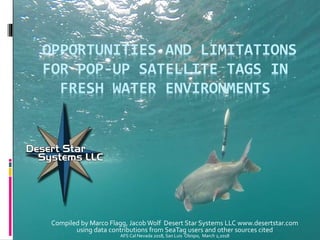
- 1. OPPORTUNITIES AND LIMITATIONS FOR POP-UP SATELLITE TAGS IN FRESH WATER ENVIRONMENTS Compiled by Marco Flagg, Jacob Wolf Desert Star Systems LLC www.desertstar.com using data contributions from SeaTag users and other sources cited AFS Cal Nevada 2018, San Luis Obispo, March 2,2018
- 2. Operation of Pop-Up Satellite Tags (PSAT) 1. Fish are tagged & released (Goetz) 2.Tag archives observations (~0.08 sec to 4 min intervals) for pre-programmed period typically up to ~1 year (Goetz) 3.Tag pops up & sends limited data set via Argos satellite (Seider) 4.Tag retrieval via satellite position and radio direction finder yields full data set (Seider)
- 3. Opportunities with PSAT tags Track over large scales, without the need for a monitoring infrastructure (acoustic networks, etc.) Ocean drifters track/simulate juvenile sea turtle dispersion (Van Houtan) Study animal response to dynamic environmental conditions Sailfish tracking towards the convergence zone around eddies (Fitchett) Diel sailfish activity relative to illumination (Pohlot) Obtain fine-scale observations on animal behavior such as activity or diving
- 4. Practical use of PSAT in Pelagic Marine Species: Migration & Mortality Studies Migration from light & SST observations (Goldsmith) Mortality from cessation of temperature gradients (Goldsmith) Vertical habitat from depth and temperature observations (ICCAT/AOTTP) Bluefin with SeaTag-LOT (Goldsmith, pic SaltywaterTackle)
- 5. SeaTag: A PSAT line enabling fresh water tagging Light,Temperature Light,Temp., Magnetometer Light, Depth, Temp., Mag. Light, Depth, Temp., Mag., Accel. 38g 38g-48g 57g 145g $499-$899 $945-$1350 $1400-$2000 $1750-$2500 Single use Single use Single use Multi use Solar panel
- 6. SeaTag: A PSAT line enabling fresh water tagging Characteristic Traditional PSAT SeaTag line of PSAT Release mechanism Galvanic corrosion; requires sea water Kinetic; works in sea or fresh water Migration Estimation Light & SST; too inaccurate for fresh water bodies Magnetometer yields useful position estimates under certain conditions: Magnetic anomaly, large lakes or long rivers crossing geomagnetic gradient. Activity observation Not available Available via accelerometer Physical recovery (to obtain full dataset) Possible, but limited by short satellite transmission endurance (~10 days). Solar powered transmissions provide long opportunities to track & recover the tag. 88% recovery of reporting tags observed in Lake Superior (Seider) Cost At ~$4000 and no or limited re-use, can be cost prohibitive for many studies Acquisition cost $499-$2500. -SeaTag-MOD reusable high- capability; $850/deployment @ 3rd use -SeaTag-LOT smallest, $499-$899
- 7. But aren’t PSAT too big for fresh water species? First principles: 1. Total tag force = √(fbuoyant^2 + fdrag^2) 2. At zero speed, tag force = buoyant force (~10% of tag weight) 3. Conclusion: You can use larger, more capable tags for slower moving animals, but use smaller and more streamlined models for faster animals.Large, high-capability SeaTag-MOD on slow moving lobster (Morse) Small SeaTag-LOT on fast moving tuna (Goldsmith, pic Bobby Rice) SeaTag-LOT Forces (Lynch)
- 8. But aren’t PSAT too big for fresh water species? SeaTag-MOD on trout (Goetz) SeaTag-MOD on lake sturgeon (Kough) SeaTag-3D on Chinook salmon (Watkins) Size: •2% rule (Winter 1983&1996,AFS Fishing Techniques) •Species/use/life stage limits (Jepsen 2003) •Internal tags up to 8% of body weight do not affect salmon swimming (Collins 2013) •SeaTag-MOD: 145g, for fish >= 1.8kg (8% rule), >= 7.25kg (2% rule) •SeaTag-3D: 57g, for fish >= 0.525kg (8% rule), >= 2.9kg (2% rule) 14kg fish, 145g tag, 1.0% 7.2kg fish, 57g tag, 0.8% 5kg fish, 145g tag, 2.9%
- 9. Morphotype Specific Depth Habitat Selection of Lake Trout in Lake Superior (Goetz) Siscowet: high lipid, big eye, large fin, angled snout Lean: low lipid, small eye, small fin, straight snout Observation Period: 3-7 months Sampling interval: 4 minutes Animals tagged: 107 with 74 tags (completed deployments as of 02/2018, more in progress) Observations: Depth, temperature, pop-up location Reporting Rate: 75% of tags Physical Recovery Rate: 91% of reporting tags
- 10. Morphotype Specific Depth Habitat Selection of Lake Trout in Lake Superior (Goetz) Migration (tagging and pop-up location): 1. Lean and redfin stayed close to Isle Royale 2. Siscowet migrated away from island into deep water
- 11. Morphotype Specific Depth Habitat Selection of Lake Trout in Lake Superior (Goetz) November December January February March April May June Depth(meters) Temperature(C) Sample depth & temperature profile of one siscowet trout: Resides at greater depth during colder months; experiences temperature drops during brief forays to shallower depth.
- 12. Morphotype Specific Depth Habitat Selection of Lake Trout in Lake Superior (Goetz) Aggregate results, depth habitat: •Lean trout reside at shallow depth •Siscowet trout change their depth distribution drastically and dive to much greater depth •Redfin trout exhibit intermediate behavior Siscowet Lean Redfin Aggregate depth June – September. Darker colors indicate more time spent at that depth
- 13. How Important is Water Temperature for Chinook Distribution? (Watkins) Observation Period: 6 days – 4 months Sampling interval: 1 minutes Animals tagged: Evaluation project. Date from 2 recovered tags out of 4 successful deployments. Observations: Depth, temperature, pop-up location Reporting: None (see limitations) Recovered: 2 out of 4
- 14. How Important is Water Temperature for Chinook Distribution? (Watkins) Migration (tagging and pop-up location): 1. Both fish moved to Salmon River, where tags were found on shore by fishers. Braddock Bay Oswego Salmon River July 13 July 18 Oct 6 Sept 22 ?
- 15. How Important is Water Temperature for Chinook Distribution? (Watkins) Sept 6, 2017 Enter Salmon River July 13, 2017 Oswego, NY 64 second records Upwelling Aug 27-29? Temperature (Celsius) Thermocline
- 16. How Important is Water Temperature for Chinook Distribution? (Watkins) Conclusions •Chinook follow temperature (13 C) at base of thermocline extremely closely •Quickly respond to thermal changes such as upwelling events
- 17. Observation Period: 4 months programmed Sampling interval: 64 seconds Animals tagged: Data from 25 tagged animals (total # of animals tagged not specified) Observations: Acceleration, Depth,Temp., Pop-up location Reporting Rate: 25 tags Physical Recovery Rate: 12 tags (48%) Diel timing of lake sturgeon activity (Kough)
- 18. Diel timing of lake sturgeon activity (Kough) Migration
- 19. Diel timing of lake sturgeon activity (Kough) Acceleration Events
- 20. Diel timing of lake sturgeon activity (Kough) 24h Circular Analysis of Activity Conclusion: Nocturnal Activity
- 21. • Construction of the Mario M. Cuomo Bridge on the Hudson River began in 2013 • AKRF, Inc. has conducted sturgeon monitoring and studies as part of the bridge construction project, on the behalf of the NewYork State Thruway Authority • Studies have focused on sturgeon ecology, as well as monitoring of anthropogenic impacts to shortnose sturgeon and Atlantic sturgeon AKRF Justin Krebs jkrebs@akrf.com
- 22. • Vessel strikes are a significant threat to sturgeon populations in the Delaware, Hudson, and James Rivers (NMFS BiOp 2017) • Considerable vessel traffic on the Hudson River • Commercial tankers, tugs and barges, passenger ferries, law enforcement boats • Recreational fishing and pleasure boats • To better understand the risk to sturgeon posed by vessel traffic, AKRF and theThruway Authority conducted a study to characterize the vertical distribution of Atlantic sturgeon in the water column in the Hudson River (Conservation Recommendation in the NMFS Biological Opinion for the project) • The goal of the study is to address a significant question: Where do sturgeon swim in the water column and how often are they near the water’s surface? • Critical to understanding the risk of vessel strike
- 23. • During spring 2017, Atlantic sturgeon were collected from a tidal freshwater portion of the Hudson River approximately 50 miles from the Atlantic Ocean. • Ten subadult sturgeon were fitted with SeaTag 3D pop-off satellite archive tags (PSATs) obtained from Desert Star Systems and released to the river • Tags were programmed to log water depth and temperature at 4-minute intervals and to transmit 2- hour depth and temperature histograms to the Argos satellite • Tags were programmed to pop off in January 2018 following migration of fish to the Atlantic Ocean and to begin transmitting data continuously at that time • No results yet; data collection is underway
- 24. Freshwater Limitations of PSAT tags In rivers or small lakes, high risk of popped-up tags quickly beaching and with limited or no ability of effective satellite reporting. Even with magnetometer sensing, estimated (underwater) positions often too inaccurate Beached tag, Lake Superior (Seider) Geomagnetic estimated tag positions, Lake Superior (Goetz)
- 25. Sneak Preview: Ongoing PSAT Research or Proposals at Desert Star 1. A tag that will detect and report the location and time of spawning 2. A blood sampling tag, drawing multiple samples responsive to specified conditions such as fish activity level, temperature, depth or specified time 3. A wide-area, precision (~meters) positioning tag based on acoustic signal detection and a sparse (1km-10km interval) static pinger network in the body of water (inversed principle fromVemco, Lotek ATS etc.) 4. Optimizations for improved fresh water and river performance, incl. GPS integration for easier tag recovery, reporting of mission statistics first, insulated antenna to transmit more effectively if part submerged Please let us know if interested! It may prioritize that work.
- 26. Citations Goetz, R. (2017) Lake trout are differentiated on the basis of fin size/shape, fat level and habitat depth, Unpublished. Goldsmith, W. M., Scheld, A. M., & Graves, J. E. (2017). Performance of a low-cost, solar powered pop-up satellite archival tag for assessing post-release mortality of Atlantic bluefin tuna (Thunnus thynnus) caught in the US east coast light- tackle recreational fishery. Animal Biotelemetry,5(1). doi:10.1186/s40317-017-0144-9 Houtan, K. S., Francke, D. L., Alessi, S., Jones, T. T., Martin, S. L., Kurpita, L., . . . Baird, R. W. (2016). The developmental biogeography of hawksbill sea turtles in the North Pacific. Ecology and Evolution,6(8), 2378-2389. doi:10.1002/ece3.2034 Jespin, N. ( 2003). A brief discussion on the 2% tag/body mass rule of thumb, Aquatic telemetry: advances and applications. Proceedings of the Fifth Conference on Fish Telmetry held in Europe. Kough, A. S., Jacobs, G. R., Gorsky, D., & Willink, P. W. (2018). Diel timing of lake sturgeon ( Acipenser fulvescens ) activity revealed by satellite tags in the Laurentian Great Lake Basin. Journal of Great Lakes Research,44(1), 157-165. doi:10.1016/j.jglr.2017.10.008 Lynch, S. D., Marcek, B. J., Marshall, H. M., Bushnell, P. G., Bernal, D., & Brill, R. W. (2017). The effects of pop-up satellite archival tags (PSATs) on the metabolic rate and swimmint kinematics of juvenile sandbar shark Carcharhinus plumbeus. Fisheries Research,186, 205 215. doi:10.1016/j.fishres.2016.08.013 Morse, B. (2013). American Lobster Tagging Project. http://www.cfrn-rcrp.ca/article126 Pohlot, B et al. (2013). Distribution, Behavior, and Habitat Use of Sailfish in the Tropical Eastern Pacific. Pohlot, B. G., & Ehrhardt, N. (2017). An analysis of sailfish daily activity in the Eastern Pacific Ocean using satellite tagging and recreational fisheries data. ICES Journal of Marine Science. doi:10.1093/icesjms/fsx082 Seider, M et al. (2017) Methods for Successful Recovery of Pop-up Satellite Tags: Finding a Needle in a Haystack. Watkins, J (2017) Tracking diel foraging behavior of Chinook Salmon in Lake Ontario using pop off archival satellite tags.
Notas do Editor
- The new Mario M. Cuomo Bridge is currently being constructed to replace the ageing Tappan Zee Bridge that spans the Hudson River 27 miles north of New York City. As part of the environmental commitments for that project, the New York State Thruway Authority, Federal Highway Administration, NY State Department of Environmental Conservation, and fish ecologists from AKRF, Inc. are conducting a series of sturgeon conservation studies to learn more about the ecology and potential anthropogenic impacts to two federally threatened or endangered fish species in the Hudson River: the shortnose and Atlantic sturgeon.