DSD-INT 2019 The Incident Management Forecasting System (IMFS) for England - Laeger
•
1 gostou•409 visualizações

Presentation by Stefan Laeger, Environment Agency, at the Delft-FEWS User Days, during Delft Software Days - Edition 2019. Wednesday, 6 November 2019, Delft.

Recomendados
Recomendados
Mais conteúdo relacionado
Mais procurados
Mais procurados (14)
Semelhante a DSD-INT 2019 The Incident Management Forecasting System (IMFS) for England - Laeger
Semelhante a DSD-INT 2019 The Incident Management Forecasting System (IMFS) for England - Laeger (20)
Mais de Deltares
Mais de Deltares (20)
Último
Último (20)
DSD-INT 2019 The Incident Management Forecasting System (IMFS) for England - Laeger
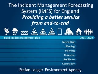
- 1. The Incident Management Forecasting System (IMFS) for England Providing a better service from end-to-end Stefan Laeger, Environment Agency
- 2. Aims for today -why the Forecasting Service needed to change, -What our Incident Management Forecasting System is about -Wow It will help delivering a ‘new look’ consistent, efficient improved Forecasting Service end-to-end
- 3. Our new Incident Management Forecasting System (IMFS) makes sure we are resilient and ready to respond to flood incidents in England Leading the way in forecast led incident management • More resilient & interoperable • Platform for growth/innovation • Responding faster to user needs
- 4. Leading the way in forecast led incident management
- 5. • Increased efficiency and resilience • 8 into 1’ national system - increased interoperability • Step change how system is configured/maintained (6500hrs!) • Streamlining our stock of legacy models • Synergies across the business • Inclusion of Bathing Water • Single source for FIM threshold information • Improving our service and user experience • Common FF training and exercising • Making it easier to forecast BE/RWCS • Easier access to historic info and performance • Platform for growth • Scalable - cloud based • Ready for ensemble forecasting to make better use of MO info • Easier to make future improvements/synergies Outcomes and Benefits
- 6. The big picture Good delivery and superb team effort - 6 prototypes delivered, 750 legacy models converted Ways of working streamlined, interoperability increased, well received ‘show and tell’ sessions Ensuring the business this ready and we maintain resilience of and accessibility to the cloud Balancing continued delivery with operational FF duties Fwd look: final prototype development, End to end testing, training/roll out in Spring 2020 7
- 7. END TO END FORECASTING Met Office run their weather forecast models for Hydromets at the Flood Forecasting Centre (FFC). FFC Hydromets create a Best Estimate and Reasonable Worst Case scenario (if required) for EA MFDOs. ‘Decision makers’ respond or plan a risk based response to flood forecast. EA MFDOs create local flood forecasts to share with national and area customers.
- 8. The Forecasting Service end-to-end The process starts with the Met Office models The FFC then provide expert interpretation and create BE and a RWC scenario if required Rainfall processing tools, flood models and summary processing all run automatically It is now that the automatic rainfall products are available on the webportal Rate of Rise and FFOI products calculate and are available to customers Next process is creation of products. Scenario maps, summary tables and flood model outputs shape FGS reply and LFO content Using MFDO consultancy, hydrographs on the webportal and flood products the decision makers respond or plan the risk based response Using the Hydromet Guidance and reviewing data MFDO makes any modifications Reviewing model outputs the MFDO then creates and discusses the flood forecast with customers
- 9. Azure Cloud FFFS – Demo highlights IMFS Explained – Systems linked So how does IMFS fit together and how do the related systems deliver the Incident Management Service? FWD Flood Warnings Direct Direct Warnings to the public FIS Flood Information Service Flood information to communities FFOI & RLOI Forecasts and levels shared with the public IR&T Incident Report and Track Managing our response & situational awareness FoNT Future of National Telemetry Telemetry Systems x7 Observed data from field IMFS Web Portal Sharing forecasts with decision makers IMTD Thresholds Database IMFS Forecasting System IMRD Reference Database Consistent forecasting platform Efficient system maintenance Consistent thresholds to all systems
- 10. FFFS – Demo highlights IMFS Explained – IMFS highlights Incident Management Forecasting System – Core Engine
- 11. FFFS – Demo highlights IMFS Explained – IMFS highlights Who are the users? All MFDOs and Hydromets Why is it better? All forecasters using one system, consistent data and tools. More efficient to maintain, develop and train users on. What does it do? Displays Met Office model data Where FFC create BE and RWC Where fluvial models and coastal flood forecast processing occurs and outputs displayed
- 12. IMFS Explained – IMRD highlights Incident Management Reference Database and GUI
- 13. IMFS Explained – IMRD highlights PDM England Consistent working practices Incident Management Forecasting System FMP A massive change!
- 14. IMFS Explained – IMRD highlights Challenges • Scale: >800 models • Modelling efficiency • Client review process • Visualisation of results • Comparison with existing
- 15. IMFS Explained – IMRD highlights Who are the users? Digital Services What does it do? Is the brains of the forecasting system Holds all the data and information needed to run the forecasting system Why is it better? Replaces 8 inconsistent sets of NFFS configuration Enables national consistency, efficient maintenance and fast system development
- 16. IMFS Explained – IMTD highlights Incident Management Thresholds Database and GUI
- 17. IMFS Explained – IMTD highlights Who are the users? Area Threshold Editors Forecasting Threshold Editors Telemetry Power Users FFOI/RLOI Power users What does it do? Single nation store of all operational Flood related thresholds Why is it better? Update multiple systems efficiently Clarity on what the operational threshold is Consistent approach to threshold storage and management
- 18. IMFS Explained – Web Portal highlights Incident Management Forecasting System – Web Portal
- 19. IMFS Explained – Web Portal highlights Who are the users? Area Duty roles – FWDO FIDO, ABC, ADM National Duty Roles – NFFDM, NDM, NBC What does it do? Shop window of the forecasting service Hydrographs, FFC products, commentary Why is it better? National standard with more data, more easily accessible and easier to interpret and use to aid decision making
- 20. FFFS – Demo highlights IMFS Explained The IMFS Project is not just about building 4 new systems New ways of working – approach, language, tools, data and how we present our forecasts Common national training for MFDOs and all IMFS elements supported by training Updated procedures with more nationally consistent content Clear launch and handover process to the long term owners of IMFS
- 22. IMFS Explained – International Collaboration • Memorandum of Understanding with Australia’s Bureau of Meteorology • 4-8 March spent with Deltares and Simon Pierotti (Senior Hydrologist) from BoM (top left) • Synergies and collaborative system/service development including training, exercising and business change • UK FEWS User Days held in Cardiff in July (bottom right) • Sharing technical system development and looking for synergies • Setting longer-term objectives for future sharing on system and service improvements
- 23. What’s next for IMFS? Day 1 is only the beginning – there is a backlog of exciting possibilities • LFO/NFFDM Slide Pack automation/replacements • Performance standards fully delivered – Potentially hugely powerful. Automated model performance assessment tool assisting MFDOs to understand model performance characteristics • Fluvial / Coastal Scenario maps - automated This would see the maps published on the web portal – with MFDO commentary and input • Fluvial / Coastal Scenario maps - automated This would see the maps published on the web portal – with MFDO commentary and input • Performance standards fully delivered – Potentially hugely powerful. Automated model performance assessment tool assisting MFDOs to understand model performance characteristics • LFO/NFFDM Slide Pack automation/replacements • Coastal Real Time Strategy solution National consistent coastal forecasting solution will be implemented • Coastal Real Time Strategy solution National consistent coastal forecasting solution will be implemented • MFDO Action lists and prompts Automatically generated prompts and actions. Can be assigned to other DOs • MFDO Action lists and prompts Automatically generated prompts and actions. Can be assigned to other DOs • Probabilistic forecasting World of fun! % likelihood of threshold crossing. Cost vs Risk. Customer bespoke thresholds • Probabilistic forecasting World of fun! % likelihood of threshold crossing. Cost vs Risk. Customer bespoke thresholds • And, and, and… There is a world of possibilities and developments available. Impact forecasting, HSR next steps, automation of Flood Alerts (!), Webcam and CCTV feeds, Forecast alerting (FoNT) etc
- 24. Key milestones - summary 25 Approval of BCUR/new contractor Complete (Oct 18)! Prototypes 0, 1, 2, 3, 4, 5 and 6 Complete! Trialing of shadow system early Dec 2019 Full end to end testing Jan 2020 onwards Training of users Jan – April 2020 Switch over to new system/Day 1 end April 2020 (BE) End July 2020 (RWCS)
- 25. Maximising the benefits of FF & Giving power to the people Provided on GOV.UK
- 26. FEEDBACK IMFSChange@environment-agency.gov.uk Stefan.Laeger@environment-agency.gov.uk Project Executive charlie.pilling@metoffice.gov.uk Flood Forecasting Centre Marc.vanDijk@deltares.nl Deltares paul.wass@jbaconsulting.com JBA Consulting