Dholavira.pptx
•Transferir como PPTX, PDF•
0 gostou•96 visualizações

these ppt is about Dholavira.

Recomendados
Mais conteúdo relacionado
Mais procurados
Mais procurados (20)
Semelhante a Dholavira.pptx
Semelhante a Dholavira.pptx (20)
Mais de Darshan Darji
Mais de Darshan Darji (19)
Último
Último (20)
Dholavira.pptx
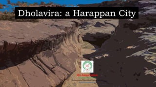
- 1. Dholavira: a Harappan City M.G.ScienceInstitute (Geology Department) Navrangpura,Ahmedabad,Gujarat 380009 darshandaiya234@gmail.com
- 3. Why Dholavira is an heritage site. • Archaeological site of a Harappan-era city, received the UNESCO world heritage site • Proto-historic Bronze Age urban settlement pertaining to the Harappan Civilization bears evidence of a multi-cultural and stratified society during the 3rd and 2nd millennia BCE. • well-preserved urban settlements in South Asia which were discovered in 1968 by archaeologist Jagat Pati Joshi. • Geological significance of Dholavira apart from its archaeology lies in its stratigraphy, sedimentology, geomorphology, palaeontology. 3/29/2023
- 4. (Geological map of the Kachchh Basin showing three distinct lithostratigraphic divisions. (1) Mainland of Kachchh, (2) Pachham Island, and (3) Eastern Kachchh) (modified from Biswas & Deshpande 1970)
- 5. Geological Significance of Dholavira • Geologically, Dholavira lies in the Khadir Island, one of the island belts consisting of four discontinuous land masses, i.e. Pachham, Khadir, Bela and Chorar islands, progressively from west to east with Wagad in the south. These regions are mainly covered by Mesozoic and Tertiary formations (Merh, 2005). • Kachchh had rich geological deposits and important archaeological sites, like those near Dholavira, which provided the Harappans with a variety of useful minerals. Studying these artifacts and materials helps us understand their origins and the geological significance of the area (Prasad & Prabhakar, 2022). • A number of tools and ornaments have been excavated which were made of Agate and jasper/chalcedony, feldspar, quartz. Apart from this, stone blocks of Sandstone, siltstone and limestone, evidences of utilisation of Pb and Cu ores, etc. have been found. 3/29/2023
- 6. • The microcrystalline quartz varieties like agate, jasper, carnelian, opal, chert, etc. as minerals was likely derived from amygdaloidal Deccan Basalt, which were plentiful in Kachchh and Saurashtra. • Exposures of quartz, chert, clay and haematite have been observed in the nearby regions like Rohri hills and Jhandiyasar region. • Limestone and gypsum were likely to be derived from the katrol and chari formations. • Some metallic raw materials like Cu and Pb nodules were probably sourced geologically from the Aravalli and Delhi Supergroups from Rajasthan. 3/29/2023 Sources of raw materials:
- 7. (a) ‘Fossil Park’ with a variety of invertebrate fossils and large sections of fossil wood (Middle Jurassic, Khadir Formation) (b) large wood fossils (Middle Jurassic period) at Dholavira Fossil Park (c) interior of the 3-storied Harappan Fort (d) Circular residential structure (e) earthquake resistant structures (f) ancient water reservoir
- 8. 3/29/2023 • Dholavira is situated on the Khadir uplift. E-W chain of small highlands including Khadir, Pachham, Bela, and the Chorar Uplift is observed. • These four highlands were once islands during the Late Neogene-Quaternary periods when the low land areas were flooded by the sea. They still look like islands today, surrounded by water during the monsoon season. They are collectively known as the 'Island Belt' and form an east-west chain amidst the surrounding plains of Banni and Rann. (Biswas 1971). • These highlands were part of a previously continuous E-W south sloping fault bounded ridge which was broken into four segments by wrench faulting
- 9. 3/29/2023 The Great and Little Rann salt flats exposed in the area of around 23000 sq. km have sediments with the potential sediments to understand an uninterrupted history of Holocene sea level and climate change. The Great Rann of Kutch (or Rann of Kutch seasonal salt marsh) is a salt marsh in the Thar Desert in the Kutch District of Gujarat, India. It is about 7500 km2 (2900 sq miles) in area and is reputed to be one of the largest salt deserts in the world
- 10. References • Mineralogical characterization of raw materials from Dholavira, Gujarat, India and its geological and archaeological significance, Ravi Kant Prasad* and V. N. Prabhakar, page - 1342 • https://whc.unesco.org/ • Merh, S. S., The Great Rann of Kachchh: perceptions of a field geologist. J. Geol. Soc. India (on-line archive from vol. 1 to vol. 78). 2005, 65(1), 9–25 • Chauhan, G., Biswas, S. K., Thakkar, M. G., & Page, K. N. (2021). The unique geoheritage of the Kachchh (Kutch) Basin, Western India, and its conservation. Geoheritage, 13, 1-34. 3/29/2023
- 11. Columnar joints developed in Early Cretaceous sandstone of the Bhuj Formation accompanied by basic igneous dykes in which such joints are also common, near Kodki Village
- 12. 3/29/2023