Presentación al 4th Iberian Conference on Landscape Ecology (IV ICLE)
•
0 gostou•149 visualizações

La playa emergida como fuente de información para gestionar la adaptación de las playas mediterraneas al cambio climático

Recomendados
Recomendados
Mais conteúdo relacionado
Mais procurados
Mais procurados (20)
Semelhante a Presentación al 4th Iberian Conference on Landscape Ecology (IV ICLE)
Semelhante a Presentación al 4th Iberian Conference on Landscape Ecology (IV ICLE) (20)
Mais de Josep Lascurain - S·G·M s.l.
Mais de Josep Lascurain - S·G·M s.l. (20)
Último
Último (20)
Presentación al 4th Iberian Conference on Landscape Ecology (IV ICLE)
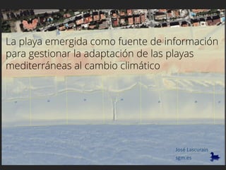
- 1. La playa emergida como fuente de información para gestionar la adaptación de las playas mediterráneas al cambio climático sgm.es José Lascurain
- 8. Mean difference and total error topo1k 2008 2012 2014 2017 topo1k 2008 0,15 2012 0,14 0,08 2014 0,16 0,12 0,08 2017 0,13 0,09 0,08 0,11 We explored the potential of LIDAR technology with a new method. RMS to define vertical accuracy
- 9. Shoreline established at 0,7 m height in order to avoid wave interference. Coastline defined by the software, not digitised. So its resolution is the same as the provided DEM (1m).
- 10. Dune and backshore differentiated. So, each 100m cell is transformed in a point containing information of area, volume, slope, azimuth,..
- 11. Backshore Total Lack of correlation of beach width and sand volume.
- 12. Total emerged sandBackshore Recognizable patterns at backshore level between cell volume and average slope. A relationship with sand grain diameter.
- 13. When outliers suggest dysfunctions
- 14. Strong winter winds parallel to the beach Human-induced wind scour process Mechanical sieving to get sand cleaned impedes vegetation growth, thus allowing wind scour.
- 15. It can be a “non linear” process. Probably a sea level rise of only 20 cm could made this beach stretch disappear
- 19. A very relevant question: how much sand is enough?
- 20. ) 2 )004.0563.0( 35.0()(10.1 5.02 5,0 00%2 + += β βLHR L’impacte dels temporals proveeix més informació més ràpidament que els models predictius pel 2100 R2% = run-up overpassed by 2% A2% = màximum wave reach ηmax= set-up RT 2% = total wave height for a T retorn period Overwash risk gives a similar value for a T return period of 16,5 yrs.
- 21. So, it is possible to get a glimpse of the overall backshore sand budget, and how it changes with time. Transfers between beach stretches easily identified, but transfers to the submerged part or neat losses from the beach cell not so easy to be identified
- 22. But always keeping in mind of the obligation to provide every summer with the needed amount of dry and clean sand to as much as 500 sunbathers for each 100 m long cell.
- 23. A sand budget with a clear geographic expression
- 24. Also useful to detect risk areas and prevent storm impacts.
- 25. 2010 Summer 2016 Storm 20-21 januray 2017
- 26. 0 500000 1000000 1500000 2000000 2500000 2010 2017 Emerged sand volume (m3) Backshore Dune Mapping vulnerability and the role of the “declining” dune reserve”
- 28. The dune system will provide the needed barriers to prevent wave overwash
- 30. The need to learn how to construct and maintain mobile and semi-mobile dunes.
- 31. 6,3 m 3,2 m ..it is the most visited landscape on most of the Mediterranean basin, provides huge flows of ecosystem services, and sustains a relevant part of the economy. The emerged beach is just the “tip of the iceberg” of the system, but … This sand is just gold, because . . .
- 32. The knowledge of sand budget has been mostly provided by numerical models They need sustained bathymetric surveys and > 10 yrs of wave environment data. So, creating large information gaps along the med coast.
- 36. Climate change is making med beaches to shrink. Some beaches are starting to be unable to provide enough space to cope with the social demand of sunbathers
- 37. The loss of beach quality and quantity will have a huge cultural and economic impact. And those scenarios are probably much closer than previously thought. It is also about brandscape ecology.
- 38. This is why we need an efficient and reliable accounting system • LIDAR information can fill the gap (cheap, fast and with increasing accuracy). • A reliable method to manage the emerged sand budget for: • Fast identification of outliers(dysfunctions). • Provision of short term scenarios. • Inform daily beach management. • Assess existing management strategies,. • The need of a new governance to adapt to the pace of climate change.
- 39. Thanks for your attention. info@sgm.es