Eops 2015 1_28
•
0 gostou•432 visualizações

Warm air and water temperatures and offshore winds have persisted since fall. Numerous and sizable jelly fish patches are still present in southern inlets of Puget Sound. Coastal waters were colored in shades of gray to brown by sediment and humic substances. Phytoplankton blooms were restricted to the surf zone. We were treated to artful views of meandering sloughs and gullies on exposed mud flats during low tide in Willapa Bay, interspersed with the geometry of shellfish management. Brown pelicans: a story of recovery.

Recomendados
Mais conteúdo relacionado
Mais procurados
Mais procurados (18)
Destaque
Destaque (20)
Semelhante a Eops 2015 1_28
Mais de Christopher Krembs
Eops 2015 1_28
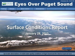
- 1. Eyes Over Puget Sound Fieldlog Climate Water column Aerial photos - - Publication No. 15-03-070 Start here Up-to-date observations of visiblewater quality conditions in Puget Sound and the Strait of Juan de Fuca January 28, 2015 Surface Conditions Report
- 2. Personalfieldlog p.3 The BrownPelicanPelecanus occidentalis and warmer water. Climateconditions p.5 The air temperature andoceanconditions remainwarm. Rivers are above normal except at the coast (Chehalis). Sunshine and precipitationhave beenepisodic during the past two weeks. Watercolumn p.6 In2014, temperatures got really warm,salinity decreasedin Central andSouthSound, andoxygenwas mostly lower except in HoodCanal where a highanomaly persisted. A Hypothesis p.9 Nitrogenis significantly increasing.The nutrient balance is changing inPuget Sound. We need to talk about it! Aerialphotography p.10 Numerous patches of jellyfishpersist inclear water of finger inlets of SouthSound. Willapa Bay reveals its interesting subtidal patternand humanactivity during ebbing tide. LONG-TERMMARINEMONITORINGUNIT Brooke McIntyre Mya Keyzers Laura Hermanson Skip Albertson Dr. Christopher Krembs Julia Bos Suzan Pool Editorial assistance provided by: CarolMaloy and Julianne Ruffner Marine conditionsfrom 1-28-2015 at a glance Fieldlog Climate Water column Aerial photos - - Please give us feedback
- 3. The Brown Pelican Pelecanus occidentalis Paleyellow crown Silver/grey/brown body Very long bill that can hold about 3 gallonsof water 3.25-5 ft. long 6-12 lbs. 6-8 ft. Wingspan Webbed feet Characteristics Habitat Coastalareas including sandy beaches, lagoons, and marineestuaries. Oncea month we travelto GraysHarbor and Willapa Bay for our Coast marine flight. During these flights we usually see brown pelicans. Itis alwaysentertaining to watch these large, beautiful pelicans fly and dive for food. So this month we wanted to highlight some facts about this charismatic coastal bird. Mudflatsin GraysHarbor Range Map Atlantic,Pacific,and Gulf Coast White head SandyBeaches at Ocean Shores Personal Field Impression 1-28-2015 Fieldlog Climate Water column Aerial photos - -
- 4. Diet Marineinvertebrates and mostly small foragefish such as… Behavior Brown pelicans are gregariousbirdsthat roost, migrate, and feed in groups. They plunge dive fromup to 60 ft. to catch fish with their huge bill pouches. Brown pelicans and seagulls feasting on a school of fish in Willapa Bay Herring SardinesMullet ConservationConnection Brown pelicans almost wentextinct in the late 1950’sdueto harmfulpesticides, such as DDT, entering the food web. Pastprotection under the endangered species actand banning DDThas enabled brown pelican populationsto recover and thrive today. Affected by an Unusually Warm Ocean? NOAA scientists observed much higher than usual sea surface temperatures in the North Pacific Ocean throughout2014 thatdid not follow typical El Niño weather patterns. The warmwatersmay benefit some species and negatively impact others. Scientists also observed raresightings of tropical species off the west coast due to these warmer waters. Click links to articles formore info. NOAA Article & OPB Article Diving pelican Photo Credits – Christopher Krembs; Bill Holsten on www.whatbird.com ; www.montereyfish.com; www.monkeyfacenew.com; www.fooduniversity.com; http://www.theanimalfiles.com/birds/pelicans_relatives/brown_pelican.html Personal Field Impression Fieldlog Weather Water column Aerial photos - - Personal Field Impression 1-28-2015 Fieldlog Climate Water column Aerial photos - -
- 5. Fieldlog Climate Water column Aerial photos - - Climateand natural influencesbefore 1-28-2015 Summary: Air temperatures have generally been above normal continuing a 9-month trend. Precipitation has been episodic, with several rain events in the past two weeks. Sunshine has alternated with clouds over the past two weeks. River flows are above normal across the Puget Sound region, but below normal at the coast (Chehalis River). PDO remains in the warm phase, and upwelling is increasing. lowerhigher expected No data New section! Climate and natural influences are conditions that influence our marine waters, including weather, rivers, and the adjacent ocean (previously called Weather). For an explanation of the figure, see: http://www.ecy.wa.gov/programs/eap/mar_wat/weather.html, page 26.
- 6. We use a chartered float plane to access our monthly monitoring stations. We communicate data and environmentalmarine conditions using: 1. MarineWater ConditionIndex (MWCI) 2. EyesOverPuget Sound (EOPS) 3. Anomaliesand sourcedata Fieldlog Weather Water column Aerial photos - - Ourlong-termmarinemonitoringstationsinWashington Starthere Isl. .
- 7. Temperature warmer Oxygen lower except HC In2014,conditions were dominatedby warm water during summer and fall,associatedwiththe NE Pacific warmsurface anomaly. InOctober andNovember,temperatures were the highest onour recordsince 1989. Salinity was higher inearly 2014,then waters southof Admiralty Reachbecame fresher while saltier conditions persistedinthe SanJuans. Oxygenwas mostly lower except inHoodCanal where a highanomaly persistedinto the fall. Salinity lower in Central& South 2014: Very Warm Fall! Physical conditionsin the water column Fieldlog Weather Water column Aerial photos - -
- 8. a) PacificDecadalOscillationIndex(PDO,temperature) (explanation) b) UpwellingIndex(anomalies)(Upwelling,lowoxygen) (explanation) c) NorthPacificGyreOscillationIndex(NPGO,productivity) (explanation) NPGO(x10) PDO/UpwellingIndex Three-year running average of PDO, Upwelling, and NPGO indices scores Fieldlog Weather Water column Aerial photos - - Theoceanaffectswaterquality:OceanClimateIndices -25 -20 -15 -10 -5 0 5 10 15 20 25 -1.5 -1 -0.5 0 0.5 1 1.5 1945 1950 1955 1960 1965 1970 1975 1980 1985 1990 1995 2000 2005 2010 2015 Ocean boundaryconditions have been favorable for water qualityin Puget Sound: (a)colder water (PDO), (b)less upwelled lowoxygen and high nutrient ocean water reachingPuget Sound (UpwellingIndex),and (c) higher surface productivityalongthe coast (NPGO). Where are we headingnext?.
- 9. Is the food web changing in Puget Sound? Follow the experts WebEx Hypothesis! Increasesin nitrate concentrations couldbe caused by a top-down controlon phytoplankton biomass. Noctiluca a visible harbingerof a food web change? Hypothesis for combining a series of recent observations affecting energy and material transfer to higher trophic levels Arechangesin highertropic levelspart of a story of the low food web?
- 10. Summary: Aerial photography1-28-2015 Numerouspatches of jellyfish persist in clear water of the finger inlets in South Sound. Willapa Bay reveals it’s interesting subtidal pattern and human activity during ebbing tide. Fieldlog Weather Water column Aerial photos - - Start here Mixing andFronts: Strong tidal frontsin GraysHarbor and Willapa Bay. Debris: Organic debrisand foamforming in patches near mudflats, river plumes, and tidal fronts. Visible blooms: Within surf zone of coastal beach. Jellyfish: Jellyfish patches still numerous in southern inlets of South Sound (Totten, Eld, and Budd Inlets). BloomDebrisFront Suspendedsediment: Suspended sediment along riversand draining mudflats. Plume 1 20 3 11 12 Brooke McIntyre: our talentedintern CTD package being loweredinto the water 3 8 16 4 5 8 9 10 16
- 11. GraysHarbor Willapa Bay Fieldlog Climate Water column Aerial photos - - Observation Maps: Afternoonflight,photos 10-20: Sunny,mild,winds decreasing Flight Information: Morningflight,photos 1-9 Offshore winds,clouds,low visibility8 11 10 Aerial photography and navigation guide 20 6 Coast SouthSound SeattleTides:H.tide:12:02AM10:58AM,,L.tide:4:57AM,6:11PM 7 12 5 Flight route17 9 18 3 2 1 4 14 19 16 1315
- 12. B. 1:58 PMA. 9:06 AM Numerous jellyfishpatches in otherwise clear blue green water. Location: A.Off YoungCove, Eld Inlet,B. , Budd Inlet (South Sound). 1 Aerial photography 1-28-2015 Navigate Fieldlog Climate Water column Aerial photos - - jellyfish jellyfish jellyfish jellyfish jellyfish jellyfish jellyfish jellyfish jellyfish barge
- 13. 2 NavigateAerial photography 1-28-2015 Fieldlog Climate Water column Aerial photos - - Industrial complex next to Chehalis River with billowing emissions traveling at low altitude. Location:Cosmopolis,Aberdeen (GrayHarbor)9:25AM.
- 14. A. 3 NavigateAerial photography 1-28-2015 A.Offshore wind pushing sediment rich Chehalis River plume into the ocean below. B. Low lying clouds. Location: OffDamon Point (Grays Harbor),10:19 AM. Fieldlog Climate Water column Aerial photos - - Debris B. Front Plume boat
- 15. 4 Navigate Fieldlog Climate Water column Aerial photos - - Aerial photography 1-28-2015 Diatom bloom in surf zone, suspended sediment from waves and low lying clouds. Location: OffTwin Harbor State Park, Cohasset Beach (Coast),10:25 AM. Bloom suspendedsediment
- 16. 5 NavigateAerial photography 1-28-2015 Fieldlog Climate Water column Aerial photos - - Boggy water mixing with a diatom bloom in surf zone. Location: OffTwin Harbor State Park, Cohasset Beach (Coast),10:26 AM. Plume Bloom
- 17. Cranberry fields with a nice splash of color, cloud banks and windmills. Location: Grayland,(Coast),10:29AM. 6 NavigateAerial photography 1-28-2015 Fieldlog Climate Water column Aerial photos - - windmills
- 18. Boggy water entering from Drainage Ditch number 1 into Willapa Bay. Location: Entrance to WillapaBay(Willapa Bay),10:32AM. 7 NavigateAerial photography 1-28-2015 Fieldlog Climate Water column Aerial photos - - Plume Plume
- 19. Numerous large fronts lined by organic debris and foam show surface water flow during ebbing tide. Location: OffKindred Island (Willapa Bay),11:00 AM. 8 NavigateAerial photography 1-28-2015 Fieldlog Climate Water column Aerial photos - - Front Debris
- 20. A. B. Regular convection cells at the transition to deeper water as ebbing water moves into channels. Location: A.Off Diamond Point on Long Island,B. StanleyChannel (WillapaBay),12:00 PM. 9 NavigateAerial photography 1-28-2015 Fieldlog Climate Water column Aerial photos - - Plume Plume Debris Debris
- 21. 10 NavigateAerial photography 1-28-2015 Surface water of different origins (South and North Bay) meetingat the entrance to Grays Harbor. Location: OffSunshine Point,Naselle River (Willapa Bay), 12:24 PM. Fieldlog Climate Water column Aerial photos - - Plume Debris
- 22. 11 NavigateAerial photography 1-28-2015 Tidal gullies connect draining mud flats during ebbing tide and expose nice patterns. Location: OffSunshine Point,Naselle River (Willapa Bay),12:44 PM. Fieldlog Climate Water column Aerial photos - - Plume suspendedsediment
- 23. A draining mudflat showing a mixing of clearer and muddier water during ebbing tide. Location: OffNeedle Point,near South Nemah River (Willapa Bay),12:45 PM. 12 Navigate Fieldlog Climate Water column Aerial photos - - Aerial photography 1-28-2015 Plume suspendedsediment suspendedsediment
- 24. Crushed shells distributedon mud flats highlight the large-scale underwater management of the bay. Location: BayCenter (Willapa Bay),12:50 PM. 13 NavigateAerial photography 1-28-2015 Fieldlog Climate Water column Aerial photos - - shells beds
- 25. Patterns on mud flats, resembling fields,highlight the large-scale underwater management of the bay. Location: BayCenter (Willapa Bay),12:50 PM. 14 Navigate Fieldlog Climate Water column Aerial photos - - Aerial photography 1-28-2015 beds beds beds
- 26. 15 Navigate Fieldlog Climate Water column Aerial photos - - Patterns on mud flats, resembling fields,highlight the large-scale underwater management of the bay. Location: BayCenter (Willapa Bay),12:51 PM. Aerial photography 1-28-2015 beds beds beds beds beds beds
- 27. 16 Navigate Long foamy debris lines form along convergences of surface water leaving the bay. Location: Russell Channel (WillapaBay),12:51 PM. Aerial photography 1-28-2015 Fieldlog Climate Water column Aerial photos - - Debris
- 28. A. B. 17 Navigate Fieldlog Climate Water column Aerial photos - - Tidally regulatedregions at the Willapa Bay estuary garner productive grasslands. Location: A.Mailboat Slough,B.Stuart Slough (Willapa Bay),12:53 PM. Aerial photography 1-28-2015 dike
- 29. 18 Navigate Fieldlog Climate Water column Aerial photos - - The artisticpatterns of mud flats and tidal gullies. Location: Across KelloggSlough (Willapa Bay),12:53 PM. Aerial photography 1-28-2015
- 30. 19 Navigate Fieldlog Climate Water column Aerial photos - - Interstate crossingsouthern reaches of Eld Inlet during high tide. Location: Mudd BayRoad,Southern extent ofEld Inlet (South Sound),1:52 PM. Aerial photography 1-28-2015
- 31. 20 Navigate Numerous jellyfishpatches in otherwise clear bluegreen water. Location: Across Snyder Cover,Eld Inlet,(South Sound)1:55 PM. Aerial photography 1-28-2015 Fieldlog Climate Water column Aerial photos - - jellyfish jellyfish jellyfish jellyfish jellyfish jellyfish jellyfish boat
- 32. Numbers on map refer to picture numbers for spatial reference Date: 1-28-2015 Coast Aerial photography observations in Central SoundObservations in Central and North Sound Navigate Fieldlog Climate Water column Aerial photos - - 9 4 3 8 13 14 15 16 2 17 18 5 6 10 7 11 12
- 33. Date: 1-28-2015 Observations in Hood Canal and South Sound Numbers on map refer to picture numbers for spatial reference Navigate Fieldlog Climate Water column Aerial photos - - SouthSound 19 20 1
- 34. Legendto map annotations Comments: Maps are producedby observers during and after flights. They are intendedto give an approximate reconstructionofthe surface conditions onscales that connect to and overlapwithsatellite images inthe sectionthat follows. Debris: Debris canbe distinguished into natural and anthropogenic debris floating at the surface sensu Moore andAllen(2000). The majority of organic debris inPuget Soundis natural and mixedwithdiscardedman-made pieces of plastic,wood,etc. Fromthe plane,we cannot differentiatethe quality of debris at the surface andtherefore,call it for reasons of practicality just “debris”. S.L. Moore,M. J. Allen. 2000. Distribution of Anthropogenicand Natural Debris on the Mainland Shelf of the Southern California Bight. Marine Pollution Bulletin,40(1): 83–88. Navigate Fieldlog Climate Water column Aerial photos - -
- 35. Accessmooring data: ftp://www.ecy.wa.gov/ea p/Mooring_Raw/Puget_S ound/ - : Suzan.Pool@ecy.wa.gov Get data from Ecology’sMarine MonitoringPrograms Long–Term MonitoringNetwork Real–Time SensorNetwork Accesscore monitoringdata: http://www.ecy.wa.gov/a pps/eap/marinewq/mwda taset.asp christopher.krembs@ecy.w a.gov Ecology’s long-termmarine monitoring stations Ferrytrack Fieldlog Climate Water column Aerial photos - - Riverand Stream WaterQuality Monitoring http://www.ecy.wa.gov/programs/eap/fw_riv /rv_main.html Discontinued (fundingcuts)
- 36. You maysubscribe or unsubscribe to the Eyes Over Puget Sound email listservby going to: http://listserv.wa.gov/cgi-bin/wa?A0=ECOLOGY-EYES-OVER-PUGET-SOUND Many thanks to our business partners: Clipper Navigations,SwantownMarina,andKenmore Air. We are looking forfeedbackto improve ourproducts. Dr. ChristopherKrembs christopher.krembs@ecy.wa.gov Marine Monitoring Unit EnvironmentalAssessment Program WA Department of Ecology Fieldlog Climate Water column Aerial photos - -