CaBA Learning Workshops - Mapping, Modelling and Data Management
•Transferir como PPTX, PDF•
1 gostou•654 visualizações

Outline of the support available to CaBA partnerships from the Defra and EA-funded CaBA support programme run by The Rivers Trust

Recomendados
Recomendados
Mais conteúdo relacionado
Semelhante a CaBA Learning Workshops - Mapping, Modelling and Data Management
Semelhante a CaBA Learning Workshops - Mapping, Modelling and Data Management (20)
Mais de CaBASupport
Mais de CaBASupport (20)
Último
Último (20)
CaBA Learning Workshops - Mapping, Modelling and Data Management
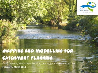
- 1. Mapping and modelling for catchment planning CaBA Learning Workshops, London, Lancashire and Gloucestershire. February / March 2014
- 2. Mapping and modelling for catchment planning Introduction Michelle Walker Data to Information – the recipe for catchment planning Nick Paling CaBA Support Package – what help is available Michelle Walker GIS Data Package and Modelling Overview Dave Johnson Workshop: Using Maps and Data to plan next steps for catchment partnerships Groups Discussion and question time All
- 3. Data & evidence in catchment planning Consideration of data & evidence is vital throughout stakeholder-led catchment planning - it enables and facilitates the entire process Shared understanding Common language Explore complex issues Target measures Predict benefits Identify pressures
- 4. STAKEHOLDER-LED CATCHMENT PLAN A shared plan developed though collaboration www GIS / DATA TRAINING INTERP. TRAINING www Mapping & visualisation CATCHMENT PARTNERSHIP REGIONAL&NATIONALORGANISATIONS TRAINING
- 5. CATCHMENT PARTNERSHIP STAKEHOLDER-LED CATCHMENT PLAN A shared plan developed though collaboration www www REGIONAL&NATIONALORGANISATIONS GIS / DATA TRAINING INTERP. TRAINING Mapping & visualisation TRAINING ? ? ? ? ? ? ?
- 6. CaBA Support Package – What help is available? • GIS Training: – Nick Paling, Westcountry RT – ArcGIS Desktop v10 – University of Reading – 31st March – 4th April – Two days introductory – Two days intermediate/advanced – Final workshop / surgery data – Find out more on the CaBA Forum
- 7. CaBA Support Package – What help is available? • Ecosystem Services Mapping Framework – Nick Paling, WRT – Guidance and data sources on how to undertake ES Mapping in your catchment – April 2014
- 8. STAKEHOLDER-LED CATCHMENT PLAN A shared plan developed though collaboration www GIS / DATA TRAINING INTERP. TRAINING www Mapping & visualisation CATCHMENT PARTNERSHIP REGIONAL&NATIONALORGANISATIONS TRAINING
- 9. CaBA Support Package – What help is available? • GIS Data Package – Dave Johnson (RT contractor) – Survey – Walkover survey index – ArcGIS Desktop v10 & PDF maps – End March – Complete license to receive data package – Joined up with GIS Training Package
- 10. STAKEHOLDER-LED CATCHMENT PLAN A shared plan developed though collaboration www GIS / DATA TRAINING INTERP. TRAINING www Mapping & visualisation CATCHMENT PARTNERSHIP REGIONAL&NATIONALORGANISATIONS TRAINING
- 11. CaBA Support Package – What help is available? • Web Mapping Portal – Michelle Walker (The Rivers Trust), Sarah Wigley (Westcountry Rivers Trust), Esther Collis (FWAG) – http://maps.theriverstrust.org – Functionality improvements – Additional data – Interactive layer – Local information
- 12. STAKEHOLDER-LED CATCHMENT PLAN A shared plan developed though collaboration www GIS / DATA TRAINING INTERP. TRAINING www Mapping & visualisation CATCHMENT PARTNERSHIP REGIONAL&NATIONALORGANISATIONS TRAINING
- 13. CaBA Support Package – What help is available? • User Centred Design of Online Tools – Trevor Page (Lancaster University) – Lots of tools in development: CCMhub.net, CaBA Website, CaBA forum, Catchment Mapping Portal, Catchment Data Explorer, UKWIR Database – What do YOU need? – Funding available to attend workshops and get your voice heard
- 14. STAKEHOLDER-LED CATCHMENT PLAN A shared plan developed though collaboration www GIS / DATA TRAINING INTERP. TRAINING www Mapping & visualisation CATCHMENT PARTNERSHIP REGIONAL&NATIONALORGANISATIONS TRAINING
- 15. CaBA Support Package – What help is available? • Catchment Data User Group Membership: – Environment Agency, Natural England, Forest Research, Internal Drainage Boards, Wildlife Trusts, Rivers Trusts, Academia, Water Companies, Canal & Rivers Trust, National Trust, River Restoration Centre, Freshwater Habitats Trust, Freshwater Biological Association, Farming & Wildlife Advisory Group, Joint Nature Conservation Committee – Seeking new members from CaBA partnerships
- 16. CaBA Support Package – What help is available? • Catchment Data User Group Purpose: – Review and prioritise options for data and information sharing developments to be funded under the Catchment Partnership Fund National Allocation – To coordinate, develop and promote the contribution of external data in to the river basin planning process – To help identify end user requirements for river basin planning products and outputs – To advise and support clear external communications regarding proposed changes to the river basin planning process (for example WFD classifications, tools and ‘building blocks’, economic appraisal, etc). – To identify opportunities for dissemination of best practice, joining up with parallel data and information-sharing initiatives and developing wider links to facilitate this.
- 17. STAKEHOLDER-LED CATCHMENT PLAN A shared plan developed though collaboration www GIS / DATA TRAINING INTERP. TRAINING www Mapping & visualisation CATCHMENT PARTNERSHIP REGIONAL&NATIONALORGANISATIONS TRAINING
- 18. CaBA Support Package – What help is available? • CaBA Website – Nick Paling, WRT – Sharing best practice, techniques, guidance – Maps, photos, documents, videos – CCM Hub/ Forum / UKWIR – single source of info, multiple uses – End Feb content management system with example content – Information trawl ongoing - YOUR input is needed – Network of contributors / editors – Line up with CCM Hub / UKWIR db – User requirements
- 22. CaBA Support Package – What help is available? • CaBA Helpdesk and Forum – Open to all – Sign up to the forum and start posting! www.catchmentbasedapproach.net info@catchmentbasedapproach.org 0300 302 0511 #CaBA
- 23. STAKEHOLDER-LED CATCHMENT PLAN A shared plan developed though collaboration www GIS / DATA TRAINING INTERP. TRAINING www Mapping & visualisation CATCHMENT PARTNERSHIP REGIONAL&NATIONALORGANISATIONS TRAINING
- 24. CaBA Support Package – What help is available? • Catchment Activity Data Standard: – Mike Haft, Freshwater Biological Association – Harmonise the way information is collected, stored and reported – Feeding in to RBMP process – Single database multiple ‘front ends’ – River Wiki, UKWIR Database, Mapping Portal, EA Catchment Planning System, etc…. – Need standard fields, attributes, units to facilitate better data sharing – Need templates to speed up reporting / info gathering
- 25. STAKEHOLDER-LED CATCHMENT PLAN A shared plan developed though collaboration www GIS / DATA TRAINING INTERP. TRAINING www Mapping & visualisation CATCHMENT PARTNERSHIP REGIONAL&NATIONALORGANISATIONS TRAINING
- 26. CaBA Support Item Main Contacts Detail How can you get involved? Due date Subsidised ArcGIS Training Nick Paling nick@wrt.org.uk Training courses in Reading (31st March – 4th April) £50/day Online modules Sign up for training End March Desktop GIS Package Dave Johnson & Sarah Wigley david@theriverstrust.org sarah@theriverstrust.org Disk or download ArcGIS MXD, Datasets, Data Inventory and Guidance notes Return license when issued to receive data package End March Web Mapping Portal Michelle Walker & Sarah Wigley michelle@theriverstrust.org Online mapping tool for sharing catchment management information Register, use and provide feedback Ongoing User Centred Design of future online tools Trevor Page (Lancaster Uni) t.page@lancaster.ac.uk Regional workshops to identify user needs for information sharing and mapping tools Sign up now (funding and expenses available to attend) Early – Mid March Catchment Data User Group Michelle Walker & Tom Guilbert (EA) – co-chairs michelle@theriverstrust.org tom.guilbert@environment- agency.gov.uk Forum for identifying and tackling information and data sharing issues for catchment management stakeholders Contact co-chairs to request membership Ongoing Catchment Activity Data Standard Mike Haft (FBA) & Michelle Walker MHaft@fba.org.uk michelle@theriverstrust.org Task group to agree standard template for reporting catchment management activity Contact if you are interested in contributing Early March CaBA Website Nick Paling & Michelle Walker nick@wrt.org.uk michelle@theriverstrust.org Online resources to guide you through the CaBA process and share best practice between CaBA partners Provide case studies, contact details, logos, photos, videos, summaries End Feb and ongoing CaBA Helpdesk and Forum Ali Morse (WT) & Rob Collins (RT) Info@catchmentbasedapproach.net Tel: 0300 302 0511 subscribe to the CaBA mailing list. Email address Message board Phone number Mailing list Sign up for the forum and mailing list. Forward to your colleagues Contact the helpdesk with queries Ongoing UK Water Industry Research Database Michelle Walker, Dave Corbelli (Cascade) michelle@theriverstrust.org Database of catchment management initiatives and best practice Provide case studies and supporting material (to link up with CaBA Website / CCM Hub) March - September Online version of this handout: http://tinyurl.com/cabadata01
- 27. Overview of data resources There is a lot of data out there for urban (less) and rural (more). The aim is to make it as accessible as possible. In the basic package you will be getting... X
- 28. Basic Data. Organised according to four questions 1) Where are the opportunities for action? 2) Where are the known issues? 3) What are the key catchment characteristics? 4) What are the possible causes of problems?Base mapping (context)
- 29. How is the data organised?
- 30. Where are the opportunities for actions? Focus effort where we can do things? 1)Freshwater and 2)Water Regulation (e.g. SuDS) 3)Habitats & wildlife, 4)Recreation & Culture 5)Climate Regulation X Drinking water SSSI, & Habitat opportunity
- 31. Where are the known problems? Start with WFD 2013 and then move on to any local assessments. For 1)Surface Water and 2)Groundwater 3)Lakes, 4) Transitional & 5)Coastal waters Ecological status Chemical status Monitoring sites
- 32. What are the key catchment characteristics? To help understand the problems and more importantly what we can do about them. Rainfall, Landuse and Habitats, Surface & Groundwater. Lakes, Transitional and Coastal Priority Habitats Land Drainage
- 33. What are the possible causes? If there is only one possible cause it is easy; multiple causes are more troublesome! 1) Point sources & 2) Diffuse Barriers & other + EA reasons for failure
- 34. Additional Data Resources: Refine the basic data pack with according to your specific issues • More detailed versions of basic data • Additional data layers – Geostore, NE, RT data store – OS, BGS, CEH & NSRI – Local data, e.g. Walkovers • Urban data is often in this section I am afraid.
- 35. Additional Data Resources: Refine the basic data pack according to your specific issues X
- 36. How confident can we be of the data? Measurement error, sample error and model error Optimism with a touch of cynicism
- 37. Collecting our own data? Data storage, standards & provenance 1) Predict 2) Monitor 3) Understand 4) Monitor
- 38. Some final thoughts on data? 1) Bring out your walkover data! 2) We are getting a central license sorted out but you will need to send it back, 50 layers in the basic package. 3) We have surveyed you and got a lot of good feedback but please come and see me, especially urban. 4) This is not the end .......
- 39. Overview of modelling tools: The basics • All models are wrong, but then so is the monitoring! • They are useful for ‘What ifs?’. • Models are an important component of a weight of evidence approach. • You are getting model output in the basic data package.
- 40. Rural modelling: A wealth of outputs available. • SA GIS (In river concentration) • PSYCHIC, NeapN, and Farmscoper • SCIMAP (Relative risk) • ECM+ (Export coefficient) • FS2. • SWAT, CatchIS, iMap Water and many more! Output from the optimisation of measures in Farmscoper
- 41. Urban modelling: There is a lot of outputs available. • SA GIS. • Integrated Urban Drainage Modelling. • Agency urban nitrate layer • ConSim and LandSim. • And many more for specific situations. Integrated Urban drainage modelling
- 42. Some final thoughts. • Models give better relative than absolute predictions. • Designed to answer a problem. Work with the modellers to answer your problem. • Scale is critical. • Using multiple model outputs is good practice. • You will get quite a few model outputs in the basic data package. SuDS map from BGS
- 43. Some final thoughts: If everyone agrees about the cause of the problem and the best measures to solve it we don’t need models. Where there is a lack of consensus models can help.
- 44. Interactive Session The River Perch catchment • 271 square kilometres in the English midlands, • drains a varied landscape and range of habitats. • rises in the moorland and mires of the Hassett Hills • flows south through a rolling agricultural landscape before entering the town of Felpersham. • Tributary Am – flows through intensive agricultural landscape • Joins sea at Severn Estuary
- 45. Interactive Session The River Perch catchment • 4 of the 7 waterbodies failing WFD • CaBA partnership - The River Perch Catchment Initiative –jointly led by the Friends of the River Perch and the Borsetshire Wildlife Trust. • You have been invited to a River Perch Catchment Initiative stakeholder workshop planning meeting to decide on the next steps for your partnership.
- 46. Interactive Session Your mission (should you choose to accept it!): Use the maps and information you have access to in order to prioritise and select three next steps for your partnership to take You have 20 minutes to review the information and decide on your next steps. Please nominate a reporter to feed back at the end on how your group made the decisions and what you think you do and don’t know about your catchment. You may like to consider these questions when reviewing the information that you have been provided with: – What are the key characteristics of my catchment? – Where are the well-known problems in my catchment? – What are the possible causes of problems? – Where are the priority areas?
- 47. Interactive Session 1. Obtain outputs from sediment runoff risk model 2. Hold a meeting at a water treatment works between farmers and the water company 3. Undertake pollution walkover survey 4. Hold a ' causes workshop' to investigate with stakeholders what the possible causes of problems are 5. Seek funding to identify urban misconnections and undertake a public education campaign 6. Review monitoring data to identify information gaps and decide what additional data would be useful 7. Identify delivery organisations already active in the catchment
- 48. Interactive Session 8. Obtain outputs from a nutrient source apportionment model 9. Find out more about reasons for failure 10. Hold a 'measures' workshop to identify which measures to select 11. Apply for a grant to deliver a programme of agricultural advice and investment 12. Meet with your main stakeholders in a brainstorming or workshop situation to build consensus about the main issues and concerns in the catchment. 13. Undertake a Yellow fish labelling campaign on road drains
Notas do Editor
- Nick screengrabs
- Forum & HelpdeskCaBA WebsiteData StandardTraining – reading pics and training need GIS & Data Package – ESRI / MXD previewMapping portalCDUGUKWIR dbEA Catchment Data ExplorerUser Requirements
- Forum & HelpdeskCaBA WebsiteData StandardTraining – reading pics and training need GIS & Data Package – ESRI / MXD previewMapping portalCDUGUKWIR dbEA Catchment Data ExplorerUser Requirements
- Mapping portal pic
- Forum & HelpdeskCaBA WebsiteData StandardTraining – reading pics and training need GIS & Data Package – ESRI / MXD previewMapping portalCDUGUKWIR dbEA Catchment Data ExplorerUser Requirements
- Screengrabs / user centred design workshops
- Forum & HelpdeskCaBA WebsiteData StandardTraining – reading pics and training need GIS & Data Package – ESRI / MXD previewMapping portalCDUGUKWIR dbEA Catchment Data ExplorerUser Requirements
- Screengrabs / user centred design workshops
- Screengrabs / user centred design workshops
- Forum & HelpdeskCaBA WebsiteData StandardTraining – reading pics and training need GIS & Data Package – ESRI / MXD previewMapping portalCDUGUKWIR dbEA Catchment Data ExplorerUser Requirements
- Nick screengrabs
- Nick screengrabs
- Forum & HelpdeskCaBA WebsiteData StandardTraining – reading pics and training need GIS & Data Package – ESRI / MXD previewMapping portalCDUGUKWIR dbEA Catchment Data ExplorerUser Requirements
- Screengrabs from startup ppt
- Forum & HelpdeskCaBA WebsiteData StandardTraining – reading pics and training need GIS & Data Package – ESRI / MXD previewMapping portalCDUGUKWIR dbEA Catchment Data ExplorerUser Requirements
- CDXESSFWHTFWAG