

Recomendados
Mais conteúdo relacionado
Mais procurados
Mais procurados (20)
Destaque
Semelhante a Rcs professional profile
Semelhante a Rcs professional profile (20)
Último
Último (20)
Rcs professional profile
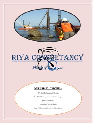
- 1. RIYA Consultancy A unit of Surveyors NILESH D. CHOPDA B/h Shri Mahaprabhuji Bethak, Opp. Shriji Society, Kherawadi, Dharampur, Jam-Khambhalia, Jamnagar (Gujarat), India Email Address: riyaconssurvey@gmail.com g
- 2. Riya Consultancy a unit of Surveyors Table of content 1.0 WELCOME TO RIYA CONSULTANCY ..................................................................................... 2 PROFESSIONAL PROFILE ............................................................................................2 2.0 CONSULTANCY AND ITS PRODUCTS ...................................................................................... 3 CADASTRAL SURVEY ....................................................................................................3 TOPOGRAPHIC SURVEYS ............................................................................................4 CONTOUR SURVEY .......................................................................................................4 MINING SURVEY ...........................................................................................................5 ROUTE SURVEY .............................................................................................................5 LEVEL SURVEY ..............................................................................................................6 CROSS-SECTION SURVEY ............................................................................................6 3.0 EQUIPMENT AND TECHNOLOGY SKILLS................................................................................ 7 4.0 WHO REQUIRED SURVEYORS ?.............................................................................................. 8 Mr. Nilesh D. Chopda Page 1 +91-9879512453 Email: riyaconssurvey@gmail.com
- 3. Riya Consultancy a unit of Surveyors 1.0 Welcome to RIYA CONSULTANCY Riya Consultancy is a fully licensed Land Surveying firm offering a wide range of Complete Land Survey Services. The Surveyors at Riya Consultancy possess strong skills for undertaking any type of survey project and will provide prompt, efficient, confidential and cost-effective results. We are confident we can be of assistance in any project you may wish to undertake. Riya Consultancy is emerging organization. The founder of this organization, Mr. Nilesh D. Chopda was set up with the notion of providing high-quality and comprehensive surveying solution to its customers. Mr. Nilesh has over 6 years’ experience in the field of Surveying. After getting Surveyor license from The Government of Gujarat he decided to start a Consultancy firm. Over 6 year’s excellent experience in the field of Survey with various Organizations. From the past experience and an optimistic approach built his confidence in this consultancy. PROFESSIONAL PROFILE Cadastral survey, Topographical survey, Road project survey, Canal work survey, Trancemition Line work, All Types of Construction work survey, Power Plant survey, Tank marking, Verticals checking, Earth work, Quantity survey, Petrochemical Refinery survey, Contour survey, Refinery survey, J.T. work survey, Land Survey, Agriculture To Non Agriculture Land survey, Plotting, Railway work survey, Building lay out, Mining survey, Pipe Line survey, Wind Farm survey Etc, With LEVEL Instrument and TOTAL STATION Machine. Mr. Nilesh D. Chopda Page 2 +91-9879512453 Email: riyaconssurvey@gmail.com
- 4. Riya Consultancy a unit of Surveyors 2.0 Consultancy and its products The most and fundamental question arise in our mind is “what is Survey?” Survey is the Science of measurement of spatial positions of the features on the surface of the earth. The purpose of conduction a land survey is to locate the positions of selected points on or near the surface of the earth. In simple word, land surveying is the process of demarcating the boundaries, area or elevations of land or structures on the earth’s surface via taking angle and distance measurements. Each of the various kinds of surveys described below is some form of variation of the above description. We pride ourselves on providing a complete solution to your surveying needs. CADASTRAL SURVEY Cadastral surveys are used to document land ownership, by the production of documents, diagrams, sketches, plans, charts, and maps. They are the surveys that create, mark, define, retrace, or reestablish the boundaries and subdivisions of the public lands. Cadastral surveying is the discipline of land surveying that relates to the laws of land ownership and the definition of property boundaries. It involves interpreting and advising on boundary locations, on the status of land ownership and on the rights, restrictions and interests in property, as well as the recording of such information for use on plans, maps, etc. Mr. Nilesh D. Chopda Page 3 +91-9879512453 Email: riyaconssurvey@gmail.com
- 5. Riya Consultancy a unit of Surveyors TOPOGRAPHIC SURVEYS The purpose of a Topographic Surveys is to gather survey data about the natural and man-made features of the land, as well as its elevations. From this information a three- dimensional map may be prepared. The work usually consists of the following: Establishing horizontal and vertical control that will serve as the framework of the survey Determining enough horizontal location and elevation (usually called side shots) of ground points to provide enough data for plotting when the map is prepared Locating natural and man-made features that may be required by the purpose of the survey Topographical Survey Computing distances, angles, and elevations Drawing the topographic map Topographic surveys are commonly identified with horizontal and/or vertical control of third- and lower-order accuracies. CONTOUR SURVEY Contours are an imaginary line connecting the equal height. Most contour and detail surveys are done by ground survey methods using electronic total stations and data recorders in much the same way as the preparation of a topographic map. Commencing from some known starting points in both horizontal and vertical dimension, the location of all points which define the terrain and the Contours structures are recorded. The terrain is often measured using a grid pattern of spot heights. Most surveyors who have a field capacity undertake contour and detail surveys, either as part of an overall development project or as a discreet project. Mr. Nilesh D. Chopda Page 4 +91-9879512453 Email: riyaconssurvey@gmail.com
- 6. Riya Consultancy a unit of Surveyors MINING SURVEY There are two types of mining (i) Open Cast Mining and (ii) Underground Mining. Our experience in Open Cast Mining, we did survey in mining for pillar marking, contour marking, detailed survey etc. Mining surveys may be horizontal, vertical or both and for the most part (except for possible control surveys) are plane surveys. Mining Survey ROUTE SURVEY Route surveys establish the location of transportation routes such as: Highways and roads Railways Rapid transit Canals Pipelines and Transmission lines. Surveys are required for all types of route alignment, planning, design and construction work. Road Survey with Total Station Pipeline Survey Mr. Nilesh D. Chopda Page 5 +91-9879512453 Email: riyaconssurvey@gmail.com
- 7. Riya Consultancy a unit of Surveyors LEVEL SURVEY Drainage systems, both above and below ground, work by creating a slope and relying on gravity to cause the water (or other liquids) to flow from the high point to the low point. Unless you have a pumped system the flow of drainage through the pipeline work will be dictated by the gradient at which the pipeline work has been laid. This is known as the fall and is generally expressed using a ratio i.e. 1:100, which indicates that over a length of 100mm, the pipe will fall 1mm from the high point to the low point. Current regulations require standard 100 mm diameter foul drainage pipeline work to be laid at a minimum fall of 1:80. If the pipeline work is laid below these falls, i.e. at a too flat a gradient, then disruptions to the flow of drainage are likely to occur which will often cause blockages within the pipeline. Insufficient falls will often manifest themselves with manholes or toilets backing up with foul waste. CROSS-SECTION SURVEY Definition: Cross-sectional research is a research method often used in developmental psychology, but also utilized in many other areas including social science and education. This type of study utilizes different groups of people who differ in the variable of interest, but share other characteristics such as socioeconomic status, educational background, and ethnicity. For example, researchers studying developmental psychology might select groups of people who are remarkably similar in most areas, but differ only in age. By doing this, any differences between groups can presumably be attributed to age differences rather than to other variables. Mr. Nilesh D. Chopda Page 6 +91-9879512453 Email: riyaconssurvey@gmail.com
- 8. Riya Consultancy a unit of Surveyors Types of Surveys Data are usually collected through the use of questionnaires, although sometimes researchers directly interview subjects. Surveys can use qualitative (e.g. ask open-ended questions) or quantitative (e.g. use forced-choice questions) measures. There are two basic types of surveys: cross-sectional surveys and longitudinal surveys. Much of the following information was taken from an excellent book on the subject, called Survey Research Methods. Cross-Sectional Surveys Cross-sectional surveys are used to gather information on a population at a single point in time. An example of a cross sectional survey would be a questionnaire that collects data on how parents feel about Internet filtering, as of March of 1999. A different cross-sectional survey questionnaire might try to determine the relationship between two factors, like religiousness of parents and views on Internet filtering. Longitudinal Surveys Longitudinal surveys gather data over a period of time. The researcher may then analyze changes in the population and attempt to describe and/or explain them. The three main types of longitudinal surveys are trend studies, cohort studies, and panel studies. 3.0 Equipment and Technology Skills This Consultancy firm has always attempted to work with the latest technological instruments. We have Electronic Total Station Instruments, GPS (Global Positioning System). We have well trained operator of AutoCAD. (Computer Aided Drawing-CAD), Auto Plotter. Global Positioning System (GPS) Software Based Map Mr. Nilesh D. Chopda Page 7 +91-9879512453 Email: riyaconssurvey@gmail.com
- 9. Riya Consultancy a unit of Surveyors 4.0 Who Required Surveyors ? One of the Basic Question arises in our mind what is the important of survey and who required surveyors? From our past experience we just suggest some of the fields that required surveyors Road project work Canal work Trancemition Line work All Types of Construction work Power Plant Refinery work J.T. work Land Survey Agriculture To Non Agriculture Land Railway work Building work Mining work Pipe Line Windmills Survey Mining Sector Infrastructure Sector Engineering Sector Construction Industry Local Villagers or Farmers All type of Software related work Farm work and Other Many work Should Be Required of Surveyor “SURVEY IS THE BASE OF GROWTH” Mr. Nilesh D. Chopda Page 8 +91-9879512453 Email: riyaconssurvey@gmail.com