
Recomendados
Recomendados
Mais conteúdo relacionado
Mais procurados
Mais procurados (20)
Semelhante a Integrating Minibuses into African City Transport Planning
Semelhante a Integrating Minibuses into African City Transport Planning (20)
Mais de BRTCoE
Mais de BRTCoE (20)
Último
Último (20)
Integrating Minibuses into African City Transport Planning
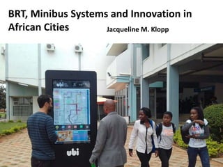
- 1. BRT, Minibus Systems and Innovation in African Cities Jacqueline M. Klopp
- 2. Minibus systems often missing in transportation planning despite ubiquity and importance Basic Observations Nairobi Vision 2030/Thika Highway
- 3. This has transferred over to mass transit planning…. Minibuses are in the white empty spaces? Little holistic data and analysis based on data of actual minibus systems, rail, NMT (fragmented, corridor approach)
- 4. BRT planning: Missing Data for an Integrated Network Addis Ababa City Administration Transport Programs Management Office BRT-Project Management Unit ?
- 5. Source: Transaction Capital 2017 from SA Taxi telematics data as at 11 October 2016 | National Land Transport Strategic Framework 2015
- 6. Emerging trends: Minibuses not going to disappear Growing work on paratransit, policies, practices, operations (Paratransit in African Cities, Taken for a Ride, Ghana on the Go, )…growing literature but no systematic review or learning across cities. Signs of innovation within minibus sector (is BRT necessary as a catalyst for change and for introducing new technologies?) Some innovation within cities eg. in South Africa with the greatest experience of BRT… “A Review of Minibus-Taxi Reform Initiatives in South African Cities” World Bank forthcoming
- 7. Service Contracts plus Technology
- 8. Smart Matatu and drivers! Erin Kelley Greg Lane David Scḧonholzer and Peter Wagacha Waiganjo (2017) Increases in productivity drivers, owners/higher incomes… safety improvements, driver income increases needed.
- 9. Improvements in Fleet Management: AccraMobile Case Accra and smart Matatu Saddier and Johnson 2016)- need for rank changes average waiting 3.5 hours a day! Saddier, S, Z. Patterson, A. Johnson and N. Wiseman. 2016. Fickle or Flexible? Assessing Paratransit Reliability (quite reliable!)
- 10. Improve Infrastructure Wallacedene Taxi Rank Cape Town
- 11. Maputo: Passenger Information Improving Business, Advertising
- 12. Public Transport with Minibus Mapping for planning, passenger service, and as a new engagement strategy Nairobi (DigitalMatatus) Maputo (Mapos dos Chapas)
- 13. Mapping Can Support Formalization/More Positive Engagement Officialization of bus stops 1 Map of collective transport across modes 2 Map owned by the local authority 3 Maputo: City has started to formalize stops
- 14. COLLABORATIVE DATA COLLECTION DEVELOP OPEN DATA= CHANGE USER/PLANNING APPS AND INFO TRANSPORT MODELS PUBLIC TRANSIT VISIBLE IN (GTFS) STANDARD FORMAT ONLINE AND PAPER INFORMATION FOR ADVOCACY INNOVATION, EMPOWERED USERS ANDCITY PLANNERS + + == Leverage Growing Cellphone Use to Collect Missing Transit Data
- 16. Disorganized transit systems “planned” by the actions of many private actors do naturally evolve certain forms of efficiency, but they do not naturally evolve into the most efficient and productive network for the whole city. That final push into coherence requires network design! Jarett Walker 2014 Network Analysis and Design
- 17. Nairobi’s Matatus on Google Maps: Accessing transport is also information Looking at actual travel…. NMT always there on map! New Passenger Services: Increases Business
- 18. Kenya Urbanization Review World Bank 2016 Measuring Access to Services
- 19. Power of the Digital- new analysis
- 20. Cairo: New communities rely on microtransit
- 21. Displace and Replace or Embrace? • We need a balanced, holistic approach with BRT fitting into a bigger picture on integrated transit • We need better data and analysis of the whole system including minibuses… also for better pre, post analysis and assessment of options • Better to work with minibuses on a more respectful basis (no politics can be skirted via BRT processes) • Incremental approach- better idea? • Can we build on the ongoing innovation in the minibus sector for better more equitable transport in African cities?