SlideShare uma empresa Scribd logo
1 de 89
Baixar para ler offline
Major &
Collector
Street Plan
Implementing
Complete
Streets
Volume V:
Access
Nashville
2040
A General Plan for Nashville & Davidson County
II
Mission Statements
The Planning Commission guides growth and development as Nashville and Davidson County evolve into a more
socially, economically and environmentally sustainable community, with a commitment to preservation of important
assets, efficient use of public infrastructure, distinctive and diverse neighborhood character, free and open civic life,
and choices in housing and transportation.
The Planning Department helps Nashville and Davidson County evolve into a more sustainable community, guided
by a commitment to efficient use of infrastructure, distinctive and diverse community character, open and vibrant
civic life, and choices in housing and transportation focused on improving the quality of life.
The Planning Department does not discriminate on the basis of race, color, national origin, gender, gender identity, sexual orientation, age, religion,
creed or disability in admission to, access to or operations of its programs, services or activities. Discrimination against any person in recruitment,
examination, appointment, training, promotion, retention, discipline or any other employment practices because of nonmerit factors shall be
prohibited.
For ADA inquiries, contact Josie Bass, ADA compliance coordinator, at 615-862-7150 or email her at josie.bass@nashville.gov. For Title VI inquiries,
call Metro Human Relations Commission at 615-880-3370. For all employment-related inquiries, contact Human Resources at 615-862-6640.
Please see the Metro Planning Commission website at http://www.nashville.gov/Planning-Department.aspx for the most up-to-date version of this
statement.
IIIIII
IV
V
Table of Contents
Chapter 1 – Introduction  ...............................................................................................		 1
Purpose of the Major and Collector Street Plan ................................................................................	2
The Need to Update the Major and Collector Street Plan .................................................................	4
How the Major and Collector Street Plan Was Updated ...................................................................	 4
Users of the Major and Collector Street Plan ....................................................................................	 8
Chapter 2 – Using the Major and Collector Street Plan .........................	 9
Context Sensitive Solutions and Complete Streets for Nashville ....................................................		 10
The Elements of Each Street Segment ................................................................................................	13
Environment .......................................................................................................................................		 14
Street Context .....................................................................................................................................	 17
Functional Design Type ......................................................................................................................	 18
MCSP Mapping ...................................................................................................................................		 20
Chapter 3 – Context Sensitive Solutions Design Guidelines .............	23
Functional Design Type Guidelines ...................................................................................................		 24
Street Element Descriptions ..............................................................................................................	 27
Collector-Avenue  ................................................................................................................................	 32
Arterial-Boulevard  ............................................................................................................................		 43
Arterial-Parkway  ...............................................................................................................................		 57
Multimodal Corridor ..........................................................................................................................		 64
Appendix. ...........................................................................................................................................	70
Appendix A–Right-of-Way Dimensions .............................................................................................	71
Appendix B–Resources and Tools Used to Determine the Classification of Each Street .................	75
Appendix C–Glossary ..........................................................................................................................	79
VI
As Nashville continues to grow and reinvest in its walkable centers, policies related to the entire right-of-way of streets are needed to
ensure people can walk, bike, and access transit as needed.
1
Chapter 1
Introduction
Metro Transit Authority (MTA) successes: Music City Star becomes Tennessee’s first commuter rail service. MTA adds new hybrid buses to the fleet and places them in service on the Gallatin Road Bus Rapid
Transit route.
2
Second Avenue in downtown Nashville was designed with wide
sidewalks and on-street parking due to high pedestrian and
commercial activity.
21st
Avenue in Hillsboro Village has been designed to
complement its urban character, including on-street parking,
access management, and wide sidewalks.
PURPOSE OF THE MAJOR
AND COLLECTOR STREET PLAN
The Major and Collector Street Plan (MCSP) is
a comprehensive plan and implementation tool
for guiding public and private investment in
the major streets (Arterial-Boulevards, Arterial-
Parkways and Collector-Avenues) that make up
the backbone of the city’s transportation system.
It is a part of, and implements, Access Nashville
2040, which is a functional plan component of
the General Plan called NashvilleNext.
Access Nashville 2040 outlines Accessiblity
Principles and ties together these four elements:
1.	 The MCSP prepared by the Metro Planning
Department and adopted by the Metro
Planning Commission;
2.	 The Strategic Transit Master Plan prepared
by the Metro Transit Authority (MTA), which
is currently being updated;
3.	 The Strategic Plan for Sidewalks and
Bikeways prepared by the Metro Public
Works Department (MPW) in 2003 and
updated in 2008; and
4.	 The Metro Parks and Greenways Master Plan,
which will be updated in 2016.
The MCSP implements the Accessibility
Principles of Access Nashville 2040 by mapping
the vision for Nashville’s major and collector
streets and ensuring that this vision is fully
integrated with the city’s land use, mass transit,
and bicycle and pedestrian planning efforts.
The MCSP aims to help Nashvillians “complete
the trip” by increasing the quality of streets in
Nashville, meeting the needs of all users, people
who walk, bike, take transit, move goods, and
drive cars, in a manner that respects the context
and users of the street.
The MCSP contains guidance for two related
components of the street network: character and
function. The two approaches used to provide
guidance for street character are called “Context
Sensitive Solutions”(CSS) and “Complete
Streets.” These character guidelines apply to the
planning, construction and redevelopment of
streets. Street function is defined by the degree
of mobility, including the number of travel lanes
needed during the period covered by the MCSP
(20-25years); the degree of accessibility the
street provides, as well as its role in the larger
network of streets. Major and collector streets
are two separate functional classifications of
streets that form an interrelated network,
which is why they are presented together in this
document.
In addition to the detailed analysis of all the
major streets within Davidson County, the MCSP
also provides basic information on right-of-way
widths for local streets.
The 28th
/31st
Avenue Connector includes Context Sensitive
Solutions, including protected bikeways, sidewalks, public art
elements, transit shelters, and low impact stormwater solutions.
3
Context Sensitive Solutions
The Federal Highway Administration defines
Context Sensitive Solutions (CSS) as a
collaborative, interdisciplinary approach
involving all stakeholders to develop a
transportation facility that fits its physical
setting and preserves scenic, aesthetic,
historic and environmental resources, while
maintaining safety and mobility. CSS is an
approach that considers the total context
within which a transportation improvement
project will exist. Where prior versions of
the MCSP have addressed “context” in terms
of only rural or urban and focused solely on
functional classification, this update of the
MCSP introduces the idea of CSS to begin to
create new streets and improve existing streets
to be more responsive to their context, potential
future users, and development changes. CSS is
described in greater detail in Chapter 2.
Complete Streets
This update of the MCSP also reaffirms Metro’s
commitment to utilizing a “Complete Streets”
approach to street design. Complete Streets is
an initiative by which cities, states, and other
jurisdictions adopt policies to ensure future
roadway projects will attempt to accommodate
all users who walk, bike, take transit, move
goods, or drive cars.
This MCSP advances the concept of Complete
Streets by developing a thoroughfare system
that provides for safe and effective access for all
users in completing their trips, while addressing
streetscape design in context with the existing
or envisioned character of the community.
This philosophy in design of transportation
corridors emerged in response to a changing
culture and demographics which demand
more transportation choices. The emphasis
on active lifestyles, energy conservation, and
the importance of accommodating users of all
ages and abilities illustrates that a street can no
longer be designed just for the automobile.
Complete Street design should be understood
as a process, not a specific product. For that
reason, not all “Complete Streets” will look the
same. Complete Street design is both an art
and a science. As such, good design standards
balance engineering judgment and user needs
within the context of the street. Roadway design
must rely on the design professional’s knowledge
of elements such as travel speeds, volumes,
horizontal and vertical alignments and sight
lines. User needs also influence the design of the
Complete Street. Many of the facilities contained
within the right-of-way are uniquely associated
with the needs of people of all ages and abilities.
Character, or the physical context in which the
street resides, is another factor considered in
Complete Street design. Character influences
the form and function of the roadway and its
associated streetscape all of which are designed
to complement and enhance the surrounding
character.
CSS and Complete Streets approaches support
the development of healthy and sustainable
communities in keeping with local and national
policies and initiatives. A national example is
the Centers for Disease Control and Prevention’s
Healthy Community Design Initiative. This
initiative promotes the integration of evidence-
based health strategies into community
planning, transportation, and land use
decisions. Providing opportunities for people to
incorporate physical activity into their daily lives
is an example of one of these strategies and can
be accomplished by facilitating activities such as
walking to transit, biking to work, or walking to
nearby shopping destinations. A transportation
system that allows the healthy choice to be the
easy choice will contribute to healthier life styles
within the community.
Locally, Mayor Karl Dean’s Complete Streets
executive order, “Together Making Nashville
Green” initiative, the NashVitality campaign,
Moving in Harmony campaign, and Access
Nashville 2040, along with NashvilleNext
inform the direction of this MCSP. The Complete
Streets Executive Order, issued on October 6,
2010, directs Metro Departments to “Give full
consideration to the accommodation of the
transportation needs of all users, regardless of
age or ability...” We anticipate future mayoral
administrations to reaffirm this commitment.
“Together Making Nashville Green” involves
citywide efforts to advance environmental
sustainability and community health throughout
Nashville. Nashviltality promotes a healthy,
active and green city. Moving in Harmony
promotes sharing the road among all street
users–bikes, pedestrians, and cars. NashvilleNext
4
Music City Central is strategically located on Charlotte Pike
and 4th
Avenue North, which are both major downtown streets
providing regional access. The facility provides a safe and
attractive transit facility for MTA riders.
reinforces sustainability efforts, smart land use
decisions, and a multimodal transportation
network. CSS and Complete Streets further these
initiatives by supporting active transportation
choices and also by complementing a compact
and sustainable urban form that emphasizes
investment in the central city and centers where
infrastructure is in place and where active
transportation choices are relatively easy and
convenient to make as part of day-to-day life.
THE NEED TO UPDATE THE MAJOR
AND COLLECTOR STREET PLAN
As a functional component of the General Plan or
NashvilleNext’s Access Nashville 2040 (Volume
V), the MCSP should be updated regularly and
as needed to reflect changes that have occurred
and to respond to future planned growth,
development and preservation.
Access Nashville 2040’s Accessibility Principles
respond to these key issues in Nashville:
1.	 Nashville’s street network is mostly
built. Acquiring new right-of-way is very
challenging.
2.	 The city’s transportation network must
reflect what is appropriate for Nashville.
3.	 Nashville is the region’s population and
employment hub, so Middle Tennessee
residents need to connect to Nashville and
get around in multiple ways as part of the
regional transportation network.
4.	 Nashville’s street network is evolving into
a multimodal transportation network and
should accommodate all modes and people.
5.	 Nashville’s multimodal transportation
network evolves as walkable centers grow.
HOW THE MAJOR AND COLLECTOR
STREET PLAN WAS UPDATED
The 2015 update of the MCSP involved the
following steps:
1.	 Review of the plans referenced below,
2.	 Analysis of the existing conditions of all
the Major and Collector streets in Davidson
County, review of local transportation plans,
and assessment of the role of each street
in light of Access Nashville’s Accessibility
Principles,
3.	 Update the Environment based upon the
transect category, Street Context, and
Functional Design Type for each applicable
street, to align with land use policies in
the Community Plans (Volume III) of
NashvilleNext,
4.	 Input and feedback from other Metro and
state of Tennessee Agencies during the
process of creating NashvilleNext, and
5.	 Input from the public at organized
community meetings and discussion of
issues with planning staff during the three-
year NashvilleNext process.
Bike lanes along Demonbreun Street have been implemented as
redevelopment occurs.
5
Plans Reviewed
A comprehensive review of the following local
planning documents influenced this update of
the MCSP as NashvilleNext was adopted.
Community Plans Major and Collector
Street Plan (MCSP)—This plan includes
recommendations for improvements to existing
streets and the creation of new streets. It is
created through the Community Planning
process, led by Metro Planning staff and
community members in the fourteen planning
communities in Nashville. This plan has
historically reflected community objectives, but
has often downgraded or removed connections
or collectors at the request of Council Members,
community members or developers that
may have been legitimately warranted for
transportation network connectivity.
Because the MCSP is informed by the
Community Plan Updates, the MCSP is
sometimes amended following a community
planning process to reflect the specific changes
applicable to that community. These now align
with NashvilleNext.
2040 Update and 2035 Nashville Area MPO
Regional Transportation Plan—Adopted by
the regional transportation planning agency, the
Nashville Area MPO, the network is a reflection
of all planned Regional Transportation Plan
(RTP) projects for travel demand modeling
purposes. It establishes a 25 year vision for
transportation in Middle Tennessee. In 2015, the
MPO is updating the Regional Transportation
Plan.
2008 Update and 2003 Strategic Plan for
Sidewalks and Bikeways—Adopted by the
Metro Planning Commission in 2003 and
updated in July, 2008, this plan addresses all
aspects of pedestrian and bicycle planning, and
specifically outlines the streets that need bicycle
facilities and what type of facility is warranted.
NashvilleNext identifies that the Strategic Plan
for Sidewalks and Bikeways needs to be updated.
nMotion 2015 and 2009 Nashville Strategic
Transit Master Plan—Adopted by the
Nashville Metro Transit Authority in 2009, this
plan sets forth guiding principles and policies
for improving public transportation in Nashville,
as well as describes actions and projects for
the future. MTA will update the Strategic Plan
in 2015-2016 called nMotion and utilize the
High Capacity Transit Corridors identified in
NashvilleNext Growth and Preservation Concept
Plan as a starting point. The MCSP will need to
be amended once the nMotion Strategic Plan is
finalized.
2008 Update to the Metropolitan Parks and
Greenways Master Plan—The Master Plan
outlines a vision for the parks and greenways
systems . Residents increasingly use the
extensive greenways network for transportation
purposes and should be encouraged.
NashvilleNext outlines the need to update the
plan, and Metro Parks anticipates updating the
Master Plan in 2015-2016.
2014 Downtown Multimodal Mobility
Study—The Multimodal Mobility Study was
completed by Metro Public Works to estalblish
a mobility action plan for all mosdes of
transportation in downtown Nashville for the
next 10 years.
2014 Pedestrian and Bicycle Safety Pilot
Project Report—A report completed by Metro
Public Works that identifies high crash locations
for pedestrians and bicyclists and potential
countermeasures to improve safety.
2010 Metro Nashville Multimodal Connectivity
Study—This study was initiated by the Mayor’s
Office and the Bicycle and Pedestrian Advisory
Committee to identify recommendations for
improved connections between existing bicycle,
Deaderick Street, a public sector project, incorporates
sustainable design features including street trees, a vegetated
median, pedestrian scale lighting, and adequate sidewalk
widths.
6
pedestrian, and transit facilities and between
trip attractors and generators. This includes
multi-use paths, restriping roads for bike lanes,
right-sizing streets, and construction of sidewalk
segments.
2015 Northwest Corridor Transit Study
and 2009 Northwest Corridor Conceptual
Feasibility Study—An initial feasibility study
was undertaken in 2009 to look at the corridor
between the cities of Clarksville and Nashville
to determine if commuter rail is feasible in this
corridor, determine the most likely alignment,
develop a preliminary capital cost estimate,
and a potential operating schedule and budget.
In 2015, this study builds upon and expands
on the 2009 findings and recommendations
to determine a combination of alternatives
that can be integrated and phased into Middle
Tennessee’s regional transit plan.
2015 Southeast Area Transportation
and Lands Use Study and 2007 Southeast
Corridor Alternatives Analysis—The
Southeast Corridor High-Performance
Transit Alternatives Study looked at potential
transit systems that could be built in the
corridor between the cities of Nashville and
Murfreesboro. The study considered several high
performance transit alternatives and compared
the cost and benefits of those alternatives to
determine a transit solution that includes both
short-term and long-term recommendations.
The Locally Preferred Alternative selected
was a combination of phased bus service
enhancements, including development of
express bus and skip stop bus services on I-24
and Murfreesboro Road (US 41/70S), and
extended local bus service on Murfreesboro.
In 2014, the Nashville Area MPO kicked off a
more comprehensive study to look at a range of
alternatives involving all transportation modes
and the integration of land use decisions in
Middle Tennessee in the area.
2011 Northeast Corridor Mobility Study—
Initiated by the Nashville Area MPO, this study
develops a regional transportation investment
strategy for the 30-mile corridor between
downtown Nashville and Gallatin.
Music Row—17th
Avenue South is part of a one-way pair that serves a District Office Concentration with Context Sensitive features
that include bike lanes and on-street parking.
7
2015 Update and 2009 Regional Bicycle &
Pedestrian Study—The Nashville Area MPO
updated the findings of the 2009 study in 2015
to establish a strategic vision for improving
walking and bicycling opportunities in the
greater Nashville region.
Regional Freight and Goods Movement
Study, Phases I, II, and III—The Nashville
Area MPO completed the third phase of the
study in 2015 to align economic development,
land use decisions, and urban design
considerations with freight and local delivery
needs while minimizing conflicts with quality of
life principles.
The Code of the Metropolitan Government
of Nashville and Davidson County,
Tennessee—Including Title 12, Vehicles and
Traffic; Title 13, Streets, Sidewalks, and Public
Places; and Title 17, Zoning.
The Subdivision Regulations of the
Metropolitan Government of Nashville and
Davidson County, Tennessee—Adopted by the
Metropolitan Planning Commission on March 9,
2006 and as amended through January 9, 2014.
The Accessibility Principles of Access
Nashville 2040—Also adopted by the Metro
Planning Commission on June 22, 2015, Access
Nashville 2040(Volume V of NashvilleNext) sets
Accessibility Principles for future transportation
decisions, which are to be implemented through
the MCSP.
FY 2013-2014 Capital Improvements Budget
—The fiscal year 2013 through 2014 CIB is the
latest plan of proposed expenditures for Metro
capital projects and the means of financing them
over a five-year horizon.
2015 Update to TDOT’s 25-Year Long
Range Transportation Plan—TDOT is
currently finalizing its update to the state’s long
range transportation plan. This plan creates a
new long-term vision for transportation and
provides guidance for priortizing transportation
investments across the state.
Magnolia Boulevard is a classic urban boulevard with a vegetated median, bike lanes, and areas of on-street parking that serves a variety
of urban areas ranging from Major Institutional District to Urban Neighborhoods, Corridors, and Centers.
8
Murphy Road is an Arterial-Boulevard with a buffered bike lane.
USERS OF THE MAJOR AND
COLLECTOR STREET PLAN
In addition to this document, the MCSP also
includes a map and electronic database of every
Major and Collector street in Nashville. The
designation of the street is labeled in the map
and defined in this document through a series
of tables and diagrams that explain how each
street should be designed (See Chapters 2 and
3). The plan is intended to be used by the public
and private sectors in planning, designing,
budgeting, and constructing new streets and
making improvements to existing streets.
Public Investment and
Development
Metro Government, including Planning, Public
Works, Finace, Metro Transit Authority (MTA),
Metro Parks, and Nashville Electric Service (NES)
must consult the MCSP:
1.	 To assess proposed street improvements
and new streets to be built through private
sector development (through rezoning or
subdivision) as well as with private sector
redevelopment where additional right of way
or reallocation of existing right of way may
be required;
2.	 For proposing street improvements and
new streets as part of the land development
process when Metro government is acting as
a public sector developer through the Capital
Improvements Budget; and,
3.	 For proposing street improvements and
new streets as part of the local and regional
transportation planning and budgeting
processes, as part of Metro’s Capital
Improvement Budget and the Nashville
Area MPO’s Transportation Improvement
Program.
In making these decisions, Metro staff will make
a determination of whether a Major or Collector
street is a constrained or unconstrained facility
in terms of having substantial right-of-way
limitations (a “constrained” facility) and will
take that status into account when assessing
proposed street improvements. Constrained
facilities will be less likely to gain the standard
amount of right-of-way, thus requiring
thoughtful consideration of how to use the
constrained right-of-way to provide for all modes
of transportation.
Metro Planning Commission members will use
the MCSP to assess the streets proposed in
zoning and subdivision cases and to develop a
recommended annual Capital Improvements
Budget and Program that includes proposed
new streets and street improvements that
carry forward the priorities identified in
NashvilleNext.
Citizens will use the MCSP to gain a better
understanding of each street’s role in Metro
Nashville’s transportation network.
Private Investment and
Development
The private sector will use the MCSP when
proposing new development to determine if any
major or collector streets are to be provided or
upgraded in the proposed development area and
what the street cross section should look like.
The private sector will then design the new street
or improve the existing street accordingly.
The private sector will also use the MCSP when
proposing redevelopment to determine if any
additional right-of-way and/or facilities need
to be provided to meet the future vision for the
street.
In both cases, Metro government will review
proposed new streets and improvements to
existing streets against the guidelines in the
MCSP.
9
Chapter 2
Using the Major and Collector Street Plan
10
Deaderick Street and Church Street complement and support the urban form of the downtown environment with appropriate scale
and pedestrian sensitive design.
Past iterations of the Major and Collector
Street Plan (MCSP) have addressed Nashville’s
planning for major streets in terms of functional
classification, which is a process where streets
are grouped into classes according to the type of
vehicular service they are intended to provide,
channeling traffic through a network of smaller
and larger streets in a logical and efficient
manner. Consideration of the overall network
and its efficiency is important, but a model based
solely on functional classification tends to lack
guidance on developing the character of streets
and on creating streets that serve all modes of
transportation.
This earlier approach to street design overlooks
the fact that streets are the most prevalent
public spaces in the community and, as such,
merit attention to their character as well as their
vehicular function. Across the country, cities
and states now utilize models for considering
the character of prominent streets in light
of the street’s context as well as models for
providing real transportation choice. Two
planning philosophies, called “Context Sensitive
Solutions” (CSS) and “Complete Streets,” are
reaffirmed in this update of the MCSP.
Nashville’s Street Network is
Mostly Built
The conventional development of a street system
has two basic levels of planning and design.
The first is network design, which addresses
the layout, spacing and general size of major
streets. The second is street design, which covers
the geometric design of streets. Although most
of Nashville’s major and collector streets are
built, many are not complete because they do
not comfortably serve all people. The MCSP
guides how these streets can be redesigned as
complete streets. This chapter addresses two of
the key aspects of street design— integrating the
street with the character of development that
surrounds it while meeting the needs of all likely
users.
CONTEXT SENSITIVE SOLUTIONS AND COMPLETE STREETS FOR NASHVILLE
11
T2 Rural streets in Whites Creek accommodate high levels
of automobile and pedestrian traffic while retaining a rural
character through the incorporation of elements such as a soft
shoulder and an appropriately narrow width.
21st Avenue in Hillsboro Village also has high levels of
automobile and pedestrian traffic. It has curb, gutter, wide
sidewalks, and formal on-street parking. It provides mobility
while being kept at a narrow scale to support the T4 Urban
mixed use environment.
The Context Sensitive Solutions
Approach
A street’s “character” refers to the different
elements included in a street (sidewalks versus
multi-use paths, bike lanes versus protected
bikeways, curb and gutter versus swale, etc.)
and how they are designed to complement the
existing or proposed context of the area through
which they are passing. The determination of
street character must take into account the
adjacent land use and context. 20th
century
street planning typically only allowed two levels
of sensitivity to the surrounding land use and
context—streets were either rural or urban—
resulting in street designs with limited relation
to their surroundings.
Context Sensitive Solutions (CSS) is a practical
approach to transportation decision-making
and design that takes into consideration the
communities and lands through which streets,
roads, and highways pass – the context. The CSS
approach can be thought of as evolving from
the National Environmental Policy Act (NEPA)
of 1969, which established the Environmental
Impact Statement (EIS) process for judging large-
scale infrastructure projects. The EIS process
was among the first to consider the impact
of infrastructure projects—including road
construction—on the surrounding community.
Most recently, two prominent and influential
professional organizations representing urban
planning professionals and transportation
engineers have issued the 2010 document
Designing Walkable Urban Thoroughfares: A
Context Sensitive Approach. The document
was issued by the Institute of Transportation
Engineers (ITE) and the Congress for the New
Urbanism (CNU). Designing Walkable Urban
Thoroughfares applies the CSS approach and
principles to urban street design. It has been
designated an ITE Recommended Practice,
formally adopted by the ITE after a thorough
development and review process.
CSS has the following attributes:
»» CSS addresses transportation needs in a
financially feasible manner by matching the
street to the setting that ensures safety for
all users of an end-product;
»» CSS involves stakeholders in the design
process, balancing various stakeholders’
needs to produce a solution that is an
asset of lasting value to a community. In
the case of CSS in the MCSP, most of the
community’s involvement took place during
the community plan update. These ideas were
then incorporated into the MCSP;
»» CSS allows flexibility in design guidelines,
particularly in constrained conditions;
»» CSS designs a transportation system and
individual roads that serve multiple users
regardless of travel mode; and
»» CSS incorporates aesthetics as an integral
part of good design.
Additionally, the National Association of City
Transportation Officials (NATCO) has developed
two guides that provide cities with state of the
art solutions for 21st
century transportation
infrastructure. The Urban Street Design Guide
and Urban Bikeway Design Guide provide a
12
blueprint for complete streets that are safe and
enjoyable for everyone. With this update to the
MCSP, Nashville joins local, state, and federal
governments across the country in endorsing
the NACTO guidelines as a recommended best
practice.
Relationship between
Conventional Street Planning and
CSS
The main difference between conventional
street planning and CSS street planning is in
the flexibility provided by CSS to create a new
street (or redesign an existing street) that meets
the needs of its context – whether it is a rural,
suburban, urban or downtown setting.
The MCSP incorporates CSS thinking by
following the Community Transect, which is a
system for categorizing, understanding, and
designing the various levels of development
within a region, from the most rural to the most
urban. The Community Transect is the basis for
Metro’s land use planning system. The Transect
recognizes the full spectrum of development in
a region while CSS provides variation in street
character to complement changes in the context.
As an example, Table 1 shows the limited context
designations in 21st century street planning
model (which only recognized rural or urban
settings) as compared to the additional, tailored
street designations available under a CSS
approach. Table 1 also shows what criteria are
used to design streets utilizing the conventional
model versus through a CSS approach. The
CSS approach weighs more criteria as it links
community context and street design to produce
streets that serve a broader array of community
needs.
The Complete Streets Approach
The Context Sensitive Solutions (CSS) approach
and the Complete Streets approach work hand-
in-glove in the MCSP. The Complete Streets
approach requires that the needs of all users
be considered on each street. While it may
not be necessary or viable to provide facilities
for all users on every street based on context,
the Complete Streets approach guides the
conversation about multimodal transportation.
The combined approach asks designers to
think about each segment of a street, what its
context is, and what its resulting needs are for
multimodal options. For example, consider
an Arterial-Boulevard in a rural setting. Are
sidewalks with curb and gutter appropriate in
a rural setting? Likely they are not, but there
may still be community members and visitors
that want to travel by bike or on foot. Therefore,
a multi-use path on one side of the street may
be the best solution to provide a meaningful
transportation option in a rural setting.
Table 1: 20th century street design factors compared with CSS street design factors.
Functional ClassFunctional Class
Multiple Travel Modes and Users DemandVehicle Travel Demand
Adopted Community ObjectivesVehicle Design Speed
Context/Adjacent Land UseVehicle Level of Service
Street design criteria primarily based on:Street design criteria primarily based on:
Downtown (ex. James Robertson Pkwy.)
Center (ex. Rivergate area streets)
Residential (ex. West End Ave. between I-440 and St. Thomas Hospital)
Mixed-Use (ex. Woodland St. between 5th and 11th St.)
UrbanUrban
Residential (ex. Harding Pl. between I-65 and Nolensville Pk.)Rural
Mixed-Use (ex. Old Hickory Blvd. & Edmondson Pk.)
Suburban
Residential (i.e. Whites Creek Pk., Joelton)
Mixed-Use (ex. Ashland City Hwy. & Old Hickory Blvd.)
Rural
Possible Context Designations:Possible Context Designations:
CSS Street DesignConventional Street Design
13
T2 - R - CA# -
THE ELEMENTS OF EACH STREET SEGMENT
The MCSP places emphasis on designing streets that serve all people and
reflect the character of the neighborhoods and centers through users pass.
Therefore, this update of the MCSP continues to categorize each street
segment in a manner that provides greater guidance as to the purpose and
goals of each street segment.
The defining elements of each street segment include Environment, Street
Context, and Functional Design Type. In some cases there is a fourth
element, which represents a Multimodal and/or Scenic Overlay.
Every Major and Collector street is identified with a specific label string
comprised of the elements appropriate for that street segment. An overview
of these elements is provided below, with more detailed explanations of each
element in the following pages.
Environment
The Transect is the central organizing
tool for Nashville’s land use planning
and policies. The Transect is a tool for
categorizing a community’s natural and
built environment from rural to downtown.
Just as Nashville has a diversity of
development and preservation areas, its
streets should reflect the same diversity.
Transect Categories indicate an area’s
general character and are therefore listed
first in defining a street’s character.
This designation influences the scale,
location, and orientation of development
in a given area (i.e. T2 Rural ranging to
T6 Downtown). The Transect is aligned
with land use policies contained in the
Community Plans of NashvilleNext.
Street Context
The Street Context adds to the
understanding of context by defining
the predominant existing or intended
development pattern flanking a given
street section. This designation influences
design elements like setbacks and sidewalk
widths. The street context aligns with land
use properties included in the Community
Plans of NashvilleNext. The three Street
Context designations used in this document
are Residential, Mixed Use, and Industrial.
Functional Design Type
The purpose of the Functional Design
Type is to classify streets according to the
character of service they are intended to
provide and to design those streets so that
they fit their context and serve all users.
Each street is labeled, in this document
and in mapped form, with one of the
three Street Types – Collector-Avenue,
Arterial-Boulevard, and Arterial-Parkway.
Guidelines are laid out in tables and
diagrammed in illustrative cross-sections,
both found in Chapter 3. Since most streets
are built, this element informs how Metro
can remedy street design that has mostly
privileged people driving.
Multimodal or Scenic
Overlay
Multimodal Corridors may be Immediate
Needs (IM) or Long Term Needs (LM).
Multimodal Corridors are anticipated to
serve a greater role in providing local and
regional transit and align with the High
Capacity Transit Corridors identified in the
NashvilleNext Growth and Preservation
Concept Map. Accommodating transit
and support for bike/pedestrian access
is critical. Streets designated as Scenic
connect areas of scenic and cultural
significance and call for enhancement or
preservation of existing natural areas on
private property just outside the right-of-
way. The Metro Zoning Code also prohibits
new billboard signage on Scenic roads.
(O)
14
Figure 1: Transect Category Diagram: Courtesy of DPZ.
ENVIRONMENT
(T2-L-L#)
The first defining element for each street
segment is its Environment based upon the
Transect, which is a combination of a letter
and a number. The Transect is a system for
categorizing, understanding and guiding the
various development patterns of a region, from
the most rural to the most urban environments.
The Transect calls for all elements of the natural
and built environment to be consistent with the
character of the Transect Category within which
they are located.
The Transect is the central organizing tool for
future growth and preservation planning in
Nashville and Davidson County. The Nashville
Transect consists of seven categories of natural
and built environments:
»» T1 Natural
»» T2 Rural
»» T3 Suburban
»» T4 Urban
»» T5 Center
»» T6 Downtown
»» D District
Determining the Transect Category for each
area in Nashville is the first step in creating
Community Plans that are part of NashvilleNext.
Then Community Character Policies—Nashville’s
land use policies—are applied to an area based
on its Transect Category. Community Character
Policies are used in all Community Plans to guide
future growth, development, and preservation.
In working with the community, Planning
staff determines which areas of a community
are considered to be T1 Natural, T2 Rural, T3
Suburban, T4 Urban, T5 Centers, T6 Downtown,
and D Districts. The Context Sensitive Solutions
approach calls for stakeholder involvement and
the Community Plan Update Process is one way
that involvement is achieved. The results of the
Community Plan Updates are folded into this
document. Likewise, when Community Plans are
updated in the future, those updates may reveal
recommendations and amendments that need to
be made to the street classifications in the MCSP.
The MCSP includes six Transect categories; it
does not include T1 Natural areas. T1 Natural
areas have roads, but they are typically local
roads which are not addressed by the MCSP.
While different Transect categories can sit side-
by-side, it is crucial that within each Transect
category, each element of development should be
harmonious within that category. Just as a curb,
gutter and sidewalk would look out of place in a
rural setting, similarly, having rural spacing and
setbacks for housing in urban neighborhoods
would be inappropriate.
15
T-6, Downtown
T-3 Suburban
Figure ground diagrams showing building footprints and streets
illustrates how the street network differs between Transect
categories.
Transect Category Descriptions
T2 Rural Transect areas have very low density
residential and agricultural development. T2
Rural Transect areas are characterized by a
sparse street network of narrow, rural roads with
shoulder and ditch. Buildings in the T2 Rural
Transect area are often located and oriented
on the land to reflect the natural features of
the land, and not a standardized streetscape.
Buildings may have very deep setbacks and wide
side yards.
T3 Suburban Transect areas have a variety
of uses, including residential, civic and public
benefit, and mixed uses, that are generally
separated from one another, with residential as
the predominant use. Building patterns vary,
but T3 Suburban Transect residential areas are
generally characterized by moderate to deep
setbacks and side yards, curvilinear streets, and
informal landscaping. Residential building types
include single- and two-family structures as well
as multifamily structures.
T4 Urban Transect areas also have a mixture of
uses—residential, civic and public benefit, and
mixed use—but these are more likely to be found
in closer proximity. Mixed use and commercial
buildings are characterized by shallow setbacks
where buildings may be built to the back edge
of sidewalks. Residential buildings generally
have shallow setbacks and spacing. Streets are
linear with a higher level of connectivity, and
landscaping is more formal with street trees
and other formal plantings. T4 Urban Transect
areas generally contain a greater mixture of
housing as well. Single- and two-family homes
may be located in close proximity to multi-family,
and ideally building types are mixed creating a
cohesive development pattern.
T5 Center Transect areas include large
concentrated areas of mixed use development.
T5 Centers are unique in that they serve either
the entire county or multiple neighborhoods
and communities. T5 Centers are areas where
residents and visitors may live, work, and
recreate and thus are intended to be high density
and intensity mixed use, commercial, and
residential areas.
The T6 Downtown Transect area covers the east
and west bank of the Cumberland River bound by
the Inner Loop of interstates and Jefferson Street.
Downtown neighborhoods vary in scale and mass
of development ranging from neighborhoods
featuring single-family homes, low-rise townhomes
to neighborhoods with skyscrapers. Buildings are
placed close to the street with shallow setbacks
or built to the edge of sidewalk. Downtown is
inherently a mixed use setting, with commercial,
office and residential uses often located within the
same block or building.
D District Transect areas are generally
large geographic areas within Nashville that
accommodate a single land use. Within the
Nashville Transect there are six types of
Districts: Destination Retail, Employment
Center, Impact, Industrial, Major Institutional
(ex. universities or medical complexes), and
16
Office Concentration. Each District has its own
built character as well as its own operational
and land use needs. Each interacts differently
with the surrounding neighborhoods, centers,
corridors and open space.
For the MCSP, in the cases of the Major
Institutional and Office Concentration Districts,
major streets within them are assigned to the
most logical adjacent Transect category. The
roads in a suburban office park will be labeled T3
Suburban, for example, while the roads adjacent
to Vanderbilt University would be labeled T5
Center.
To plan for streets in Industrial and Impact
District areas, these areas were researched to
identify the specific characteristics for areas
that were anticipated to be the most viable
over the long term and to generate the greatest
amount of large truck traffic. The major streets
in these areas need specific treatments such as
large turning radii and wide lanes and are also
areas where such infrastructure investment is
warranted over the long term. The major street
segments that were so identified were assigned
the “D” Transect designation.
In T6 Downtown, Korean Veterans Boulevard incorporates Complete Streets elements in its design by including a vegetated median that
serves as a pedestrian refuge and as access management along with parking bays, bike racks, benches, and pedestrian bulb-outs.
17
STREET CONTEXT
(L#-R-L#)
Another defining element for each street
segment is the Street Context, depicted as
a letter. As noted above, one street can run
through several Transect Categories, and even
within one Transect Category, a street may pass
through both residential and mixed use areas.
Therefore, after finding a given street segment’s
Transect Category, its intended Street Context
is labeled as one of three types in this document
and in mapped form. Street Context refers to the
predominant development pattern or intended
development pattern flanking the street whether
residential, mixed use (commercial) or industrial,
that influences design elements like building
setbacks, sidewalk widths, landscaping and on-
street parking. These are closely aligned with
the land use policies in the Community Plans of
NashvilleNext.
The following are the principal features that
create street context:
»» Land use or proposed land use
»» Site design and urban form
»» Building orientation and setback
»» Parking type and orientation
»» Block length
»» Building design
»» Building height and thoroughfare enclosure
»» Building width
»» Building scale and variety
»» Building entries
The Street Context types are listed below:
R = Residential
Street segments with this Street Context are
flanked primarily with residential development
and have a character to fit that development
type. Housing types can vary along these streets,
ranging from mostly single family-homes to
mixed housing with flats and townhouses.
M = Mixed Use
Street segments with this Street Context
are designed to complement the mixture of
uses along them. Development type can vary
along these streets from vertical mixed use to
commercial, office, or even small areas of light
industrial development.
In cases where one side of a street is mostly
residential and the other side has mixed uses, the
street segment’s Street Context type defaults to
Mixed Use. By using a default Mixed Use Street
Context designation, public and private entities
are required to design streets to accommodate
more users as is likely in a mixed use setting.
I = Industrial
Street segments with this Street Context are
designed to facilitate industrial freight and
goods movement in large trucks. Unlike small
light industrial areas that might be found within
larger areas where a more mixed use pattern
predominates, these are larger more intense
industrial areas. Development types along these
streets include manufacturing, warehousing,
distribution, major transportation and utilities,
and especially impactful uses such as quarries.
The primary concerns in this street context
are to accommodate the turning movements,
length, width, and weights of large trucks. In
most other regards these streets will share the
characteristics of Mixed Use street segments.
T3 Suburban streets have not kept pace with development and
need additional investment such as sidewalks to handle today’s
mobility needs.
18
Major streets in the Gulch in downtown Nashville are designed to function in this highly urban mixed use community by accommodating
all modes of travel and providing design elements that support the surrounding urban form.
FUNCTIONAL DESIGN TYPE
(L#-L-AB#)
The third defining element for each street
segment is the Functional Design Type. This
element combines the functional classification,
traditionally focused solely on vehicle level of
service, with a new street classification that
informs the design and function of the street for
multiple users.
The purpose of the Functional Design Type is
to classify streets according to the character
of service they are intended to provide and to
design those streets so that they fit their context
and serve all users. Each street is labeled, in this
document and in mapped form, with one of the
three Street Types: Collector -Avenue, Arterial-
Boulevard, and Arterial-Parkway; and some
streets have an additional piece of information
which is the Multimodal or Scenic Overlay.
The MCSP provides guidelines for the design
of the street and its features per its Functional
Design Type. These guidelines are laid out in
tables and diagrammed in illustrative cross-
sections found in Chapter 3. Representative
cross-sections are shown in the examples.
Standard cross-sections are most appropriate for
new construction and undeveloped areas while
other cross-sections may be more appropriate for
existing/constrained right-of-way in developed
areas. Proposed cross sections will be judged on
their abilities to meet CSS and Complete Streets
goals. Included with the Functional Design Type
category label is the planned number of lanes
(#) that a street segment is intended to have
including continuous, but not intermittent, turn
lanes.
CA = Collector-Avenue
Collector-Avenues (CA) are relatively low-speed,
low- to medium-volume streets that provide
circulation within and between neighborhoods.
Collector-Avenues usually serve short trips and
are intended for collecting trips from local streets
and distributing them to the Arterial-Boulevard
network. Collector -Avenues privilege access (the
ability to get vehicles in and out of surrounding
properties) over mobility (the ability to move
cyclists, pedestrians and vehicles through the
area). They are present in both residential and
mixed-use areas.
AB = Arterial-Boulevard
Arterial-Boulevards are medium- to high-speed,
high-volume streets that serve longer trips
within and between different communities
within the city, with access provided by
driveways, alleys or frontage roads.
While the public may generally think of a
boulevard as having a median, in Nashville,
Arterial-Boulevards range from three-lane, one-
way streets downtown to five-lane suburban
streets. They are designated Arterial-Boulevards
because of the function they serve—to balance
access and mobility equally. The balance of
moving people through the area while providing
access to property results in a different design for
the Arterial-Boulevard than that of the Collector-
Avenue.
19
AP= Arterial-Parkway
Arterial-Parkways are typically at-grade, limited-
access roadways which provide mobility for cross-
town trips while also acting as linear green spaces
with landscaping along them. They serve both
residential and mixed use areas. In prioritizing
mobility over access, Arterial-Parkways have a
different design that accommodates higher traffic
speeds and keeps pedestrians and cyclists further
away from vehicles to increase safety.
Other functional classifications that are not
addressed by the MCSP are listed below.
E = Expressway
Expressways are high-speed, high-volume
roadways, that may include state highways,
which interconnect freeway and arterial streets,
with access only at interchanges or signalized
intersections.
F = Freeway
Freeways are grade-separated, high-speed, high-
volume roadways, including Interstate highways
that provide a high degree of mobility, with
access only at spaced interchanges.
R = Ramp
Ramps are one-way road sections which provide
entering and exiting access onto freeways and
expressways.
OVERLAYS
IM and LM = Multimodal Corridors
Multimodal Corridors are roadways that provide
the highest level of multimodal mobility - with
an emphasis on transit service and linking to
walking and biking infrastructure.They serve
both residential and mixed-use areas.
Within the MCSP some routes are designated
with a Multimodal Overlay to align with the
High Capacity Transit Corridors identified on
the NashvilleNext Growth and Preservation
Concept Map. These corridors are anticipated to
have more frequent transit service in the future,
which will be prioritized by the Metropolitan
Transit Authority Strategic Transit Master Plan
or in the MPO’s Regional Transportation Plan.
While transit may be provided on other streets,
these corridors are anticipated to serve a greater
role in providing higher capacity, more frequent
transit service in the future. Because these
streets are envisioned to play a prominent role in
transit, the study of each street, and their design
to accommodate transit and support people
walking and biking to transit, is critical.
There are two sub-types of Multimodal Corridors:
Immediate Need Multimodal Corridors (IM) and
Long Term Need Multimodal Corridors (LM).
Immediate Needs tend to coincide with the
arterial pikes that connect people into and out
of downtown. They mostly have regular local bus
service, and MTA has plans to upgrade service
to BRT Lite. Long Term Needs may or may not
have existing bus service, but there is a desire
to establish service and/or upgrade to higher
capacity service over time. In both instances,
these corridors are anticipated to experience
more housing and employment intensity in the
future.
S = Scenic
Scenic roads, typically Arterial-Boulevards or
Arterial-Parkways, are streets and highways
which pass through or connect areas of particular
scenic significance or provide linkages between
areas of historic, natural, cultural or recreational
importance. Scenic roads call for preservation
or enhancement of existing natural areas within
easements on private property adjacent to the
edge of the right-of-way, beyond the minimum
functional right-of-way, and planting of new
landscaped areas. The Metro Zoning Code
prohibits new billboard signage on Scenic roads.
20
The color and pattern scheme for the MCSP map is as follows:
Major and Collector Street Legend
Potential Multimodal Freeway Corridor
Planned Multimodal Freeway Corridor
Arterial-Parkway Scenic
Arterial-Boulevard Scenic
Planned Arterial-Boulevard Scenic
Arterial-Boulevard
Planned Arterial-Boulevard
Collector-Avenue
Planned Collector-Avenue
Downtown Local Street
Planned Downtown Local Street
Planned Downtown Alley
Local Street
Planned Local Alley
Ramp
Planned Ramp
Centers
Tie
Tie
Tie
MCSP MAPPING
The MCSP map (found online at www.nashville.
gov/mpc) indicates each street segment’s
designation through the three primary elements
– Environment, Street Context, and Functional
Design Type. Each street has a unique symbol
that is a combination of a color, pattern, and
label. The color indicates the Functional Design
Type and the pattern indicates whether the
street exists or is planned.
The dashed lines on the MCSP map represent the
general alignments of proposed streets. The exact
alignments of these streets will be determined
during the design and engineering phases of
their construction in accordance with the MCSP.
The solid lines on the MCSP map represent the
centerlines of existing major streets. The exact
extent of any future changes made to the rights-
of-way of these streets will also be determined
during the design and engineering phases of
their construction in accordance with the MCSP.
The MCSP map is a dynamic GIS (geographic
information systems) database containing
information about each of the thousands of
major street segments in Nashville.
A mid-block crossing along Belmont Boulevard encourages people to cross at safe locations. A bike lane and bike parking are elements that
support bicycling within the neighborhood.
21
Figure 2: Example of Major and Collector Street Plan Map, found online at www.nashville.gov/mpc
22
Greenways and multi-use paths provide opportunities for recreation and transportation. The trailhead for the Mill Creek Greenway along
Old Glenrose Road near East Thompson Lane has a mid-block crossing and flashing pedestrian sign.
23
Chapter 3
Context Sensitive Solutions
Design Guidelines
24
FUNCTIONAL DESIGN TYPE
GUIDELINES
How to Use the Guidelines
Chapter three explores more fully the third
element of the street’s text string, the Functional
Design Type: Collector-Avenue (CA), Arterial-
Boulevard (AB), and Arterial-Parkway (AP) in
order to provide specific design criteria for each.
The MCSP analyzes the function of the street
and then provides detailed design guidelines
based on the Environment (transect category)
and Street Context (mixed use, residential or
industrial) in order to achieve the functional and
design goals of the street.
The guidelines consist of design
recommendations for both the Travelway and
Streetside elements of the right-of-way. This
chapter details how the right-of-way for each
Functional Design Type should be developed.
(Please note that the District Street Context
is not denoted separately in the tables, rather
it follows the design guidelines for the T3-
Suburban Environment and the Mixed Use Street
Context with variations for wider turning radii
and travel lanes to accommodate large trucks.)
The Standard right-of-way widths, delineating
the ultimate right-of-way for each street
designation, can be found in Appendix A.
A Standard right-of-way for local streets shall be
set at fifty feet for all existing streets. The fifty
foot right-of-way shall be used to determine the
appropriate building placement in conjunction
with the Metro Zoning Code. Construction
of new local streets and the acquisition of
right-of-way on existing local streets shall be
considered on a case by case basis with regard to
environment and context.
Multimodal Overlay
In addition to the Functional Design Types—
that specifically outline the multiple functions of
a street and the design needed to implement the
objectives, this chapter addresses the need for
more in-depth study of corridors with high mass
transit potential.
The Multimodal Overlay is a designation that
is applied to specific routes that align with the
NashvilleNext Growth and Preservation Concept
Map. See page 64 for more specific information
on Multimodal corridors.
Scenic Overlay
The Scenic Overlay designation is applied to
streets that pass through or connect areas of
particular scenic significance or provide linkages
between areas of historic, natural, cultural
or recreational importance. Scenic Arterial-
Boulevards and Scenic Arterial-Parkways call for
preservation or enhancement of existing natural
areas within a dedicated landscaped easement
outside of the public right-of-way. See the Metro
Zoning Code 17.24.070 for specific regulations.
Lane Designations
The MCSP street designations and subsequent
right-of-way widths provide the intended
maximum number of travel lanes within each
roadway in the city. There can be two or more
travel lanes designated per roadway section
depending on the context of the roadway. If the
designation number is an odd number, then the
roadway is typically planned for a continuous left
turn lane to allow access to adjacent properties,
although access management should still be
utilized for efficient and safe vehicular, transit,
pedestrian, and bicycle travel. Even number lane
designations do not include a continuous turn
lane within the roadway section. At roadway
intersections, additional left and right turn
lanes may be required when warranted,
exceeding the lane number designation and
overall right-of-way width identified for the
Standard segment of the roadway.
Nashville B-cycle was launched in 2011 and provides short-term
bicycle rentals in the more urbanized areas of the city.
25
Constrained Roadways
In most cases the ultimate right-of-way that
most fully implements the MCSP will be
established as the “Standard” right-of-way for
a given facility. In some instances a particular
street or street segment may be deemed
“Constrained” by the Planning Department and
Public Works Department Directors following
a study by Planning and Public Works staff. The
rights-of-way along Constrained Facilities are
established as the particular street segment is
studied. Such studies may be initiated by either
the Directors of the Metro Departments of
Planning and Public Works or at the request
of a property owner or developer. If a right-
of-way is unable to be successfully established
through this departmental review process, or the
applicant wishes to appeal the decision of the
department Directors, an appeal may be made to
the Metropolitan Planning Commission.
Constrained Facilities are defined as:
»» Those Collector-Avenues and Arterial
-Boulevards in T4 Urban, T5 Center, and T6
Downtown environments where the building
placement restricts full implementation
of the Standard Right-of-Way and
redevelopment with deeper setbacks is not
expected or desired as determined by the
area’s community plan; or
»» Those Collector-Avenues and Arterial-
Boulevards in T5 Center and T6 Downtown
environments where, even when
redevelopment is expected or desired,
all possible building mass and setback
opportunities are needed due to typical
lot sizes and block patterns and therefore
additional right-of-way is unlikely to be
gained. This specifically includes all streets in
the Downtown Community Plan; or,
»» Those Collector-Avenues and Arterial
-Boulevards in any transect environment
where roadways pass through historically
significant areas that would be impacted by
widening the corridor; or,
»» Those portions of any Collector-Avenue or
Arterial-Boulevard on any bridge or bridge
approach not planned for dimensional
increase in vehicular transportation capacity;
or,
»» Those Collector-Avenues and Arterial
-Boulevards in any transect environment
except for T5 Center and T6 Downtown
where roadways pass through
environmentally sensitive areas that have
been identified for preservation, which is the
default condition for such areas. Exceptions
could be found in situations where a
community plan or its component has
identified such an environmentally sensitive
area as subject to alteration due to a trade-
off being made for an important community
benefit; or,
»» Those Collector-Avenues and Arterial-
Boulevards where a determination is made
and documented by the Metro Departments
of Planning and Public Works that
development conditions along the facility
in question warrant its classification as a
Constrained Facility; or,
»» Those Collector-Avenues and Arterial-
Boulevards where a determination has been
made and documented by the Planning
Department that they are Constrained
Facilities through an appeal process to their
classification in the MCSP.
All streets in downtown are considered constrained roadways
because of the existing built environment and need to secure
wider sidewalks as new buildings are constructed.
Eastland Avenue, an Arterial-Boulevard, travels through a
T4 Urban Neighborhood Center where new buildings should
contribute to a more walkable environment.
26
35
Collector - Avenue Segment Guidelines
T3
TA B LE
CA2
T3-R-CA#
T3 Suburban – Residential – Collector-Avenue #
T3-M-CA#
T3 Suburban – Mixed Use – Collector-Avenue #
General Standards
Block Length Recommended less than 1,200’, except where environmental constraints are present Recommended less than 600’, except where environmental constraints are present
Utilities
(in order of preferred location)
1) Underground (provided there is no street tree conict)
2) Alley/service road
3) Behind sidewalk where greater setbacks allow
4) Planting strip where present
Stormwater Management Curb and gutter, coupled with Low Impact Development strategies
Pedestrian Zone
Frontage Zone Not typical
Recommended 18 inches where buildings are built at the property line.
Landscaping should screen parking areas.
Pedestrian Travelway (Sidewalk) 6 ft. standard ; 5 ft. minimum 8 ft. standard ; 6 ft. minimum
Green Zone
Furnishing Zone/Planting Strip 6 ft. standard ; 5 ft. minimum 6 ft. standard ; 4 ft. minimum
Street Tree Guidelines
Canopy trees are preferred in continuous planting areas. Understory trees may be
used when limited planter width and conicts with utilities exist.
Canopy trees are preferred in large planting areas. Understory trees may be used
when limited planter width and conicts with utilities exist. When tree wells are
utilized, minimum well dimension should be 4 ft. x 6 ft.
Transit Stops If located along planting strip, paved pad should be provided for passengers.
If located along marked, on-street parking, transit stop should include curb
extensions.
Parking Zone
On-Street Parallel Parking Unmarked parking is typical 8 ft. standard
Curb Extensions Not typical Recommended where marked on-street parking exists
Bike Zone
(options)
1) Bike lane, 6 ft. standard; 4 ft. minimum acceptable in the absence of a vertical curb
2) Shared pavement marking for planned bike route
Vehicle Zone
Shoulder Not typical. If swale is present, gravel or paved shoulder is recommended Not typical
Lane Width Urban typical Urban
Medians/Pedestrian Refuge Not typical. When provided, best practices min. width is 6 ft. for pedestrian refuge Not typical. When provided, best practices min. width is 6 ft. for pedestrian refuge
Figure 3: How to Read the Text String Key to the Guidelines Tables for Each Street Type.
Environment:
The Transect designation explains whether
the street segment is part of a Rural,
Suburban, Urban, Center, Downtown, or
District area.
Functional Design Type:
Explains the street’s role in the larger
network of streets and assigns design
criteria to accomplish functional and
design goals. The # represents the planned
number of lanes.
Street Context:
Denotes whether the street segment is
part of a Residential or Mixed Use area.
Industrial Street Context areas follow
standards for Mixed Use.
HOW TO READ THE TABLES
The guideline tables are organized according to the three elements discussed
in Chapter 2: Environment, Street Context, and the Functional Design Type.
Look for the organizing label string to identify the major or collector street.
For example, the street segment is designated: T3 Suburban– Residential –
Collector-Avenue 2 lanes (T3-R-CA2)
Look for the corresponding table first by going to “Section I: Collector-
Avenue” and then looking for the rest of the text string as shown in Figure 3:
27
STREET ELEMENT DESCRIPTIONS
Every street segment includes many different elements that all work
together to create streets that are thoughtfully designed to meet the needs of
multiple users. The cross sections presented in this document show different
possible arrangements for the elements that make up a street. Generally,
within the public right-of-way, the elements of the street exist either within
the Streetside or the Travelway. The following section offers brief summaries
of the all the street elements.
STREETSIDE
The Streetside accommodates most of the
non-vehicular activity of the street including
pedestrian travel, business activity, and some
stormwater functions. The Streetside is the
public space where much of the social activity
of the city takes place. Street furniture,
bicycle racks, and protected bikeways may be
appropriate in the streetside.
Travelway StreetsideStreetside
Street Components
TRAVELWAY
The Travelway is the portion of the right-of-
way between the curbs that accommodates the
movement of vehicles including transit and
bicycles, as well as on-street parking.
28
STREETSIDE ELEMENTS
Pedestrian Zone
The pedestrian zone provides for the mobility
of people walking to and from their destination,
whether their entire trip was as a pedestrian
or they were simply walking from their car
or from the transit stop. It also serves as an
important social space where people interact
with one another, window shop and access
businesses, have a meal at a café or wait for
transit. The pedestrian zone must accommodate
the unobstructed movement of people as well
as the facilities and space for social functions.
Accessibility and safety are primary design
considerations as is the transition from the
public space of the street to private property.
Included within the pedestrian zone are the
furnishing zone, the pedestrian travelway, the
frontage zone, and transit stops.
Frontage Zone—The frontage zone is the area
next to the property line. It may front a building,
parking area, front yard, or undeveloped
property. The frontage zone is the ideal
location to accommodate dining and display
areas for adjacent businesses. These types of
private activities must meet the Zoning Code
requirements and will require proper permitting.
Pedestrian Travelway—The pedestrian
travelway is designed to facilitate the
unobstructed through movement of pedestrians.
Ideally, even the narrowest travelway should
accommodate the width of two people
walking side by side. Travelway width should
vary based on context and the anticipated
pedestrian activity of adjacent uses. In areas
where pedestrian activity is predicted to be
exceptionally high, near stadiums and arenas,
convention centers, theaters or other uses that
generate high volumes of foot traffic, pedestrian
travelway widths should be expanded. A
protected bikeway may also be appropriate to
attract a range of people biking. In more rural
and suburban settings, the pedestrian travelway
may consist of a multi-use path (see bike zone
for a full description of protected bikeway and
multi-use path). The multi-use path may or may
not be part of the public right-of-way. It can
be maintained on private property as part of a
pedestrian easement.
Furnishing Zone—The furnishing zone
accommodates several different functions.
Located between the curb and the pedestrian
travelway, the furnishing zone provides a
buffer between pedestrians and vehicles. In
rural settings the furnishing zone may not be
present, in suburban and residential contexts the
furnishing zone may consist solely of a landscape
strip with street trees, while in a more urban
mixed use setting, the zone may accommodate
seating, newspaper kiosks and bicycle racks in
addition to trees in tree-wells. In most contexts,
utility poles, fire hydrants, transit platforms and
public signage are also accommodated in this
zone.
Pedestrian
Travelway
Furnishing
Zonestreet
Frontage
Zone
Pedestrian Zone
Streetside Cross Section - a protected bikeway may be
appropriate in the Pedestrian Zone that is additional to the
Pedestrian Travelway
29
Street Trees and Landscaping—Landscaping
provides a buffer between pedestrians and traffic
and shields them from the elements, all while
providing stormwater and air quality benefits.
The best plants and trees for streets are well
adapted to the climate, low maintenance, and
sized properly for the available planting area.
Typically, maintenance of landscaped areas
within the right-of-way is the responsibility of
the adjacent landowner.
Street trees are a great benefit to any street.
Proper planning is essential when incorporating
trees into the street design. By avoiding conflicts
with underground utilities, “limbing” trees in
their first few years to achieve proper clearance,
and making sure planting strips and tree wells
are properly sized and have adequate room for
root growth; street trees will have a greater
chance of reaching full maturity.
Transit Stops—Mass transit, including buses,
provide transportation services to a large
portion of the population and are essential to
all Nashvillians. People who prefer not to drive,
who are physically unable to drive, or who do
not have access to a car benefit from transit
services, and all of Nashville benefits from fewer
vehicles on the road and reduced emissions. This
service is typically located on major corridors,
and transit stop placement along those corridors
must consider many factors including: traffic
operations, proximity to large trip generators,
accessibility, and passenger amenities. Transit
stops should be well integrated into the
pedestrian realm and designed as safe and
comfortable places for people who use transit,
but they should also be incorporated into the
context and function as an urban design amenity
for the city.
Stormwater Management—Incorporating
stormwater management into the design of
streets is beneficial to the community on many
levels. The use of green stormwater management
practices such as Low Impact Development
techniques, including Light Imprint strategies,
provide visual stimulation, buffering of
automobile traffic, and help infiltrate stormwater
thus reducing runoff and flooding, especially in
urban areas with high percentages of impervious
surfaces. Green stormwater management
facilities can be integrated with on-street parking
areas as tree bulbs or pervious pavement,
included with landscaping and street trees in
the pedestrian zone, or designed into medians
in the center of the street. Metro Stormwater’s
Green Infrastructure Design Manual should be
consulted during the design phase of any new
street or street retrofit.
Swales are typically used to mitigate stormwarter
in more rural and suburban environments.
Swales may be part of the public right-of-way or
dedicated via an easement.
Streetside with curb, swale and multi-use path.
Streetside with curb inlet that directs water to stormwater
infrastructure within the Furnishing Zone.
30
TRAVELWAY ELEMENTS
Parking Zone
On-street parking not only helps to meet the
parking needs of the adjacent uses, but it also
offers comfort for pedestrians by providing a
buffer from moving traffic in the street. While
in most cases, on-street parking cannot supply
all of the parking needs for a commercial area,
it provides convenient spaces that increase
pedestrian activity and allow for easy loading and
unloading when additional parking is located to
the rear or side of buildings. Additionally, on-
street parking helps to slow street traffic thus
making pedestrian crossings safer. Parking lanes
should be measured to the face of the curb.
Bike Zone
Bicycle travel is an important component in any
multimodal street that can be accommodated
in variety of ways. Varying street types, cyclist
skill level and the availability of off-street bike
routes influence the design of bike facilities.
Bicycle facilities are required in accordance with
recommendations of Access Nashville 2040.
Bikeway design impacts the amount of right-of-
way, so guidance from NACTO and FHWA has
been utilized to determine appropriate widths.
Bicycle Lanes or Buffered Bike Lanes—
Locating bicycle lanes along major and collector
streets is an important part of a Complete Street
approach, but not all major and collector streets
require a bicycle lane to be a Complete Street.
Several factors are taken into consideration to
designate a bike lane on a street including:
»» Streets with high traffic volume.
»» Streets with high target speeds of 30 miles per
hour or more.
»» Connectivity to existing and/or planned
bicycle systems and transit facilities.
»» Connectivity to large employment centers
and/or popular civic destinations.
»» Experience or skill level of cyclist.
Striped bicycle lanes are recommended on
certain streets in order to provide cyclists with
a designated travelway that is visually separated
from automobile traffic.
A standard striped bicycle lane should be six
feet wide between face of curb and outside of
painted stripe. A minimum of three feet of this
width should be ridable surface located outside
of the gutter pan. In the absence of a vertical
curb, a four foot minimum bike lane is acceptable.
Additionally, when formal parking and bike lanes
coexist, the width should be six feet.
Bike Boulevards—Bike boulevards are
strategically identified local street corridors
that are outfitted with traffic calming measures
to maintain access for all road users while
prioritizing local and active transportation and
accommodating recreational uses. Bike Boulevards
can be implemented with curb extensions, road
reconfigurations, diverters, roundabouts, and
many other infrastructure components that
permit access while discouraging non-local
automobile traffic from using the corridor as a cut
through.
Multi-Use Path, Protected Bikeway, or
Cycle Track—While cycling on a sidewalk
is discouraged in urban areas, along Arterial-
Parkways and other streets in more rural or
suburban settings, a multi-use path that is wide
enough to accommodate both pedestrians and
cyclists may be appropriate. Motorized traffic
is excluded along multi-use paths because these
facilities are designed for use by pedestrians,
bicyclists, skaters, wheelchair users, runners, and
other non-motorized users. Typically, a multi-use
path, which is a combination of the bicycle and
pedestrian zones, is separated from the vehicle
zone by a landscaped area.
A protected bikeway also combines the bicycle and
pedestrian zones, but the bicyclist is protected by
barriers created between the zones. A two-way,
raised cycle track is similar but intended for only
bicyclists while walking accommodations are
handled on a sidewalk.
The location of multi-use paths and protected
bikeways within street rights-of-way, especially
near road intersections, can challenge motorist
expectations of bicyclists, so their design and
interface with other travel modes should be
carefully analyzed.
Buffered bike lanes along Church Street
31
Vehicle Zone
Travel Lanes—Travel lanes accommodate
movement of vehicular, transit, and bicycle
traffic. Lane width is influenced by two distinct
goals that must be balanced to create complete
streets. The first is to move a particular volume
of vehicles through an area safely and efficiently.
The second is to create a safe and comfortable
pedestrian environment by limiting crossing
distances and reducing vehicle speeds. Wide
streets create barriers for pedestrians and
encourage higher vehicular speeds reducing
the level of pedestrian activity that supports
economic and community activity.
Urban and Suburban Lanes: The American
Association of State Highway and Transportation
Officials (AASHTO) recommends narrower (10
to 11 feet) travel lanes on lower-speed urban
streets, to promote flexibility in constrained
right-of-way situations and to accommodate
multiple modes of transportation by creating
more room within the right-of-way. The
benefits of narrower travel lanes include the
creation of a safer pedestrian conditions with
shorter crossing distances and slower traffic,
the ability to accommodate more modes of
transportation in constrained rights-of-way,
and lower construction cost. Wide outside lanes
(12 feet) are appropriate on transit corridors to
accommodate transit.
Rural Lanes: In non-urban settings with less
pedestrian activity, wider (12 feet) vehicle lanes
are appropriate. However, when wider lanes
are required, consider balancing the total width
of the travel way by narrowing turn lanes or
medians to maintain the same overall pedestrian
crossing distance.
Medians and Pedestrian Refuges—Medians
are continuous islands separating the opposing
directions of traffic. Medians are used for
beautification, access management, safety,
utilities, and stormwater management. By
separating and controlling traffic, medians help
reduce vehicle-and-vehicle as well as vehicle
-and-bicycle/pedestrian conflicts. Landscaped
medians, especially those with canopy trees,
can be a unique focal point to a neighborhood,
and when properly designed, they can provide
efficient stormwater management and reduce
urban temperatures. Medians can also function
as pedestrian refuges. These refuges break up
a large crossing by providing a safe place for
pedestrians and cyclists to stop while crossing
the street. They are especially important on wide
thoroughfares.
Landscaped medians should take priority over
continuous left turn lanes or paved medians
where maintenance funding is available.
Plant and hardscape materials should be low
maintenance including miniature grasses that do
not require mowing and/or drought tolerant tree
and shrub species.
Traffic Control Devices—Metro Nashville
Public Works maintains over 2,200 miles of
public roadways and rights-of-way and more
than 800 signalized intersections. Along with
the Tennessee Department of Transportation
(TDOT), Public Works installs and maintains
traffic control devices including signals,
pavement markings, and signs within the Vehicle
Zone. The Manual on Uniform Traffic Control
Devices (MUTCD) defines the standards used by
local road managers installing and maintaining
traffic control devices on all public streets,
highways, bikeways, and private roads open to
public traffic. Coordination with Public Works
and TDOT while applying the MCSP is essential
for the safe and efficient movement of people
and supporting community activities.
In addition to the MUTCD, Nashville joins
FHWA, TDOT, Memphis, Chattanooga, and cities
and states across the country in adopting the
NACTO Urban Street Design Guide and Urban
Bikeway Design Guide as a recommended best
practice.
DEVELOPMENT ZONE
The development zone is the private property
that abuts the public right-of-way. While this
document does not address any standards
specific to the development zone, the character
of the development zone affects the design and
use of the public street space.
Pedestrian refuge on Korean Veteran’s Boulevard
32
Bowling Avenue is a Collector-Avenue with a vegetated median,
curb, gutter, sidewalk, and on-street parking.
Section I: Collector–Avenue
Collector–Avenue Defined
Collector-Avenues (CA) are relatively low-speed,
low- to medium- volume streets that provide
circulation within and between neighborhoods.
Collector-Avenues usually serve short trips and
are intended for collecting trips from local streets
and distributing them to the Arterial-Boulevard
network.
Intent
The intent of the Collector-Avenue is to balance
the mobility needs of multiple transportation
modes, while providing access via driveways,
alleys or side streets to businesses and
residences. Therefore, while there may be peak-
hour congestion, this is considered a legitimate
trade-off to attain other community goals such
as access and pedestrian/cyclist comfort. As a
result, the width of the road is not expanded to
accommodate additional capacity or maintain
free flowing traffic at all times.
Guidelines
These design guidelines are to be used by the
private and public sectors when proposing street
improvements and/or new streets. The guidelines
are expressed in a series of tables and diagrams
for street segments and general guidelines for
intersections. Figure CA1 shows the Typical
Zones and the purposes served by each.
Collector–Avenue Elements
Tables CA1-CA3 list the design guidelines for
Collector-Avenues segments and the design
elements within the right-of-way. These tables
are followed by a variety of possible cross-
sections for Collector-Avenues. Please see page
26 for the explanation of how to read the tables.
Avenue Intersection Guidelines
At the end of this section is a list of guidelines for
how to create an appropriate Collector-Avenue
intersection as well as intersections of Collector-
Avenue and other street types.
Collector-Avenue at a glance
Future complete street function:
»» Serves shorter trips, more pedestrian and bicycle
oriented trips
»» Relatively low speed of vehicles
»» Low to medium user volumes
»» Collects and distributes trips from local roads to
the larger network.
»» Balance user mobility and vehicular access to
business/residences
Potential Design Remedies:
»» Reduce travel lane widths
»» Introduce parallel parking
»» Introduce sidewalks and trees
»» Accommodate bicycles
»» Ensure sidewalks are provided
Eastland Avenue is a Arterial-Boulevard with sidewalks and
an advanced stop bar for bicyclists.
33
Collector–Avenue: Typical Zones
FIG U RE
CA1
Throughout the tables and the diagrams, street sections are divided into zones with corresponding colors. A description of the zones is found on pages 27-31
Development Zone
The basic intent for the Development Zone is that buildings orient
toward and have good functional and visual connections to the
street. Within the Development Zone, the building setbacks, site
design and land uses will vary based on the context.
Pedestrian Zone
Collector-Avenues design privileges walking as a travel option.
Therefore, the Pedestrian Zone should include unobstructed side-
walks at appropriate widths for adjacent land uses.
Parking Zone
The need for the Parking Zone varies on Collector-Avenues. The
benefits of the Parking Zone include traffic calming, buffering
between vehicles and pedestrians, and easy “in and out” access to
adjacent land uses.
Bicycle Zone
The Bicycle Zone is sometimes adjacent to the Pedestrian Zone.
This is an essential component to many Complete Streets. In the
chart, look for standards under “Bike Zone.”
Green Zone
Landscaping and trees in the Green Zone serve multiple purposes:
•	Buffering for pedestrians from weather and automobile traffic
•	Green Infrastructure to mitigate stormwater and summer heat/glare
•	Underlying support for property values/desirability of real estate
Vehicle Zone
The Vehicle Zone serves motor vehicles, with a variety of lane
configurations, to accommodate higher volumes than local streets.
Narrower lanes will help to slow traffic, and provide other modes
of transportation additional room within the right-of-way.
Development
Zone
Pedestrian
Zone
GreenZone
VehicleZone
Parking
Zone
BicycleZone
GreenZone
BicycleZone
Pedestrian
Zone
Development
Zone
34
TA BLE
CA1 Collector–Avenue Segment: Guidelines
T2
T2-R-CA#
T2 Rural – Residential – Collector-Avenue #
T2-M-CA#
T2 Rural – Mixed Use – Collector-Avenue #
General Standards
Block Length N/A
Utilities (location) Within ROW avoiding conflicts with trees and stormwater infrastructure
Stormwater Management Swales or other Low Impact Development or Light Imprint Development strategy
Pedestrian Zone
Frontage Zone N/A
Pedestrian Travelway (Sidewalk)
1) Recommended 12 ft. multi-use path on one side of street
2) 6 ft. minimum or wider sidewalk appropriate alternative
1) Recommended 12 ft. multi-use path on both sides of street
2) 6 ft. minimum or wider sidewalk appropriate alternative
Green Zone
Furnishing Zone/Planting Strip Drainage Swale, 12 ft. standard ; 5 ft. minimum
Street Tree Guidelines Informal plantings
Transit Stops Not Typical.
Parking Zone
On-Street Parallel Parking Not typical Unmarked parking is appropriate
Curb Extensions N/A
Bike Zone:
(options)
1) Multi-use path: 12 ft. swale, 12 ft. path standard
2) Shared lane marking for planned bikeways when ADT < 3,000
1) Multi-use path: 12 ft. swale, 12 ft. path standard
2) Wide shoulder to act as bike lane
3) Shared lane marking for planned bikeways when ADT < 3,000
Vehicle Zone
Shoulder 4 ft. standard; no minimum
Lane Width 12 ft.
Medians/Pedestrian Refuge N/A
35
Collector–Avenue Segment Guidelines
T3
TA BLE
CA2
T3-R-CA#
T3 Suburban – Residential – Collector-Avenue #
T3-M-CA#
T3 Suburban – Mixed Use – Collector-Avenue #
General Standards
Block Length Recommended less than 1,200’, except where environmental constraints are present Recommended less than 600’, except where environmental constraints are present
Utilities
(in order of preferred location)
1) Underground (provided there is no street tree conflict)
2) Alley/service road
3) Planting strip where present
4) Behind sidewalk where greater setbacks allowed or when no planting strip is present
Stormwater Management Curb and gutter, coupled with Low Impact Development strategies
Pedestrian Zone
Frontage Zone Not typical
Recommended 18 inches where buildings are built at the property line.
Landscaping should screen parking areas.
Pedestrian Travelway (Sidewalk) 6 ft. standard 8 ft. standard
Green Zone
Furnishing Zone/Planting Strip 6 ft. standard 6 ft. standard
Street Tree Guidelines
Canopy trees are preferred in continuous planting areas. Understory trees may be
used when limited planter width and conflicts with utilities exist.
Canopy trees are preferred in large planting areas. Understory trees may be used
where limited planter width and conflicts with utilities exist. When tree wells are
utilized, minimum well dimension should be 4 ft. x 6 ft.
Transit Stops If located along planting strip, paved pad should be provided for passengers.
If located along marked, on-street parking, transit stop should include curb
extensions.
Parking Zone
On-Street Parallel Parking Unmarked parking is typical 8 ft. standard
Curb Extensions Not typical Recommended where marked on-street parking exists
Bike Zone
(options)
1) Protected bikeway: 2 ft. protected buffer, 6 ft. bikeway standard
2) Multi-use path: 8ft. planting strip, 12ft. path for two-way bikeway standard
3) Conventional bike lane: 6 ft. bikeway standard
Vehicle Zone
Shoulder Not typical. If swale is present, gravel or paved shoulder is recommended Not typical
Lane Width 10-11 ft. 10-11 ft.
Medians/Pedestrian Refuge Not typical. When provided, best practices min. width is 6 ft. for pedestrian refuge Not typical. When provided, best practices min. width is 6 ft. for pedestrian refuge
36
TA BLE
CA3
Collector–Avenue Segment Guidelines
T4, T5, T6
T4-R-CA#
T4 Urban – Residential – Collector-Avenue #
T4/5/6-M-CA#
T4/T5/T6 – Mixed Use – Collector-Avenue #
General Standards
Block Length Recommended 200-600 ft., except where environmental constraints are present
Utilities
(in order of preferred location)
1) Underground (provided there is no street tree conflict)
2) Alley/service road
3) Planting strip within Green Zone
4) Behind sidewalk where greater setbacks allowed or when no planting strip is present
Stormwater Management Curb and gutter, coupled with Low Impact Development or Light Imprint Development retrofit/remediation strategies
Pedestrian Zone
Frontage Zone Not typical 4 ft. standard
Pedestrian Travelway (Sidewalk) 6 ft. standard
T4: 8 ft. standard
T5 and T6: 10 ft. standard
Green Zone
Furnishing Zone/Planting Strip
6 ft. standard
Pedestrian lighting recommended in high traffic areas
4 ft. standard
Pedestrian scaled lighting is recommended
Street Tree Guidelines
Canopy trees are preferred in continuous planting areas. Understory trees may
be used when limited planter width and conflicts with utilities exist.
Trees in wells are recommended, minimum well dimension should be 4 ft. x 6 ft.
Transit Stops If located along planting strip, paved pad should be provided for passengers.
If located along full-time on-street parking, bus stop should include curb
extensions.
Parking Zone
On-Street Parallel Parking 8 ft. standard
Curb Extensions Recommended where full-time on-street parking exists
Bike Zone
(options)
1) Protected bikeway: 2 ft. protected buffer, 6 ft. bikeway standard
2) Raised cycle track: 4 ft. planting strip, 6 ft. one-way or 12ft. path for two-way
3) Conventional bike lane: 6 ft. bikeway standard
Vehicle Zone
Shoulder Not typical
Lane Width
T4: 10-11 ft.
T5 and T6: 10 ft.
Medians/Pedestrian Refuge Not typical. When provided, best practices min. width is 6 ft. for pedestrian refuge
37
FIG U RE
CA2Collector–Avenue with Swales and Multi-use Path
Context
»» T2 Residential 		
»» T2 Mixed Use		
»» T3 Residential		
See discussion of Street Elements starting on page 27 for detailed information on each element.
Development
Zone
GreenZone
VehicleZone
GreenZone
BicycleZone/
Pedestrian
Zone
Development
Zone
GreenZone
38
Collector–Avenue with Protected Bike Lane
FIG U RE
CA3
Context			
»» T3 Residential		
»» T3 Mixed Use		
»» T4 Residential		
»» T4 Mixed Use
»» T5 Mixed Use
»» T6 Mixed Use		
See discussion of Street Elements starting on page 27 for detailed information on each element.
Development
Zone
Pedestrian
Zone
GreenZone
BicycleZone
GreenZone
BicycleZone
Pedestrian
Zone
Development
Zone
VehicleZone
39
Collector–Avenue with Median and Protected Bike Lanes
FIG U RE
CA4
Context
»» T3 Residential		
»» T3 Mixed Use		
»» T4 Residential		
»» T4 Mixed Use
»» T5 Mixed Use
»» T6 Mixed Use		
VehicleZone
Median/Turn
Lane
See discussion of Street Elements starting on page 27 for detailed information on each element.
Development
Zone
GreenZone
VehicleZone
GreenZone
Pedestrian
Zone
Pedestrian
Zone
Development
Zone
BicycleZone
BicycleZone
40
Collector–Avenue with On-street Parking and
Curb Extensions
FIG U RE
CA5
Context
»» T4 Residential 		
»» T4 Mixed Use		
»» T5 Mixed Use 		
»» T6 Mixed Use
See discussion of Street Elements starting on page 27 for detailed information on each element.
VehicleZone
Development
Zone
Parking
Zone/
GreenZone
Pedestrian
Zone
Pedestrian
Zone
Development
Zone
Parking
Zone/
GreenZone
41
FIG U RE
CA6Collector–Avenue with Parking on One Side
Context
»» T4 Mixed Use 		
»» T5 Mixed Use 		
»» T6 Mixed Use		
	
See discussion of Street Elements starting on page 27 for detailed information on each element.
Bicycle Zone/
Vehicle Zone
Development
Zone
Green
Zone
Pedes-
trian
Zone
Development
Zone
Parking
Zone
Green
Zone
Pedes-
trian
Zone
Avenues: Typical Zones
FIG U RE
A5
42
Collector–Avenue Intersection Guidelines
Thoughtful intersection design is essential
to reduce conflicts between all modes of
transportation: vehicles, pedestrians, and
cyclists. Good intersection design allows all users
the opportunity to continue their trip in a safe
and orderly manner.
Medians
Medians are not typical at smaller intersections,
those generally involving a Collector-Avenue and
other two lane roads. Medians are recommended
as pavement widths increase and crossing
distances for pedestrians are lengthened, as
medians provide a refuge for pedestrians mid-
crossing.
Left-turn Lanes
Left turn lanes are typical for Collector-Avenues
with three lanes or more.
Right-turn Lanes
Right turn lanes are not typical on Collector-
Avenues in areas of high connectivity in the
surrounding street network. When right-turn
lanes are necessary, a pedestrian island should be
considered to increase pedestrian safety. Islands
should be a minimum of 50 square feet and
landscaped to provide a buffer between vehicles
and pedestrians.
Curb Extensions
Collector-Avenue intersections transitioning
from on-street parking and those with large
shoulders should include curb extensions. Curb
extensions help reduce the intersection crossing
distance for pedestrians and clearly define the
limits of on-street parking.
Curb Radii
It is recommended to keep curb radii as small
as possible. Curb radii should be measured by
effective radius of turning movements, not
actual curb radius.
Crosswalks
Crosswalks are recommended at all intersections
on all legs, unless pedestrian crossings would
decrease safety. Crosswalks should be located
outside of the curb radius where possible, while
remaining as close to the intersection as possible.
Bike Signals
Collector-Avenues with high bike volumes or
intersections that transition from one bike
facility to another may need signalization for
bicyclists.
Bike Boxes
Bike boxes are recommended at intersections
where there may be right or left-turning conflicts
between bicyclists and motorists.
Example of a bike box along Church Street.
43
Section II: Arterial–Boulevard
Arterial-Boulevards Defined
Arterial-Boulevards (AB) usually serve longer
trips with medium to high volume and are
intended to collect trips from Collector-Avenues
and distribute them to the larger network.
Intent
Arterial-Boulevards prioritize the mobility needs
of multiple transportation modes over business
and residence access. Access management
occurs through establishing appropriate block
length, presence of medians, and the spacing
and consolidation of access points to individual
developments. Arterial-Boulevards include
landscaping and facilities for multiple modes
of transportation, such as sidewalks, bikeways,
transit stops, and in some cases transit lines.
Improvements may include some or all of the
following, depending on available right-of-
way: vegetated medians, wide sidewalks, street
trees, and urban design elements that create a
comfortable, inviting place to walk or bike.
Context
While the public may generally think of a
boulevard as having a vegetated median, in
Nashville Arterial-Boulevards are designated
as such because of the function they serve—to
balance access to surrounding land uses and
mobility. For example, Rosa L. Parks Boulevard
is an Arterial-Boulevard with a vegetated median
near Werthan Mills and becomes a five-lane
Arterial-Boulevard with a center turn-lane at the
Nashville Farmer’s Market.
Guidelines
Design guidelines are to be used by the private
and public sectors when proposing street
improvements and/or new streets. The guidelines
are expressed in a series of tables and diagrams
for street segments and general guidelines for
intersections. Figure AB1 shows the Typical
Zones and the purposes served by each.
Arterial-Boulevard Elements
Tables AB1-AB4 list the design guidelines for
Arterial-Boulevard segments and the design
elements within the right-of-way. This table is
followed by a variety of possible cross-sections
for Arterial-Boulevards. Please see page 26 for
the explanation of how to read the tables.
Arterial-Boulevard Intersection Guidelines
At the end of this section is a list of guidelines for
how to create an appropriate Arterial-Boulevard
intersection as well as intersections of Arterial-
Boulevards with other street types.
Arterial–Boulevard at a glance
Future Complete Street Function:
»» Serve longer vehicular and bicycle trips
»» Medium to high user volumes due to higher
intensity land uses
»» Collects trips from Collector-Avenues and
distribute them to the larger network
»» Prioritize user mobility over access
Potential Design Remedies:
»» Reduce travel lane widths
»» Introduce parallel parking
»» Introduce sidewalks, planting strips, and street
trees
»» Introduce medians
»» Accommodate bicycles
»» Balance transit elements–future light rail, bus
rapid transit, or local bus service
Rosa L. Parks Boulevard - an Arterial-Boulevard
Major and Collector Street Plan

Mais conteúdo relacionado

Mais procurados

Mais procurados (20)

best civic centers
best civic centersbest civic centers
best civic centers
 
Ud ppt
Ud pptUd ppt
Ud ppt
 
Elements of urban design
Elements of urban designElements of urban design
Elements of urban design
 
Lift form slab construction
Lift form slab constructionLift form slab construction
Lift form slab construction
 
Grp site analysis
Grp site analysisGrp site analysis
Grp site analysis
 
Masters Thesis Report _ Skyscraper _ High rise Mixed use Development
Masters Thesis Report _ Skyscraper _ High rise Mixed use DevelopmentMasters Thesis Report _ Skyscraper _ High rise Mixed use Development
Masters Thesis Report _ Skyscraper _ High rise Mixed use Development
 
FINAL PROJECT TRAIN STATION
FINAL PROJECT TRAIN STATIONFINAL PROJECT TRAIN STATION
FINAL PROJECT TRAIN STATION
 
City forms
City formsCity forms
City forms
 
City Beautiful Movement
City Beautiful Movement  City Beautiful Movement
City Beautiful Movement
 
Ekistics
EkisticsEkistics
Ekistics
 
Urban design
Urban designUrban design
Urban design
 
Theories and Concepts of town planning
Theories and Concepts of town planningTheories and Concepts of town planning
Theories and Concepts of town planning
 
Jane Jacobs- urban activist
Jane Jacobs- urban activistJane Jacobs- urban activist
Jane Jacobs- urban activist
 
TYPES OF HOUSING AND RESIDINTIAL BLOCKS
TYPES OF HOUSING AND RESIDINTIAL BLOCKSTYPES OF HOUSING AND RESIDINTIAL BLOCKS
TYPES OF HOUSING AND RESIDINTIAL BLOCKS
 
EKISTICS
EKISTICSEKISTICS
EKISTICS
 
Mixed use building case study
Mixed use building case studyMixed use building case study
Mixed use building case study
 
Nakagin Capsule Tower
Nakagin Capsule TowerNakagin Capsule Tower
Nakagin Capsule Tower
 
Town planning theories concept and models
Town planning theories concept and models Town planning theories concept and models
Town planning theories concept and models
 
Constantinos apostolou doxiadis
Constantinos apostolou doxiadisConstantinos apostolou doxiadis
Constantinos apostolou doxiadis
 
Post lintel structre
Post lintel structrePost lintel structre
Post lintel structre
 

Destaque

Movement and transport planning 2011, Noha Nasser
Movement and transport planning 2011, Noha NasserMovement and transport planning 2011, Noha Nasser
Movement and transport planning 2011, Noha NasserDesign South East
 
UTTIPEC STREET DESIGN GUIDELINES
UTTIPEC STREET DESIGN GUIDELINESUTTIPEC STREET DESIGN GUIDELINES
UTTIPEC STREET DESIGN GUIDELINESUttipec Dda
 
Indiana Complete Streets
Indiana Complete StreetsIndiana Complete Streets
Indiana Complete StreetsNikki Davis
 
Targets for Resilient Cities
Targets for Resilient CitiesTargets for Resilient Cities
Targets for Resilient CitiesKym Lennox
 
Complete Streets workshop presentation
Complete Streets workshop presentationComplete Streets workshop presentation
Complete Streets workshop presentationKittelson Slides
 
Transport planning - looking to studies of science to reveal why it matters
Transport planning - looking to studies of science to reveal why it mattersTransport planning - looking to studies of science to reveal why it matters
Transport planning - looking to studies of science to reveal why it mattersInstitute for Transport Studies (ITS)
 
Keep it moving - construction phase transport planning
Keep it moving - construction phase  transport planningKeep it moving - construction phase  transport planning
Keep it moving - construction phase transport planningJumpingJaq
 
Participative Transport Planning and Social Exclusion: Where do we begin? Und...
Participative Transport Planning and Social Exclusion: Where do we begin? Und...Participative Transport Planning and Social Exclusion: Where do we begin? Und...
Participative Transport Planning and Social Exclusion: Where do we begin? Und...Institute for Transport Studies (ITS)
 
Promoting community health
Promoting community healthPromoting community health
Promoting community healthRiza Jean Larino
 
Accessibility in an Urban Area: Alcântara, Lisboa, Presentation part 2
Accessibility in an Urban Area: Alcântara, Lisboa, Presentation part 2Accessibility in an Urban Area: Alcântara, Lisboa, Presentation part 2
Accessibility in an Urban Area: Alcântara, Lisboa, Presentation part 2Luis Neto
 
New Approach to Urban Movement
New Approach to Urban MovementNew Approach to Urban Movement
New Approach to Urban MovementDr Colin Black
 
A study for: (Public transport demand and requirement in 2020 for Kajang-Bang...
A study for: (Public transport demand and requirement in 2020 for Kajang-Bang...A study for: (Public transport demand and requirement in 2020 for Kajang-Bang...
A study for: (Public transport demand and requirement in 2020 for Kajang-Bang...p71089
 
Context Sensitive Solutions -- Case Study: A New Wave in Project Planning & D...
Context Sensitive Solutions -- Case Study: A New Wave in Project Planning & D...Context Sensitive Solutions -- Case Study: A New Wave in Project Planning & D...
Context Sensitive Solutions -- Case Study: A New Wave in Project Planning & D...SainAssociates
 
Css class 10 socio-economic context 120309
Css class 10   socio-economic context 120309Css class 10   socio-economic context 120309
Css class 10 socio-economic context 120309TTI-UTCM
 
Placemaking and Phoenix
Placemaking and PhoenixPlacemaking and Phoenix
Placemaking and PhoenixYuri Artibise
 
UTCM 09-37-15 Zietsman
UTCM 09-37-15 ZietsmanUTCM 09-37-15 Zietsman
UTCM 09-37-15 ZietsmanTTI-UTCM
 
Context Is King: Lessons from Online Communities
Context Is King: Lessons from Online CommunitiesContext Is King: Lessons from Online Communities
Context Is King: Lessons from Online CommunitiesF. Randall "Randy" Farmer
 

Destaque (20)

Movement and transport planning 2011, Noha Nasser
Movement and transport planning 2011, Noha NasserMovement and transport planning 2011, Noha Nasser
Movement and transport planning 2011, Noha Nasser
 
Manual for streets 2
Manual for streets 2Manual for streets 2
Manual for streets 2
 
UTTIPEC STREET DESIGN GUIDELINES
UTTIPEC STREET DESIGN GUIDELINESUTTIPEC STREET DESIGN GUIDELINES
UTTIPEC STREET DESIGN GUIDELINES
 
Indiana Complete Streets
Indiana Complete StreetsIndiana Complete Streets
Indiana Complete Streets
 
Targets for Resilient Cities
Targets for Resilient CitiesTargets for Resilient Cities
Targets for Resilient Cities
 
Complete Streets workshop presentation
Complete Streets workshop presentationComplete Streets workshop presentation
Complete Streets workshop presentation
 
Transport planning - looking to studies of science to reveal why it matters
Transport planning - looking to studies of science to reveal why it mattersTransport planning - looking to studies of science to reveal why it matters
Transport planning - looking to studies of science to reveal why it matters
 
Keep it moving - construction phase transport planning
Keep it moving - construction phase  transport planningKeep it moving - construction phase  transport planning
Keep it moving - construction phase transport planning
 
BRT in Challenging Environments
BRT in Challenging Environments   BRT in Challenging Environments
BRT in Challenging Environments
 
Participative Transport Planning and Social Exclusion: Where do we begin? Und...
Participative Transport Planning and Social Exclusion: Where do we begin? Und...Participative Transport Planning and Social Exclusion: Where do we begin? Und...
Participative Transport Planning and Social Exclusion: Where do we begin? Und...
 
Promoting community health
Promoting community healthPromoting community health
Promoting community health
 
Accessibility in an Urban Area: Alcântara, Lisboa, Presentation part 2
Accessibility in an Urban Area: Alcântara, Lisboa, Presentation part 2Accessibility in an Urban Area: Alcântara, Lisboa, Presentation part 2
Accessibility in an Urban Area: Alcântara, Lisboa, Presentation part 2
 
New Approach to Urban Movement
New Approach to Urban MovementNew Approach to Urban Movement
New Approach to Urban Movement
 
A study for: (Public transport demand and requirement in 2020 for Kajang-Bang...
A study for: (Public transport demand and requirement in 2020 for Kajang-Bang...A study for: (Public transport demand and requirement in 2020 for Kajang-Bang...
A study for: (Public transport demand and requirement in 2020 for Kajang-Bang...
 
Urban and transport planning related exposures and mortality
Urban and transport planning related exposures and mortalityUrban and transport planning related exposures and mortality
Urban and transport planning related exposures and mortality
 
Context Sensitive Solutions -- Case Study: A New Wave in Project Planning & D...
Context Sensitive Solutions -- Case Study: A New Wave in Project Planning & D...Context Sensitive Solutions -- Case Study: A New Wave in Project Planning & D...
Context Sensitive Solutions -- Case Study: A New Wave in Project Planning & D...
 
Css class 10 socio-economic context 120309
Css class 10   socio-economic context 120309Css class 10   socio-economic context 120309
Css class 10 socio-economic context 120309
 
Placemaking and Phoenix
Placemaking and PhoenixPlacemaking and Phoenix
Placemaking and Phoenix
 
UTCM 09-37-15 Zietsman
UTCM 09-37-15 ZietsmanUTCM 09-37-15 Zietsman
UTCM 09-37-15 Zietsman
 
Context Is King: Lessons from Online Communities
Context Is King: Lessons from Online CommunitiesContext Is King: Lessons from Online Communities
Context Is King: Lessons from Online Communities
 

Semelhante a Major and Collector Street Plan

MA Complete Streets Program - Overview for Town Council
MA Complete Streets Program - Overview for Town CouncilMA Complete Streets Program - Overview for Town Council
MA Complete Streets Program - Overview for Town CouncilFranklin Matters
 
North East Maryland Transit Oriented Development Plan
North East Maryland Transit Oriented Development PlanNorth East Maryland Transit Oriented Development Plan
North East Maryland Transit Oriented Development PlanPaul Vernon
 
Howard County Complete Streets Initiative
Howard County Complete Streets InitiativeHoward County Complete Streets Initiative
Howard County Complete Streets InitiativeDavid Cookson
 
Howard County Complete Streets Initiatives
Howard County Complete Streets InitiativesHoward County Complete Streets Initiatives
Howard County Complete Streets InitiativesDavid Cookson
 
Access Nashville 2040
Access Nashville 2040Access Nashville 2040
Access Nashville 2040Adams Carroll
 
Hoboken - Application for Pedestrian Safety Program
Hoboken - Application for Pedestrian Safety ProgramHoboken - Application for Pedestrian Safety Program
Hoboken - Application for Pedestrian Safety ProgramHoboken Resistance
 
MAPC's Sustainable Communities Regional Planning Grant Project Posters
MAPC's Sustainable Communities Regional Planning Grant Project PostersMAPC's Sustainable Communities Regional Planning Grant Project Posters
MAPC's Sustainable Communities Regional Planning Grant Project PostersMetropolitan Area Planning Council
 
Environmental and Social Management Framework (ESMF) - Karachi Neighborhood I...
Environmental and Social Management Framework (ESMF) - Karachi Neighborhood I...Environmental and Social Management Framework (ESMF) - Karachi Neighborhood I...
Environmental and Social Management Framework (ESMF) - Karachi Neighborhood I...zubeditufail
 
Municipal Perspectives on Compete Streets
Municipal Perspectives on Compete StreetsMunicipal Perspectives on Compete Streets
Municipal Perspectives on Compete StreetsAngela Vincent, AICP
 
Regional tranport system RTP
Regional tranport system RTPRegional tranport system RTP
Regional tranport system RTPSatyam Rai
 
Multi-modal Final
Multi-modal FinalMulti-modal Final
Multi-modal FinalJuan Migone
 
Anne James CV 1117 - full
Anne James CV 1117 - fullAnne James CV 1117 - full
Anne James CV 1117 - fullAnne James
 
Anchoring Complete Streets in Memphis 3.0
Anchoring Complete Streets in Memphis 3.0  Anchoring Complete Streets in Memphis 3.0
Anchoring Complete Streets in Memphis 3.0 Bike Walk Tennessee
 
Complete Streets Chatham - Susan Blickstein
Complete Streets Chatham - Susan BlicksteinComplete Streets Chatham - Susan Blickstein
Complete Streets Chatham - Susan Blicksteinnjbikeped
 
Rural Long Range Transportation Plan 2005 - 2030
Rural Long Range Transportation Plan 2005 - 2030Rural Long Range Transportation Plan 2005 - 2030
Rural Long Range Transportation Plan 2005 - 2030LSCOG
 
LSCOG Bicycle and Pedestrian Regional Plan 2012
LSCOG Bicycle and Pedestrian Regional Plan 2012LSCOG Bicycle and Pedestrian Regional Plan 2012
LSCOG Bicycle and Pedestrian Regional Plan 2012LSCOG
 
“The ethics of transport planning” - Prof Stephen Potter talks at the HCDI se...
“The ethics of transport planning” - Prof Stephen Potter talks at the HCDI se...“The ethics of transport planning” - Prof Stephen Potter talks at the HCDI se...
“The ethics of transport planning” - Prof Stephen Potter talks at the HCDI se...Marco Ajovalasit
 

Semelhante a Major and Collector Street Plan (20)

MA Complete Streets Program - Overview for Town Council
MA Complete Streets Program - Overview for Town CouncilMA Complete Streets Program - Overview for Town Council
MA Complete Streets Program - Overview for Town Council
 
North East Maryland Transit Oriented Development Plan
North East Maryland Transit Oriented Development PlanNorth East Maryland Transit Oriented Development Plan
North East Maryland Transit Oriented Development Plan
 
Howard County Complete Streets Initiative
Howard County Complete Streets InitiativeHoward County Complete Streets Initiative
Howard County Complete Streets Initiative
 
Howard County Complete Streets Initiatives
Howard County Complete Streets InitiativesHoward County Complete Streets Initiatives
Howard County Complete Streets Initiatives
 
Access Nashville 2040
Access Nashville 2040Access Nashville 2040
Access Nashville 2040
 
Hoboken - Application for Pedestrian Safety Program
Hoboken - Application for Pedestrian Safety ProgramHoboken - Application for Pedestrian Safety Program
Hoboken - Application for Pedestrian Safety Program
 
MAPC's Sustainable Communities Regional Planning Grant Project Posters
MAPC's Sustainable Communities Regional Planning Grant Project PostersMAPC's Sustainable Communities Regional Planning Grant Project Posters
MAPC's Sustainable Communities Regional Planning Grant Project Posters
 
Environmental and Social Management Framework (ESMF) - Karachi Neighborhood I...
Environmental and Social Management Framework (ESMF) - Karachi Neighborhood I...Environmental and Social Management Framework (ESMF) - Karachi Neighborhood I...
Environmental and Social Management Framework (ESMF) - Karachi Neighborhood I...
 
Municipal Perspectives on Compete Streets
Municipal Perspectives on Compete StreetsMunicipal Perspectives on Compete Streets
Municipal Perspectives on Compete Streets
 
Regional tranport system RTP
Regional tranport system RTPRegional tranport system RTP
Regional tranport system RTP
 
SSC2011_Barbara McCann PPT
SSC2011_Barbara McCann PPTSSC2011_Barbara McCann PPT
SSC2011_Barbara McCann PPT
 
01.ENTRIPS
01.ENTRIPS01.ENTRIPS
01.ENTRIPS
 
Multi-modal Final
Multi-modal FinalMulti-modal Final
Multi-modal Final
 
Anne James CV 1117 - full
Anne James CV 1117 - fullAnne James CV 1117 - full
Anne James CV 1117 - full
 
Anchoring Complete Streets in Memphis 3.0
Anchoring Complete Streets in Memphis 3.0  Anchoring Complete Streets in Memphis 3.0
Anchoring Complete Streets in Memphis 3.0
 
Active Living Redwood
Active Living RedwoodActive Living Redwood
Active Living Redwood
 
Complete Streets Chatham - Susan Blickstein
Complete Streets Chatham - Susan BlicksteinComplete Streets Chatham - Susan Blickstein
Complete Streets Chatham - Susan Blickstein
 
Rural Long Range Transportation Plan 2005 - 2030
Rural Long Range Transportation Plan 2005 - 2030Rural Long Range Transportation Plan 2005 - 2030
Rural Long Range Transportation Plan 2005 - 2030
 
LSCOG Bicycle and Pedestrian Regional Plan 2012
LSCOG Bicycle and Pedestrian Regional Plan 2012LSCOG Bicycle and Pedestrian Regional Plan 2012
LSCOG Bicycle and Pedestrian Regional Plan 2012
 
“The ethics of transport planning” - Prof Stephen Potter talks at the HCDI se...
“The ethics of transport planning” - Prof Stephen Potter talks at the HCDI se...“The ethics of transport planning” - Prof Stephen Potter talks at the HCDI se...
“The ethics of transport planning” - Prof Stephen Potter talks at the HCDI se...
 

Último

Top Rated Pune Call Girls Dapodi ⟟ 6297143586 ⟟ Call Me For Genuine Sex Serv...
Top Rated  Pune Call Girls Dapodi ⟟ 6297143586 ⟟ Call Me For Genuine Sex Serv...Top Rated  Pune Call Girls Dapodi ⟟ 6297143586 ⟟ Call Me For Genuine Sex Serv...
Top Rated Pune Call Girls Dapodi ⟟ 6297143586 ⟟ Call Me For Genuine Sex Serv...Call Girls in Nagpur High Profile
 
Top Rated Pune Call Girls Hadapsar ⟟ 6297143586 ⟟ Call Me For Genuine Sex Se...
Top Rated  Pune Call Girls Hadapsar ⟟ 6297143586 ⟟ Call Me For Genuine Sex Se...Top Rated  Pune Call Girls Hadapsar ⟟ 6297143586 ⟟ Call Me For Genuine Sex Se...
Top Rated Pune Call Girls Hadapsar ⟟ 6297143586 ⟟ Call Me For Genuine Sex Se...Call Girls in Nagpur High Profile
 
Call Girls Chakan Call Me 7737669865 Budget Friendly No Advance Booking
Call Girls Chakan Call Me 7737669865 Budget Friendly No Advance BookingCall Girls Chakan Call Me 7737669865 Budget Friendly No Advance Booking
Call Girls Chakan Call Me 7737669865 Budget Friendly No Advance Bookingroncy bisnoi
 
Top Rated Pune Call Girls Wadgaon Sheri ⟟ 6297143586 ⟟ Call Me For Genuine S...
Top Rated  Pune Call Girls Wadgaon Sheri ⟟ 6297143586 ⟟ Call Me For Genuine S...Top Rated  Pune Call Girls Wadgaon Sheri ⟟ 6297143586 ⟟ Call Me For Genuine S...
Top Rated Pune Call Girls Wadgaon Sheri ⟟ 6297143586 ⟟ Call Me For Genuine S...Call Girls in Nagpur High Profile
 
VIP Call Girl mohali 7001035870 Enjoy Call Girls With Our Escorts
VIP Call Girl mohali 7001035870 Enjoy Call Girls With Our EscortsVIP Call Girl mohali 7001035870 Enjoy Call Girls With Our Escorts
VIP Call Girl mohali 7001035870 Enjoy Call Girls With Our Escortssonatiwari757
 
VIP Model Call Girls Kiwale ( Pune ) Call ON 8005736733 Starting From 5K to 2...
VIP Model Call Girls Kiwale ( Pune ) Call ON 8005736733 Starting From 5K to 2...VIP Model Call Girls Kiwale ( Pune ) Call ON 8005736733 Starting From 5K to 2...
VIP Model Call Girls Kiwale ( Pune ) Call ON 8005736733 Starting From 5K to 2...SUHANI PANDEY
 
Global debate on climate change and occupational safety and health.
Global debate on climate change and occupational safety and health.Global debate on climate change and occupational safety and health.
Global debate on climate change and occupational safety and health.Christina Parmionova
 
Just Call Vip call girls Wardha Escorts ☎️8617370543 Starting From 5K to 25K ...
Just Call Vip call girls Wardha Escorts ☎️8617370543 Starting From 5K to 25K ...Just Call Vip call girls Wardha Escorts ☎️8617370543 Starting From 5K to 25K ...
Just Call Vip call girls Wardha Escorts ☎️8617370543 Starting From 5K to 25K ...Dipal Arora
 
Postal Ballots-For home voting step by step process 2024.pptx
Postal Ballots-For home voting step by step process 2024.pptxPostal Ballots-For home voting step by step process 2024.pptx
Postal Ballots-For home voting step by step process 2024.pptxSwastiRanjanNayak
 
Akurdi ( Call Girls ) Pune 6297143586 Hot Model With Sexy Bhabi Ready For S...
Akurdi ( Call Girls ) Pune  6297143586  Hot Model With Sexy Bhabi Ready For S...Akurdi ( Call Girls ) Pune  6297143586  Hot Model With Sexy Bhabi Ready For S...
Akurdi ( Call Girls ) Pune 6297143586 Hot Model With Sexy Bhabi Ready For S...tanu pandey
 
The Most Attractive Pune Call Girls Handewadi Road 8250192130 Will You Miss T...
The Most Attractive Pune Call Girls Handewadi Road 8250192130 Will You Miss T...The Most Attractive Pune Call Girls Handewadi Road 8250192130 Will You Miss T...
The Most Attractive Pune Call Girls Handewadi Road 8250192130 Will You Miss T...ranjana rawat
 
VIP Call Girl Service Ludhiana 7001035870 Enjoy Call Girls With Our Escorts
VIP Call Girl Service Ludhiana 7001035870 Enjoy Call Girls With Our EscortsVIP Call Girl Service Ludhiana 7001035870 Enjoy Call Girls With Our Escorts
VIP Call Girl Service Ludhiana 7001035870 Enjoy Call Girls With Our Escortssonatiwari757
 
Get Premium Budhwar Peth Call Girls (8005736733) 24x7 Rate 15999 with A/c Roo...
Get Premium Budhwar Peth Call Girls (8005736733) 24x7 Rate 15999 with A/c Roo...Get Premium Budhwar Peth Call Girls (8005736733) 24x7 Rate 15999 with A/c Roo...
Get Premium Budhwar Peth Call Girls (8005736733) 24x7 Rate 15999 with A/c Roo...MOHANI PANDEY
 
2024: The FAR, Federal Acquisition Regulations - Part 29
2024: The FAR, Federal Acquisition Regulations - Part 292024: The FAR, Federal Acquisition Regulations - Part 29
2024: The FAR, Federal Acquisition Regulations - Part 29JSchaus & Associates
 
VIP Russian Call Girls in Indore Ishita 💚😋 9256729539 🚀 Indore Escorts
VIP Russian Call Girls in Indore Ishita 💚😋  9256729539 🚀 Indore EscortsVIP Russian Call Girls in Indore Ishita 💚😋  9256729539 🚀 Indore Escorts
VIP Russian Call Girls in Indore Ishita 💚😋 9256729539 🚀 Indore Escortsaditipandeya
 
Climate change and safety and health at work
Climate change and safety and health at workClimate change and safety and health at work
Climate change and safety and health at workChristina Parmionova
 
↑VVIP celebrity ( Pune ) Serampore Call Girls 8250192130 unlimited shot and a...
↑VVIP celebrity ( Pune ) Serampore Call Girls 8250192130 unlimited shot and a...↑VVIP celebrity ( Pune ) Serampore Call Girls 8250192130 unlimited shot and a...
↑VVIP celebrity ( Pune ) Serampore Call Girls 8250192130 unlimited shot and a...ranjana rawat
 

Último (20)

Top Rated Pune Call Girls Dapodi ⟟ 6297143586 ⟟ Call Me For Genuine Sex Serv...
Top Rated  Pune Call Girls Dapodi ⟟ 6297143586 ⟟ Call Me For Genuine Sex Serv...Top Rated  Pune Call Girls Dapodi ⟟ 6297143586 ⟟ Call Me For Genuine Sex Serv...
Top Rated Pune Call Girls Dapodi ⟟ 6297143586 ⟟ Call Me For Genuine Sex Serv...
 
Rohini Sector 37 Call Girls Delhi 9999965857 @Sabina Saikh No Advance
Rohini Sector 37 Call Girls Delhi 9999965857 @Sabina Saikh No AdvanceRohini Sector 37 Call Girls Delhi 9999965857 @Sabina Saikh No Advance
Rohini Sector 37 Call Girls Delhi 9999965857 @Sabina Saikh No Advance
 
Top Rated Pune Call Girls Hadapsar ⟟ 6297143586 ⟟ Call Me For Genuine Sex Se...
Top Rated  Pune Call Girls Hadapsar ⟟ 6297143586 ⟟ Call Me For Genuine Sex Se...Top Rated  Pune Call Girls Hadapsar ⟟ 6297143586 ⟟ Call Me For Genuine Sex Se...
Top Rated Pune Call Girls Hadapsar ⟟ 6297143586 ⟟ Call Me For Genuine Sex Se...
 
Call Girls Chakan Call Me 7737669865 Budget Friendly No Advance Booking
Call Girls Chakan Call Me 7737669865 Budget Friendly No Advance BookingCall Girls Chakan Call Me 7737669865 Budget Friendly No Advance Booking
Call Girls Chakan Call Me 7737669865 Budget Friendly No Advance Booking
 
Top Rated Pune Call Girls Wadgaon Sheri ⟟ 6297143586 ⟟ Call Me For Genuine S...
Top Rated  Pune Call Girls Wadgaon Sheri ⟟ 6297143586 ⟟ Call Me For Genuine S...Top Rated  Pune Call Girls Wadgaon Sheri ⟟ 6297143586 ⟟ Call Me For Genuine S...
Top Rated Pune Call Girls Wadgaon Sheri ⟟ 6297143586 ⟟ Call Me For Genuine S...
 
VIP Call Girl mohali 7001035870 Enjoy Call Girls With Our Escorts
VIP Call Girl mohali 7001035870 Enjoy Call Girls With Our EscortsVIP Call Girl mohali 7001035870 Enjoy Call Girls With Our Escorts
VIP Call Girl mohali 7001035870 Enjoy Call Girls With Our Escorts
 
(NEHA) Call Girls Nagpur Call Now 8250077686 Nagpur Escorts 24x7
(NEHA) Call Girls Nagpur Call Now 8250077686 Nagpur Escorts 24x7(NEHA) Call Girls Nagpur Call Now 8250077686 Nagpur Escorts 24x7
(NEHA) Call Girls Nagpur Call Now 8250077686 Nagpur Escorts 24x7
 
VIP Model Call Girls Kiwale ( Pune ) Call ON 8005736733 Starting From 5K to 2...
VIP Model Call Girls Kiwale ( Pune ) Call ON 8005736733 Starting From 5K to 2...VIP Model Call Girls Kiwale ( Pune ) Call ON 8005736733 Starting From 5K to 2...
VIP Model Call Girls Kiwale ( Pune ) Call ON 8005736733 Starting From 5K to 2...
 
Global debate on climate change and occupational safety and health.
Global debate on climate change and occupational safety and health.Global debate on climate change and occupational safety and health.
Global debate on climate change and occupational safety and health.
 
Just Call Vip call girls Wardha Escorts ☎️8617370543 Starting From 5K to 25K ...
Just Call Vip call girls Wardha Escorts ☎️8617370543 Starting From 5K to 25K ...Just Call Vip call girls Wardha Escorts ☎️8617370543 Starting From 5K to 25K ...
Just Call Vip call girls Wardha Escorts ☎️8617370543 Starting From 5K to 25K ...
 
Postal Ballots-For home voting step by step process 2024.pptx
Postal Ballots-For home voting step by step process 2024.pptxPostal Ballots-For home voting step by step process 2024.pptx
Postal Ballots-For home voting step by step process 2024.pptx
 
Akurdi ( Call Girls ) Pune 6297143586 Hot Model With Sexy Bhabi Ready For S...
Akurdi ( Call Girls ) Pune  6297143586  Hot Model With Sexy Bhabi Ready For S...Akurdi ( Call Girls ) Pune  6297143586  Hot Model With Sexy Bhabi Ready For S...
Akurdi ( Call Girls ) Pune 6297143586 Hot Model With Sexy Bhabi Ready For S...
 
The Most Attractive Pune Call Girls Handewadi Road 8250192130 Will You Miss T...
The Most Attractive Pune Call Girls Handewadi Road 8250192130 Will You Miss T...The Most Attractive Pune Call Girls Handewadi Road 8250192130 Will You Miss T...
The Most Attractive Pune Call Girls Handewadi Road 8250192130 Will You Miss T...
 
VIP Call Girl Service Ludhiana 7001035870 Enjoy Call Girls With Our Escorts
VIP Call Girl Service Ludhiana 7001035870 Enjoy Call Girls With Our EscortsVIP Call Girl Service Ludhiana 7001035870 Enjoy Call Girls With Our Escorts
VIP Call Girl Service Ludhiana 7001035870 Enjoy Call Girls With Our Escorts
 
Get Premium Budhwar Peth Call Girls (8005736733) 24x7 Rate 15999 with A/c Roo...
Get Premium Budhwar Peth Call Girls (8005736733) 24x7 Rate 15999 with A/c Roo...Get Premium Budhwar Peth Call Girls (8005736733) 24x7 Rate 15999 with A/c Roo...
Get Premium Budhwar Peth Call Girls (8005736733) 24x7 Rate 15999 with A/c Roo...
 
2024: The FAR, Federal Acquisition Regulations - Part 29
2024: The FAR, Federal Acquisition Regulations - Part 292024: The FAR, Federal Acquisition Regulations - Part 29
2024: The FAR, Federal Acquisition Regulations - Part 29
 
VIP Russian Call Girls in Indore Ishita 💚😋 9256729539 🚀 Indore Escorts
VIP Russian Call Girls in Indore Ishita 💚😋  9256729539 🚀 Indore EscortsVIP Russian Call Girls in Indore Ishita 💚😋  9256729539 🚀 Indore Escorts
VIP Russian Call Girls in Indore Ishita 💚😋 9256729539 🚀 Indore Escorts
 
Call Girls Service Connaught Place @9999965857 Delhi 🫦 No Advance VVIP 🍎 SER...
Call Girls Service Connaught Place @9999965857 Delhi 🫦 No Advance  VVIP 🍎 SER...Call Girls Service Connaught Place @9999965857 Delhi 🫦 No Advance  VVIP 🍎 SER...
Call Girls Service Connaught Place @9999965857 Delhi 🫦 No Advance VVIP 🍎 SER...
 
Climate change and safety and health at work
Climate change and safety and health at workClimate change and safety and health at work
Climate change and safety and health at work
 
↑VVIP celebrity ( Pune ) Serampore Call Girls 8250192130 unlimited shot and a...
↑VVIP celebrity ( Pune ) Serampore Call Girls 8250192130 unlimited shot and a...↑VVIP celebrity ( Pune ) Serampore Call Girls 8250192130 unlimited shot and a...
↑VVIP celebrity ( Pune ) Serampore Call Girls 8250192130 unlimited shot and a...
 

Major and Collector Street Plan

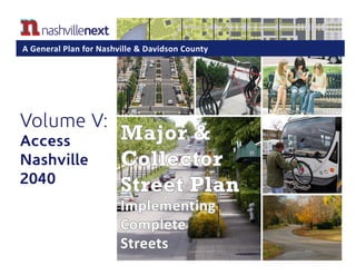
  • 1. Major & Collector Street Plan Implementing Complete Streets Volume V: Access Nashville 2040 A General Plan for Nashville & Davidson County
  • 2. II Mission Statements The Planning Commission guides growth and development as Nashville and Davidson County evolve into a more socially, economically and environmentally sustainable community, with a commitment to preservation of important assets, efficient use of public infrastructure, distinctive and diverse neighborhood character, free and open civic life, and choices in housing and transportation. The Planning Department helps Nashville and Davidson County evolve into a more sustainable community, guided by a commitment to efficient use of infrastructure, distinctive and diverse community character, open and vibrant civic life, and choices in housing and transportation focused on improving the quality of life. The Planning Department does not discriminate on the basis of race, color, national origin, gender, gender identity, sexual orientation, age, religion, creed or disability in admission to, access to or operations of its programs, services or activities. Discrimination against any person in recruitment, examination, appointment, training, promotion, retention, discipline or any other employment practices because of nonmerit factors shall be prohibited. For ADA inquiries, contact Josie Bass, ADA compliance coordinator, at 615-862-7150 or email her at josie.bass@nashville.gov. For Title VI inquiries, call Metro Human Relations Commission at 615-880-3370. For all employment-related inquiries, contact Human Resources at 615-862-6640. Please see the Metro Planning Commission website at http://www.nashville.gov/Planning-Department.aspx for the most up-to-date version of this statement.
  • 4. IV
  • 5. V Table of Contents Chapter 1 – Introduction  ............................................................................................... 1 Purpose of the Major and Collector Street Plan ................................................................................ 2 The Need to Update the Major and Collector Street Plan ................................................................. 4 How the Major and Collector Street Plan Was Updated ................................................................... 4 Users of the Major and Collector Street Plan .................................................................................... 8 Chapter 2 – Using the Major and Collector Street Plan ......................... 9 Context Sensitive Solutions and Complete Streets for Nashville .................................................... 10 The Elements of Each Street Segment ................................................................................................ 13 Environment ....................................................................................................................................... 14 Street Context ..................................................................................................................................... 17 Functional Design Type ...................................................................................................................... 18 MCSP Mapping ................................................................................................................................... 20 Chapter 3 – Context Sensitive Solutions Design Guidelines ............. 23 Functional Design Type Guidelines ................................................................................................... 24 Street Element Descriptions .............................................................................................................. 27 Collector-Avenue  ................................................................................................................................ 32 Arterial-Boulevard  ............................................................................................................................ 43 Arterial-Parkway  ............................................................................................................................... 57 Multimodal Corridor .......................................................................................................................... 64 Appendix. ........................................................................................................................................... 70 Appendix A–Right-of-Way Dimensions ............................................................................................. 71 Appendix B–Resources and Tools Used to Determine the Classification of Each Street ................. 75 Appendix C–Glossary .......................................................................................................................... 79
  • 6. VI As Nashville continues to grow and reinvest in its walkable centers, policies related to the entire right-of-way of streets are needed to ensure people can walk, bike, and access transit as needed.
  • 7. 1 Chapter 1 Introduction Metro Transit Authority (MTA) successes: Music City Star becomes Tennessee’s first commuter rail service. MTA adds new hybrid buses to the fleet and places them in service on the Gallatin Road Bus Rapid Transit route.
  • 8. 2 Second Avenue in downtown Nashville was designed with wide sidewalks and on-street parking due to high pedestrian and commercial activity. 21st Avenue in Hillsboro Village has been designed to complement its urban character, including on-street parking, access management, and wide sidewalks. PURPOSE OF THE MAJOR AND COLLECTOR STREET PLAN The Major and Collector Street Plan (MCSP) is a comprehensive plan and implementation tool for guiding public and private investment in the major streets (Arterial-Boulevards, Arterial- Parkways and Collector-Avenues) that make up the backbone of the city’s transportation system. It is a part of, and implements, Access Nashville 2040, which is a functional plan component of the General Plan called NashvilleNext. Access Nashville 2040 outlines Accessiblity Principles and ties together these four elements: 1. The MCSP prepared by the Metro Planning Department and adopted by the Metro Planning Commission; 2. The Strategic Transit Master Plan prepared by the Metro Transit Authority (MTA), which is currently being updated; 3. The Strategic Plan for Sidewalks and Bikeways prepared by the Metro Public Works Department (MPW) in 2003 and updated in 2008; and 4. The Metro Parks and Greenways Master Plan, which will be updated in 2016. The MCSP implements the Accessibility Principles of Access Nashville 2040 by mapping the vision for Nashville’s major and collector streets and ensuring that this vision is fully integrated with the city’s land use, mass transit, and bicycle and pedestrian planning efforts. The MCSP aims to help Nashvillians “complete the trip” by increasing the quality of streets in Nashville, meeting the needs of all users, people who walk, bike, take transit, move goods, and drive cars, in a manner that respects the context and users of the street. The MCSP contains guidance for two related components of the street network: character and function. The two approaches used to provide guidance for street character are called “Context Sensitive Solutions”(CSS) and “Complete Streets.” These character guidelines apply to the planning, construction and redevelopment of streets. Street function is defined by the degree of mobility, including the number of travel lanes needed during the period covered by the MCSP (20-25years); the degree of accessibility the street provides, as well as its role in the larger network of streets. Major and collector streets are two separate functional classifications of streets that form an interrelated network, which is why they are presented together in this document. In addition to the detailed analysis of all the major streets within Davidson County, the MCSP also provides basic information on right-of-way widths for local streets. The 28th /31st Avenue Connector includes Context Sensitive Solutions, including protected bikeways, sidewalks, public art elements, transit shelters, and low impact stormwater solutions.
  • 9. 3 Context Sensitive Solutions The Federal Highway Administration defines Context Sensitive Solutions (CSS) as a collaborative, interdisciplinary approach involving all stakeholders to develop a transportation facility that fits its physical setting and preserves scenic, aesthetic, historic and environmental resources, while maintaining safety and mobility. CSS is an approach that considers the total context within which a transportation improvement project will exist. Where prior versions of the MCSP have addressed “context” in terms of only rural or urban and focused solely on functional classification, this update of the MCSP introduces the idea of CSS to begin to create new streets and improve existing streets to be more responsive to their context, potential future users, and development changes. CSS is described in greater detail in Chapter 2. Complete Streets This update of the MCSP also reaffirms Metro’s commitment to utilizing a “Complete Streets” approach to street design. Complete Streets is an initiative by which cities, states, and other jurisdictions adopt policies to ensure future roadway projects will attempt to accommodate all users who walk, bike, take transit, move goods, or drive cars. This MCSP advances the concept of Complete Streets by developing a thoroughfare system that provides for safe and effective access for all users in completing their trips, while addressing streetscape design in context with the existing or envisioned character of the community. This philosophy in design of transportation corridors emerged in response to a changing culture and demographics which demand more transportation choices. The emphasis on active lifestyles, energy conservation, and the importance of accommodating users of all ages and abilities illustrates that a street can no longer be designed just for the automobile. Complete Street design should be understood as a process, not a specific product. For that reason, not all “Complete Streets” will look the same. Complete Street design is both an art and a science. As such, good design standards balance engineering judgment and user needs within the context of the street. Roadway design must rely on the design professional’s knowledge of elements such as travel speeds, volumes, horizontal and vertical alignments and sight lines. User needs also influence the design of the Complete Street. Many of the facilities contained within the right-of-way are uniquely associated with the needs of people of all ages and abilities. Character, or the physical context in which the street resides, is another factor considered in Complete Street design. Character influences the form and function of the roadway and its associated streetscape all of which are designed to complement and enhance the surrounding character. CSS and Complete Streets approaches support the development of healthy and sustainable communities in keeping with local and national policies and initiatives. A national example is the Centers for Disease Control and Prevention’s Healthy Community Design Initiative. This initiative promotes the integration of evidence- based health strategies into community planning, transportation, and land use decisions. Providing opportunities for people to incorporate physical activity into their daily lives is an example of one of these strategies and can be accomplished by facilitating activities such as walking to transit, biking to work, or walking to nearby shopping destinations. A transportation system that allows the healthy choice to be the easy choice will contribute to healthier life styles within the community. Locally, Mayor Karl Dean’s Complete Streets executive order, “Together Making Nashville Green” initiative, the NashVitality campaign, Moving in Harmony campaign, and Access Nashville 2040, along with NashvilleNext inform the direction of this MCSP. The Complete Streets Executive Order, issued on October 6, 2010, directs Metro Departments to “Give full consideration to the accommodation of the transportation needs of all users, regardless of age or ability...” We anticipate future mayoral administrations to reaffirm this commitment. “Together Making Nashville Green” involves citywide efforts to advance environmental sustainability and community health throughout Nashville. Nashviltality promotes a healthy, active and green city. Moving in Harmony promotes sharing the road among all street users–bikes, pedestrians, and cars. NashvilleNext
  • 10. 4 Music City Central is strategically located on Charlotte Pike and 4th Avenue North, which are both major downtown streets providing regional access. The facility provides a safe and attractive transit facility for MTA riders. reinforces sustainability efforts, smart land use decisions, and a multimodal transportation network. CSS and Complete Streets further these initiatives by supporting active transportation choices and also by complementing a compact and sustainable urban form that emphasizes investment in the central city and centers where infrastructure is in place and where active transportation choices are relatively easy and convenient to make as part of day-to-day life. THE NEED TO UPDATE THE MAJOR AND COLLECTOR STREET PLAN As a functional component of the General Plan or NashvilleNext’s Access Nashville 2040 (Volume V), the MCSP should be updated regularly and as needed to reflect changes that have occurred and to respond to future planned growth, development and preservation. Access Nashville 2040’s Accessibility Principles respond to these key issues in Nashville: 1. Nashville’s street network is mostly built. Acquiring new right-of-way is very challenging. 2. The city’s transportation network must reflect what is appropriate for Nashville. 3. Nashville is the region’s population and employment hub, so Middle Tennessee residents need to connect to Nashville and get around in multiple ways as part of the regional transportation network. 4. Nashville’s street network is evolving into a multimodal transportation network and should accommodate all modes and people. 5. Nashville’s multimodal transportation network evolves as walkable centers grow. HOW THE MAJOR AND COLLECTOR STREET PLAN WAS UPDATED The 2015 update of the MCSP involved the following steps: 1. Review of the plans referenced below, 2. Analysis of the existing conditions of all the Major and Collector streets in Davidson County, review of local transportation plans, and assessment of the role of each street in light of Access Nashville’s Accessibility Principles, 3. Update the Environment based upon the transect category, Street Context, and Functional Design Type for each applicable street, to align with land use policies in the Community Plans (Volume III) of NashvilleNext, 4. Input and feedback from other Metro and state of Tennessee Agencies during the process of creating NashvilleNext, and 5. Input from the public at organized community meetings and discussion of issues with planning staff during the three- year NashvilleNext process. Bike lanes along Demonbreun Street have been implemented as redevelopment occurs.
  • 11. 5 Plans Reviewed A comprehensive review of the following local planning documents influenced this update of the MCSP as NashvilleNext was adopted. Community Plans Major and Collector Street Plan (MCSP)—This plan includes recommendations for improvements to existing streets and the creation of new streets. It is created through the Community Planning process, led by Metro Planning staff and community members in the fourteen planning communities in Nashville. This plan has historically reflected community objectives, but has often downgraded or removed connections or collectors at the request of Council Members, community members or developers that may have been legitimately warranted for transportation network connectivity. Because the MCSP is informed by the Community Plan Updates, the MCSP is sometimes amended following a community planning process to reflect the specific changes applicable to that community. These now align with NashvilleNext. 2040 Update and 2035 Nashville Area MPO Regional Transportation Plan—Adopted by the regional transportation planning agency, the Nashville Area MPO, the network is a reflection of all planned Regional Transportation Plan (RTP) projects for travel demand modeling purposes. It establishes a 25 year vision for transportation in Middle Tennessee. In 2015, the MPO is updating the Regional Transportation Plan. 2008 Update and 2003 Strategic Plan for Sidewalks and Bikeways—Adopted by the Metro Planning Commission in 2003 and updated in July, 2008, this plan addresses all aspects of pedestrian and bicycle planning, and specifically outlines the streets that need bicycle facilities and what type of facility is warranted. NashvilleNext identifies that the Strategic Plan for Sidewalks and Bikeways needs to be updated. nMotion 2015 and 2009 Nashville Strategic Transit Master Plan—Adopted by the Nashville Metro Transit Authority in 2009, this plan sets forth guiding principles and policies for improving public transportation in Nashville, as well as describes actions and projects for the future. MTA will update the Strategic Plan in 2015-2016 called nMotion and utilize the High Capacity Transit Corridors identified in NashvilleNext Growth and Preservation Concept Plan as a starting point. The MCSP will need to be amended once the nMotion Strategic Plan is finalized. 2008 Update to the Metropolitan Parks and Greenways Master Plan—The Master Plan outlines a vision for the parks and greenways systems . Residents increasingly use the extensive greenways network for transportation purposes and should be encouraged. NashvilleNext outlines the need to update the plan, and Metro Parks anticipates updating the Master Plan in 2015-2016. 2014 Downtown Multimodal Mobility Study—The Multimodal Mobility Study was completed by Metro Public Works to estalblish a mobility action plan for all mosdes of transportation in downtown Nashville for the next 10 years. 2014 Pedestrian and Bicycle Safety Pilot Project Report—A report completed by Metro Public Works that identifies high crash locations for pedestrians and bicyclists and potential countermeasures to improve safety. 2010 Metro Nashville Multimodal Connectivity Study—This study was initiated by the Mayor’s Office and the Bicycle and Pedestrian Advisory Committee to identify recommendations for improved connections between existing bicycle, Deaderick Street, a public sector project, incorporates sustainable design features including street trees, a vegetated median, pedestrian scale lighting, and adequate sidewalk widths.
  • 12. 6 pedestrian, and transit facilities and between trip attractors and generators. This includes multi-use paths, restriping roads for bike lanes, right-sizing streets, and construction of sidewalk segments. 2015 Northwest Corridor Transit Study and 2009 Northwest Corridor Conceptual Feasibility Study—An initial feasibility study was undertaken in 2009 to look at the corridor between the cities of Clarksville and Nashville to determine if commuter rail is feasible in this corridor, determine the most likely alignment, develop a preliminary capital cost estimate, and a potential operating schedule and budget. In 2015, this study builds upon and expands on the 2009 findings and recommendations to determine a combination of alternatives that can be integrated and phased into Middle Tennessee’s regional transit plan. 2015 Southeast Area Transportation and Lands Use Study and 2007 Southeast Corridor Alternatives Analysis—The Southeast Corridor High-Performance Transit Alternatives Study looked at potential transit systems that could be built in the corridor between the cities of Nashville and Murfreesboro. The study considered several high performance transit alternatives and compared the cost and benefits of those alternatives to determine a transit solution that includes both short-term and long-term recommendations. The Locally Preferred Alternative selected was a combination of phased bus service enhancements, including development of express bus and skip stop bus services on I-24 and Murfreesboro Road (US 41/70S), and extended local bus service on Murfreesboro. In 2014, the Nashville Area MPO kicked off a more comprehensive study to look at a range of alternatives involving all transportation modes and the integration of land use decisions in Middle Tennessee in the area. 2011 Northeast Corridor Mobility Study— Initiated by the Nashville Area MPO, this study develops a regional transportation investment strategy for the 30-mile corridor between downtown Nashville and Gallatin. Music Row—17th Avenue South is part of a one-way pair that serves a District Office Concentration with Context Sensitive features that include bike lanes and on-street parking.
  • 13. 7 2015 Update and 2009 Regional Bicycle & Pedestrian Study—The Nashville Area MPO updated the findings of the 2009 study in 2015 to establish a strategic vision for improving walking and bicycling opportunities in the greater Nashville region. Regional Freight and Goods Movement Study, Phases I, II, and III—The Nashville Area MPO completed the third phase of the study in 2015 to align economic development, land use decisions, and urban design considerations with freight and local delivery needs while minimizing conflicts with quality of life principles. The Code of the Metropolitan Government of Nashville and Davidson County, Tennessee—Including Title 12, Vehicles and Traffic; Title 13, Streets, Sidewalks, and Public Places; and Title 17, Zoning. The Subdivision Regulations of the Metropolitan Government of Nashville and Davidson County, Tennessee—Adopted by the Metropolitan Planning Commission on March 9, 2006 and as amended through January 9, 2014. The Accessibility Principles of Access Nashville 2040—Also adopted by the Metro Planning Commission on June 22, 2015, Access Nashville 2040(Volume V of NashvilleNext) sets Accessibility Principles for future transportation decisions, which are to be implemented through the MCSP. FY 2013-2014 Capital Improvements Budget —The fiscal year 2013 through 2014 CIB is the latest plan of proposed expenditures for Metro capital projects and the means of financing them over a five-year horizon. 2015 Update to TDOT’s 25-Year Long Range Transportation Plan—TDOT is currently finalizing its update to the state’s long range transportation plan. This plan creates a new long-term vision for transportation and provides guidance for priortizing transportation investments across the state. Magnolia Boulevard is a classic urban boulevard with a vegetated median, bike lanes, and areas of on-street parking that serves a variety of urban areas ranging from Major Institutional District to Urban Neighborhoods, Corridors, and Centers.
  • 14. 8 Murphy Road is an Arterial-Boulevard with a buffered bike lane. USERS OF THE MAJOR AND COLLECTOR STREET PLAN In addition to this document, the MCSP also includes a map and electronic database of every Major and Collector street in Nashville. The designation of the street is labeled in the map and defined in this document through a series of tables and diagrams that explain how each street should be designed (See Chapters 2 and 3). The plan is intended to be used by the public and private sectors in planning, designing, budgeting, and constructing new streets and making improvements to existing streets. Public Investment and Development Metro Government, including Planning, Public Works, Finace, Metro Transit Authority (MTA), Metro Parks, and Nashville Electric Service (NES) must consult the MCSP: 1. To assess proposed street improvements and new streets to be built through private sector development (through rezoning or subdivision) as well as with private sector redevelopment where additional right of way or reallocation of existing right of way may be required; 2. For proposing street improvements and new streets as part of the land development process when Metro government is acting as a public sector developer through the Capital Improvements Budget; and, 3. For proposing street improvements and new streets as part of the local and regional transportation planning and budgeting processes, as part of Metro’s Capital Improvement Budget and the Nashville Area MPO’s Transportation Improvement Program. In making these decisions, Metro staff will make a determination of whether a Major or Collector street is a constrained or unconstrained facility in terms of having substantial right-of-way limitations (a “constrained” facility) and will take that status into account when assessing proposed street improvements. Constrained facilities will be less likely to gain the standard amount of right-of-way, thus requiring thoughtful consideration of how to use the constrained right-of-way to provide for all modes of transportation. Metro Planning Commission members will use the MCSP to assess the streets proposed in zoning and subdivision cases and to develop a recommended annual Capital Improvements Budget and Program that includes proposed new streets and street improvements that carry forward the priorities identified in NashvilleNext. Citizens will use the MCSP to gain a better understanding of each street’s role in Metro Nashville’s transportation network. Private Investment and Development The private sector will use the MCSP when proposing new development to determine if any major or collector streets are to be provided or upgraded in the proposed development area and what the street cross section should look like. The private sector will then design the new street or improve the existing street accordingly. The private sector will also use the MCSP when proposing redevelopment to determine if any additional right-of-way and/or facilities need to be provided to meet the future vision for the street. In both cases, Metro government will review proposed new streets and improvements to existing streets against the guidelines in the MCSP.
  • 15. 9 Chapter 2 Using the Major and Collector Street Plan
  • 16. 10 Deaderick Street and Church Street complement and support the urban form of the downtown environment with appropriate scale and pedestrian sensitive design. Past iterations of the Major and Collector Street Plan (MCSP) have addressed Nashville’s planning for major streets in terms of functional classification, which is a process where streets are grouped into classes according to the type of vehicular service they are intended to provide, channeling traffic through a network of smaller and larger streets in a logical and efficient manner. Consideration of the overall network and its efficiency is important, but a model based solely on functional classification tends to lack guidance on developing the character of streets and on creating streets that serve all modes of transportation. This earlier approach to street design overlooks the fact that streets are the most prevalent public spaces in the community and, as such, merit attention to their character as well as their vehicular function. Across the country, cities and states now utilize models for considering the character of prominent streets in light of the street’s context as well as models for providing real transportation choice. Two planning philosophies, called “Context Sensitive Solutions” (CSS) and “Complete Streets,” are reaffirmed in this update of the MCSP. Nashville’s Street Network is Mostly Built The conventional development of a street system has two basic levels of planning and design. The first is network design, which addresses the layout, spacing and general size of major streets. The second is street design, which covers the geometric design of streets. Although most of Nashville’s major and collector streets are built, many are not complete because they do not comfortably serve all people. The MCSP guides how these streets can be redesigned as complete streets. This chapter addresses two of the key aspects of street design— integrating the street with the character of development that surrounds it while meeting the needs of all likely users. CONTEXT SENSITIVE SOLUTIONS AND COMPLETE STREETS FOR NASHVILLE
  • 17. 11 T2 Rural streets in Whites Creek accommodate high levels of automobile and pedestrian traffic while retaining a rural character through the incorporation of elements such as a soft shoulder and an appropriately narrow width. 21st Avenue in Hillsboro Village also has high levels of automobile and pedestrian traffic. It has curb, gutter, wide sidewalks, and formal on-street parking. It provides mobility while being kept at a narrow scale to support the T4 Urban mixed use environment. The Context Sensitive Solutions Approach A street’s “character” refers to the different elements included in a street (sidewalks versus multi-use paths, bike lanes versus protected bikeways, curb and gutter versus swale, etc.) and how they are designed to complement the existing or proposed context of the area through which they are passing. The determination of street character must take into account the adjacent land use and context. 20th century street planning typically only allowed two levels of sensitivity to the surrounding land use and context—streets were either rural or urban— resulting in street designs with limited relation to their surroundings. Context Sensitive Solutions (CSS) is a practical approach to transportation decision-making and design that takes into consideration the communities and lands through which streets, roads, and highways pass – the context. The CSS approach can be thought of as evolving from the National Environmental Policy Act (NEPA) of 1969, which established the Environmental Impact Statement (EIS) process for judging large- scale infrastructure projects. The EIS process was among the first to consider the impact of infrastructure projects—including road construction—on the surrounding community. Most recently, two prominent and influential professional organizations representing urban planning professionals and transportation engineers have issued the 2010 document Designing Walkable Urban Thoroughfares: A Context Sensitive Approach. The document was issued by the Institute of Transportation Engineers (ITE) and the Congress for the New Urbanism (CNU). Designing Walkable Urban Thoroughfares applies the CSS approach and principles to urban street design. It has been designated an ITE Recommended Practice, formally adopted by the ITE after a thorough development and review process. CSS has the following attributes: »» CSS addresses transportation needs in a financially feasible manner by matching the street to the setting that ensures safety for all users of an end-product; »» CSS involves stakeholders in the design process, balancing various stakeholders’ needs to produce a solution that is an asset of lasting value to a community. In the case of CSS in the MCSP, most of the community’s involvement took place during the community plan update. These ideas were then incorporated into the MCSP; »» CSS allows flexibility in design guidelines, particularly in constrained conditions; »» CSS designs a transportation system and individual roads that serve multiple users regardless of travel mode; and »» CSS incorporates aesthetics as an integral part of good design. Additionally, the National Association of City Transportation Officials (NATCO) has developed two guides that provide cities with state of the art solutions for 21st century transportation infrastructure. The Urban Street Design Guide and Urban Bikeway Design Guide provide a
  • 18. 12 blueprint for complete streets that are safe and enjoyable for everyone. With this update to the MCSP, Nashville joins local, state, and federal governments across the country in endorsing the NACTO guidelines as a recommended best practice. Relationship between Conventional Street Planning and CSS The main difference between conventional street planning and CSS street planning is in the flexibility provided by CSS to create a new street (or redesign an existing street) that meets the needs of its context – whether it is a rural, suburban, urban or downtown setting. The MCSP incorporates CSS thinking by following the Community Transect, which is a system for categorizing, understanding, and designing the various levels of development within a region, from the most rural to the most urban. The Community Transect is the basis for Metro’s land use planning system. The Transect recognizes the full spectrum of development in a region while CSS provides variation in street character to complement changes in the context. As an example, Table 1 shows the limited context designations in 21st century street planning model (which only recognized rural or urban settings) as compared to the additional, tailored street designations available under a CSS approach. Table 1 also shows what criteria are used to design streets utilizing the conventional model versus through a CSS approach. The CSS approach weighs more criteria as it links community context and street design to produce streets that serve a broader array of community needs. The Complete Streets Approach The Context Sensitive Solutions (CSS) approach and the Complete Streets approach work hand- in-glove in the MCSP. The Complete Streets approach requires that the needs of all users be considered on each street. While it may not be necessary or viable to provide facilities for all users on every street based on context, the Complete Streets approach guides the conversation about multimodal transportation. The combined approach asks designers to think about each segment of a street, what its context is, and what its resulting needs are for multimodal options. For example, consider an Arterial-Boulevard in a rural setting. Are sidewalks with curb and gutter appropriate in a rural setting? Likely they are not, but there may still be community members and visitors that want to travel by bike or on foot. Therefore, a multi-use path on one side of the street may be the best solution to provide a meaningful transportation option in a rural setting. Table 1: 20th century street design factors compared with CSS street design factors. Functional ClassFunctional Class Multiple Travel Modes and Users DemandVehicle Travel Demand Adopted Community ObjectivesVehicle Design Speed Context/Adjacent Land UseVehicle Level of Service Street design criteria primarily based on:Street design criteria primarily based on: Downtown (ex. James Robertson Pkwy.) Center (ex. Rivergate area streets) Residential (ex. West End Ave. between I-440 and St. Thomas Hospital) Mixed-Use (ex. Woodland St. between 5th and 11th St.) UrbanUrban Residential (ex. Harding Pl. between I-65 and Nolensville Pk.)Rural Mixed-Use (ex. Old Hickory Blvd. & Edmondson Pk.) Suburban Residential (i.e. Whites Creek Pk., Joelton) Mixed-Use (ex. Ashland City Hwy. & Old Hickory Blvd.) Rural Possible Context Designations:Possible Context Designations: CSS Street DesignConventional Street Design
  • 19. 13 T2 - R - CA# - THE ELEMENTS OF EACH STREET SEGMENT The MCSP places emphasis on designing streets that serve all people and reflect the character of the neighborhoods and centers through users pass. Therefore, this update of the MCSP continues to categorize each street segment in a manner that provides greater guidance as to the purpose and goals of each street segment. The defining elements of each street segment include Environment, Street Context, and Functional Design Type. In some cases there is a fourth element, which represents a Multimodal and/or Scenic Overlay. Every Major and Collector street is identified with a specific label string comprised of the elements appropriate for that street segment. An overview of these elements is provided below, with more detailed explanations of each element in the following pages. Environment The Transect is the central organizing tool for Nashville’s land use planning and policies. The Transect is a tool for categorizing a community’s natural and built environment from rural to downtown. Just as Nashville has a diversity of development and preservation areas, its streets should reflect the same diversity. Transect Categories indicate an area’s general character and are therefore listed first in defining a street’s character. This designation influences the scale, location, and orientation of development in a given area (i.e. T2 Rural ranging to T6 Downtown). The Transect is aligned with land use policies contained in the Community Plans of NashvilleNext. Street Context The Street Context adds to the understanding of context by defining the predominant existing or intended development pattern flanking a given street section. This designation influences design elements like setbacks and sidewalk widths. The street context aligns with land use properties included in the Community Plans of NashvilleNext. The three Street Context designations used in this document are Residential, Mixed Use, and Industrial. Functional Design Type The purpose of the Functional Design Type is to classify streets according to the character of service they are intended to provide and to design those streets so that they fit their context and serve all users. Each street is labeled, in this document and in mapped form, with one of the three Street Types – Collector-Avenue, Arterial-Boulevard, and Arterial-Parkway. Guidelines are laid out in tables and diagrammed in illustrative cross-sections, both found in Chapter 3. Since most streets are built, this element informs how Metro can remedy street design that has mostly privileged people driving. Multimodal or Scenic Overlay Multimodal Corridors may be Immediate Needs (IM) or Long Term Needs (LM). Multimodal Corridors are anticipated to serve a greater role in providing local and regional transit and align with the High Capacity Transit Corridors identified in the NashvilleNext Growth and Preservation Concept Map. Accommodating transit and support for bike/pedestrian access is critical. Streets designated as Scenic connect areas of scenic and cultural significance and call for enhancement or preservation of existing natural areas on private property just outside the right-of- way. The Metro Zoning Code also prohibits new billboard signage on Scenic roads. (O)
  • 20. 14 Figure 1: Transect Category Diagram: Courtesy of DPZ. ENVIRONMENT (T2-L-L#) The first defining element for each street segment is its Environment based upon the Transect, which is a combination of a letter and a number. The Transect is a system for categorizing, understanding and guiding the various development patterns of a region, from the most rural to the most urban environments. The Transect calls for all elements of the natural and built environment to be consistent with the character of the Transect Category within which they are located. The Transect is the central organizing tool for future growth and preservation planning in Nashville and Davidson County. The Nashville Transect consists of seven categories of natural and built environments: »» T1 Natural »» T2 Rural »» T3 Suburban »» T4 Urban »» T5 Center »» T6 Downtown »» D District Determining the Transect Category for each area in Nashville is the first step in creating Community Plans that are part of NashvilleNext. Then Community Character Policies—Nashville’s land use policies—are applied to an area based on its Transect Category. Community Character Policies are used in all Community Plans to guide future growth, development, and preservation. In working with the community, Planning staff determines which areas of a community are considered to be T1 Natural, T2 Rural, T3 Suburban, T4 Urban, T5 Centers, T6 Downtown, and D Districts. The Context Sensitive Solutions approach calls for stakeholder involvement and the Community Plan Update Process is one way that involvement is achieved. The results of the Community Plan Updates are folded into this document. Likewise, when Community Plans are updated in the future, those updates may reveal recommendations and amendments that need to be made to the street classifications in the MCSP. The MCSP includes six Transect categories; it does not include T1 Natural areas. T1 Natural areas have roads, but they are typically local roads which are not addressed by the MCSP. While different Transect categories can sit side- by-side, it is crucial that within each Transect category, each element of development should be harmonious within that category. Just as a curb, gutter and sidewalk would look out of place in a rural setting, similarly, having rural spacing and setbacks for housing in urban neighborhoods would be inappropriate.
  • 21. 15 T-6, Downtown T-3 Suburban Figure ground diagrams showing building footprints and streets illustrates how the street network differs between Transect categories. Transect Category Descriptions T2 Rural Transect areas have very low density residential and agricultural development. T2 Rural Transect areas are characterized by a sparse street network of narrow, rural roads with shoulder and ditch. Buildings in the T2 Rural Transect area are often located and oriented on the land to reflect the natural features of the land, and not a standardized streetscape. Buildings may have very deep setbacks and wide side yards. T3 Suburban Transect areas have a variety of uses, including residential, civic and public benefit, and mixed uses, that are generally separated from one another, with residential as the predominant use. Building patterns vary, but T3 Suburban Transect residential areas are generally characterized by moderate to deep setbacks and side yards, curvilinear streets, and informal landscaping. Residential building types include single- and two-family structures as well as multifamily structures. T4 Urban Transect areas also have a mixture of uses—residential, civic and public benefit, and mixed use—but these are more likely to be found in closer proximity. Mixed use and commercial buildings are characterized by shallow setbacks where buildings may be built to the back edge of sidewalks. Residential buildings generally have shallow setbacks and spacing. Streets are linear with a higher level of connectivity, and landscaping is more formal with street trees and other formal plantings. T4 Urban Transect areas generally contain a greater mixture of housing as well. Single- and two-family homes may be located in close proximity to multi-family, and ideally building types are mixed creating a cohesive development pattern. T5 Center Transect areas include large concentrated areas of mixed use development. T5 Centers are unique in that they serve either the entire county or multiple neighborhoods and communities. T5 Centers are areas where residents and visitors may live, work, and recreate and thus are intended to be high density and intensity mixed use, commercial, and residential areas. The T6 Downtown Transect area covers the east and west bank of the Cumberland River bound by the Inner Loop of interstates and Jefferson Street. Downtown neighborhoods vary in scale and mass of development ranging from neighborhoods featuring single-family homes, low-rise townhomes to neighborhoods with skyscrapers. Buildings are placed close to the street with shallow setbacks or built to the edge of sidewalk. Downtown is inherently a mixed use setting, with commercial, office and residential uses often located within the same block or building. D District Transect areas are generally large geographic areas within Nashville that accommodate a single land use. Within the Nashville Transect there are six types of Districts: Destination Retail, Employment Center, Impact, Industrial, Major Institutional (ex. universities or medical complexes), and
  • 22. 16 Office Concentration. Each District has its own built character as well as its own operational and land use needs. Each interacts differently with the surrounding neighborhoods, centers, corridors and open space. For the MCSP, in the cases of the Major Institutional and Office Concentration Districts, major streets within them are assigned to the most logical adjacent Transect category. The roads in a suburban office park will be labeled T3 Suburban, for example, while the roads adjacent to Vanderbilt University would be labeled T5 Center. To plan for streets in Industrial and Impact District areas, these areas were researched to identify the specific characteristics for areas that were anticipated to be the most viable over the long term and to generate the greatest amount of large truck traffic. The major streets in these areas need specific treatments such as large turning radii and wide lanes and are also areas where such infrastructure investment is warranted over the long term. The major street segments that were so identified were assigned the “D” Transect designation. In T6 Downtown, Korean Veterans Boulevard incorporates Complete Streets elements in its design by including a vegetated median that serves as a pedestrian refuge and as access management along with parking bays, bike racks, benches, and pedestrian bulb-outs.
  • 23. 17 STREET CONTEXT (L#-R-L#) Another defining element for each street segment is the Street Context, depicted as a letter. As noted above, one street can run through several Transect Categories, and even within one Transect Category, a street may pass through both residential and mixed use areas. Therefore, after finding a given street segment’s Transect Category, its intended Street Context is labeled as one of three types in this document and in mapped form. Street Context refers to the predominant development pattern or intended development pattern flanking the street whether residential, mixed use (commercial) or industrial, that influences design elements like building setbacks, sidewalk widths, landscaping and on- street parking. These are closely aligned with the land use policies in the Community Plans of NashvilleNext. The following are the principal features that create street context: »» Land use or proposed land use »» Site design and urban form »» Building orientation and setback »» Parking type and orientation »» Block length »» Building design »» Building height and thoroughfare enclosure »» Building width »» Building scale and variety »» Building entries The Street Context types are listed below: R = Residential Street segments with this Street Context are flanked primarily with residential development and have a character to fit that development type. Housing types can vary along these streets, ranging from mostly single family-homes to mixed housing with flats and townhouses. M = Mixed Use Street segments with this Street Context are designed to complement the mixture of uses along them. Development type can vary along these streets from vertical mixed use to commercial, office, or even small areas of light industrial development. In cases where one side of a street is mostly residential and the other side has mixed uses, the street segment’s Street Context type defaults to Mixed Use. By using a default Mixed Use Street Context designation, public and private entities are required to design streets to accommodate more users as is likely in a mixed use setting. I = Industrial Street segments with this Street Context are designed to facilitate industrial freight and goods movement in large trucks. Unlike small light industrial areas that might be found within larger areas where a more mixed use pattern predominates, these are larger more intense industrial areas. Development types along these streets include manufacturing, warehousing, distribution, major transportation and utilities, and especially impactful uses such as quarries. The primary concerns in this street context are to accommodate the turning movements, length, width, and weights of large trucks. In most other regards these streets will share the characteristics of Mixed Use street segments. T3 Suburban streets have not kept pace with development and need additional investment such as sidewalks to handle today’s mobility needs.
  • 24. 18 Major streets in the Gulch in downtown Nashville are designed to function in this highly urban mixed use community by accommodating all modes of travel and providing design elements that support the surrounding urban form. FUNCTIONAL DESIGN TYPE (L#-L-AB#) The third defining element for each street segment is the Functional Design Type. This element combines the functional classification, traditionally focused solely on vehicle level of service, with a new street classification that informs the design and function of the street for multiple users. The purpose of the Functional Design Type is to classify streets according to the character of service they are intended to provide and to design those streets so that they fit their context and serve all users. Each street is labeled, in this document and in mapped form, with one of the three Street Types: Collector -Avenue, Arterial- Boulevard, and Arterial-Parkway; and some streets have an additional piece of information which is the Multimodal or Scenic Overlay. The MCSP provides guidelines for the design of the street and its features per its Functional Design Type. These guidelines are laid out in tables and diagrammed in illustrative cross- sections found in Chapter 3. Representative cross-sections are shown in the examples. Standard cross-sections are most appropriate for new construction and undeveloped areas while other cross-sections may be more appropriate for existing/constrained right-of-way in developed areas. Proposed cross sections will be judged on their abilities to meet CSS and Complete Streets goals. Included with the Functional Design Type category label is the planned number of lanes (#) that a street segment is intended to have including continuous, but not intermittent, turn lanes. CA = Collector-Avenue Collector-Avenues (CA) are relatively low-speed, low- to medium-volume streets that provide circulation within and between neighborhoods. Collector-Avenues usually serve short trips and are intended for collecting trips from local streets and distributing them to the Arterial-Boulevard network. Collector -Avenues privilege access (the ability to get vehicles in and out of surrounding properties) over mobility (the ability to move cyclists, pedestrians and vehicles through the area). They are present in both residential and mixed-use areas. AB = Arterial-Boulevard Arterial-Boulevards are medium- to high-speed, high-volume streets that serve longer trips within and between different communities within the city, with access provided by driveways, alleys or frontage roads. While the public may generally think of a boulevard as having a median, in Nashville, Arterial-Boulevards range from three-lane, one- way streets downtown to five-lane suburban streets. They are designated Arterial-Boulevards because of the function they serve—to balance access and mobility equally. The balance of moving people through the area while providing access to property results in a different design for the Arterial-Boulevard than that of the Collector- Avenue.
  • 25. 19 AP= Arterial-Parkway Arterial-Parkways are typically at-grade, limited- access roadways which provide mobility for cross- town trips while also acting as linear green spaces with landscaping along them. They serve both residential and mixed use areas. In prioritizing mobility over access, Arterial-Parkways have a different design that accommodates higher traffic speeds and keeps pedestrians and cyclists further away from vehicles to increase safety. Other functional classifications that are not addressed by the MCSP are listed below. E = Expressway Expressways are high-speed, high-volume roadways, that may include state highways, which interconnect freeway and arterial streets, with access only at interchanges or signalized intersections. F = Freeway Freeways are grade-separated, high-speed, high- volume roadways, including Interstate highways that provide a high degree of mobility, with access only at spaced interchanges. R = Ramp Ramps are one-way road sections which provide entering and exiting access onto freeways and expressways. OVERLAYS IM and LM = Multimodal Corridors Multimodal Corridors are roadways that provide the highest level of multimodal mobility - with an emphasis on transit service and linking to walking and biking infrastructure.They serve both residential and mixed-use areas. Within the MCSP some routes are designated with a Multimodal Overlay to align with the High Capacity Transit Corridors identified on the NashvilleNext Growth and Preservation Concept Map. These corridors are anticipated to have more frequent transit service in the future, which will be prioritized by the Metropolitan Transit Authority Strategic Transit Master Plan or in the MPO’s Regional Transportation Plan. While transit may be provided on other streets, these corridors are anticipated to serve a greater role in providing higher capacity, more frequent transit service in the future. Because these streets are envisioned to play a prominent role in transit, the study of each street, and their design to accommodate transit and support people walking and biking to transit, is critical. There are two sub-types of Multimodal Corridors: Immediate Need Multimodal Corridors (IM) and Long Term Need Multimodal Corridors (LM). Immediate Needs tend to coincide with the arterial pikes that connect people into and out of downtown. They mostly have regular local bus service, and MTA has plans to upgrade service to BRT Lite. Long Term Needs may or may not have existing bus service, but there is a desire to establish service and/or upgrade to higher capacity service over time. In both instances, these corridors are anticipated to experience more housing and employment intensity in the future. S = Scenic Scenic roads, typically Arterial-Boulevards or Arterial-Parkways, are streets and highways which pass through or connect areas of particular scenic significance or provide linkages between areas of historic, natural, cultural or recreational importance. Scenic roads call for preservation or enhancement of existing natural areas within easements on private property adjacent to the edge of the right-of-way, beyond the minimum functional right-of-way, and planting of new landscaped areas. The Metro Zoning Code prohibits new billboard signage on Scenic roads.
  • 26. 20 The color and pattern scheme for the MCSP map is as follows: Major and Collector Street Legend Potential Multimodal Freeway Corridor Planned Multimodal Freeway Corridor Arterial-Parkway Scenic Arterial-Boulevard Scenic Planned Arterial-Boulevard Scenic Arterial-Boulevard Planned Arterial-Boulevard Collector-Avenue Planned Collector-Avenue Downtown Local Street Planned Downtown Local Street Planned Downtown Alley Local Street Planned Local Alley Ramp Planned Ramp Centers Tie Tie Tie MCSP MAPPING The MCSP map (found online at www.nashville. gov/mpc) indicates each street segment’s designation through the three primary elements – Environment, Street Context, and Functional Design Type. Each street has a unique symbol that is a combination of a color, pattern, and label. The color indicates the Functional Design Type and the pattern indicates whether the street exists or is planned. The dashed lines on the MCSP map represent the general alignments of proposed streets. The exact alignments of these streets will be determined during the design and engineering phases of their construction in accordance with the MCSP. The solid lines on the MCSP map represent the centerlines of existing major streets. The exact extent of any future changes made to the rights- of-way of these streets will also be determined during the design and engineering phases of their construction in accordance with the MCSP. The MCSP map is a dynamic GIS (geographic information systems) database containing information about each of the thousands of major street segments in Nashville. A mid-block crossing along Belmont Boulevard encourages people to cross at safe locations. A bike lane and bike parking are elements that support bicycling within the neighborhood.
  • 27. 21 Figure 2: Example of Major and Collector Street Plan Map, found online at www.nashville.gov/mpc
  • 28. 22 Greenways and multi-use paths provide opportunities for recreation and transportation. The trailhead for the Mill Creek Greenway along Old Glenrose Road near East Thompson Lane has a mid-block crossing and flashing pedestrian sign.
  • 29. 23 Chapter 3 Context Sensitive Solutions Design Guidelines
  • 30. 24 FUNCTIONAL DESIGN TYPE GUIDELINES How to Use the Guidelines Chapter three explores more fully the third element of the street’s text string, the Functional Design Type: Collector-Avenue (CA), Arterial- Boulevard (AB), and Arterial-Parkway (AP) in order to provide specific design criteria for each. The MCSP analyzes the function of the street and then provides detailed design guidelines based on the Environment (transect category) and Street Context (mixed use, residential or industrial) in order to achieve the functional and design goals of the street. The guidelines consist of design recommendations for both the Travelway and Streetside elements of the right-of-way. This chapter details how the right-of-way for each Functional Design Type should be developed. (Please note that the District Street Context is not denoted separately in the tables, rather it follows the design guidelines for the T3- Suburban Environment and the Mixed Use Street Context with variations for wider turning radii and travel lanes to accommodate large trucks.) The Standard right-of-way widths, delineating the ultimate right-of-way for each street designation, can be found in Appendix A. A Standard right-of-way for local streets shall be set at fifty feet for all existing streets. The fifty foot right-of-way shall be used to determine the appropriate building placement in conjunction with the Metro Zoning Code. Construction of new local streets and the acquisition of right-of-way on existing local streets shall be considered on a case by case basis with regard to environment and context. Multimodal Overlay In addition to the Functional Design Types— that specifically outline the multiple functions of a street and the design needed to implement the objectives, this chapter addresses the need for more in-depth study of corridors with high mass transit potential. The Multimodal Overlay is a designation that is applied to specific routes that align with the NashvilleNext Growth and Preservation Concept Map. See page 64 for more specific information on Multimodal corridors. Scenic Overlay The Scenic Overlay designation is applied to streets that pass through or connect areas of particular scenic significance or provide linkages between areas of historic, natural, cultural or recreational importance. Scenic Arterial- Boulevards and Scenic Arterial-Parkways call for preservation or enhancement of existing natural areas within a dedicated landscaped easement outside of the public right-of-way. See the Metro Zoning Code 17.24.070 for specific regulations. Lane Designations The MCSP street designations and subsequent right-of-way widths provide the intended maximum number of travel lanes within each roadway in the city. There can be two or more travel lanes designated per roadway section depending on the context of the roadway. If the designation number is an odd number, then the roadway is typically planned for a continuous left turn lane to allow access to adjacent properties, although access management should still be utilized for efficient and safe vehicular, transit, pedestrian, and bicycle travel. Even number lane designations do not include a continuous turn lane within the roadway section. At roadway intersections, additional left and right turn lanes may be required when warranted, exceeding the lane number designation and overall right-of-way width identified for the Standard segment of the roadway. Nashville B-cycle was launched in 2011 and provides short-term bicycle rentals in the more urbanized areas of the city.
  • 31. 25 Constrained Roadways In most cases the ultimate right-of-way that most fully implements the MCSP will be established as the “Standard” right-of-way for a given facility. In some instances a particular street or street segment may be deemed “Constrained” by the Planning Department and Public Works Department Directors following a study by Planning and Public Works staff. The rights-of-way along Constrained Facilities are established as the particular street segment is studied. Such studies may be initiated by either the Directors of the Metro Departments of Planning and Public Works or at the request of a property owner or developer. If a right- of-way is unable to be successfully established through this departmental review process, or the applicant wishes to appeal the decision of the department Directors, an appeal may be made to the Metropolitan Planning Commission. Constrained Facilities are defined as: »» Those Collector-Avenues and Arterial -Boulevards in T4 Urban, T5 Center, and T6 Downtown environments where the building placement restricts full implementation of the Standard Right-of-Way and redevelopment with deeper setbacks is not expected or desired as determined by the area’s community plan; or »» Those Collector-Avenues and Arterial- Boulevards in T5 Center and T6 Downtown environments where, even when redevelopment is expected or desired, all possible building mass and setback opportunities are needed due to typical lot sizes and block patterns and therefore additional right-of-way is unlikely to be gained. This specifically includes all streets in the Downtown Community Plan; or, »» Those Collector-Avenues and Arterial -Boulevards in any transect environment where roadways pass through historically significant areas that would be impacted by widening the corridor; or, »» Those portions of any Collector-Avenue or Arterial-Boulevard on any bridge or bridge approach not planned for dimensional increase in vehicular transportation capacity; or, »» Those Collector-Avenues and Arterial -Boulevards in any transect environment except for T5 Center and T6 Downtown where roadways pass through environmentally sensitive areas that have been identified for preservation, which is the default condition for such areas. Exceptions could be found in situations where a community plan or its component has identified such an environmentally sensitive area as subject to alteration due to a trade- off being made for an important community benefit; or, »» Those Collector-Avenues and Arterial- Boulevards where a determination is made and documented by the Metro Departments of Planning and Public Works that development conditions along the facility in question warrant its classification as a Constrained Facility; or, »» Those Collector-Avenues and Arterial- Boulevards where a determination has been made and documented by the Planning Department that they are Constrained Facilities through an appeal process to their classification in the MCSP. All streets in downtown are considered constrained roadways because of the existing built environment and need to secure wider sidewalks as new buildings are constructed. Eastland Avenue, an Arterial-Boulevard, travels through a T4 Urban Neighborhood Center where new buildings should contribute to a more walkable environment.
  • 32. 26 35 Collector - Avenue Segment Guidelines T3 TA B LE CA2 T3-R-CA# T3 Suburban – Residential – Collector-Avenue # T3-M-CA# T3 Suburban – Mixed Use – Collector-Avenue # General Standards Block Length Recommended less than 1,200’, except where environmental constraints are present Recommended less than 600’, except where environmental constraints are present Utilities (in order of preferred location) 1) Underground (provided there is no street tree conict) 2) Alley/service road 3) Behind sidewalk where greater setbacks allow 4) Planting strip where present Stormwater Management Curb and gutter, coupled with Low Impact Development strategies Pedestrian Zone Frontage Zone Not typical Recommended 18 inches where buildings are built at the property line. Landscaping should screen parking areas. Pedestrian Travelway (Sidewalk) 6 ft. standard ; 5 ft. minimum 8 ft. standard ; 6 ft. minimum Green Zone Furnishing Zone/Planting Strip 6 ft. standard ; 5 ft. minimum 6 ft. standard ; 4 ft. minimum Street Tree Guidelines Canopy trees are preferred in continuous planting areas. Understory trees may be used when limited planter width and conicts with utilities exist. Canopy trees are preferred in large planting areas. Understory trees may be used when limited planter width and conicts with utilities exist. When tree wells are utilized, minimum well dimension should be 4 ft. x 6 ft. Transit Stops If located along planting strip, paved pad should be provided for passengers. If located along marked, on-street parking, transit stop should include curb extensions. Parking Zone On-Street Parallel Parking Unmarked parking is typical 8 ft. standard Curb Extensions Not typical Recommended where marked on-street parking exists Bike Zone (options) 1) Bike lane, 6 ft. standard; 4 ft. minimum acceptable in the absence of a vertical curb 2) Shared pavement marking for planned bike route Vehicle Zone Shoulder Not typical. If swale is present, gravel or paved shoulder is recommended Not typical Lane Width Urban typical Urban Medians/Pedestrian Refuge Not typical. When provided, best practices min. width is 6 ft. for pedestrian refuge Not typical. When provided, best practices min. width is 6 ft. for pedestrian refuge Figure 3: How to Read the Text String Key to the Guidelines Tables for Each Street Type. Environment: The Transect designation explains whether the street segment is part of a Rural, Suburban, Urban, Center, Downtown, or District area. Functional Design Type: Explains the street’s role in the larger network of streets and assigns design criteria to accomplish functional and design goals. The # represents the planned number of lanes. Street Context: Denotes whether the street segment is part of a Residential or Mixed Use area. Industrial Street Context areas follow standards for Mixed Use. HOW TO READ THE TABLES The guideline tables are organized according to the three elements discussed in Chapter 2: Environment, Street Context, and the Functional Design Type. Look for the organizing label string to identify the major or collector street. For example, the street segment is designated: T3 Suburban– Residential – Collector-Avenue 2 lanes (T3-R-CA2) Look for the corresponding table first by going to “Section I: Collector- Avenue” and then looking for the rest of the text string as shown in Figure 3:
  • 33. 27 STREET ELEMENT DESCRIPTIONS Every street segment includes many different elements that all work together to create streets that are thoughtfully designed to meet the needs of multiple users. The cross sections presented in this document show different possible arrangements for the elements that make up a street. Generally, within the public right-of-way, the elements of the street exist either within the Streetside or the Travelway. The following section offers brief summaries of the all the street elements. STREETSIDE The Streetside accommodates most of the non-vehicular activity of the street including pedestrian travel, business activity, and some stormwater functions. The Streetside is the public space where much of the social activity of the city takes place. Street furniture, bicycle racks, and protected bikeways may be appropriate in the streetside. Travelway StreetsideStreetside Street Components TRAVELWAY The Travelway is the portion of the right-of- way between the curbs that accommodates the movement of vehicles including transit and bicycles, as well as on-street parking.
  • 34. 28 STREETSIDE ELEMENTS Pedestrian Zone The pedestrian zone provides for the mobility of people walking to and from their destination, whether their entire trip was as a pedestrian or they were simply walking from their car or from the transit stop. It also serves as an important social space where people interact with one another, window shop and access businesses, have a meal at a café or wait for transit. The pedestrian zone must accommodate the unobstructed movement of people as well as the facilities and space for social functions. Accessibility and safety are primary design considerations as is the transition from the public space of the street to private property. Included within the pedestrian zone are the furnishing zone, the pedestrian travelway, the frontage zone, and transit stops. Frontage Zone—The frontage zone is the area next to the property line. It may front a building, parking area, front yard, or undeveloped property. The frontage zone is the ideal location to accommodate dining and display areas for adjacent businesses. These types of private activities must meet the Zoning Code requirements and will require proper permitting. Pedestrian Travelway—The pedestrian travelway is designed to facilitate the unobstructed through movement of pedestrians. Ideally, even the narrowest travelway should accommodate the width of two people walking side by side. Travelway width should vary based on context and the anticipated pedestrian activity of adjacent uses. In areas where pedestrian activity is predicted to be exceptionally high, near stadiums and arenas, convention centers, theaters or other uses that generate high volumes of foot traffic, pedestrian travelway widths should be expanded. A protected bikeway may also be appropriate to attract a range of people biking. In more rural and suburban settings, the pedestrian travelway may consist of a multi-use path (see bike zone for a full description of protected bikeway and multi-use path). The multi-use path may or may not be part of the public right-of-way. It can be maintained on private property as part of a pedestrian easement. Furnishing Zone—The furnishing zone accommodates several different functions. Located between the curb and the pedestrian travelway, the furnishing zone provides a buffer between pedestrians and vehicles. In rural settings the furnishing zone may not be present, in suburban and residential contexts the furnishing zone may consist solely of a landscape strip with street trees, while in a more urban mixed use setting, the zone may accommodate seating, newspaper kiosks and bicycle racks in addition to trees in tree-wells. In most contexts, utility poles, fire hydrants, transit platforms and public signage are also accommodated in this zone. Pedestrian Travelway Furnishing Zonestreet Frontage Zone Pedestrian Zone Streetside Cross Section - a protected bikeway may be appropriate in the Pedestrian Zone that is additional to the Pedestrian Travelway
  • 35. 29 Street Trees and Landscaping—Landscaping provides a buffer between pedestrians and traffic and shields them from the elements, all while providing stormwater and air quality benefits. The best plants and trees for streets are well adapted to the climate, low maintenance, and sized properly for the available planting area. Typically, maintenance of landscaped areas within the right-of-way is the responsibility of the adjacent landowner. Street trees are a great benefit to any street. Proper planning is essential when incorporating trees into the street design. By avoiding conflicts with underground utilities, “limbing” trees in their first few years to achieve proper clearance, and making sure planting strips and tree wells are properly sized and have adequate room for root growth; street trees will have a greater chance of reaching full maturity. Transit Stops—Mass transit, including buses, provide transportation services to a large portion of the population and are essential to all Nashvillians. People who prefer not to drive, who are physically unable to drive, or who do not have access to a car benefit from transit services, and all of Nashville benefits from fewer vehicles on the road and reduced emissions. This service is typically located on major corridors, and transit stop placement along those corridors must consider many factors including: traffic operations, proximity to large trip generators, accessibility, and passenger amenities. Transit stops should be well integrated into the pedestrian realm and designed as safe and comfortable places for people who use transit, but they should also be incorporated into the context and function as an urban design amenity for the city. Stormwater Management—Incorporating stormwater management into the design of streets is beneficial to the community on many levels. The use of green stormwater management practices such as Low Impact Development techniques, including Light Imprint strategies, provide visual stimulation, buffering of automobile traffic, and help infiltrate stormwater thus reducing runoff and flooding, especially in urban areas with high percentages of impervious surfaces. Green stormwater management facilities can be integrated with on-street parking areas as tree bulbs or pervious pavement, included with landscaping and street trees in the pedestrian zone, or designed into medians in the center of the street. Metro Stormwater’s Green Infrastructure Design Manual should be consulted during the design phase of any new street or street retrofit. Swales are typically used to mitigate stormwarter in more rural and suburban environments. Swales may be part of the public right-of-way or dedicated via an easement. Streetside with curb, swale and multi-use path. Streetside with curb inlet that directs water to stormwater infrastructure within the Furnishing Zone.
  • 36. 30 TRAVELWAY ELEMENTS Parking Zone On-street parking not only helps to meet the parking needs of the adjacent uses, but it also offers comfort for pedestrians by providing a buffer from moving traffic in the street. While in most cases, on-street parking cannot supply all of the parking needs for a commercial area, it provides convenient spaces that increase pedestrian activity and allow for easy loading and unloading when additional parking is located to the rear or side of buildings. Additionally, on- street parking helps to slow street traffic thus making pedestrian crossings safer. Parking lanes should be measured to the face of the curb. Bike Zone Bicycle travel is an important component in any multimodal street that can be accommodated in variety of ways. Varying street types, cyclist skill level and the availability of off-street bike routes influence the design of bike facilities. Bicycle facilities are required in accordance with recommendations of Access Nashville 2040. Bikeway design impacts the amount of right-of- way, so guidance from NACTO and FHWA has been utilized to determine appropriate widths. Bicycle Lanes or Buffered Bike Lanes— Locating bicycle lanes along major and collector streets is an important part of a Complete Street approach, but not all major and collector streets require a bicycle lane to be a Complete Street. Several factors are taken into consideration to designate a bike lane on a street including: »» Streets with high traffic volume. »» Streets with high target speeds of 30 miles per hour or more. »» Connectivity to existing and/or planned bicycle systems and transit facilities. »» Connectivity to large employment centers and/or popular civic destinations. »» Experience or skill level of cyclist. Striped bicycle lanes are recommended on certain streets in order to provide cyclists with a designated travelway that is visually separated from automobile traffic. A standard striped bicycle lane should be six feet wide between face of curb and outside of painted stripe. A minimum of three feet of this width should be ridable surface located outside of the gutter pan. In the absence of a vertical curb, a four foot minimum bike lane is acceptable. Additionally, when formal parking and bike lanes coexist, the width should be six feet. Bike Boulevards—Bike boulevards are strategically identified local street corridors that are outfitted with traffic calming measures to maintain access for all road users while prioritizing local and active transportation and accommodating recreational uses. Bike Boulevards can be implemented with curb extensions, road reconfigurations, diverters, roundabouts, and many other infrastructure components that permit access while discouraging non-local automobile traffic from using the corridor as a cut through. Multi-Use Path, Protected Bikeway, or Cycle Track—While cycling on a sidewalk is discouraged in urban areas, along Arterial- Parkways and other streets in more rural or suburban settings, a multi-use path that is wide enough to accommodate both pedestrians and cyclists may be appropriate. Motorized traffic is excluded along multi-use paths because these facilities are designed for use by pedestrians, bicyclists, skaters, wheelchair users, runners, and other non-motorized users. Typically, a multi-use path, which is a combination of the bicycle and pedestrian zones, is separated from the vehicle zone by a landscaped area. A protected bikeway also combines the bicycle and pedestrian zones, but the bicyclist is protected by barriers created between the zones. A two-way, raised cycle track is similar but intended for only bicyclists while walking accommodations are handled on a sidewalk. The location of multi-use paths and protected bikeways within street rights-of-way, especially near road intersections, can challenge motorist expectations of bicyclists, so their design and interface with other travel modes should be carefully analyzed. Buffered bike lanes along Church Street
  • 37. 31 Vehicle Zone Travel Lanes—Travel lanes accommodate movement of vehicular, transit, and bicycle traffic. Lane width is influenced by two distinct goals that must be balanced to create complete streets. The first is to move a particular volume of vehicles through an area safely and efficiently. The second is to create a safe and comfortable pedestrian environment by limiting crossing distances and reducing vehicle speeds. Wide streets create barriers for pedestrians and encourage higher vehicular speeds reducing the level of pedestrian activity that supports economic and community activity. Urban and Suburban Lanes: The American Association of State Highway and Transportation Officials (AASHTO) recommends narrower (10 to 11 feet) travel lanes on lower-speed urban streets, to promote flexibility in constrained right-of-way situations and to accommodate multiple modes of transportation by creating more room within the right-of-way. The benefits of narrower travel lanes include the creation of a safer pedestrian conditions with shorter crossing distances and slower traffic, the ability to accommodate more modes of transportation in constrained rights-of-way, and lower construction cost. Wide outside lanes (12 feet) are appropriate on transit corridors to accommodate transit. Rural Lanes: In non-urban settings with less pedestrian activity, wider (12 feet) vehicle lanes are appropriate. However, when wider lanes are required, consider balancing the total width of the travel way by narrowing turn lanes or medians to maintain the same overall pedestrian crossing distance. Medians and Pedestrian Refuges—Medians are continuous islands separating the opposing directions of traffic. Medians are used for beautification, access management, safety, utilities, and stormwater management. By separating and controlling traffic, medians help reduce vehicle-and-vehicle as well as vehicle -and-bicycle/pedestrian conflicts. Landscaped medians, especially those with canopy trees, can be a unique focal point to a neighborhood, and when properly designed, they can provide efficient stormwater management and reduce urban temperatures. Medians can also function as pedestrian refuges. These refuges break up a large crossing by providing a safe place for pedestrians and cyclists to stop while crossing the street. They are especially important on wide thoroughfares. Landscaped medians should take priority over continuous left turn lanes or paved medians where maintenance funding is available. Plant and hardscape materials should be low maintenance including miniature grasses that do not require mowing and/or drought tolerant tree and shrub species. Traffic Control Devices—Metro Nashville Public Works maintains over 2,200 miles of public roadways and rights-of-way and more than 800 signalized intersections. Along with the Tennessee Department of Transportation (TDOT), Public Works installs and maintains traffic control devices including signals, pavement markings, and signs within the Vehicle Zone. The Manual on Uniform Traffic Control Devices (MUTCD) defines the standards used by local road managers installing and maintaining traffic control devices on all public streets, highways, bikeways, and private roads open to public traffic. Coordination with Public Works and TDOT while applying the MCSP is essential for the safe and efficient movement of people and supporting community activities. In addition to the MUTCD, Nashville joins FHWA, TDOT, Memphis, Chattanooga, and cities and states across the country in adopting the NACTO Urban Street Design Guide and Urban Bikeway Design Guide as a recommended best practice. DEVELOPMENT ZONE The development zone is the private property that abuts the public right-of-way. While this document does not address any standards specific to the development zone, the character of the development zone affects the design and use of the public street space. Pedestrian refuge on Korean Veteran’s Boulevard
  • 38. 32 Bowling Avenue is a Collector-Avenue with a vegetated median, curb, gutter, sidewalk, and on-street parking. Section I: Collector–Avenue Collector–Avenue Defined Collector-Avenues (CA) are relatively low-speed, low- to medium- volume streets that provide circulation within and between neighborhoods. Collector-Avenues usually serve short trips and are intended for collecting trips from local streets and distributing them to the Arterial-Boulevard network. Intent The intent of the Collector-Avenue is to balance the mobility needs of multiple transportation modes, while providing access via driveways, alleys or side streets to businesses and residences. Therefore, while there may be peak- hour congestion, this is considered a legitimate trade-off to attain other community goals such as access and pedestrian/cyclist comfort. As a result, the width of the road is not expanded to accommodate additional capacity or maintain free flowing traffic at all times. Guidelines These design guidelines are to be used by the private and public sectors when proposing street improvements and/or new streets. The guidelines are expressed in a series of tables and diagrams for street segments and general guidelines for intersections. Figure CA1 shows the Typical Zones and the purposes served by each. Collector–Avenue Elements Tables CA1-CA3 list the design guidelines for Collector-Avenues segments and the design elements within the right-of-way. These tables are followed by a variety of possible cross- sections for Collector-Avenues. Please see page 26 for the explanation of how to read the tables. Avenue Intersection Guidelines At the end of this section is a list of guidelines for how to create an appropriate Collector-Avenue intersection as well as intersections of Collector- Avenue and other street types. Collector-Avenue at a glance Future complete street function: »» Serves shorter trips, more pedestrian and bicycle oriented trips »» Relatively low speed of vehicles »» Low to medium user volumes »» Collects and distributes trips from local roads to the larger network. »» Balance user mobility and vehicular access to business/residences Potential Design Remedies: »» Reduce travel lane widths »» Introduce parallel parking »» Introduce sidewalks and trees »» Accommodate bicycles »» Ensure sidewalks are provided Eastland Avenue is a Arterial-Boulevard with sidewalks and an advanced stop bar for bicyclists.
  • 39. 33 Collector–Avenue: Typical Zones FIG U RE CA1 Throughout the tables and the diagrams, street sections are divided into zones with corresponding colors. A description of the zones is found on pages 27-31 Development Zone The basic intent for the Development Zone is that buildings orient toward and have good functional and visual connections to the street. Within the Development Zone, the building setbacks, site design and land uses will vary based on the context. Pedestrian Zone Collector-Avenues design privileges walking as a travel option. Therefore, the Pedestrian Zone should include unobstructed side- walks at appropriate widths for adjacent land uses. Parking Zone The need for the Parking Zone varies on Collector-Avenues. The benefits of the Parking Zone include traffic calming, buffering between vehicles and pedestrians, and easy “in and out” access to adjacent land uses. Bicycle Zone The Bicycle Zone is sometimes adjacent to the Pedestrian Zone. This is an essential component to many Complete Streets. In the chart, look for standards under “Bike Zone.” Green Zone Landscaping and trees in the Green Zone serve multiple purposes: • Buffering for pedestrians from weather and automobile traffic • Green Infrastructure to mitigate stormwater and summer heat/glare • Underlying support for property values/desirability of real estate Vehicle Zone The Vehicle Zone serves motor vehicles, with a variety of lane configurations, to accommodate higher volumes than local streets. Narrower lanes will help to slow traffic, and provide other modes of transportation additional room within the right-of-way. Development Zone Pedestrian Zone GreenZone VehicleZone Parking Zone BicycleZone GreenZone BicycleZone Pedestrian Zone Development Zone
  • 40. 34 TA BLE CA1 Collector–Avenue Segment: Guidelines T2 T2-R-CA# T2 Rural – Residential – Collector-Avenue # T2-M-CA# T2 Rural – Mixed Use – Collector-Avenue # General Standards Block Length N/A Utilities (location) Within ROW avoiding conflicts with trees and stormwater infrastructure Stormwater Management Swales or other Low Impact Development or Light Imprint Development strategy Pedestrian Zone Frontage Zone N/A Pedestrian Travelway (Sidewalk) 1) Recommended 12 ft. multi-use path on one side of street 2) 6 ft. minimum or wider sidewalk appropriate alternative 1) Recommended 12 ft. multi-use path on both sides of street 2) 6 ft. minimum or wider sidewalk appropriate alternative Green Zone Furnishing Zone/Planting Strip Drainage Swale, 12 ft. standard ; 5 ft. minimum Street Tree Guidelines Informal plantings Transit Stops Not Typical. Parking Zone On-Street Parallel Parking Not typical Unmarked parking is appropriate Curb Extensions N/A Bike Zone: (options) 1) Multi-use path: 12 ft. swale, 12 ft. path standard 2) Shared lane marking for planned bikeways when ADT < 3,000 1) Multi-use path: 12 ft. swale, 12 ft. path standard 2) Wide shoulder to act as bike lane 3) Shared lane marking for planned bikeways when ADT < 3,000 Vehicle Zone Shoulder 4 ft. standard; no minimum Lane Width 12 ft. Medians/Pedestrian Refuge N/A
  • 41. 35 Collector–Avenue Segment Guidelines T3 TA BLE CA2 T3-R-CA# T3 Suburban – Residential – Collector-Avenue # T3-M-CA# T3 Suburban – Mixed Use – Collector-Avenue # General Standards Block Length Recommended less than 1,200’, except where environmental constraints are present Recommended less than 600’, except where environmental constraints are present Utilities (in order of preferred location) 1) Underground (provided there is no street tree conflict) 2) Alley/service road 3) Planting strip where present 4) Behind sidewalk where greater setbacks allowed or when no planting strip is present Stormwater Management Curb and gutter, coupled with Low Impact Development strategies Pedestrian Zone Frontage Zone Not typical Recommended 18 inches where buildings are built at the property line. Landscaping should screen parking areas. Pedestrian Travelway (Sidewalk) 6 ft. standard 8 ft. standard Green Zone Furnishing Zone/Planting Strip 6 ft. standard 6 ft. standard Street Tree Guidelines Canopy trees are preferred in continuous planting areas. Understory trees may be used when limited planter width and conflicts with utilities exist. Canopy trees are preferred in large planting areas. Understory trees may be used where limited planter width and conflicts with utilities exist. When tree wells are utilized, minimum well dimension should be 4 ft. x 6 ft. Transit Stops If located along planting strip, paved pad should be provided for passengers. If located along marked, on-street parking, transit stop should include curb extensions. Parking Zone On-Street Parallel Parking Unmarked parking is typical 8 ft. standard Curb Extensions Not typical Recommended where marked on-street parking exists Bike Zone (options) 1) Protected bikeway: 2 ft. protected buffer, 6 ft. bikeway standard 2) Multi-use path: 8ft. planting strip, 12ft. path for two-way bikeway standard 3) Conventional bike lane: 6 ft. bikeway standard Vehicle Zone Shoulder Not typical. If swale is present, gravel or paved shoulder is recommended Not typical Lane Width 10-11 ft. 10-11 ft. Medians/Pedestrian Refuge Not typical. When provided, best practices min. width is 6 ft. for pedestrian refuge Not typical. When provided, best practices min. width is 6 ft. for pedestrian refuge
  • 42. 36 TA BLE CA3 Collector–Avenue Segment Guidelines T4, T5, T6 T4-R-CA# T4 Urban – Residential – Collector-Avenue # T4/5/6-M-CA# T4/T5/T6 – Mixed Use – Collector-Avenue # General Standards Block Length Recommended 200-600 ft., except where environmental constraints are present Utilities (in order of preferred location) 1) Underground (provided there is no street tree conflict) 2) Alley/service road 3) Planting strip within Green Zone 4) Behind sidewalk where greater setbacks allowed or when no planting strip is present Stormwater Management Curb and gutter, coupled with Low Impact Development or Light Imprint Development retrofit/remediation strategies Pedestrian Zone Frontage Zone Not typical 4 ft. standard Pedestrian Travelway (Sidewalk) 6 ft. standard T4: 8 ft. standard T5 and T6: 10 ft. standard Green Zone Furnishing Zone/Planting Strip 6 ft. standard Pedestrian lighting recommended in high traffic areas 4 ft. standard Pedestrian scaled lighting is recommended Street Tree Guidelines Canopy trees are preferred in continuous planting areas. Understory trees may be used when limited planter width and conflicts with utilities exist. Trees in wells are recommended, minimum well dimension should be 4 ft. x 6 ft. Transit Stops If located along planting strip, paved pad should be provided for passengers. If located along full-time on-street parking, bus stop should include curb extensions. Parking Zone On-Street Parallel Parking 8 ft. standard Curb Extensions Recommended where full-time on-street parking exists Bike Zone (options) 1) Protected bikeway: 2 ft. protected buffer, 6 ft. bikeway standard 2) Raised cycle track: 4 ft. planting strip, 6 ft. one-way or 12ft. path for two-way 3) Conventional bike lane: 6 ft. bikeway standard Vehicle Zone Shoulder Not typical Lane Width T4: 10-11 ft. T5 and T6: 10 ft. Medians/Pedestrian Refuge Not typical. When provided, best practices min. width is 6 ft. for pedestrian refuge
  • 43. 37 FIG U RE CA2Collector–Avenue with Swales and Multi-use Path Context »» T2 Residential »» T2 Mixed Use »» T3 Residential See discussion of Street Elements starting on page 27 for detailed information on each element. Development Zone GreenZone VehicleZone GreenZone BicycleZone/ Pedestrian Zone Development Zone GreenZone
  • 44. 38 Collector–Avenue with Protected Bike Lane FIG U RE CA3 Context »» T3 Residential »» T3 Mixed Use »» T4 Residential »» T4 Mixed Use »» T5 Mixed Use »» T6 Mixed Use See discussion of Street Elements starting on page 27 for detailed information on each element. Development Zone Pedestrian Zone GreenZone BicycleZone GreenZone BicycleZone Pedestrian Zone Development Zone VehicleZone
  • 45. 39 Collector–Avenue with Median and Protected Bike Lanes FIG U RE CA4 Context »» T3 Residential »» T3 Mixed Use »» T4 Residential »» T4 Mixed Use »» T5 Mixed Use »» T6 Mixed Use VehicleZone Median/Turn Lane See discussion of Street Elements starting on page 27 for detailed information on each element. Development Zone GreenZone VehicleZone GreenZone Pedestrian Zone Pedestrian Zone Development Zone BicycleZone BicycleZone
  • 46. 40 Collector–Avenue with On-street Parking and Curb Extensions FIG U RE CA5 Context »» T4 Residential »» T4 Mixed Use »» T5 Mixed Use »» T6 Mixed Use See discussion of Street Elements starting on page 27 for detailed information on each element. VehicleZone Development Zone Parking Zone/ GreenZone Pedestrian Zone Pedestrian Zone Development Zone Parking Zone/ GreenZone
  • 47. 41 FIG U RE CA6Collector–Avenue with Parking on One Side Context »» T4 Mixed Use »» T5 Mixed Use »» T6 Mixed Use See discussion of Street Elements starting on page 27 for detailed information on each element. Bicycle Zone/ Vehicle Zone Development Zone Green Zone Pedes- trian Zone Development Zone Parking Zone Green Zone Pedes- trian Zone
  • 48. Avenues: Typical Zones FIG U RE A5 42 Collector–Avenue Intersection Guidelines Thoughtful intersection design is essential to reduce conflicts between all modes of transportation: vehicles, pedestrians, and cyclists. Good intersection design allows all users the opportunity to continue their trip in a safe and orderly manner. Medians Medians are not typical at smaller intersections, those generally involving a Collector-Avenue and other two lane roads. Medians are recommended as pavement widths increase and crossing distances for pedestrians are lengthened, as medians provide a refuge for pedestrians mid- crossing. Left-turn Lanes Left turn lanes are typical for Collector-Avenues with three lanes or more. Right-turn Lanes Right turn lanes are not typical on Collector- Avenues in areas of high connectivity in the surrounding street network. When right-turn lanes are necessary, a pedestrian island should be considered to increase pedestrian safety. Islands should be a minimum of 50 square feet and landscaped to provide a buffer between vehicles and pedestrians. Curb Extensions Collector-Avenue intersections transitioning from on-street parking and those with large shoulders should include curb extensions. Curb extensions help reduce the intersection crossing distance for pedestrians and clearly define the limits of on-street parking. Curb Radii It is recommended to keep curb radii as small as possible. Curb radii should be measured by effective radius of turning movements, not actual curb radius. Crosswalks Crosswalks are recommended at all intersections on all legs, unless pedestrian crossings would decrease safety. Crosswalks should be located outside of the curb radius where possible, while remaining as close to the intersection as possible. Bike Signals Collector-Avenues with high bike volumes or intersections that transition from one bike facility to another may need signalization for bicyclists. Bike Boxes Bike boxes are recommended at intersections where there may be right or left-turning conflicts between bicyclists and motorists. Example of a bike box along Church Street.
  • 49. 43 Section II: Arterial–Boulevard Arterial-Boulevards Defined Arterial-Boulevards (AB) usually serve longer trips with medium to high volume and are intended to collect trips from Collector-Avenues and distribute them to the larger network. Intent Arterial-Boulevards prioritize the mobility needs of multiple transportation modes over business and residence access. Access management occurs through establishing appropriate block length, presence of medians, and the spacing and consolidation of access points to individual developments. Arterial-Boulevards include landscaping and facilities for multiple modes of transportation, such as sidewalks, bikeways, transit stops, and in some cases transit lines. Improvements may include some or all of the following, depending on available right-of- way: vegetated medians, wide sidewalks, street trees, and urban design elements that create a comfortable, inviting place to walk or bike. Context While the public may generally think of a boulevard as having a vegetated median, in Nashville Arterial-Boulevards are designated as such because of the function they serve—to balance access to surrounding land uses and mobility. For example, Rosa L. Parks Boulevard is an Arterial-Boulevard with a vegetated median near Werthan Mills and becomes a five-lane Arterial-Boulevard with a center turn-lane at the Nashville Farmer’s Market. Guidelines Design guidelines are to be used by the private and public sectors when proposing street improvements and/or new streets. The guidelines are expressed in a series of tables and diagrams for street segments and general guidelines for intersections. Figure AB1 shows the Typical Zones and the purposes served by each. Arterial-Boulevard Elements Tables AB1-AB4 list the design guidelines for Arterial-Boulevard segments and the design elements within the right-of-way. This table is followed by a variety of possible cross-sections for Arterial-Boulevards. Please see page 26 for the explanation of how to read the tables. Arterial-Boulevard Intersection Guidelines At the end of this section is a list of guidelines for how to create an appropriate Arterial-Boulevard intersection as well as intersections of Arterial- Boulevards with other street types. Arterial–Boulevard at a glance Future Complete Street Function: »» Serve longer vehicular and bicycle trips »» Medium to high user volumes due to higher intensity land uses »» Collects trips from Collector-Avenues and distribute them to the larger network »» Prioritize user mobility over access Potential Design Remedies: »» Reduce travel lane widths »» Introduce parallel parking »» Introduce sidewalks, planting strips, and street trees »» Introduce medians »» Accommodate bicycles »» Balance transit elements–future light rail, bus rapid transit, or local bus service Rosa L. Parks Boulevard - an Arterial-Boulevard