DIY aerial mapping in Perugia - School of Data
•Transferir como PPTX, PDF•
1 gostou•694 visualizações

DIY aerial mapping workshop in Perugia through the School of Data as part of the International Journalism Festival 2014. "From tools to issues and from DIY to DIT (or doing it together)". Thanks to Eymund Diegel for the slides on the Gowanus Canal and to Hagit Keysar for her materials on mapping Jerusalem.

Recomendados
Mais conteúdo relacionado
Mais procurados
Mais procurados (14)
Semelhante a DIY aerial mapping in Perugia - School of Data
Semelhante a DIY aerial mapping in Perugia - School of Data (20)
Último
Último (20)
DIY aerial mapping in Perugia - School of Data
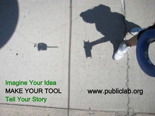
- 1. Imagine Your Idea MAKE YOUR TOOL Tell Your Story www.publiclab.org
- 10. aerial mapping
- 12. Creative Commons Share Back with Attribution for the collaborative production of knowledge
- 13. simple noise monitor kite mapping kite-making workshop camera Kite
- 17. Helping to set up a cleanup process – but where ? Gowanus Canal Sewage: gets a million gallons a day …
- 18. Gowanus Low Altitude Mapping Program
- 19. 15 DECEMBER 2012 BALLOON AERIAL GOWANUS CANAL MAPPING OF SEWAGE PLUMES FROM HURRICANE SANDY DAMAGE
- 20. 15 DECEMBER 2012 BALLOON AERIAL GOWANUS CANAL MAPPING OF FRESH WATER INFLOWS FROM HISTORIC SPRINGS INTO SEWAGE CONTAMINATED WATERS Unmapped spring discovered
- 21. LOCAL CITIZEN PHOTOGRAPHY 2008 State Photo Program 2011 Citizen Kite Photo Program IMPROVING PUBLIC DATA & CREATING TOOLS FOR LOCAL INSIGHT
- 22. CAN WE MAP ALL THE OLD GHOST STREAMS AND CREEKS ? THESE CAN HELP DIVERT RAINWATER OUT OF SEWERS AND REDUCE SEWER OVERFLOW POLLUTION Looking for Solutions to the Problem…
- 23. First Street Basin As seen from canoe
- 24. 1766 Freeke’s Mill Building Potential Spring This is a public Right of Way: Could this stream be restored for the new park ? Why are plants in concrete cracks growing so well ? Is the spring still running ? July 2011 Balloon Photo CIVIC DATA THAT ASKS QUESTIONS
- 25. Grassroots Mapping – finding things that matter to YOU
- 26. 1766 CAN OLD MAPS HELP US UNDERSTAND OUR GRASSROOTS AERIAL PHOTOS ? FIRST STREET BASIN
- 27. EXISTING SPRING 1766 stream FIRST STREET BASIN GOWANUS CANAL (SALTY WATER) COLONIAL MILL NEEDING FRESH WATER OLD 1766 MAP OVERLAID ON “DO IT YOURSELF” 2011 BALLOON AERIAL SHOWS US WHAT IS GOING ON
- 28. Surviving stream is now argument for 5th Street Basin Greenway & Park Restoration
- 29. The Revolution in our Back Yard Battle of Brooklyn: 27 August 1776 Alonzo Chappel, 1858
- 30. Delaware Regiment fighting in Battle of Brooklyn, painting by Domenick D’Andrea, Corbis Archives 1776 – Soldiers died and were buried here
- 32. Helping people tell their story Bob Furman, local historian
- 33. The OVER MY DEAD BODY BALLOON MAPPING EXPEDITION comparing notes with local Brooklyn authorities on how much space would be needed to bury 256 bodies Pic by Dan Phiffer, 7 July 2012
- 35. PORTIONS OF THE NORTHERN MARYLANDER SITE WERE EXCAVATED IN 2009, AND THIS AREA STUDIED BY ARCHEOLOGICAL TEAMS – BUT NOTHING FOUND – WOULD WE HAVE MORE LUCK WITH SOUTHERN PORTION ? 1957 Columbia University Archeological Study Area ( nothing found ) Microsoft Bing Aerials, circa 2010 1998 Bona Fide Oil Archeological Study Area 2012 Over My Dead Body Balloon Mapping Site NEVER EXCAVATED… 1947 Robert Moses Historical Park Proposal Area 1890s Discovery of 30 bodies by Contractor Ryan - location unclear
- 36. The 7 July 2012 Balloon Photographs show an interesting pattern of cracks running on a north south axis. Military burials typically had bodies facing the rising sun. Cracks match proportions of burial trenches described by by 1956 Archeological Survey.
- 37. 2010 NYC LIDAR 3D Topographic Model of Slab half inch “bumps” on slab
- 40. “…aerial photographs do not speak for themselves. And in particular those made by communities. Exactly like any other form of photography aerial images are ground for interpretation, rather than for objective decoding.” - Hagit Keysar, 2013
- 44. other examples
- 48. mapknitter.org
- 67. DIY manifesto • DIY = empowerment & sense of ownership • DIY = independence • DIY = creativity • DIY = understanding of things and taking charge • DIY = the right to choose • DIY transforms consumers into contributors • DIY is saves you money!
- 68. Nat Fein, 1947, Central Park SMALL DATA vs BIG DATA Reconnecting the State with it’s Citizen Knowledge TELLING THE LOCAL STORY
- 69. A very special thank you to all the wonderful staff and volunteers at IFJ A big thank you to all of you - now masters in DIY kite mapping and who endured the cold and wet kite mapping intro Thank you to PublicLab.org community for their work and open source materials, many of them included in this presentation publiclab.org | @publiclab | @cwb_london
Notas do Editor
- We are doing this with contraptions such as this one, where we cut up plastic bottles to protect cheap digital cameras, and the we program the to take pictures every 10 seconds
- Photography of public spaces and people in them is by and large legal. But things get more complicated when taking pictures from an unusual vantage point that can expose private property. If you’re mapping away from home, get to know people in the places you’re working -- reach out for partners and collaborators, who may have key insights into how and where to gather information, and to whom the data is surely relevant.
- This is why we use the balloon and kite photography tools because they allow us to see MORE – like this puddle – and you may shrug and say – yeah it’s a puddle but..
- The New York chapter of Public Laboratory has begun an ongoing periodic monitoring campaign in partnership with local environmental advocacy group the Gowanus Canal Conservancy. Designated a Superfund cleanup site by the EPA in 2010 due to pollution from decades of coal tar accumulation and sewage dumping. Local activists have adapted and improved many of the techniques developed for monitoring the effects of oil contamination in the Gulf of Mexico. This group of local activists have created a high-resolution map area they care about and imagery has replaced commercial and government data as a recognized representation of that place — this is a powerful example of the civic science in action.
- Gowanus Dredgers - their problem along the Gowanus Canal is raw sewage pouring into the Canal during heavy rains – about a million gallons per day of the stuff.
- So what have decided to do ? Well the sewage overflows are directly related to too much rain getting into our sewer system – so we’ve launched the Gowanus Low Altitude Mapping Program were we tie helium balloons and send them up a 1000 feet to take pictures of the Canals water quality and opportunities for improving it.
- In particular, we are interested in spots were rainwater could be diverted out of the overloaded sewer system and into old historic stream beds that got buried a hundred years ago. The idea is that by figuring out a more natural and sustainable manner to manage our rain water we can be better prepared for the big disasters. This for example is balloon photo taken by our canoe team right after the Sandy Hurricane which caused our local sewage pump station explode, pouring massive amounts of sewage into New York waters. But what can better quality Citizen aerials actually tell us ?
- The data the Public Lab community is micro – Scale – but that is precisely it’s value – it is from local citizens willing to “get their feet wet” and reconnect their expert knowledge of their backyards to a broader data sharing network