SlideShare uma empresa Scribd logo
1 de 6
NORTHERN CROSSING,
                    BIBLICAL and DARDANUS FLOOD
                             (Reykjavik, Iceland, c.770 BC)

Dr. R.M. de Jonge ©, drsrmdejonge@hotmail.com

Summary
Three Russian ladies of the Institute of Universal Knowledge discovered ten megalithic sites
on Iceland. One of these in Reykjavic consists of three huge boulders placed at the corners of
a triangle. This monument tells three different stories. The first one deals with the discovery
of the Northern Crossing of the Ocean by the 3rd king Nefererkare of the Fifth Dynasty of E-
gypt. The second one deals with the subsequent Biblical Flood at the start of the Sixth Dy-
nasty, at which 2.6 million people perished (54% of the world population). The third one
deals with the Dardanus Flood during the reign of the 2nd king Ramses III in the 20th Dynas-
ty. It was caused by the same Comet: 3.8 million people died, and another 2.0 million people
expired due to system collapse (32% of the world population). The monument was erected in
Dynasty 23.

Introduction
Lidia Peretrutova, Elvira Babenko and Elena Alekseeva are members of the Institute of Uni-
versal Knowledge in Moscow, Russia, which was founded in 1989. They studied the megali-
thic monuments of Western Europe for about twenty years. In 2011 they visited Iceland, and
discovered about ten different megalithic sites, both in the vicinity of Reykjavic and around
Egilsstadir in the east. One of these sites is located at a distance of c.100 meters from the
church of Kopavog (Kopavogskirkja) in Hamraborg near the capital of Reykjavik. Three huge
boulders are placed at the corners of a triangle. Each of these boulders has a diameter of about
one meter (Fig.1).

The Megalithic Culture of Western Europe lasted from 6000 to 1000 BC, but monuments out-
side this area may have later dates. Iceland was discovered by the megalith builders in c.3400
BC. The three boulders in Reykjavic form a typical megalithic monument. Its meaning may
be difficult to establish. However, it appears the structure was erected because of the disco-
very of the Northern Crossing of the Ocean as well as the subsequent Biblical Flood.
(Refs.1-7)

Northern Crossing
The three huge boulders correspond to the Nile Delta of Egypt, at 30°N. The Northern Cros-
sing of the Ocean was defined by the three landpoints of the Shetland Islands, the South Cape
of Greenland, and Cape Chidley, Canada, at the complementary latitude of 90-30= 60°N. In
antiquity latitudes were already known after 4800 BC, and the use of complementary latitudes
was very common.

The capital of Reykjavic is located 5 Egyptian Moiras, or 50°, west of the Nile Delta, when
measured along the equator. It encodes the Fifth Dynasty of Egypt (Old Kingdom). The three
boulders correspond to the 3rd king. So, the 3rd king Nefererkare (c.2498-2478 BC) of the
Fifth Dynasty discovered the Northern Crossing of the Ocean. After the Southern Crossing
and the Return Route via the Azores, it was the Third Crossing of the Atlantic. (Refs.8-15)
Biblical Flood
The capital of Reykjavic is located at 64°N. The complementary latitude of the site is 90-64=
26°N, encoding the 2.6 million casualties of the Flood, which was caused by a Comet Cata-
strophe. The The South Cape of Greenland, at 60°N, refers to Cape Brewster, Greenland, 6°
above the site, at 64+6= 70°N, in agreement with the 7 figures of this number (2.6 million).
The islet of Rockall, at 57°N, is located 64-57= 7° below the site, confirming it. - The three
boulders also correspond to the three island groups of the Azores, in the middle of the Ocean,
at 38°N. Their average latitude is 64-38= 26° below the site, confirming the 2.6 million vic-
tims.

Reykjavic is located due north of the shortest sailing route to the Cape Verde Islands, which
are situated on about the same meridian, at 16°N. The site is located 64-16= 48° above these
islands, encoding the original world population before the Flood of 4.8 million men. The A-
zores are located 38-16= 22° above these islands, encoding the number of survivors, 4.8-2.6=
2.2 million men.

The percentage of victims was (2.6/4.8)x100= 54%. This number is symbolized by the west
coast of Ireland, at 64-10= 54°N, and by the monuments in the Boyne Valley at this latitude,
64-54= 10° below the site as indicated by the ten Cape Verde islands. The Strait of Gibraltar
is located at the complementary latitude of 90-54= 36°N. It symbolizes the circumference of
the planet Earth, 360°, or 36 Egyptian Moiras. It shows it was a worldwide Catastrophe! It
ended all ancient civilizations on Earth, including the Old Kingdom.

The Flood was caused by a Comet. In antiquity the Head of this Comet was symbolized by
the island of Greenland, which consists of ice and stones. The Tail of the Comet was repre-
sented by the North Atlantic Ocean, which contains a huge amount of water.

The three boulders of the site encode the important SW Cape of Greenland, 3° below the
monument, at 64-3= 61°N. This latitude of 60+1= 61°N shows it happened during the reign of
the 1st king Teti (c.2370-2338 BC) of the Sixth Dynasty of Egypt. This is correct, because it
occurred in c.2344 BC (tree-ring dating). Reykjavic is located 64-32= 32° above the island of
Bermuda, confirming the 32 years of reign of this king.

The three boulders encode the latitude of the Nile Delta, at 30°N. Cape Farvel, the south cape
of Greenland, is located at the complementary latitude of 90-30= 60°N. It corresponds to the
duration of the two stages of the Calamity, because each of these lasted 60 days. In total the
Disaster lasted 180-60= 120 days. Cape Farvel is located 64-60= 4° below the site, confirming
its duration of 4 months. The complementary latitude of 90-60= 30°N corresponds to the 30
days of the month. (Refs.16-24)

The latitude also corresponds to the periodicity of this dangerous Comet (or Comet Swarm),
about 600 years. The three boulders as well as the Nile Delta, at 90-60= 30°N, confirm the 3
figures of this number. The three boulders encode the more accurate periodicity of 600-30=
570 years, as indicated by the latitude of the islet of Rockall, at 57°N. - The Azores are
located 38-30= 8° above the Nile Delta, encoding the total precipitation during the Flood of
about 80 micromoiras= 80x0.11= 8.8, or 9 meters of water (1 moira = 1 degree= 111 km).

The consequences of the Comet Catastrophe lasted to the start of the 12th Dynasty (Middle
Kingdom), c.2007 BC, more than three centuries after the event. The three boulders confirm
these three centuries. (Refs.25-32)
The three boulders encode Cape Holm, Greenland, on the holy Arctic Circle, at 64+3= 67°N.
It is the northernmost line the Sun still shines at midwinter day. At this day the Sun is at right
angles above the Tropic of Capricorn. The slow southerly movement of the Sun turns into a
northerly movement. So, people believe in the Egyptian SunGod Ra! (Refs.1-5)

The three boulders appear to show the date of the site. It was the third time period of good
government of Egypt, after the Old Kingdom and the Middle Kingdom. So the site appears to
date from the New Kingdom. It consists of the 18th, 19th and 20th Dynasty. So, the three
boulders appear to indicate a date in the 20th Dynasty. However, in that case the boulders
may also tell the story of the Dardanus Flood, which happened during this dynasty. The three
boulders definitely show this monument is dealing with three important stories (instead of
two)!


  Fig.1 Megalithic Monument at Kopavogskirkja, Hamraborg, at Reykjavik on Iceland. It
 appears the three boulders were placed because of the Biblical Flood, which ended the Old
    Kingdom of Egypt (Dynasty 23, c.818-715 BC). (Courtesy Mrs. Elena Alekseeva of
                  the Institute of Universal Knowledge, Moscow, Russia).

Dardanus Flood
The true periodicity of the Comet equals 575 years. So, the Comet was expected to return in
the year of 2344-2x575= 1194 BC. It was the first year of government of queen Tausert (1194
-1186 BC), who acted as a regent for king Siptah (1194-1188 BC), the last heads of state of
the 19th Dynasty. However, the Comet exploded near the Sun. A dangerous part of it reached
the Earth 35 years later, in 1194-35= 1159 BC. The three boulders, 5 Moiras west of the Nile
Delta, confirm these 30+5= 35 years. Reykjavic is located 64-29= 35° above the Canary Is-
lands, confirming it.

Iceland was reached from the Orkney Islands by sailing 2 moiras to the Faroer, and another 2
moiras to its SE coast, at 64°N. Reykjavic is located 64-62= 2° above the Faroer, all corres-
ponding to the 20th Dynasty. It is located 64-44= 20° above the north coast of Spain (and
Sable Island), confirming it. The coast of Trondheim, Norway, at the latitude of Reykjavic is
situated 2 Moiras, or 20°, west of the Nile Delta, confiming it, again.

The three boulders consist of two stones close to each other, and a third one further away (see
Fig.1). It represents the 2nd king Ramses III (1184-1153 BC). The Disaster happened at the
end of his reign, in 1159 BC. Reykjavic is located 64-33= 31° above the two islands of
Madeira, confirming the 31 years of reign of this 2nd king.

Reykjavic is located 64-60= 4° above Cape Farvel, the south cape of Greenland, encoding the
first time period of 40 days. The falling stones were causing horrible forest-fires, and the mel-
ting ice resulted in torrential rains and worldwide floodings. It was completely dark on Earth.
The second time period lasted 40 days, too. The climate was completely disrupted. The terri-
ble rains continued, but it also became very cold. So, the rains changed into ferrocious snow
and hail storms. – It resembled the Biblical Flood at the start of the Sixth Dynasty!

The Azores are located 38-30= 8° above the Nile Delta, confirming the total duration of 40+
40= 80 days. The Central Azores consist of 5 islands, and Reykjavic is located 5 Moiras west
of the Nile Delta, both encoding the precipitation during the Dardanus Flood, 50 micromoi-
ras= 50x0.11= c.5.5 meters of water. - The consequences of the Comet Catastrophe lasted to
the end of Dynasty 22, more than four centuries after the event. Reykjavic is located 4° above
Cape Farvel, confirming these four centuries.

The Azores are located at 38°N, encoding the 3.8 million casualties. The north coast of Schot-
land is located 20° higher, encoding the 2.0 million casualties because of system collapse
(lack of government, wars). It is located at 38+20= 58°N, corresponding with the total number
of 5.8 million victims of the Dardanus Flood. The islet of Rockall, at 57°N, is situated 64-57=
7° below the site, in agreement with the 7 figures of this number (5.8 million).

Cape Farvel, the south cape of Greenland, is located at 60°N, confirming the total number of
casualties, c.6 million men. The length of its meridian on the Northern Hemisphere equals
180°, encoding the original world population before the Catastrophe, 18 million men. The
complementary ‘latitude’ of 180-60= 120° corresponds to the number of survivors, 18-6= 12
million men. The Azores are located 38-30= 8° above the Nile Delta, confirming the 8 figures
of this number (12 million).

The south point of the Gulf of Campeche, Mexico, is located at 18°N, confirming the original
world population before the Flood, 18 million men. It is the center of the Realm of the Dead
(the land of Punt), where the Olmec Culture started. Cape Gallinas, the north cape of South
America is located at 12°N, corresponding to the number of survivors, 12 million men. The
difference equals the number of casualties of the Dardanus Flood, 18-12= c.6 million men.

The precise number of victims was 5.8 million men. It is (5.8/18)x100= 32% of the world po-
pulation, as indicated by the latitude of the island of Bermuda, at 32°N. The name of ‘Darda-
nus’ means Third, because it was the Flood, in which about one third of the people died, one
third of these because of system collapse. The three boulders are a symbol of it. Most of the
survivors were seriously injured. (Refs.12,29,33-38)

The three boulders encode Cape Holm, Greenland, on the holy Arctic Circle, at 64+3= 67°N.
The center of the Southern Egyptian Empire is at the complementary latitude of 90-67= 23°N.
It is also the center of the Sun religion. It encodes the date of the megalithic monument on I-
celand in Dynasty 23 (c.818-715 BC). The 3 boulders of the site at Reykjavic confirm it: 3
dy-nasties after the 20th Dynasty of the Dardanus Flood!

References
1. De Jonge, R.M., and Wakefield, J.S., How the SunGod Reached America c.2500 BC, A Guide to Megalithic
Sites, 2002 (ISBN 0-917054-19-9). Available: MCS Inc., Box 3392, Kirkland, Wa 98083, also on CD. Website:
www.howthesungod.com
2. Wakefield, J.S., and De Jonge, R.M., Rocks & Rows, Sailing Routes across the Atlantic and the Copper
Trade, MCS Inc, 2010 (ISBN 0-917054-20-2). Available: MCS Inc, Box 3392, Kirkland, Wa USA 98083.
Website: www.rocksandrows.com
3. De Jonge, R.M., Website: www.slideshare.net/rmdejonge
4. De Jonge, R.M., Website: www.slideshare.net/drsrmdejonge
5. Pellech, Chr., Website: www.migration-diffusion.info
6. De Jonge, R.M., and Wakefield, J.S., “Discovery of the Islands in the Ocean (Cairn T, Loughcrew, Co. Meath,
Ireland, c.3200 BC)” (2011), Ref.3, to be published.
7. De Jonge, R.M., and Wakefield, J.S., "The Passage Grave of Karleby, Encoding the Islands Discovered in the
Ocean, c.2950 BC", Migration & Diffusion, Vol.5, No.18, pgs.64-74 (2004), Ref.5.
8. De Jonge, R.M., “The Discovery of Three Continents (Santo Stefano, North Sardinia, Italy, c.2300 BC)”, An-
cient American, Vol.12, No.76, pgs.28-29 (2007), Ref.3.
9. De Jonge, R.M., “Houghton’s Petroglyph (Copper Country, Michigan, 2500-1200 BC)” (2009), Ref.3, to be pu-
blished.
10. De Jonge, R.M., “The Mystic Symbol, mark of the Michigan Mound Builders” (2009), Ref.3, to be publish-
ed.
11. De Jonge, R.M., “A Sword for America (Kirkburn, East Yorkshire, England, c.250 BC)” (2009), Ref.3, to be
published.
12. De Jonge, R.M., “The Battersea Shield (River Thames, London, c.190 BC)” (2009), Ref.3, to be published.
13. De Jonge, R.M., “Anglo-Saxon Cemetery Artifacts (Sittingbourne, Kent, SE England, c.650 AD)” (2011),
Refs.3,5, to be published.
14. De Jonge, R.M., “Tripod Rock, Pyramid Mountain (Morris County, New Jersey, c.1900 BC)” (2011),
Refs.-3,5, to be published.
15. De Jonge, R.M., “Stonehenge, Monument for the Discovery of America (Salisbury Plain, South England,
c.2000 BC) (2011), Refs.3,5, to be published.
16. Peiser, B.J., Palmer, T., Bailey, M.E., Natural Catastrophes during Bronze Age Civilizations, BAR Interna-
tional Series 728, Oxford, 1998 (ISBN 0-86054-916-X).
17. Baillie, M.G.L., “Hints that Cometary Debris played some Role in several Tree-Ring Dated Environmental
Downturns in the Bronze Age”, Ref.16, pgs.109-117.
18. Peiser, B.J., “Evidence for a Global Disaster in the Late 3rd Millennium BC”, Ref.16, pgs.117-140.
19. Courty, M.-A., “The Soil Record of an Exceptional Event at 4000 BP in the Middle East”, Ref.16,
     pgs.93-109.
20. Clube, S.V.M., and Napier, W.M., The Cosmic Serpent, Faber and Faber, London, 1982.
21. Clube, S.V.M., and Napier, W.M., The Cosmic Winter, Blackwell, Oxford, 1990.
22. Joseph, F., Survivors of Atlantis, Their Impact on World Culture, Bear & Co., Vermont, 2004 (ISBN
1-59143-0-040-2).
23. Baillie, M., Exodus to Arthur, Catastrophic Encounters with Comets, BT Batsford Ltd., London, 1999 (ISBN
0-7134-8681-3).
24. De Jonge, R.M., “The Comet Catastrophe of c.2345 BC”, (thirteen articles),
Webpage: http://www.barry.warmkessel.com/dejonge.html
25. De Jonge, R.M., The Phaistos Disc Decoded, New Testimony of a Lost Civilization, 300 pgs., Netherlands
(2008). Website: www.slideshare.net/drsrmdejonge
26. De Jonge, R.M., “Discovery of America and the Flood (c.2300 BC, Ita Letra, Villarrica, Paraguay)” (2009),
Ref.3, to be published.
27. De Jonge, R.M., “The Discovery of Australia and the Flood (The Rainbow Serpent Shelter, Mt. Borradaile,
Arnhem Land)” (2010), Ref.3, to be published.
28. De Jonge, R.M., “The Ikom Monoliths and the Flood (1200 BC-200 AD, Cross River State, Nigeria)”
(2010), Ref.3, to be published.
29. De Jonge, R.M., “Great Serpent Mound (c.2300 BC, Adams County, Ohio)” (2010), Ref.3, to be published.
30. De Jonge, R.M., “Gold Ring (Grand Canyon, Arizona, c.1450 BC) (2010), Ref.3, to be published.
31. De Jonge, R.M., “The Swan Stone (Burrows Cave, near Olney, Illinois)” (2011), Ref.3 , to be published.
32. De Jonge, R.M., “Sentinel Rock, Vermont (Discovery of America and Biblical Flood, c.1900 BC)” (2011),
Refs.3,5, to be published.
33. De Jonge, R.M., “The Brandenburg Stone, Comet Catastrophe of 536/540 AD” (560 AD, Battletown, Meade
County, Kentucky) (2010), Ref.3, to be published.
34. De Jonge, R.M., “Four Ancient Stories (Poverty Point, NE Louisiana, c.700 BC)” (2009), Ref.3, to be pu-
blished.
35. De Jonge, R.M., “The Myths of Monks Mound (Cahokia, Illinois, 650-1400 AD)” (2010), Ref.3, to be pu-
blished.
36. De Jonge, R.M., “Ikom and the Dardanus Flood (c.1159 BC, Cross River State, Nigeria)” (2010), Ref.3, to
be published.
37. De Jonge, R.M., “Peters Creek Mound (c.715 BC, Clairton, Pennsylvania)” (2010), Ref.3, to be published.
38. Susan English, Website of the Ancient Waterways Society.

Mais conteúdo relacionado

Mais procurados

Illuminati council of 13 human sacrifice denver colorado (updated june 21) ...
Illuminati council of 13 human sacrifice denver colorado (updated june 21)   ...Illuminati council of 13 human sacrifice denver colorado (updated june 21)   ...
Illuminati council of 13 human sacrifice denver colorado (updated june 21) ...
PublicLeaks
 
VATICANO - A HISTÓRIA SECRETA DA RENÚNCIA DE BENTO XVI
VATICANO - A HISTÓRIA SECRETA DA RENÚNCIA DE BENTO XVIVATICANO - A HISTÓRIA SECRETA DA RENÚNCIA DE BENTO XVI
VATICANO - A HISTÓRIA SECRETA DA RENÚNCIA DE BENTO XVI
Claudio José Ayrosa Rosière
 
Madina book 2 arabic solutions
Madina book 2 arabic solutionsMadina book 2 arabic solutions
Madina book 2 arabic solutions
Mansour1
 

Mais procurados (20)

1666 and the Occultic Roots of the New World Disorder
1666 and the Occultic Roots of the New World Disorder1666 and the Occultic Roots of the New World Disorder
1666 and the Occultic Roots of the New World Disorder
 
The Brothers Flexner by Nancy Turner Banks M.D., MBA
The Brothers Flexner by Nancy Turner Banks M.D., MBAThe Brothers Flexner by Nancy Turner Banks M.D., MBA
The Brothers Flexner by Nancy Turner Banks M.D., MBA
 
1_4918415583227151199.pdf
1_4918415583227151199.pdf1_4918415583227151199.pdf
1_4918415583227151199.pdf
 
Crowley and Jung. The Book of the Law and Seven Sermons.
Crowley and Jung. The Book of the Law and Seven Sermons.Crowley and Jung. The Book of the Law and Seven Sermons.
Crowley and Jung. The Book of the Law and Seven Sermons.
 
The X-mas/Nimrod Truth
The X-mas/Nimrod TruthThe X-mas/Nimrod Truth
The X-mas/Nimrod Truth
 
Ancient Israelite History: Slavery and Exodus
Ancient Israelite History: Slavery and ExodusAncient Israelite History: Slavery and Exodus
Ancient Israelite History: Slavery and Exodus
 
Muslim Inventions
Muslim InventionsMuslim Inventions
Muslim Inventions
 
Ancient Israelite Hisory: The Patriarchal Period
Ancient Israelite Hisory: The Patriarchal PeriodAncient Israelite Hisory: The Patriarchal Period
Ancient Israelite Hisory: The Patriarchal Period
 
It's a Pagan World
It's a Pagan WorldIt's a Pagan World
It's a Pagan World
 
7 spirits & 7 headed beast. Mystery of spirits behind 7 empires.
7 spirits & 7 headed beast. Mystery of spirits behind 7 empires.7 spirits & 7 headed beast. Mystery of spirits behind 7 empires.
7 spirits & 7 headed beast. Mystery of spirits behind 7 empires.
 
Illuminati council of 13 human sacrifice denver colorado (updated june 21) ...
Illuminati council of 13 human sacrifice denver colorado (updated june 21)   ...Illuminati council of 13 human sacrifice denver colorado (updated june 21)   ...
Illuminati council of 13 human sacrifice denver colorado (updated june 21) ...
 
666 The Human #
666  The Human #666  The Human #
666 The Human #
 
KNOWLEDGE OF SELF
KNOWLEDGE OF SELFKNOWLEDGE OF SELF
KNOWLEDGE OF SELF
 
VATICANO - A HISTÓRIA SECRETA DA RENÚNCIA DE BENTO XVI
VATICANO - A HISTÓRIA SECRETA DA RENÚNCIA DE BENTO XVIVATICANO - A HISTÓRIA SECRETA DA RENÚNCIA DE BENTO XVI
VATICANO - A HISTÓRIA SECRETA DA RENÚNCIA DE BENTO XVI
 
Madina book 2 arabic solutions
Madina book 2 arabic solutionsMadina book 2 arabic solutions
Madina book 2 arabic solutions
 
Cults and Esoterica
Cults and EsotericaCults and Esoterica
Cults and Esoterica
 
Pawns In The Game (Complete)
Pawns In The Game (Complete)Pawns In The Game (Complete)
Pawns In The Game (Complete)
 
Revelation
RevelationRevelation
Revelation
 
How the new world order is hijacking civilization
How the new world order is hijacking civilizationHow the new world order is hijacking civilization
How the new world order is hijacking civilization
 
The Ecumenism in SDA Church
The Ecumenism in SDA ChurchThe Ecumenism in SDA Church
The Ecumenism in SDA Church
 

Semelhante a MEGALITHS ON ICELAND

Semelhante a MEGALITHS ON ICELAND (20)

COPPER SPEAR TIP, MN
COPPER SPEAR TIP, MNCOPPER SPEAR TIP, MN
COPPER SPEAR TIP, MN
 
DISCOVERY OF THREE CONTINENTS, SARDINIA
DISCOVERY OF THREE CONTINENTS, SARDINIADISCOVERY OF THREE CONTINENTS, SARDINIA
DISCOVERY OF THREE CONTINENTS, SARDINIA
 
EARLY DISCOVERY OF THE WORLD (I)
EARLY DISCOVERY OF THE WORLD (I)EARLY DISCOVERY OF THE WORLD (I)
EARLY DISCOVERY OF THE WORLD (I)
 
GRAVE CREEK MOUND II, WV
GRAVE CREEK MOUND II, WVGRAVE CREEK MOUND II, WV
GRAVE CREEK MOUND II, WV
 
GOLD RING, ARIZONA
GOLD RING, ARIZONAGOLD RING, ARIZONA
GOLD RING, ARIZONA
 
SWAN STONE, ILLINOIS
SWAN STONE, ILLINOISSWAN STONE, ILLINOIS
SWAN STONE, ILLINOIS
 
DISCOVERY OF AMERICA
DISCOVERY OF AMERICADISCOVERY OF AMERICA
DISCOVERY OF AMERICA
 
A SWORD FOR AMERICA
A SWORD FOR AMERICAA SWORD FOR AMERICA
A SWORD FOR AMERICA
 
MYSTERY MOUNTAIN (I), WV
MYSTERY MOUNTAIN (I), WVMYSTERY MOUNTAIN (I), WV
MYSTERY MOUNTAIN (I), WV
 
ANGLO-SAXON ARTIFACTS
ANGLO-SAXON ARTIFACTSANGLO-SAXON ARTIFACTS
ANGLO-SAXON ARTIFACTS
 
OLD COPPER CULTURE II, MN
OLD COPPER CULTURE II, MNOLD COPPER CULTURE II, MN
OLD COPPER CULTURE II, MN
 
ANCIENT STONE BALLS, MN
ANCIENT STONE BALLS, MNANCIENT STONE BALLS, MN
ANCIENT STONE BALLS, MN
 
OIL CITY GLYPHS I, PA
OIL CITY GLYPHS I, PAOIL CITY GLYPHS I, PA
OIL CITY GLYPHS I, PA
 
MEGALITHIC WRITING (I), ORKNEY'S
MEGALITHIC WRITING (I), ORKNEY'SMEGALITHIC WRITING (I), ORKNEY'S
MEGALITHIC WRITING (I), ORKNEY'S
 
POVERTY POINT, NE LOUISIANA
POVERTY POINT, NE LOUISIANAPOVERTY POINT, NE LOUISIANA
POVERTY POINT, NE LOUISIANA
 
CIRCLE CROSS CARVING, MI
CIRCLE CROSS CARVING, MICIRCLE CROSS CARVING, MI
CIRCLE CROSS CARVING, MI
 
MYSTERY MOUNTAIN (II), WV
MYSTERY MOUNTAIN (II), WVMYSTERY MOUNTAIN (II), WV
MYSTERY MOUNTAIN (II), WV
 
EARLY DISCOVERY OF THE WORLD (II)
EARLY DISCOVERY OF THE WORLD (II)EARLY DISCOVERY OF THE WORLD (II)
EARLY DISCOVERY OF THE WORLD (II)
 
LONGYOU CAVES, CHINA
LONGYOU CAVES, CHINALONGYOU CAVES, CHINA
LONGYOU CAVES, CHINA
 
MEGALITHIC WRITING (II), ORKNEY'S
MEGALITHIC WRITING (II), ORKNEY'SMEGALITHIC WRITING (II), ORKNEY'S
MEGALITHIC WRITING (II), ORKNEY'S
 

Mais de INSTITUTE OF MEGALITHIC RESEARCH

Mais de INSTITUTE OF MEGALITHIC RESEARCH (16)

Lennox head 5
Lennox head 5Lennox head 5
Lennox head 5
 
PREHISTORY OF AZORES (3600-1200 BC)
PREHISTORY OF AZORES (3600-1200 BC)PREHISTORY OF AZORES (3600-1200 BC)
PREHISTORY OF AZORES (3600-1200 BC)
 
SAILING FROM NEW ZEALAND TO AUSTRALIA
SAILING FROM NEW ZEALAND TO AUSTRALIASAILING FROM NEW ZEALAND TO AUSTRALIA
SAILING FROM NEW ZEALAND TO AUSTRALIA
 
MAN OF BACKA, SWEDEN
MAN OF BACKA, SWEDENMAN OF BACKA, SWEDEN
MAN OF BACKA, SWEDEN
 
OMAK ROCK (II), WA
OMAK ROCK (II), WAOMAK ROCK (II), WA
OMAK ROCK (II), WA
 
OMAK ROCK (I), WA
OMAK ROCK (I), WAOMAK ROCK (I), WA
OMAK ROCK (I), WA
 
BALANCED ROCK (II), ID
BALANCED ROCK (II), IDBALANCED ROCK (II), ID
BALANCED ROCK (II), ID
 
BALANCED ROCK (I), ID
BALANCED ROCK (I), IDBALANCED ROCK (I), ID
BALANCED ROCK (I), ID
 
FOUR CHAMBERS (I), CO
FOUR CHAMBERS (I), COFOUR CHAMBERS (I), CO
FOUR CHAMBERS (I), CO
 
SPHERICAL ROCK, WI
SPHERICAL ROCK, WISPHERICAL ROCK, WI
SPHERICAL ROCK, WI
 
Could it be just a rock?
Could it be just a rock?Could it be just a rock?
Could it be just a rock?
 
RATTLESNAKE DISC (MOUNDVILLE, AL)
RATTLESNAKE DISC (MOUNDVILLE, AL)RATTLESNAKE DISC (MOUNDVILLE, AL)
RATTLESNAKE DISC (MOUNDVILLE, AL)
 
GRAVE CREEK MOUND I, WV
GRAVE CREEK MOUND I, WVGRAVE CREEK MOUND I, WV
GRAVE CREEK MOUND I, WV
 
OLD COPPER CULTURE I, MN
OLD COPPER CULTURE I, MNOLD COPPER CULTURE I, MN
OLD COPPER CULTURE I, MN
 
OIL CITY GLYPHS II, PA
OIL CITY GLYPHS II, PAOIL CITY GLYPHS II, PA
OIL CITY GLYPHS II, PA
 
NARRAGANSETT RUNE STONE
NARRAGANSETT RUNE STONENARRAGANSETT RUNE STONE
NARRAGANSETT RUNE STONE
 

Último

Gardella_PRCampaignConclusion Pitch Letter
Gardella_PRCampaignConclusion Pitch LetterGardella_PRCampaignConclusion Pitch Letter
Gardella_PRCampaignConclusion Pitch Letter
MateoGardella
 
Russian Escort Service in Delhi 11k Hotel Foreigner Russian Call Girls in Delhi
Russian Escort Service in Delhi 11k Hotel Foreigner Russian Call Girls in DelhiRussian Escort Service in Delhi 11k Hotel Foreigner Russian Call Girls in Delhi
Russian Escort Service in Delhi 11k Hotel Foreigner Russian Call Girls in Delhi
kauryashika82
 

Último (20)

Mattingly "AI & Prompt Design: The Basics of Prompt Design"
Mattingly "AI & Prompt Design: The Basics of Prompt Design"Mattingly "AI & Prompt Design: The Basics of Prompt Design"
Mattingly "AI & Prompt Design: The Basics of Prompt Design"
 
Basic Civil Engineering first year Notes- Chapter 4 Building.pptx
Basic Civil Engineering first year Notes- Chapter 4 Building.pptxBasic Civil Engineering first year Notes- Chapter 4 Building.pptx
Basic Civil Engineering first year Notes- Chapter 4 Building.pptx
 
Unit-V; Pricing (Pharma Marketing Management).pptx
Unit-V; Pricing (Pharma Marketing Management).pptxUnit-V; Pricing (Pharma Marketing Management).pptx
Unit-V; Pricing (Pharma Marketing Management).pptx
 
Application orientated numerical on hev.ppt
Application orientated numerical on hev.pptApplication orientated numerical on hev.ppt
Application orientated numerical on hev.ppt
 
Paris 2024 Olympic Geographies - an activity
Paris 2024 Olympic Geographies - an activityParis 2024 Olympic Geographies - an activity
Paris 2024 Olympic Geographies - an activity
 
Mehran University Newsletter Vol-X, Issue-I, 2024
Mehran University Newsletter Vol-X, Issue-I, 2024Mehran University Newsletter Vol-X, Issue-I, 2024
Mehran University Newsletter Vol-X, Issue-I, 2024
 
Sports & Fitness Value Added Course FY..
Sports & Fitness Value Added Course FY..Sports & Fitness Value Added Course FY..
Sports & Fitness Value Added Course FY..
 
Holdier Curriculum Vitae (April 2024).pdf
Holdier Curriculum Vitae (April 2024).pdfHoldier Curriculum Vitae (April 2024).pdf
Holdier Curriculum Vitae (April 2024).pdf
 
SECOND SEMESTER TOPIC COVERAGE SY 2023-2024 Trends, Networks, and Critical Th...
SECOND SEMESTER TOPIC COVERAGE SY 2023-2024 Trends, Networks, and Critical Th...SECOND SEMESTER TOPIC COVERAGE SY 2023-2024 Trends, Networks, and Critical Th...
SECOND SEMESTER TOPIC COVERAGE SY 2023-2024 Trends, Networks, and Critical Th...
 
Gardella_PRCampaignConclusion Pitch Letter
Gardella_PRCampaignConclusion Pitch LetterGardella_PRCampaignConclusion Pitch Letter
Gardella_PRCampaignConclusion Pitch Letter
 
How to Give a Domain for a Field in Odoo 17
How to Give a Domain for a Field in Odoo 17How to Give a Domain for a Field in Odoo 17
How to Give a Domain for a Field in Odoo 17
 
Measures of Central Tendency: Mean, Median and Mode
Measures of Central Tendency: Mean, Median and ModeMeasures of Central Tendency: Mean, Median and Mode
Measures of Central Tendency: Mean, Median and Mode
 
Russian Escort Service in Delhi 11k Hotel Foreigner Russian Call Girls in Delhi
Russian Escort Service in Delhi 11k Hotel Foreigner Russian Call Girls in DelhiRussian Escort Service in Delhi 11k Hotel Foreigner Russian Call Girls in Delhi
Russian Escort Service in Delhi 11k Hotel Foreigner Russian Call Girls in Delhi
 
SOCIAL AND HISTORICAL CONTEXT - LFTVD.pptx
SOCIAL AND HISTORICAL CONTEXT - LFTVD.pptxSOCIAL AND HISTORICAL CONTEXT - LFTVD.pptx
SOCIAL AND HISTORICAL CONTEXT - LFTVD.pptx
 
microwave assisted reaction. General introduction
microwave assisted reaction. General introductionmicrowave assisted reaction. General introduction
microwave assisted reaction. General introduction
 
ICT Role in 21st Century Education & its Challenges.pptx
ICT Role in 21st Century Education & its Challenges.pptxICT Role in 21st Century Education & its Challenges.pptx
ICT Role in 21st Century Education & its Challenges.pptx
 
Web & Social Media Analytics Previous Year Question Paper.pdf
Web & Social Media Analytics Previous Year Question Paper.pdfWeb & Social Media Analytics Previous Year Question Paper.pdf
Web & Social Media Analytics Previous Year Question Paper.pdf
 
Unit-IV; Professional Sales Representative (PSR).pptx
Unit-IV; Professional Sales Representative (PSR).pptxUnit-IV; Professional Sales Representative (PSR).pptx
Unit-IV; Professional Sales Representative (PSR).pptx
 
Unit-IV- Pharma. Marketing Channels.pptx
Unit-IV- Pharma. Marketing Channels.pptxUnit-IV- Pharma. Marketing Channels.pptx
Unit-IV- Pharma. Marketing Channels.pptx
 
PROCESS RECORDING FORMAT.docx
PROCESS      RECORDING        FORMAT.docxPROCESS      RECORDING        FORMAT.docx
PROCESS RECORDING FORMAT.docx
 

MEGALITHS ON ICELAND

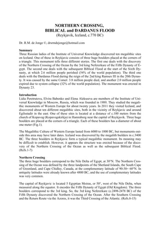
  • 1. NORTHERN CROSSING, BIBLICAL and DARDANUS FLOOD (Reykjavik, Iceland, c.770 BC) Dr. R.M. de Jonge ©, drsrmdejonge@hotmail.com Summary Three Russian ladies of the Institute of Universal Knowledge discovered ten megalithic sites on Iceland. One of these in Reykjavic consists of three huge boulders placed at the corners of a triangle. This monument tells three different stories. The first one deals with the discovery of the Northern Crossing of the Ocean by the 3rd king Nefererkare of the Fifth Dynasty of E- gypt. The second one deals with the subsequent Biblical Flood at the start of the Sixth Dy- nasty, at which 2.6 million people perished (54% of the world population). The third one deals with the Dardanus Flood during the reign of the 2nd king Ramses III in the 20th Dynas- ty. It was caused by the same Comet: 3.8 million people died, and another 2.0 million people expired due to system collapse (32% of the world population). The monument was erected in Dynasty 23. Introduction Lidia Peretrutova, Elvira Babenko and Elena Alekseeva are members of the Institute of Uni- versal Knowledge in Moscow, Russia, which was founded in 1989. They studied the megali- thic monuments of Western Europe for about twenty years. In 2011 they visited Iceland, and discovered about ten different megalithic sites, both in the vicinity of Reykjavic and around Egilsstadir in the east. One of these sites is located at a distance of c.100 meters from the church of Kopavog (Kopavogskirkja) in Hamraborg near the capital of Reykjavik. Three huge boulders are placed at the corners of a triangle. Each of these boulders has a diameter of about one meter (Fig.1). The Megalithic Culture of Western Europe lasted from 6000 to 1000 BC, but monuments out- side this area may have later dates. Iceland was discovered by the megalith builders in c.3400 BC. The three boulders in Reykjavic form a typical megalithic monument. Its meaning may be difficult to establish. However, it appears the structure was erected because of the disco- very of the Northern Crossing of the Ocean as well as the subsequent Biblical Flood. (Refs.1-7) Northern Crossing The three huge boulders correspond to the Nile Delta of Egypt, at 30°N. The Northern Cros- sing of the Ocean was defined by the three landpoints of the Shetland Islands, the South Cape of Greenland, and Cape Chidley, Canada, at the complementary latitude of 90-30= 60°N. In antiquity latitudes were already known after 4800 BC, and the use of complementary latitudes was very common. The capital of Reykjavic is located 5 Egyptian Moiras, or 50°, west of the Nile Delta, when measured along the equator. It encodes the Fifth Dynasty of Egypt (Old Kingdom). The three boulders correspond to the 3rd king. So, the 3rd king Nefererkare (c.2498-2478 BC) of the Fifth Dynasty discovered the Northern Crossing of the Ocean. After the Southern Crossing and the Return Route via the Azores, it was the Third Crossing of the Atlantic. (Refs.8-15)
  • 2. Biblical Flood The capital of Reykjavic is located at 64°N. The complementary latitude of the site is 90-64= 26°N, encoding the 2.6 million casualties of the Flood, which was caused by a Comet Cata- strophe. The The South Cape of Greenland, at 60°N, refers to Cape Brewster, Greenland, 6° above the site, at 64+6= 70°N, in agreement with the 7 figures of this number (2.6 million). The islet of Rockall, at 57°N, is located 64-57= 7° below the site, confirming it. - The three boulders also correspond to the three island groups of the Azores, in the middle of the Ocean, at 38°N. Their average latitude is 64-38= 26° below the site, confirming the 2.6 million vic- tims. Reykjavic is located due north of the shortest sailing route to the Cape Verde Islands, which are situated on about the same meridian, at 16°N. The site is located 64-16= 48° above these islands, encoding the original world population before the Flood of 4.8 million men. The A- zores are located 38-16= 22° above these islands, encoding the number of survivors, 4.8-2.6= 2.2 million men. The percentage of victims was (2.6/4.8)x100= 54%. This number is symbolized by the west coast of Ireland, at 64-10= 54°N, and by the monuments in the Boyne Valley at this latitude, 64-54= 10° below the site as indicated by the ten Cape Verde islands. The Strait of Gibraltar is located at the complementary latitude of 90-54= 36°N. It symbolizes the circumference of the planet Earth, 360°, or 36 Egyptian Moiras. It shows it was a worldwide Catastrophe! It ended all ancient civilizations on Earth, including the Old Kingdom. The Flood was caused by a Comet. In antiquity the Head of this Comet was symbolized by the island of Greenland, which consists of ice and stones. The Tail of the Comet was repre- sented by the North Atlantic Ocean, which contains a huge amount of water. The three boulders of the site encode the important SW Cape of Greenland, 3° below the monument, at 64-3= 61°N. This latitude of 60+1= 61°N shows it happened during the reign of the 1st king Teti (c.2370-2338 BC) of the Sixth Dynasty of Egypt. This is correct, because it occurred in c.2344 BC (tree-ring dating). Reykjavic is located 64-32= 32° above the island of Bermuda, confirming the 32 years of reign of this king. The three boulders encode the latitude of the Nile Delta, at 30°N. Cape Farvel, the south cape of Greenland, is located at the complementary latitude of 90-30= 60°N. It corresponds to the duration of the two stages of the Calamity, because each of these lasted 60 days. In total the Disaster lasted 180-60= 120 days. Cape Farvel is located 64-60= 4° below the site, confirming its duration of 4 months. The complementary latitude of 90-60= 30°N corresponds to the 30 days of the month. (Refs.16-24) The latitude also corresponds to the periodicity of this dangerous Comet (or Comet Swarm), about 600 years. The three boulders as well as the Nile Delta, at 90-60= 30°N, confirm the 3 figures of this number. The three boulders encode the more accurate periodicity of 600-30= 570 years, as indicated by the latitude of the islet of Rockall, at 57°N. - The Azores are located 38-30= 8° above the Nile Delta, encoding the total precipitation during the Flood of about 80 micromoiras= 80x0.11= 8.8, or 9 meters of water (1 moira = 1 degree= 111 km). The consequences of the Comet Catastrophe lasted to the start of the 12th Dynasty (Middle Kingdom), c.2007 BC, more than three centuries after the event. The three boulders confirm these three centuries. (Refs.25-32)
  • 3. The three boulders encode Cape Holm, Greenland, on the holy Arctic Circle, at 64+3= 67°N. It is the northernmost line the Sun still shines at midwinter day. At this day the Sun is at right angles above the Tropic of Capricorn. The slow southerly movement of the Sun turns into a northerly movement. So, people believe in the Egyptian SunGod Ra! (Refs.1-5) The three boulders appear to show the date of the site. It was the third time period of good government of Egypt, after the Old Kingdom and the Middle Kingdom. So the site appears to date from the New Kingdom. It consists of the 18th, 19th and 20th Dynasty. So, the three boulders appear to indicate a date in the 20th Dynasty. However, in that case the boulders may also tell the story of the Dardanus Flood, which happened during this dynasty. The three boulders definitely show this monument is dealing with three important stories (instead of two)! Fig.1 Megalithic Monument at Kopavogskirkja, Hamraborg, at Reykjavik on Iceland. It appears the three boulders were placed because of the Biblical Flood, which ended the Old Kingdom of Egypt (Dynasty 23, c.818-715 BC). (Courtesy Mrs. Elena Alekseeva of the Institute of Universal Knowledge, Moscow, Russia). Dardanus Flood The true periodicity of the Comet equals 575 years. So, the Comet was expected to return in the year of 2344-2x575= 1194 BC. It was the first year of government of queen Tausert (1194 -1186 BC), who acted as a regent for king Siptah (1194-1188 BC), the last heads of state of the 19th Dynasty. However, the Comet exploded near the Sun. A dangerous part of it reached the Earth 35 years later, in 1194-35= 1159 BC. The three boulders, 5 Moiras west of the Nile Delta, confirm these 30+5= 35 years. Reykjavic is located 64-29= 35° above the Canary Is- lands, confirming it. Iceland was reached from the Orkney Islands by sailing 2 moiras to the Faroer, and another 2 moiras to its SE coast, at 64°N. Reykjavic is located 64-62= 2° above the Faroer, all corres-
  • 4. ponding to the 20th Dynasty. It is located 64-44= 20° above the north coast of Spain (and Sable Island), confirming it. The coast of Trondheim, Norway, at the latitude of Reykjavic is situated 2 Moiras, or 20°, west of the Nile Delta, confiming it, again. The three boulders consist of two stones close to each other, and a third one further away (see Fig.1). It represents the 2nd king Ramses III (1184-1153 BC). The Disaster happened at the end of his reign, in 1159 BC. Reykjavic is located 64-33= 31° above the two islands of Madeira, confirming the 31 years of reign of this 2nd king. Reykjavic is located 64-60= 4° above Cape Farvel, the south cape of Greenland, encoding the first time period of 40 days. The falling stones were causing horrible forest-fires, and the mel- ting ice resulted in torrential rains and worldwide floodings. It was completely dark on Earth. The second time period lasted 40 days, too. The climate was completely disrupted. The terri- ble rains continued, but it also became very cold. So, the rains changed into ferrocious snow and hail storms. – It resembled the Biblical Flood at the start of the Sixth Dynasty! The Azores are located 38-30= 8° above the Nile Delta, confirming the total duration of 40+ 40= 80 days. The Central Azores consist of 5 islands, and Reykjavic is located 5 Moiras west of the Nile Delta, both encoding the precipitation during the Dardanus Flood, 50 micromoi- ras= 50x0.11= c.5.5 meters of water. - The consequences of the Comet Catastrophe lasted to the end of Dynasty 22, more than four centuries after the event. Reykjavic is located 4° above Cape Farvel, confirming these four centuries. The Azores are located at 38°N, encoding the 3.8 million casualties. The north coast of Schot- land is located 20° higher, encoding the 2.0 million casualties because of system collapse (lack of government, wars). It is located at 38+20= 58°N, corresponding with the total number of 5.8 million victims of the Dardanus Flood. The islet of Rockall, at 57°N, is situated 64-57= 7° below the site, in agreement with the 7 figures of this number (5.8 million). Cape Farvel, the south cape of Greenland, is located at 60°N, confirming the total number of casualties, c.6 million men. The length of its meridian on the Northern Hemisphere equals 180°, encoding the original world population before the Catastrophe, 18 million men. The complementary ‘latitude’ of 180-60= 120° corresponds to the number of survivors, 18-6= 12 million men. The Azores are located 38-30= 8° above the Nile Delta, confirming the 8 figures of this number (12 million). The south point of the Gulf of Campeche, Mexico, is located at 18°N, confirming the original world population before the Flood, 18 million men. It is the center of the Realm of the Dead (the land of Punt), where the Olmec Culture started. Cape Gallinas, the north cape of South America is located at 12°N, corresponding to the number of survivors, 12 million men. The difference equals the number of casualties of the Dardanus Flood, 18-12= c.6 million men. The precise number of victims was 5.8 million men. It is (5.8/18)x100= 32% of the world po- pulation, as indicated by the latitude of the island of Bermuda, at 32°N. The name of ‘Darda- nus’ means Third, because it was the Flood, in which about one third of the people died, one third of these because of system collapse. The three boulders are a symbol of it. Most of the survivors were seriously injured. (Refs.12,29,33-38) The three boulders encode Cape Holm, Greenland, on the holy Arctic Circle, at 64+3= 67°N. The center of the Southern Egyptian Empire is at the complementary latitude of 90-67= 23°N.
  • 5. It is also the center of the Sun religion. It encodes the date of the megalithic monument on I- celand in Dynasty 23 (c.818-715 BC). The 3 boulders of the site at Reykjavic confirm it: 3 dy-nasties after the 20th Dynasty of the Dardanus Flood! References 1. De Jonge, R.M., and Wakefield, J.S., How the SunGod Reached America c.2500 BC, A Guide to Megalithic Sites, 2002 (ISBN 0-917054-19-9). Available: MCS Inc., Box 3392, Kirkland, Wa 98083, also on CD. Website: www.howthesungod.com 2. Wakefield, J.S., and De Jonge, R.M., Rocks & Rows, Sailing Routes across the Atlantic and the Copper Trade, MCS Inc, 2010 (ISBN 0-917054-20-2). Available: MCS Inc, Box 3392, Kirkland, Wa USA 98083. Website: www.rocksandrows.com 3. De Jonge, R.M., Website: www.slideshare.net/rmdejonge 4. De Jonge, R.M., Website: www.slideshare.net/drsrmdejonge 5. Pellech, Chr., Website: www.migration-diffusion.info 6. De Jonge, R.M., and Wakefield, J.S., “Discovery of the Islands in the Ocean (Cairn T, Loughcrew, Co. Meath, Ireland, c.3200 BC)” (2011), Ref.3, to be published. 7. De Jonge, R.M., and Wakefield, J.S., "The Passage Grave of Karleby, Encoding the Islands Discovered in the Ocean, c.2950 BC", Migration & Diffusion, Vol.5, No.18, pgs.64-74 (2004), Ref.5. 8. De Jonge, R.M., “The Discovery of Three Continents (Santo Stefano, North Sardinia, Italy, c.2300 BC)”, An- cient American, Vol.12, No.76, pgs.28-29 (2007), Ref.3. 9. De Jonge, R.M., “Houghton’s Petroglyph (Copper Country, Michigan, 2500-1200 BC)” (2009), Ref.3, to be pu- blished. 10. De Jonge, R.M., “The Mystic Symbol, mark of the Michigan Mound Builders” (2009), Ref.3, to be publish- ed. 11. De Jonge, R.M., “A Sword for America (Kirkburn, East Yorkshire, England, c.250 BC)” (2009), Ref.3, to be published. 12. De Jonge, R.M., “The Battersea Shield (River Thames, London, c.190 BC)” (2009), Ref.3, to be published. 13. De Jonge, R.M., “Anglo-Saxon Cemetery Artifacts (Sittingbourne, Kent, SE England, c.650 AD)” (2011), Refs.3,5, to be published. 14. De Jonge, R.M., “Tripod Rock, Pyramid Mountain (Morris County, New Jersey, c.1900 BC)” (2011), Refs.-3,5, to be published. 15. De Jonge, R.M., “Stonehenge, Monument for the Discovery of America (Salisbury Plain, South England, c.2000 BC) (2011), Refs.3,5, to be published. 16. Peiser, B.J., Palmer, T., Bailey, M.E., Natural Catastrophes during Bronze Age Civilizations, BAR Interna- tional Series 728, Oxford, 1998 (ISBN 0-86054-916-X). 17. Baillie, M.G.L., “Hints that Cometary Debris played some Role in several Tree-Ring Dated Environmental Downturns in the Bronze Age”, Ref.16, pgs.109-117. 18. Peiser, B.J., “Evidence for a Global Disaster in the Late 3rd Millennium BC”, Ref.16, pgs.117-140. 19. Courty, M.-A., “The Soil Record of an Exceptional Event at 4000 BP in the Middle East”, Ref.16, pgs.93-109. 20. Clube, S.V.M., and Napier, W.M., The Cosmic Serpent, Faber and Faber, London, 1982. 21. Clube, S.V.M., and Napier, W.M., The Cosmic Winter, Blackwell, Oxford, 1990. 22. Joseph, F., Survivors of Atlantis, Their Impact on World Culture, Bear & Co., Vermont, 2004 (ISBN 1-59143-0-040-2). 23. Baillie, M., Exodus to Arthur, Catastrophic Encounters with Comets, BT Batsford Ltd., London, 1999 (ISBN 0-7134-8681-3). 24. De Jonge, R.M., “The Comet Catastrophe of c.2345 BC”, (thirteen articles), Webpage: http://www.barry.warmkessel.com/dejonge.html 25. De Jonge, R.M., The Phaistos Disc Decoded, New Testimony of a Lost Civilization, 300 pgs., Netherlands (2008). Website: www.slideshare.net/drsrmdejonge 26. De Jonge, R.M., “Discovery of America and the Flood (c.2300 BC, Ita Letra, Villarrica, Paraguay)” (2009), Ref.3, to be published. 27. De Jonge, R.M., “The Discovery of Australia and the Flood (The Rainbow Serpent Shelter, Mt. Borradaile, Arnhem Land)” (2010), Ref.3, to be published. 28. De Jonge, R.M., “The Ikom Monoliths and the Flood (1200 BC-200 AD, Cross River State, Nigeria)” (2010), Ref.3, to be published. 29. De Jonge, R.M., “Great Serpent Mound (c.2300 BC, Adams County, Ohio)” (2010), Ref.3, to be published. 30. De Jonge, R.M., “Gold Ring (Grand Canyon, Arizona, c.1450 BC) (2010), Ref.3, to be published. 31. De Jonge, R.M., “The Swan Stone (Burrows Cave, near Olney, Illinois)” (2011), Ref.3 , to be published.
  • 6. 32. De Jonge, R.M., “Sentinel Rock, Vermont (Discovery of America and Biblical Flood, c.1900 BC)” (2011), Refs.3,5, to be published. 33. De Jonge, R.M., “The Brandenburg Stone, Comet Catastrophe of 536/540 AD” (560 AD, Battletown, Meade County, Kentucky) (2010), Ref.3, to be published. 34. De Jonge, R.M., “Four Ancient Stories (Poverty Point, NE Louisiana, c.700 BC)” (2009), Ref.3, to be pu- blished. 35. De Jonge, R.M., “The Myths of Monks Mound (Cahokia, Illinois, 650-1400 AD)” (2010), Ref.3, to be pu- blished. 36. De Jonge, R.M., “Ikom and the Dardanus Flood (c.1159 BC, Cross River State, Nigeria)” (2010), Ref.3, to be published. 37. De Jonge, R.M., “Peters Creek Mound (c.715 BC, Clairton, Pennsylvania)” (2010), Ref.3, to be published. 38. Susan English, Website of the Ancient Waterways Society.