SlideShare uma empresa Scribd logo
1 de 61
SPATIAL INFORMATION and the
                                                                                     Alan Glennon
                                                             INTERNET              spatial.ucsb.edu
                   University of California, Santa Barbara
19 February 2009


                                                                                         Image Source: GeoEye.com 2009
Mission:

                                                             To facilitate the integration of spatial thinking into processes for
                                                             learning and discovery in the natural, social, and behavioral
                                                             sciences, to promote excellence in engineering and applied
                                                             sciences, and to enhance creativity in the arts and humanities.
                   University of California, Santa Barbara


                                                             Engagement:
19 February 2009


                                                                     Hosting events (brownbags, workshops, lectures)
                                                                     Developing spatial analytic tools
                                                                     Offering a help desk
                                                                     Assisting with research proposal development

                                                                                                                     Image Source: NAIP, 2005
Source: Wikimedia Commons, 2008
University of California, Santa Barbara
        19 February 2009
Source: Allen Gathman, 2008
University of California, Santa Barbara
        19 February 2009
Source: Strangemaps, 2008
University of California, Santa Barbara
        19 February 2009
Grassroots mapping of Gaza
                                                             (Gaza project spearheaded by Mikel Maron. left: December 2008 data; right: February 2009 data)
                   University of California, Santa Barbara
19 February 2009


                                                                                                                  Source: openstreetmap.org, 2009
Image Source: GeoEye.com 2008
Source: Photosynth.com, 2008
University of California, Santa Barbara
        19 February 2009
SPATIAL INFORMATION and the
                                                             INTERNET
                                                                      • Three significant maps of the last
                                                                             twelve months
                                                                      • Considering spatial data
                                                                      • Web 2.0
                                                                      • Comparing the language of
                   University of California, Santa Barbara


                                                             Topics          cartography, GIS, and Internet
19 February 2009


                                                                             geography
                                                                      • Capabilities and concerns
                                                                      • Policy and best practices
                                                                      • Future
                                                                                              Image Source: GeoEye.com 2008
Geographic Data


                                                                        Two practical perspectives:
                   University of California, Santa Barbara


                                                             Data that include or can be harvested for spatial
19 February 2009


                                                             references

                                                             Combinations of spatially-referenced points, polylines,
                                                             polygons, and images with their associated attributes
                                                             and relationships

                                                                                                      Image Source: Google.com 2008
Image Source: Google.com 2008
Geographic Data
                  University of California, Santa Barbara
                          19 February 2009
Geographic Data
                                                             Significance:

                                                                     visually compelling

                                                                     provide context and content; close things are
                                                                     usually more related; spatial order; pattern and trend
                   University of California, Santa Barbara


                                                                     recognition
19 February 2009


                                                                     popular; widespread use, particularly on the Internet

                                                                     professional expectation: Google Maps as a baseline
“…it would behove spatial scientists to articulate to
                                                             the broader research community the potential of
                                                             recording and making accessible spatial data in the
                                                             appropriate formats — and the painlessness of the
                                                             process.”
                   University of California, Santa Barbara
19 February 2009


                                                                                                             A place for everything:
                                                              More researchers must record the latitude and longitude of their data.
                                                                                             Editorial: Nature 453, 2 (1 May 2008)
Web 2.0 and Spatial Mashups

                                                             Web 2.0: The notion of the Internet as a
                                                             computing platform.
                                                             tags: sharing, collaboration, user generated content, community, dynamic, real-time
                   University of California, Santa Barbara


                                                             quot;Web 2.0 is the business revolution in the computer
                                                             industry caused by the move to the Internet as platform,
19 February 2009


                                                             and an attempt to understand the rules for success on
                                                             that new platform.“

                                                                                                                    Tim O’Reilly, December 2006
What is a Mashup?
                                                             Mashup: a website or application that
                                                             combines data from more than one source.

                                                             Characteristics:
                   University of California, Santa Barbara


                                                             combination, aggregation, visualization
19 February 2009
Enabling Technologies

                                                             • web search
                                                             • client-server architecture
                                                             • Internet applications and AJAX
                                                                 wikis, online office apps, email, maps, media
                                                                 hosting, social networks, asynchronous data
                                                                 and response
                   University of California, Santa Barbara


                                                             • structured, simple data types
19 February 2009


                                                                 XML and RSS
                                                             • Application Programming Interfaces (API)
                                                             • willing users
Sample Software


                                                             Open Source
                                                                           NASA World Wind (client and server)
                                                                           OpenLayers (client)
                                                                           MapServer (server)
                                                                           Geoserver (server)
                                                                           GDAL/OGR (server-based geo-database toolkit)
                                                                           GRASS (full desktop GIS client)

                                                                           Google Earth (client)
                                                                           Google Maps (client)
                                                             Free


                                                                           Microsoft Virtual Earth (client)
                   University of California, Santa Barbara


                                                                           ArcGIS Explorer (client)
                                                                           MapQuest (client)
19 February 2009


                                                                           Google Earth Enterprise (server)
                                                             Proprietary


                                                                           ArcGIS (full desktop GIS client)
                                                                           ArcGIS Server (server)
                                                                           deCarta (server)
                                                                           AutoDesk AutoCad (client)
                                                                           AutoDesk ProductStream (server)
                                                                           Oracle Spatial (server)
Example Geographic File Types
                                                             • ESRI shapefile (.shp)
                                                             • KeyHole Markup Language (.kml)
                                                             • GeoRSS (.rss, .xml)
                                                             • AutoCad DXF (.dxf)
                                                             • Census TIGER
                                                             • ESRI Coverage
                                                             • ESRI Personal Geodatabase
                                                             • GeoTIFF
                                                             • Digital Raster Graphic (DRG)
                                                             • Digital Elevation Model (DEM)
                   University of California, Santa Barbara


                                                             • Spatial Data Transfer Standard (SDTS)
                                                             • Image formats like jpg, tiff, gif, and png (often served via a WMS operation)
19 February 2009


                                                             Considerations when choosing a file type for spatial data:
                                                             What software support it? What does your consumer want? Is it fast? What
                                                             type of data, complexity, and dynamics can it support? How easy is it to
                                                             autogenerate and update (from your database to the new file format)? How
                                                             well will it age?
The language, tools, and technology of cartographers, geographers and spatial
                                                                 information engineers.

                                                             Map Making Process
                                                                 Transformation
                                                                 simplifying, generalizing, and abstracting the world

                                                                 Interrogation
                                                                 asking questions of spatial data and maps

                                                                 Communication
                                                                 creating spatial results that can be understood and have meaning

                                                             Geographic Information Systems
                                                                 Collection
                   University of California, Santa Barbara


                                                                 Storage
                                                                 Analysis
19 February 2009


                                                                 Visualization

                                                             Geostack
                                                                 capture
                                                                 produce
                                                                 communicate
                                                                 aggregate
                                                                 consume
University of California, Santa Barbara
19 February 2009


                                                             Note: Classroom use only. Cartographers, GIS Thinkers, Neogeographers
University of California, Santa Barbara
19 February 2009


                                                             The Geostack (Source: Andrew Turner, highearthorbit.com)
The nature of online spatial queries
                                                             • data overlays are common
                                                             • queries are often predesigned and directed
                                                             • user generated content, also known as volunteered
                                                               geographic information, is prevalent. These data are
                                                               often harnessed as “wisdom of crowds” / “collective
                                                               intelligence”. Could be considered a brute-force type
                                                               query.
                                                             • data are often discovered through search and browsing
                   University of California, Santa Barbara


                                                             • simplicity and ease of use are emphasized
19 February 2009


                                                                                  Google’s Impact
                                                                                  250,000,000 Google Earth activations
                                                                                  1,000 human lifetimes spent using Maps/Earth
                                                                                  Source: John Hanke, October 2007
Source: openstreetmap.org, 2009
University of California, Santa Barbara
        19 February 2009
reliability (authority, persistence, legacy) of data
                                                             patchiness (inconsistent data quality, availability and resolution)
                                                             reliability of associated infrastructure
                                                             inaccessibility when not connected to internet
                                                             lack of metadata
                                                             privacy (both in space and time)
                                                             national security interests
                                                             inappropriate use of data (analytical issues, scale)


                                                                                                                            Concerns
                                                             classical mapping issues
                   University of California, Santa Barbara


                                                                        misunderstanding projections
                                                                        poor design, confusing, misleading
19 February 2009


                                                                        hard to use
                                                             slow, varying scales (often ignored) -- Google Maps
                                                             intellectual property
                                                             unlabeled censorship
University of California, Santa Barbara
19 February 2009


                                                             Source: http://crschmidt.net/mapping/wpserverdemo/, 2009
Practice

                                                             familiarity with “the geostack”
                                                                    client/server interaction
                                                                                      Python
                                                                                         Java
                   University of California, Santa Barbara


                                                                                   Javascript
19 February 2009


                                                                                  GDAL/OGR
                                                                             OSGeo Projects
Case Study: Keyhole Markup Language (KML)
                                                              Keyhole Markup Language (KML) is an open source XML-based
                                                             specification for expressing geographic data.

                                                             Developed as a Google Earth file format to represent
                                                             georeferenced points, polylines, polygons, and images

                                                             KML has become widely supported by many other software
                                                             applications and online mapping services.
                   University of California, Santa Barbara


                                                             Core data within a KML document include longitude, latitude,
19 February 2009


                                                             elevation, and name descriptions

                                                             A sizable number of advanced specifications also exist, including
                                                             tags for cartographic customization, viewer position, time, and
                                                             iterative data refresh calls.
HelloWorld.kml

                                                             <?xml version=quot;1.0quot; encoding=quot;UTF-8quot;?>
                                                             <kml xmlns=quot;http://earth.google.com/kml/2.2quot;>
                                                             <Document>
                                                             <name>HelloWorld1.kml</name>
                                                             <Placemark>
                                                                      <name>Transformers</name>
                                                                      <description>There are some transformers here.</description>
                                                                      <Point>
                                                                               <coordinates>
                                                                               -119.8512453552352,34.41944355498201,0
                                                                               </coordinates>
                                                                      </Point>
                   University of California, Santa Barbara


                                                             </Placemark>
                                                             </Document>
                                                             </kml>
19 February 2009


                                                                                                           Something to notice
                                                                                                 If the first letter of a tag is upper
                                                                                                 case, it can hold child elements. If
                                                                                                 the first letter is lower case, it
                                                                                                 denotes a simple element—one
                                                                                                 that has no possible children.
HelloWorld.kml   University of California, Santa Barbara
                         19 February 2009
Network Link
                                                                           Via a Network Link, a server-side
                                                                           script could call external
                                                                           databases or other online
                                                             Dynamic KML


                                                                           sources.

                                                                           You could also create a webpage
                                                                           interface that assembles and
                                                                           returns a KML based on user
                   University of California, Santa Barbara


                                                                           preferences.
19 February 2009


                                                                           For example:                                      Source: NOAA


                                                                           http://radar.weather.gov/ridge/kmzgenerator.php
                                                                           http://www.srh.noaa.gov/gis/kml/
Time
                                                                           In KML, features can be associated with time with
                                                                           these tags:

                                                                               <TimeStamp> associates a feature to an
                                                             Dynamic KML


                                                                                           instant in time

                                                                               <TimeSpan>         associates a feature to a
                                                                                                  length of time. The tag
                   University of California, Santa Barbara


                                                                                                  requires a begin time
                                                                                                  and/or end time.
19 February 2009


                                                                           With respect to rendering, these tags typically
                                                                           serve as a visibility filter against a timeline.
Temporal Tags Example
                                                                           …
                                                                               <Placemark>
                                                                                    <name>Transformers</name>
                                                                                    <description>There are some transformers here.</description>
                                                                                    <Point>
                                                                                          <coordinates>0,0,0<!simplified></coordinates>
                                                             Dynamic KML


                                                                                    </Point>
                                                                                    <TimeSpan>
                                                                                          <begin>1990</begin>
                                                                                          <end>2009</end>
                                                                                    </TimeSpan>
                                                                                 </Placemark>
                   University of California, Santa Barbara


                                                                                 <Placemark>
                                                                                       <name>homebase</name>
                                                                                       <description>Line from home base to transformers.</description>
19 February 2009


                                                                                       <LineString>
                                                                                             <tessellate>1</tessellate>
                                                                                             <coordinates>0,0,0 1,1,0<! simplified></coordinates>
                                                                                       </LineString>
                                                                                       <TimeStamp>
                                                                                            <when>2008-09-24T10:30:15-08:00</when>
                                                                                       </TimeStamp>
                                                                               </Placemark>
                                                                           …
Time
                                                             When Google
                                                             Earth reads a
                                                             temporal tag
                                                             within KML, a
                                                             time browser
                                                             appears.

                                                             Clicking on the
                   University of California, Santa Barbara


                                                             clock icon
19 February 2009


                                                             brings up
                                                             additional time
                                                             navigation
                                                             options.

                                                                               Source: Google Earth and Declan Butler; http://www.nature.com/news/author/Declan+Butler
Distribution and Sharing
                                                                               (Note: some of these overlap and/or could be combined)

                                                             A) Delivery of raw or auto-assembled KML
                                                                       KML file is shared via a website, email, or disk
                                                                       User loads KML into the Google Earth application

                                                             B) Delivery of KML from Google Maps
                                                                       KML is hosted
                                                                       Google Maps renders KML

                                                             C) Delivery of KML with the Google Earth browser plug-in
                                                                       Webpage created using Google Earth API
                                                                       Hosted KML is rendered within Google Earth frame
                   University of California, Santa Barbara


                                                             D) Delivery with desktop applications like ArcGIS Explorer,
                                                                Virtual Earth, NASA World Wind, etc.
19 February 2009


                                                                       Generally similar to standalone KML (option A)

                                                             E) Mediator web service
                                                                      Website service allows user collaboration, provides
                                                                      hosting, and file index or discovery mechanism.
                                                                      Examples: Google MyMaps, Flickr, Platial , Facebook,
                                                                      Yahoo! FireEagle
Distribution and Sharing
                                                                               (Note: some of these overlap and/or could be combined)


                                                             F) Server-based delivery
                                                                       Application and data are hosted. Interface may be
                                                                       public or, in some cases, secured. Examples: Google
                                                                       Earth Enterprise, OpenLayers, ArcGIS Server

                                                             G) Enterprise relational database manager
                                                                      Typically for intranet-type usage. Manages multiple user
                                                                      collaboration, conflicts, and versioning
                                                                      Oracle Spatial, ArcSDE
                   University of California, Santa Barbara


                                                             H) Search engine discovery of spatial data (an emerging case);
                                                                      programmatic structured query using various sites’ APIs.
19 February 2009


                                                                      Application launches as defined by user or OS (assisted
                                                                      by properly configured MIME type). Examples: Google
                                                                      Search, Yahoo! Pipes, Microsoft Popfly
Select Geographic Database Analysis Tasks

                                                                           Relational-spatial attribute query

                                                                           Proximity analysis (buffer and
                                                                           distance calculation)
                                                             Query


                                                                           Spatial joins (intersection and union
                                                                           comparisons; inside/out)
                   University of California, Santa Barbara


                                                                           Network analysis (routing and
19 February 2009


                                                                           optimization; left/right; topology)

                                                                           Raster comparison (Map Algebra)
Geocoding
                                                                     The process of assigning geographic coordinates to a
                                                                     map feature, description, or address.

                                                                     Input: Address or location description
                                                                            Examples: Goleta, CA; 90210; New Zealand
                                                                            World Trade Center, downtown Los Angeles
                                                             Query


                                                                     Output: Geographic Coordinates
                   University of California, Santa Barbara


                                                                           45.2342W, 15.2346N, 1000m asl, WGS84
19 February 2009


                                                                     There are many complicating factors to geocoding.
                                                                     For example: the grammar of the input, positional
                                                                     accuracy / vagueness / scale, places with the same
                                                                     name, foreign languages, deprecated names, new
                                                                     names, misspellings, etc.
Geocoding
                                                                     Despite the problems, geocoding is at the core of
                                                                     many web-based mapping applications.
                                                                     KML offers the <address> element as an alternative
                                                                     to coordinates. Google Earth and Google Maps will
                                                                     attempt to geocode the address and render the
                                                             Query


                                                                     position. Usability will largely depend on the input
                                                                     address and the intended application.
                   University of California, Santa Barbara


                                                                     For example, the following KML uses the street
                                                                     address of a UCSB electrical transformer station
19 February 2009


                                                                     (shown in the middle left of the screen; geocoded
                                                                     address is on the bottom right).
                                                                     Note: In Google Earth and Maps, if a <Point> tag is provided in the
                                                                     KML also, it will take precedence over an <address>.
<?xml version=quot;1.0quot; encoding=quot;UTF-8quot;?>
                                                             <kml xmlns=quot;http://earth.google.com/kml/2.2quot;>
                                                             <Document>
                                                                     <name>addressexample.kml</name>
                                                                     <Placemark>
                                                                              <name>Transformers</name>
                                                                              <description>Better than nothing.</description>
                                                                              <address>552 University Road, Santa Barbara, CA
                   University of California, Santa Barbara


                                                                              93106</address>
                                                                     </Placemark>
19 February 2009


                                                             </Document>
                                                             </kml>
Geocoding Resources
                                                                     Google Maps API

                                                                     Yahoo! Maps and FireEagle API

                                                                     MetaCarta Labs
                                                             Query


                                                                     Geocoder.us
                   University of California, Santa Barbara


                                                                     Batchgeocode.com
19 February 2009


                                                                     NGA Geographic Names Search

                                                                     Mapping Hacks by Erle, Walsh, and Gibson
                                                                           (available from O’Reilly). How to build your
                                                                           own geocoder.
Routing and
                                                               Service Area
                                                               Routing implementations
                                                               remain largely proprietary,
                                                               though some open source
                                                               options are beginning to
                                                               emerge.

                                                               The Google Maps API offers
                                                               access to driving directions.
                   University of California, Santa Barbara


                                                               Proprietary web services are
                                                               plentiful.
19 February 2009


                                                               ArcGIS Server offers routing
                                                               functionality.


                                                             Image source: ArcGIS Network Analyst, esri.com
Google Earth Developers
                                                                                         Interact with other developers and explore their work.
                                                             Query: Analysis Resources   (http://groups.google.com/group/kml-support)


                                                                                         ArcGIS Explorer
                                                                                         Proprietary virtual globe with analysis functionality, particularly
                                                                                         when coupled with other ESRI products. Note: UCSB has an
                                                                                         ArcGIS site license. (esri.com)
                                                                                         Yahoo! Pipes
                                                                                         Graphical multistep web query that includes spatial data.
                                                                                         (pipes.yahoo.com)
                   University of California, Santa Barbara


                                                                                         Microsoft Popfly
                                                                                         Graphical multistep web query that includes spatial data.
                                                                                         (popfly.com)
19 February 2009


                                                                                         OpenLayers
                                                                                         Javascript slippy map library with a gallery of numerous web
                                                                                         applications. (openlayers.org)
                                                                                         GIS.com
                                                                                         A “paleo” introduction to geographic information and analysis
Source: Yahoo! Pipes; Photos near Wineries, Author: Ido
Query: Example
        University of California, Santa Barbara
                19 February 2009
University of California, Santa Barbara
19 February 2009


                                                             http://www.esri.com/software/arcgis/explorer/graphics/showcase/longbeach-plume-lg.jpg

                                                                                   Source: ArcGIS Explorer, esri.com
Policy and Best Practices   The Policy Landscape

                                                                                         No homogenous body of geographic data web standards
                                                                                         or regulations exist. So far, emerging precedents are
                                                                                         largely arising from privacy and intellectual property law.
                                                                                         Private enterprise is also gauging consumer reaction and
                                                                                         trying to maximize utility, create monetization potential,
                                                                                         and not alienate users.
                   University of California, Santa Barbara


                                                                                         Accessibility
19 February 2009


                                                                                         Suggested Design Practices

                                                                                         Locational Privacy
-Wired.com, September 11, 2008
Policy and Best Practices
              University of California, Santa Barbara
                      19 February 2009
Accessibility
                                                             Policy and Best Practices   Provide a text description of the map’s or data’s purpose.

                                                                                         Provide descriptions of any included, integrated multimedia.

                                                                                         Use clear, descriptive names and labels.

                                                                                         Consider appropriate colors and contrast for people with color
                                                                                         discernment difficulties or other visual impairment

                                                                                         Cite data sources; allowing users to investigate other mechanisms for
                                                                                         its visualization
                   University of California, Santa Barbara


                                                                                         In technology selection, consider open 3D rendering formats. For
                                                                                         instance, OpenGL calls to a graphics card can be captured and
19 February 2009


                                                                                         manipulated. Haptic feedback devices can more readily interpret the
                                                                                         data.

                                                                                         Ensure links are simple, visible, and exposed (no hidden image links)

                                                                                         Be very cautious about rapid blinking and dynamic data refreshes.
                                                                                         Provide warnings as necessary to assist epileptic population.
Best Practices
                                                             Policy and Best Practices
                                                                                         Consider geographic and cartographic principles

                                                                                         Use GeoRSS to syndicate geographic data (refer to
                                                                                         KML). HTML:RSS::KML:GeoRSS

                                                                                         Maximize link confidence (hide awkward script
                                                                                         calls; links to external resources should be reliable;
                                                                                         make sure the external resource acts like you think
                   University of California, Santa Barbara


                                                                                         it should).

                                                                                         Provide usage information and instructions for
19 February 2009


                                                                                         complex data

                                                                                         Provide data authorship credit (also affords author
                                                                                         responsibility).
Best Practices
                                                             Policy and Best Practices
                                                                                         Consider window viewing sizes (large images and
                                                                                         long descriptions can take over an entire
                                                                                         viewscreen).

                                                                                         Allow users control and navigation of layers.

                                                                                         Consider file size, number of points, complexity
                                                                                         (warn as necessary). For instance, in KML, use
                   University of California, Santa Barbara


                                                                                         Regionator to manage large image overlays
19 February 2009


                                                                                         Minimize the distraction of legends or screen
                                                                                         overlays.

                                                                                         Cache geocodes
Geographic Privacy
                                                             Policy and Best Practices
                                                                                         Right to privacy varies greatly by jurisdiction. The
                                                                                         California Constitution, Article 1, Section 1,
                                                                                         describes privacy as an inalienable right.

                                                                                         Spatial and temporal data resolution is a key
                                                                                         component with respect to invasion of privacy.
                                                                                         For example, spatially aggregated U.S. Census
                   University of California, Santa Barbara


                                                                                         data are available soon after compilation.
                                                                                         Individual Census responses are prohibited from
19 February 2009


                                                                                         release for 72 years.

                                                                                         Aggregating multiple individuals’ personal
                                                                                         information is considered less invasive than
                                                                                         individually identifiable information.
Geographic Privacy
                                                             Policy and Best Practices
                                                                                              Internet users are comprised of all age groups, including
                                                                                              those that may have no understanding of personal privacy
                                                                                              or its consequences.
                   University of California, Santa Barbara
19 February 2009


                                                                                                           Graphic source: David H. Williams/E911-LBS, October 25, 2006,
                                                                                         The associated article argues for privacy considerations to be an fundamental part of Location-Base Service design
                                                                                                                            http://www.directionsmag.com/article.php?article_id=2323&trv=1
Yahoo! Fire Eagle
                                                             Policy and Best Practices     Developer Code of Conduct
                                                                                                 Note: These points are paraphrased.

                                                                                         Always tell users what you want to do with
                                                                                            their location
                                                                                         Let users know when you are collecting their
                                                                                             location information

                                                                                         Give users control of their own data
                   University of California, Santa Barbara


                                                                                         Make sure users' data are secure
19 February 2009


                                                                                         Only allow users to manage their location, but
                                                                                         not others
                                                                                         Don't be creepy
                                                                                                                            Source: Fire Eagle Developer Code of Conduct,
                                                                                                   http://fireeagle.yahoo.net/developer/documentation/code_of_conduct
International Safe Harbor Privacy Principles
                                                             Policy and Best Practices   Notice - Individuals must be informed that their data is being
                                                                                         collected and about how it will be used.

                                                                                         Choice - Individuals must have the ability to opt out of the
                                                                                         collection and forward transfer of the data to third parties.

                                                                                         Onward Transfer - Transfers of data to third parties may only occur
                                                                                         to other organizations that follow adequate data protection
                                                                                         principles.

                                                                                         Security - Reasonable efforts must be made to prevent loss of
                   University of California, Santa Barbara


                                                                                         collected information.
                                                                                         Data Integrity - Data must be relevant and reliable for the purpose
19 February 2009


                                                                                         it was collected for.

                                                                                         Access - Individuals must be able to access information held about
                                                                                         them, and correct or delete it if it is inaccurate.
                                                                                         Enforcement - There must be effective means of enforcing these
                                                                                         rules.

                                                                                                                       Source: United State International Trade Administration
“We no longer go to maps to find out
                                                             where we are. Instead, we tell maps
                                                             where we are and they form around us
                                                             on the fly.”

                                                                    Jessica Clark- American University
                   University of California, Santa Barbara


                                                                                      (February 2008)
19 February 2009
Evolving Spatial Information
                                                             •   software objects for dynamics
                                                             •   language for object dynamics
                                                             •   UML equivalent for fields
                                                             •   handling real-time feeds
                                                             •   handling spherical/global queries
                                                             •   realistic actors (phenomena that react to stimuli:
                                                                 interactions, time, physics)
                                                             •   interior data models
                   University of California, Santa Barbara


                                                             •   spatiotemporal data handling
                                                             •   asynchronous analysis
19 February 2009


                                                             •   sensor networks

                                                             Source: Goodchild and Glennon (2007)
The near Future of Spatial Data


                                                                     more. everywhere.
                   University of California, Santa Barbara
19 February 2009


                                                                                         Image Source: NAIP, 2005
The near Future of Spatial Data
                                                             • Web 3.0: automated data discovery and
                                                                   analysis
                                                             • ubiquity
                                                             • mixed reality
                   University of California, Santa Barbara


                                                             • evolving business models
19 February 2009


                                                             • conversations with maps
                                                             • expanding scales
                                                             • interior spaces
                                                                                              Image Source: NAIP, 2005
The Future of Spatial Data
                                                             An evolving platform:
                                                             extending the geographic model to Eames’ and
                                                             Morrisons’ Powers of Ten

                                                             The Progression of Internet Maps Interaction:
                                                                 1. view (see my house)
                   University of California, Santa Barbara


                                                                 2. add (tag locations important to me)
19 February 2009


                                                                 3. query (get directions, see patterns)
                                                                 4a. communicate (sharing and social interaction)
                                                                 4b. mirror world (more realism/physics)
                                                                 5. inhabit

                                                                                                      Image Source: NAIP, 2005
The Future of Spatial Data
                                                             Semantic Spatial Web
                                                             (spatially literate, natural language Internet)

                                                             3D Internet
                                                             (spatially visualized and inhabitable Internet. Mixed
                                                             mirrored and virtual reality)
                   University of California, Santa Barbara


                                                             Digital Earth
                                                             (spatiotemporal database of everything)
19 February 2009


                                                             Transhumanism
                                                             (closer connection of information to individual senses.
                                                             Think digital contact lenses and putting your own skin
                                                             on reality. Consequential multi-place existence)
                                                                                                               Image Source: NAIP, 2005
University of California, Santa Barbara
19 February 2009


                                                             Sources: GeoEye.com 2008, Openstreetmap 2009, Wikimedia 2008
                                                                                             Image Source: GeoEye.com 2008
SPATIAL INFORMATION and the
                                                             INTERNET
                                                             • Internet geography is mass media. Be a communicator.

                                                             • Internet geography is accessible. Be useful.

                                                             • Internet geography is at its best when it is timely and also considers
                                                             geographic concepts. Be fast. Be smart.
                   University of California, Santa Barbara


                                                             • Internet geography creates higher public expectations for
19 February 2009


                                                             professional geographers. Be thoughtful. Be better.

                                                             • Internet geography is not bound to simple queries and mashups.
                                                             That is, it can be GIS. Push it forward. Be an engineer. Be a geographer.


                                                                                                                    Image Source: GeoEye.com 2008

Mais conteúdo relacionado

Destaque

Credit Crisis in US from 2007-2008
Credit Crisis in US from 2007-2008Credit Crisis in US from 2007-2008
Credit Crisis in US from 2007-2008virgoqq
 
Webinar-Compensating the Workforce of Tomorrow
Webinar-Compensating the Workforce of TomorrowWebinar-Compensating the Workforce of Tomorrow
Webinar-Compensating the Workforce of TomorrowPayScale, Inc.
 
The evolution of kin selection
The evolution of kin selectionThe evolution of kin selection
The evolution of kin selectionadityakuroodi
 
RESUME March 2016-Expanded Version
RESUME March 2016-Expanded VersionRESUME March 2016-Expanded Version
RESUME March 2016-Expanded VersionAdam Borick
 

Destaque (8)

Shakespeare
ShakespeareShakespeare
Shakespeare
 
Credit Crisis in US from 2007-2008
Credit Crisis in US from 2007-2008Credit Crisis in US from 2007-2008
Credit Crisis in US from 2007-2008
 
Vivências em Biodanza
Vivências em BiodanzaVivências em Biodanza
Vivências em Biodanza
 
Webinar-Compensating the Workforce of Tomorrow
Webinar-Compensating the Workforce of TomorrowWebinar-Compensating the Workforce of Tomorrow
Webinar-Compensating the Workforce of Tomorrow
 
ERROMA
ERROMAERROMA
ERROMA
 
The evolution of kin selection
The evolution of kin selectionThe evolution of kin selection
The evolution of kin selection
 
RESUME March 2016-Expanded Version
RESUME March 2016-Expanded VersionRESUME March 2016-Expanded Version
RESUME March 2016-Expanded Version
 
Bantotal Ctarget: una Solución Life Banking
Bantotal Ctarget: una Solución Life Banking      Bantotal Ctarget: una Solución Life Banking
Bantotal Ctarget: una Solución Life Banking
 

Último

Connector Corner: Accelerate revenue generation using UiPath API-centric busi...
Connector Corner: Accelerate revenue generation using UiPath API-centric busi...Connector Corner: Accelerate revenue generation using UiPath API-centric busi...
Connector Corner: Accelerate revenue generation using UiPath API-centric busi...DianaGray10
 
Apidays Singapore 2024 - Building Digital Trust in a Digital Economy by Veron...
Apidays Singapore 2024 - Building Digital Trust in a Digital Economy by Veron...Apidays Singapore 2024 - Building Digital Trust in a Digital Economy by Veron...
Apidays Singapore 2024 - Building Digital Trust in a Digital Economy by Veron...apidays
 
Repurposing LNG terminals for Hydrogen Ammonia: Feasibility and Cost Saving
Repurposing LNG terminals for Hydrogen Ammonia: Feasibility and Cost SavingRepurposing LNG terminals for Hydrogen Ammonia: Feasibility and Cost Saving
Repurposing LNG terminals for Hydrogen Ammonia: Feasibility and Cost SavingEdi Saputra
 
presentation ICT roal in 21st century education
presentation ICT roal in 21st century educationpresentation ICT roal in 21st century education
presentation ICT roal in 21st century educationjfdjdjcjdnsjd
 
How to Troubleshoot Apps for the Modern Connected Worker
How to Troubleshoot Apps for the Modern Connected WorkerHow to Troubleshoot Apps for the Modern Connected Worker
How to Troubleshoot Apps for the Modern Connected WorkerThousandEyes
 
Polkadot JAM Slides - Token2049 - By Dr. Gavin Wood
Polkadot JAM Slides - Token2049 - By Dr. Gavin WoodPolkadot JAM Slides - Token2049 - By Dr. Gavin Wood
Polkadot JAM Slides - Token2049 - By Dr. Gavin WoodJuan lago vázquez
 
Partners Life - Insurer Innovation Award 2024
Partners Life - Insurer Innovation Award 2024Partners Life - Insurer Innovation Award 2024
Partners Life - Insurer Innovation Award 2024The Digital Insurer
 
Top 5 Benefits OF Using Muvi Live Paywall For Live Streams
Top 5 Benefits OF Using Muvi Live Paywall For Live StreamsTop 5 Benefits OF Using Muvi Live Paywall For Live Streams
Top 5 Benefits OF Using Muvi Live Paywall For Live StreamsRoshan Dwivedi
 
A Year of the Servo Reboot: Where Are We Now?
A Year of the Servo Reboot: Where Are We Now?A Year of the Servo Reboot: Where Are We Now?
A Year of the Servo Reboot: Where Are We Now?Igalia
 
Bajaj Allianz Life Insurance Company - Insurer Innovation Award 2024
Bajaj Allianz Life Insurance Company - Insurer Innovation Award 2024Bajaj Allianz Life Insurance Company - Insurer Innovation Award 2024
Bajaj Allianz Life Insurance Company - Insurer Innovation Award 2024The Digital Insurer
 
🐬 The future of MySQL is Postgres 🐘
🐬  The future of MySQL is Postgres   🐘🐬  The future of MySQL is Postgres   🐘
🐬 The future of MySQL is Postgres 🐘RTylerCroy
 
Workshop - Best of Both Worlds_ Combine KG and Vector search for enhanced R...
Workshop - Best of Both Worlds_ Combine  KG and Vector search for  enhanced R...Workshop - Best of Both Worlds_ Combine  KG and Vector search for  enhanced R...
Workshop - Best of Both Worlds_ Combine KG and Vector search for enhanced R...Neo4j
 
Deploy with confidence: VMware Cloud Foundation 5.1 on next gen Dell PowerEdg...
Deploy with confidence: VMware Cloud Foundation 5.1 on next gen Dell PowerEdg...Deploy with confidence: VMware Cloud Foundation 5.1 on next gen Dell PowerEdg...
Deploy with confidence: VMware Cloud Foundation 5.1 on next gen Dell PowerEdg...Principled Technologies
 
Boost Fertility New Invention Ups Success Rates.pdf
Boost Fertility New Invention Ups Success Rates.pdfBoost Fertility New Invention Ups Success Rates.pdf
Boost Fertility New Invention Ups Success Rates.pdfsudhanshuwaghmare1
 
Apidays New York 2024 - The Good, the Bad and the Governed by David O'Neill, ...
Apidays New York 2024 - The Good, the Bad and the Governed by David O'Neill, ...Apidays New York 2024 - The Good, the Bad and the Governed by David O'Neill, ...
Apidays New York 2024 - The Good, the Bad and the Governed by David O'Neill, ...apidays
 
Powerful Google developer tools for immediate impact! (2023-24 C)
Powerful Google developer tools for immediate impact! (2023-24 C)Powerful Google developer tools for immediate impact! (2023-24 C)
Powerful Google developer tools for immediate impact! (2023-24 C)wesley chun
 
HTML Injection Attacks: Impact and Mitigation Strategies
HTML Injection Attacks: Impact and Mitigation StrategiesHTML Injection Attacks: Impact and Mitigation Strategies
HTML Injection Attacks: Impact and Mitigation StrategiesBoston Institute of Analytics
 
TrustArc Webinar - Stay Ahead of US State Data Privacy Law Developments
TrustArc Webinar - Stay Ahead of US State Data Privacy Law DevelopmentsTrustArc Webinar - Stay Ahead of US State Data Privacy Law Developments
TrustArc Webinar - Stay Ahead of US State Data Privacy Law DevelopmentsTrustArc
 
Scaling API-first – The story of a global engineering organization
Scaling API-first – The story of a global engineering organizationScaling API-first – The story of a global engineering organization
Scaling API-first – The story of a global engineering organizationRadu Cotescu
 

Último (20)

Connector Corner: Accelerate revenue generation using UiPath API-centric busi...
Connector Corner: Accelerate revenue generation using UiPath API-centric busi...Connector Corner: Accelerate revenue generation using UiPath API-centric busi...
Connector Corner: Accelerate revenue generation using UiPath API-centric busi...
 
Apidays Singapore 2024 - Building Digital Trust in a Digital Economy by Veron...
Apidays Singapore 2024 - Building Digital Trust in a Digital Economy by Veron...Apidays Singapore 2024 - Building Digital Trust in a Digital Economy by Veron...
Apidays Singapore 2024 - Building Digital Trust in a Digital Economy by Veron...
 
Repurposing LNG terminals for Hydrogen Ammonia: Feasibility and Cost Saving
Repurposing LNG terminals for Hydrogen Ammonia: Feasibility and Cost SavingRepurposing LNG terminals for Hydrogen Ammonia: Feasibility and Cost Saving
Repurposing LNG terminals for Hydrogen Ammonia: Feasibility and Cost Saving
 
presentation ICT roal in 21st century education
presentation ICT roal in 21st century educationpresentation ICT roal in 21st century education
presentation ICT roal in 21st century education
 
How to Troubleshoot Apps for the Modern Connected Worker
How to Troubleshoot Apps for the Modern Connected WorkerHow to Troubleshoot Apps for the Modern Connected Worker
How to Troubleshoot Apps for the Modern Connected Worker
 
Polkadot JAM Slides - Token2049 - By Dr. Gavin Wood
Polkadot JAM Slides - Token2049 - By Dr. Gavin WoodPolkadot JAM Slides - Token2049 - By Dr. Gavin Wood
Polkadot JAM Slides - Token2049 - By Dr. Gavin Wood
 
Partners Life - Insurer Innovation Award 2024
Partners Life - Insurer Innovation Award 2024Partners Life - Insurer Innovation Award 2024
Partners Life - Insurer Innovation Award 2024
 
Top 5 Benefits OF Using Muvi Live Paywall For Live Streams
Top 5 Benefits OF Using Muvi Live Paywall For Live StreamsTop 5 Benefits OF Using Muvi Live Paywall For Live Streams
Top 5 Benefits OF Using Muvi Live Paywall For Live Streams
 
A Year of the Servo Reboot: Where Are We Now?
A Year of the Servo Reboot: Where Are We Now?A Year of the Servo Reboot: Where Are We Now?
A Year of the Servo Reboot: Where Are We Now?
 
Bajaj Allianz Life Insurance Company - Insurer Innovation Award 2024
Bajaj Allianz Life Insurance Company - Insurer Innovation Award 2024Bajaj Allianz Life Insurance Company - Insurer Innovation Award 2024
Bajaj Allianz Life Insurance Company - Insurer Innovation Award 2024
 
🐬 The future of MySQL is Postgres 🐘
🐬  The future of MySQL is Postgres   🐘🐬  The future of MySQL is Postgres   🐘
🐬 The future of MySQL is Postgres 🐘
 
Workshop - Best of Both Worlds_ Combine KG and Vector search for enhanced R...
Workshop - Best of Both Worlds_ Combine  KG and Vector search for  enhanced R...Workshop - Best of Both Worlds_ Combine  KG and Vector search for  enhanced R...
Workshop - Best of Both Worlds_ Combine KG and Vector search for enhanced R...
 
Deploy with confidence: VMware Cloud Foundation 5.1 on next gen Dell PowerEdg...
Deploy with confidence: VMware Cloud Foundation 5.1 on next gen Dell PowerEdg...Deploy with confidence: VMware Cloud Foundation 5.1 on next gen Dell PowerEdg...
Deploy with confidence: VMware Cloud Foundation 5.1 on next gen Dell PowerEdg...
 
Boost Fertility New Invention Ups Success Rates.pdf
Boost Fertility New Invention Ups Success Rates.pdfBoost Fertility New Invention Ups Success Rates.pdf
Boost Fertility New Invention Ups Success Rates.pdf
 
+971581248768>> SAFE AND ORIGINAL ABORTION PILLS FOR SALE IN DUBAI AND ABUDHA...
+971581248768>> SAFE AND ORIGINAL ABORTION PILLS FOR SALE IN DUBAI AND ABUDHA...+971581248768>> SAFE AND ORIGINAL ABORTION PILLS FOR SALE IN DUBAI AND ABUDHA...
+971581248768>> SAFE AND ORIGINAL ABORTION PILLS FOR SALE IN DUBAI AND ABUDHA...
 
Apidays New York 2024 - The Good, the Bad and the Governed by David O'Neill, ...
Apidays New York 2024 - The Good, the Bad and the Governed by David O'Neill, ...Apidays New York 2024 - The Good, the Bad and the Governed by David O'Neill, ...
Apidays New York 2024 - The Good, the Bad and the Governed by David O'Neill, ...
 
Powerful Google developer tools for immediate impact! (2023-24 C)
Powerful Google developer tools for immediate impact! (2023-24 C)Powerful Google developer tools for immediate impact! (2023-24 C)
Powerful Google developer tools for immediate impact! (2023-24 C)
 
HTML Injection Attacks: Impact and Mitigation Strategies
HTML Injection Attacks: Impact and Mitigation StrategiesHTML Injection Attacks: Impact and Mitigation Strategies
HTML Injection Attacks: Impact and Mitigation Strategies
 
TrustArc Webinar - Stay Ahead of US State Data Privacy Law Developments
TrustArc Webinar - Stay Ahead of US State Data Privacy Law DevelopmentsTrustArc Webinar - Stay Ahead of US State Data Privacy Law Developments
TrustArc Webinar - Stay Ahead of US State Data Privacy Law Developments
 
Scaling API-first – The story of a global engineering organization
Scaling API-first – The story of a global engineering organizationScaling API-first – The story of a global engineering organization
Scaling API-first – The story of a global engineering organization
 

Spatial Information and the Internet

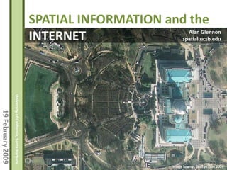
  • 1. SPATIAL INFORMATION and the Alan Glennon INTERNET spatial.ucsb.edu University of California, Santa Barbara 19 February 2009 Image Source: GeoEye.com 2009
  • 2. Mission: To facilitate the integration of spatial thinking into processes for learning and discovery in the natural, social, and behavioral sciences, to promote excellence in engineering and applied sciences, and to enhance creativity in the arts and humanities. University of California, Santa Barbara Engagement: 19 February 2009 Hosting events (brownbags, workshops, lectures) Developing spatial analytic tools Offering a help desk Assisting with research proposal development Image Source: NAIP, 2005
  • 3. Source: Wikimedia Commons, 2008 University of California, Santa Barbara 19 February 2009
  • 4. Source: Allen Gathman, 2008 University of California, Santa Barbara 19 February 2009
  • 5. Source: Strangemaps, 2008 University of California, Santa Barbara 19 February 2009
  • 6. Grassroots mapping of Gaza (Gaza project spearheaded by Mikel Maron. left: December 2008 data; right: February 2009 data) University of California, Santa Barbara 19 February 2009 Source: openstreetmap.org, 2009
  • 8. Source: Photosynth.com, 2008 University of California, Santa Barbara 19 February 2009
  • 9. SPATIAL INFORMATION and the INTERNET • Three significant maps of the last twelve months • Considering spatial data • Web 2.0 • Comparing the language of University of California, Santa Barbara Topics cartography, GIS, and Internet 19 February 2009 geography • Capabilities and concerns • Policy and best practices • Future Image Source: GeoEye.com 2008
  • 10. Geographic Data Two practical perspectives: University of California, Santa Barbara Data that include or can be harvested for spatial 19 February 2009 references Combinations of spatially-referenced points, polylines, polygons, and images with their associated attributes and relationships Image Source: Google.com 2008
  • 11. Image Source: Google.com 2008 Geographic Data University of California, Santa Barbara 19 February 2009
  • 12. Geographic Data Significance: visually compelling provide context and content; close things are usually more related; spatial order; pattern and trend University of California, Santa Barbara recognition 19 February 2009 popular; widespread use, particularly on the Internet professional expectation: Google Maps as a baseline
  • 13. “…it would behove spatial scientists to articulate to the broader research community the potential of recording and making accessible spatial data in the appropriate formats — and the painlessness of the process.” University of California, Santa Barbara 19 February 2009 A place for everything: More researchers must record the latitude and longitude of their data. Editorial: Nature 453, 2 (1 May 2008)
  • 14. Web 2.0 and Spatial Mashups Web 2.0: The notion of the Internet as a computing platform. tags: sharing, collaboration, user generated content, community, dynamic, real-time University of California, Santa Barbara quot;Web 2.0 is the business revolution in the computer industry caused by the move to the Internet as platform, 19 February 2009 and an attempt to understand the rules for success on that new platform.“ Tim O’Reilly, December 2006
  • 15. What is a Mashup? Mashup: a website or application that combines data from more than one source. Characteristics: University of California, Santa Barbara combination, aggregation, visualization 19 February 2009
  • 16. Enabling Technologies • web search • client-server architecture • Internet applications and AJAX wikis, online office apps, email, maps, media hosting, social networks, asynchronous data and response University of California, Santa Barbara • structured, simple data types 19 February 2009 XML and RSS • Application Programming Interfaces (API) • willing users
  • 17. Sample Software Open Source NASA World Wind (client and server) OpenLayers (client) MapServer (server) Geoserver (server) GDAL/OGR (server-based geo-database toolkit) GRASS (full desktop GIS client) Google Earth (client) Google Maps (client) Free Microsoft Virtual Earth (client) University of California, Santa Barbara ArcGIS Explorer (client) MapQuest (client) 19 February 2009 Google Earth Enterprise (server) Proprietary ArcGIS (full desktop GIS client) ArcGIS Server (server) deCarta (server) AutoDesk AutoCad (client) AutoDesk ProductStream (server) Oracle Spatial (server)
  • 18. Example Geographic File Types • ESRI shapefile (.shp) • KeyHole Markup Language (.kml) • GeoRSS (.rss, .xml) • AutoCad DXF (.dxf) • Census TIGER • ESRI Coverage • ESRI Personal Geodatabase • GeoTIFF • Digital Raster Graphic (DRG) • Digital Elevation Model (DEM) University of California, Santa Barbara • Spatial Data Transfer Standard (SDTS) • Image formats like jpg, tiff, gif, and png (often served via a WMS operation) 19 February 2009 Considerations when choosing a file type for spatial data: What software support it? What does your consumer want? Is it fast? What type of data, complexity, and dynamics can it support? How easy is it to autogenerate and update (from your database to the new file format)? How well will it age?
  • 19. The language, tools, and technology of cartographers, geographers and spatial information engineers. Map Making Process Transformation simplifying, generalizing, and abstracting the world Interrogation asking questions of spatial data and maps Communication creating spatial results that can be understood and have meaning Geographic Information Systems Collection University of California, Santa Barbara Storage Analysis 19 February 2009 Visualization Geostack capture produce communicate aggregate consume
  • 20. University of California, Santa Barbara 19 February 2009 Note: Classroom use only. Cartographers, GIS Thinkers, Neogeographers
  • 21. University of California, Santa Barbara 19 February 2009 The Geostack (Source: Andrew Turner, highearthorbit.com)
  • 22. The nature of online spatial queries • data overlays are common • queries are often predesigned and directed • user generated content, also known as volunteered geographic information, is prevalent. These data are often harnessed as “wisdom of crowds” / “collective intelligence”. Could be considered a brute-force type query. • data are often discovered through search and browsing University of California, Santa Barbara • simplicity and ease of use are emphasized 19 February 2009 Google’s Impact 250,000,000 Google Earth activations 1,000 human lifetimes spent using Maps/Earth Source: John Hanke, October 2007
  • 23. Source: openstreetmap.org, 2009 University of California, Santa Barbara 19 February 2009
  • 24. reliability (authority, persistence, legacy) of data patchiness (inconsistent data quality, availability and resolution) reliability of associated infrastructure inaccessibility when not connected to internet lack of metadata privacy (both in space and time) national security interests inappropriate use of data (analytical issues, scale) Concerns classical mapping issues University of California, Santa Barbara misunderstanding projections poor design, confusing, misleading 19 February 2009 hard to use slow, varying scales (often ignored) -- Google Maps intellectual property unlabeled censorship
  • 25. University of California, Santa Barbara 19 February 2009 Source: http://crschmidt.net/mapping/wpserverdemo/, 2009
  • 26. Practice familiarity with “the geostack” client/server interaction Python Java University of California, Santa Barbara Javascript 19 February 2009 GDAL/OGR OSGeo Projects
  • 27. Case Study: Keyhole Markup Language (KML) Keyhole Markup Language (KML) is an open source XML-based specification for expressing geographic data. Developed as a Google Earth file format to represent georeferenced points, polylines, polygons, and images KML has become widely supported by many other software applications and online mapping services. University of California, Santa Barbara Core data within a KML document include longitude, latitude, 19 February 2009 elevation, and name descriptions A sizable number of advanced specifications also exist, including tags for cartographic customization, viewer position, time, and iterative data refresh calls.
  • 28. HelloWorld.kml <?xml version=quot;1.0quot; encoding=quot;UTF-8quot;?> <kml xmlns=quot;http://earth.google.com/kml/2.2quot;> <Document> <name>HelloWorld1.kml</name> <Placemark> <name>Transformers</name> <description>There are some transformers here.</description> <Point> <coordinates> -119.8512453552352,34.41944355498201,0 </coordinates> </Point> University of California, Santa Barbara </Placemark> </Document> </kml> 19 February 2009 Something to notice If the first letter of a tag is upper case, it can hold child elements. If the first letter is lower case, it denotes a simple element—one that has no possible children.
  • 29. HelloWorld.kml University of California, Santa Barbara 19 February 2009
  • 30. Network Link Via a Network Link, a server-side script could call external databases or other online Dynamic KML sources. You could also create a webpage interface that assembles and returns a KML based on user University of California, Santa Barbara preferences. 19 February 2009 For example: Source: NOAA http://radar.weather.gov/ridge/kmzgenerator.php http://www.srh.noaa.gov/gis/kml/
  • 31. Time In KML, features can be associated with time with these tags: <TimeStamp> associates a feature to an Dynamic KML instant in time <TimeSpan> associates a feature to a length of time. The tag University of California, Santa Barbara requires a begin time and/or end time. 19 February 2009 With respect to rendering, these tags typically serve as a visibility filter against a timeline.
  • 32. Temporal Tags Example … <Placemark> <name>Transformers</name> <description>There are some transformers here.</description> <Point> <coordinates>0,0,0<!simplified></coordinates> Dynamic KML </Point> <TimeSpan> <begin>1990</begin> <end>2009</end> </TimeSpan> </Placemark> University of California, Santa Barbara <Placemark> <name>homebase</name> <description>Line from home base to transformers.</description> 19 February 2009 <LineString> <tessellate>1</tessellate> <coordinates>0,0,0 1,1,0<! simplified></coordinates> </LineString> <TimeStamp> <when>2008-09-24T10:30:15-08:00</when> </TimeStamp> </Placemark> …
  • 33. Time When Google Earth reads a temporal tag within KML, a time browser appears. Clicking on the University of California, Santa Barbara clock icon 19 February 2009 brings up additional time navigation options. Source: Google Earth and Declan Butler; http://www.nature.com/news/author/Declan+Butler
  • 34. Distribution and Sharing (Note: some of these overlap and/or could be combined) A) Delivery of raw or auto-assembled KML KML file is shared via a website, email, or disk User loads KML into the Google Earth application B) Delivery of KML from Google Maps KML is hosted Google Maps renders KML C) Delivery of KML with the Google Earth browser plug-in Webpage created using Google Earth API Hosted KML is rendered within Google Earth frame University of California, Santa Barbara D) Delivery with desktop applications like ArcGIS Explorer, Virtual Earth, NASA World Wind, etc. 19 February 2009 Generally similar to standalone KML (option A) E) Mediator web service Website service allows user collaboration, provides hosting, and file index or discovery mechanism. Examples: Google MyMaps, Flickr, Platial , Facebook, Yahoo! FireEagle
  • 35. Distribution and Sharing (Note: some of these overlap and/or could be combined) F) Server-based delivery Application and data are hosted. Interface may be public or, in some cases, secured. Examples: Google Earth Enterprise, OpenLayers, ArcGIS Server G) Enterprise relational database manager Typically for intranet-type usage. Manages multiple user collaboration, conflicts, and versioning Oracle Spatial, ArcSDE University of California, Santa Barbara H) Search engine discovery of spatial data (an emerging case); programmatic structured query using various sites’ APIs. 19 February 2009 Application launches as defined by user or OS (assisted by properly configured MIME type). Examples: Google Search, Yahoo! Pipes, Microsoft Popfly
  • 36. Select Geographic Database Analysis Tasks Relational-spatial attribute query Proximity analysis (buffer and distance calculation) Query Spatial joins (intersection and union comparisons; inside/out) University of California, Santa Barbara Network analysis (routing and 19 February 2009 optimization; left/right; topology) Raster comparison (Map Algebra)
  • 37. Geocoding The process of assigning geographic coordinates to a map feature, description, or address. Input: Address or location description Examples: Goleta, CA; 90210; New Zealand World Trade Center, downtown Los Angeles Query Output: Geographic Coordinates University of California, Santa Barbara 45.2342W, 15.2346N, 1000m asl, WGS84 19 February 2009 There are many complicating factors to geocoding. For example: the grammar of the input, positional accuracy / vagueness / scale, places with the same name, foreign languages, deprecated names, new names, misspellings, etc.
  • 38. Geocoding Despite the problems, geocoding is at the core of many web-based mapping applications. KML offers the <address> element as an alternative to coordinates. Google Earth and Google Maps will attempt to geocode the address and render the Query position. Usability will largely depend on the input address and the intended application. University of California, Santa Barbara For example, the following KML uses the street address of a UCSB electrical transformer station 19 February 2009 (shown in the middle left of the screen; geocoded address is on the bottom right). Note: In Google Earth and Maps, if a <Point> tag is provided in the KML also, it will take precedence over an <address>.
  • 39. <?xml version=quot;1.0quot; encoding=quot;UTF-8quot;?> <kml xmlns=quot;http://earth.google.com/kml/2.2quot;> <Document> <name>addressexample.kml</name> <Placemark> <name>Transformers</name> <description>Better than nothing.</description> <address>552 University Road, Santa Barbara, CA University of California, Santa Barbara 93106</address> </Placemark> 19 February 2009 </Document> </kml>
  • 40. Geocoding Resources Google Maps API Yahoo! Maps and FireEagle API MetaCarta Labs Query Geocoder.us University of California, Santa Barbara Batchgeocode.com 19 February 2009 NGA Geographic Names Search Mapping Hacks by Erle, Walsh, and Gibson (available from O’Reilly). How to build your own geocoder.
  • 41. Routing and Service Area Routing implementations remain largely proprietary, though some open source options are beginning to emerge. The Google Maps API offers access to driving directions. University of California, Santa Barbara Proprietary web services are plentiful. 19 February 2009 ArcGIS Server offers routing functionality. Image source: ArcGIS Network Analyst, esri.com
  • 42. Google Earth Developers Interact with other developers and explore their work. Query: Analysis Resources (http://groups.google.com/group/kml-support) ArcGIS Explorer Proprietary virtual globe with analysis functionality, particularly when coupled with other ESRI products. Note: UCSB has an ArcGIS site license. (esri.com) Yahoo! Pipes Graphical multistep web query that includes spatial data. (pipes.yahoo.com) University of California, Santa Barbara Microsoft Popfly Graphical multistep web query that includes spatial data. (popfly.com) 19 February 2009 OpenLayers Javascript slippy map library with a gallery of numerous web applications. (openlayers.org) GIS.com A “paleo” introduction to geographic information and analysis
  • 43. Source: Yahoo! Pipes; Photos near Wineries, Author: Ido Query: Example University of California, Santa Barbara 19 February 2009
  • 44. University of California, Santa Barbara 19 February 2009 http://www.esri.com/software/arcgis/explorer/graphics/showcase/longbeach-plume-lg.jpg Source: ArcGIS Explorer, esri.com
  • 45. Policy and Best Practices The Policy Landscape No homogenous body of geographic data web standards or regulations exist. So far, emerging precedents are largely arising from privacy and intellectual property law. Private enterprise is also gauging consumer reaction and trying to maximize utility, create monetization potential, and not alienate users. University of California, Santa Barbara Accessibility 19 February 2009 Suggested Design Practices Locational Privacy
  • 46. -Wired.com, September 11, 2008 Policy and Best Practices University of California, Santa Barbara 19 February 2009
  • 47. Accessibility Policy and Best Practices Provide a text description of the map’s or data’s purpose. Provide descriptions of any included, integrated multimedia. Use clear, descriptive names and labels. Consider appropriate colors and contrast for people with color discernment difficulties or other visual impairment Cite data sources; allowing users to investigate other mechanisms for its visualization University of California, Santa Barbara In technology selection, consider open 3D rendering formats. For instance, OpenGL calls to a graphics card can be captured and 19 February 2009 manipulated. Haptic feedback devices can more readily interpret the data. Ensure links are simple, visible, and exposed (no hidden image links) Be very cautious about rapid blinking and dynamic data refreshes. Provide warnings as necessary to assist epileptic population.
  • 48. Best Practices Policy and Best Practices Consider geographic and cartographic principles Use GeoRSS to syndicate geographic data (refer to KML). HTML:RSS::KML:GeoRSS Maximize link confidence (hide awkward script calls; links to external resources should be reliable; make sure the external resource acts like you think University of California, Santa Barbara it should). Provide usage information and instructions for 19 February 2009 complex data Provide data authorship credit (also affords author responsibility).
  • 49. Best Practices Policy and Best Practices Consider window viewing sizes (large images and long descriptions can take over an entire viewscreen). Allow users control and navigation of layers. Consider file size, number of points, complexity (warn as necessary). For instance, in KML, use University of California, Santa Barbara Regionator to manage large image overlays 19 February 2009 Minimize the distraction of legends or screen overlays. Cache geocodes
  • 50. Geographic Privacy Policy and Best Practices Right to privacy varies greatly by jurisdiction. The California Constitution, Article 1, Section 1, describes privacy as an inalienable right. Spatial and temporal data resolution is a key component with respect to invasion of privacy. For example, spatially aggregated U.S. Census University of California, Santa Barbara data are available soon after compilation. Individual Census responses are prohibited from 19 February 2009 release for 72 years. Aggregating multiple individuals’ personal information is considered less invasive than individually identifiable information.
  • 51. Geographic Privacy Policy and Best Practices Internet users are comprised of all age groups, including those that may have no understanding of personal privacy or its consequences. University of California, Santa Barbara 19 February 2009 Graphic source: David H. Williams/E911-LBS, October 25, 2006, The associated article argues for privacy considerations to be an fundamental part of Location-Base Service design http://www.directionsmag.com/article.php?article_id=2323&trv=1
  • 52. Yahoo! Fire Eagle Policy and Best Practices Developer Code of Conduct Note: These points are paraphrased. Always tell users what you want to do with their location Let users know when you are collecting their location information Give users control of their own data University of California, Santa Barbara Make sure users' data are secure 19 February 2009 Only allow users to manage their location, but not others Don't be creepy Source: Fire Eagle Developer Code of Conduct, http://fireeagle.yahoo.net/developer/documentation/code_of_conduct
  • 53. International Safe Harbor Privacy Principles Policy and Best Practices Notice - Individuals must be informed that their data is being collected and about how it will be used. Choice - Individuals must have the ability to opt out of the collection and forward transfer of the data to third parties. Onward Transfer - Transfers of data to third parties may only occur to other organizations that follow adequate data protection principles. Security - Reasonable efforts must be made to prevent loss of University of California, Santa Barbara collected information. Data Integrity - Data must be relevant and reliable for the purpose 19 February 2009 it was collected for. Access - Individuals must be able to access information held about them, and correct or delete it if it is inaccurate. Enforcement - There must be effective means of enforcing these rules. Source: United State International Trade Administration
  • 54. “We no longer go to maps to find out where we are. Instead, we tell maps where we are and they form around us on the fly.” Jessica Clark- American University University of California, Santa Barbara (February 2008) 19 February 2009
  • 55. Evolving Spatial Information • software objects for dynamics • language for object dynamics • UML equivalent for fields • handling real-time feeds • handling spherical/global queries • realistic actors (phenomena that react to stimuli: interactions, time, physics) • interior data models University of California, Santa Barbara • spatiotemporal data handling • asynchronous analysis 19 February 2009 • sensor networks Source: Goodchild and Glennon (2007)
  • 56. The near Future of Spatial Data more. everywhere. University of California, Santa Barbara 19 February 2009 Image Source: NAIP, 2005
  • 57. The near Future of Spatial Data • Web 3.0: automated data discovery and analysis • ubiquity • mixed reality University of California, Santa Barbara • evolving business models 19 February 2009 • conversations with maps • expanding scales • interior spaces Image Source: NAIP, 2005
  • 58. The Future of Spatial Data An evolving platform: extending the geographic model to Eames’ and Morrisons’ Powers of Ten The Progression of Internet Maps Interaction: 1. view (see my house) University of California, Santa Barbara 2. add (tag locations important to me) 19 February 2009 3. query (get directions, see patterns) 4a. communicate (sharing and social interaction) 4b. mirror world (more realism/physics) 5. inhabit Image Source: NAIP, 2005
  • 59. The Future of Spatial Data Semantic Spatial Web (spatially literate, natural language Internet) 3D Internet (spatially visualized and inhabitable Internet. Mixed mirrored and virtual reality) University of California, Santa Barbara Digital Earth (spatiotemporal database of everything) 19 February 2009 Transhumanism (closer connection of information to individual senses. Think digital contact lenses and putting your own skin on reality. Consequential multi-place existence) Image Source: NAIP, 2005
  • 60. University of California, Santa Barbara 19 February 2009 Sources: GeoEye.com 2008, Openstreetmap 2009, Wikimedia 2008 Image Source: GeoEye.com 2008
  • 61. SPATIAL INFORMATION and the INTERNET • Internet geography is mass media. Be a communicator. • Internet geography is accessible. Be useful. • Internet geography is at its best when it is timely and also considers geographic concepts. Be fast. Be smart. University of California, Santa Barbara • Internet geography creates higher public expectations for 19 February 2009 professional geographers. Be thoughtful. Be better. • Internet geography is not bound to simple queries and mashups. That is, it can be GIS. Push it forward. Be an engineer. Be a geographer. Image Source: GeoEye.com 2008