SlideShare uma empresa Scribd logo
1 de 39
Content


• What is Roam?
• Search, zoom/pan, select features, save
• Customise your map: select features, map style,
  annotate, hillshading
• Screenshare – recreate some maps in Roam
• Print and/or save
Digimap’s Ordnance Survey Collection


                                        •View and
                                        print PDF
                                          maps


                                       •Download
                                        data – 3
                                        facilities


                                         •Query
                                          tools
What is Roam?

  • Facility in Digimap’s Ordnance Survey Collection
  • Create, save and print A3/A4 PDF maps using Ordnance
    Survey maps
  • 13 fixed scale map views, each view uses a OS map
    product with a level of detail appropriate for the scale, e.g.
     – National view 1:1,600,000, MiniScale®
     – Plan view 1:1,250, OS MasterMap data


  • Find out more about Ordnance Survey map products:
  http://www.ordnancesurvey.co.uk/oswebsite/products/index.html


                                                        Digimap Training Workshops
Digimap’s Ordnance Survey Collection


  •Roam – fixed scale mapping. Print A3, A4 PDF.
  •Carto – user selects scale of map. However Carto will not display a
  product if it is not sensible to do so at the selected scale...e.g. very
  detailed mapping will not be displayed if the user selects a small scale,
  say 1:500000. Print A4 to A0 PDF.
Carto will be replaced

  • Digimap team working on replacement, to be available
    2013
  • Too difficult to maintain - changes to web browsers
    and Java
  • Your feedback appreciated on development:
     – http://digimap.blogs.edina.ac.uk/2012/10/12/digimap-carto-we-
       need-your-help/


                                                        Digimap Training Workshops
Roam              •Map tools: hill
                 shading, measure,
                  annotate, print


                                     •Hints & Tips
   •Task menu:   •Map panel
   Search, Map
  Content, Map
  Info, MyMaps
Local View
Neighbourhood View
Street View
Detailed View
Menus


 • Click on a menu item to open it
 • Choose to Hide or Display menus with the double arrows


                                                Digimap Training Workshops
Search – Place name


                      Digimap Training Workshops
Search – Place name


                      Digimap Training Workshops
Search – Place name


                       Local view
                      map returned


                          Digimap Training Workshops
Gazetteer


  • Place name search
    uses the OS 1: 50000
    Scale Gazetteer
  • Same database that is
    used on the
    Landranger Maps
  • No street name
    searching possible


                            Digimap Training Workshops
Search - postcode


                    Digimap Training Workshops
Search - postcode


                     Street view
                    map returned


                                   Digimap Training Workshops
Search – 100 x 100 km OS tile


                        Regional
                         view

          SE


                                   Digimap Training Workshops
Search – 4 figure grid reference


                        Metropolitan
                           view

          SE4182


                                       Digimap Training Workshops
Search – 6 figure grid reference


                        Local view


    SE416820


                                     Digimap Training Workshops
Navigation

             • Zoom in/out
                – Fishbone
                – Double click to zoom in
                – Scroll wheel on mouse


             • Pan
                – Click and drag the map
                – Compass


             • Full extent / Previous / Next views


                                            Digimap Training Workshops
Map Content Control

  • Allows the user to customise the features they see on
    the map, e.g. remove water features, or road features
  • Available in 8 views:
     • Metropolitan View
     • City View
     • District View
     • Neighbourhood View
     • Street View
     • Detailed View
     • Plan View


                                                 Digimap Training Workshops
Map Content Control


                      List of layers


                                       Digimap Training Workshops
Map Content Control


                        Uncheck
                        boxes to
                      remove layers


                                      Digimap Training Workshops
Map Content Control


                      • OS maps used
                        in Roam are
                        Vector or
                        Raster map
                        data.
                      • We cannot
                        select individual
                        features in
                        raster maps. If
                        a view uses a
                        raster map you
                        cannot
                        customise it.
                             Digimap Training Workshops
Alternative map styles


 • Alternatives styles available in 4 most detailed
   views: Neighbourhood, Street, Detailed, Plan
 • Fond within Map Content Control - Theme
Alternative map styles

 • In Map Content Control, allows user to choose from a
   selection of styles
 • Used new data product to create these styles –
   VectorMap Local


 • http://www.youtube.com/user/EDINADigimap#p/a/u/1/wa
   dgUWe3jNA
Map Information


                  Map product,
                  Coordinates,
                   Print scale
                                 Digimap Training Workshops
Annotations tools

 • Tools to add lines, shapes, text and labels to your maps


                                                  Digimap Training Workshops
Annotation tools


 • Toolbar appears at the top of the screen – can be moved around
 • Main options to add annotations in the Draw & Create area - add:
     • Add symbols, text, lines, polygons, pre-defined shapes
 • Annotations remain on your map at the same scale as you zoom in
 and out
 • Options: save annotations within Digimap, make visible on PDF print,
 export, import


                                                                Digimap Training Workshops
Sample of annotations


                        Digimap Training Workshops
Hillshading


•   Uses Land-Form PANORAMA 1:50,000 data to shade
    elevated areas
Recreate this map in Roam

 • Map of the site for a proposed new hotel
   and retail development in central Edinburgh
   –   Search with a postcode, EH1 1JF
   –   Zoom in to Plan View
   –   Centre the map where Cowgate meets South Bridge
   –   Select Line Drawing Theme
   –   Add a polygon that covers the empty site
   –   Add labels for Hotel entrance and Retail Development
Recreate this map in Roam

• Project to mark location of water vole survey sites
  on Isle of Wight. Only need map of island, with town
  information for context.
  – Search for Isle of Wight
  – Zoom out to City View
  – Display A, B, minor roads, coastline, cities towns and
    other settlements.
  – Add red markers where shown.


                                                  Digimap Training Workshops
Print


        • add gridlines, annotations, title
        • move map around in preview
        • print A3/A4 landscape or portrait
PDF print
Keep in touch

 • EDINA Helpdesk
     – email: edina@ed.ac.uk
     – telephone: 0131 650 3302


  •http://digimap.blogs.edina.ac.uk/
  •http://www.facebook.com/EDINADigimap
  •http://www.youtube.com/user/EDINADigimap
  •http://twitter.com/edina_digimap

Mais conteúdo relacionado

Mais procurados

Mildorf ppt gi2011_plan4all_final
Mildorf ppt gi2011_plan4all_finalMildorf ppt gi2011_plan4all_final
Mildorf ppt gi2011_plan4all_finalIGN Vorstand
 
Using Digimap data for Archaeology - Geoforum 2016 - Kathleen O'Donnell
Using Digimap data for Archaeology - Geoforum 2016 - Kathleen O'DonnellUsing Digimap data for Archaeology - Geoforum 2016 - Kathleen O'Donnell
Using Digimap data for Archaeology - Geoforum 2016 - Kathleen O'DonnellEDINA, University of Edinburgh
 
Maps and Apps
Maps and AppsMaps and Apps
Maps and AppsAddy Pope
 
GeoKnowledge: Providing E-Learning Resources for UK Academia
GeoKnowledge: Providing E-Learning Resources for UK AcademiaGeoKnowledge: Providing E-Learning Resources for UK Academia
GeoKnowledge: Providing E-Learning Resources for UK AcademiaGail Millin-Chalabi
 
Haiti HOT OSM éducation 15/02/2012 (FR)
Haiti HOT OSM éducation 15/02/2012 (FR)Haiti HOT OSM éducation 15/02/2012 (FR)
Haiti HOT OSM éducation 15/02/2012 (FR)Severin Menard
 
CartoHeritage 2011: Annotations, Tags and Linked Data
CartoHeritage 2011: Annotations, Tags and Linked DataCartoHeritage 2011: Annotations, Tags and Linked Data
CartoHeritage 2011: Annotations, Tags and Linked Dataaboutgeo
 
Connecting European Archaeology datasets: prospects and challenges
Connecting European Archaeology datasets: prospects and challengesConnecting European Archaeology datasets: prospects and challenges
Connecting European Archaeology datasets: prospects and challengesCARARE
 
An Academic SDI: Introducing the Enhanced Kaia Geoportal & Learning Zone
An Academic SDI: Introducing the Enhanced Kaia Geoportal & Learning ZoneAn Academic SDI: Introducing the Enhanced Kaia Geoportal & Learning Zone
An Academic SDI: Introducing the Enhanced Kaia Geoportal & Learning ZoneGail Millin-Chalabi
 
GI2011+proceedings v5 final
GI2011+proceedings v5 finalGI2011+proceedings v5 final
GI2011+proceedings v5 finalIGN Vorstand
 
Crowdsourced mapping for open collaboration: A story of Taiwan so far
Crowdsourced mapping for open collaboration: A story of Taiwan so farCrowdsourced mapping for open collaboration: A story of Taiwan so far
Crowdsourced mapping for open collaboration: A story of Taiwan so farDongpo Deng
 
Re-Mapping the World's Population
Re-Mapping the World's PopulationRe-Mapping the World's Population
Re-Mapping the World's PopulationBenjamin Hennig
 

Mais procurados (13)

Mildorf ppt gi2011_plan4all_final
Mildorf ppt gi2011_plan4all_finalMildorf ppt gi2011_plan4all_final
Mildorf ppt gi2011_plan4all_final
 
Using Digimap data for Archaeology - Geoforum 2016 - Kathleen O'Donnell
Using Digimap data for Archaeology - Geoforum 2016 - Kathleen O'DonnellUsing Digimap data for Archaeology - Geoforum 2016 - Kathleen O'Donnell
Using Digimap data for Archaeology - Geoforum 2016 - Kathleen O'Donnell
 
AR @ Mimas
AR @ MimasAR @ Mimas
AR @ Mimas
 
Maps and Apps
Maps and AppsMaps and Apps
Maps and Apps
 
GeoKnowledge: Providing E-Learning Resources for UK Academia
GeoKnowledge: Providing E-Learning Resources for UK AcademiaGeoKnowledge: Providing E-Learning Resources for UK Academia
GeoKnowledge: Providing E-Learning Resources for UK Academia
 
Haiti HOT OSM éducation 15/02/2012 (FR)
Haiti HOT OSM éducation 15/02/2012 (FR)Haiti HOT OSM éducation 15/02/2012 (FR)
Haiti HOT OSM éducation 15/02/2012 (FR)
 
CartoHeritage 2011: Annotations, Tags and Linked Data
CartoHeritage 2011: Annotations, Tags and Linked DataCartoHeritage 2011: Annotations, Tags and Linked Data
CartoHeritage 2011: Annotations, Tags and Linked Data
 
Connecting European Archaeology datasets: prospects and challenges
Connecting European Archaeology datasets: prospects and challengesConnecting European Archaeology datasets: prospects and challenges
Connecting European Archaeology datasets: prospects and challenges
 
An Academic SDI: Introducing the Enhanced Kaia Geoportal & Learning Zone
An Academic SDI: Introducing the Enhanced Kaia Geoportal & Learning ZoneAn Academic SDI: Introducing the Enhanced Kaia Geoportal & Learning Zone
An Academic SDI: Introducing the Enhanced Kaia Geoportal & Learning Zone
 
GI2011+proceedings v5 final
GI2011+proceedings v5 finalGI2011+proceedings v5 final
GI2011+proceedings v5 final
 
Digimap Ordnance Survey Collection - Essentials
Digimap Ordnance Survey Collection - EssentialsDigimap Ordnance Survey Collection - Essentials
Digimap Ordnance Survey Collection - Essentials
 
Crowdsourced mapping for open collaboration: A story of Taiwan so far
Crowdsourced mapping for open collaboration: A story of Taiwan so farCrowdsourced mapping for open collaboration: A story of Taiwan so far
Crowdsourced mapping for open collaboration: A story of Taiwan so far
 
Re-Mapping the World's Population
Re-Mapping the World's PopulationRe-Mapping the World's Population
Re-Mapping the World's Population
 

Destaque

What’s Different about the Digital: Community Action via UK LOCKSS Alliance
What’s Different about the Digital: Community Action via UK LOCKSS AllianceWhat’s Different about the Digital: Community Action via UK LOCKSS Alliance
What’s Different about the Digital: Community Action via UK LOCKSS AllianceEDINA, University of Edinburgh
 
Map Styling Tools and Interactive maps on the web with OpenLayers - Addy Pope...
Map Styling Tools and Interactive maps on the web with OpenLayers - Addy Pope...Map Styling Tools and Interactive maps on the web with OpenLayers - Addy Pope...
Map Styling Tools and Interactive maps on the web with OpenLayers - Addy Pope...JISC GECO
 
Introduction to Collaborative by Nature: Interoperable Geospatial Approaches ...
Introduction to Collaborative by Nature: Interoperable Geospatial Approaches ...Introduction to Collaborative by Nature: Interoperable Geospatial Approaches ...
Introduction to Collaborative by Nature: Interoperable Geospatial Approaches ...JISC GECO
 
Exploiting the value of Dublin Core through pragmatic development
Exploiting the value of Dublin Core through pragmatic developmentExploiting the value of Dublin Core through pragmatic development
Exploiting the value of Dublin Core through pragmatic developmentPaul Walk
 
Discovering What You Can't Always Get From Google: Jisc MediaHub
Discovering What You Can't Always Get From Google: Jisc MediaHubDiscovering What You Can't Always Get From Google: Jisc MediaHub
Discovering What You Can't Always Get From Google: Jisc MediaHubEDINA, University of Edinburgh
 
Developing Research Data Management Policy and Services
Developing Research Data Management Policy and ServicesDeveloping Research Data Management Policy and Services
Developing Research Data Management Policy and ServicesRobin Rice
 

Destaque (20)

Research Data MANTRA Demo
Research Data MANTRA DemoResearch Data MANTRA Demo
Research Data MANTRA Demo
 
Deep Impact: Metadata and SUNCAT
Deep Impact: Metadata and SUNCATDeep Impact: Metadata and SUNCAT
Deep Impact: Metadata and SUNCAT
 
EDINA National Datacentre Activity Update to GWG
EDINA National Datacentre Activity Update to GWGEDINA National Datacentre Activity Update to GWG
EDINA National Datacentre Activity Update to GWG
 
Location Based Services Without the Cocoa
Location Based Services Without the CocoaLocation Based Services Without the Cocoa
Location Based Services Without the Cocoa
 
Introduction to RDM for trainee physicians
Introduction to RDM for trainee physiciansIntroduction to RDM for trainee physicians
Introduction to RDM for trainee physicians
 
What’s Different about the Digital: Community Action via UK LOCKSS Alliance
What’s Different about the Digital: Community Action via UK LOCKSS AllianceWhat’s Different about the Digital: Community Action via UK LOCKSS Alliance
What’s Different about the Digital: Community Action via UK LOCKSS Alliance
 
Engaging the Researcher in RDM
Engaging the Researcher in RDMEngaging the Researcher in RDM
Engaging the Researcher in RDM
 
IASSIST Latin Engagement Strategic Action Group
IASSIST Latin Engagement Strategic Action GroupIASSIST Latin Engagement Strategic Action Group
IASSIST Latin Engagement Strategic Action Group
 
MANTRA for Change
MANTRA for ChangeMANTRA for Change
MANTRA for Change
 
Map Styling Tools and Interactive maps on the web with OpenLayers - Addy Pope...
Map Styling Tools and Interactive maps on the web with OpenLayers - Addy Pope...Map Styling Tools and Interactive maps on the web with OpenLayers - Addy Pope...
Map Styling Tools and Interactive maps on the web with OpenLayers - Addy Pope...
 
Investigation into Private LOCKSS Networks
Investigation into Private LOCKSS NetworksInvestigation into Private LOCKSS Networks
Investigation into Private LOCKSS Networks
 
UK RepositoryNet+: Jisc Oversight Group, 2012-11-29
UK RepositoryNet+: Jisc Oversight Group, 2012-11-29UK RepositoryNet+: Jisc Oversight Group, 2012-11-29
UK RepositoryNet+: Jisc Oversight Group, 2012-11-29
 
SafeNet: Progress and Data Gathering
SafeNet: Progress and Data GatheringSafeNet: Progress and Data Gathering
SafeNet: Progress and Data Gathering
 
Open @ EDINA
Open @ EDINAOpen @ EDINA
Open @ EDINA
 
RDM Programme at University of Edinburgh
RDM Programme at University of EdinburghRDM Programme at University of Edinburgh
RDM Programme at University of Edinburgh
 
Introduction to Collaborative by Nature: Interoperable Geospatial Approaches ...
Introduction to Collaborative by Nature: Interoperable Geospatial Approaches ...Introduction to Collaborative by Nature: Interoperable Geospatial Approaches ...
Introduction to Collaborative by Nature: Interoperable Geospatial Approaches ...
 
Exploiting the value of Dublin Core through pragmatic development
Exploiting the value of Dublin Core through pragmatic developmentExploiting the value of Dublin Core through pragmatic development
Exploiting the value of Dublin Core through pragmatic development
 
Discovering What You Can't Always Get From Google: Jisc MediaHub
Discovering What You Can't Always Get From Google: Jisc MediaHubDiscovering What You Can't Always Get From Google: Jisc MediaHub
Discovering What You Can't Always Get From Google: Jisc MediaHub
 
Developing Research Data Management Policy and Services
Developing Research Data Management Policy and ServicesDeveloping Research Data Management Policy and Services
Developing Research Data Management Policy and Services
 
Open Access Repository Junction
Open Access Repository JunctionOpen Access Repository Junction
Open Access Repository Junction
 

Semelhante a Digimap Roam

Optimizing your Map Services
Optimizing your Map ServicesOptimizing your Map Services
Optimizing your Map ServicesEsri
 
Explore new dimensions with MapInfo Vertical Mapper
Explore new dimensions with MapInfo Vertical Mapper Explore new dimensions with MapInfo Vertical Mapper
Explore new dimensions with MapInfo Vertical Mapper DataMap Europe Ltd.
 
EDINA Geoservices: Geological Society Higher Education Network 2015
EDINA Geoservices: Geological Society Higher Education Network 2015EDINA Geoservices: Geological Society Higher Education Network 2015
EDINA Geoservices: Geological Society Higher Education Network 2015Tom Armitage
 
Publishing on ArcGIS Mobile
Publishing on ArcGIS MobilePublishing on ArcGIS Mobile
Publishing on ArcGIS MobileEsri
 
Real-Time Multi-Resolution Labeling in 3D GIS - Damien Saunder - Esri USA
Real-Time Multi-Resolution Labeling in 3D GIS - Damien Saunder - Esri USAReal-Time Multi-Resolution Labeling in 3D GIS - Damien Saunder - Esri USA
Real-Time Multi-Resolution Labeling in 3D GIS - Damien Saunder - Esri USAInternational Map Industry Association
 
brandonbal-afm_tech
brandonbal-afm_techbrandonbal-afm_tech
brandonbal-afm_techBrandon Bal
 
MapInfo Professional 12.5 and Discover3D 2014 - A brief overview
MapInfo Professional 12.5 and Discover3D 2014 - A brief overviewMapInfo Professional 12.5 and Discover3D 2014 - A brief overview
MapInfo Professional 12.5 and Discover3D 2014 - A brief overviewPrakher Hajela Saxena
 

Semelhante a Digimap Roam (20)

Introduction to Digimap's Ordnance Survey Collection
Introduction to Digimap's Ordnance Survey CollectionIntroduction to Digimap's Ordnance Survey Collection
Introduction to Digimap's Ordnance Survey Collection
 
Digimap Roam webinar
Digimap Roam webinarDigimap Roam webinar
Digimap Roam webinar
 
Making the most of Roam
Making the most of RoamMaking the most of Roam
Making the most of Roam
 
Optimizing your Map Services
Optimizing your Map ServicesOptimizing your Map Services
Optimizing your Map Services
 
Geology Digimap
Geology DigimapGeology Digimap
Geology Digimap
 
Using data from Digimap in ArcGIS
Using data from Digimap in ArcGISUsing data from Digimap in ArcGIS
Using data from Digimap in ArcGIS
 
4 march 2015 digimap urban map data cad
4 march 2015 digimap urban map data cad4 march 2015 digimap urban map data cad
4 march 2015 digimap urban map data cad
 
Rs unit iii-gis--- [repaired]
Rs unit iii-gis--- [repaired]Rs unit iii-gis--- [repaired]
Rs unit iii-gis--- [repaired]
 
Rs unit iii-gis--- [repaired]
Rs unit iii-gis--- [repaired]Rs unit iii-gis--- [repaired]
Rs unit iii-gis--- [repaired]
 
Environment Digimap
Environment DigimapEnvironment Digimap
Environment Digimap
 
Geo visualization_why maps
Geo visualization_why mapsGeo visualization_why maps
Geo visualization_why maps
 
Explore new dimensions with MapInfo Vertical Mapper
Explore new dimensions with MapInfo Vertical Mapper Explore new dimensions with MapInfo Vertical Mapper
Explore new dimensions with MapInfo Vertical Mapper
 
EDINA Geoservices: Geological Society Higher Education Network 2015
EDINA Geoservices: Geological Society Higher Education Network 2015EDINA Geoservices: Geological Society Higher Education Network 2015
EDINA Geoservices: Geological Society Higher Education Network 2015
 
Publishing on ArcGIS Mobile
Publishing on ArcGIS MobilePublishing on ArcGIS Mobile
Publishing on ArcGIS Mobile
 
Historic Digimap
Historic DigimapHistoric Digimap
Historic Digimap
 
Real-Time Multi-Resolution Labeling in 3D GIS - Damien Saunder - Esri USA
Real-Time Multi-Resolution Labeling in 3D GIS - Damien Saunder - Esri USAReal-Time Multi-Resolution Labeling in 3D GIS - Damien Saunder - Esri USA
Real-Time Multi-Resolution Labeling in 3D GIS - Damien Saunder - Esri USA
 
brandonbal-afm_tech
brandonbal-afm_techbrandonbal-afm_tech
brandonbal-afm_tech
 
Geoservices Activities at EDINA
Geoservices Activities at EDINAGeoservices Activities at EDINA
Geoservices Activities at EDINA
 
Edina Geoservices Review - Emma Diffley
Edina Geoservices Review - Emma DiffleyEdina Geoservices Review - Emma Diffley
Edina Geoservices Review - Emma Diffley
 
MapInfo Professional 12.5 and Discover3D 2014 - A brief overview
MapInfo Professional 12.5 and Discover3D 2014 - A brief overviewMapInfo Professional 12.5 and Discover3D 2014 - A brief overview
MapInfo Professional 12.5 and Discover3D 2014 - A brief overview
 

Mais de EDINA, University of Edinburgh

We have the technology... We have the data... What next?
We have the technology... We have the data... What next?We have the technology... We have the data... What next?
We have the technology... We have the data... What next?EDINA, University of Edinburgh
 
Reference Rot in Theses: A HiberActive Pilot - 10x10 session for Repository F...
Reference Rot in Theses: A HiberActive Pilot - 10x10 session for Repository F...Reference Rot in Theses: A HiberActive Pilot - 10x10 session for Repository F...
Reference Rot in Theses: A HiberActive Pilot - 10x10 session for Repository F...EDINA, University of Edinburgh
 
If I Googled You, What Would I Find? Managing your digital footprint - Nicola...
If I Googled You, What Would I Find? Managing your digital footprint - Nicola...If I Googled You, What Would I Find? Managing your digital footprint - Nicola...
If I Googled You, What Would I Find? Managing your digital footprint - Nicola...EDINA, University of Edinburgh
 
Managing your Digital Footprint : Taking control of the metadata and tracks a...
Managing your Digital Footprint : Taking control of the metadata and tracks a...Managing your Digital Footprint : Taking control of the metadata and tracks a...
Managing your Digital Footprint : Taking control of the metadata and tracks a...EDINA, University of Edinburgh
 
Social media and blogging to develop and communicate research in the arts and...
Social media and blogging to develop and communicate research in the arts and...Social media and blogging to develop and communicate research in the arts and...
Social media and blogging to develop and communicate research in the arts and...EDINA, University of Edinburgh
 
Enhancing your research impact through social media - Nicola Osborne
Enhancing your research impact through social media - Nicola OsborneEnhancing your research impact through social media - Nicola Osborne
Enhancing your research impact through social media - Nicola OsborneEDINA, University of Edinburgh
 
Social Media in Marketing in Support of Your Personal Brand - Nicola Osborne
Social Media in Marketing in Support of Your Personal Brand - Nicola OsborneSocial Media in Marketing in Support of Your Personal Brand - Nicola Osborne
Social Media in Marketing in Support of Your Personal Brand - Nicola OsborneEDINA, University of Edinburgh
 
Best Practice for Social Media in Teaching & Learning Contexts - Nicola Osborne
Best Practice for Social Media in Teaching & Learning Contexts - Nicola OsborneBest Practice for Social Media in Teaching & Learning Contexts - Nicola Osborne
Best Practice for Social Media in Teaching & Learning Contexts - Nicola OsborneEDINA, University of Edinburgh
 
Introduction to Edinburgh University Data Library and national data services
Introduction to Edinburgh University Data Library and national data servicesIntroduction to Edinburgh University Data Library and national data services
Introduction to Edinburgh University Data Library and national data servicesEDINA, University of Edinburgh
 
Digimap for Schools: Introduction to an ICT based cross curricular resource f...
Digimap for Schools: Introduction to an ICT based cross curricular resource f...Digimap for Schools: Introduction to an ICT based cross curricular resource f...
Digimap for Schools: Introduction to an ICT based cross curricular resource f...EDINA, University of Edinburgh
 

Mais de EDINA, University of Edinburgh (20)

The Making of the English Landscape:
The Making of the English Landscape: The Making of the English Landscape:
The Making of the English Landscape:
 
Spatial Data, Spatial Humanities
Spatial Data, Spatial HumanitiesSpatial Data, Spatial Humanities
Spatial Data, Spatial Humanities
 
Land Cover Map 2015
Land Cover Map 2015Land Cover Map 2015
Land Cover Map 2015
 
We have the technology... We have the data... What next?
We have the technology... We have the data... What next?We have the technology... We have the data... What next?
We have the technology... We have the data... What next?
 
Reference Rot in Theses: A HiberActive Pilot - 10x10 session for Repository F...
Reference Rot in Theses: A HiberActive Pilot - 10x10 session for Repository F...Reference Rot in Theses: A HiberActive Pilot - 10x10 session for Repository F...
Reference Rot in Theses: A HiberActive Pilot - 10x10 session for Repository F...
 
GeoForum EDINA report 2017
GeoForum EDINA report 2017GeoForum EDINA report 2017
GeoForum EDINA report 2017
 
If I Googled You, What Would I Find? Managing your digital footprint - Nicola...
If I Googled You, What Would I Find? Managing your digital footprint - Nicola...If I Googled You, What Would I Find? Managing your digital footprint - Nicola...
If I Googled You, What Would I Find? Managing your digital footprint - Nicola...
 
Moray housemarch2017
Moray housemarch2017Moray housemarch2017
Moray housemarch2017
 
Uniof stirlingmarch2017secondary
Uniof stirlingmarch2017secondaryUniof stirlingmarch2017secondary
Uniof stirlingmarch2017secondary
 
Uniof glasgow jan2017_secondary
Uniof glasgow jan2017_secondaryUniof glasgow jan2017_secondary
Uniof glasgow jan2017_secondary
 
Managing your Digital Footprint : Taking control of the metadata and tracks a...
Managing your Digital Footprint : Taking control of the metadata and tracks a...Managing your Digital Footprint : Taking control of the metadata and tracks a...
Managing your Digital Footprint : Taking control of the metadata and tracks a...
 
Social media and blogging to develop and communicate research in the arts and...
Social media and blogging to develop and communicate research in the arts and...Social media and blogging to develop and communicate research in the arts and...
Social media and blogging to develop and communicate research in the arts and...
 
Enhancing your research impact through social media - Nicola Osborne
Enhancing your research impact through social media - Nicola OsborneEnhancing your research impact through social media - Nicola Osborne
Enhancing your research impact through social media - Nicola Osborne
 
Social Media in Marketing in Support of Your Personal Brand - Nicola Osborne
Social Media in Marketing in Support of Your Personal Brand - Nicola OsborneSocial Media in Marketing in Support of Your Personal Brand - Nicola Osborne
Social Media in Marketing in Support of Your Personal Brand - Nicola Osborne
 
Best Practice for Social Media in Teaching & Learning Contexts - Nicola Osborne
Best Practice for Social Media in Teaching & Learning Contexts - Nicola OsborneBest Practice for Social Media in Teaching & Learning Contexts - Nicola Osborne
Best Practice for Social Media in Teaching & Learning Contexts - Nicola Osborne
 
SCURL and SUNCAT serials holdings comparison service
SCURL and SUNCAT serials holdings comparison serviceSCURL and SUNCAT serials holdings comparison service
SCURL and SUNCAT serials holdings comparison service
 
Big data in Digimap
Big data in DigimapBig data in Digimap
Big data in Digimap
 
Introduction to Edinburgh University Data Library and national data services
Introduction to Edinburgh University Data Library and national data servicesIntroduction to Edinburgh University Data Library and national data services
Introduction to Edinburgh University Data Library and national data services
 
Digimap for Schools: Introduction to an ICT based cross curricular resource f...
Digimap for Schools: Introduction to an ICT based cross curricular resource f...Digimap for Schools: Introduction to an ICT based cross curricular resource f...
Digimap for Schools: Introduction to an ICT based cross curricular resource f...
 
Digimap Update - Geoforum 2016 - Guy McGarva
Digimap Update - Geoforum 2016 - Guy McGarvaDigimap Update - Geoforum 2016 - Guy McGarva
Digimap Update - Geoforum 2016 - Guy McGarva
 

Último

Presentation by Andreas Schleicher Tackling the School Absenteeism Crisis 30 ...
Presentation by Andreas Schleicher Tackling the School Absenteeism Crisis 30 ...Presentation by Andreas Schleicher Tackling the School Absenteeism Crisis 30 ...
Presentation by Andreas Schleicher Tackling the School Absenteeism Crisis 30 ...EduSkills OECD
 
Kisan Call Centre - To harness potential of ICT in Agriculture by answer farm...
Kisan Call Centre - To harness potential of ICT in Agriculture by answer farm...Kisan Call Centre - To harness potential of ICT in Agriculture by answer farm...
Kisan Call Centre - To harness potential of ICT in Agriculture by answer farm...Krashi Coaching
 
Sports & Fitness Value Added Course FY..
Sports & Fitness Value Added Course FY..Sports & Fitness Value Added Course FY..
Sports & Fitness Value Added Course FY..Disha Kariya
 
CARE OF CHILD IN INCUBATOR..........pptx
CARE OF CHILD IN INCUBATOR..........pptxCARE OF CHILD IN INCUBATOR..........pptx
CARE OF CHILD IN INCUBATOR..........pptxGaneshChakor2
 
Measures of Dispersion and Variability: Range, QD, AD and SD
Measures of Dispersion and Variability: Range, QD, AD and SDMeasures of Dispersion and Variability: Range, QD, AD and SD
Measures of Dispersion and Variability: Range, QD, AD and SDThiyagu K
 
Call Girls in Dwarka Mor Delhi Contact Us 9654467111
Call Girls in Dwarka Mor Delhi Contact Us 9654467111Call Girls in Dwarka Mor Delhi Contact Us 9654467111
Call Girls in Dwarka Mor Delhi Contact Us 9654467111Sapana Sha
 
Paris 2024 Olympic Geographies - an activity
Paris 2024 Olympic Geographies - an activityParis 2024 Olympic Geographies - an activity
Paris 2024 Olympic Geographies - an activityGeoBlogs
 
Mastering the Unannounced Regulatory Inspection
Mastering the Unannounced Regulatory InspectionMastering the Unannounced Regulatory Inspection
Mastering the Unannounced Regulatory InspectionSafetyChain Software
 
Z Score,T Score, Percential Rank and Box Plot Graph
Z Score,T Score, Percential Rank and Box Plot GraphZ Score,T Score, Percential Rank and Box Plot Graph
Z Score,T Score, Percential Rank and Box Plot GraphThiyagu K
 
Measures of Central Tendency: Mean, Median and Mode
Measures of Central Tendency: Mean, Median and ModeMeasures of Central Tendency: Mean, Median and Mode
Measures of Central Tendency: Mean, Median and ModeThiyagu K
 
The Most Excellent Way | 1 Corinthians 13
The Most Excellent Way | 1 Corinthians 13The Most Excellent Way | 1 Corinthians 13
The Most Excellent Way | 1 Corinthians 13Steve Thomason
 
Sanyam Choudhary Chemistry practical.pdf
Sanyam Choudhary Chemistry practical.pdfSanyam Choudhary Chemistry practical.pdf
Sanyam Choudhary Chemistry practical.pdfsanyamsingh5019
 
Russian Call Girls in Andheri Airport Mumbai WhatsApp 9167673311 💞 Full Nigh...
Russian Call Girls in Andheri Airport Mumbai WhatsApp  9167673311 💞 Full Nigh...Russian Call Girls in Andheri Airport Mumbai WhatsApp  9167673311 💞 Full Nigh...
Russian Call Girls in Andheri Airport Mumbai WhatsApp 9167673311 💞 Full Nigh...Pooja Nehwal
 
1029-Danh muc Sach Giao Khoa khoi 6.pdf
1029-Danh muc Sach Giao Khoa khoi  6.pdf1029-Danh muc Sach Giao Khoa khoi  6.pdf
1029-Danh muc Sach Giao Khoa khoi 6.pdfQucHHunhnh
 
The byproduct of sericulture in different industries.pptx
The byproduct of sericulture in different industries.pptxThe byproduct of sericulture in different industries.pptx
The byproduct of sericulture in different industries.pptxShobhayan Kirtania
 
Nutritional Needs Presentation - HLTH 104
Nutritional Needs Presentation - HLTH 104Nutritional Needs Presentation - HLTH 104
Nutritional Needs Presentation - HLTH 104misteraugie
 
Beyond the EU: DORA and NIS 2 Directive's Global Impact
Beyond the EU: DORA and NIS 2 Directive's Global ImpactBeyond the EU: DORA and NIS 2 Directive's Global Impact
Beyond the EU: DORA and NIS 2 Directive's Global ImpactPECB
 
Student login on Anyboli platform.helpin
Student login on Anyboli platform.helpinStudent login on Anyboli platform.helpin
Student login on Anyboli platform.helpinRaunakKeshri1
 

Último (20)

Presentation by Andreas Schleicher Tackling the School Absenteeism Crisis 30 ...
Presentation by Andreas Schleicher Tackling the School Absenteeism Crisis 30 ...Presentation by Andreas Schleicher Tackling the School Absenteeism Crisis 30 ...
Presentation by Andreas Schleicher Tackling the School Absenteeism Crisis 30 ...
 
Kisan Call Centre - To harness potential of ICT in Agriculture by answer farm...
Kisan Call Centre - To harness potential of ICT in Agriculture by answer farm...Kisan Call Centre - To harness potential of ICT in Agriculture by answer farm...
Kisan Call Centre - To harness potential of ICT in Agriculture by answer farm...
 
Sports & Fitness Value Added Course FY..
Sports & Fitness Value Added Course FY..Sports & Fitness Value Added Course FY..
Sports & Fitness Value Added Course FY..
 
CARE OF CHILD IN INCUBATOR..........pptx
CARE OF CHILD IN INCUBATOR..........pptxCARE OF CHILD IN INCUBATOR..........pptx
CARE OF CHILD IN INCUBATOR..........pptx
 
Measures of Dispersion and Variability: Range, QD, AD and SD
Measures of Dispersion and Variability: Range, QD, AD and SDMeasures of Dispersion and Variability: Range, QD, AD and SD
Measures of Dispersion and Variability: Range, QD, AD and SD
 
Call Girls in Dwarka Mor Delhi Contact Us 9654467111
Call Girls in Dwarka Mor Delhi Contact Us 9654467111Call Girls in Dwarka Mor Delhi Contact Us 9654467111
Call Girls in Dwarka Mor Delhi Contact Us 9654467111
 
Paris 2024 Olympic Geographies - an activity
Paris 2024 Olympic Geographies - an activityParis 2024 Olympic Geographies - an activity
Paris 2024 Olympic Geographies - an activity
 
Mastering the Unannounced Regulatory Inspection
Mastering the Unannounced Regulatory InspectionMastering the Unannounced Regulatory Inspection
Mastering the Unannounced Regulatory Inspection
 
Z Score,T Score, Percential Rank and Box Plot Graph
Z Score,T Score, Percential Rank and Box Plot GraphZ Score,T Score, Percential Rank and Box Plot Graph
Z Score,T Score, Percential Rank and Box Plot Graph
 
Mattingly "AI & Prompt Design: The Basics of Prompt Design"
Mattingly "AI & Prompt Design: The Basics of Prompt Design"Mattingly "AI & Prompt Design: The Basics of Prompt Design"
Mattingly "AI & Prompt Design: The Basics of Prompt Design"
 
Measures of Central Tendency: Mean, Median and Mode
Measures of Central Tendency: Mean, Median and ModeMeasures of Central Tendency: Mean, Median and Mode
Measures of Central Tendency: Mean, Median and Mode
 
The Most Excellent Way | 1 Corinthians 13
The Most Excellent Way | 1 Corinthians 13The Most Excellent Way | 1 Corinthians 13
The Most Excellent Way | 1 Corinthians 13
 
Sanyam Choudhary Chemistry practical.pdf
Sanyam Choudhary Chemistry practical.pdfSanyam Choudhary Chemistry practical.pdf
Sanyam Choudhary Chemistry practical.pdf
 
Russian Call Girls in Andheri Airport Mumbai WhatsApp 9167673311 💞 Full Nigh...
Russian Call Girls in Andheri Airport Mumbai WhatsApp  9167673311 💞 Full Nigh...Russian Call Girls in Andheri Airport Mumbai WhatsApp  9167673311 💞 Full Nigh...
Russian Call Girls in Andheri Airport Mumbai WhatsApp 9167673311 💞 Full Nigh...
 
INDIA QUIZ 2024 RLAC DELHI UNIVERSITY.pptx
INDIA QUIZ 2024 RLAC DELHI UNIVERSITY.pptxINDIA QUIZ 2024 RLAC DELHI UNIVERSITY.pptx
INDIA QUIZ 2024 RLAC DELHI UNIVERSITY.pptx
 
1029-Danh muc Sach Giao Khoa khoi 6.pdf
1029-Danh muc Sach Giao Khoa khoi  6.pdf1029-Danh muc Sach Giao Khoa khoi  6.pdf
1029-Danh muc Sach Giao Khoa khoi 6.pdf
 
The byproduct of sericulture in different industries.pptx
The byproduct of sericulture in different industries.pptxThe byproduct of sericulture in different industries.pptx
The byproduct of sericulture in different industries.pptx
 
Nutritional Needs Presentation - HLTH 104
Nutritional Needs Presentation - HLTH 104Nutritional Needs Presentation - HLTH 104
Nutritional Needs Presentation - HLTH 104
 
Beyond the EU: DORA and NIS 2 Directive's Global Impact
Beyond the EU: DORA and NIS 2 Directive's Global ImpactBeyond the EU: DORA and NIS 2 Directive's Global Impact
Beyond the EU: DORA and NIS 2 Directive's Global Impact
 
Student login on Anyboli platform.helpin
Student login on Anyboli platform.helpinStudent login on Anyboli platform.helpin
Student login on Anyboli platform.helpin
 

Digimap Roam

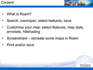
  • 1. Content • What is Roam? • Search, zoom/pan, select features, save • Customise your map: select features, map style, annotate, hillshading • Screenshare – recreate some maps in Roam • Print and/or save
  • 2. Digimap’s Ordnance Survey Collection •View and print PDF maps •Download data – 3 facilities •Query tools
  • 3. What is Roam? • Facility in Digimap’s Ordnance Survey Collection • Create, save and print A3/A4 PDF maps using Ordnance Survey maps • 13 fixed scale map views, each view uses a OS map product with a level of detail appropriate for the scale, e.g. – National view 1:1,600,000, MiniScale® – Plan view 1:1,250, OS MasterMap data • Find out more about Ordnance Survey map products: http://www.ordnancesurvey.co.uk/oswebsite/products/index.html Digimap Training Workshops
  • 4. Digimap’s Ordnance Survey Collection •Roam – fixed scale mapping. Print A3, A4 PDF. •Carto – user selects scale of map. However Carto will not display a product if it is not sensible to do so at the selected scale...e.g. very detailed mapping will not be displayed if the user selects a small scale, say 1:500000. Print A4 to A0 PDF.
  • 5. Carto will be replaced • Digimap team working on replacement, to be available 2013 • Too difficult to maintain - changes to web browsers and Java • Your feedback appreciated on development: – http://digimap.blogs.edina.ac.uk/2012/10/12/digimap-carto-we- need-your-help/ Digimap Training Workshops
  • 6. Roam •Map tools: hill shading, measure, annotate, print •Hints & Tips •Task menu: •Map panel Search, Map Content, Map Info, MyMaps
  • 11. Menus • Click on a menu item to open it • Choose to Hide or Display menus with the double arrows Digimap Training Workshops
  • 12. Search – Place name Digimap Training Workshops
  • 13. Search – Place name Digimap Training Workshops
  • 14. Search – Place name Local view map returned Digimap Training Workshops
  • 15. Gazetteer • Place name search uses the OS 1: 50000 Scale Gazetteer • Same database that is used on the Landranger Maps • No street name searching possible Digimap Training Workshops
  • 16. Search - postcode Digimap Training Workshops
  • 17. Search - postcode Street view map returned Digimap Training Workshops
  • 18. Search – 100 x 100 km OS tile Regional view SE Digimap Training Workshops
  • 19. Search – 4 figure grid reference Metropolitan view SE4182 Digimap Training Workshops
  • 20. Search – 6 figure grid reference Local view SE416820 Digimap Training Workshops
  • 21. Navigation • Zoom in/out – Fishbone – Double click to zoom in – Scroll wheel on mouse • Pan – Click and drag the map – Compass • Full extent / Previous / Next views Digimap Training Workshops
  • 22. Map Content Control • Allows the user to customise the features they see on the map, e.g. remove water features, or road features • Available in 8 views: • Metropolitan View • City View • District View • Neighbourhood View • Street View • Detailed View • Plan View Digimap Training Workshops
  • 23. Map Content Control List of layers Digimap Training Workshops
  • 24. Map Content Control Uncheck boxes to remove layers Digimap Training Workshops
  • 25. Map Content Control • OS maps used in Roam are Vector or Raster map data. • We cannot select individual features in raster maps. If a view uses a raster map you cannot customise it. Digimap Training Workshops
  • 26. Alternative map styles • Alternatives styles available in 4 most detailed views: Neighbourhood, Street, Detailed, Plan • Fond within Map Content Control - Theme
  • 27. Alternative map styles • In Map Content Control, allows user to choose from a selection of styles • Used new data product to create these styles – VectorMap Local • http://www.youtube.com/user/EDINADigimap#p/a/u/1/wa dgUWe3jNA
  • 28. Map Information Map product, Coordinates, Print scale Digimap Training Workshops
  • 29. Annotations tools • Tools to add lines, shapes, text and labels to your maps Digimap Training Workshops
  • 30. Annotation tools • Toolbar appears at the top of the screen – can be moved around • Main options to add annotations in the Draw & Create area - add: • Add symbols, text, lines, polygons, pre-defined shapes • Annotations remain on your map at the same scale as you zoom in and out • Options: save annotations within Digimap, make visible on PDF print, export, import Digimap Training Workshops
  • 31. Sample of annotations Digimap Training Workshops
  • 32. Hillshading • Uses Land-Form PANORAMA 1:50,000 data to shade elevated areas
  • 33. Recreate this map in Roam
  • 34. Recreate this map in Roam • Map of the site for a proposed new hotel and retail development in central Edinburgh – Search with a postcode, EH1 1JF – Zoom in to Plan View – Centre the map where Cowgate meets South Bridge – Select Line Drawing Theme – Add a polygon that covers the empty site – Add labels for Hotel entrance and Retail Development
  • 35. Recreate this map in Roam
  • 36. Recreate this map in Roam • Project to mark location of water vole survey sites on Isle of Wight. Only need map of island, with town information for context. – Search for Isle of Wight – Zoom out to City View – Display A, B, minor roads, coastline, cities towns and other settlements. – Add red markers where shown. Digimap Training Workshops
  • 37. Print • add gridlines, annotations, title • move map around in preview • print A3/A4 landscape or portrait
  • 39. Keep in touch • EDINA Helpdesk – email: edina@ed.ac.uk – telephone: 0131 650 3302 •http://digimap.blogs.edina.ac.uk/ •http://www.facebook.com/EDINADigimap •http://www.youtube.com/user/EDINADigimap •http://twitter.com/edina_digimap