
Recomendados
Recomendados
Mais conteúdo relacionado
Mais procurados
Mais procurados (19)
Semelhante a Unit One Notes 1
Semelhante a Unit One Notes 1 (20)
Mais de dsaska
Último
Último (20)
Unit One Notes 1
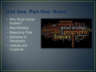
- 1. Unit One: Part One: Notes Why Study Social Studies? Map Reading Measuring Time Elements of Geography Latitude and Longitude
- 2. What exactly is social studies? WHY STUDY SOCIAL STUDIES??
- 3. Why Study Social Studies? 4 Main Topics in Social Studies: 1. History 2. Government 3. Economy 4. Geography Depending on your number, try to come up with a definition for your topic.
- 4. Parts of a Map- TOGKS Title Orientation Grid Key Scale
- 5. Title Describes what the map is showing Examples: “Climates of the United States” “Spain: Political” “Empires and States in Africa”
- 6. Orientation A Compass Rose that tells you where the cardinal directions of north, south, east, and west are positioned.
- 7. Grid A Pattern of lines usually running horizontally and vertically, that helps you find specific locations on a map
- 8. Key (Legend) A map key explains the lines, symbols, and colors used on a map.
- 9. Scale A scale bar helps you figure out distance on a map. It tells you what the distance on the earth is represented by the measurement on the scale bar.
- 10. Measuring Time Historians rely on calendars and the dating of events to measure time B.C.= Before Christ Treat like negative numbers A.D.= Anno Domini, Latin for “ in the year of our Lord” Like positive numbers
- 11. To date events before the birth of Christ Count backwards from A.D. 1 There is no Year 0!! So, the year before A.D. 1 is 1 B.C. Notice how A.D. comes before the year; and B.C. comes after the year To date events after the birth of Christ Count forwards from A.D. 1
- 12. How many years between? The rise of Mesopotamia (3000BC) to the fall of Rome (AD 475) Answer: 3475 years The beginning of the Renaissance (AD 1500) to the end of the Age of Exploration (AD 1800) Answer: 300 years The rise of Chinese civilization (2200 BC) to its collapse (1100 BC) Answer: 1100 years The rise of Greece (2600 BC) to the fall of Rome (AD 475)Answer: 3075 years The rise of Rome (625 BC) tothe end of the Middle Ages (AD 1500) Answer: 2125 years The rise of Mesopotamia (3000 BC) to the end of the Age of Exploration (AD 1800)Answer: 4800 years
- 13. Map Projections Review Good’s Interrupted Equal Area Peeled-orange Shows the true size of continents Robinson Projection Areas near poles distorted
- 14. Map Projections Review WinkelTripel Good overall view of continent shapes and sizes Mercator Shows true direction and land shapes Does not show accurate size of continents or distance Distorted as you move away from the equator
- 15. General Purpose Maps Physical Political
- 16. The 6 Elements of Geography To understand how our world is connected, geographers break down our world into 6 “themes” or “elements”
- 17. Element One: The World in Spatial Terms “Where is it?” Two types of location: 1. Absolute location: the exact spot on the earth where something can be found Example: Tohickon is at 40 degrees North latitude and 75 degrees West longitude. 2. Relative location: where something is located in relation to something else Example: Tohickon is south of my house.
- 18. Element Two: Places and Regions Place: Describes what a place is like by its physical and human characteristics Physical: Landforms, Climate, animal life “What does it look like outside your window?” Human: Religions, languages, customs “What are people like?” Region: places that have one or more things in common
- 19. Element Three: Physical Systems Language, landforms, plants, and animals “How do these things shape the earth’s surface?”
- 20. Element Four: Human Systems “How have humans shaped the world?” “Why do people settle in one place and not another?” Boundary lines Movement: 2 types Communication: movement of ideas Transportation: movement of people and goods
- 21. Element Five: Environment and Society “How do our surroundings effect the way we live?” “How do people use the environment?” “How do humans change the environment?” Human/Environment Interaction: 2 types: Adapt: when people adjust to the environment Modify: when people change the environment to meet their needs
- 22. Element Six: The Uses of Geography Using geography and its tools to understand the relationships between people, places, and the environment. Example: A meteorologist using latitude and longitude to predict a path of a hurricane
- 23. Latitude and Longitude Latitude Lines: Run horizontally A.K.A. parallels- because they are parallel to the equator Equal distance from each other (about 70 miles apart)
- 24. Latitude Lines Always measure these first! They run east to west but measure north and south “Ladder Tude”
- 25. Longitude Lines Run vertically A.K.A. meridians Not equal distance from each other Touch at poles Farthest apart at the equator
- 26. How do we write latitude and longitude? Latitude, Longitude Examples: 38° N Lat., 96° W Long. 35° S Lat., 30° E Long.